Abilene has always been a town divided. Having been founded around the railroad, both figuratively and literally, the tracks form a dividing line through central Abilene, cutting it into the North Side and South Side. Both sides have a distinct personality. Growing up on one side or the other determines how you're perceived by fellow Abilenians. If you live on the South Side, you can't even imagine ever living north of the tracks. Northsiders assuredly feel the same way about the South Side. The 1960 opening of Cooper High School on the far south side only served to perpetuate the division. I grew up on the South Side (not far from the Mall which opened in 1979) and, until I started attending Abilene Christian University in the fall of 2005, I had virtually no knowledge of the roads or landmarks of northern Abilene. Fellow students from faraway cities and states knew more about the North Side than I did.
All this being said, I come to my purpose in this post. This historic core of Downtown Abilene is as divided as the rest of town. North of the tracks is where the big businesses built for much of the city's history. It's the side with the train stations and the hotels and the concert halls and the theater and the apartment towers. The north part of downtown has tidy planters lining its streets and maturing live oaks spreading shade over pedestrians as the wander between galleries and cafes. When you say you're going "downtown," you really mean north Downtown.
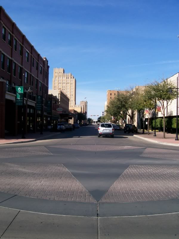
However, there is a southern part of downtown. A red-headed stepchild, if you will. When redevelopment and restoration swept through north Downtown in the 1980s and 90s, it skipped this half. South Downtown Abilene is home to the monolithic 1970s Taylor County Courthouse. It is also, oddly enough, home to Abilene's tallest tower, the 300-foot 1983 Enterprise Tower, home to Bank of America among other things. But by and large, this area has not been shown the love given to its northern neighbors. Perhaps it's because it was a little more stripped of its history than the north side during Abilene's abusive love affair with the wrecking ball in the 1960s and 70s. Perhaps it's because the south side was always a little more industrial and less commercial and people have always had fewer reasons to venture there. Maybe it was even cursed by having the Courthouse and other government bodies located there, as they provided a constant stream of inhabitants and it may not have appeared to need a facelift like the ghostly and abandoned north side of the 80s. Surely, it's a combination of all of the above.
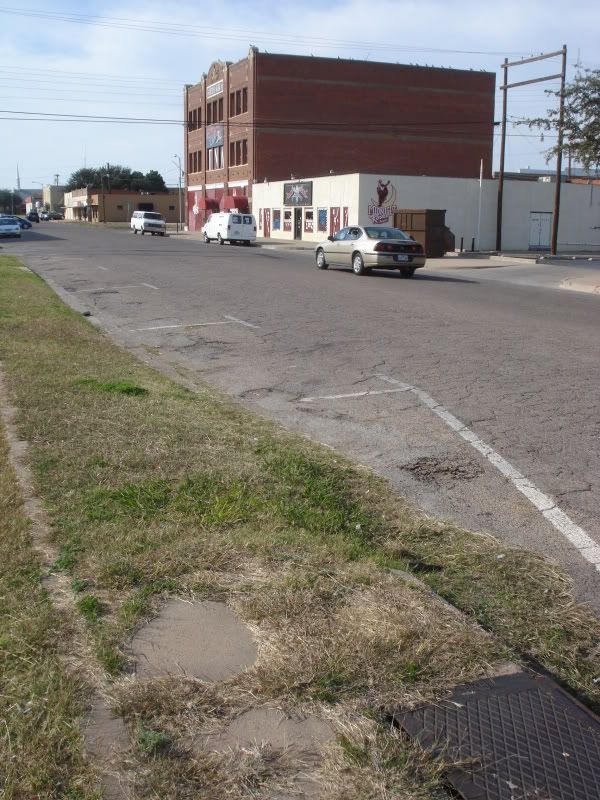
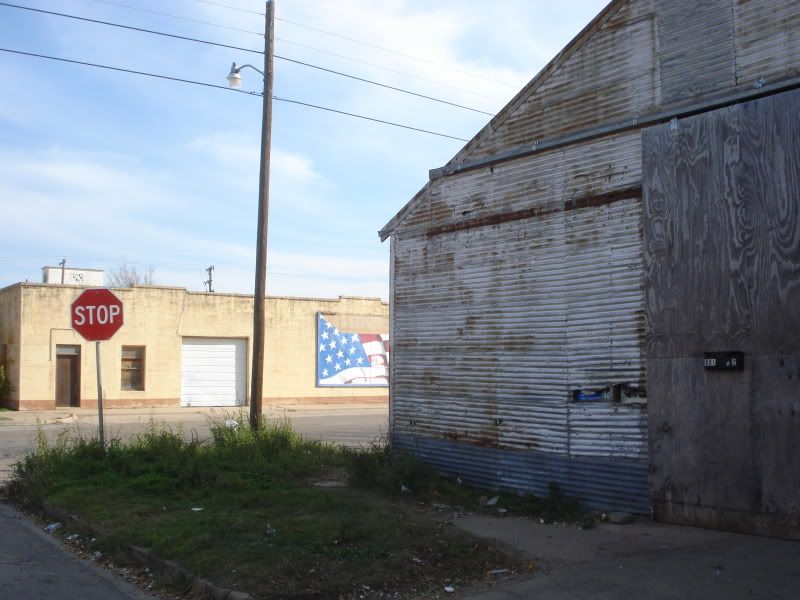
All this being said, the south side of downtown is worn out. It is run-down. It is dirty and unkempt and crumbling. Sidewalks lined with oaks during some previous revitalization attempt lay cracked and buckled, many of the trees now dead, the pavement littered with crushed acorns and beer cans. In other places, the remains of what was once a sidewalk hides beneath a blanket of grass and weeds and trash. Most of the storefronts that once comprised "the square" around the courthouse are either abandoned or destroyed, save a cafe or two and a couple of less-than-reputable clubs ("The Stairs", "Midnight Rodeo 3" etc). A tidy little train depot sits awkward and unused, beautiful old warehouses and silos loom quietly, their windows smashed and their painted signs faded. A block from the courthouse, buildings are boarded up, streets are desolate and an overwhelming sense of abandonment permeates the air.
Recently, however, city planners have come up with a master plan to overhaul this forgotten portion of town. The plan, still in its early stages, calls for "the construction of townhomes, the salvaging of historical buildings and the establishment of plazas and open spaces." From the Abilene Reporter-News: "Suggested features include mixed use of commercial, retail, office and residential; wide sidewalks; landscaping and streetscaping; one main park and possibly four smaller parks; street improvements and the conversion of one-way streets to two-way traffic; designated gateways to parts of the area; improved linkages between downtown areas north and south of the railroad tracks; and pedestrian and bicycle-friendly traffic." Developers hope to increase the permanent population of the neighborhood from the current 200 to somewhere between 2 and 4 thousand.
All this in mind, I took a little walking tour of South Downtown on the afternoon of Saturday, November 14 2009. Much of what I saw, I'd never seen before, despite having lived in Abilene a large majority of my 22 years of life. It was depressing to see such advanced decay, but I gained a large amount of optimism as I saw generally good bones in the neighborhood. There's great potential for a thriving urban center. Perhaps even more potential than the north side of downtown because the south side has empty lots and derelict swaths of condemned and crumbling old homes not worth saving that could be converted into glossy new homes and businesses to complement the restored historic portions. Who knows. It might all be a pipe dream. Check out my pictures below and comment if you'd like. If you read this whole long-winded thing, I commend you.
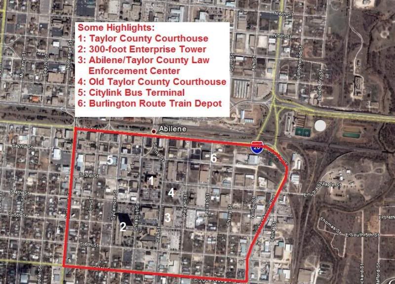
A rough map I made of the area. It is bounded on the north by the tracks, on the south by South 7th Street, on the east by Treadaway Blvd and on the west by Butternut Street.
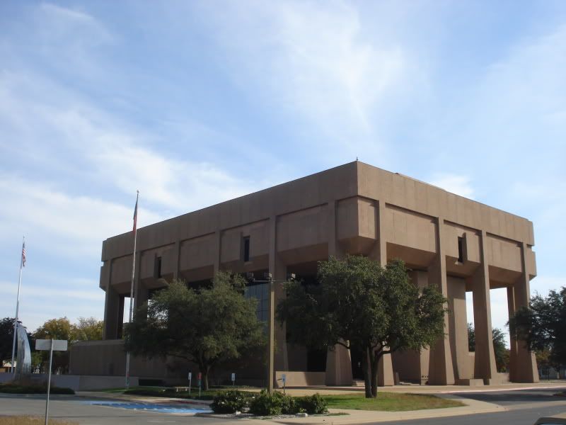
My starting point: Taylor County Courthouse.
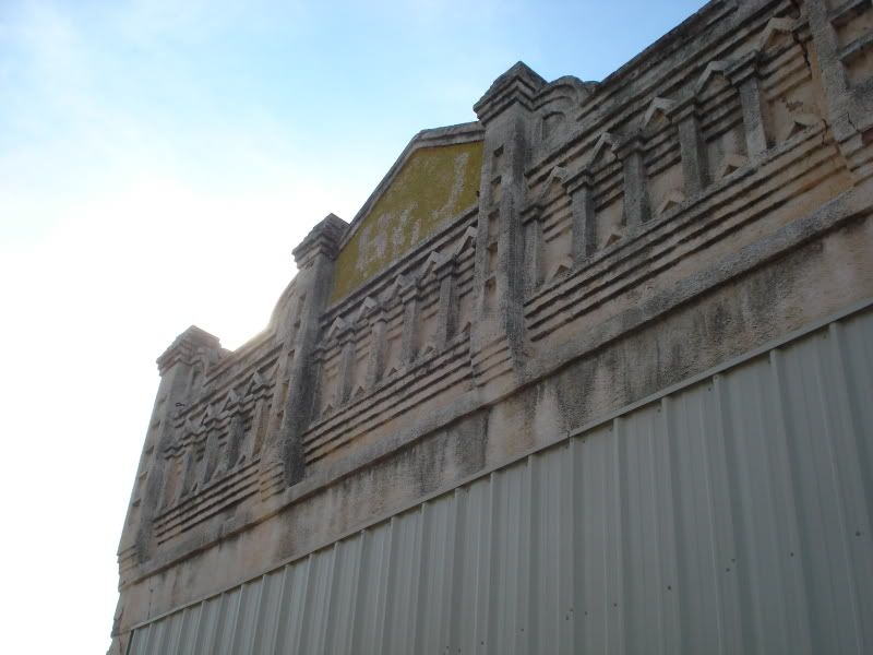
The roof line of an abandoned storefront. It says "B & J" but I have no clue as to what this once was.
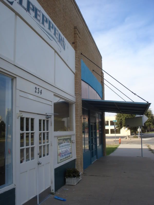
A couple of shops actually in use on the courthouse square. Culpepper's and Gloria's Grill.
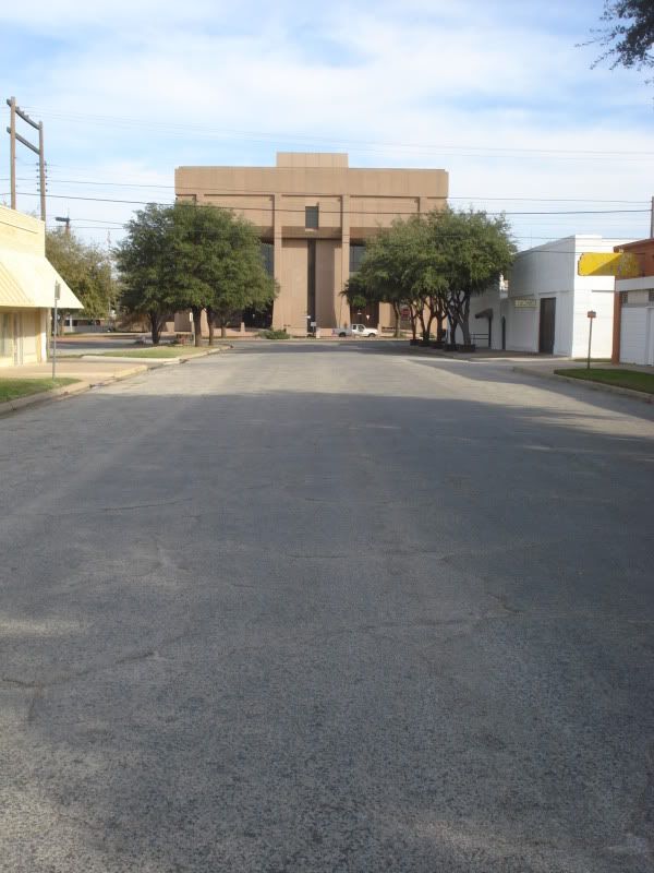
Looking south down Chestnut Street toward Enterprise tower.
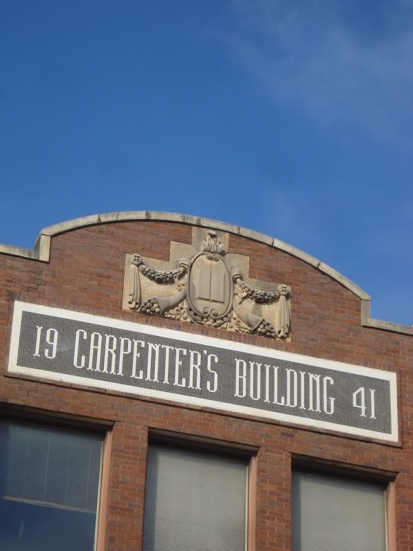
Looking west down South 2nd street toward the 1921 Carpenter building (3 stories) which is now a nightclub. Whatever building used to be at this corner is little more than wall foundations now, and the sidewalk has long since been abandoned.
Taylor County Courthouse and the Enterprise.
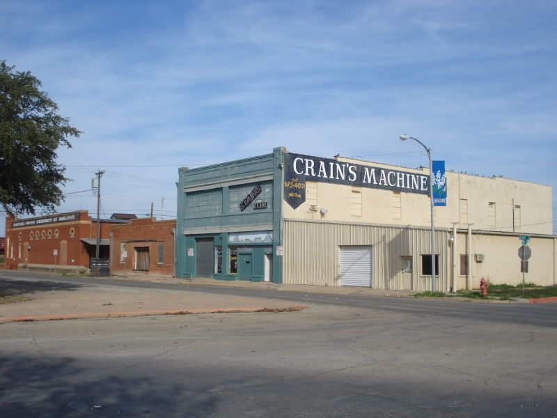
Another old store front converted into a nightclub. Looking northeast at the intersection of Oak and S 2nd.
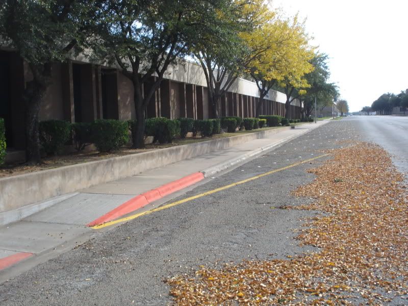
A row of somewhat sterile offices along Oak street.
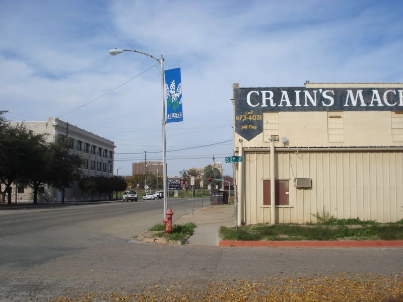
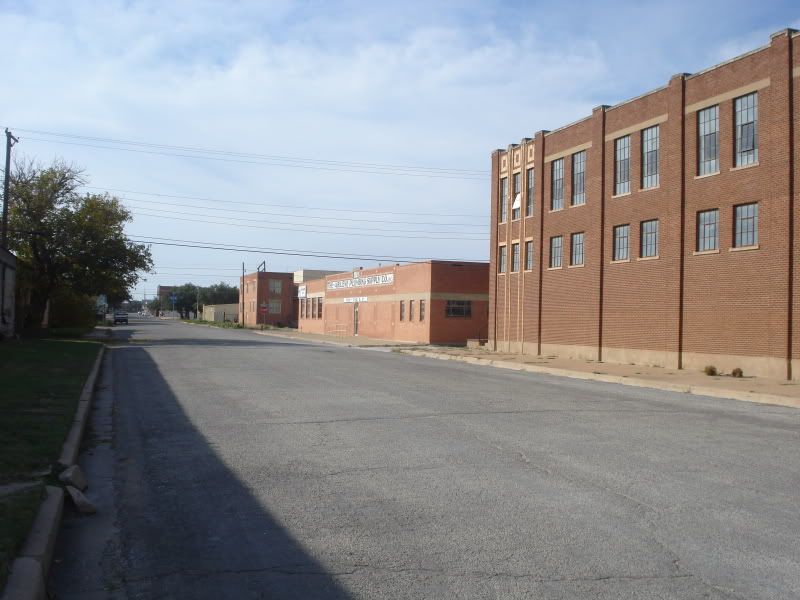
Looking north toward the railroad tracks on Oak street. The light brick building ahead on the left of the road is the headquarters for Lauren Engineering, a major firm with nationwide operations.
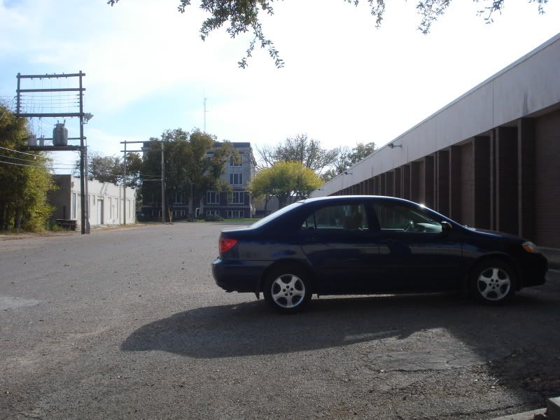
A lone car at the office. South side of S 2nd st.
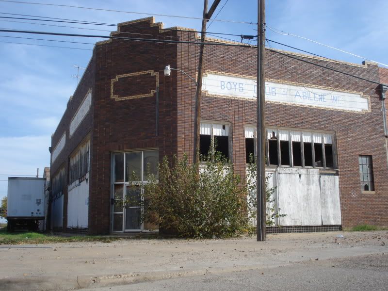
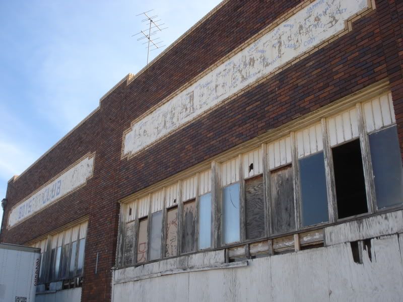
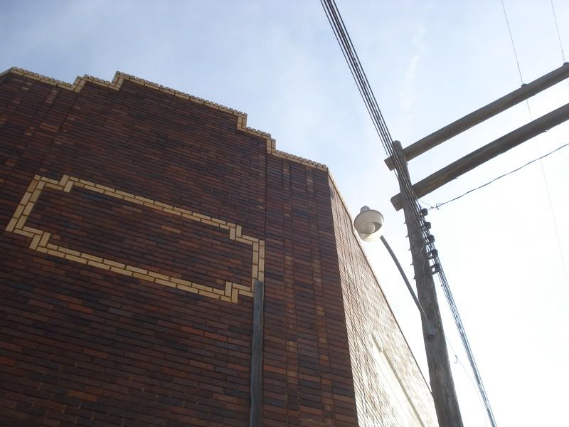
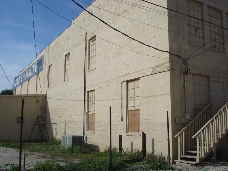
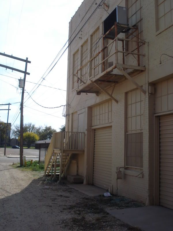
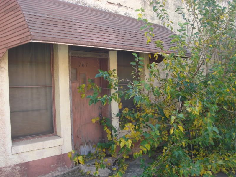
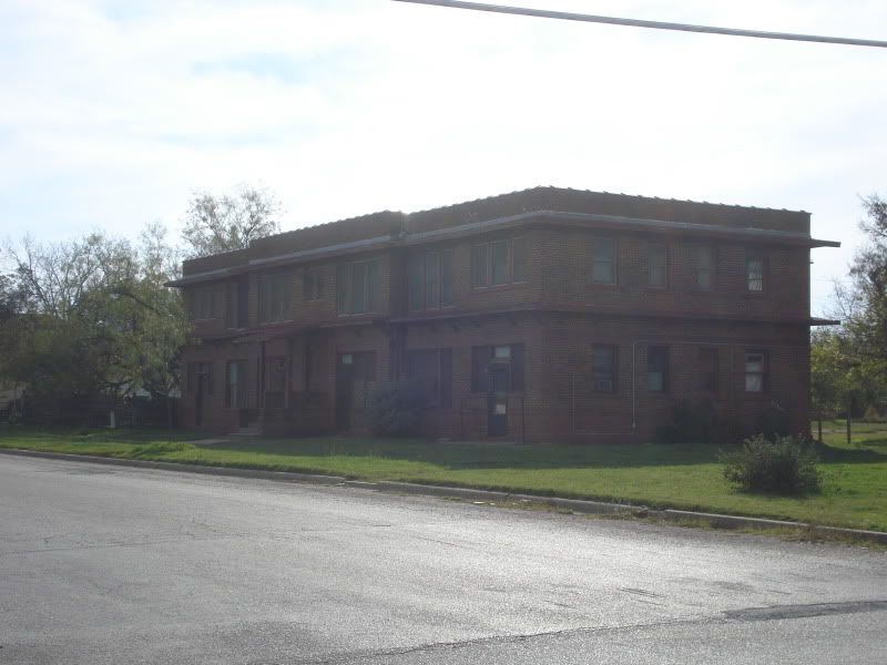
I have absolutely no knowledge of this building. The sign is shoddily painted to say "The Abilene Boys Clubs, Inc" but it has obviously not been anything for many years. The windows are smashed out and the pressed tin ceiling inside is peeling and rusted. On South 2nd between Oak & Pecan.
Looking southwest. The "Boys Club" on the left, the Enterprise looming in the distance.
The building's South 2nd front.
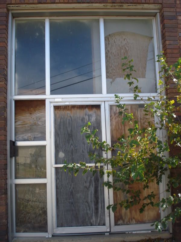
Long-unused doors.
Detailing above the entrance.
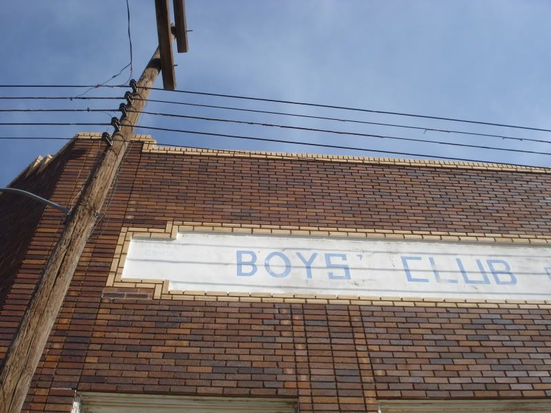
The Boys Club - a mystery to me.
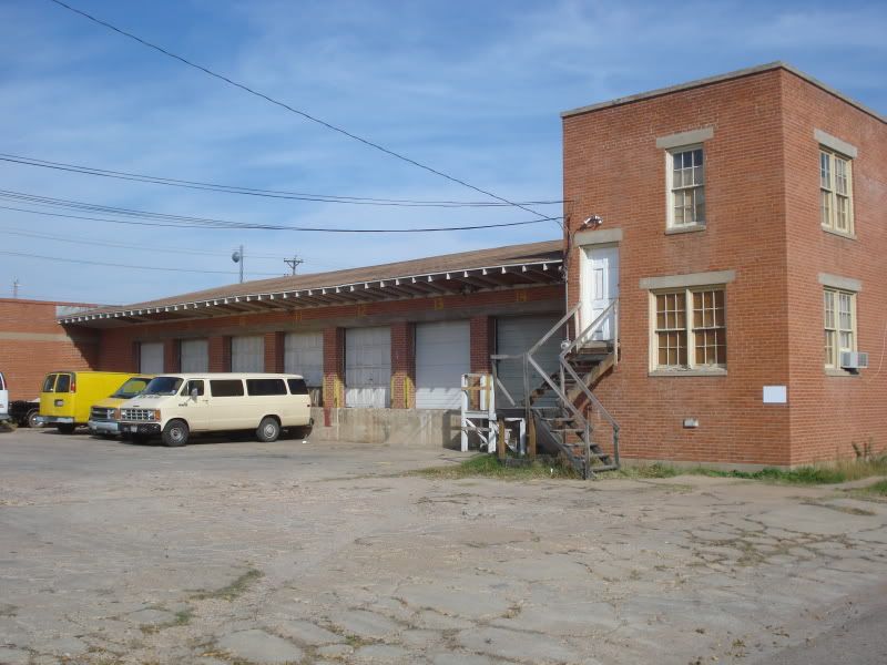
An old loading dock on South 2nd that seems to still be in use.
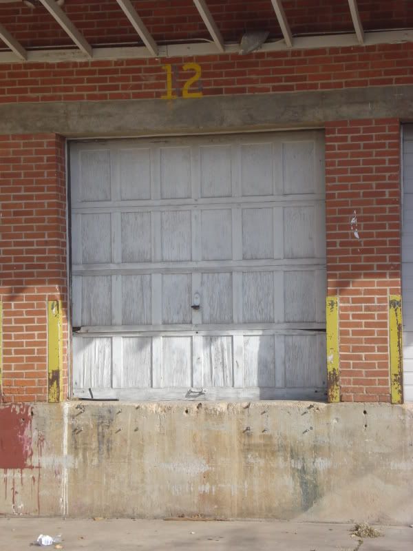
One of the aging dock doors.
Walking behind The Stairs nightclub.
I'm not entirely sure if this shop is still functioning or if this is just a relic.
Looking north toward an abandoned train loading platform of a building on South 1st.
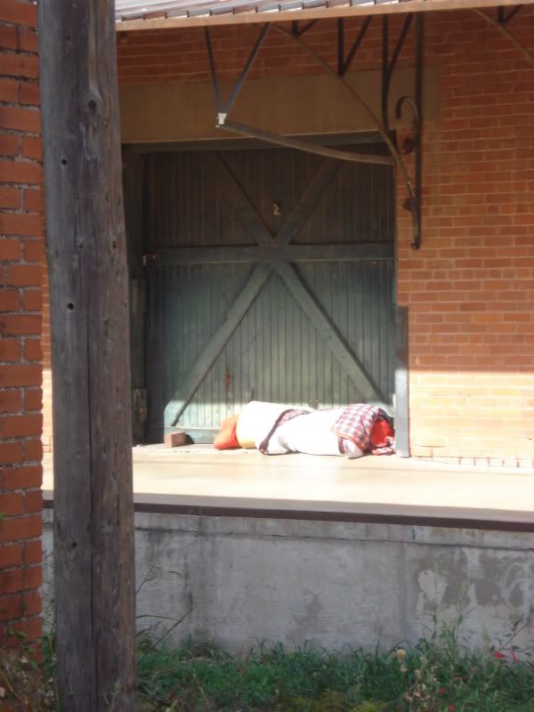
A beautiful platform accentuated by the earthly belongings of a vagrant.
Heading back out of the alley - the back of the nightclub again.
The bustling corner of South 2nd & Pecan.
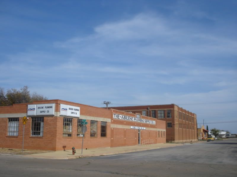
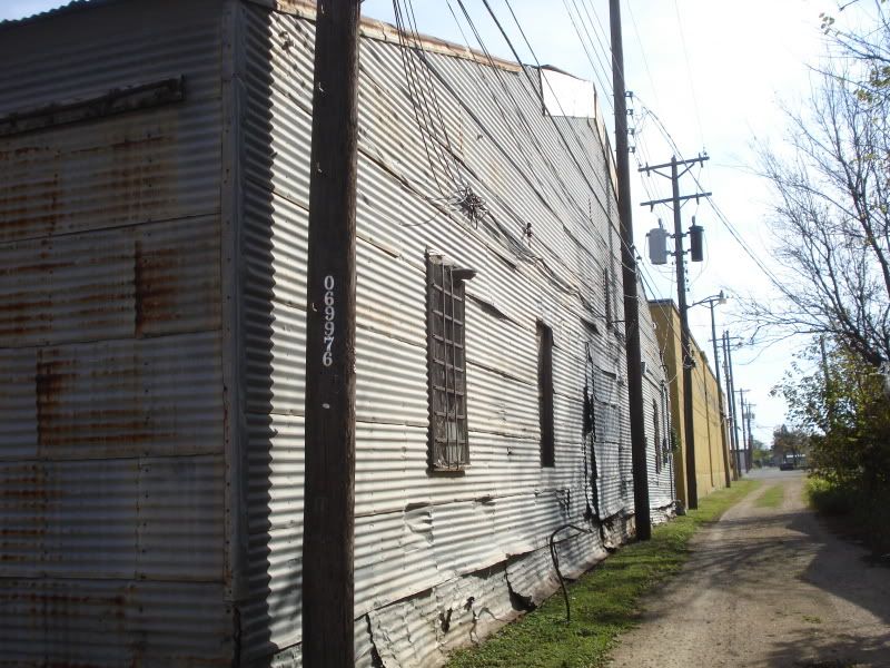
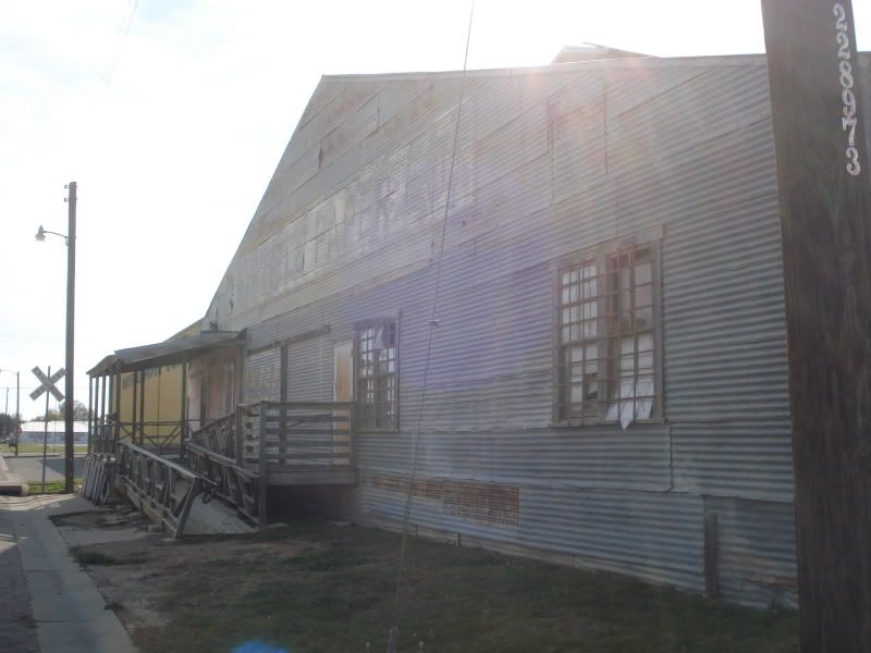
A row of eerily quiet warehouses on South 2nd.
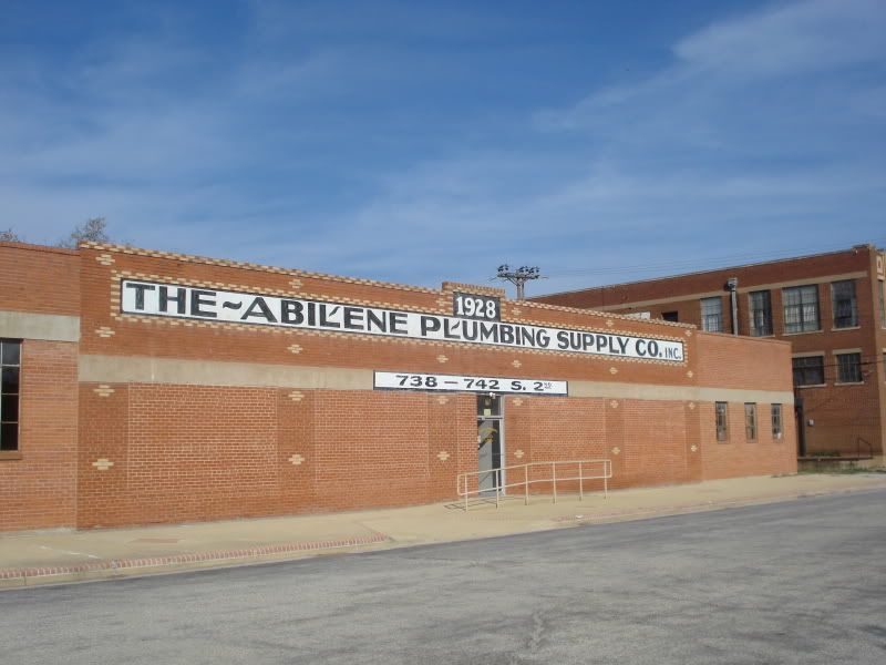
A closeup of the 1928 "Abilene Plumbing Supplies" building. It obviously had large picture windows in a happier time.
It doesn't look as if anyone's used this door in some time.
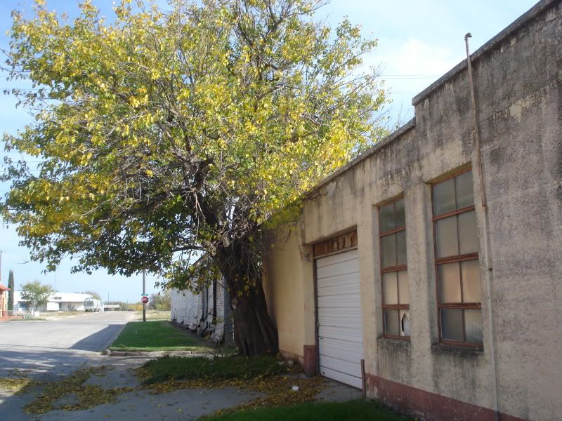
A tree has grown unchecked for generations. South 2nd between Pecan & Locust.

South 2nd.
Peering down an alley that runs from South 2nd to South 3rd.
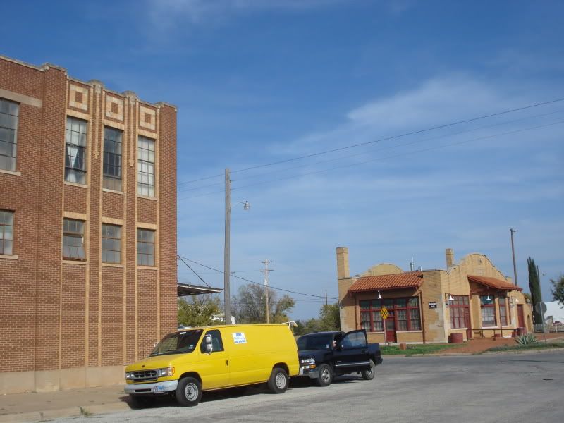
The corner of South 2nd & Locust. A 3-story warehouse/furniture making company on the left, the 1929 Burlington Route Depot on the right.
Part of the Mayfield Paper Company at 2nd & Locust.
Looking back west down 2nd.
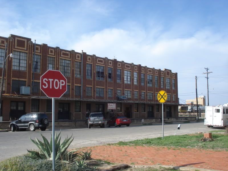
Cattle Annie's - a furniture making company that I never knew existed. If they're not using all 3 floors, that building could make some great lofts.
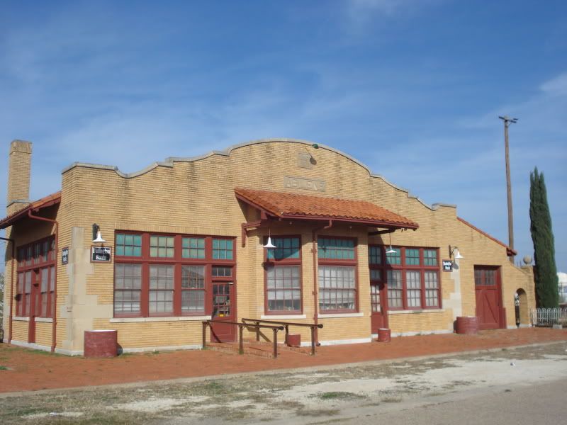
The 1929 Burlington Route Depot. The current owner has plans to turn it into a restaurant.
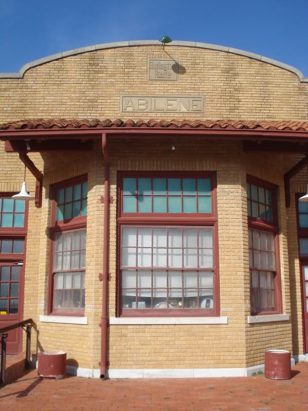
The depot's bay window.
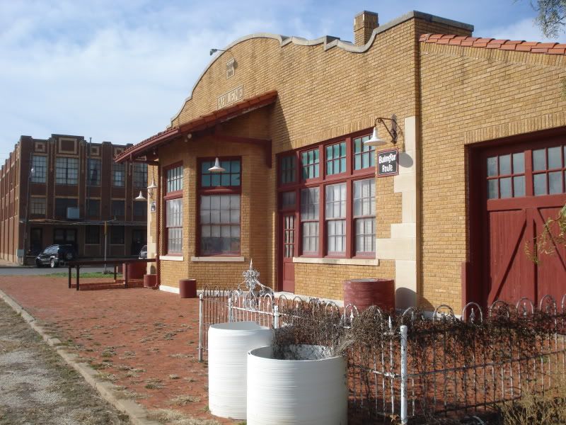
It has great potential.
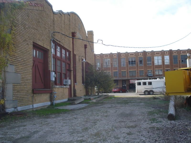
From behind.
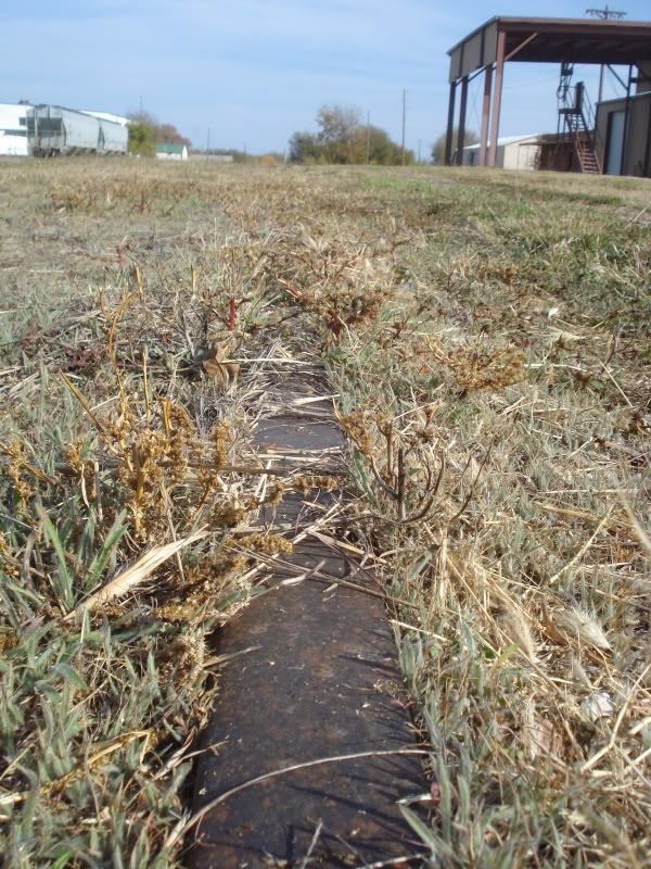
Across the street, tracks lay buried under dead grass.
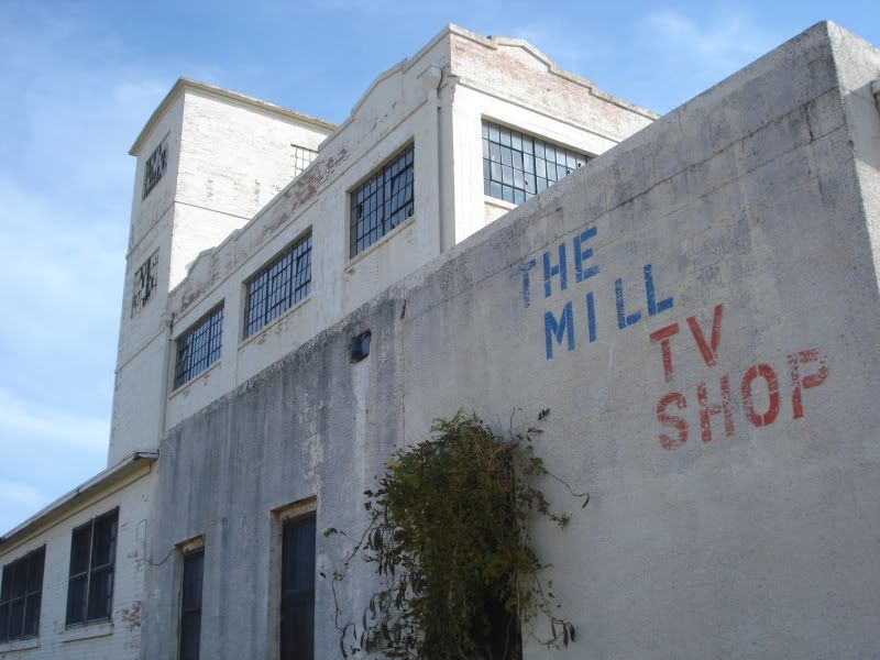
Above looms an old feed mill - turned TV shop - turned antique shop - turned abandoned shell. On the block bounded by 2nd & 3rd, Locust & Cherry.
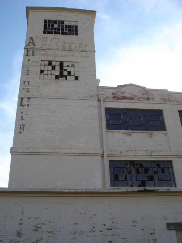
Hardly a window was spared.
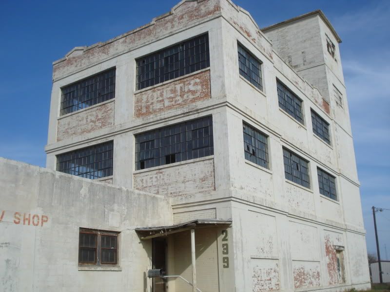
Remnants of a painted feed company sign linger above the door.
Looking southwest toward the courthouse and tower.
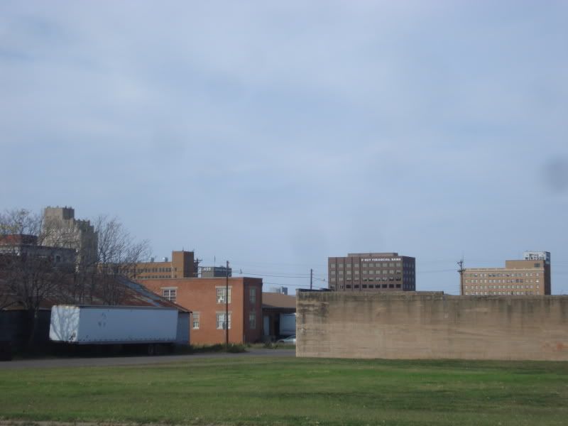
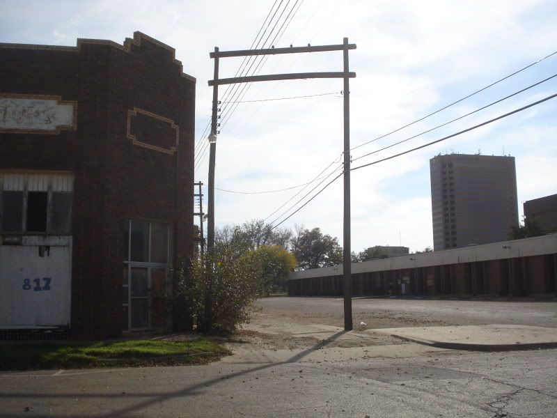
Looking north at the north side highrises peeking over the south side warehouses.
Cutting west back to Pecan street, these two old buildings sit behind the lesser-known 1914 courthouse between 3rd and 4th.
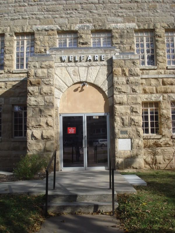
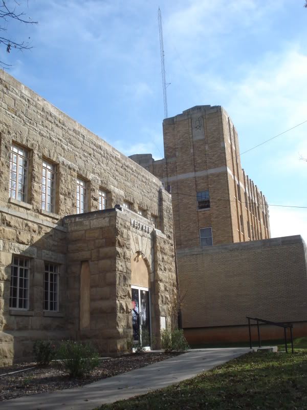
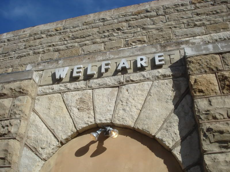
The Welfare Offices - older letters hide behind the current sign, though.
Indeed, the Welfare building apparently used to house the Agriculture Department.
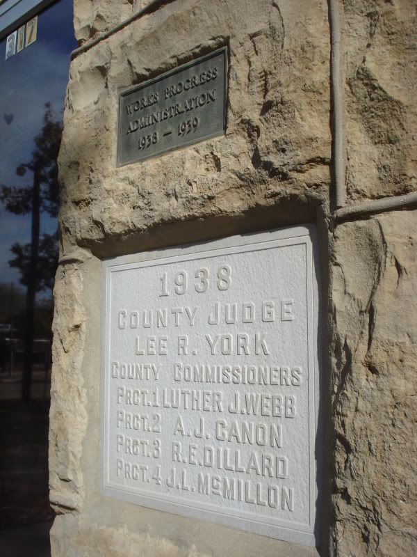
Built in the late 1930s as part of Roosevelt's Works Progress program.
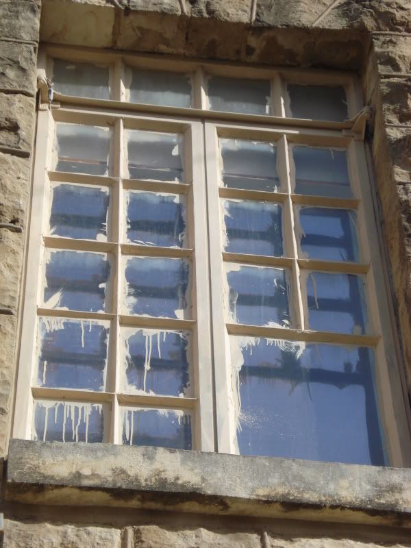
"Care" was not the name of the game apparently when this window was painted.
The rear of the 1914 Taylor County Courthouse. It is actually the 2nd courthouse to have been built in Abilene. The more traditional clock-tower-adorned original courthouse, built in the 1890s, was torn down to make way for this neoclassical beauty as Abilene's population soared and space was needed.
A beautiful art-deco building next to the Welfare offices. At least, its crown is beautiful.
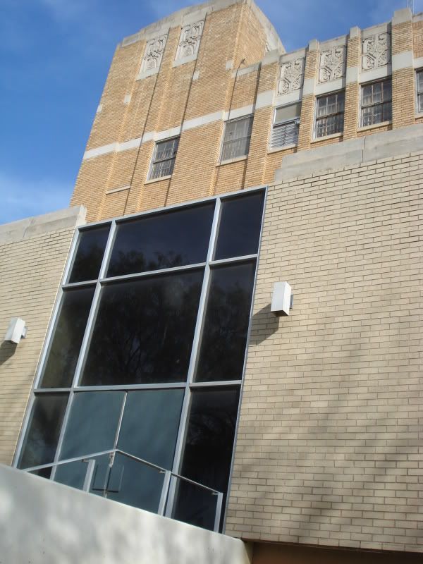
The building itself fell victim to a 1960s need for more space. Luckily, they didn't destroy the entire thing, but with the delicate crown to heavily out of balance with its blocky first floor, they might as well have.
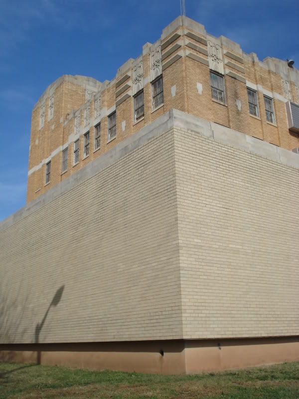
The contrast is laughable.
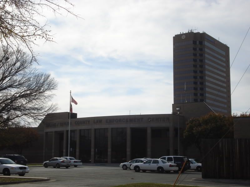
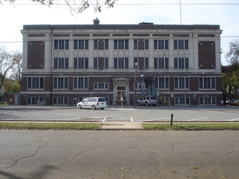
The Abilene/Taylor County Law Enforcement Center, built around the turn of this century, replaced large a popular department store that had long since gone out of business. Older residents still reminisce about its Christmas window displays. I believe it was Grissom's, but I'm not entirely sure.
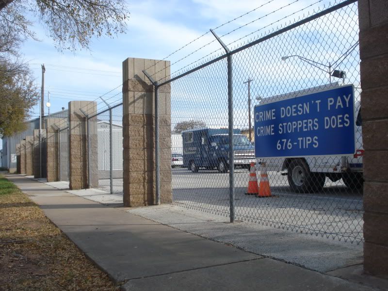
Abilene's supply of police vehicle sit behind barbed wire across from the Law Enforcement Center. Between 4th and 5th on Pecan.
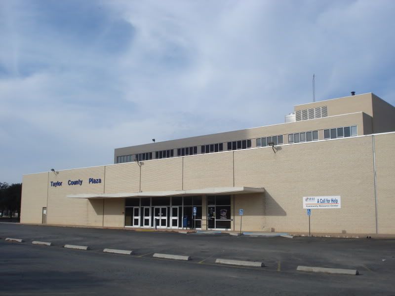
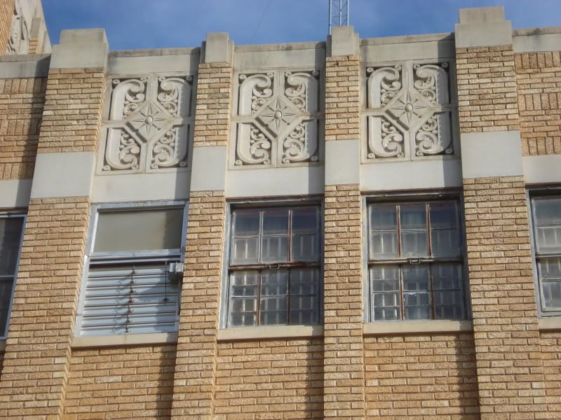
The Taylor County Plaza is a tribute to bad architecture of the 1960s. It is home to many county offices.
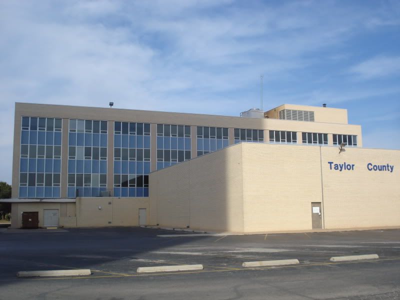
The building sit directly south of the Courthouse, occupying the block bounded by 3rd & 4th, Oak & Chestnut.
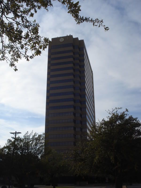
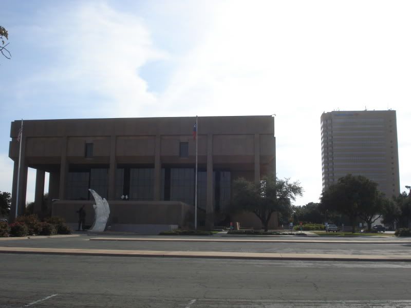
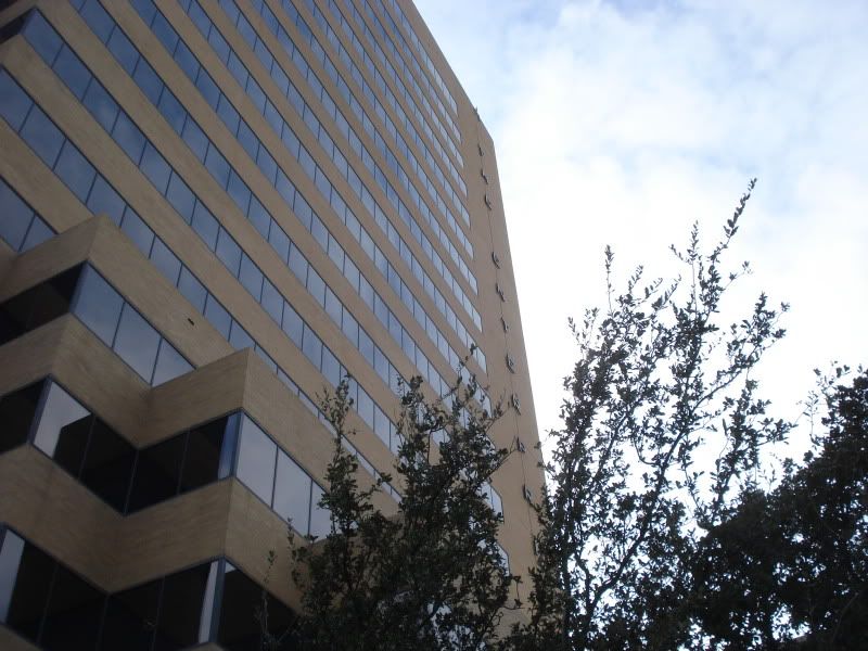
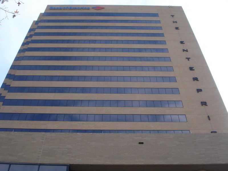
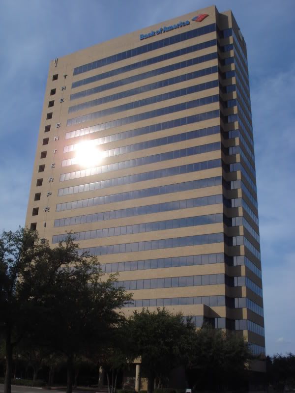
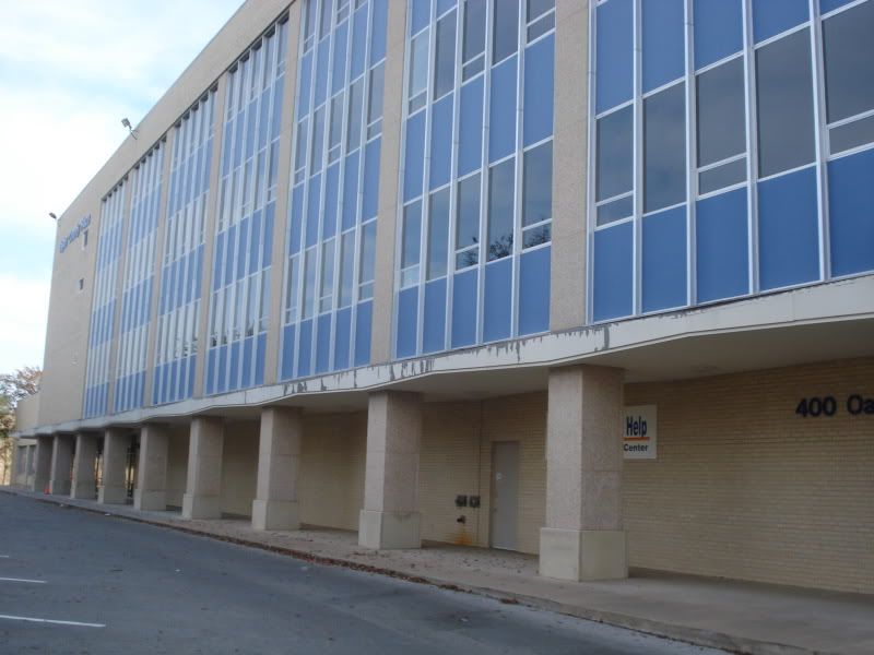
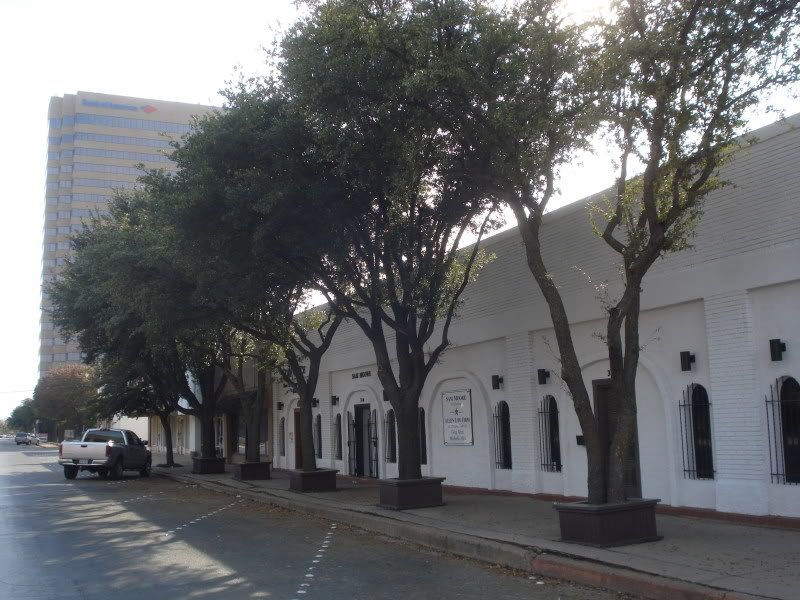
Built during Abilene's subdued 1980s oil boom, the 300-foot-tall Enterprise tower is an anomaly. It is the tallest building in Abilene, separated from the core skyline by about 6 blocks. Its neighbors are little more than woodframe houses and parking lots. Obviously, at one time, the south side of downtown was expected to prosper more than it ultimately did.
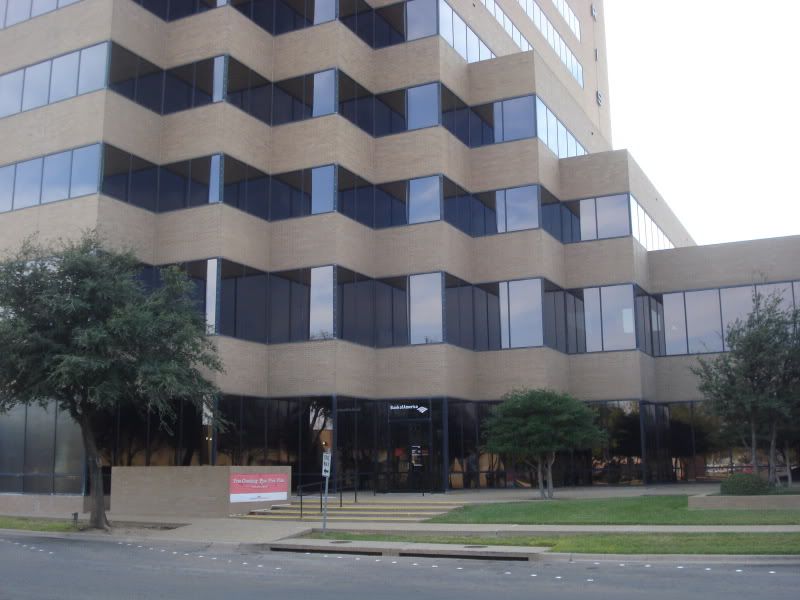
The lobby houses the main branch of Bank of America.
Looking up.
All by itself, the building is somewhat oppressive. Its stark rectangular 1980s form is in desperate need of some contrasting neighbors to balance it out. Hopefully the revitalization project will include some midrise apartment towers.
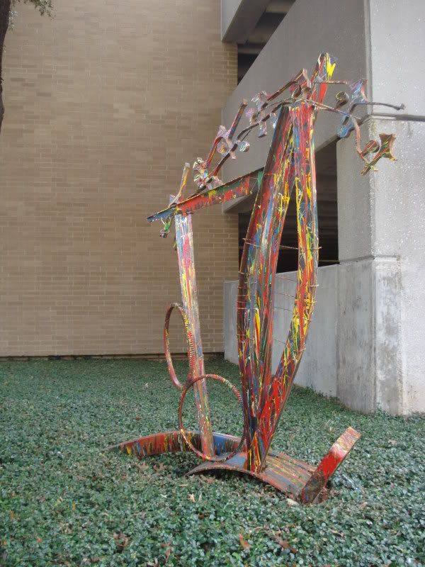
Some modern art decorating one of the planters out front.
This made me laugh. On Sycamore, directly west of the tower.
What I believe to be a long-abandoned school house on Sycamore. It is now apartments.
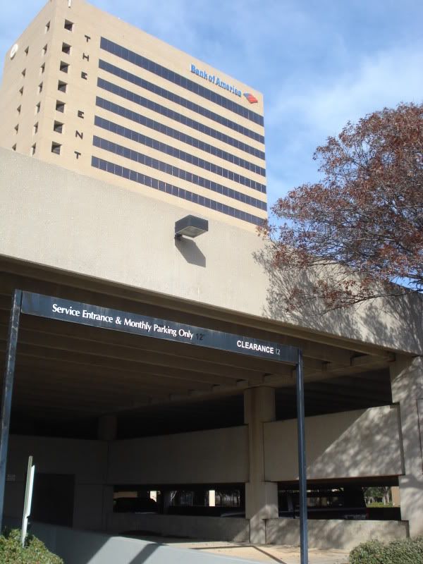
The south face of the tower looming over the parking garage.
The afternoon sun glaring off the windows as I meander back north on Chestnut toward the courthouse.
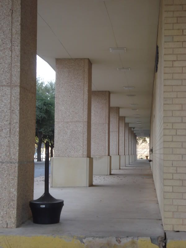
The portico of Taylor County plaza.
A fresh paint job would do wonders here.
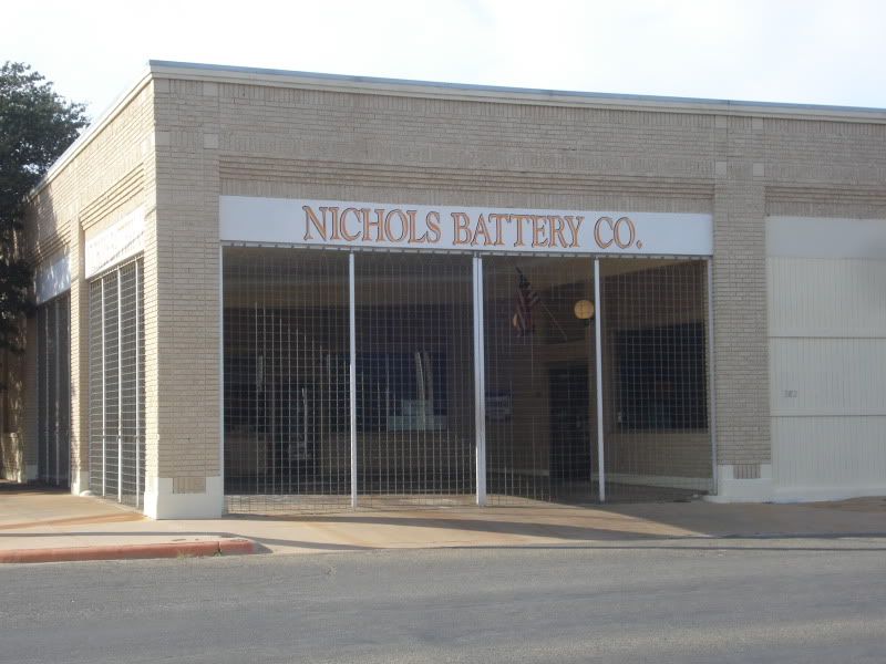
A tidy shop, Nichols Battery at Chestnut & 4th. The owner was interviewed by the Reporter-News about the possible revitalization of the area. He said he loves the idea and is glad it's finally "their turn." He says he'd like to see Chestnut look like Cypress Street, the showcase road of historic north downtown.
Nichols' neighbors: an empty lot and two frightening store fronts.
A drab row of lawyers' offices on Chestnut across from the courthouse. The trees are beautiful, though.
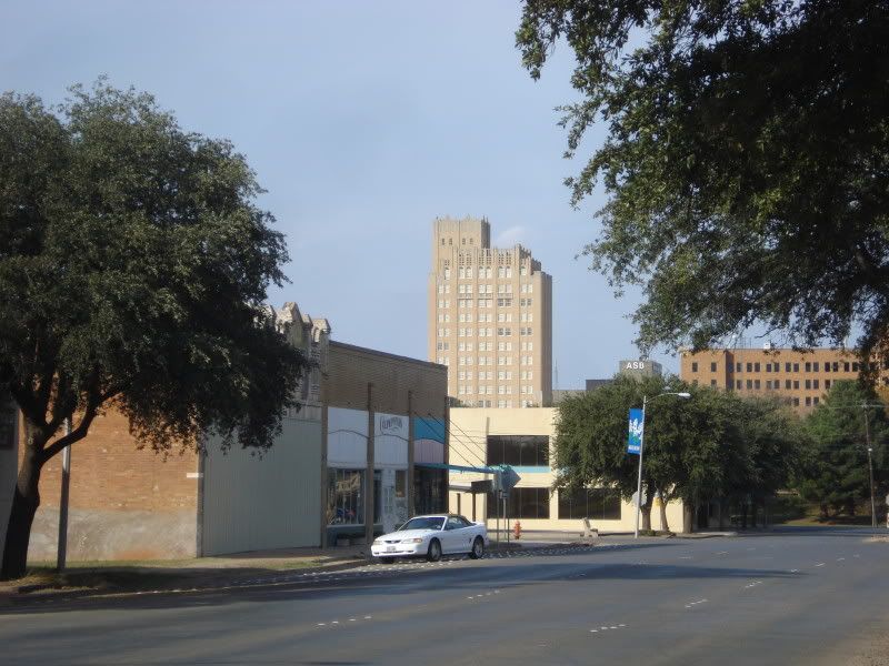
The 1930 Wooten Tower, now luxury apartments, peers down at south downtown.
The lawyer block, or so it seems.
An oddly sterile place for lunch. The Enterprise Tower peeks in.
Not much explanation necessary here. On South 3rd between Sycamore and Chestnut.
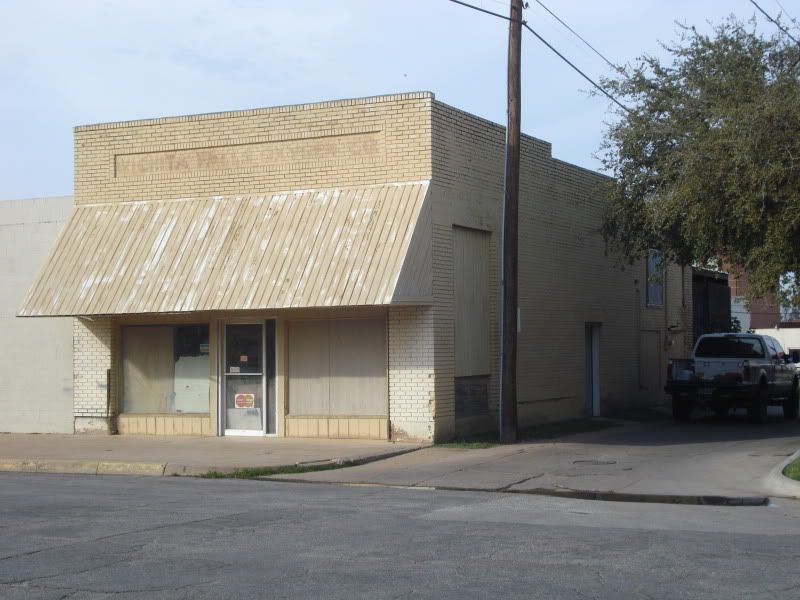
Across the street, the building barely reads "Wichita Falls Oxygen Co"
A couple of the many hideous relics that could easily be demolished in favor of a park or apartment community.
The west face of the courthouse from South 3rd.
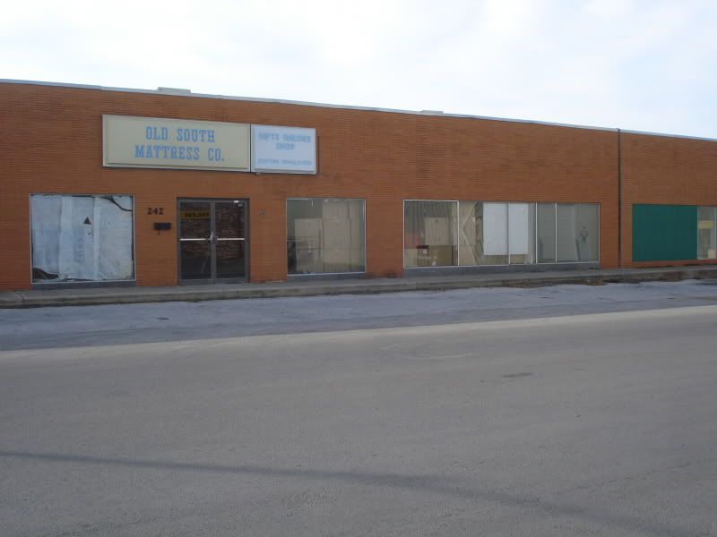
A custom mattress shop on Sycamore.
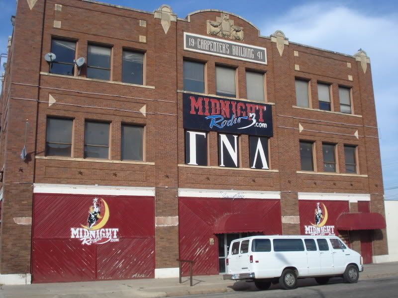
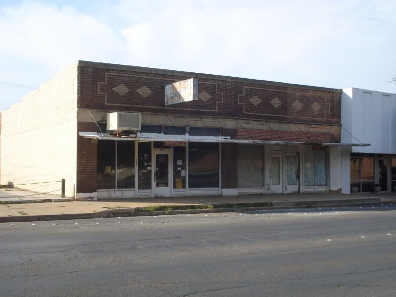
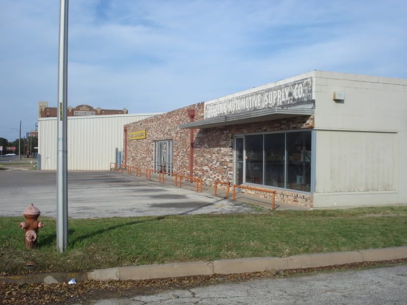
I'm not sure of this building's history. The mosaic says 1941, but the masonry at the roofline says 1921. Either way, I think it deserves a classier tenant than Midnight Rodeo 3.
The ornate crown.
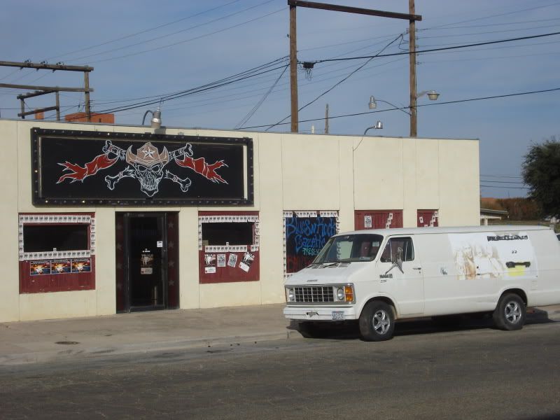
Next door, another shady concert venue.
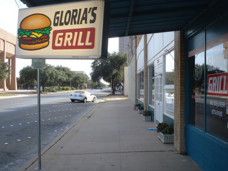
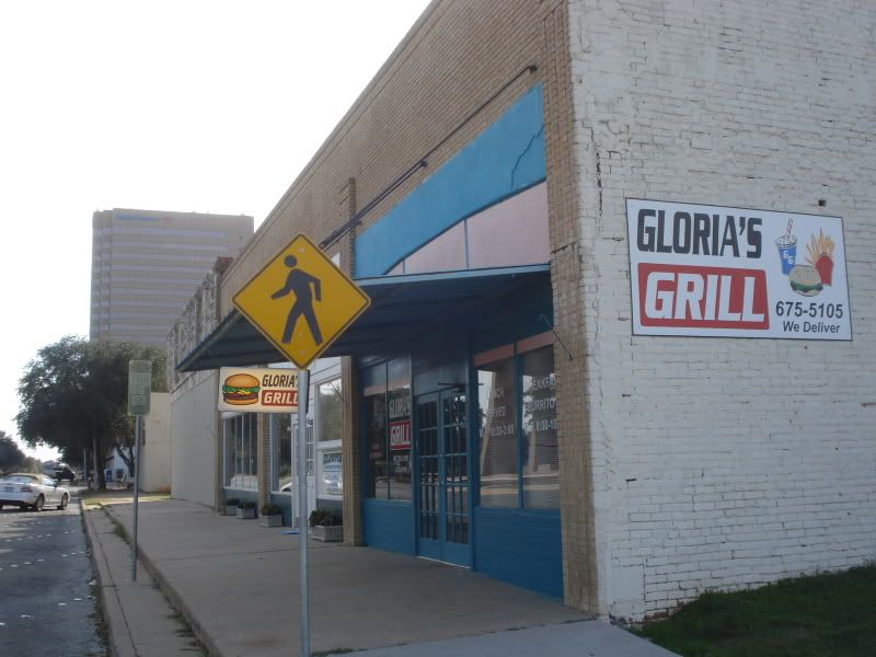
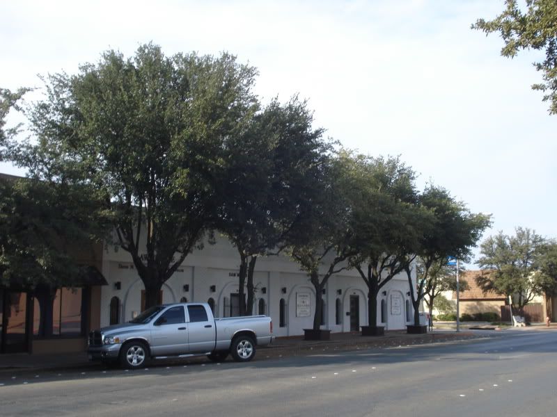
Back to Gloria's Grill on Chestnut. The owner is a bit more pessimistic about the plans for south downtown. She feels that she's doing a good lunch business, but that they'd need to bring "a lot" of people down there to make it worth staying open for dinner.
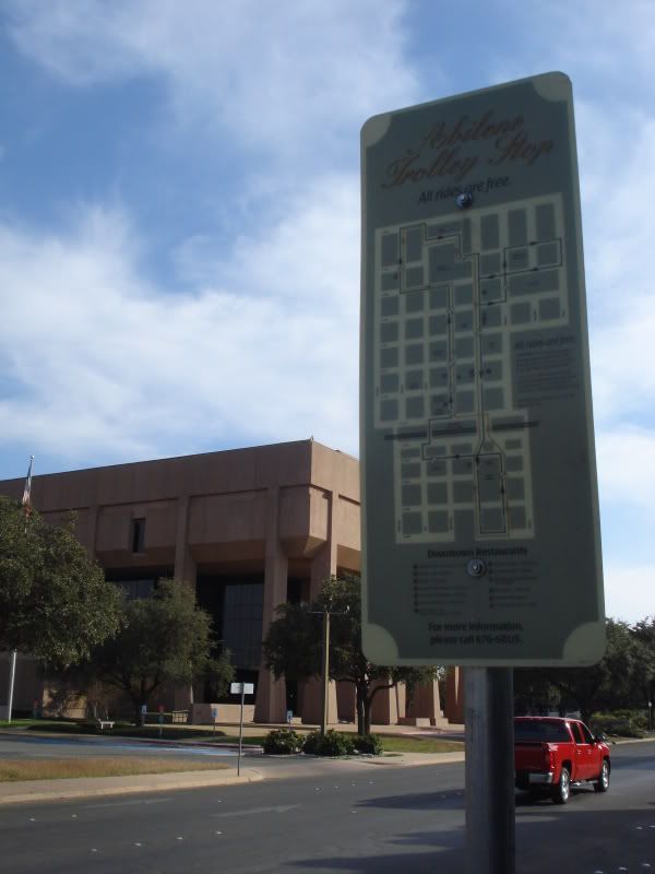
Gloria's is part of the Abilene Trolley's lunch route. The trolley is little more than a dressed-up city bus, but it's a nice touch for the many employees who spend the middle part of the day downtown. Hopefully, it can become a permanent home for more people in the coming decade.