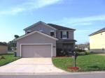
Property valuation of Lancashire Drive, Jacksonville, FL (tax assessments)
Other nearby streets: Lancashire Drive (1)  Lancashire Drive (2)
  Lancashire Drive (3)
  Rose Creek Lane (1)
  Rose Creek Lane (2)
Listed properties vs overall distribution of properties in Jacksonville, FL:
Advertisements
Lancashire Drive
Jacksonville, FL 32219
Find on map >>
Owner: ST JAMES PLACE COMMUNITY ASSOCIATION INC
Total market value: $1,065
Total land value: $1,065
Land usage: Jurisdictional Wetlands
Assessment for fiscal year: 2008/2009
Jacksonville, FL 32219
Find on map >>
Owner: ST JAMES PLACE COMMUNITY ASSOCIATION INC
Total market value: $1,065
Total land value: $1,065
Land usage: Jurisdictional Wetlands
Assessment for fiscal year: 2008/2009
Lancashire Drive
Jacksonville, FL 32219
Find on map >>
Owner: MARONDA HOMES INC OF FLORIDA
Total market value: $30,000
Total assessed value for property: $30,000
Total land value: $30,000
Land usage: Residential Land 3-7 Units Per Acre
Assessment for fiscal year: 2008/2009
Building usage: Single Family Residence 2 Story Soh
Actual year built: 2009
Effective year built: 2009
Heated area: 2,812 square feet
Baths: 3
Bedrooms: 5
Stories: 2
Rooms / Units: 1
Base Area (actual / effective / heated): 1,852 / 1,852 / 1,852 square feet
Finished Garage (actual / effective / heated): 340 / 170 / 0 square feet
Finished Open Porch (actual / effective / heated): 36 / 11 / 0 square feet
Finished upper story 1 (actual / effective / heated): 960 / 912 / 960 square feet
Lancashire Drive
Jacksonville, FL 32219
Find on map >>
Owner: WATERBROOK FALLS LLC
Total market value: $105
Total land value: $105
Land usage: Waste Land
Assessment for fiscal year: 2008/2009
Jacksonville, FL 32219
Find on map >>
Owner: WATERBROOK FALLS LLC
Total market value: $105
Total land value: $105
Land usage: Waste Land
Assessment for fiscal year: 2008/2009
Lancashire Drive
Jacksonville, FL 32219
Find on map >>
Owner: A T & COMMUNICATIONS T
Total market value: $410
Total assessed value for property: $410
Total land value: $410
Land usage: Utility
Assessment for fiscal year: 2008/2009
Jacksonville, FL 32219
Find on map >>
Owner: A T & COMMUNICATIONS T
Total market value: $410
Total assessed value for property: $410
Total land value: $410
Land usage: Utility
Assessment for fiscal year: 2008/2009
Lancashire Drive
Jacksonville, FL 32219
Find on map >>
Owner: WATERBROOK FALLS LLC
Total market value: $105
Total land value: $105
Land usage: Waste Land
Assessment for fiscal year: 2008/2009
Jacksonville, FL 32219
Find on map >>
Owner: WATERBROOK FALLS LLC
Total market value: $105
Total land value: $105
Land usage: Waste Land
Assessment for fiscal year: 2008/2009
Lancashire Drive
Jacksonville, FL 32219
Find on map >>
Owner: A T & COMMUNICATIONS T
Total market value: $250
Total assessed value for property: $250
Total land value: $250
Land usage: Utility
Assessment for fiscal year: 2008/2009
Jacksonville, FL 32219
Find on map >>
Owner: A T & COMMUNICATIONS T
Total market value: $250
Total assessed value for property: $250
Total land value: $250
Land usage: Utility
Assessment for fiscal year: 2008/2009
Lancashire Drive
Jacksonville, FL 32219
Find on map >>
Owner: WATERBROOK FALLS LLC
Total market value: $20,000
Total land value: $20,000
Land usage: Residential Land 3-7 Units Per Acre
Assessment for fiscal year: 2008/2009
Jacksonville, FL 32219
Find on map >>
Owner: WATERBROOK FALLS LLC
Total market value: $20,000
Total land value: $20,000
Land usage: Residential Land 3-7 Units Per Acre
Assessment for fiscal year: 2008/2009
Lancashire Drive
Jacksonville, FL 32219
Find on map >>
Owner: A T & COMMUNICATIONS T
Total market value: $400
Total assessed value for property: $400
Total land value: $400
Land usage: Utility
Assessment for fiscal year: 2008/2009
Jacksonville, FL 32219
Find on map >>
Owner: A T & COMMUNICATIONS T
Total market value: $400
Total assessed value for property: $400
Total land value: $400
Land usage: Utility
Assessment for fiscal year: 2008/2009
Lancashire Drive
Jacksonville, FL 32219
Find on map >>
Owner: A T & COMMUNICATIONS T
Total market value: $600
Total assessed value for property: $600
Total land value: $600
Land usage: Utility
Assessment for fiscal year: 2008/2009
Jacksonville, FL 32219
Find on map >>
Owner: A T & COMMUNICATIONS T
Total market value: $600
Total assessed value for property: $600
Total land value: $600
Land usage: Utility
Assessment for fiscal year: 2008/2009
Lancashire Drive
Jacksonville, FL 32219
Find on map >>
Owner: A T & COMMUNICATIONS T
Total market value: $230
Total assessed value for property: $230
Total land value: $230
Land usage: Utility
Assessment for fiscal year: 2008/2009
Jacksonville, FL 32219
Find on map >>
Owner: A T & COMMUNICATIONS T
Total market value: $230
Total assessed value for property: $230
Total land value: $230
Land usage: Utility
Assessment for fiscal year: 2008/2009
Other nearby streets: Lancashire Drive (1)  Lancashire Drive (2)
  Lancashire Drive (3)
  Rose Creek Lane (1)
  Rose Creek Lane (2)

Settings
X


