Cambridge, Massachusetts Neighborhood Map - Income, House Prices, Occupations, Boundaries
Settings
X

- City boundary
- Neighborhood boundaries
Business Search - 14 Million verified businesses
Neighborhoods:
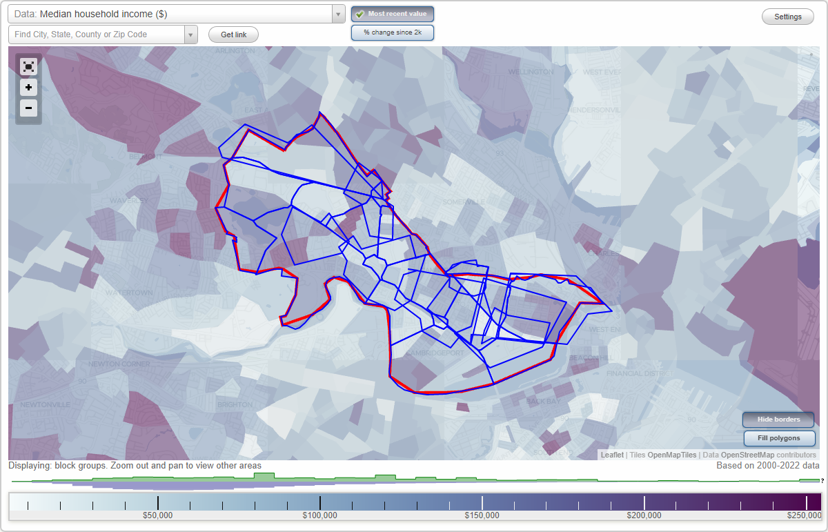
Agassiz, Avon Hill, Cambridge Highlands, Cambridgeport, Central Square, Central Square, East Cambridge, East Cambridge, Harvard Square, Harvard Square, Huron Village, Inman Square, Inman Square, Kendall Square, Kendall Square, Larchwood, MIT, Mid Cambridge, Neighborhood Four, North Cambridge, North Cambridge, Porter Square, Porter Square, Riverside, Strawberry Hill, Wellington Harrington, West CambridgeAgassiz neighborhood in Cambridge statistics: (Find on map)
Area: 0.284 square miles
Population: 14,740
Population density:
Median household income in 2021:
Median rent in in 2021:
Male vs Females
Median age
Housing prices:
Average estimated value of detached houses in 2021 (11.9% of all units):
Average estimated value of townhouses or other attached units in 2021 (13.4% of all units):
Average estimated value of housing units in 2-unit structures in 2021 (18.5% of all units):
Average estimated '21 value of housing units in 3-to-4-unit structures (29.8% of all units):
Average estimated '21 value of housing units in 5-or-more-unit structures (6.7% of all units):
Most popular occupations of males: education, training, and library occupations (18.3%); computer and mathematical occupations (12.4%); life, physical, and social science occupations (11.7%); arts, design, entertainment, sports, and media occupations (10.5%); management occupations (except farmers) (9.9%); service occupations (9.6%); architecture and engineering occupations (6.7%)
Most popular occupations of females: education, training, and library occupations (19.4%); sales and office occupations (15.3%); business and financial operations occupations (15.2%); management occupations (except farmers) (12.9%); life, physical, and social science occupations (11.1%); service occupations (8.8%); healthcare practitioners and technical occupations (5.1%)
Highways in this neighborhood: State Hwy 2 Alt (Massachusetts Ave).
Roads and streets: Oxford St; Wendell St; Sacramento St; Francis Ave; Irving St; Kirkland St; Hammond St; Everett St; Mellen St; Prentiss St; Museum St; Bryant St; Frost St; Forest St; Crescent St; Eustis St; Farrar St; Holden St; Gorham St; Scott St; Carver St; Newport Rd; Garfield St; Harris St; Shady Hill Sq; Howland St; Traymore St; Sacramento Pl; Arcadia St; Frost Ter; Holden Green; Sedgewick Rd; Jarvis St.
Agassiz neighborhood detailed profile
Area: 0.284 square miles
Population: 14,740
Population density:
| Agassiz: | 51,977 people per square mile |
| Cambridge: | 18,215 people per square mile |
Median household income in 2021:
| Agassiz: | $107,405 |
| Cambridge: | $104,746 |
Median rent in in 2021:
| Agassiz: | $2,249 |
| Cambridge: | $2,001 |
Male vs Females
| Males: | 7,078 |
| Females: | 7,662 |
Median age
| Males: | 34.7 years |
| Females: | 32.8 years |
Housing prices:
Average estimated value of detached houses in 2021 (11.9% of all units):
| Agassiz: | $1,608,934 |
| Cambridge: | $1,820,581 |
Average estimated value of townhouses or other attached units in 2021 (13.4% of all units):
| This neighborhood: | $1,562,195 |
| city: | $1,163,617 |
Average estimated value of housing units in 2-unit structures in 2021 (18.5% of all units):
| This neighborhood: | $1,260,121 |
| Cambridge: | $1,112,522 |
Average estimated '21 value of housing units in 3-to-4-unit structures (29.8% of all units):
| Agassiz: | $849,630 |
| city: | $976,252 |
Average estimated '21 value of housing units in 5-or-more-unit structures (6.7% of all units):
| Agassiz: | $613,588 |
| Cambridge: | $834,095 |
Most popular occupations of males: education, training, and library occupations (18.3%); computer and mathematical occupations (12.4%); life, physical, and social science occupations (11.7%); arts, design, entertainment, sports, and media occupations (10.5%); management occupations (except farmers) (9.9%); service occupations (9.6%); architecture and engineering occupations (6.7%)
Most popular occupations of females: education, training, and library occupations (19.4%); sales and office occupations (15.3%); business and financial operations occupations (15.2%); management occupations (except farmers) (12.9%); life, physical, and social science occupations (11.1%); service occupations (8.8%); healthcare practitioners and technical occupations (5.1%)
Highways in this neighborhood: State Hwy 2 Alt (Massachusetts Ave).
Roads and streets: Oxford St; Wendell St; Sacramento St; Francis Ave; Irving St; Kirkland St; Hammond St; Everett St; Mellen St; Prentiss St; Museum St; Bryant St; Frost St; Forest St; Crescent St; Eustis St; Farrar St; Holden St; Gorham St; Scott St; Carver St; Newport Rd; Garfield St; Harris St; Shady Hill Sq; Howland St; Traymore St; Sacramento Pl; Arcadia St; Frost Ter; Holden Green; Sedgewick Rd; Jarvis St.
Agassiz neighborhood detailed profile
Avon Hill neighborhood in Cambridge statistics: (Find on map)
Area: 0.309 square miles
Population: 8,015
Population density:
Median household income in 2021:
Median rent in in 2021:
Male vs Females
Median age
Housing prices:
Average estimated value of detached houses in 2021 (13.2% of all units):
Average estimated value of townhouses or other attached units in 2021 (13.5% of all units):
Average estimated value of housing units in 2-unit structures in 2021 (22.6% of all units):
Average estimated '21 value of housing units in 3-to-4-unit structures (26.0% of all units):
Average estimated '21 value of housing units in 5-or-more-unit structures (1.2% of all units):
Most popular occupations of males: education, training, and library occupations (18.3%); management occupations (except farmers) (17.5%); life, physical, and social science occupations (10.4%); architecture and engineering occupations (9.9%); service occupations (9.7%); computer and mathematical occupations (6.9%); sales and office occupations (6.6%)
Most popular occupations of females: life, physical, and social science occupations (23.3%); business and financial operations occupations (13.1%); education, training, and library occupations (12.7%); sales and office occupations (10.7%); computer and mathematical occupations (9.8%); management occupations (except farmers) (9.4%); legal occupations (8.5%)
Roads and streets: Walden St; Concord Ave; Richdale Ave; Upland Rd; Sherman St; Garden St; Field St; New St; Walden Square Rd; Raymond St; Bellis Cir; Fayerweather St; Hubbard Ave; Stearns St; Bolton St; Bay State Rd; Donnell St; Cambridge Ter; Copley St; Cadbury Rd; Buena Vista Park; Fern St; Newell St; Birch St; Corporal Burns Rd; Esten St; Fenno St; Chilton St; Whittier St; Vincent St; Alpine St; Mount Pleasant St; Sheridan St; Wood St; Lincoln Way; Hazel St; Ivy St; Chetwynd Rd; Herbert St; Blair Pl; Walden Mews; Bellis Ct.
Avon Hill neighborhood detailed profile
Area: 0.309 square miles
Population: 8,015
Population density:
| Avon Hill: | 25,953 people per square mile |
| Cambridge: | 18,215 people per square mile |
Median household income in 2021:
| Avon Hill: | $153,769 |
| Cambridge: | $104,746 |
Median rent in in 2021:
| Avon Hill: | $2,513 |
| Cambridge: | $2,001 |
Male vs Females
| Males: | 3,864 |
| Females: | 4,150 |
Median age
| Males: | 42.0 years |
| Females: | 40.0 years |
Housing prices:
Average estimated value of detached houses in 2021 (13.2% of all units):
| Avon Hill: | $2,203,934 |
| Cambridge: | $1,820,581 |
Average estimated value of townhouses or other attached units in 2021 (13.5% of all units):
| This neighborhood: | $1,093,217 |
| city: | $1,163,617 |
Average estimated value of housing units in 2-unit structures in 2021 (22.6% of all units):
| This neighborhood: | $1,174,235 |
| Cambridge: | $1,112,522 |
Average estimated '21 value of housing units in 3-to-4-unit structures (26.0% of all units):
| Avon Hill: | $875,357 |
| city: | $976,252 |
Average estimated '21 value of housing units in 5-or-more-unit structures (1.2% of all units):
| Avon Hill: | $719,313 |
| Cambridge: | $834,095 |
Most popular occupations of males: education, training, and library occupations (18.3%); management occupations (except farmers) (17.5%); life, physical, and social science occupations (10.4%); architecture and engineering occupations (9.9%); service occupations (9.7%); computer and mathematical occupations (6.9%); sales and office occupations (6.6%)
Most popular occupations of females: life, physical, and social science occupations (23.3%); business and financial operations occupations (13.1%); education, training, and library occupations (12.7%); sales and office occupations (10.7%); computer and mathematical occupations (9.8%); management occupations (except farmers) (9.4%); legal occupations (8.5%)
Roads and streets: Walden St; Concord Ave; Richdale Ave; Upland Rd; Sherman St; Garden St; Field St; New St; Walden Square Rd; Raymond St; Bellis Cir; Fayerweather St; Hubbard Ave; Stearns St; Bolton St; Bay State Rd; Donnell St; Cambridge Ter; Copley St; Cadbury Rd; Buena Vista Park; Fern St; Newell St; Birch St; Corporal Burns Rd; Esten St; Fenno St; Chilton St; Whittier St; Vincent St; Alpine St; Mount Pleasant St; Sheridan St; Wood St; Lincoln Way; Hazel St; Ivy St; Chetwynd Rd; Herbert St; Blair Pl; Walden Mews; Bellis Ct.
Avon Hill neighborhood detailed profile
Cambridge Highlands neighborhood in Cambridge statistics: (Find on map)
Area: 0.535 square miles
Population: 1,431
Population density:
Median household income in 2021:
Median rent in in 2021:
Male vs Females
Median age
Housing prices:
Average estimated value of detached houses in 2021 (15.0% of all units):
Average estimated value of townhouses or other attached units in 2021 (12.0% of all units):
Average estimated value of housing units in 2-unit structures in 2021 (13.2% of all units):
Average estimated '21 value of housing units in 3-to-4-unit structures (16.7% of all units):
Average estimated '21 value of housing units in 5-or-more-unit structures (34.5% of all units):
Most popular occupations of males: management occupations (except farmers) (31.1%); computer and mathematical occupations (19.6%); business and financial operations occupations (16.2%); life, physical, and social science occupations (8.1%); arts, design, entertainment, sports, and media occupations (7.1%); service occupations (5.9%); sales and office occupations (5.8%)
Most popular occupations of females: management occupations (except farmers) (21.0%); sales and office occupations (17.6%); service occupations (15.7%); education, training, and library occupations (15.0%); business and financial operations occupations (11.8%); computer and mathematical occupations (8.9%); arts, design, entertainment, sports, and media occupations (7.7%)
Highways in this neighborhood: US Hwy 3 (Alewife Brook Pkwy, State Hwy 2, State Hwy 16).
Roads and streets: Concord Ave; Fawcett St; Smith Pl; Mooney St; Normandy Ave; Blanchard Rd; Griswold St; Wilson Rd; Moulton St; Terminal Rd; S Normandy Ave; Spinelli Pl; Concord Ln; Loomis St; Wheeler St; Adley Rd; Sunset Rd; Normandy Ter; Normandy Ter Exn.
Railroad features: Mbta Commuter Rail; Mbta RR.
Other features: Alewife Brk.
Cambridge Highlands neighborhood detailed profile
Area: 0.535 square miles
Population: 1,431
Population density:
| Cambridge Highlands: | 2,674 people per square mile |
| Cambridge: | 18,215 people per square mile |
Median household income in 2021:
| Cambridge Highlands: | $128,760 |
| Cambridge: | $104,746 |
Median rent in in 2021:
| Cambridge Highlands: | $2,368 |
| Cambridge: | $2,001 |
Male vs Females
| Males: | 655 |
| Females: | 775 |
Median age
| Males: | 34.6 years |
| Females: | 40.6 years |
Housing prices:
Average estimated value of detached houses in 2021 (15.0% of all units):
| Cambridge Highlands: | $543,590 |
| Cambridge: | $1,820,581 |
Average estimated value of townhouses or other attached units in 2021 (12.0% of all units):
| This neighborhood: | $586,668 |
| city: | $1,163,617 |
Average estimated value of housing units in 2-unit structures in 2021 (13.2% of all units):
| This neighborhood: | $739,157 |
| Cambridge: | $1,112,522 |
Average estimated '21 value of housing units in 3-to-4-unit structures (16.7% of all units):
| Cambridge Highlands: | $1,095,128 |
| city: | $976,252 |
Average estimated '21 value of housing units in 5-or-more-unit structures (34.5% of all units):
| Cambridge Highlands: | $549,375 |
| Cambridge: | $834,095 |
Most popular occupations of males: management occupations (except farmers) (31.1%); computer and mathematical occupations (19.6%); business and financial operations occupations (16.2%); life, physical, and social science occupations (8.1%); arts, design, entertainment, sports, and media occupations (7.1%); service occupations (5.9%); sales and office occupations (5.8%)
Most popular occupations of females: management occupations (except farmers) (21.0%); sales and office occupations (17.6%); service occupations (15.7%); education, training, and library occupations (15.0%); business and financial operations occupations (11.8%); computer and mathematical occupations (8.9%); arts, design, entertainment, sports, and media occupations (7.7%)
Highways in this neighborhood: US Hwy 3 (Alewife Brook Pkwy, State Hwy 2, State Hwy 16).
Roads and streets: Concord Ave; Fawcett St; Smith Pl; Mooney St; Normandy Ave; Blanchard Rd; Griswold St; Wilson Rd; Moulton St; Terminal Rd; S Normandy Ave; Spinelli Pl; Concord Ln; Loomis St; Wheeler St; Adley Rd; Sunset Rd; Normandy Ter; Normandy Ter Exn.
Railroad features: Mbta Commuter Rail; Mbta RR.
Other features: Alewife Brk.
Cambridge Highlands neighborhood detailed profile
Cambridgeport neighborhood in Cambridge statistics: (Find on map)
Area: 0.844 square miles
Population: 17,235
Population density:
Median household income in 2021:
Median rent in in 2021:
Male vs Females
Median age
Housing prices:
Average estimated value of detached houses in 2021 (8.3% of all units):
Average estimated value of townhouses or other attached units in 2021 (11.6% of all units):
Average estimated value of housing units in 2-unit structures in 2021 (14.0% of all units):
Average estimated '21 value of housing units in 3-to-4-unit structures (24.9% of all units):
Average estimated '21 value of housing units in 5-or-more-unit structures (16.7% of all units):
Most popular occupations of males: life, physical, and social science occupations (15.9%); management occupations (except farmers) (14.0%); computer and mathematical occupations (12.3%); education, training, and library occupations (10.1%); business and financial operations occupations (9.5%); service occupations (7.3%); sales and office occupations (6.5%)
Most popular occupations of females: education, training, and library occupations (15.2%); management occupations (except farmers) (14.8%); sales and office occupations (12.1%); business and financial operations occupations (11.4%); life, physical, and social science occupations (9.5%); healthcare practitioners and technical occupations (8.6%); computer and mathematical occupations (6.9%)
Highways in this neighborhood: US Hwy 3 (Memorial Dr, State Hwy 2); State Hwy 2 Alt (Massachusetts Ave); Boston Univ Brg (State Hwy 2).
Roads and streets: Vassar St; Brookline St; Magazine St; Pearl St; Putnam Ave; Sidney St; River St; Allston St; Pleasant St; Amherst St; Chestnut St; Albany St; Waverly St; Franklin St; Erie St; Green St; Henry St; Auburn St; Hamilton St; Landsdowne St; Pacific St; Granite St; Fairmont St; Cottage St; William St; Porrington St; Kelly Rd; Blanche St; Riverside Rd; Pilgrim St; Prince St; Chalk St; Audrey St; Upton St; Cross St; Valentine St; Speridakis Ter; Tufts St; Glenwood Ave; Decatur St; Lopez St; Tudor St; Perry St; Watson St; McTernan St; Lawrence St; Amesbury St; Emily St; Florence St; Bell Ct; Fairmont Ave; Andrew St; Talbot St; Kenwood St; Rockwell St; Danforth St; Pleasant Pl; Merriam St; Rockingham St; Laurel St; Newton St; Anglim St; Peters St; Whitney Ave; Acorn St; Grove Ave; Hastings Sq; Fowler St; Salem St; Endicott St; Westacott Ct; Cottage Ct; Reardon St; Auburn Park; Gordon Pl; Rollins Ct; Fort Washington Pl; Putnam Ct; Rockingham Pl; Stinson Ct; Pearl Street Pl; Glenn Ter; Magazine Ct; Bailey Pl; Allston Ct; Woodrow Wilson Ct; Kinnaird St.
Railroad features: Conrail RR; Penn Central RR.
Highways in this neighborhood: State Hwy 2 (Boston University Brg).
Cambridgeport neighborhood detailed profile
Area: 0.844 square miles
Population: 17,235
Population density:
| Cambridgeport: | 20,426 people per square mile |
| Cambridge: | 18,215 people per square mile |
Median household income in 2021:
| Cambridgeport: | $124,758 |
| Cambridge: | $104,746 |
Median rent in in 2021:
| Cambridgeport: | $2,143 |
| Cambridge: | $2,001 |
Male vs Females
| Males: | 7,927 |
| Females: | 9,307 |
Median age
| Males: | 35.6 years |
| Females: | 35.2 years |
Housing prices:
Average estimated value of detached houses in 2021 (8.3% of all units):
| Cambridgeport: | $1,130,606 |
| Cambridge: | $1,820,581 |
Average estimated value of townhouses or other attached units in 2021 (11.6% of all units):
| This neighborhood: | $1,097,273 |
| city: | $1,163,617 |
Average estimated value of housing units in 2-unit structures in 2021 (14.0% of all units):
| This neighborhood: | $200,849 |
| Cambridge: | $1,112,522 |
Average estimated '21 value of housing units in 3-to-4-unit structures (24.9% of all units):
| Cambridgeport: | $593,478 |
| city: | $976,252 |
Average estimated '21 value of housing units in 5-or-more-unit structures (16.7% of all units):
| Cambridgeport: | $1,174,510 |
| Cambridge: | $834,095 |
Most popular occupations of males: life, physical, and social science occupations (15.9%); management occupations (except farmers) (14.0%); computer and mathematical occupations (12.3%); education, training, and library occupations (10.1%); business and financial operations occupations (9.5%); service occupations (7.3%); sales and office occupations (6.5%)
Most popular occupations of females: education, training, and library occupations (15.2%); management occupations (except farmers) (14.8%); sales and office occupations (12.1%); business and financial operations occupations (11.4%); life, physical, and social science occupations (9.5%); healthcare practitioners and technical occupations (8.6%); computer and mathematical occupations (6.9%)
Highways in this neighborhood: US Hwy 3 (Memorial Dr, State Hwy 2); State Hwy 2 Alt (Massachusetts Ave); Boston Univ Brg (State Hwy 2).
Roads and streets: Vassar St; Brookline St; Magazine St; Pearl St; Putnam Ave; Sidney St; River St; Allston St; Pleasant St; Amherst St; Chestnut St; Albany St; Waverly St; Franklin St; Erie St; Green St; Henry St; Auburn St; Hamilton St; Landsdowne St; Pacific St; Granite St; Fairmont St; Cottage St; William St; Porrington St; Kelly Rd; Blanche St; Riverside Rd; Pilgrim St; Prince St; Chalk St; Audrey St; Upton St; Cross St; Valentine St; Speridakis Ter; Tufts St; Glenwood Ave; Decatur St; Lopez St; Tudor St; Perry St; Watson St; McTernan St; Lawrence St; Amesbury St; Emily St; Florence St; Bell Ct; Fairmont Ave; Andrew St; Talbot St; Kenwood St; Rockwell St; Danforth St; Pleasant Pl; Merriam St; Rockingham St; Laurel St; Newton St; Anglim St; Peters St; Whitney Ave; Acorn St; Grove Ave; Hastings Sq; Fowler St; Salem St; Endicott St; Westacott Ct; Cottage Ct; Reardon St; Auburn Park; Gordon Pl; Rollins Ct; Fort Washington Pl; Putnam Ct; Rockingham Pl; Stinson Ct; Pearl Street Pl; Glenn Ter; Magazine Ct; Bailey Pl; Allston Ct; Woodrow Wilson Ct; Kinnaird St.
Railroad features: Conrail RR; Penn Central RR.
Highways in this neighborhood: State Hwy 2 (Boston University Brg).
Cambridgeport neighborhood detailed profile
Central Square neighborhood in Cambridge statistics: (Find on map)
Area: 0.025 square miles
Population: 24,317
Population density:
Median household income in 2021:
Median rent in in 2021:
Male vs Females
Median age
Housing prices:
Average estimated value of detached houses in 2021 (10.1% of all units):
Average estimated value of townhouses or other attached units in 2021 (6.7% of all units):
Average estimated value of housing units in 2-unit structures in 2021 (11.3% of all units):
Average estimated '21 value of housing units in 3-to-4-unit structures (22.0% of all units):
Average estimated '21 value of housing units in 5-or-more-unit structures (12.0% of all units):
Most popular occupations of males: education, training, and library occupations (17.8%); computer and mathematical occupations (16.5%); management occupations (except farmers) (12.3%); life, physical, and social science occupations (11.8%); business and financial operations occupations (6.6%); arts, design, entertainment, sports, and media occupations (6.6%); sales and office occupations (6.1%)
Most popular occupations of females: education, training, and library occupations (20.6%); management occupations (except farmers) (13.6%); sales and office occupations (12.8%); life, physical, and social science occupations (10.6%); business and financial operations occupations (9.3%); healthcare practitioners and technical occupations (8.8%); service occupations (6.9%)
Highways in this neighborhood: Massachusetts Ave (State Hwy 2 Alt).
Roads and streets: River St; Green St; Prospect St; Pleasant St; Central Sq; Western Ave; Essex St; Magazine St.
Central Square neighborhood detailed profile
Area: 0.025 square miles
Population: 24,317
Population density:
| Central Square: | 963,907 people per square mile |
| Cambridge: | 18,215 people per square mile |
Median household income in 2021:
| Central Square: | $114,322 |
| Cambridge: | $104,746 |
Median rent in in 2021:
| Central Square: | $2,393 |
| Cambridge: | $2,001 |
Male vs Females
| Males: | 12,637 |
| Females: | 11,679 |
Median age
| Males: | 32.1 years |
| Females: | 33.4 years |
Housing prices:
Average estimated value of detached houses in 2021 (10.1% of all units):
| Central Square: | $2,203,792 |
| Cambridge: | $1,820,581 |
Average estimated value of townhouses or other attached units in 2021 (6.7% of all units):
| This neighborhood: | $1,369,672 |
| city: | $1,163,617 |
Average estimated value of housing units in 2-unit structures in 2021 (11.3% of all units):
| This neighborhood: | $1,141,523 |
| Cambridge: | $1,112,522 |
Average estimated '21 value of housing units in 3-to-4-unit structures (22.0% of all units):
| Central Square: | $846,983 |
| city: | $976,252 |
Average estimated '21 value of housing units in 5-or-more-unit structures (12.0% of all units):
| Central Square: | $392,703 |
| Cambridge: | $834,095 |
Most popular occupations of males: education, training, and library occupations (17.8%); computer and mathematical occupations (16.5%); management occupations (except farmers) (12.3%); life, physical, and social science occupations (11.8%); business and financial operations occupations (6.6%); arts, design, entertainment, sports, and media occupations (6.6%); sales and office occupations (6.1%)
Most popular occupations of females: education, training, and library occupations (20.6%); management occupations (except farmers) (13.6%); sales and office occupations (12.8%); life, physical, and social science occupations (10.6%); business and financial operations occupations (9.3%); healthcare practitioners and technical occupations (8.8%); service occupations (6.9%)
Highways in this neighborhood: Massachusetts Ave (State Hwy 2 Alt).
Roads and streets: River St; Green St; Prospect St; Pleasant St; Central Sq; Western Ave; Essex St; Magazine St.
Central Square neighborhood detailed profile
East Cambridge neighborhood in Cambridge statistics: (Find on map)
Area: 0.681 square miles
Population: 10,835
Population density:
Median household income in 2021:
Median rent in in 2021:
Male vs Females
Median age
Housing prices:
Average estimated value of detached houses in 2021 (9.2% of all units):
Average estimated value of townhouses or other attached units in 2021 (5.7% of all units):
Average estimated value of housing units in 2-unit structures in 2021 (19.8% of all units):
Average estimated '21 value of housing units in 3-to-4-unit structures (21.5% of all units):
Average estimated '21 value of housing units in 5-or-more-unit structures (82.8% of all units):
Most popular occupations of males: computer and mathematical occupations (23.1%); business and financial operations occupations (15.2%); arts, design, entertainment, sports, and media occupations (9.3%); life, physical, and social science occupations (8.3%); management occupations (except farmers) (7.9%); education, training, and library occupations (7.8%); service occupations (6.4%)
Most popular occupations of females: service occupations (16.0%); management occupations (except farmers) (15.0%); education, training, and library occupations (15.0%); sales and office occupations (14.4%); business and financial operations occupations (8.4%); healthcare practitioners and technical occupations (5.7%); life, physical, and social science occupations (5.4%)
Highways in this neighborhood: Monsignor Obrien Hwy (State Hwy 28); Charlestown Ave (Gilmore Brg); US Hwy 3; State Hwy 28 (Msgr O'Brien Hwy).
Roads and streets: Land Blvd (Commercial Ave); Cambridge St; Rogers St; 3rd St; Binney St; Thorndike St; Spring St; Charles St; Otis St; Hurley St; 1st St; Gore St; 5th St; Bent St; 2nd St; Cambridge Pkwy; 6th St; Linskey Way (Munroe St); Sciarappa St; Fulkerson St; Industrial Park Rd; Broadway; Main St; Canal Park; 7th St; Winter St; Museum Way; Cambridgeside Pl; 8th St; Athenaeum St; Potter St; Water St; Lopez Ave; Lambert St; Spring Pl; N Point Blvd; Emmet Pl; Bacon Ct; Memorial Dr; Linehan Ct; Rufo Rd; 4th Street Pl.
Railroad features: Mbta Commuter Rail.
Mass transit rail lines: Lechmere Viaduct (Mbta Green Line Trolley).
Other features: Broad Cnl.
Highways in this neighborhood: .
Railroad features: Boston and Maine RR.
East Cambridge neighborhood detailed profile
Area: 0.681 square miles
Population: 10,835
Population density:
| East Cambridge: | 15,918 people per square mile |
| Cambridge: | 18,215 people per square mile |
Median household income in 2021:
| East Cambridge: | $121,516 |
| Cambridge: | $104,746 |
Median rent in in 2021:
| East Cambridge: | $2,094 |
| Cambridge: | $2,001 |
Male vs Females
| Males: | 5,056 |
| Females: | 5,778 |
Median age
| Males: | 36.6 years |
| Females: | 36.0 years |
Housing prices:
Average estimated value of detached houses in 2021 (9.2% of all units):
| East Cambridge: | $494,604 |
| Cambridge: | $1,820,581 |
Average estimated value of townhouses or other attached units in 2021 (5.7% of all units):
| This neighborhood: | $584,848 |
| city: | $1,163,617 |
Average estimated value of housing units in 2-unit structures in 2021 (19.8% of all units):
| This neighborhood: | $544,400 |
| Cambridge: | $1,112,522 |
Average estimated '21 value of housing units in 3-to-4-unit structures (21.5% of all units):
| East Cambridge: | $412,903 |
| city: | $976,252 |
Average estimated '21 value of housing units in 5-or-more-unit structures (82.8% of all units):
| East Cambridge: | $572,839 |
| Cambridge: | $834,095 |
Most popular occupations of males: computer and mathematical occupations (23.1%); business and financial operations occupations (15.2%); arts, design, entertainment, sports, and media occupations (9.3%); life, physical, and social science occupations (8.3%); management occupations (except farmers) (7.9%); education, training, and library occupations (7.8%); service occupations (6.4%)
Most popular occupations of females: service occupations (16.0%); management occupations (except farmers) (15.0%); education, training, and library occupations (15.0%); sales and office occupations (14.4%); business and financial operations occupations (8.4%); healthcare practitioners and technical occupations (5.7%); life, physical, and social science occupations (5.4%)
Highways in this neighborhood: Monsignor Obrien Hwy (State Hwy 28); Charlestown Ave (Gilmore Brg); US Hwy 3; State Hwy 28 (Msgr O'Brien Hwy).
Roads and streets: Land Blvd (Commercial Ave); Cambridge St; Rogers St; 3rd St; Binney St; Thorndike St; Spring St; Charles St; Otis St; Hurley St; 1st St; Gore St; 5th St; Bent St; 2nd St; Cambridge Pkwy; 6th St; Linskey Way (Munroe St); Sciarappa St; Fulkerson St; Industrial Park Rd; Broadway; Main St; Canal Park; 7th St; Winter St; Museum Way; Cambridgeside Pl; 8th St; Athenaeum St; Potter St; Water St; Lopez Ave; Lambert St; Spring Pl; N Point Blvd; Emmet Pl; Bacon Ct; Memorial Dr; Linehan Ct; Rufo Rd; 4th Street Pl.
Railroad features: Mbta Commuter Rail.
Mass transit rail lines: Lechmere Viaduct (Mbta Green Line Trolley).
Other features: Broad Cnl.
Highways in this neighborhood: .
Railroad features: Boston and Maine RR.
East Cambridge neighborhood detailed profile
Harvard Square neighborhood in Cambridge statistics: (Find on map)
Area: 0.048 square miles
Population: 18,936
Population density:
Median household income in 2021:
Median rent in in 2021:
Male vs Females
Median age
Housing prices:
Average estimated value of detached houses in 2021 (8.8% of all units):
Average estimated value of townhouses or other attached units in 2021 (4.2% of all units):
Average estimated value of housing units in 2-unit structures in 2021 (8.0% of all units):
Average estimated '21 value of housing units in 3-to-4-unit structures (12.2% of all units):
Average estimated '21 value of housing units in 5-or-more-unit structures (26.0% of all units):
Most popular occupations of males: education, training, and library occupations (27.7%); management occupations (except farmers) (9.4%); life, physical, and social science occupations (8.9%); sales and office occupations (7.5%); computer and mathematical occupations (7.4%); arts, design, entertainment, sports, and media occupations (7.3%); business and financial operations occupations (6.5%)
Most popular occupations of females: education, training, and library occupations (29.5%); sales and office occupations (13.9%); life, physical, and social science occupations (13.0%); management occupations (except farmers) (9.6%); service occupations (7.5%); business and financial operations occupations (6.6%); arts, design, entertainment, sports, and media occupations (6.1%)
Highways in this neighborhood: State Hwy 2 Alt (Massachusetts Ave).
Roads and streets: Garden St; Church St; Jfk St.
Harvard Square neighborhood detailed profile
Area: 0.048 square miles
Population: 18,936
Population density:
| Harvard Square: | 390,487 people per square mile |
| Cambridge: | 18,215 people per square mile |
Median household income in 2021:
| Harvard Square: | $115,593 |
| Cambridge: | $104,746 |
Median rent in in 2021:
| Harvard Square: | $2,478 |
| Cambridge: | $2,001 |
Male vs Females
| Males: | 9,688 |
| Females: | 9,248 |
Median age
| Males: | 30.8 years |
| Females: | 30.6 years |
Housing prices:
Average estimated value of detached houses in 2021 (8.8% of all units):
| Harvard Square: | $1,608,621 |
| Cambridge: | $1,820,581 |
Average estimated value of townhouses or other attached units in 2021 (4.2% of all units):
| This neighborhood: | $7,465,643 |
| city: | $1,163,617 |
Average estimated value of housing units in 2-unit structures in 2021 (8.0% of all units):
| This neighborhood: | $1,260,000 |
| Cambridge: | $1,112,522 |
Average estimated '21 value of housing units in 3-to-4-unit structures (12.2% of all units):
| Harvard Square: | $850,000 |
| city: | $976,252 |
Average estimated '21 value of housing units in 5-or-more-unit structures (26.0% of all units):
| Harvard Square: | $684,250 |
| Cambridge: | $834,095 |
Most popular occupations of males: education, training, and library occupations (27.7%); management occupations (except farmers) (9.4%); life, physical, and social science occupations (8.9%); sales and office occupations (7.5%); computer and mathematical occupations (7.4%); arts, design, entertainment, sports, and media occupations (7.3%); business and financial operations occupations (6.5%)
Most popular occupations of females: education, training, and library occupations (29.5%); sales and office occupations (13.9%); life, physical, and social science occupations (13.0%); management occupations (except farmers) (9.6%); service occupations (7.5%); business and financial operations occupations (6.6%); arts, design, entertainment, sports, and media occupations (6.1%)
Highways in this neighborhood: State Hwy 2 Alt (Massachusetts Ave).
Roads and streets: Garden St; Church St; Jfk St.
Harvard Square neighborhood detailed profile
Huron Village neighborhood in Cambridge statistics: (Find on map)
Area: 0.393 square miles
Population: 4,320
Population density:
Median household income in 2021:
Median rent in in 2021:
Male vs Females
Median age
Housing prices:
Average estimated value of detached houses in 2021 (31.2% of all units):
Average estimated value of townhouses or other attached units in 2021 (5.4% of all units):
Average estimated value of housing units in 2-unit structures in 2021 (39.4% of all units):
Average estimated '21 value of housing units in 3-to-4-unit structures (14.9% of all units):
Average estimated '21 value of housing units in 5-or-more-unit structures (7.9% of all units):
Most popular occupations of males: management occupations (except farmers) (17.8%); education, training, and library occupations (17.2%); business and financial operations occupations (15.3%); sales and office occupations (13.2%); computer and mathematical occupations (8.8%); life, physical, and social science occupations (5.0%); arts, design, entertainment, sports, and media occupations (3.9%)
Most popular occupations of females: management occupations (except farmers) (26.2%); education, training, and library occupations (14.6%); life, physical, and social science occupations (12.4%); healthcare practitioners and technical occupations (9.7%); sales and office occupations (8.7%); service occupations (7.4%); business and financial operations occupations (6.1%)
Highways in this neighborhood: State Hwy 2 (Fresh Pond Pkwy, State Hwy 16, US Hwy 3).
Roads and streets: Huron Ave; Vassal Ln; Lake View Ave; Concord Ave; Lexington Ave; Fayerweather St; Brattle St; Appleton St; Reservoir St; Highland St; Buckingham St; Grozier Rd; Saville St; Sparks St; Brewster St; Standish St; Walden St; Parker St; Granville Rd; Chilton St; Kelley St; Gurney St; Blakeslee St; Manassas Ave; Royal Ave; Healey St; Hutchinson St; Channing Pl; Kennedy Rd; Hemlock Rd; Worthington St; Malcolm Rd; Poplar Rd; Appleton Rd; Wyman Rd; Dunstable Rd; Lincoln Ln; Buckingham Pl; Hawthorne Park; Waterman Rd; Donnell St; Appleton Ter; Clement Cir; Tierney St; Elmwood Ave; Boyle Ter; Parkway Ter; Gracewood Park; Orrin St.
Huron Village neighborhood detailed profile
Area: 0.393 square miles
Population: 4,320
Population density:
| Huron Village: | 10,981 people per square mile |
| Cambridge: | 18,215 people per square mile |
Median household income in 2021:
| Huron Village: | $167,673 |
| Cambridge: | $104,746 |
Median rent in in 2021:
| Huron Village: | $2,440 |
| Cambridge: | $2,001 |
Male vs Females
| Males: | 1,936 |
| Females: | 2,383 |
Median age
| Males: | 40.6 years |
| Females: | 42.0 years |
Housing prices:
Average estimated value of detached houses in 2021 (31.2% of all units):
| Huron Village: | $1,210,627 |
| Cambridge: | $1,820,581 |
Average estimated value of townhouses or other attached units in 2021 (5.4% of all units):
| This neighborhood: | $268,793 |
| city: | $1,163,617 |
Average estimated value of housing units in 2-unit structures in 2021 (39.4% of all units):
| This neighborhood: | $878,808 |
| Cambridge: | $1,112,522 |
Average estimated '21 value of housing units in 3-to-4-unit structures (14.9% of all units):
| Huron Village: | $1,095,128 |
| city: | $976,252 |
Average estimated '21 value of housing units in 5-or-more-unit structures (7.9% of all units):
| Huron Village: | $149,060 |
| Cambridge: | $834,095 |
Most popular occupations of males: management occupations (except farmers) (17.8%); education, training, and library occupations (17.2%); business and financial operations occupations (15.3%); sales and office occupations (13.2%); computer and mathematical occupations (8.8%); life, physical, and social science occupations (5.0%); arts, design, entertainment, sports, and media occupations (3.9%)
Most popular occupations of females: management occupations (except farmers) (26.2%); education, training, and library occupations (14.6%); life, physical, and social science occupations (12.4%); healthcare practitioners and technical occupations (9.7%); sales and office occupations (8.7%); service occupations (7.4%); business and financial operations occupations (6.1%)
Highways in this neighborhood: State Hwy 2 (Fresh Pond Pkwy, State Hwy 16, US Hwy 3).
Roads and streets: Huron Ave; Vassal Ln; Lake View Ave; Concord Ave; Lexington Ave; Fayerweather St; Brattle St; Appleton St; Reservoir St; Highland St; Buckingham St; Grozier Rd; Saville St; Sparks St; Brewster St; Standish St; Walden St; Parker St; Granville Rd; Chilton St; Kelley St; Gurney St; Blakeslee St; Manassas Ave; Royal Ave; Healey St; Hutchinson St; Channing Pl; Kennedy Rd; Hemlock Rd; Worthington St; Malcolm Rd; Poplar Rd; Appleton Rd; Wyman Rd; Dunstable Rd; Lincoln Ln; Buckingham Pl; Hawthorne Park; Waterman Rd; Donnell St; Appleton Ter; Clement Cir; Tierney St; Elmwood Ave; Boyle Ter; Parkway Ter; Gracewood Park; Orrin St.
Huron Village neighborhood detailed profile
Inman Square neighborhood in Cambridge statistics: (Find on map)
Area: 0.180 square miles
Population: 19,625
Population density:
Median household income in 2021:
Median rent in in 2021:
Male vs Females
Median age
Housing prices:
Average estimated value of detached houses in 2021 (11.2% of all units):
Average estimated value of townhouses or other attached units in 2021 (7.0% of all units):
Average estimated value of housing units in 2-unit structures in 2021 (12.9% of all units):
Average estimated '21 value of housing units in 3-to-4-unit structures (30.2% of all units):
Average estimated '21 value of housing units in 5-or-more-unit structures (12.4% of all units):
Most popular occupations of males: computer and mathematical occupations (17.0%); education, training, and library occupations (14.5%); management occupations (except farmers) (11.4%); life, physical, and social science occupations (10.7%); sales and office occupations (8.2%); service occupations (7.1%); business and financial operations occupations (5.8%)
Most popular occupations of females: education, training, and library occupations (16.7%); sales and office occupations (16.6%); management occupations (except farmers) (13.0%); healthcare practitioners and technical occupations (9.5%); service occupations (9.0%); business and financial operations occupations (8.8%); life, physical, and social science occupations (8.3%)
Roads and streets: Cambridge St; Hampshire St; Columbia St; Tremont St; Oak St; Norfolk St; Prospect St; Webster Ave; Elm St; Windsor St; Houghton St; Dickinson St; Lincoln St; Springfield St; Bolton St; Carlisle St; Columbia Ct; Oakland St; Clary St; Citizens Pl; Beach Ave; Leon St; Livermore Pl; Harwell Dr; Concord Ave; Holts Ave; Hampshire Pl; Hampshire Ct; Wellington Ln; Oak Street Pl; Harrington Ter; Union St; Tremont Pl.
Inman Square neighborhood detailed profile
Area: 0.180 square miles
Population: 19,625
Population density:
| Inman Square: | 109,250 people per square mile |
| Cambridge: | 18,215 people per square mile |
Median household income in 2021:
| Inman Square: | $148,052 |
| Cambridge: | $104,746 |
Median rent in in 2021:
| Inman Square: | $2,732 |
| Cambridge: | $2,001 |
Male vs Females
| Males: | 10,167 |
| Females: | 9,458 |
Median age
| Males: | 37.6 years |
| Females: | 40.5 years |
Housing prices:
Average estimated value of detached houses in 2021 (11.2% of all units):
| Inman Square: | $2,505,719 |
| Cambridge: | $1,820,581 |
Average estimated value of townhouses or other attached units in 2021 (7.0% of all units):
| This neighborhood: | $1,110,454 |
| city: | $1,163,617 |
Average estimated value of housing units in 2-unit structures in 2021 (12.9% of all units):
| This neighborhood: | $882,900 |
| Cambridge: | $1,112,522 |
Average estimated '21 value of housing units in 3-to-4-unit structures (30.2% of all units):
| Inman Square: | $803,609 |
| city: | $976,252 |
Average estimated '21 value of housing units in 5-or-more-unit structures (12.4% of all units):
| Inman Square: | $414,330 |
| Cambridge: | $834,095 |
Most popular occupations of males: computer and mathematical occupations (17.0%); education, training, and library occupations (14.5%); management occupations (except farmers) (11.4%); life, physical, and social science occupations (10.7%); sales and office occupations (8.2%); service occupations (7.1%); business and financial operations occupations (5.8%)
Most popular occupations of females: education, training, and library occupations (16.7%); sales and office occupations (16.6%); management occupations (except farmers) (13.0%); healthcare practitioners and technical occupations (9.5%); service occupations (9.0%); business and financial operations occupations (8.8%); life, physical, and social science occupations (8.3%)
Roads and streets: Cambridge St; Hampshire St; Columbia St; Tremont St; Oak St; Norfolk St; Prospect St; Webster Ave; Elm St; Windsor St; Houghton St; Dickinson St; Lincoln St; Springfield St; Bolton St; Carlisle St; Columbia Ct; Oakland St; Clary St; Citizens Pl; Beach Ave; Leon St; Livermore Pl; Harwell Dr; Concord Ave; Holts Ave; Hampshire Pl; Hampshire Ct; Wellington Ln; Oak Street Pl; Harrington Ter; Union St; Tremont Pl.
Inman Square neighborhood detailed profile
Kendall Square neighborhood in Cambridge statistics: (Find on map)
Area: 0.241 square miles
Population: 19,317
Population density:
Median household income in 2021:
Median rent in in 2021:
Male vs Females
Median age
Housing prices:
Average estimated value of detached houses in 2021 (8.7% of all units):
Average estimated value of townhouses or other attached units in 2021 (6.7% of all units):
Average estimated value of housing units in 2-unit structures in 2021 (14.6% of all units):
Average estimated '21 value of housing units in 3-to-4-unit structures (30.2% of all units):
Average estimated '21 value of housing units in 5-or-more-unit structures (28.8% of all units):
Most popular occupations of males: computer and mathematical occupations (18.1%); business and financial operations occupations (10.0%); sales and office occupations (10.0%); management occupations (except farmers) (9.8%); life, physical, and social science occupations (9.8%); education, training, and library occupations (9.2%); arts, design, entertainment, sports, and media occupations (6.3%)
Most popular occupations of females: sales and office occupations (16.2%); education, training, and library occupations (13.7%); service occupations (13.0%); management occupations (except farmers) (12.2%); business and financial operations occupations (11.0%); computer and mathematical occupations (7.2%); healthcare practitioners and technical occupations (6.4%)
Highways in this neighborhood: .
Roads and streets: Main St; Binney St; Broadway; Linskey Way (Munroe St); Galileo Galilei Way; 3rd St; Portland St; 1st St; Land Blvd (Commercial Ave); Hampshire St; Cardinal Medeiros Ave; Mid-Block Con; Athenaeum St; Potter St; 2nd St; Technology Sq; 5th St; Memorial Dr; Cambridge Pkwy.
Railroad features: Penn Central RR.
Other features: Broad Cnl.
Kendall Square neighborhood detailed profile
Area: 0.241 square miles
Population: 19,317
Population density:
| Kendall Square: | 80,303 people per square mile |
| Cambridge: | 18,215 people per square mile |
Median household income in 2021:
| Kendall Square: | $122,553 |
| Cambridge: | $104,746 |
Median rent in in 2021:
| Kendall Square: | $2,476 |
| Cambridge: | $2,001 |
Male vs Females
| Males: | 9,394 |
| Females: | 9,923 |
Median age
| Males: | 37.2 years |
| Females: | 36.2 years |
Housing prices:
Average estimated value of detached houses in 2021 (8.7% of all units):
| Kendall Square: | $893,317 |
| Cambridge: | $1,820,581 |
Average estimated value of townhouses or other attached units in 2021 (6.7% of all units):
| This neighborhood: | $631,929 |
| city: | $1,163,617 |
Average estimated value of housing units in 2-unit structures in 2021 (14.6% of all units):
| This neighborhood: | $586,843 |
| Cambridge: | $1,112,522 |
Average estimated '21 value of housing units in 3-to-4-unit structures (30.2% of all units):
| Kendall Square: | $471,968 |
| city: | $976,252 |
Average estimated '21 value of housing units in 5-or-more-unit structures (28.8% of all units):
| Kendall Square: | $495,994 |
| Cambridge: | $834,095 |
Most popular occupations of males: computer and mathematical occupations (18.1%); business and financial operations occupations (10.0%); sales and office occupations (10.0%); management occupations (except farmers) (9.8%); life, physical, and social science occupations (9.8%); education, training, and library occupations (9.2%); arts, design, entertainment, sports, and media occupations (6.3%)
Most popular occupations of females: sales and office occupations (16.2%); education, training, and library occupations (13.7%); service occupations (13.0%); management occupations (except farmers) (12.2%); business and financial operations occupations (11.0%); computer and mathematical occupations (7.2%); healthcare practitioners and technical occupations (6.4%)
Highways in this neighborhood: .
Roads and streets: Main St; Binney St; Broadway; Linskey Way (Munroe St); Galileo Galilei Way; 3rd St; Portland St; 1st St; Land Blvd (Commercial Ave); Hampshire St; Cardinal Medeiros Ave; Mid-Block Con; Athenaeum St; Potter St; 2nd St; Technology Sq; 5th St; Memorial Dr; Cambridge Pkwy.
Railroad features: Penn Central RR.
Other features: Broad Cnl.
Kendall Square neighborhood detailed profile
Larchwood neighborhood in Cambridge statistics: (Find on map)
Area: 0.308 square miles
Population: 6,829
Population density:
Median household income in 2021:
Median rent in in 2021:
Male vs Females
Median age
Housing prices:
Average estimated value of detached houses in 2021 (12.4% of all units):
Average estimated value of townhouses or other attached units in 2021 (6.7% of all units):
Average estimated value of housing units in 2-unit structures in 2021 (7.0% of all units):
Average estimated '21 value of housing units in 3-to-4-unit structures (11.0% of all units):
Average estimated '21 value of housing units in 5-or-more-unit structures (17.8% of all units):
Most popular occupations of males: education, training, and library occupations (26.1%); management occupations (except farmers) (18.9%); business and financial operations occupations (10.1%); computer and mathematical occupations (8.1%); architecture and engineering occupations (5.7%); life, physical, and social science occupations (5.5%); legal occupations (4.7%)
Most popular occupations of females: education, training, and library occupations (20.6%); management occupations (except farmers) (15.5%); sales and office occupations (13.8%); healthcare practitioners and technical occupations (10.3%); life, physical, and social science occupations (7.9%); business and financial operations occupations (6.7%); arts, design, entertainment, sports, and media occupations (5.7%)
Highways in this neighborhood: Massachusetts Ave (State Hwy 2 Alt).
Roads and streets: Garden St; Concord Ave; Linnaean St; Huron Ave; Shepard St; Walker St; Chauncy St; Arlington St; Lancaster St; Follen St; Raymond St; Martin St; Avon Hill St; Gray Gardens E; Waterhouse St; Langdon St; Bowdoin St; Avon St; Robinson St; Madison St; Fernald Dr; Winslow St; Washington Ave; Bellevue Ave; Bond St; Gray Gardens W; Hudson St; Gray St; Hurlbut St; Hillside Ave; Bates St; Holly Ave; Tierney St; Agassiz St; Kelley St; Rutland St; Humboldt St; Upland Rd; Wright St; Orrin St; Sherman St; Newell Ter; Garden Ter; W Bellevue Ave; Hillside Pl; Wyman St; Avon Pl; Hudson Pl; Boyle Ter; Garden Ct; Chauncy Ter; Cutler Ave; Potter Park; Walker Street Pl; Norton Pl; Arsenal Sq; Walker Ter; Langdon Sq; Chauncy Ln; Garfield St.
Larchwood neighborhood detailed profile
Area: 0.308 square miles
Population: 6,829
Population density:
| Larchwood: | 22,198 people per square mile |
| Cambridge: | 18,215 people per square mile |
Median household income in 2021:
| Larchwood: | $143,875 |
| Cambridge: | $104,746 |
Median rent in in 2021:
| Larchwood: | $2,283 |
| Cambridge: | $2,001 |
Male vs Females
| Males: | 3,338 |
| Females: | 3,490 |
Median age
| Males: | 36.8 years |
| Females: | 33.9 years |
Housing prices:
Average estimated value of detached houses in 2021 (12.4% of all units):
| Larchwood: | $2,228,571 |
| Cambridge: | $1,820,581 |
Average estimated value of townhouses or other attached units in 2021 (6.7% of all units):
| This neighborhood: | $1,099,254 |
| city: | $1,163,617 |
Average estimated value of housing units in 2-unit structures in 2021 (7.0% of all units):
| This neighborhood: | $1,184,705 |
| Cambridge: | $1,112,522 |
Average estimated '21 value of housing units in 3-to-4-unit structures (11.0% of all units):
| Larchwood: | $869,167 |
| city: | $976,252 |
Average estimated '21 value of housing units in 5-or-more-unit structures (17.8% of all units):
| Larchwood: | $682,031 |
| Cambridge: | $834,095 |
Most popular occupations of males: education, training, and library occupations (26.1%); management occupations (except farmers) (18.9%); business and financial operations occupations (10.1%); computer and mathematical occupations (8.1%); architecture and engineering occupations (5.7%); life, physical, and social science occupations (5.5%); legal occupations (4.7%)
Most popular occupations of females: education, training, and library occupations (20.6%); management occupations (except farmers) (15.5%); sales and office occupations (13.8%); healthcare practitioners and technical occupations (10.3%); life, physical, and social science occupations (7.9%); business and financial operations occupations (6.7%); arts, design, entertainment, sports, and media occupations (5.7%)
Highways in this neighborhood: Massachusetts Ave (State Hwy 2 Alt).
Roads and streets: Garden St; Concord Ave; Linnaean St; Huron Ave; Shepard St; Walker St; Chauncy St; Arlington St; Lancaster St; Follen St; Raymond St; Martin St; Avon Hill St; Gray Gardens E; Waterhouse St; Langdon St; Bowdoin St; Avon St; Robinson St; Madison St; Fernald Dr; Winslow St; Washington Ave; Bellevue Ave; Bond St; Gray Gardens W; Hudson St; Gray St; Hurlbut St; Hillside Ave; Bates St; Holly Ave; Tierney St; Agassiz St; Kelley St; Rutland St; Humboldt St; Upland Rd; Wright St; Orrin St; Sherman St; Newell Ter; Garden Ter; W Bellevue Ave; Hillside Pl; Wyman St; Avon Pl; Hudson Pl; Boyle Ter; Garden Ct; Chauncy Ter; Cutler Ave; Potter Park; Walker Street Pl; Norton Pl; Arsenal Sq; Walker Ter; Langdon Sq; Chauncy Ln; Garfield St.
Larchwood neighborhood detailed profile
MIT neighborhood in Cambridge statistics: (Find on map)
Area: 0.378 square miles
Population: 2,181
Population density:
Median household income in 2021:
Median rent in in 2021:
Male vs Females
Median age
Most popular occupations of males: transportation occupations (18.7%); computer and mathematical occupations (16.4%); sales and office occupations (13.8%); life, physical, and social science occupations (13.3%); education, training, and library occupations (9.2%); service occupations (6.8%); management occupations (except farmers) (6.4%)
Most popular occupations of females: service occupations (24.1%); sales and office occupations (21.0%); healthcare practitioners and technical occupations (10.9%); management occupations (except farmers) (10.2%); transportation occupations (7.8%); education, training, and library occupations (5.2%); business and financial operations occupations (5.0%)
Highways in this neighborhood: Memorial Dr (US Hwy 3); US Hwy 3; Massachusetts Ave (State Hwy 2 Alt); Harvard Brg (State Hwy 2 Alt, Massachusetts Avenue Brg, Massachusetts Ave).
Roads and streets: Main St; Ames St; Amherst St; Wadsworth St; Broadway; Hayward St; Carleton St; Deacon St; Mid-Block Con; Dock St.
Highways in this neighborhood: State Hwy 3.
MIT neighborhood detailed profile
Area: 0.378 square miles
Population: 2,181
Population density:
| MIT (Massachusetts Institute of Technology): | 5,765 people per square mile |
| Cambridge: | 18,215 people per square mile |
Median household income in 2021:
| MIT (Massachusetts Institute of Technology): | $68,350 |
| Cambridge: | $104,746 |
Median rent in in 2021:
| MIT (Massachusetts Institute of Technology): | $1,255 |
| Cambridge: | $2,001 |
Male vs Females
| Males: | 1,226 |
| Females: | 954 |
Median age
| Males: | 25.3 years |
| Females: | 33.0 years |
Most popular occupations of males: transportation occupations (18.7%); computer and mathematical occupations (16.4%); sales and office occupations (13.8%); life, physical, and social science occupations (13.3%); education, training, and library occupations (9.2%); service occupations (6.8%); management occupations (except farmers) (6.4%)
Most popular occupations of females: service occupations (24.1%); sales and office occupations (21.0%); healthcare practitioners and technical occupations (10.9%); management occupations (except farmers) (10.2%); transportation occupations (7.8%); education, training, and library occupations (5.2%); business and financial operations occupations (5.0%)
Highways in this neighborhood: Memorial Dr (US Hwy 3); US Hwy 3; Massachusetts Ave (State Hwy 2 Alt); Harvard Brg (State Hwy 2 Alt, Massachusetts Avenue Brg, Massachusetts Ave).
Roads and streets: Main St; Ames St; Amherst St; Wadsworth St; Broadway; Hayward St; Carleton St; Deacon St; Mid-Block Con; Dock St.
Highways in this neighborhood: State Hwy 3.
MIT neighborhood detailed profile
Mid Cambridge neighborhood in Cambridge statistics: (Find on map)
Area: 0.461 square miles
Population: 12,428
Population density:
Median household income in 2021:
Median rent in in 2021:
Male vs Females
Median age
Housing prices:
Average estimated value of detached houses in 2021 (7.7% of all units):
Average estimated value of townhouses or other attached units in 2021 (7.1% of all units):
Average estimated value of housing units in 2-unit structures in 2021 (12.0% of all units):
Average estimated '21 value of housing units in 3-to-4-unit structures (14.6% of all units):
Average estimated '21 value of housing units in 5-or-more-unit structures (12.6% of all units):
Most popular occupations of males: education, training, and library occupations (20.2%); computer and mathematical occupations (14.5%); management occupations (except farmers) (14.4%); life, physical, and social science occupations (13.6%); business and financial operations occupations (7.9%); arts, design, entertainment, sports, and media occupations (6.2%); architecture and engineering occupations (4.5%)
Most popular occupations of females: education, training, and library occupations (23.0%); life, physical, and social science occupations (13.5%); sales and office occupations (13.1%); management occupations (except farmers) (12.2%); business and financial operations occupations (9.5%); healthcare practitioners and technical occupations (7.0%); service occupations (6.8%)
Highways in this neighborhood: State Hwy 2 Alt (Massachusetts Ave).
Roads and streets: Cambridge St; Broadway; Harvard St; Trowbridge St; Dana St; Ellery St; Quincy St; Inman St; Antrim St; Lee St; Fayette St; Line St; Hancock St; Maple Ave; Prescott St; Highland Ave; Ellsworth Ave; Clinton St; Chatham St; Magnolia Ave; Centre St; Bigelow St; Hovey Ave; Roberts Rd; Ware St; West St; Kirkland St; Leonard Ave; Sumner Rd; Irving Ter; Amory St; Felton St; Remington St; Fainwood Cir; Cleveland St; Greenough Ave; Marie Ave; Bishop Richard Allen Dr; Irving St; St Mary Rd; West Pl; Goodman Rd; Broadway Ter; Dana Pl; Merrill St; Vail Ct; Broadway Ct; St Paul St; Crawford St; Ellsworth Park; Trowbridge Ter; Ellery Pl; Inman Ct; Ashton Pl; Trowbridge Pl; Corliss Pl; Emmons Pl; Adams Ter; Inman Pl; Highland Park; Nichols Pl; King Pl; Ellery Sq; Jackson Gardens; Austin Park; Fayette Park; Lamont Ave; Baldwin Street Ct; Amory Pl; Hancock Park; Hancock Pl; Arnold Cir.
Mid Cambridge neighborhood detailed profile
Area: 0.461 square miles
Population: 12,428
Population density:
| Mid Cambridge: | 26,987 people per square mile |
| Cambridge: | 18,215 people per square mile |
Median household income in 2021:
| Mid Cambridge: | $112,823 |
| Cambridge: | $104,746 |
Median rent in in 2021:
| Mid Cambridge: | $2,257 |
| Cambridge: | $2,001 |
Male vs Females
| Males: | 6,364 |
| Females: | 6,064 |
Median age
| Males: | 29.8 years |
| Females: | 31.6 years |
Housing prices:
Average estimated value of detached houses in 2021 (7.7% of all units):
| Mid Cambridge: | $1,854,487 |
| Cambridge: | $1,820,581 |
Average estimated value of townhouses or other attached units in 2021 (7.1% of all units):
| This neighborhood: | $1,553,896 |
| city: | $1,163,617 |
Average estimated value of housing units in 2-unit structures in 2021 (12.0% of all units):
| This neighborhood: | $1,331,517 |
| Cambridge: | $1,112,522 |
Average estimated '21 value of housing units in 3-to-4-unit structures (14.6% of all units):
| Mid Cambridge: | $856,659 |
| city: | $976,252 |
Average estimated '21 value of housing units in 5-or-more-unit structures (12.6% of all units):
| Mid Cambridge: | $384,052 |
| Cambridge: | $834,095 |
Most popular occupations of males: education, training, and library occupations (20.2%); computer and mathematical occupations (14.5%); management occupations (except farmers) (14.4%); life, physical, and social science occupations (13.6%); business and financial operations occupations (7.9%); arts, design, entertainment, sports, and media occupations (6.2%); architecture and engineering occupations (4.5%)
Most popular occupations of females: education, training, and library occupations (23.0%); life, physical, and social science occupations (13.5%); sales and office occupations (13.1%); management occupations (except farmers) (12.2%); business and financial operations occupations (9.5%); healthcare practitioners and technical occupations (7.0%); service occupations (6.8%)
Highways in this neighborhood: State Hwy 2 Alt (Massachusetts Ave).
Roads and streets: Cambridge St; Broadway; Harvard St; Trowbridge St; Dana St; Ellery St; Quincy St; Inman St; Antrim St; Lee St; Fayette St; Line St; Hancock St; Maple Ave; Prescott St; Highland Ave; Ellsworth Ave; Clinton St; Chatham St; Magnolia Ave; Centre St; Bigelow St; Hovey Ave; Roberts Rd; Ware St; West St; Kirkland St; Leonard Ave; Sumner Rd; Irving Ter; Amory St; Felton St; Remington St; Fainwood Cir; Cleveland St; Greenough Ave; Marie Ave; Bishop Richard Allen Dr; Irving St; St Mary Rd; West Pl; Goodman Rd; Broadway Ter; Dana Pl; Merrill St; Vail Ct; Broadway Ct; St Paul St; Crawford St; Ellsworth Park; Trowbridge Ter; Ellery Pl; Inman Ct; Ashton Pl; Trowbridge Pl; Corliss Pl; Emmons Pl; Adams Ter; Inman Pl; Highland Park; Nichols Pl; King Pl; Ellery Sq; Jackson Gardens; Austin Park; Fayette Park; Lamont Ave; Baldwin Street Ct; Amory Pl; Hancock Park; Hancock Pl; Arnold Cir.
Mid Cambridge neighborhood detailed profile
Neighborhood Four neighborhood in Cambridge statistics: (Find on map)
Area: 0.307 square miles
Population: 13,547
Population density:
Median household income in 2021:
Median rent in in 2021:
Male vs Females
Median age
Housing prices:
Average estimated value of detached houses in 2021 (12.9% of all units):
Average estimated value of townhouses or other attached units in 2021 (3.7% of all units):
Average estimated value of housing units in 2-unit structures in 2021 (11.9% of all units):
Average estimated '21 value of housing units in 3-to-4-unit structures (32.9% of all units):
Average estimated '21 value of housing units in 5-or-more-unit structures (8.9% of all units):
Most popular occupations of males: computer and mathematical occupations (19.3%); education, training, and library occupations (13.5%); life, physical, and social science occupations (13.3%); sales and office occupations (11.3%); management occupations (except farmers) (11.1%); service occupations (8.0%); business and financial operations occupations (4.4%)
Most popular occupations of females: education, training, and library occupations (20.3%); management occupations (except farmers) (14.3%); healthcare practitioners and technical occupations (13.4%); sales and office occupations (9.4%); life, physical, and social science occupations (8.8%); service occupations (8.0%); business and financial operations occupations (6.7%)
Highways in this neighborhood: State Hwy 2 Alt (Massachusetts Ave).
Roads and streets: Main St; Broadway; Harvard St; Washington St; Columbia St; Windsor St; Bishop Richard Allen Dr; Market St; Prospect St; Norfolk St; Portland St; Albany St; State St; Cherry St; Pine St; School St; Essex St; Elm St; Osborne St; Suffolk St; Tremont St; Worcester St; Dickinson St; Clark St; Columbia Ter; Technology Sq; Scouting Way; Gardner Rd; Douglas St; Davis St; Moore St; Richardson St; Boardman St; Norfolk Ct; Eaton St; Crossland St; Harold Pl; Ashburton Pl; Percy Pl; Lamson Pl; Marvin Pl; Smart St; Linwood Pl; Washington Ct; Fisk Pl; Bristol St; Norfolk Ter; Boardman Pl; Cherry Ct; Rumeal Robinson Pl.
Neighborhood Four neighborhood detailed profile
Area: 0.307 square miles
Population: 13,547
Population density:
| Neighborhood Four: | 44,151 people per square mile |
| Cambridge: | 18,215 people per square mile |
Median household income in 2021:
| Neighborhood Four: | $118,247 |
| Cambridge: | $104,746 |
Median rent in in 2021:
| Neighborhood Four: | $2,403 |
| Cambridge: | $2,001 |
Male vs Females
| Males: | 7,508 |
| Females: | 6,038 |
Median age
| Males: | 30.6 years |
| Females: | 32.1 years |
Housing prices:
Average estimated value of detached houses in 2021 (12.9% of all units):
| Neighborhood Four: | $2,734,255 |
| Cambridge: | $1,820,581 |
Average estimated value of townhouses or other attached units in 2021 (3.7% of all units):
| This neighborhood: | $950,000 |
| city: | $1,163,617 |
Average estimated value of housing units in 2-unit structures in 2021 (11.9% of all units):
| This neighborhood: | $672,031 |
| Cambridge: | $1,112,522 |
Average estimated '21 value of housing units in 3-to-4-unit structures (32.9% of all units):
| Neighborhood Four: | $706,250 |
| city: | $976,252 |
Average estimated '21 value of housing units in 5-or-more-unit structures (8.9% of all units):
| Neighborhood Four: | $960,714 |
| Cambridge: | $834,095 |
Most popular occupations of males: computer and mathematical occupations (19.3%); education, training, and library occupations (13.5%); life, physical, and social science occupations (13.3%); sales and office occupations (11.3%); management occupations (except farmers) (11.1%); service occupations (8.0%); business and financial operations occupations (4.4%)
Most popular occupations of females: education, training, and library occupations (20.3%); management occupations (except farmers) (14.3%); healthcare practitioners and technical occupations (13.4%); sales and office occupations (9.4%); life, physical, and social science occupations (8.8%); service occupations (8.0%); business and financial operations occupations (6.7%)
Highways in this neighborhood: State Hwy 2 Alt (Massachusetts Ave).
Roads and streets: Main St; Broadway; Harvard St; Washington St; Columbia St; Windsor St; Bishop Richard Allen Dr; Market St; Prospect St; Norfolk St; Portland St; Albany St; State St; Cherry St; Pine St; School St; Essex St; Elm St; Osborne St; Suffolk St; Tremont St; Worcester St; Dickinson St; Clark St; Columbia Ter; Technology Sq; Scouting Way; Gardner Rd; Douglas St; Davis St; Moore St; Richardson St; Boardman St; Norfolk Ct; Eaton St; Crossland St; Harold Pl; Ashburton Pl; Percy Pl; Lamson Pl; Marvin Pl; Smart St; Linwood Pl; Washington Ct; Fisk Pl; Bristol St; Norfolk Ter; Boardman Pl; Cherry Ct; Rumeal Robinson Pl.
Neighborhood Four neighborhood detailed profile
North Cambridge neighborhood in Cambridge statistics: (Find on map)
Area: 0.843 square miles
Population: 14,069
Population density:
Median household income in 2021:
Median rent in in 2021:
Male vs Females
Median age
Housing prices:
Average estimated value of detached houses in 2021 (12.9% of all units):
Average estimated value of townhouses or other attached units in 2021 (9.1% of all units):
Average estimated value of housing units in 2-unit structures in 2021 (19.5% of all units):
Average estimated '21 value of housing units in 3-to-4-unit structures (27.2% of all units):
Average estimated '21 value of housing units in 5-or-more-unit structures (13.9% of all units):
Most popular occupations of males: computer and mathematical occupations (17.7%); sales and office occupations (10.4%); life, physical, and social science occupations (10.2%); education, training, and library occupations (9.5%); business and financial operations occupations (9.3%); management occupations (except farmers) (7.4%); architecture and engineering occupations (6.7%)
Most popular occupations of females: education, training, and library occupations (17.2%); sales and office occupations (14.6%); management occupations (except farmers) (14.2%); life, physical, and social science occupations (11.2%); business and financial operations occupations (9.3%); healthcare practitioners and technical occupations (7.4%); computer and mathematical occupations (5.3%)
Highways in this neighborhood: Massachusetts Ave (State Hwy 2 Alt); Alewife Brook Pkwy (State Hwy 16, State Hwy 2, US Hwy 3); State Hwy 2 (Concord Tpke).
Roads and streets: Rindge Ave; Pemberton St; Cambridgepark Dr (Rindge Ave Exd, Cambridge Park Dr); Dudley St; Harvey St; Whittemore Ave; Cedar St; Haskell St; Jackson St; Clay St; Reed St; Montgomery St; Rice St; Clifton St; Matignon Rd; Cogswell Ave; Middlesex St; Sherman St; Columbus Ave; Hollis St; Jackson Pl; Seagrave Rd; Norris St; Walden St; Sargent St; Yerxa Rd; Beech St; Clarendon Ave; Orchard St; Locke St; Regent St; Churchill Ave; Magoun St; Murray Hill Rd (Murray Rd); Hill Muller Ave (Muller Ave); Cameron Ave; Creighton St; Fairfield St; Madison Ave; Gold Star Rd; Cogswell Pl; Shea Rd; Elm St; Foch St; Blake St; Rindgefield St; Washburn Ave; Woodbridge St; Brookford St; Meacham Rd; Van Norden St; Mead St; Miller Ave; Harrison Ave; Jefferson Park; Notre Dame Ave; Richard Ave; Camp St; Cottage Park Ct (Cottage Park Ave); Hadley St; Alberta Ter; Harrington Rd; Day St; Kimball St; Reed Street Ter (Reed Ter); Theriault Ct; George St; Gladstone St; Edmunds St; Newman St; Cedar Sq; Houston Park; Fair Oaks St; Verdun St; Sycamore St; Cypress St; McLean Pl; King St; Warwick Park; Wilson Ave; Rice Cir; Jackson Cir; Hollis Park; Tyler Ct; Kassul Park; Washburn Ter; Kimball Ln; St Gerard Ter; Gold Star Road Ct; Westley Ave; Dudley Ct; Olive Pl; Morrison Ct; Pemberton Ter; Hooper Pl; Drummond Pl; Frances Pl; Reed Steet Ct; Gold Star Road Pl; Belmont Ct; Rindge Ter; Pemberton Ct; Seven Pines Ave.
Railroad features: Mbta Commuter Rail.
Other features: Alewife Brk.
North Cambridge neighborhood detailed profile
Area: 0.843 square miles
Population: 14,069
Population density:
| North Cambridge: | 16,683 people per square mile |
| Cambridge: | 18,215 people per square mile |
Median household income in 2021:
| North Cambridge: | $147,907 |
| Cambridge: | $104,746 |
Median rent in in 2021:
| North Cambridge: | $2,166 |
| Cambridge: | $2,001 |
Male vs Females
| Males: | 6,606 |
| Females: | 7,462 |
Median age
| Males: | 36.0 years |
| Females: | 35.0 years |
Housing prices:
Average estimated value of detached houses in 2021 (12.9% of all units):
| North Cambridge: | $1,196,442 |
| Cambridge: | $1,820,581 |
Average estimated value of townhouses or other attached units in 2021 (9.1% of all units):
| This neighborhood: | $796,707 |
| city: | $1,163,617 |
Average estimated value of housing units in 2-unit structures in 2021 (19.5% of all units):
| This neighborhood: | $898,181 |
| Cambridge: | $1,112,522 |
Average estimated '21 value of housing units in 3-to-4-unit structures (27.2% of all units):
| North Cambridge: | $861,627 |
| city: | $976,252 |
Average estimated '21 value of housing units in 5-or-more-unit structures (13.9% of all units):
| North Cambridge: | $369,420 |
| Cambridge: | $834,095 |
Most popular occupations of males: computer and mathematical occupations (17.7%); sales and office occupations (10.4%); life, physical, and social science occupations (10.2%); education, training, and library occupations (9.5%); business and financial operations occupations (9.3%); management occupations (except farmers) (7.4%); architecture and engineering occupations (6.7%)
Most popular occupations of females: education, training, and library occupations (17.2%); sales and office occupations (14.6%); management occupations (except farmers) (14.2%); life, physical, and social science occupations (11.2%); business and financial operations occupations (9.3%); healthcare practitioners and technical occupations (7.4%); computer and mathematical occupations (5.3%)
Highways in this neighborhood: Massachusetts Ave (State Hwy 2 Alt); Alewife Brook Pkwy (State Hwy 16, State Hwy 2, US Hwy 3); State Hwy 2 (Concord Tpke).
Roads and streets: Rindge Ave; Pemberton St; Cambridgepark Dr (Rindge Ave Exd, Cambridge Park Dr); Dudley St; Harvey St; Whittemore Ave; Cedar St; Haskell St; Jackson St; Clay St; Reed St; Montgomery St; Rice St; Clifton St; Matignon Rd; Cogswell Ave; Middlesex St; Sherman St; Columbus Ave; Hollis St; Jackson Pl; Seagrave Rd; Norris St; Walden St; Sargent St; Yerxa Rd; Beech St; Clarendon Ave; Orchard St; Locke St; Regent St; Churchill Ave; Magoun St; Murray Hill Rd (Murray Rd); Hill Muller Ave (Muller Ave); Cameron Ave; Creighton St; Fairfield St; Madison Ave; Gold Star Rd; Cogswell Pl; Shea Rd; Elm St; Foch St; Blake St; Rindgefield St; Washburn Ave; Woodbridge St; Brookford St; Meacham Rd; Van Norden St; Mead St; Miller Ave; Harrison Ave; Jefferson Park; Notre Dame Ave; Richard Ave; Camp St; Cottage Park Ct (Cottage Park Ave); Hadley St; Alberta Ter; Harrington Rd; Day St; Kimball St; Reed Street Ter (Reed Ter); Theriault Ct; George St; Gladstone St; Edmunds St; Newman St; Cedar Sq; Houston Park; Fair Oaks St; Verdun St; Sycamore St; Cypress St; McLean Pl; King St; Warwick Park; Wilson Ave; Rice Cir; Jackson Cir; Hollis Park; Tyler Ct; Kassul Park; Washburn Ter; Kimball Ln; St Gerard Ter; Gold Star Road Ct; Westley Ave; Dudley Ct; Olive Pl; Morrison Ct; Pemberton Ter; Hooper Pl; Drummond Pl; Frances Pl; Reed Steet Ct; Gold Star Road Pl; Belmont Ct; Rindge Ter; Pemberton Ct; Seven Pines Ave.
Railroad features: Mbta Commuter Rail.
Other features: Alewife Brk.
North Cambridge neighborhood detailed profile
Porter Square neighborhood in Cambridge statistics: (Find on map)
Area: 0.050 square miles
Population: 7,995
Population density:
Median household income in 2021:
Median rent in in 2021:
Male vs Females
Median age
Housing prices:
Average estimated value of detached houses in 2021 (11.6% of all units):
Average estimated value of townhouses or other attached units in 2021 (9.3% of all units):
Average estimated value of housing units in 2-unit structures in 2021 (14.4% of all units):
Average estimated '21 value of housing units in 3-to-4-unit structures (22.9% of all units):
Average estimated '21 value of housing units in 5-or-more-unit structures (8.9% of all units):
Most popular occupations of males: education, training, and library occupations (19.7%); management occupations (except farmers) (11.9%); computer and mathematical occupations (11.8%); life, physical, and social science occupations (9.5%); architecture and engineering occupations (7.9%); business and financial operations occupations (7.3%); healthcare practitioners and technical occupations (5.9%)
Most popular occupations of females: education, training, and library occupations (18.9%); management occupations (except farmers) (12.5%); sales and office occupations (12.4%); business and financial operations occupations (12.3%); life, physical, and social science occupations (11.5%); computer and mathematical occupations (7.7%); healthcare practitioners and technical occupations (7.0%)
Highways in this neighborhood: Massachusetts Ave (State Hwy 2 Alt).
Roads and streets: Porter Rd; White St; Davenport St; Allen St; Orchard St; Porter Sq; Porter Park.
Railroad features: Mbta Commuter Rail.
Porter Square neighborhood detailed profile
Area: 0.050 square miles
Population: 7,995
Population density:
| Porter Square: | 160,912 people per square mile |
| Cambridge: | 18,215 people per square mile |
Median household income in 2021:
| Porter Square: | $164,834 |
| Cambridge: | $104,746 |
Median rent in in 2021:
| Porter Square: | $2,488 |
| Cambridge: | $2,001 |
Male vs Females
| Males: | 3,705 |
| Females: | 4,289 |
Median age
| Males: | 38.0 years |
| Females: | 35.8 years |
Housing prices:
Average estimated value of detached houses in 2021 (11.6% of all units):
| Porter Square: | $1,854,739 |
| Cambridge: | $1,820,581 |
Average estimated value of townhouses or other attached units in 2021 (9.3% of all units):
| This neighborhood: | $990,585 |
| city: | $1,163,617 |
Average estimated value of housing units in 2-unit structures in 2021 (14.4% of all units):
| This neighborhood: | $1,107,802 |
| Cambridge: | $1,112,522 |
Average estimated '21 value of housing units in 3-to-4-unit structures (22.9% of all units):
| Porter Square: | $865,723 |
| city: | $976,252 |
Average estimated '21 value of housing units in 5-or-more-unit structures (8.9% of all units):
| Porter Square: | $391,565 |
| Cambridge: | $834,095 |
Most popular occupations of males: education, training, and library occupations (19.7%); management occupations (except farmers) (11.9%); computer and mathematical occupations (11.8%); life, physical, and social science occupations (9.5%); architecture and engineering occupations (7.9%); business and financial operations occupations (7.3%); healthcare practitioners and technical occupations (5.9%)
Most popular occupations of females: education, training, and library occupations (18.9%); management occupations (except farmers) (12.5%); sales and office occupations (12.4%); business and financial operations occupations (12.3%); life, physical, and social science occupations (11.5%); computer and mathematical occupations (7.7%); healthcare practitioners and technical occupations (7.0%)
Highways in this neighborhood: Massachusetts Ave (State Hwy 2 Alt).
Roads and streets: Porter Rd; White St; Davenport St; Allen St; Orchard St; Porter Sq; Porter Park.
Railroad features: Mbta Commuter Rail.
Porter Square neighborhood detailed profile
Riverside neighborhood in Cambridge statistics: (Find on map)
Area: 0.324 square miles
Population: 13,618
Population density:
Median household income in 2021:
Median rent in in 2021:
Male vs Females
Median age
Housing prices:
Average estimated value of detached houses in 2021 (10.5% of all units):
Average estimated value of townhouses or other attached units in 2021 (4.9% of all units):
Average estimated value of housing units in 2-unit structures in 2021 (11.2% of all units):
Average estimated '21 value of housing units in 3-to-4-unit structures (17.8% of all units):
Average estimated '21 value of housing units in 5-or-more-unit structures (48.1% of all units):
Most popular occupations of males: education, training, and library occupations (29.6%); arts, design, entertainment, sports, and media occupations (10.7%); management occupations (except farmers) (8.6%); computer and mathematical occupations (7.4%); sales and office occupations (6.7%); life, physical, and social science occupations (6.5%); business and financial operations occupations (5.5%)
Most popular occupations of females: education, training, and library occupations (32.0%); sales and office occupations (17.0%); life, physical, and social science occupations (10.5%); management occupations (except farmers) (9.7%); arts, design, entertainment, sports, and media occupations (6.9%); service occupations (6.9%); business and financial operations occupations (5.9%)
Highways in this neighborhood: State Hwy 2 (Memorial Dr, US Hwy 3).
Roads and streets: Western Ave; Franklin St; Green St; Putnam Ave; Mount Auburn St; Kinnaird St; Banks St; Howard St; Bow St; Plympton St; Mill St; Flagg St; Callender St; Magee St; Dewolfe St; Cowperthwaite St; Grant St; Hingham St; Riverview Ave; Jay St; Montague St; Soden St; Hancock St; Holyoke Pl; Athens St; Blackstone St; Bay St; Surrey St; Peabody Ter; Dunster St; Holyoke St; Elmer St; Akron St; Hayes St; Hews St; Linden St; Winthrop St; Riverside Pl; South St; Ballord Pl; Pleasant St; Dodge St; Belvidere Pl; Fallon Pl; Walker Ct; Warren Pl; Jay Street Pl; Athens Ter; Jfk St; Cottage Row; Walbro St; Pond Pl; Gilmore St; Soden Pl; Franklin Pl; Ridgely Ct.
Roads and streets: N Harvard St.
Riverside neighborhood detailed profile
Area: 0.324 square miles
Population: 13,618
Population density:
| Riverside: | 42,021 people per square mile |
| Cambridge: | 18,215 people per square mile |
Median household income in 2021:
| Riverside: | $88,939 |
| Cambridge: | $104,746 |
Median rent in in 2021:
| Riverside: | $2,288 |
| Cambridge: | $2,001 |
Male vs Females
| Males: | 7,020 |
| Females: | 6,598 |
Median age
| Males: | 29.2 years |
| Females: | 28.2 years |
Housing prices:
Average estimated value of detached houses in 2021 (10.5% of all units):
| Riverside: | $796,211 |
| Cambridge: | $1,820,581 |
Average estimated value of townhouses or other attached units in 2021 (4.9% of all units):
| This neighborhood: | $1,583,000 |
| city: | $1,163,617 |
Average estimated value of housing units in 2-unit structures in 2021 (11.2% of all units):
| This neighborhood: | $1,553,810 |
| Cambridge: | $1,112,522 |
Average estimated '21 value of housing units in 3-to-4-unit structures (17.8% of all units):
| Riverside: | $924,676 |
| city: | $976,252 |
Average estimated '21 value of housing units in 5-or-more-unit structures (48.1% of all units):
| Riverside: | $564,962 |
| Cambridge: | $834,095 |
Most popular occupations of males: education, training, and library occupations (29.6%); arts, design, entertainment, sports, and media occupations (10.7%); management occupations (except farmers) (8.6%); computer and mathematical occupations (7.4%); sales and office occupations (6.7%); life, physical, and social science occupations (6.5%); business and financial operations occupations (5.5%)
Most popular occupations of females: education, training, and library occupations (32.0%); sales and office occupations (17.0%); life, physical, and social science occupations (10.5%); management occupations (except farmers) (9.7%); arts, design, entertainment, sports, and media occupations (6.9%); service occupations (6.9%); business and financial operations occupations (5.9%)
Highways in this neighborhood: State Hwy 2 (Memorial Dr, US Hwy 3).
Roads and streets: Western Ave; Franklin St; Green St; Putnam Ave; Mount Auburn St; Kinnaird St; Banks St; Howard St; Bow St; Plympton St; Mill St; Flagg St; Callender St; Magee St; Dewolfe St; Cowperthwaite St; Grant St; Hingham St; Riverview Ave; Jay St; Montague St; Soden St; Hancock St; Holyoke Pl; Athens St; Blackstone St; Bay St; Surrey St; Peabody Ter; Dunster St; Holyoke St; Elmer St; Akron St; Hayes St; Hews St; Linden St; Winthrop St; Riverside Pl; South St; Ballord Pl; Pleasant St; Dodge St; Belvidere Pl; Fallon Pl; Walker Ct; Warren Pl; Jay Street Pl; Athens Ter; Jfk St; Cottage Row; Walbro St; Pond Pl; Gilmore St; Soden Pl; Franklin Pl; Ridgely Ct.
Roads and streets: N Harvard St.
Riverside neighborhood detailed profile
Strawberry Hill neighborhood in Cambridge statistics: (Find on map)
Area: 0.302 square miles
Population: 1,186
Population density:
Median household income in 2021:
Median rent in in 2021:
Male vs Females
Median age
Housing prices:
Average estimated value of detached houses in 2021 (11.4% of all units):
Average estimated value of townhouses or other attached units in 2021 (6.6% of all units):
Average estimated value of housing units in 2-unit structures in 2021 (22.7% of all units):
Average estimated '21 value of housing units in 3-to-4-unit structures (14.0% of all units):
Average estimated '21 value of housing units in 5-or-more-unit structures (25.9% of all units):
Most popular occupations of males: management occupations (except farmers) (22.0%); computer and mathematical occupations (16.5%); education, training, and library occupations (12.6%); business and financial operations occupations (12.5%); life, physical, and social science occupations (10.9%); sales and office occupations (7.4%); legal occupations (6.2%)
Most popular occupations of females: management occupations (except farmers) (26.7%); education, training, and library occupations (21.7%); sales and office occupations (10.9%); business and financial operations occupations (10.4%); service occupations (9.9%); community and social services occupations (8.5%); arts, design, entertainment, sports, and media occupations (6.6%)
Roads and streets: Huron Ave; Holworthy St; Cushing St; Belmont St; Lawn St; Park Ave; Thingvalla Ave; St Sauveur Ct; May St; High St; Holworthy Pl; Corcoran Way; Fresh Pond Pl; Holmes St; Vineyard St; Spruce Ave; Locust St; Fountain Ter; Edward Sullivan Rd; Lawn Ct; Norman St; Norumbega St; Oxford Ave; Fairview Ave; Locust Ter; Holworthy Ter.
Strawberry Hill neighborhood detailed profile
Area: 0.302 square miles
Population: 1,186
Population density:
| Strawberry Hill: | 3,933 people per square mile |
| Cambridge: | 18,215 people per square mile |
Median household income in 2021:
| Strawberry Hill: | $131,341 |
| Cambridge: | $104,746 |
Median rent in in 2021:
| Strawberry Hill: | $2,169 |
| Cambridge: | $2,001 |
Male vs Females
| Males: | 543 |
| Females: | 643 |
Median age
| Males: | 35.2 years |
| Females: | 39.5 years |
Housing prices:
Average estimated value of detached houses in 2021 (11.4% of all units):
| Strawberry Hill: | $543,426 |
| Cambridge: | $1,820,581 |
Average estimated value of townhouses or other attached units in 2021 (6.6% of all units):
| This neighborhood: | $586,703 |
| city: | $1,163,617 |
Average estimated value of housing units in 2-unit structures in 2021 (22.7% of all units):
| This neighborhood: | $739,063 |
| Cambridge: | $1,112,522 |
Average estimated '21 value of housing units in 3-to-4-unit structures (14.0% of all units):
| Strawberry Hill: | $759,649 |
| city: | $976,252 |
Average estimated '21 value of housing units in 5-or-more-unit structures (25.9% of all units):
| Strawberry Hill: | $549,375 |
| Cambridge: | $834,095 |
Most popular occupations of males: management occupations (except farmers) (22.0%); computer and mathematical occupations (16.5%); education, training, and library occupations (12.6%); business and financial operations occupations (12.5%); life, physical, and social science occupations (10.9%); sales and office occupations (7.4%); legal occupations (6.2%)
Most popular occupations of females: management occupations (except farmers) (26.7%); education, training, and library occupations (21.7%); sales and office occupations (10.9%); business and financial operations occupations (10.4%); service occupations (9.9%); community and social services occupations (8.5%); arts, design, entertainment, sports, and media occupations (6.6%)
Roads and streets: Huron Ave; Holworthy St; Cushing St; Belmont St; Lawn St; Park Ave; Thingvalla Ave; St Sauveur Ct; May St; High St; Holworthy Pl; Corcoran Way; Fresh Pond Pl; Holmes St; Vineyard St; Spruce Ave; Locust St; Fountain Ter; Edward Sullivan Rd; Lawn Ct; Norman St; Norumbega St; Oxford Ave; Fairview Ave; Locust Ter; Holworthy Ter.
Strawberry Hill neighborhood detailed profile
Wellington Harrington neighborhood in Cambridge statistics: (Find on map)
Area: 0.263 square miles
Population: 10,231
Population density:
Median household income in 2021:
Median rent in in 2021:
Male vs Females
Median age
Housing prices:
Average estimated value of detached houses in 2021 (8.1% of all units):
Average estimated value of townhouses or other attached units in 2021 (7.8% of all units):
Average estimated value of housing units in 2-unit structures in 2021 (12.4% of all units):
Average estimated '21 value of housing units in 3-to-4-unit structures (36.0% of all units):
Average estimated '21 value of housing units in 5-or-more-unit structures (13.9% of all units):
Most popular occupations of males: computer and mathematical occupations (13.9%); education, training, and library occupations (11.7%); management occupations (except farmers) (10.8%); sales and office occupations (9.8%); life, physical, and social science occupations (8.8%); service occupations (8.0%); business and financial operations occupations (6.7%)
Most popular occupations of females: sales and office occupations (18.0%); education, training, and library occupations (14.1%); business and financial operations occupations (12.1%); management occupations (except farmers) (11.8%); service occupations (11.5%); computer and mathematical occupations (8.0%); life, physical, and social science occupations (7.5%)
Roads and streets: Hampshire St; Cambridge St; Cardinal Medeiros Ave; Webster Ave; Windsor St; Columbia St; Berkshire St; Willow St; Plymouth St; Norfolk St; Tremont St; Lincoln St; Binney St; Bristol St; Elm St; Prospect St; Porter St; Jefferson St; Galileo Galilei Way; York St; Union St; Hunting St; Portsmouth St; Harding St; Warren St; Cornelius Way; Vandine St; Palermo St; Hardwick St; Wellington Harrington Memorial Way; York Pl; Marney St; Berkshire Pl; Marcella St; Seckle St; Michael Way; Carlisle St; Lilac Ct; Broadway; James Way; Clary St; Marion St; Citizens Pl; Max Ave (Parnell St); Hamlin St; Oakland St; Clark St; Oak St; Union Pl; Union Ter; Livermore Pl; Harwell Dr; Springfield St; Hampshire Pl; Hampshire Ct; Wellington Ln; Harrington Ter.
Railroad features: Penn Central RR.
Other features: Broad Cnl.
Wellington Harrington neighborhood detailed profile
Area: 0.263 square miles
Population: 10,231
Population density:
| Wellington Harrington: | 38,911 people per square mile |
| Cambridge: | 18,215 people per square mile |
Median household income in 2021:
| Wellington Harrington: | $107,453 |
| Cambridge: | $104,746 |
Median rent in in 2021:
| Wellington Harrington: | $2,074 |
| Cambridge: | $2,001 |
Male vs Females
| Males: | 4,956 |
| Females: | 5,275 |
Median age
| Males: | 31.3 years |
| Females: | 31.8 years |
Housing prices:
Average estimated value of detached houses in 2021 (8.1% of all units):
| Wellington Harrington: | $924,398 |
| Cambridge: | $1,820,581 |
Average estimated value of townhouses or other attached units in 2021 (7.8% of all units):
| This neighborhood: | $635,836 |
| city: | $1,163,617 |
Average estimated value of housing units in 2-unit structures in 2021 (12.4% of all units):
| This neighborhood: | $589,491 |
| Cambridge: | $1,112,522 |
Average estimated '21 value of housing units in 3-to-4-unit structures (36.0% of all units):
| Wellington Harrington: | $476,432 |
| city: | $976,252 |
Average estimated '21 value of housing units in 5-or-more-unit structures (13.9% of all units):
| Wellington Harrington: | $492,994 |
| Cambridge: | $834,095 |
Most popular occupations of males: computer and mathematical occupations (13.9%); education, training, and library occupations (11.7%); management occupations (except farmers) (10.8%); sales and office occupations (9.8%); life, physical, and social science occupations (8.8%); service occupations (8.0%); business and financial operations occupations (6.7%)
Most popular occupations of females: sales and office occupations (18.0%); education, training, and library occupations (14.1%); business and financial operations occupations (12.1%); management occupations (except farmers) (11.8%); service occupations (11.5%); computer and mathematical occupations (8.0%); life, physical, and social science occupations (7.5%)
Roads and streets: Hampshire St; Cambridge St; Cardinal Medeiros Ave; Webster Ave; Windsor St; Columbia St; Berkshire St; Willow St; Plymouth St; Norfolk St; Tremont St; Lincoln St; Binney St; Bristol St; Elm St; Prospect St; Porter St; Jefferson St; Galileo Galilei Way; York St; Union St; Hunting St; Portsmouth St; Harding St; Warren St; Cornelius Way; Vandine St; Palermo St; Hardwick St; Wellington Harrington Memorial Way; York Pl; Marney St; Berkshire Pl; Marcella St; Seckle St; Michael Way; Carlisle St; Lilac Ct; Broadway; James Way; Clary St; Marion St; Citizens Pl; Max Ave (Parnell St); Hamlin St; Oakland St; Clark St; Oak St; Union Pl; Union Ter; Livermore Pl; Harwell Dr; Springfield St; Hampshire Pl; Hampshire Ct; Wellington Ln; Harrington Ter.
Railroad features: Penn Central RR.
Other features: Broad Cnl.
Wellington Harrington neighborhood detailed profile
West Cambridge neighborhood in Cambridge statistics: (Find on map)
Area: 1.197 square miles
Population: 9,032
Population density:
Median household income in 2021:
Median rent in in 2021:
Male vs Females
Median age
Housing prices:
Average estimated value of detached houses in 2021 (25.8% of all units):
Average estimated value of townhouses or other attached units in 2021 (4.9% of all units):
Average estimated value of housing units in 2-unit structures in 2021 (19.3% of all units):
Average estimated '21 value of housing units in 3-to-4-unit structures (10.9% of all units):
Average estimated '21 value of housing units in 5-or-more-unit structures (14.6% of all units):
Most popular occupations of males: education, training, and library occupations (20.0%); management occupations (except farmers) (17.5%); business and financial operations occupations (12.1%); computer and mathematical occupations (10.1%); sales and office occupations (10.0%); life, physical, and social science occupations (6.5%); arts, design, entertainment, sports, and media occupations (5.8%)
Most popular occupations of females: management occupations (except farmers) (19.9%); education, training, and library occupations (18.0%); healthcare practitioners and technical occupations (10.5%); life, physical, and social science occupations (10.1%); sales and office occupations (8.6%); business and financial operations occupations (8.0%); service occupations (7.4%)
Highways in this neighborhood: Mount Auburn St (State Hwy 16); US Hwy 3 (State Hwy 2, Fresh Pond Pkwy); US Hwy 3 (State Hwy 2, Memorial Dr); Huron Ave (State Hwy 16); Gerrys Landing Rd (State Hwy 2, US Hwy 3); Aberdeen Ave (State Hwy 16).
Roads and streets: Brattle St; Vassal Ln; Lake View Ave; Lexington Ave; Fayerweather St; Sparks St; Larchwood Dr; Larch Rd; Coolidge Ave; Coolidge Hill; Appleton St; Reservoir St; Foster St; Highland St; Fresh Pond Ln; Greenough Blvd; Grozier Rd; Meadow Way; Jfk St; Ash St; Berkeley St; Craigie St; Saville St; Coolidge Hill Rd; Brewster St; Hubbard Park Rd; Standish St; Lowell St; Granville Rd; Elmwood Ave; Willard St; Buckingham St; Longfellow Park; Chilton St; St Johns Rd; Channing St; Hilliard St; Gurney St; Hawthorn St; Homer Ave; Berkeley Pl; Blakeslee St; Story St; Bennett St; Healey St; Traill St; University Rd; Mercer Cir; Parker St; Hutchinson St; Channing Pl; Brown St; Gibson St; Phillips Pl; Kennedy Rd; Eliot Brg; Hemlock Rd; Bradbury St; Shady Hill Rd; Worthington St; Acacia St; Malcolm Rd; Walden St; Winthrop St; Riedesel Ave; Hastings Ave; Poplar Rd; Appleton Rd; Eliot St; Shaler Ln; Wyman Rd; Longfellow Rd; Mason St; Kenway St; Dunstable Rd; Lincoln Ln; Gerry St; Buckingham Pl; Brewer St; Maynard Pl; Hawthorne Park; James St; Mifflin Pl; Brattle Sq; Ash Street Pl; Willard Street Ct; Waterman Rd; Appleton Ter; Craigie Cir; Nutting Rd; Eliot Sq (Eliot St); Dinsmore Ct; Sibley Ct; Camden Pl; Foster Pl; Revere St; Hilliard Pl; Clement Cir; Royal Ave; Chapman Pl; Ross St; Hasting Ave; Old Dee Rd; Fuller Pl; Brattle Cir; Aberdeen Ct; Doane St; Burns Ct; Parkway Ter; Sparks Pl; Gracewood Park; Channing Cir.
Railroad features: Mbta RR.
Roads and streets: Eliot Brg.
West Cambridge neighborhood detailed profile
Area: 1.197 square miles
Population: 9,032
Population density:
| West Cambridge (Huron Village): | 7,548 people per square mile |
| Cambridge: | 18,215 people per square mile |
Median household income in 2021:
| West Cambridge (Huron Village): | $138,048 |
| Cambridge: | $104,746 |
Median rent in in 2021:
| West Cambridge (Huron Village): | $2,482 |
| Cambridge: | $2,001 |
Male vs Females
| Males: | 4,113 |
| Females: | 4,919 |
Median age
| Males: | 34.4 years |
| Females: | 36.0 years |
Housing prices:
Average estimated value of detached houses in 2021 (25.8% of all units):
| West Cambridge (Huron Village): | $1,089,370 |
| Cambridge: | $1,820,581 |
Average estimated value of townhouses or other attached units in 2021 (4.9% of all units):
| This neighborhood: | $374,541 |
| city: | $1,163,617 |
Average estimated value of housing units in 2-unit structures in 2021 (19.3% of all units):
| This neighborhood: | $868,394 |
| Cambridge: | $1,112,522 |
Average estimated '21 value of housing units in 3-to-4-unit structures (10.9% of all units):
| West Cambridge (Huron Village): | $1,095,128 |
| city: | $976,252 |
Average estimated '21 value of housing units in 5-or-more-unit structures (14.6% of all units):
| West Cambridge (Huron Village): | $255,381 |
| Cambridge: | $834,095 |
Most popular occupations of males: education, training, and library occupations (20.0%); management occupations (except farmers) (17.5%); business and financial operations occupations (12.1%); computer and mathematical occupations (10.1%); sales and office occupations (10.0%); life, physical, and social science occupations (6.5%); arts, design, entertainment, sports, and media occupations (5.8%)
Most popular occupations of females: management occupations (except farmers) (19.9%); education, training, and library occupations (18.0%); healthcare practitioners and technical occupations (10.5%); life, physical, and social science occupations (10.1%); sales and office occupations (8.6%); business and financial operations occupations (8.0%); service occupations (7.4%)
Highways in this neighborhood: Mount Auburn St (State Hwy 16); US Hwy 3 (State Hwy 2, Fresh Pond Pkwy); US Hwy 3 (State Hwy 2, Memorial Dr); Huron Ave (State Hwy 16); Gerrys Landing Rd (State Hwy 2, US Hwy 3); Aberdeen Ave (State Hwy 16).
Roads and streets: Brattle St; Vassal Ln; Lake View Ave; Lexington Ave; Fayerweather St; Sparks St; Larchwood Dr; Larch Rd; Coolidge Ave; Coolidge Hill; Appleton St; Reservoir St; Foster St; Highland St; Fresh Pond Ln; Greenough Blvd; Grozier Rd; Meadow Way; Jfk St; Ash St; Berkeley St; Craigie St; Saville St; Coolidge Hill Rd; Brewster St; Hubbard Park Rd; Standish St; Lowell St; Granville Rd; Elmwood Ave; Willard St; Buckingham St; Longfellow Park; Chilton St; St Johns Rd; Channing St; Hilliard St; Gurney St; Hawthorn St; Homer Ave; Berkeley Pl; Blakeslee St; Story St; Bennett St; Healey St; Traill St; University Rd; Mercer Cir; Parker St; Hutchinson St; Channing Pl; Brown St; Gibson St; Phillips Pl; Kennedy Rd; Eliot Brg; Hemlock Rd; Bradbury St; Shady Hill Rd; Worthington St; Acacia St; Malcolm Rd; Walden St; Winthrop St; Riedesel Ave; Hastings Ave; Poplar Rd; Appleton Rd; Eliot St; Shaler Ln; Wyman Rd; Longfellow Rd; Mason St; Kenway St; Dunstable Rd; Lincoln Ln; Gerry St; Buckingham Pl; Brewer St; Maynard Pl; Hawthorne Park; James St; Mifflin Pl; Brattle Sq; Ash Street Pl; Willard Street Ct; Waterman Rd; Appleton Ter; Craigie Cir; Nutting Rd; Eliot Sq (Eliot St); Dinsmore Ct; Sibley Ct; Camden Pl; Foster Pl; Revere St; Hilliard Pl; Clement Cir; Royal Ave; Chapman Pl; Ross St; Hasting Ave; Old Dee Rd; Fuller Pl; Brattle Cir; Aberdeen Ct; Doane St; Burns Ct; Parkway Ter; Sparks Pl; Gracewood Park; Channing Cir.
Railroad features: Mbta RR.
Roads and streets: Eliot Brg.
West Cambridge neighborhood detailed profile