West Side neighborhood in Fort Collins, Colorado (CO), 80521 detailed profile
Settings
X


Business Search - 14 Million verified businesses
Area: 1.991 square miles
Population: 20,541
Population density:
| West Side: | 10,316 people per square mile |
| Fort Collins: | 3,636 people per square mile |

- 16,60778.1%White
- 1,6687.8%Hispanic or Latino
- 1,2015.6%Two or more races
- 7543.5%American Indian
- 5122.4%Black
- 4892.3%Asian
- 380.2%Native Hawaiian and Other
Pacific Islander

Distribution of median household income
![Distribution of median household income]()
- 1,886Less than $10,000
- 3,923$10,000 to $19,999
- 1,583$20,000 to $29,999
- 934$30,000 to $39,999
- 909$40,000 to $49,999
- 1,137$50,000 to $59,999
- 898$60,000 to $74,999
- 1,581$75,000 to $99,999
- 503$100,000 to $124,999
- 1,100$125,000 to $149,999
- 853$150,000 to $199,999
- 1,166$200,000 or more

Distribution of owner-occupied house/condo value
![Distribution of owner-occupied house/condo value]()
- 36Less than $50,000
- 605$100,000 to $149,999
- 24$250,000 to $299,999
- 559$300,000 to $399,999
- 939$400,000 to $499,999
- 1,780$500,000 to $749,999
- 426$750,000 to $999,999
- 202$1,000,000 or more

Distribution of rent paid by renters
![Distribution of rent paid by renters]()
- 248$200 to $299
- 275$300 to $399
- 1,483$400 to $499
- 248$500 to $599
- 247$600 to $699
- 1,029$700 to $799
- 1,324$800 to $899
- 608$900 to $999
- 2,163$1,000 to $1,249
- 850$1,250 to $1,499
- 2,469$1,500 to $1,999
- 2,361$2,000 or more

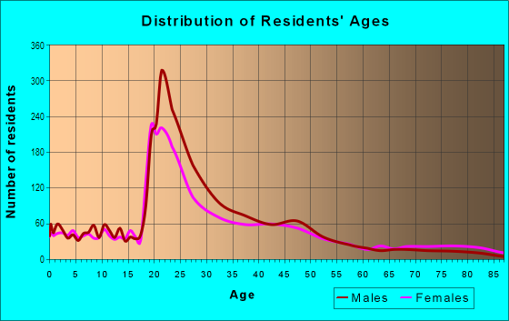
| Males: | 9,506 |
| Females: | 11,035 |
Males:
| This neighborhood: | 34.2 years |
| Whole city: | 30.2 years |
| This neighborhood: | 31.5 years |
| Whole city: | 30.8 years |
Percentage of family households:
| West Side: | 19.3% |
| Fort Collins: | 37.9% |
| Here: | 18.9% |
| Fort Collins: | 40.8% |
Percentage of married-couple families with children (among all households):
| West Side: | 34.9% |
| Fort Collins: | 31.7% |
Percentage of single-mother households (among all households):
| West Side: | 1.8% |
| Fort Collins: | 8.9% |
Percentage of never married males 15 years old and over:
Percentage of never married females 15 years old and over:
| West Side: | 17.8% |
| Fort Collins: | 24.1% |
Percentage of never married females 15 years old and over:
| West Side: | 28.9% |
| city: | 21.4% |
Percentage of people that speak English not well or not at all:
| West Side: | 0.6% |
| Fort Collins: | 0.8% |
Percentage of people born in this state:
Percentage of people born in another U.S. state:
Percentage of native residents but born outside the U.S.:
Percentage of foreign born residents:
| Here: | 32.8% |
| Fort Collins: | 36.7% |
Percentage of people born in another U.S. state:
| West Side: | 59.6% |
| Fort Collins: | 56.5% |
Percentage of native residents but born outside the U.S.:
| Here: | 1.6% |
| city: | 1.1% |
Percentage of foreign born residents:
| Here: | 6.0% |
| Fort Collins: | 5.7% |

Owner-occupied
Renter-occupied


- Rooms in owner-occupied houses and condos in West Side
- 3291 room
- 2742 rooms
- 2743 rooms
- 7074 rooms
- 7435 rooms
- 4256 rooms
- 5937 rooms
- 1,0098 rooms
- 2579+ rooms

- Rooms in renter-occupied apartments in West Side
- 1,9921 room
- 2,5092 rooms
- 2,2923 rooms
- 1,9054 rooms
- 1,3135 rooms
- 1,6966 rooms
- 5217 rooms
- 518 rooms
- 1749+ rooms
Owner-occupied
Renter-occupied

- Bedrooms in owner-occupied houses and condos in West Side
- 329no bedroom
- 5491 bedroom
- 1,1812 bedrooms
- 1,9363 bedrooms
- 7254 bedrooms
- 475+ bedrooms

- Bedrooms in renter-occupied apartments in West Side
- 2,285no bedroom
- 5,0201 bedroom
- 2,3132 bedrooms
- 1,9203 bedrooms
- 824 bedrooms
- 6865+ bedrooms
Average number of cars or other vehicles available in houses/condos:
Average number of cars or other vehicles available in apartments:
| This neighborhood: | |
| Fort Collins: |
Average number of cars or other vehicles available in apartments:
| Here: | |
| city: |
Percentage of units with a mortgage:
| West Side: | 44.7% |
| Fort Collins: | 66.9% |

- Year house built in West Side
- 02020 or later
- 6,6802010 to 2019
- 2,7492000 to 2009
- 1941990 to 1999
- 5791980 to 1989
- 1,5561970 to 1979
- 3691960 to 1969
- 1,1261950 to 1959
- 3111940 to 1949
- 4,7961939 or earlier

City-data.com crime index for city in 2020 (higher means more crime):
| City: | 139.0 |
| U.S. average: | 219.5 |
Travel time to work (commute)
![Travel time to work (commute)]()
- 306Less than 5 minutes
- 1,1365 to 9 minutes
- 80610 to 14 minutes
- 82115 to 19 minutes
- 78120 to 24 minutes
- 19325 to 29 minutes
- 49030 to 34 minutes
- 3835 to 39 minutes
- 1040 to 44 minutes
- 8245 to 59 minutes
- 12560 to 89 minutes
- 3190 or more minutes

Means of transportation to work
![Means of transportation to work]()
- 60.7%7,381Drove a car alone
- 2.7%330Carpooled
- 0.6%67Bus
- 0.4%44Motorcycle
- 9.1%1,109Bicycle
- 12.9%1,572Walked
- 0.0%5Other means
- 16.3%1,982Worked at home

Time leaving home to go to work
![Time leaving home to go to work]()
- 9512:00 a.m. to 4:59 a.m.
- 2055:00 a.m. to 5:29 a.m.
- 325:30 a.m. to 5:59 a.m.
- 3096:00 a.m. to 6:29 a.m.
- 2066:30 a.m. to 6:59 a.m.
- 4267:00 a.m. to 7:29 a.m.
- 7707:30 a.m. to 7:59 a.m.
- 7978:00 a.m. to 8:29 a.m.
- 4588:30 a.m. to 8:59 a.m.
- 2019:00 a.m. to 9:59 a.m.
- 15910:00 a.m. to 10:59 a.m.
- 21511:00 a.m. to 11:59 a.m.
- 70712:00 p.m. to 3:59 p.m.
- 2134:00 p.m. to 11:59 p.m.

Occupations of males:
- Percentage of males in management occupations (except farmers):
Here: 14.0% city: 13.4%
- Percentage of males in business and financial operations occupations:
Here: 10.9% city: 4.9%
- Percentage of males in computer and mathematical occupations:
Here: 6.6% city: 7.7%
- Percentage of males in architecture and engineering occupations:
Here: 3.6% city: 6.2%
- Percentage of males in life, physical, and social science occupations:
Here: 3.5% city: 3.5%
- Percentage of males in education, training, and library occupations:
Here: 18.5% city: 5.7%
- Percentage of males in arts, design, entertainment, sports, and media occupations:
Here: 3.8% city: 2.7%
- Percentage of males in service occupations:
Here: 7.1% city: 13.3%
- Percentage of males in sales and office occupations:
Here: 8.9% city: 15.5%
- Percentage of males in construction, extraction, and maintenance occupations:
Here: 2.3% city: 6.0%
- Percentage of males in production occupations:
Here: 11.7% city: 4.0%
- Percentage of males in transportation occupations:
Here: 5.8% city: 4.2%
Occupations of females:
- Percentage of females in management occupations (except farmers):
Here: 3.1% city: 9.7%
- Percentage of females in business and financial operations occupations:
Here: 10.0% city: 6.9%
- Percentage of females in computer and mathematical occupations:
Here: 7.0% city: 2.5%
- Percentage of females in life, physical, and social science occupations:
Here: 6.6% city: 2.6%
- Percentage of females in community and social services occupations:
Here: 5.0% city: 3.9%
- Percentage of females in education, training, and library occupations:
Here: 4.0% city: 12.1%
- Percentage of females in arts, design, entertainment, sports, and media occupations:
Here: 3.5% city: 3.5%
- Percentage of females in healthcare practitioners and technical occupations:
Here: 6.6% city: 8.9%
- Percentage of females in service occupations:
Here: 31.9% city: 20.9%
- Percentage of females in sales and office occupations:
Here: 20.9% city: 23.2%
Education in this neighborhood (subdivision or community):
- Percentage of people 3 years and older in K-12 schools:
West Side: 8.7% Fort Collins: 14.1%
- Percentage of people 3 years and older in undergraduate colleges:
West Side: 12.9% Fort Collins: 16.7%
- Percentage of people 3 years and older in grad. or professional schools:
West Side: 1.4% Fort Collins: 4.2%
- Percentage of students K-12 enrolled in private schools:
West Side: 0.0% Fort Collins: 7.2%
Percentage of population below poverty level:
| West Side: | 25.9% |
| Fort Collins: | 18.1% |
Percentage of married-couple families with both working:
| West Side: | 100.9% |
| Fort Collins: | 76.1% |

- 55.1%Utility gas
- 36.6%Electricity
- 3.4%Fuel oil, kerosene, etc.
- 2.3%Other fuel
- 1.6%Bottled, tank, or LP gas
- 1.1%No fuel used
Highways in this neighborhood:
US Hwy 287 (S College Ave)
Length: 0.14 miles
Direction: N-S
Address range: 600 to 699
Direction: N-S
Address range: 600 to 699
Roads and streets:
W Mulberry St
Length: 2.14 miles
Directions: E-W, SE-NW, SW-NE
Address range: 300 to 1999
Directions: E-W, SE-NW, SW-NE
Address range: 300 to 1999
W Mountain Ave
Length: 1.96 miles
Direction: E-W
Address range: 400 to 1947
Direction: E-W
Address range: 400 to 1947
Maple St
Length: 1.73 miles
Directions: E-W, N-S, SW-NE
Address range: 300 to 1599
Directions: E-W, N-S, SW-NE
Address range: 300 to 1599
W Oak St
Length: 1.64 miles
Directions: E-W, SE-NW, SW-NE
Address range: 400 to 1597
Directions: E-W, SE-NW, SW-NE
Address range: 400 to 1597
Cherry St
Length: 1.59 miles
Directions: E-W, N-S
Address range: 100 to 1599
Directions: E-W, N-S
Address range: 100 to 1599
Laporte Ave
Length: 1.36 miles
Direction: E-W
Address range: 300 to 1298
Direction: E-W
Address range: 300 to 1298
Elm St
Length: 1.27 miles
Directions: E-W, N-S, SE-NW
Address range: 500 to 1599
Directions: E-W, N-S, SE-NW
Address range: 500 to 1599
W Laurel St
Length: 1.22 miles
Direction: E-W
Address range: 100 to 999
Direction: E-W
Address range: 100 to 999
W Magnolia St
Length: 1.21 miles
Direction: E-W
Address range: 350 to 1399
Direction: E-W
Address range: 350 to 1399
W Myrtle St
Length: 0.99 miles
Direction: E-W
Address range: 100 to 899
Direction: E-W
Address range: 100 to 899
Sycamore St
Length: 0.96 miles
Direction: E-W
Address range: 400 to 1299
Direction: E-W
Address range: 400 to 1299
W Olive St
Length: 0.84 miles
Direction: E-W
Address range: 400 to 1299
Direction: E-W
Address range: 400 to 1299
W Vine Dr (Co Rd 48)
Length: 0.69 miles
Directions: E-W, SE-NW
Address range: 900 to 1479
Directions: E-W, SE-NW
Address range: 900 to 1479
N Sherwood St
Length: 0.67 miles
Directions: E-W, N-S, SW-NE
Address range: 100 to 699
Directions: E-W, N-S, SW-NE
Address range: 100 to 699
N Shields St (Co Rd 17)
Length: 0.64 miles
Directions: N-S, SW-NE
Address range: 100 to 699
Directions: N-S, SW-NE
Address range: 100 to 699
Wood St
Length: 0.63 miles
Directions: N-S, SW-NE
Address range: 200 to 867
Directions: N-S, SW-NE
Address range: 200 to 867
S Sherwood St
Length: 0.61 miles
Direction: N-S
Address range: 100 to 699
Direction: N-S
Address range: 100 to 699
S Whitcomb St
Length: 0.61 miles
Direction: N-S
Address range: 100 to 699
Direction: N-S
Address range: 100 to 699
S Loomis Ave
Length: 0.61 miles
Direction: N-S
Address range: 100 to 699
Direction: N-S
Address range: 100 to 699
S Grant Ave
Length: 0.61 miles
Direction: N-S
Address range: 100 to 699
Direction: N-S
Address range: 100 to 699
S Washington Ave
Length: 0.61 miles
Direction: N-S
Address range: 100 to 699
Direction: N-S
Address range: 100 to 699
N Grant Ave
Length: 0.55 miles
Directions: N-S, SW-NE
Address range: 100 to 599
Directions: N-S, SW-NE
Address range: 100 to 599
N Roosevelt Ave
Length: 0.55 miles
Directions: N-S, SE-NW
Address range: 100 to 499
Directions: N-S, SE-NW
Address range: 100 to 499
N Loomis Ave
Length: 0.55 miles
Directions: N-S, SW-NE
Address range: 100 to 599
Directions: N-S, SW-NE
Address range: 100 to 599
S Meldrum St
Length: 0.52 miles
Direction: N-S
Address range: 100 to 699
Direction: N-S
Address range: 100 to 699
N Whitcomb St
Length: 0.52 miles
Direction: N-S
Address range: 100 to 599
Direction: N-S
Address range: 100 to 599
Lyons St
Length: 0.49 miles
Direction: N-S
Address range: 100 to 689
Direction: N-S
Address range: 100 to 689
S Bryan Ave
Length: 0.48 miles
Directions: E-W, N-S, SE-NW, SW-NE
Address range: 100 to 499
Directions: E-W, N-S, SE-NW, SW-NE
Address range: 100 to 499
la Porte Ave
Length: 0.45 miles
Direction: E-W
Address range: 1231 to 1699
Direction: E-W
Address range: 1231 to 1699
Park St
Length: 0.44 miles
Direction: N-S
Address range: 200 to 699
Direction: N-S
Address range: 200 to 699
West St
Length: 0.43 miles
Direction: N-S
Address range: 200 to 699
Direction: N-S
Address range: 200 to 699
City Park Dr
Length: 0.43 miles
Directions: E-W, SW-NE
Address range: 1300 to 1599
Directions: E-W, SW-NE
Address range: 1300 to 1599
N Meldrum St
Length: 0.42 miles
Direction: N-S
Address range: 100 to 499
Direction: N-S
Address range: 100 to 499
Columbine Ct
Length: 0.42 miles
Directions: E-W, N-S, SW-NE
Address range: 200 to 1257
Directions: E-W, N-S, SW-NE
Address range: 200 to 1257
Sheldon Dr
Length: 0.41 miles
Directions: N-S, SE-NW
Address range: 100 to 499
Directions: N-S, SE-NW
Address range: 100 to 499
Clover Ln
Length: 0.41 miles
Directions: N-S, SE-NW
Address range: 200 to 499
Directions: N-S, SE-NW
Address range: 200 to 499
Pearl St
Length: 0.38 miles
Direction: N-S
Address range: 100 to 599
Direction: N-S
Address range: 100 to 599
Co Rd 17 (S Shields St)
Length: 0.37 miles
Direction: N-S
Address range: 100 to 516
Direction: N-S
Address range: 100 to 516
Scott Ave
Length: 0.37 miles
Direction: N-S
Address range: 100 to 499
Direction: N-S
Address range: 100 to 499
Jackson Ave
Length: 0.36 miles
Direction: N-S
Address range: 100 to 499
Direction: N-S
Address range: 100 to 499
Hanna St
Length: 0.35 miles
Directions: E-W, N-S
Address range: 400 to 759
Directions: E-W, N-S
Address range: 400 to 759
Canyon Ave
Length: 0.31 miles
Direction: SW-NE
Address range: 300 to 499
Direction: SW-NE
Address range: 300 to 499
Woodford Ave
Length: 0.30 miles
Direction: E-W
Address range: 900 to 1199
Direction: E-W
Address range: 900 to 1199
Akin Ave
Length: 0.30 miles
Direction: E-W
Address range: 900 to 1199
Direction: E-W
Address range: 900 to 1199
N McKinley Ave
Length: 0.29 miles
Direction: N-S
Address range: 100 to 299
Direction: N-S
Address range: 100 to 299
Juniper Ct
Length: 0.28 miles
Directions: E-W, N-S
Address range: 1100 to 1299
Directions: E-W, N-S
Address range: 1100 to 1299
Fishback Ave
Length: 0.28 miles
Direction: N-S
Address range: 100 to 299
Direction: N-S
Address range: 100 to 299
Pioneer Ave
Length: 0.26 miles
Directions: E-W, N-S, SE-NW
Address range: 900 to 999
Directions: E-W, N-S, SE-NW
Address range: 900 to 999
S Howes St
Length: 0.23 miles
Direction: N-S
Address range: 500 to 699
Direction: N-S
Address range: 500 to 699
Bungalow Ct
Length: 0.22 miles
Directions: E-W, N-S
Address range: 900 to 999
Directions: E-W, N-S
Address range: 900 to 999
Gordon St
Length: 0.21 miles
Direction: N-S
Address range: 300 to 599
Direction: N-S
Address range: 300 to 599
Wayne St
Length: 0.21 miles
Direction: N-S
Address range: 300 to 599
Direction: N-S
Address range: 300 to 599
Monte Vista Ave
Length: 0.20 miles
Directions: N-S, SE-NW
Address range: 600 to 699
Directions: N-S, SE-NW
Address range: 600 to 699
Tedmon Dr
Length: 0.16 miles
Direction: N-S
Address range: 400 to 599
Direction: N-S
Address range: 400 to 599
Franklin St
Length: 0.16 miles
Direction: N-S
Address range: 400 to 599
Direction: N-S
Address range: 400 to 599
Riddle Dr
Length: 0.16 miles
Direction: N-S
Address range: 400 to 599
Direction: N-S
Address range: 400 to 599
S Mack St
Length: 0.16 miles
Direction: N-S
Address range: 100 to 299
Direction: N-S
Address range: 100 to 299
Leland Ave
Length: 0.15 miles
Direction: E-W
Address range: 1300 to 1499
Direction: E-W
Address range: 1300 to 1499
N Bryan Ave
Length: 0.15 miles
Directions: N-S, SE-NW
Address range: 100 to 199
Directions: N-S, SE-NW
Address range: 100 to 199
Beech Ct
Length: 0.14 miles
Directions: E-W, N-S, SE-NW
Address range: 1400 to 1499
Directions: E-W, N-S, SE-NW
Address range: 1400 to 1499
S Mason St
Length: 0.14 miles
Direction: N-S
Address range: 600 to 699
Direction: N-S
Address range: 600 to 699
Sylvan Ct
Length: 0.14 miles
Direction: N-S
Address range: 100 to 199
Direction: N-S
Address range: 100 to 199
N Mack St
Length: 0.14 miles
Direction: N-S
Address range: 100 to 199
Direction: N-S
Address range: 100 to 199
N Washington Ave
Length: 0.14 miles
Direction: N-S
Address range: 100 to 199
Direction: N-S
Address range: 100 to 199
del Norte Pl
Length: 0.12 miles
Directions: N-S, SW-NE
Address range: 600 to 699
Directions: N-S, SW-NE
Address range: 600 to 699
Richards Pl
Length: 0.11 miles
Direction: E-W
Address range: 1600 to 1699
Direction: E-W
Address range: 1600 to 1699
Bishop St
Length: 0.10 miles
Direction: N-S
Address range: 200 to 299
Direction: N-S
Address range: 200 to 299
Beech St
Length: 0.10 miles
Direction: E-W
Address range: 1100 to 1199
Direction: E-W
Address range: 1100 to 1199
Grandview Ave
Length: 0.10 miles
Direction: N-S
Address range: 100 to 169
Direction: N-S
Address range: 100 to 169
Frey Ave
Length: 0.10 miles
Direction: N-S
Address range: 100 to 175
Direction: N-S
Address range: 100 to 175
Armstrong Ave
Length: 0.10 miles
Directions: N-S, SW-NE
Address range: 600 to 699
Directions: N-S, SW-NE
Address range: 600 to 699
Hawkins St
Length: 0.10 miles
Direction: N-S
Address range: 400 to 499
Direction: N-S
Address range: 400 to 499
S McKinley Ave
Length: 0.10 miles
Direction: N-S
Address range: 100 to 199
Direction: N-S
Address range: 100 to 199
Griffin Pl
Length: 0.09 miles
Direction: N-S
Address range: 600 to 699
Direction: N-S
Address range: 600 to 699
Sunset Ave
Length: 0.08 miles
Direction: E-W
Address range: 1000 to 1013
Direction: E-W
Address range: 1000 to 1013
Collins Ct
Length: 0.07 miles
Direction: E-W
Address range: 1600 to 1699
Direction: E-W
Address range: 1600 to 1699
Layland Ct
Length: 0.07 miles
Direction: E-W
Address range: 1600 to 1699
Direction: E-W
Address range: 1600 to 1699
N Howes St
Length: 0.05 miles
Direction: N-S
Address range: 200 to 239
Direction: N-S
Address range: 200 to 239
Jamith Pl
Length: 0.05 miles
Direction: N-S
Address range: 100 to 199
Direction: N-S
Address range: 100 to 199
Elm Ct
Length: 0.03 miles
Direction: N-S
Address range: 921 to 999
Direction: N-S
Address range: 921 to 999
Railroad features:
Colorado and Southern Rlwy
Length: 0.63 miles
Directions: E-W, SW-NE
Directions: E-W, SW-NE
Union Pacific RR
Length: 0.05 miles
Direction: N-S
Direction: N-S
Other features:
Ft Clns Irigtn Ditch
Length: 1.82 miles
Directions: E-W, N-S, SE-NW, SW-NE
Directions: E-W, N-S, SE-NW, SW-NE
New Mercer Cnl
Length: 0.59 miles
Directions: E-W, N-S, SE-NW, SW-NE
Directions: E-W, N-S, SE-NW, SW-NE
Larimer County Canal Number 2
Length: 0.35 miles
Directions: N-S, SE-NW, SW-NE
Directions: N-S, SE-NW, SW-NE
Lrmr Cnty Canal Two
Length: 0.23 miles
Directions: N-S, SE-NW, SW-NE
Directions: N-S, SE-NW, SW-NE
Other features:
Flat Collins Irrigation Ditch
Length: 0.05 miles
Directions: SE-NW, SW-NE
Directions: SE-NW, SW-NE