Milan Township neighborhood in Milan, Ohio (OH), 44847, 44857, 44846, 44870 detailed profile
Settings
X


Business Search - 14 Million verified businesses
Area: 43.983 square miles
Population: 5,155
Population density:
| Milan Township: | 117 people per square mile |
| Milan: | 1,579 people per square mile |

- 5,04287.4%White
- 4638.0%Hispanic or Latino
- 1091.9%Asian
- 691.2%Two or more races
- 530.9%Black
- 360.6%Native Hawaiian and Other
Pacific Islander

Median household income in 2022:
| Milan Township: | $82,820 |
| Milan: | $90,145 |
Distribution of median household income
![Distribution of median household income]()
- 215Less than $10,000
- 196$10,000 to $19,999
- 171$20,000 to $29,999
- 138$30,000 to $39,999
- 275$40,000 to $49,999
- 211$50,000 to $59,999
- 183$60,000 to $74,999
- 310$75,000 to $99,999
- 320$100,000 to $124,999
- 221$125,000 to $149,999
- 190$150,000 to $199,999
- 132$200,000 or more

Distribution of owner-occupied house/condo value
![Distribution of owner-occupied house/condo value]()
- 694Less than $50,000
- 655$50,000 to $99,999
- 469$100,000 to $149,999
- 553$150,000 to $199,999
- 196$200,000 to $249,999
- 186$250,000 to $299,999
- 401$300,000 to $399,999
- 117$400,000 to $499,999
- 159$500,000 to $749,999
- 31$750,000 to $999,999
- 231$1,000,000 or more

Distribution of rent paid by renters
![Distribution of rent paid by renters]()
- 11$300 to $399
- 892$400 to $499
- 636$500 to $599
- 537$600 to $699
- 878$700 to $799
- 804$800 to $899
- 658$900 to $999
- 131$1,000 to $1,249
- 61$1,250 to $1,499
- 44$1,500 to $1,999

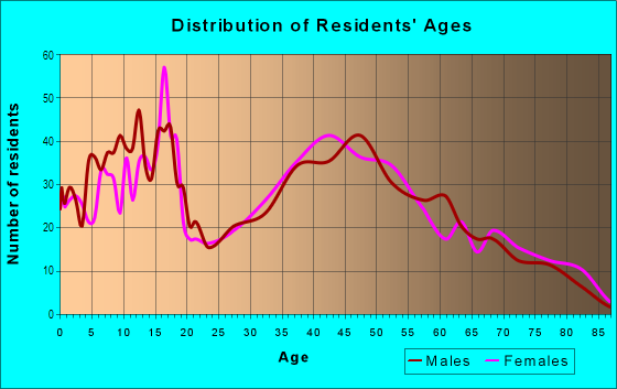
| Males: | 2,453 |
| Females: | 2,702 |
Males:
| This neighborhood: | 47.6 years |
| Whole city: | 40.2 years |
| This neighborhood: | 49.2 years |
| Whole city: | 40.1 years |
Average household size:
| Milan Township: | 4.1 people |
| Milan: | 3.0 people |
Percentage of family households:
| Milan Township: | 44.7% |
| Milan: | 56.4% |
| Here: | 60.8% |
| Milan: | 56.6% |
Percentage of married-couple families with children (among all households):
| Milan Township: | 35.9% |
| Milan: | 28.2% |
Percentage of single-mother households (among all households):
| Milan Township: | 8.0% |
| Milan: | 1.0% |
Percentage of never married males 15 years old and over:
Percentage of never married females 15 years old and over:
| Milan Township: | 12.4% |
| Milan: | 16.7% |
Percentage of never married females 15 years old and over:
| Milan Township: | 7.7% |
| village: | 10.7% |
Percentage of people that speak English not well or not at all:
| Milan Township: | 0.2% |
| Milan: | 0.4% |
Percentage of people born in this state:
Percentage of people born in another U.S. state:
Percentage of native residents but born outside the U.S.:
Percentage of foreign born residents:
| Here: | 85.0% |
| Milan: | 86.1% |
Percentage of people born in another U.S. state:
| Milan Township: | 14.1% |
| Milan: | 13.2% |
Percentage of native residents but born outside the U.S.:
| Here: | 0.2% |
| village: | 0.7% |
Percentage of foreign born residents:
| Here: | 0.7% |
| Milan: | 0.0% |

Owner-occupied
Renter-occupied


- Rooms in owner-occupied houses and condos in Milan Township
- 141 room
- 1612 rooms
- 643 rooms
- 994 rooms
- 1655 rooms
- 4806 rooms
- 2537 rooms
- 1978 rooms
- 5779+ rooms

- Rooms in renter-occupied apartments in Milan Township
- 01 room
- 02 rooms
- 5463 rooms
- 3174 rooms
- 2945 rooms
- 1106 rooms
- 1747 rooms
- 2598 rooms
- 5529+ rooms
Owner-occupied
Renter-occupied

- Bedrooms in owner-occupied houses and condos in Milan Township
- 102no bedroom
- 691 bedroom
- 2712 bedrooms
- 9063 bedrooms
- 4354 bedrooms
- 1785+ bedrooms

- Bedrooms in renter-occupied apartments in Milan Township
- 0no bedroom
- 1391 bedroom
- 4902 bedrooms
- 1583 bedrooms
- 1344 bedrooms
- 8035+ bedrooms
Average number of cars or other vehicles available in houses/condos:
Average number of cars or other vehicles available in apartments:
| This neighborhood: | 3.1 |
| Milan: | 2.2 |
Average number of cars or other vehicles available in apartments:
| Here: | |
| village: |
Percentage of units with a mortgage:
| Milan Township: | 52.8% |
| Milan: | 64.1% |
Average estimated value of detached houses in 2022 (94.4% of all units):
| Milan Township: | $202,456 |
| Milan: | $206,171 |

- Year house built in Milan Township
- 392020 or later
- 2492010 to 2019
- 1702000 to 2009
- 2511990 to 1999
- 1671980 to 1989
- 2881970 to 1979
- 3041960 to 1969
- 2821950 to 1959
- 1301940 to 1949
- 6261939 or earlier

City-data.com crime index for village in 2020 (higher means more crime):
| City: | 72.2 |
| U.S. average: | 219.5 |
Travel time to work (commute)
![Travel time to work (commute)]()
- 146Less than 5 minutes
- 3645 to 9 minutes
- 30010 to 14 minutes
- 52615 to 19 minutes
- 32020 to 24 minutes
- 22825 to 29 minutes
- 17630 to 34 minutes
- 2935 to 39 minutes
- 4040 to 44 minutes
- 6845 to 59 minutes
- 10260 to 89 minutes
- 6690 or more minutes

Means of transportation to work
![Means of transportation to work]()
- 81.0%1,853Drove a car alone
- 10.3%236Carpooled
- 2.9%67Bus
- 0.2%5Motorcycle
- 5.2%118Walked
- 7.6%173Other means
- 6.3%144Worked at home

Time leaving home to go to work
![Time leaving home to go to work]()
- 10712:00 a.m. to 4:59 a.m.
- 1255:00 a.m. to 5:29 a.m.
- 1585:30 a.m. to 5:59 a.m.
- 1626:00 a.m. to 6:29 a.m.
- 4446:30 a.m. to 6:59 a.m.
- 3717:00 a.m. to 7:29 a.m.
- 2177:30 a.m. to 7:59 a.m.
- 1698:00 a.m. to 8:29 a.m.
- 1218:30 a.m. to 8:59 a.m.
- 1419:00 a.m. to 9:59 a.m.
- 3610:00 a.m. to 10:59 a.m.
- 1911:00 a.m. to 11:59 a.m.
- 9512:00 p.m. to 3:59 p.m.
- 1974:00 p.m. to 11:59 p.m.

Occupations of males:
- Percentage of males in management occupations (except farmers):
Here: 15.9% village: 21.4%
- Percentage of males in business and financial operations occupations:
Here: 2.5% village: 1.1%
- Percentage of males in computer and mathematical occupations:
Here: 2.3% village: 0.9%
- Percentage of males in architecture and engineering occupations:
Here: 4.2% village: 3.8%
- Percentage of males in community and social services occupations:
Here: 1.5% village: 0.0%
- Percentage of males in education, training, and library occupations:
Here: 1.8% village: 1.6%
- Percentage of males in healthcare practitioners and technical occupations:
Here: 1.5% village: 3.8%
- Percentage of males in service occupations:
Here: 16.2% village: 14.9%
- Percentage of males in sales and office occupations:
Here: 11.2% village: 7.9%
- Percentage of males in construction, extraction, and maintenance occupations:
Here: 9.4% village: 9.9%
- Percentage of males in production occupations:
Here: 13.7% village: 17.1%
- Percentage of males in transportation occupations:
Here: 6.6% village: 4.1%
- Percentage of males in material moving occupations:
Here: 6.4% village: 4.1%
Occupations of females:
- Percentage of females in management occupations (except farmers):
Here: 6.1% village: 6.9%
- Percentage of females in business and financial operations occupations:
Here: 3.2% village: 2.8%
- Percentage of females in computer and mathematical occupations:
Here: 1.0% village: 0.0%
- Percentage of females in community and social services occupations:
Here: 2.7% village: 2.5%
- Percentage of females in education, training, and library occupations:
Here: 10.1% village: 10.3%
- Percentage of females in healthcare practitioners and technical occupations:
Here: 13.1% village: 9.7%
- Percentage of females in service occupations:
Here: 12.7% village: 32.2%
- Percentage of females in sales and office occupations:
Here: 42.1% village: 26.1%
- Percentage of females in production occupations:
Here: 6.7% village: 6.4%
- Percentage of females in material moving occupations:
Here: 2.6% village: 1.4%
Percentage of people 16-64 in Armed Forces:
| Milan Township: | 0.0% |
| Milan: | 0.0% |
Education in this neighborhood (subdivision or community):
- Percentage of people 3 years and older in K-12 schools:
Milan Township: 38.5% Milan: 19.5%
- Percentage of people 3 years and older in undergraduate colleges:
Milan Township: 7.8% Milan: 3.0%
- Percentage of people 3 years and older in grad. or professional schools:
Milan Township: 8.7% Milan: 0.2%
- Percentage of students K-12 enrolled in private schools:
Milan Township: 97.4% Milan: 5.8%
Percentage of population below poverty level:
| Milan Township: | 4.9% |
| Milan: | 5.2% |
Median year owner moved in (as recorded in 2022):
| Milan Township: | 2003 |
| Milan: | 2010 |
Percentage of married-couple families with both working:
| Milan Township: | 75.0% |
| Milan: | 34.5% |

- 54.0%Utility gas
- 19.1%Electricity
- 14.1%Bottled, tank, or LP gas
- 3.8%Fuel oil, kerosene, etc.
- 3.6%Other fuel
- 3.2%Wood
- 2.1%No fuel used
Limited-access highways (interstate or state) in this neighborhood:
I- 80 (Ohio Tpke, I- 90)
Length: 19.74 miles
Direction: E-W
Direction: E-W
Highways in this neighborhood:
State Rte 113 W (State Rte 113)
Length: 9.90 miles
Directions: E-W, SE-NW, SW-NE
Address range: 1 to 4799
Directions: E-W, SE-NW, SW-NE
Address range: 1 to 4799
US Hwy 250 (US Rte 250)
Length: 3.27 miles
Directions: N-S, SE-NW, SW-NE
Address range: 11176 to 12999
Directions: N-S, SE-NW, SW-NE
Address range: 11176 to 12999
US Hwy 250 (Sandusky-Norwalk Rd, US Rte 250)
Length: 2.45 miles
Directions: N-S, SE-NW, SW-NE
Address range: 9200 to 11099
Directions: N-S, SE-NW, SW-NE
Address range: 9200 to 11099
State Rte 601 (S Main St)
Length: 1.01 miles
Direction: SE-NW
Address range: 1 to 15326
Direction: SE-NW
Address range: 1 to 15326
Church St (State Rte 113)
Length: 0.49 miles
Directions: E-W, SW-NE
Address range: 13 to 299
Directions: E-W, SW-NE
Address range: 13 to 299
State Rte 61 N (State Rte 61 E, State Rte 61)
Length: 0.41 miles
Direction: SW-NE
Address range: 14201 to 14699
Direction: SW-NE
Address range: 14201 to 14699
Milan Rd (US Hwy 250, US Rte 250)
Length: 0.32 miles
Direction: SE-NW
Address range: 8177 to 8499
Direction: SE-NW
Address range: 8177 to 8499
State Rte 2
Length: 0.04 miles
Direction: E-W
Direction: E-W
Roads and streets:
Twp Hwy 126 (River Rd)
Length: 6.14 miles
Directions: E-W, N-S, SE-NW, SW-NE
Address range: 1800 to 13999
Directions: E-W, N-S, SE-NW, SW-NE
Address range: 1800 to 13999
Jeffries Rd (Co Hwy 128)
Length: 5.80 miles
Directions: E-W, N-S, SE-NW, SW-NE
Address range: 9001 to 14098
Directions: E-W, N-S, SE-NW, SW-NE
Address range: 9001 to 14098
Co Hwy 13 (Mason Rd)
Length: 5.79 miles
Directions: E-W, SE-NW
Address range: 100 to 5407
Directions: E-W, SE-NW
Address range: 100 to 5407
Strecker Rd (Strecker Rd W, Co Hwy 15)
Length: 5.09 miles
Direction: E-W
Address range: 100 to 4199
Direction: E-W
Address range: 100 to 4199
Old Mudbrook Rd (Twp Hwy 125, Mudbrook Rd)
Length: 4.92 miles
Directions: N-S, SE-NW, SW-NE
Address range: 7678 to 13698
Directions: N-S, SE-NW, SW-NE
Address range: 7678 to 13698
Scheid Rd (W Scheid Rd)
Length: 4.55 miles
Direction: E-W
Address range: 142 to 2412
Direction: E-W
Address range: 142 to 2412
Patrol Rd
Length: 4.54 miles
Directions: E-W, N-S, SE-NW
Directions: E-W, N-S, SE-NW
Twp Hwy 16 (Bryan Rd)
Length: 4.49 miles
Directions: E-W, N-S, SE-NW
Address range: 100 to 3699
Directions: E-W, N-S, SE-NW
Address range: 100 to 3699
Twp Hwy 114 (Thomas Rd)
Length: 3.99 miles
Directions: N-S, SE-NW
Address range: 8700 to 12599
Directions: N-S, SE-NW
Address range: 8700 to 12599
Co Hwy 13 (Mason Rd W)
Length: 3.96 miles
Direction: E-W
Address range: 100 to 2799
Direction: E-W
Address range: 100 to 2799
Twp Hwy 127 (Wikel Rd)
Length: 3.92 miles
Direction: N-S
Address range: 9301 to 13099
Direction: N-S
Address range: 9301 to 13099
Twp Hwy 116 (Kelley Rd)
Length: 2.95 miles
Directions: N-S, SW-NE
Address range: 11200 to 13899
Directions: N-S, SW-NE
Address range: 11200 to 13899
Twp Hwy 124 (Hoover Rd)
Length: 2.82 miles
Directions: E-W, N-S, SE-NW, SW-NE
Address range: 9700 to 12399
Directions: E-W, N-S, SE-NW, SW-NE
Address range: 9700 to 12399
Twp Hwy 130 (Arlington Rd)
Length: 2.72 miles
Directions: N-S, SE-NW
Address range: 11600 to 13899
Directions: N-S, SE-NW
Address range: 11600 to 13899
S Magazine Rd
Length: 2.32 miles
Directions: E-W, SE-NW, SW-NE
Directions: E-W, SE-NW, SW-NE
N Magazine Rd
Length: 2.30 miles
Directions: E-W, SW-NE
Directions: E-W, SW-NE
Twp Hwy 94 (Higbee Rd)
Length: 2.23 miles
Directions: E-W, N-S, SE-NW
Address range: 2500 to 4299
Directions: E-W, N-S, SE-NW
Address range: 2500 to 4299
Huron Avery Rd (Co Hwy 123)
Length: 2.09 miles
Directions: E-W, SW-NE
Address range: 9192 to 11099
Directions: E-W, SW-NE
Address range: 9192 to 11099
Columbus Ave
Length: 1.98 miles
Directions: N-S, SE-NW
Directions: N-S, SE-NW
Seminary Rd (Twp Hwy 53)
Length: 1.59 miles
Directions: E-W, SE-NW
Address range: 1600 to 18109
Directions: E-W, SE-NW
Address range: 1600 to 18109
Taft Rd
Length: 1.35 miles
Directions: N-S, SE-NW
Directions: N-S, SE-NW
Twp Hwy 113 (Livengood Rd)
Length: 1.24 miles
Direction: N-S
Address range: 11600 to 12299
Direction: N-S
Address range: 11600 to 12299
Milliman Rd (Twp Hwy 55)
Length: 1.04 miles
Directions: N-S, SE-NW
Address range: 13101 to 13969
Directions: N-S, SE-NW
Address range: 13101 to 13969
Center Magazine Rd
Length: 0.98 miles
Direction: E-W
Direction: E-W
Mc Intyre Rd (Twp Hwy 54)
Length: 0.86 miles
Direction: N-S
Direction: N-S
Twp Hwy 83 (Knight Rd)
Length: 0.83 miles
Direction: E-W
Address range: 4807 to 10799
Direction: E-W
Address range: 4807 to 10799
Ridgeview Cir
Length: 0.80 miles
Directions: E-W, N-S, SE-NW, SW-NE
Address range: 1 to 99
Directions: E-W, N-S, SE-NW, SW-NE
Address range: 1 to 99
Lovers Ln (Co Hwy 48)
Length: 0.76 miles
Directions: E-W, N-S, SE-NW
Directions: E-W, N-S, SE-NW
Berlin St
Length: 0.74 miles
Directions: E-W, SW-NE
Address range: 1 to 1799
Directions: E-W, SW-NE
Address range: 1 to 1799
S Edison Dr
Length: 0.71 miles
Directions: N-S, SE-NW
Address range: 1 to 198
Directions: N-S, SE-NW
Address range: 1 to 198
Twin Oaks Dr
Length: 0.63 miles
Directions: E-W, N-S, SE-NW, SW-NE
Address range: 1 to 99
Directions: E-W, N-S, SE-NW, SW-NE
Address range: 1 to 99
Twp Hwy 117 (Schug Rd)
Length: 0.63 miles
Directions: N-S, SE-NW
Address range: 13200 to 13599
Directions: N-S, SE-NW
Address range: 13200 to 13599
Shaw Mill Rd (Twp Hwy 49)
Length: 0.62 miles
Directions: E-W, SW-NE
Directions: E-W, SW-NE
Twp Hwy 46 (Huber Rd)
Length: 0.58 miles
Directions: E-W, N-S, SE-NW
Address range: 12700 to 13099
Directions: E-W, N-S, SE-NW
Address range: 12700 to 13099
S Center St
Length: 0.55 miles
Direction: SE-NW
Address range: 37 to 172
Direction: SE-NW
Address range: 37 to 172
Twp Hwy 84 (Huff Rd)
Length: 0.54 miles
Direction: E-W
Direction: E-W
Lockwood Rd
Length: 0.51 miles
Directions: N-S, SW-NE
Address range: 1 to 99
Directions: N-S, SW-NE
Address range: 1 to 99
W Williams St
Length: 0.50 miles
Direction: SW-NE
Address range: 1 to 99
Direction: SW-NE
Address range: 1 to 99
New Scheid Rd
Length: 0.50 miles
Direction: E-W
Direction: E-W
E Wilcoxson St
Length: 0.46 miles
Directions: E-W, SW-NE
Address range: 13 to 38
Directions: E-W, SW-NE
Address range: 13 to 38
Plank Rd (Twp Hwy 50)
Length: 0.45 miles
Directions: N-S, SW-NE
Address range: 14412 to 14718
Directions: N-S, SW-NE
Address range: 14412 to 14718
County Line Rd (County Line Road 222 Rd, Twp Hwy 222)
Length: 0.43 miles
Direction: E-W
Address range: 2085 to 2091
Direction: E-W
Address range: 2085 to 2091
Schaffer Rd (Twp Hwy 47)
Length: 0.43 miles
Directions: E-W, SE-NW
Address range: 2800 to 2810
Directions: E-W, SE-NW
Address range: 2800 to 2810
Riley Rd
Length: 0.38 miles
Directions: N-S, SE-NW
Address range: 13317 to 13915
Directions: N-S, SE-NW
Address range: 13317 to 13915
Twp Hwy 44 (Ransom Rd)
Length: 0.35 miles
Direction: N-S
Address range: 10205 to 11202
Direction: N-S
Address range: 10205 to 11202
N Main St
Length: 0.35 miles
Directions: E-W, N-S, SE-NW, SW-NE
Address range: 1 to 199
Directions: E-W, N-S, SE-NW, SW-NE
Address range: 1 to 199
Walnut St
Length: 0.34 miles
Directions: E-W, N-S, SE-NW
Address range: 13600 to 13621
Directions: E-W, N-S, SE-NW
Address range: 13600 to 13621
Horn Rd
Length: 0.34 miles
Directions: E-W, SE-NW, SW-NE
Directions: E-W, SE-NW, SW-NE
Taylor Rd
Length: 0.33 miles
Direction: SW-NE
Address range: 890 to 1026
Direction: SW-NE
Address range: 890 to 1026
Front St
Length: 0.33 miles
Directions: E-W, SW-NE
Address range: 27 to 43
Directions: E-W, SW-NE
Address range: 27 to 43
S Huron St (Huron St)
Length: 0.33 miles
Directions: E-W, SE-NW
Address range: 1 to 195
Directions: E-W, SE-NW
Address range: 1 to 195
Fairoaks Dr
Length: 0.32 miles
Directions: E-W, N-S, SE-NW, SW-NE
Address range: 13 to 99
Directions: E-W, N-S, SE-NW, SW-NE
Address range: 13 to 99
Box Factory Rd
Length: 0.31 miles
Direction: SW-NE
Direction: SW-NE
Landsdown Dr (Landsdown St)
Length: 0.30 miles
Direction: SW-NE
Address range: 1 to 9
Direction: SW-NE
Address range: 1 to 9
Twp Hwy 39 (Enterprise Rd, Twp Hwy 248, County Line Rd)
Length: 0.29 miles
Direction: E-W
Direction: E-W
Bond St
Length: 0.28 miles
Directions: E-W, SE-NW
Address range: 1 to 99
Directions: E-W, SE-NW
Address range: 1 to 99
Peru Center Rd N (Twp Hwy 45)
Length: 0.28 miles
Directions: N-S, SW-NE
Address range: 4000 to 5399
Directions: N-S, SW-NE
Address range: 4000 to 5399
Oak St
Length: 0.28 miles
Directions: E-W, N-S, SE-NW, SW-NE
Address range: 13700 to 13799
Directions: E-W, N-S, SE-NW, SW-NE
Address range: 13700 to 13799
Merry St
Length: 0.27 miles
Directions: E-W, SW-NE
Address range: 31 to 37
Directions: E-W, SW-NE
Address range: 31 to 37
Eastwood Dr
Length: 0.27 miles
Directions: E-W, N-S, SE-NW
Address range: 1 to 26
Directions: E-W, N-S, SE-NW
Address range: 1 to 26
Liberty St
Length: 0.27 miles
Directions: E-W, N-S, SE-NW, SW-NE
Address range: 1 to 199
Directions: E-W, N-S, SE-NW, SW-NE
Address range: 1 to 199
S Huron St
Length: 0.27 miles
Direction: SE-NW
Address range: 45 to 147
Direction: SE-NW
Address range: 45 to 147
Chippewa Dr
Length: 0.26 miles
Direction: SW-NE
Address range: 1 to 31
Direction: SW-NE
Address range: 1 to 31
Perrin Rd
Length: 0.25 miles
Directions: N-S, SW-NE
Address range: 1 to 14015
Directions: N-S, SW-NE
Address range: 1 to 14015
Broad St
Length: 0.25 miles
Directions: E-W, SW-NE
Address range: 1 to 99
Directions: E-W, SW-NE
Address range: 1 to 99
Bank St
Length: 0.25 miles
Directions: E-W, N-S, SE-NW, SW-NE
Address range: 27 to 38
Directions: E-W, N-S, SE-NW, SW-NE
Address range: 27 to 38
Alpine Trl
Length: 0.23 miles
Directions: E-W, N-S, SE-NW, SW-NE
Directions: E-W, N-S, SE-NW, SW-NE
Old Mason Rd
Length: 0.22 miles
Directions: E-W, SE-NW, SW-NE
Address range: 2000 to 4499
Directions: E-W, SE-NW, SW-NE
Address range: 2000 to 4499
Elm St
Length: 0.22 miles
Directions: E-W, SE-NW
Address range: 58 to 113
Directions: E-W, SE-NW
Address range: 58 to 113
Pawnee Dr
Length: 0.21 miles
Directions: N-S, SE-NW, SW-NE
Address range: 1 to 99
Directions: N-S, SE-NW, SW-NE
Address range: 1 to 99
Warwick Dr
Length: 0.20 miles
Directions: E-W, N-S, SE-NW, SW-NE
Address range: 1900 to 2012
Directions: E-W, N-S, SE-NW, SW-NE
Address range: 1900 to 2012
Judson St
Length: 0.19 miles
Directions: E-W, SW-NE
Directions: E-W, SW-NE
E Judson St
Length: 0.18 miles
Directions: E-W, SW-NE
Directions: E-W, SW-NE
Edison Dr
Length: 0.16 miles
Directions: E-W, SE-NW
Address range: 2 to 145
Directions: E-W, SE-NW
Address range: 2 to 145
E Front St
Length: 0.14 miles
Directions: E-W, SE-NW
Address range: 1 to 47
Directions: E-W, SE-NW
Address range: 1 to 47
Twp Hwy 190 (Diehl Rd)
Length: 0.13 miles
Directions: E-W, SE-NW
Directions: E-W, SE-NW
Sr13/sr113 (US Hwy 250, U 250, Sr13/sr113)
Length: 0.11 miles
Direction: SE-NW
Direction: SE-NW
East St
Length: 0.10 miles
Direction: SW-NE
Direction: SW-NE
W Merry St
Length: 0.09 miles
Direction: SW-NE
Address range: 21 to 29
Direction: SW-NE
Address range: 21 to 29
W Front St
Length: 0.09 miles
Direction: SW-NE
Address range: 1 to 36
Direction: SW-NE
Address range: 1 to 36
St Charles St
Length: 0.09 miles
Direction: E-W
Address range: 12301 to 13721
Direction: E-W
Address range: 12301 to 13721
Williams St
Length: 0.08 miles
Direction: SW-NE
Address range: 41 to 99
Direction: SW-NE
Address range: 41 to 99
E Church St
Length: 0.08 miles
Direction: SW-NE
Address range: 35 to 51
Direction: SW-NE
Address range: 35 to 51
Fisk Rd
Length: 0.08 miles
Direction: N-S
Address range: 13901 to 13917
Direction: N-S
Address range: 13901 to 13917
Park St
Length: 0.07 miles
Direction: SE-NW
Direction: SE-NW
Shawnee St (Shawnee Pl)
Length: 0.06 miles
Direction: SE-NW
Direction: SE-NW
Water St
Length: 0.05 miles
Directions: N-S, SE-NW, SW-NE
Directions: N-S, SE-NW, SW-NE
Creekside Cir
Length: 0.05 miles
Directions: E-W, SE-NW
Address range: 1 to 100
Directions: E-W, SE-NW
Address range: 1 to 100
Swan St
Length: 0.05 miles
Directions: E-W, SW-NE
Address range: 101 to 107
Directions: E-W, SW-NE
Address range: 101 to 107
Oakfield Dr
Length: 0.04 miles
Direction: E-W
Address range: 1 to 99
Direction: E-W
Address range: 1 to 99
Old US Hwy 250
Length: 0.03 miles
Directions: SE-NW, SW-NE
Directions: SE-NW, SW-NE
Railroad features:
Norfolk and Western Rlwy
Length: 17.37 miles
Directions: E-W, N-S, SE-NW, SW-NE
Directions: E-W, N-S, SE-NW, SW-NE
Wheeling and Lake Erie Rlwy
Length: 2.12 miles
Directions: E-W, N-S, SE-NW, SW-NE
Directions: E-W, N-S, SE-NW, SW-NE
Other features:
West Branch Huron Riv
Length: 2.23 miles
Directions: E-W, N-S, SE-NW, SW-NE
Directions: E-W, N-S, SE-NW, SW-NE
Huron Riv
Length: 1.93 miles
Directions: E-W, N-S, SE-NW, SW-NE
Directions: E-W, N-S, SE-NW, SW-NE
Mud Brk
Length: 1.82 miles
Directions: E-W, N-S, SE-NW, SW-NE
Directions: E-W, N-S, SE-NW, SW-NE
Other features:
Homestead Inn Landing Fld
Length: 0.58 miles
Direction: E-W
Direction: E-W
Other features:
Ransom Brk
Length: 0.51 miles
Directions: N-S, SE-NW
Directions: N-S, SE-NW
Roads and streets:
County Line Road 222 Rd (Twp Hwy 222, County Line Rd)
Length: 0.43 miles
Direction: E-W
Address range: 2085 to 2091
Direction: E-W
Address range: 2085 to 2091
Twp Hwy 39 (Twp Hwy 248, Enterprise Rd, County Line Rd)
Length: 0.29 miles
Direction: E-W
Direction: E-W