Groton Township (Groton) neighborhood in Bellevue, Ohio (OH), 44811, 44824 detailed profile
Settings
X


Business Search - 14 Million verified businesses
Area: 26.734 square miles
Population: 1,090
Population density:
| Groton Township (Groton): | 41 people per square mile |
| Bellevue: | 1,623 people per square mile |

- 1,08972.5%White
- 25817.2%Hispanic or Latino
- 1067.1%Some other race
- 281.9%American Indian
- 181.2%Two or more races
- 20.1%Black
- 20.1%Native Hawaiian and Other
Pacific Islander

Median household income in 2022:
| Groton Township (Groton): | $83,705 |
| Bellevue: | $55,770 |
Distribution of median household income
![Distribution of median household income]()
- 83Less than $10,000
- 60$10,000 to $19,999
- 50$20,000 to $29,999
- 67$30,000 to $39,999
- 89$40,000 to $49,999
- 87$50,000 to $59,999
- 32$60,000 to $74,999
- 84$75,000 to $99,999
- 87$100,000 to $124,999
- 36$125,000 to $149,999
- 50$150,000 to $199,999
- 78$200,000 or more

Distribution of owner-occupied house/condo value
![Distribution of owner-occupied house/condo value]()
- 154Less than $50,000
- 203$50,000 to $99,999
- 56$100,000 to $149,999
- 192$150,000 to $199,999
- 46$200,000 to $249,999
- 29$250,000 to $299,999
- 31$300,000 to $399,999
- 22$400,000 to $499,999
- 1,605$500,000 to $749,999
- 19$750,000 to $999,999

Distribution of rent paid by renters
![Distribution of rent paid by renters]()
- 253$100 to $199
- 216$200 to $299
- 98$300 to $399
- 31$400 to $499
- 141$500 to $599
- 12$600 to $699
- 27$700 to $799
- 5$800 to $899
- 5$900 to $999
- 201$1,000 to $1,249
- 22$1,500 to $1,999

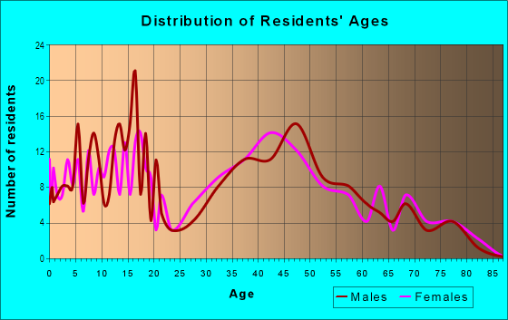
| Males: | 560 |
| Females: | 529 |
Males:
| This neighborhood: | 45.8 years |
| Whole city: | 37.6 years |
| This neighborhood: | 50.1 years |
| Whole city: | 43.2 years |
Average household size:
| Groton Township (Groton): | 5.4 people |
| Bellevue: | 2.3 people |
Percentage of family households:
| Groton Township (Groton): | 60.6% |
| Bellevue: | 43.7% |
| Here: | 62.1% |
| Bellevue: | 41.6% |
Percentage of married-couple families with children (among all households):
| Groton Township (Groton): | 34.7% |
| Bellevue: | 25.1% |
Percentage of single-mother households (among all households):
| Groton Township (Groton): | 7.4% |
| Bellevue: | 15.0% |
Percentage of never married males 15 years old and over:
Percentage of never married females 15 years old and over:
| Groton Township (Groton): | 9.3% |
| Bellevue: | 16.3% |
Percentage of never married females 15 years old and over:
| Groton Township (Groton): | 16.9% |
| city: | 11.1% |
Percentage of people that speak English not well or not at all:
| Groton Township (Groton): | 0.0% |
| Bellevue: | 0.3% |
Percentage of people born in this state:
Percentage of people born in another U.S. state:
Percentage of native residents but born outside the U.S.:
Percentage of foreign born residents:
| Here: | 87.2% |
| Bellevue: | 82.1% |
Percentage of people born in another U.S. state:
| Groton Township (Groton): | 12.1% |
| Bellevue: | 13.7% |
Percentage of native residents but born outside the U.S.:
| Here: | 0.2% |
| city: | 0.8% |
Percentage of foreign born residents:
| Here: | 0.6% |
| Bellevue: | 3.5% |

Owner-occupied
Renter-occupied


- Rooms in owner-occupied houses and condos in Groton Township <
> - 241 room
- 92 rooms
- 313 rooms
- 274 rooms
- 315 rooms
- 1496 rooms
- 617 rooms
- 438 rooms
- 859+ rooms

- Rooms in renter-occupied apartments in Groton Township <
> - 2001 room
- 2002 rooms
- 823 rooms
- 784 rooms
- 835 rooms
- 526 rooms
- 257 rooms
- 38 rooms
- 49+ rooms
Owner-occupied
Renter-occupied

- Bedrooms in owner-occupied houses and condos in Groton Township <
> - 24no bedroom
- 501 bedroom
- 622 bedrooms
- 2553 bedrooms
- 424 bedrooms
- 385+ bedrooms

- Bedrooms in renter-occupied apartments in Groton Township <
> - 200no bedroom
- 1451 bedroom
- 1062 bedrooms
- 523 bedrooms
- 254 bedrooms
- 45+ bedrooms
Average number of cars or other vehicles available in houses/condos:
Average number of cars or other vehicles available in apartments:
| This neighborhood: | 3.3 |
| Bellevue: | 2.1 |
Average number of cars or other vehicles available in apartments:
| Here: | |
| city: |
Percentage of units with a mortgage:
| Groton Township (Groton): | 61.1% |
| Bellevue: | 61.5% |
Average estimated value of detached houses in 2022 (96.4% of all units):
| Groton Township (Groton): | $176,937 |
| Ohio: | $254,366 |

- Year house built in Groton Township <
> - 362020 or later
- 322010 to 2019
- 682000 to 2009
- 731990 to 1999
- 521980 to 1989
- 501970 to 1979
- 831960 to 1969
- 1281950 to 1959
- 801940 to 1949
- 761939 or earlier

City-data.com crime index for city in 2016 (higher means more crime):
| City: | 7.3 |
| U.S. average: | 245.7 |
Travel time to work (commute)
![Travel time to work (commute)]()
- 39Less than 5 minutes
- 845 to 9 minutes
- 7810 to 14 minutes
- 15915 to 19 minutes
- 9820 to 24 minutes
- 7425 to 29 minutes
- 4830 to 34 minutes
- 735 to 39 minutes
- 840 to 44 minutes
- 2945 to 59 minutes
- 2860 to 89 minutes
- 2190 or more minutes

Means of transportation to work
![Means of transportation to work]()
- 77.3%643Drove a car alone
- 11.2%93Carpooled
- 0.6%5Bus
- 3.8%32Motorcycle
- 0.5%4Bicycle
- 2.4%20Walked
- 13.1%109Other means
- 5.7%47Worked at home

Time leaving home to go to work
![Time leaving home to go to work]()
- 2612:00 a.m. to 4:59 a.m.
- 395:00 a.m. to 5:29 a.m.
- 495:30 a.m. to 5:59 a.m.
- 476:00 a.m. to 6:29 a.m.
- 1386:30 a.m. to 6:59 a.m.
- 1057:00 a.m. to 7:29 a.m.
- 517:30 a.m. to 7:59 a.m.
- 388:00 a.m. to 8:29 a.m.
- 358:30 a.m. to 8:59 a.m.
- 469:00 a.m. to 9:59 a.m.
- 1010:00 a.m. to 10:59 a.m.
- 411:00 a.m. to 11:59 a.m.
- 1412:00 p.m. to 3:59 p.m.
- 594:00 p.m. to 11:59 p.m.

Occupations of males:
- Percentage of males in management occupations (except farmers):
Here: 10.0% city: 8.7%
- Percentage of males in business and financial operations occupations:
Here: 5.2% city: 2.2%
- Percentage of males in service occupations:
Here: 6.9% city: 5.6%
- Percentage of males in sales and office occupations:
Here: 40.4% city: 18.2%
- Percentage of males in construction, extraction, and maintenance occupations:
Here: 12.7% city: 8.3%
- Percentage of males in production occupations:
Here: 5.3% city: 20.0%
- Percentage of males in material moving occupations:
Here: 5.5% city: 10.2%
Occupations of females:
- Percentage of females in business and financial operations occupations:
Here: 10.8% city: 3.7%
- Percentage of females in computer and mathematical occupations:
Here: 4.9% city: 0.0%
- Percentage of females in community and social services occupations:
Here: 5.6% city: 1.9%
- Percentage of females in education, training, and library occupations:
Here: 6.4% city: 6.1%
- Percentage of females in arts, design, entertainment, sports, and media occupations:
Here: 6.1% city: 0.7%
- Percentage of females in healthcare practitioners and technical occupations:
Here: 1.9% city: 11.1%
- Percentage of females in service occupations:
Here: 38.7% city: 24.0%
- Percentage of females in sales and office occupations:
Here: 18.0% city: 19.0%
- Percentage of females in production occupations:
Here: 5.7% city: 17.4%
- Percentage of females in material moving occupations:
Here: 1.7% city: 3.7%
Education in this neighborhood (subdivision or community):
- Percentage of people 3 years and older in K-12 schools:
Groton Township (Groton): 33.2% Bellevue: 19.3%
- Percentage of people 3 years and older in undergraduate colleges:
Groton Township (Groton): 13.9% Bellevue: 2.0%
- Percentage of people 3 years and older in grad. or professional schools:
Groton Township (Groton): 7.1% Bellevue: 0.2%
- Percentage of students K-12 enrolled in private schools:
Groton Township (Groton): 173.2% Bellevue: 10.0%
Percentage of population below poverty level:
| Groton Township (Groton): | 5.0% |
| Bellevue: | 18.0% |
Median year owner moved in (as recorded in 2022):
| Groton Township (Groton): | 2003 |
| Bellevue: | 2006 |
Percentage of married-couple families with both working:
| Groton Township (Groton): | 138.1% |
| Bellevue: | 73.7% |

- 28.5%Utility gas
- 26.7%Bottled, tank, or LP gas
- 22.6%Electricity
- 7.9%Other fuel
- 6.6%Wood
- 5.6%No fuel used
- 2.1%Fuel oil, kerosene, etc.
Limited-access highways (interstate or state) in this neighborhood:
I- 80 (I- 90, Ohio Tpke)
Length: 13.43 miles
Direction: E-W
Direction: E-W
Highways in this neighborhood:
State Rte 4 (Hayes Ave, Columbus-Sandusky Rd)
Length: 5.52 miles
Directions: N-S, SW-NE
Address range: 8000 to 12011
Directions: N-S, SW-NE
Address range: 8000 to 12011
State Rte 269 (State Rte 269 S)
Length: 5.15 miles
Directions: N-S, SW-NE
Address range: 6024 to 11999
Directions: N-S, SW-NE
Address range: 6024 to 11999
State Rte 113 W (Edison Hwy, State Rte 113)
Length: 3.50 miles
Directions: E-W, SW-NE
Address range: 9411 to 9417
Directions: E-W, SW-NE
Address range: 9411 to 9417
Roads and streets:
Strecker Rd W (Strecker Rd, Co Hwy 15)
Length: 6.61 miles
Direction: E-W
Address range: 7300 to 12399
Direction: E-W
Address range: 7300 to 12399
Portland Rd (Co Rd 32, Co Rd 175)
Length: 6.40 miles
Direction: E-W
Address range: 6306 to 12999
Direction: E-W
Address range: 6306 to 12999
Co Hwy 13 (Mason Rd)
Length: 5.41 miles
Direction: E-W
Address range: 7116 to 11799
Direction: E-W
Address range: 7116 to 11799
Northwest Rd (Co Hwy 1, Southwest Rd, Co Rd 312)
Length: 5.00 miles
Directions: E-W, N-S, SW-NE
Address range: 100 to 10798
Directions: E-W, N-S, SW-NE
Address range: 100 to 10798
Skadden Rd (Co Hwy 42)
Length: 4.51 miles
Directions: N-S, SE-NW
Address range: 6342 to 11099
Directions: N-S, SE-NW
Address range: 6342 to 11099
Billings Rd (Twp Hwy 38)
Length: 4.48 miles
Direction: N-S
Address range: 5815 to 11199
Direction: N-S
Address range: 5815 to 11199
Twp Hwy 37 (Bragg Rd)
Length: 2.52 miles
Direction: N-S
Address range: 9200 to 10799
Direction: N-S
Address range: 9200 to 10799
Twp Hwy 97 (Smith Rd)
Length: 2.47 miles
Directions: E-W, SW-NE
Address range: 9400 to 11199
Directions: E-W, SW-NE
Address range: 9400 to 11199
Bemis Rd (Twp Hwy 109)
Length: 2.27 miles
Direction: SW-NE
Address range: 9400 to 11299
Direction: SW-NE
Address range: 9400 to 11299
Potter Rd (Twp Hwy 98)
Length: 2.01 miles
Direction: E-W
Address range: 10700 to 12199
Direction: E-W
Address range: 10700 to 12199
Twp Hwy 29 (Dining Rd)
Length: 1.88 miles
Direction: E-W
Address range: 11200 to 12999
Direction: E-W
Address range: 11200 to 12999
Knauss Rd (Twp Hwy 96)
Length: 1.72 miles
Direction: E-W
Address range: 10700 to 11999
Direction: E-W
Address range: 10700 to 11999
Twp Hwy 102 (Deyo Rd)
Length: 1.41 miles
Direction: N-S
Address range: 6266 to 7499
Direction: N-S
Address range: 6266 to 7499
Maple Ave (Twp Hwy 103)
Length: 1.30 miles
Directions: E-W, N-S, SE-NW
Address range: 6001 to 9622
Directions: E-W, N-S, SE-NW
Address range: 6001 to 9622
Twp Hwy 104 (Magill Rd)
Length: 1.15 miles
Directions: E-W, N-S, SE-NW
Address range: 6300 to 7499
Directions: E-W, N-S, SE-NW
Address range: 6300 to 7499
Twp Hwy 108 (Harris Rd)
Length: 0.98 miles
Direction: E-W
Address range: 4300 to 5999
Direction: E-W
Address range: 4300 to 5999
Twp Hwy 31 (Hale Rd)
Length: 0.71 miles
Direction: E-W
Direction: E-W
Kilroy Rd (Twp Hwy 36)
Length: 0.41 miles
Directions: N-S, SE-NW, SW-NE
Address range: 2700 to 6999
Directions: N-S, SE-NW, SW-NE
Address range: 2700 to 6999
Sand Hill Rd (Twp Hwy 40)
Length: 0.26 miles
Direction: SE-NW
Direction: SE-NW
Stacey Rd (Twp Hwy 51)
Length: 0.18 miles
Direction: N-S
Address range: 7900 to 8026
Direction: N-S
Address range: 7900 to 8026
Twp Hwy 109
Length: 0.17 miles
Direction: SW-NE
Direction: SW-NE
Yingling Rd (Twp Hwy 41)
Length: 0.08 miles
Direction: N-S
Direction: N-S
Railroad features:
Norfolk and Western Rlwy
Length: 33.52 miles
Directions: E-W, N-S, SE-NW, SW-NE
Directions: E-W, N-S, SE-NW, SW-NE
Other features:
Snyders Ditch
Length: 3.81 miles
Directions: E-W, N-S, SE-NW, SW-NE
Directions: E-W, N-S, SE-NW, SW-NE
Mills Crk
Length: 3.39 miles
Directions: E-W, N-S, SE-NW, SW-NE
Directions: E-W, N-S, SE-NW, SW-NE
Pipe Crk
Length: 0.25 miles
Directions: E-W, N-S, SW-NE
Directions: E-W, N-S, SW-NE
Highways in this neighborhood:
State Rte 113 (State Rte 113 W, Edison Hwy)
Length: 0.87 miles
Direction: E-W
Direction: E-W
Roads and streets:
Private Rd
Length: 0.03 miles
Direction: N-S
Direction: N-S
Great Lakes Pkwy
Length: 0.03 miles
Direction: SW-NE
Direction: SW-NE
Railroad features:
Norfolk and Western Rlwy
Length: 0.17 miles
Directions: E-W, SE-NW, SW-NE
Directions: E-W, SE-NW, SW-NE
Roads and streets:
Northwest Rd (Co Hwy 1, Southwest Rd, Co Rd 312)
Length: 5.00 miles
Directions: E-W, N-S, SW-NE
Address range: 100 to 10798
Directions: E-W, N-S, SW-NE
Address range: 100 to 10798