Downtown Mayfield Heights (The Retail District) neighborhood in Cleveland, Ohio (OH), 44040, 44143, 44124 detailed profile
Settings
X


Business Search - 14 Million verified businesses
Area: 5.105 square miles
Population: 13,854
Population density:
| Downtown Mayfield Heights (The Retail District): | 2,714 people per square mile |
| Cleveland: | 4,662 people per square mile |

- 10,07465.8%White
- 3,11720.4%Black
- 7314.8%Hispanic or Latino
- 6784.4%Two or more races
- 5623.7%Asian
- 880.6%Some other race
- 350.2%Native Hawaiian and Other
Pacific Islander - 150.10%American Indian

Median household income in 2022:
| Downtown Mayfield Heights (The Retail District): | $112,282 |
| Cleveland: | $37,351 |
Distribution of median household income
![Distribution of median household income]()
- 665Less than $10,000
- 434$10,000 to $19,999
- 1,414$20,000 to $29,999
- 1,034$30,000 to $39,999
- 1,566$40,000 to $49,999
- 267$50,000 to $59,999
- 567$60,000 to $74,999
- 892$75,000 to $99,999
- 714$100,000 to $124,999
- 439$125,000 to $149,999
- 549$150,000 to $199,999
- 427$200,000 or more

Distribution of owner-occupied house/condo value
![Distribution of owner-occupied house/condo value]()
- 1,726Less than $50,000
- 1,360$50,000 to $99,999
- 967$100,000 to $149,999
- 1,420$150,000 to $199,999
- 1,158$200,000 to $249,999
- 503$250,000 to $299,999
- 236$300,000 to $399,999
- 83$400,000 to $499,999
- 162$500,000 to $749,999
- 99$750,000 to $999,999
- 179$1,000,000 or more

Distribution of rent paid by renters
![Distribution of rent paid by renters]()
- 66$200 to $299
- 250$300 to $399
- 163$400 to $499
- 554$500 to $599
- 138$600 to $699
- 1,455$700 to $799
- 4,558$800 to $899
- 6,598$900 to $999
- 1,984$1,000 to $1,249
- 463$1,250 to $1,499
- 496$1,500 to $1,999
- 409$2,000 or more

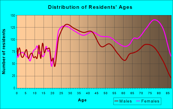
| Males: | 6,784 |
| Females: | 7,070 |
Males:
| This neighborhood: | 42.7 years |
| Whole city: | 35.6 years |
| This neighborhood: | 46.2 years |
| Whole city: | 38.1 years |
Average household size:
| Downtown Mayfield Heights (The Retail District): | 2.3 people |
| Cleveland: | 27.0 people |
Percentage of family households:
| Downtown Mayfield Heights (The Retail District): | 39.1% |
| Cleveland: | 32.3% |
| Here: | 38.2% |
| Cleveland: | 18.6% |
Percentage of married-couple families with children (among all households):
| Downtown Mayfield Heights (The Retail District): | 32.0% |
| Cleveland: | 10.0% |
Percentage of single-mother households (among all households):
| Downtown Mayfield Heights (The Retail District): | 30.9% |
| Cleveland: | 30.3% |
Percentage of never married males 15 years old and over:
Percentage of never married females 15 years old and over:
| Downtown Mayfield Heights (The Retail District): | 18.5% |
| Cleveland: | 27.7% |
Percentage of never married females 15 years old and over:
| Downtown Mayfield Heights (The Retail District): | 14.3% |
| city: | 26.3% |
Percentage of people that speak English not well or not at all:
| Downtown Mayfield Heights (The Retail District): | 3.6% |
| Cleveland: | 2.7% |
Percentage of people born in this state:
Percentage of people born in another U.S. state:
Percentage of native residents but born outside the U.S.:
Percentage of foreign born residents:
| Here: | 69.2% |
| Cleveland: | 71.5% |
Percentage of people born in another U.S. state:
| Downtown Mayfield Heights (The Retail District): | 14.2% |
| Cleveland: | 17.9% |
Percentage of native residents but born outside the U.S.:
| Here: | 1.7% |
| city: | 4.3% |
Percentage of foreign born residents:
| Here: | 15.3% |
| Cleveland: | 6.3% |

Owner-occupied
Renter-occupied


- Rooms in owner-occupied houses and condos in Downtown Mayfield Heights <
> - 5351 room
- 852 rooms
- 1313 rooms
- 2814 rooms
- 8065 rooms
- 1,1666 rooms
- 7947 rooms
- 4528 rooms
- 6999+ rooms

- Rooms in renter-occupied apartments in Downtown Mayfield Heights <
> - 2071 room
- 1,0682 rooms
- 3,2523 rooms
- 1,9064 rooms
- 8795 rooms
- 5436 rooms
- 2467 rooms
- 1128 rooms
- 3999+ rooms
Owner-occupied
Renter-occupied

- Bedrooms in owner-occupied houses and condos in Downtown Mayfield Heights <
> - 535no bedroom
- 4231 bedroom
- 6732 bedrooms
- 2,5093 bedrooms
- 7784 bedrooms
- 1545+ bedrooms

- Bedrooms in renter-occupied apartments in Downtown Mayfield Heights <
> - 207no bedroom
- 2,5861 bedroom
- 2,2632 bedrooms
- 6063 bedrooms
- 1054 bedrooms
- 1645+ bedrooms
Average number of cars or other vehicles available in houses/condos:
Average number of cars or other vehicles available in apartments:
| This neighborhood: | 2.8 |
| Cleveland: | 1.6 |
Average number of cars or other vehicles available in apartments:
| Here: | |
| city: |
Percentage of units with a mortgage:
| Downtown Mayfield Heights (The Retail District): | 62.7% |
| Cleveland: | 50.7% |
Average estimated value of detached houses in 2022 (59.3% of all units):
| Downtown Mayfield Heights (The Retail District): | $216,355 |
| Ohio: | $254,366 |

- Year house built in Downtown Mayfield Heights <
> - 582020 or later
- 1132010 to 2019
- 402000 to 2009
- 4861990 to 1999
- 1,2911980 to 1989
- 5821970 to 1979
- 1,5971960 to 1969
- 1,9811950 to 1959
- 4991940 to 1949
- 9161939 or earlier

City-data.com crime index for city in 2020 (higher means more crime):
| City: | 735.3 |
| U.S. average: | 219.5 |
Travel time to work (commute)
![Travel time to work (commute)]()
- 182Less than 5 minutes
- 5175 to 9 minutes
- 98410 to 14 minutes
- 71815 to 19 minutes
- 1,07120 to 24 minutes
- 45425 to 29 minutes
- 1,19530 to 34 minutes
- 8035 to 39 minutes
- 11640 to 44 minutes
- 92345 to 59 minutes
- 20960 to 89 minutes
- 8190 or more minutes

Means of transportation to work
![Means of transportation to work]()
- 75.1%5,612Drove a car alone
- 7.3%545Carpooled
- 16.1%1,200Bus
- 0.1%9Subway or elevated rail
- 1.7%129Light rail, streetcar or trolley
- 0.1%7Taxi
- 3.6%270Bicycle
- 12.0%895Walked
- 13.7%1,026Other means
- 12.0%895Worked at home

Time leaving home to go to work
![Time leaving home to go to work]()
- 41012:00 a.m. to 4:59 a.m.
- 3795:00 a.m. to 5:29 a.m.
- 2145:30 a.m. to 5:59 a.m.
- 4106:00 a.m. to 6:29 a.m.
- 3856:30 a.m. to 6:59 a.m.
- 7727:00 a.m. to 7:29 a.m.
- 9297:30 a.m. to 7:59 a.m.
- 1,0078:00 a.m. to 8:29 a.m.
- 5498:30 a.m. to 8:59 a.m.
- 2709:00 a.m. to 9:59 a.m.
- 21710:00 a.m. to 10:59 a.m.
- 16711:00 a.m. to 11:59 a.m.
- 26112:00 p.m. to 3:59 p.m.
- 3704:00 p.m. to 11:59 p.m.

Occupations of males:
- Percentage of males in management occupations (except farmers):
Here: 10.9% city: 7.3%
- Percentage of males in business and financial operations occupations:
Here: 5.7% city: 4.6%
- Percentage of males in computer and mathematical occupations:
Here: 7.0% city: 3.6%
- Percentage of males in architecture and engineering occupations:
Here: 4.4% city: 1.8%
- Percentage of males in life, physical, and social science occupations:
Here: 1.6% city: 1.2%
- Percentage of males in legal occupations:
Here: 1.1% city: 1.2%
- Percentage of males in education, training, and library occupations:
Here: 4.8% city: 2.1%
- Percentage of males in arts, design, entertainment, sports, and media occupations:
Here: 3.8% city: 1.7%
- Percentage of males in healthcare practitioners and technical occupations:
Here: 1.9% city: 3.5%
- Percentage of males in service occupations:
Here: 6.8% city: 20.2%
- Percentage of males in sales and office occupations:
Here: 16.3% city: 14.2%
- Percentage of males in construction, extraction, and maintenance occupations:
Here: 9.7% city: 6.7%
- Percentage of males in production occupations:
Here: 5.0% city: 10.8%
- Percentage of males in transportation occupations:
Here: 11.5% city: 5.8%
- Percentage of males in material moving occupations:
Here: 5.0% city: 9.1%
Occupations of females:
- Percentage of females in management occupations (except farmers):
Here: 8.4% city: 6.9%
- Percentage of females in business and financial operations occupations:
Here: 6.3% city: 5.8%
- Percentage of females in computer and mathematical occupations:
Here: 2.5% city: 1.6%
- Percentage of females in community and social services occupations:
Here: 1.6% city: 2.8%
- Percentage of females in legal occupations:
Here: 1.1% city: 1.4%
- Percentage of females in education, training, and library occupations:
Here: 8.6% city: 5.8%
- Percentage of females in arts, design, entertainment, sports, and media occupations:
Here: 1.5% city: 1.2%
- Percentage of females in healthcare practitioners and technical occupations:
Here: 10.8% city: 9.3%
- Percentage of females in service occupations:
Here: 13.2% city: 26.3%
- Percentage of females in sales and office occupations:
Here: 37.0% city: 27.0%
- Percentage of females in production occupations:
Here: 3.7% city: 5.0%
- Percentage of females in material moving occupations:
Here: 4.0% city: 2.6%
Education in this neighborhood (subdivision or community):
- Percentage of people 3 years and older in K-12 schools:
Downtown Mayfield Heights (The Retail District): 28.4% Cleveland: 15.5%
- Percentage of people 3 years and older in undergraduate colleges:
Downtown Mayfield Heights (The Retail District): 2.6% Cleveland: 5.1%
- Percentage of people 3 years and older in grad. or professional schools:
Downtown Mayfield Heights (The Retail District): 3.5% Cleveland: 1.7%
- Percentage of students K-12 enrolled in private schools:
Downtown Mayfield Heights (The Retail District): 40.2% Cleveland: 22.4%
Percentage of population below poverty level:
| Downtown Mayfield Heights (The Retail District): | 7.9% |
| Cleveland: | 31.8% |
Percentage of married-couple families with both working:
| Downtown Mayfield Heights (The Retail District): | 94.4% |
| Cleveland: | 72.0% |

- 61.1%Utility gas
- 16.8%Electricity
- 8.9%No fuel used
- 7.3%Other fuel
- 2.0%Bottled, tank, or LP gas
- 1.6%Fuel oil, kerosene, etc.
- 1.3%Solar energy
- 0.8%Wood
Limited-access highways (interstate or state) in this neighborhood:
Outerbelt East Fwy (I- 271)
Length: 4.43 miles
Directions: E-W, N-S, SE-NW, SW-NE
Directions: E-W, N-S, SE-NW, SW-NE
Highways in this neighborhood:
Mayfield Rd (US Hwy 322)
Length: 3.69 miles
Directions: E-W, SW-NE
Address range: 6002 to 7399
Directions: E-W, SW-NE
Address range: 6002 to 7399
State Rte 91 (Som Center Rd)
Length: 1.95 miles
Direction: N-S
Address range: 858 to 1940
Direction: N-S
Address range: 858 to 1940
Roads and streets:
Gates Mills Blvd
Length: 3.84 miles
Directions: E-W, N-S, SE-NW, SW-NE
Address range: 1882 to 7121
Directions: E-W, N-S, SE-NW, SW-NE
Address range: 1882 to 7121
Lander Rd
Length: 1.94 miles
Direction: N-S
Address range: 800 to 2179
Direction: N-S
Address range: 800 to 2179
Ridgebury Blvd
Length: 1.69 miles
Direction: E-W
Address range: 6000 to 6699
Direction: E-W
Address range: 6000 to 6699
W Hill Dr
Length: 1.53 miles
Directions: E-W, N-S, SE-NW, SW-NE
Address range: 189 to 1549
Directions: E-W, N-S, SE-NW, SW-NE
Address range: 189 to 1549
Hillcreek Ln
Length: 1.33 miles
Directions: E-W, N-S, SE-NW, SW-NE
Address range: 875 to 7199
Directions: E-W, N-S, SE-NW, SW-NE
Address range: 875 to 7199
Marsol Rd
Length: 1.32 miles
Directions: E-W, SW-NE
Address range: 6000 to 6698
Directions: E-W, SW-NE
Address range: 6000 to 6698
Wilson Mills Rd
Length: 1.26 miles
Direction: E-W
Address range: 5994 to 6499
Direction: E-W
Address range: 5994 to 6499
Parkland Blvd
Length: 1.24 miles
Directions: E-W, N-S, SE-NW, SW-NE
Address range: 6000 to 6299
Directions: E-W, N-S, SE-NW, SW-NE
Address range: 6000 to 6299
Cedar Rd
Length: 0.95 miles
Direction: E-W
Address range: 30600 to 32699
Direction: E-W
Address range: 30600 to 32699
Woodhawk Dr
Length: 0.92 miles
Direction: E-W
Address range: 6000 to 8999
Direction: E-W
Address range: 6000 to 8999
Gates Rd
Length: 0.82 miles
Directions: E-W, N-S, SW-NE
Address range: 6900 to 7199
Directions: E-W, N-S, SW-NE
Address range: 6900 to 7199
Washington Blvd
Length: 0.80 miles
Direction: N-S
Address range: 1000 to 1499
Direction: N-S
Address range: 1000 to 1499
Lander Haven Dr
Length: 0.78 miles
Directions: E-W, N-S
Address range: 6000 to 31999
Directions: E-W, N-S
Address range: 6000 to 31999
Commonwealth Ave
Length: 0.73 miles
Direction: N-S
Address range: 1100 to 1477
Direction: N-S
Address range: 1100 to 1477
Worton Blvd
Length: 0.73 miles
Direction: N-S
Address range: 1100 to 1477
Direction: N-S
Address range: 1100 to 1477
Genesee Ave
Length: 0.73 miles
Direction: N-S
Address range: 1100 to 1499
Direction: N-S
Address range: 1100 to 1499
Sunset Dr (Sunset Rd)
Length: 0.73 miles
Direction: N-S
Address range: 1100 to 1499
Direction: N-S
Address range: 1100 to 1499
Orchard Heights Dr
Length: 0.73 miles
Direction: N-S
Address range: 1100 to 1477
Direction: N-S
Address range: 1100 to 1477
Maplewood Rd
Length: 0.73 miles
Direction: E-W
Address range: 6054 to 6699
Direction: E-W
Address range: 6054 to 6699
W Miner Rd
Length: 0.71 miles
Directions: N-S, SE-NW, SW-NE
Address range: 1100 to 1499
Directions: N-S, SE-NW, SW-NE
Address range: 1100 to 1499
E Miner Rd
Length: 0.71 miles
Directions: N-S, SE-NW, SW-NE
Address range: 1100 to 1498
Directions: N-S, SE-NW, SW-NE
Address range: 1100 to 1498
Andrews Ln
Length: 0.69 miles
Directions: E-W, N-S, SE-NW, SW-NE
Address range: 800 to 6899
Directions: E-W, N-S, SE-NW, SW-NE
Address range: 800 to 6899
Golden Gate Blvd
Length: 0.66 miles
Directions: N-S, SE-NW
Address range: 1100 to 1499
Directions: N-S, SE-NW
Address range: 1100 to 1499
Longridge Rd
Length: 0.57 miles
Directions: E-W, SE-NW
Address range: 6300 to 6598
Directions: E-W, SE-NW
Address range: 6300 to 6598
Bonnie Ln
Length: 0.55 miles
Directions: E-W, N-S, SE-NW
Address range: 1100 to 1499
Directions: E-W, N-S, SE-NW
Address range: 1100 to 1499
Crestwood Rd
Length: 0.55 miles
Directions: N-S, SE-NW, SW-NE
Address range: 1480 to 1799
Directions: N-S, SE-NW, SW-NE
Address range: 1480 to 1799
Giesse Dr
Length: 0.55 miles
Direction: N-S
Address range: 1100 to 1399
Direction: N-S
Address range: 1100 to 1399
Chelmsford Rd
Length: 0.54 miles
Directions: N-S, SE-NW, SW-NE
Address range: 1500 to 1799
Directions: N-S, SE-NW, SW-NE
Address range: 1500 to 1799
Roselawn Rd
Length: 0.53 miles
Directions: N-S, SE-NW
Address range: 1488 to 1899
Directions: N-S, SE-NW
Address range: 1488 to 1899
Fairhaven Rd
Length: 0.52 miles
Directions: E-W, N-S, SW-NE
Address range: 6252 to 6499
Directions: E-W, N-S, SW-NE
Address range: 6252 to 6499
Marshfield Rd
Length: 0.50 miles
Directions: E-W, N-S, SE-NW, SW-NE
Address range: 1950 to 2199
Directions: E-W, N-S, SE-NW, SW-NE
Address range: 1950 to 2199
Worton Park Dr
Length: 0.49 miles
Directions: N-S, SE-NW
Address range: 800 to 1099
Directions: N-S, SE-NW
Address range: 800 to 1099
Jackie Ln
Length: 0.48 miles
Directions: E-W, N-S, SW-NE
Address range: 1100 to 1499
Directions: E-W, N-S, SW-NE
Address range: 1100 to 1499
Seneca Rd
Length: 0.47 miles
Direction: E-W
Address range: 6600 to 6899
Direction: E-W
Address range: 6600 to 6899
Glenview Rd
Length: 0.47 miles
Direction: E-W
Address range: 6600 to 6899
Direction: E-W
Address range: 6600 to 6899
Bonnieview Rd
Length: 0.47 miles
Direction: E-W
Address range: 6600 to 6899
Direction: E-W
Address range: 6600 to 6899
Westerham Rd
Length: 0.43 miles
Directions: E-W, SW-NE
Address range: 6041 to 6221
Directions: E-W, SW-NE
Address range: 6041 to 6221
Aintree Park Dr
Length: 0.42 miles
Directions: E-W, N-S, SW-NE
Address range: 800 to 6642
Directions: E-W, N-S, SW-NE
Address range: 800 to 6642
Hickory Ln
Length: 0.42 miles
Direction: E-W
Address range: 6800 to 7099
Direction: E-W
Address range: 6800 to 7099
Rosebury Ct
Length: 0.41 miles
Directions: E-W, N-S, SE-NW, SW-NE
Address range: 100 to 499
Directions: E-W, N-S, SE-NW, SW-NE
Address range: 100 to 499
Algiers Dr
Length: 0.41 miles
Direction: N-S
Address range: 1500 to 1699
Direction: N-S
Address range: 1500 to 1699
Derby Dr
Length: 0.40 miles
Directions: E-W, SE-NW, SW-NE
Address range: 6400 to 6599
Directions: E-W, SE-NW, SW-NE
Address range: 6400 to 6599
Larchmont Dr
Length: 0.38 miles
Direction: E-W
Address range: 6600 to 6899
Direction: E-W
Address range: 6600 to 6899
Vallevista Dr
Length: 0.38 miles
Direction: E-W
Address range: 6500 to 6699
Direction: E-W
Address range: 6500 to 6699
Woodhurst Ave
Length: 0.38 miles
Direction: N-S
Address range: 1488 to 1699
Direction: N-S
Address range: 1488 to 1699
Fruitland Ave
Length: 0.38 miles
Direction: N-S
Address range: 1488 to 1699
Direction: N-S
Address range: 1488 to 1699
Parker Dr
Length: 0.38 miles
Direction: N-S
Address range: 1490 to 1699
Direction: N-S
Address range: 1490 to 1699
Hardwood Ct
Length: 0.38 miles
Directions: E-W, N-S, SE-NW, SW-NE
Address range: 824 to 899
Directions: E-W, N-S, SE-NW, SW-NE
Address range: 824 to 899
Woodrow Ave
Length: 0.38 miles
Directions: N-S, SE-NW
Address range: 1488 to 1699
Directions: N-S, SE-NW
Address range: 1488 to 1699
Eastondale Rd
Length: 0.38 miles
Directions: E-W, N-S, SW-NE
Address range: 6190 to 6436
Directions: E-W, N-S, SW-NE
Address range: 6190 to 6436
Franklin Rd
Length: 0.38 miles
Direction: E-W
Direction: E-W
Allen Bradley Dr
Length: 0.37 miles
Direction: E-W
Address range: 1 to 398
Direction: E-W
Address range: 1 to 398
Monterey Dr
Length: 0.35 miles
Direction: E-W
Address range: 6500 to 6699
Direction: E-W
Address range: 6500 to 6699
Stafford Dr
Length: 0.35 miles
Directions: E-W, SW-NE
Address range: 6700 to 6799
Directions: E-W, SW-NE
Address range: 6700 to 6799
S Woodlane Dr
Length: 0.35 miles
Direction: E-W
Address range: 6100 to 6399
Direction: E-W
Address range: 6100 to 6399
Pepper Hollow Ln
Length: 0.34 miles
Direction: E-W
Address range: 5980 to 6799
Direction: E-W
Address range: 5980 to 6799
Chatham Way
Length: 0.34 miles
Direction: E-W
Address range: 1 to 199
Direction: E-W
Address range: 1 to 199
Queens Park Ave
Length: 0.33 miles
Direction: E-W
Address range: 6500 to 6699
Direction: E-W
Address range: 6500 to 6699
Eastgate Dr
Length: 0.32 miles
Direction: E-W
Address range: 6600 to 6799
Direction: E-W
Address range: 6600 to 6799
Fox Hollow Dr
Length: 0.32 miles
Directions: E-W, N-S, SE-NW, SW-NE
Address range: 100 to 244
Directions: E-W, N-S, SE-NW, SW-NE
Address range: 100 to 244
Drury Ln
Length: 0.31 miles
Directions: E-W, SW-NE
Address range: 1 to 199
Directions: E-W, SW-NE
Address range: 1 to 199
Beechers Brook Rd
Length: 0.29 miles
Directions: N-S, SE-NW, SW-NE
Address range: 800 to 999
Directions: N-S, SE-NW, SW-NE
Address range: 800 to 999
Ridgeview Rd
Length: 0.29 miles
Direction: E-W
Address range: 6500 to 6699
Direction: E-W
Address range: 6500 to 6699
Indiana Ave
Length: 0.28 miles
Direction: E-W
Address range: 6500 to 6699
Direction: E-W
Address range: 6500 to 6699
Eagle Trce
Length: 0.28 miles
Directions: E-W, N-S
Address range: 400 to 599
Directions: E-W, N-S
Address range: 400 to 599
Enfield Dr
Length: 0.26 miles
Directions: E-W, SE-NW
Address range: 6700 to 6799
Directions: E-W, SE-NW
Address range: 6700 to 6799
Norman Ln
Length: 0.26 miles
Direction: E-W
Address range: 6100 to 6299
Direction: E-W
Address range: 6100 to 6299
Joyce Rd
Length: 0.25 miles
Direction: N-S
Address range: 800 to 999
Direction: N-S
Address range: 800 to 999
Chase Dr
Length: 0.24 miles
Direction: E-W
Address range: 6400 to 6549
Direction: E-W
Address range: 6400 to 6549
Foxboro Dr
Length: 0.23 miles
Directions: E-W, SE-NW, SW-NE
Address range: 6400 to 6549
Directions: E-W, SE-NW, SW-NE
Address range: 6400 to 6549
N Woodlane Dr
Length: 0.22 miles
Direction: E-W
Address range: 6100 to 6299
Direction: E-W
Address range: 6100 to 6299
Ashdale Rd
Length: 0.22 miles
Directions: E-W, N-S, SW-NE
Address range: 6300 to 6399
Directions: E-W, N-S, SW-NE
Address range: 6300 to 6399
Hemingway Rd
Length: 0.22 miles
Directions: E-W, SE-NW, SW-NE
Address range: 6100 to 6299
Directions: E-W, SE-NW, SW-NE
Address range: 6100 to 6299
Northboro Dr
Length: 0.21 miles
Directions: N-S, SW-NE
Address range: 850 to 999
Directions: N-S, SW-NE
Address range: 850 to 999
Beech Hill Rd
Length: 0.21 miles
Direction: N-S
Address range: 877 to 999
Direction: N-S
Address range: 877 to 999
Aldenham Dr
Length: 0.20 miles
Directions: E-W, N-S, SW-NE
Address range: 6200 to 6231
Directions: E-W, N-S, SW-NE
Address range: 6200 to 6231
Quail Roost Dr
Length: 0.20 miles
Directions: E-W, SE-NW
Address range: 200 to 299
Directions: E-W, SE-NW
Address range: 200 to 299
Dunfield Dr
Length: 0.19 miles
Directions: E-W, N-S, SE-NW
Address range: 6250 to 6372
Directions: E-W, N-S, SE-NW
Address range: 6250 to 6372
Cordova Rd
Length: 0.19 miles
Directions: N-S, SE-NW
Address range: 1100 to 1299
Directions: N-S, SE-NW
Address range: 1100 to 1299
Golden Gate Plz
Length: 0.18 miles
Directions: E-W, N-S, SW-NE
Address range: 1300 to 1699
Directions: E-W, N-S, SW-NE
Address range: 1300 to 1699
N Aintree Park
Length: 0.18 miles
Directions: E-W, N-S
Address range: 800 to 6499
Directions: E-W, N-S
Address range: 800 to 6499
Gates Mills Blvd (S O M Center Rd)
Length: 0.18 miles
Directions: E-W, N-S, SE-NW, SW-NE
Directions: E-W, N-S, SE-NW, SW-NE
Teal Trace Dr
Length: 0.17 miles
Directions: E-W, N-S, SE-NW, SW-NE
Address range: 178 to 237
Directions: E-W, N-S, SE-NW, SW-NE
Address range: 178 to 237
Bellingham Rd
Length: 0.17 miles
Direction: N-S
Address range: 1700 to 1799
Direction: N-S
Address range: 1700 to 1799
Alcester Rd
Length: 0.17 miles
Direction: N-S
Address range: 1600 to 1799
Direction: N-S
Address range: 1600 to 1799
Old Mill Rd
Length: 0.17 miles
Direction: E-W
Address range: 1436 to 7063
Direction: E-W
Address range: 1436 to 7063
Woodlane Dr
Length: 0.17 miles
Directions: E-W, N-S, SE-NW, SW-NE
Address range: 900 to 1099
Directions: E-W, N-S, SE-NW, SW-NE
Address range: 900 to 1099
Windsor Dr
Length: 0.16 miles
Directions: N-S, SE-NW, SW-NE
Address range: 1500 to 1699
Directions: N-S, SE-NW, SW-NE
Address range: 1500 to 1699
Ascot Rd
Length: 0.14 miles
Direction: E-W
Address range: 6037 to 6099
Direction: E-W
Address range: 6037 to 6099
Piercefield Dr
Length: 0.13 miles
Directions: E-W, N-S, SE-NW
Address range: 6348 to 6499
Directions: E-W, N-S, SE-NW
Address range: 6348 to 6499
Pheasant Run
Length: 0.12 miles
Directions: N-S, SE-NW
Address range: 100 to 199
Directions: N-S, SE-NW
Address range: 100 to 199
Sunningdale Rd
Length: 0.11 miles
Direction: N-S
Address range: 1600 to 1849
Direction: N-S
Address range: 1600 to 1849
Robin Cir
Length: 0.09 miles
Directions: E-W, SE-NW, SW-NE
Address range: 6100 to 6199
Directions: E-W, SE-NW, SW-NE
Address range: 6100 to 6199
Thistle Trl
Length: 0.09 miles
Directions: N-S, SE-NW, SW-NE
Address range: 300 to 399
Directions: N-S, SE-NW, SW-NE
Address range: 300 to 399
Fox Hollow Ct
Length: 0.09 miles
Directions: E-W, N-S, SE-NW
Address range: 101 to 199
Directions: E-W, N-S, SE-NW
Address range: 101 to 199
Raleigh Dr
Length: 0.08 miles
Direction: N-S
Address range: 800 to 899
Direction: N-S
Address range: 800 to 899
Stratford Ct
Length: 0.08 miles
Direction: E-W
Direction: E-W
Hunt Cir
Length: 0.08 miles
Direction: SE-NW
Address range: 6500 to 6599
Direction: SE-NW
Address range: 6500 to 6599
Heather Ct
Length: 0.06 miles
Directions: E-W, N-S
Address range: 200 to 299
Directions: E-W, N-S
Address range: 200 to 299
N Berkley Sq
Length: 0.06 miles
Direction: E-W
Address range: 6600 to 6698
Direction: E-W
Address range: 6600 to 6698
S Berkley Sq
Length: 0.06 miles
Direction: E-W
Address range: 6600 to 6698
Direction: E-W
Address range: 6600 to 6698
Marlboro Ct
Length: 0.06 miles
Direction: E-W
Direction: E-W
Berkshire Ct
Length: 0.06 miles
Direction: E-W
Direction: E-W
Mayfield Park Blvd
Length: 0.05 miles
Direction: N-S
Address range: 1400 to 1499
Direction: N-S
Address range: 1400 to 1499
Bonnie Pl
Length: 0.05 miles
Directions: N-S, SW-NE
Address range: 1140 to 1199
Directions: N-S, SW-NE
Address range: 1140 to 1199
Gaslight Ln
Length: 0.04 miles
Direction: N-S
Address range: 1 to 199
Direction: N-S
Address range: 1 to 199
Windsor Cir
Length: 0.04 miles
Direction: SW-NE
Address range: 1500 to 1699
Direction: SW-NE
Address range: 1500 to 1699
Tudor Ct
Length: 0.03 miles
Direction: N-S
Direction: N-S
Other features:
Chagrin Riv
Length: 0.13 miles
Directions: N-S, SE-NW, SW-NE
Directions: N-S, SE-NW, SW-NE