Coventry (Euclid Heights) neighborhood in Cleveland, Ohio (OH), 44106, 44118 detailed profile
Settings
X


Business Search - 14 Million verified businesses
Area: 1.911 square miles
Population: 13,608
Population density:
| Coventry (Euclid Heights): | 7,121 people per square mile |
| Cleveland: | 4,662 people per square mile |

- 7,74552.8%White
- 4,60331.4%Black
- 9736.6%Asian
- 5113.5%Two or more races
- 4232.9%Hispanic or Latino
- 2001.4%American Indian
- 2081.4%Some other race

Distribution of median household income
![Distribution of median household income]()
- 505Less than $10,000
- 1,415$10,000 to $19,999
- 659$20,000 to $29,999
- 809$30,000 to $39,999
- 752$40,000 to $49,999
- 611$50,000 to $59,999
- 620$60,000 to $74,999
- 694$75,000 to $99,999
- 634$100,000 to $124,999
- 413$125,000 to $149,999
- 429$150,000 to $199,999
- 917$200,000 or more

Distribution of owner-occupied house/condo value
![Distribution of owner-occupied house/condo value]()
- 955Less than $50,000
- 1,298$50,000 to $99,999
- 998$100,000 to $149,999
- 1,008$150,000 to $199,999
- 970$200,000 to $249,999
- 513$250,000 to $299,999
- 513$300,000 to $399,999
- 468$400,000 to $499,999
- 430$500,000 to $749,999
- 187$750,000 to $999,999
- 166$1,000,000 or more

Distribution of rent paid by renters
![Distribution of rent paid by renters]()
- 493$100 to $199
- 1,379$200 to $299
- 1,351$300 to $399
- 658$400 to $499
- 972$500 to $599
- 622$600 to $699
- 979$700 to $799
- 483$800 to $899
- 497$900 to $999
- 976$1,000 to $1,249
- 708$1,250 to $1,499
- 480$1,500 to $1,999
- 627$2,000 or more

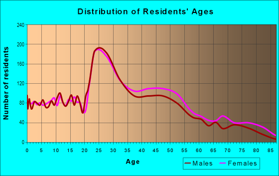
| Males: | 6,344 |
| Females: | 7,264 |
Males:
| This neighborhood: | 36.8 years |
| Whole city: | 35.6 years |
| This neighborhood: | 37.0 years |
| Whole city: | 38.1 years |
Average household size:
| Coventry (Euclid Heights): | 3.2 people |
| Cleveland: | 27.0 people |
Percentage of family households:
| Coventry (Euclid Heights): | 33.4% |
| Cleveland: | 32.3% |
| Here: | 31.8% |
| Cleveland: | 18.6% |
Percentage of married-couple families with children (among all households):
| Coventry (Euclid Heights): | 25.1% |
| Cleveland: | 10.0% |
Percentage of single-mother households (among all households):
| Coventry (Euclid Heights): | 27.0% |
| Cleveland: | 30.3% |
Percentage of never married males 15 years old and over:
Percentage of never married females 15 years old and over:
| Coventry (Euclid Heights): | 21.6% |
| Cleveland: | 27.7% |
Percentage of never married females 15 years old and over:
| Coventry (Euclid Heights): | 21.6% |
| city: | 26.3% |
Percentage of people that speak English not well or not at all:
| Coventry (Euclid Heights): | 0.6% |
| Cleveland: | 2.7% |
Percentage of people born in this state:
Percentage of people born in another U.S. state:
Percentage of native residents but born outside the U.S.:
Percentage of foreign born residents:
| Here: | 55.1% |
| Cleveland: | 71.5% |
Percentage of people born in another U.S. state:
| Coventry (Euclid Heights): | 31.3% |
| Cleveland: | 17.9% |
Percentage of native residents but born outside the U.S.:
| Here: | 1.4% |
| city: | 4.3% |
Percentage of foreign born residents:
| Here: | 12.3% |
| Cleveland: | 6.3% |

Owner-occupied
Renter-occupied


- Rooms in owner-occupied houses and condos in Coventry <
> - 581 room
- 2542 rooms
- 4903 rooms
- 2294 rooms
- 3985 rooms
- 5756 rooms
- 6417 rooms
- 7268 rooms
- 1,8149+ rooms

- Rooms in renter-occupied apartments in Coventry <
> - 3931 room
- 3162 rooms
- 1,0223 rooms
- 6814 rooms
- 8365 rooms
- 7586 rooms
- 6117 rooms
- 1898 rooms
- 1829+ rooms
Owner-occupied
Renter-occupied

- Bedrooms in owner-occupied houses and condos in Coventry <
> - 58no bedroom
- 2901 bedroom
- 3252 bedrooms
- 1,4043 bedrooms
- 1,0544 bedrooms
- 1,2225+ bedrooms

- Bedrooms in renter-occupied apartments in Coventry <
> - 398no bedroom
- 1,3201 bedroom
- 1,5012 bedrooms
- 5233 bedrooms
- 4464 bedrooms
- 1965+ bedrooms
Average number of cars or other vehicles available in houses/condos:
Average number of cars or other vehicles available in apartments:
| This neighborhood: | |
| Cleveland: |
Average number of cars or other vehicles available in apartments:
| Here: | |
| city: |
Percentage of units with a mortgage:
| Coventry (Euclid Heights): | 66.7% |
| Cleveland: | 50.7% |

- Year house built in Coventry <
> - 02020 or later
- 1242010 to 2019
- 2012000 to 2009
- 1761990 to 1999
- 3371980 to 1989
- 1,0241970 to 1979
- 3361960 to 1969
- 7631950 to 1959
- 6611940 to 1949
- 5,0641939 or earlier

City-data.com crime index for city in 2020 (higher means more crime):
| City: | 735.3 |
| U.S. average: | 219.5 |
Travel time to work (commute)
![Travel time to work (commute)]()
- 64Less than 5 minutes
- 5565 to 9 minutes
- 76910 to 14 minutes
- 1,02915 to 19 minutes
- 1,11620 to 24 minutes
- 47925 to 29 minutes
- 74230 to 34 minutes
- 13435 to 39 minutes
- 25240 to 44 minutes
- 33245 to 59 minutes
- 16160 to 89 minutes
- 12790 or more minutes

Means of transportation to work
![Means of transportation to work]()
- 68.3%4,748Drove a car alone
- 8.4%586Carpooled
- 4.6%317Bus
- 4.2%291Subway or elevated rail
- 2.6%178Light rail, streetcar or trolley
- 3.0%208Bicycle
- 8.8%613Walked
- 3.4%233Other means
- 16.2%1,124Worked at home

Time leaving home to go to work
![Time leaving home to go to work]()
- 8312:00 a.m. to 4:59 a.m.
- 1475:00 a.m. to 5:29 a.m.
- 1915:30 a.m. to 5:59 a.m.
- 2156:00 a.m. to 6:29 a.m.
- 2306:30 a.m. to 6:59 a.m.
- 6187:00 a.m. to 7:29 a.m.
- 7747:30 a.m. to 7:59 a.m.
- 7488:00 a.m. to 8:29 a.m.
- 6378:30 a.m. to 8:59 a.m.
- 8899:00 a.m. to 9:59 a.m.
- 38610:00 a.m. to 10:59 a.m.
- 9711:00 a.m. to 11:59 a.m.
- 42612:00 p.m. to 3:59 p.m.
- 2614:00 p.m. to 11:59 p.m.

Occupations of males:
- Percentage of males in management occupations (except farmers):
Here: 9.0% city: 7.3%
- Percentage of males in business and financial operations occupations:
Here: 7.6% city: 4.6%
- Percentage of males in computer and mathematical occupations:
Here: 7.1% city: 3.6%
- Percentage of males in architecture and engineering occupations:
Here: 6.4% city: 1.8%
- Percentage of males in life, physical, and social science occupations:
Here: 7.0% city: 1.2%
- Percentage of males in community and social services occupations:
Here: 2.2% city: 1.4%
- Percentage of males in legal occupations:
Here: 2.8% city: 1.2%
- Percentage of males in education, training, and library occupations:
Here: 12.6% city: 2.1%
- Percentage of males in arts, design, entertainment, sports, and media occupations:
Here: 3.5% city: 1.7%
- Percentage of males in healthcare practitioners and technical occupations:
Here: 5.9% city: 3.5%
- Percentage of males in service occupations:
Here: 10.7% city: 20.2%
- Percentage of males in sales and office occupations:
Here: 12.7% city: 14.2%
- Percentage of males in construction, extraction, and maintenance occupations:
Here: 2.8% city: 6.7%
- Percentage of males in production occupations:
Here: 2.0% city: 10.8%
- Percentage of males in transportation occupations:
Here: 2.7% city: 5.8%
- Percentage of males in material moving occupations:
Here: 3.4% city: 9.1%
Occupations of females:
- Percentage of females in management occupations (except farmers):
Here: 11.7% city: 6.9%
- Percentage of females in business and financial operations occupations:
Here: 7.6% city: 5.8%
- Percentage of females in computer and mathematical occupations:
Here: 1.2% city: 1.6%
- Percentage of females in life, physical, and social science occupations:
Here: 2.1% city: 1.1%
- Percentage of females in community and social services occupations:
Here: 6.3% city: 2.8%
- Percentage of females in legal occupations:
Here: 2.0% city: 1.4%
- Percentage of females in education, training, and library occupations:
Here: 11.9% city: 5.8%
- Percentage of females in arts, design, entertainment, sports, and media occupations:
Here: 4.3% city: 1.2%
- Percentage of females in healthcare practitioners and technical occupations:
Here: 16.6% city: 9.3%
- Percentage of females in service occupations:
Here: 10.1% city: 26.3%
- Percentage of females in sales and office occupations:
Here: 18.7% city: 27.0%
- Percentage of females in production occupations:
Here: 2.1% city: 5.0%
- Percentage of females in material moving occupations:
Here: 2.1% city: 2.6%
Percentage of people 16-64 in Armed Forces:
| Coventry (Euclid Heights): | 0.1% |
| Cleveland: | 0.3% |
Education in this neighborhood (subdivision or community):
- Percentage of people 3 years and older in K-12 schools:
Coventry (Euclid Heights): 29.5% Cleveland: 15.5%
- Percentage of people 3 years and older in undergraduate colleges:
Coventry (Euclid Heights): 7.8% Cleveland: 5.1%
- Percentage of people 3 years and older in grad. or professional schools:
Coventry (Euclid Heights): 7.2% Cleveland: 1.7%
- Percentage of students K-12 enrolled in private schools:
Coventry (Euclid Heights): 62.2% Cleveland: 22.4%
Percentage of population below poverty level:
| Coventry (Euclid Heights): | 15.4% |
| Cleveland: | 31.8% |
Percentage of married-couple families with both working:
| Coventry (Euclid Heights): | 102.1% |
| Cleveland: | 72.0% |

- 69.2%Utility gas
- 11.1%Electricity
- 6.9%No fuel used
- 6.7%Other fuel
- 3.3%Bottled, tank, or LP gas
- 2.1%Fuel oil, kerosene, etc.
- 0.6%Wood
Highways in this neighborhood:
Mayfield Rd (US Hwy 322)
Length: 1.84 miles
Directions: E-W, SW-NE
Address range: 2678 to 3169
Directions: E-W, SW-NE
Address range: 2678 to 3169
Roads and streets:
Euclid Heights Blvd
Length: 2.06 miles
Directions: E-W, N-S, SW-NE
Address range: 2500 to 3253
Directions: E-W, N-S, SW-NE
Address range: 2500 to 3253
Cedar Rd
Length: 1.98 miles
Direction: E-W
Address range: 12516 to 13299
Direction: E-W
Address range: 12516 to 13299
Berkshire Rd
Length: 1.75 miles
Directions: E-W, SE-NW, SW-NE
Address range: 2500 to 3199
Directions: E-W, SE-NW, SW-NE
Address range: 2500 to 3199
Edgehill Rd
Length: 1.62 miles
Direction: E-W
Address range: 2500 to 3151
Direction: E-W
Address range: 2500 to 3151
E Overlook Rd
Length: 1.59 miles
Directions: E-W, N-S, SE-NW, SW-NE
Address range: 2601 to 3199
Directions: E-W, N-S, SE-NW, SW-NE
Address range: 2601 to 3199
Lee Rd
Length: 1.41 miles
Directions: N-S, SE-NW
Address range: 1600 to 2339
Directions: N-S, SE-NW
Address range: 1600 to 2339
Washington Blvd
Length: 1.33 miles
Directions: E-W, SE-NW
Address range: 2800 to 3299
Directions: E-W, SE-NW
Address range: 2800 to 3299
Hampshire Rd
Length: 1.19 miles
Directions: E-W, SW-NE
Address range: 2591 to 3049
Directions: E-W, SW-NE
Address range: 2591 to 3049
Meadowbrook Blvd
Length: 1.06 miles
Directions: E-W, N-S, SE-NW
Address range: 2800 to 3235
Directions: E-W, N-S, SE-NW
Address range: 2800 to 3235
E Derbyshire Rd
Length: 1.00 miles
Direction: E-W
Address range: 2800 to 13151
Direction: E-W
Address range: 2800 to 13151
Coventry Rd
Length: 0.91 miles
Direction: N-S
Address range: 1749 to 2245
Direction: N-S
Address range: 1749 to 2245
Clarkson Rd
Length: 0.72 miles
Direction: E-W
Address range: 2640 to 2951
Direction: E-W
Address range: 2640 to 2951
Superior Rd
Length: 0.72 miles
Directions: E-W, SE-NW
Address range: 14201 to 14499
Directions: E-W, SE-NW
Address range: 14201 to 14499
Derbyshire Rd
Length: 0.71 miles
Direction: E-W
Address range: 2510 to 2817
Direction: E-W
Address range: 2510 to 2817
Cottage Grove Ave (Cottage Grove Dr)
Length: 0.68 miles
Direction: N-S
Address range: 1900 to 2299
Direction: N-S
Address range: 1900 to 2299
Essex Rd
Length: 0.64 miles
Direction: E-W
Address range: 2900 to 3199
Direction: E-W
Address range: 2900 to 3199
Kensington Rd
Length: 0.63 miles
Direction: E-W
Address range: 2900 to 3199
Direction: E-W
Address range: 2900 to 3199
Yorkshire Rd
Length: 0.63 miles
Directions: E-W, SW-NE
Address range: 2900 to 3199
Directions: E-W, SW-NE
Address range: 2900 to 3199
Cumberland Rd
Length: 0.60 miles
Directions: E-W, SE-NW
Address range: 1600 to 1899
Directions: E-W, SE-NW
Address range: 1600 to 1899
Fairmount Blvd
Length: 0.54 miles
Directions: E-W, SE-NW
Address range: 2537 to 2692
Directions: E-W, SE-NW
Address range: 2537 to 2692
Somerton Rd
Length: 0.49 miles
Direction: E-W
Address range: 2900 to 3199
Direction: E-W
Address range: 2900 to 3199
Mornington Ln
Length: 0.47 miles
Directions: N-S, SE-NW
Address range: 34 to 2098
Directions: N-S, SE-NW
Address range: 34 to 2098
Norfolk Rd
Length: 0.46 miles
Directions: E-W, N-S, SW-NE
Address range: 2400 to 2699
Directions: E-W, N-S, SW-NE
Address range: 2400 to 2699
Lincoln Blvd
Length: 0.44 miles
Directions: E-W, SE-NW, SW-NE
Address range: 2900 to 3134
Directions: E-W, SE-NW, SW-NE
Address range: 2900 to 3134
Chatfield Dr
Length: 0.36 miles
Directions: N-S, SE-NW, SW-NE
Address range: 2147 to 2311
Directions: N-S, SE-NW, SW-NE
Address range: 2147 to 2311
Demington Dr
Length: 0.33 miles
Direction: N-S
Address range: 2140 to 2299
Direction: N-S
Address range: 2140 to 2299
Lamberton Rd
Length: 0.32 miles
Directions: N-S, SW-NE
Address range: 2000 to 2239
Directions: N-S, SW-NE
Address range: 2000 to 2239
Nottinghill Ln
Length: 0.30 miles
Direction: E-W
Address range: 2540 to 2661
Direction: E-W
Address range: 2540 to 2661
Westminster Rd
Length: 0.30 miles
Directions: N-S, SE-NW
Address range: 2100 to 2299
Directions: N-S, SE-NW
Address range: 2100 to 2299
Middlehurst Rd
Length: 0.29 miles
Directions: N-S, SE-NW
Address range: 1700 to 1899
Directions: N-S, SE-NW
Address range: 1700 to 1899
Kenilworth Rd
Length: 0.28 miles
Direction: SW-NE
Address range: 2500 to 2599
Direction: SW-NE
Address range: 2500 to 2599
Stillman Rd
Length: 0.28 miles
Direction: N-S
Address range: 2000 to 2238
Direction: N-S
Address range: 2000 to 2238
Lancashire Rd
Length: 0.27 miles
Directions: E-W, N-S, SW-NE
Address range: 2693 to 2799
Directions: E-W, N-S, SW-NE
Address range: 2693 to 2799
Overlook Ln
Length: 0.27 miles
Direction: N-S
Address range: 2000 to 2199
Direction: N-S
Address range: 2000 to 2199
Woodward Ave
Length: 0.23 miles
Direction: N-S
Address range: 1888 to 2018
Direction: N-S
Address range: 1888 to 2018
Oakdale Rd
Length: 0.23 miles
Direction: N-S
Address range: 2140 to 2299
Direction: N-S
Address range: 2140 to 2299
Overlook Rd
Length: 0.23 miles
Directions: E-W, N-S, SE-NW
Address range: 2500 to 2599
Directions: E-W, N-S, SE-NW
Address range: 2500 to 2599
Briarwood Rd
Length: 0.23 miles
Direction: N-S
Address range: 2140 to 2267
Direction: N-S
Address range: 2140 to 2267
Maplewood Rd
Length: 0.23 miles
Direction: N-S
Address range: 2120 to 2299
Direction: N-S
Address range: 2120 to 2299
Rexwood Rd
Length: 0.23 miles
Direction: N-S
Address range: 2146 to 2299
Direction: N-S
Address range: 2146 to 2299
Wilton Rd
Length: 0.22 miles
Direction: N-S
Address range: 1700 to 1899
Direction: N-S
Address range: 1700 to 1899
Oak Rd
Length: 0.21 miles
Direction: E-W
Address range: 3130 to 3205
Direction: E-W
Address range: 3130 to 3205
Woodmere Dr
Length: 0.20 miles
Direction: N-S
Address range: 2200 to 2299
Direction: N-S
Address range: 2200 to 2299
Tudor Dr
Length: 0.20 miles
Direction: N-S
Address range: 2200 to 2299
Direction: N-S
Address range: 2200 to 2299
Cadwell Ave
Length: 0.19 miles
Direction: N-S
Address range: 1700 to 1899
Direction: N-S
Address range: 1700 to 1899
N St James Pkwy
Length: 0.19 miles
Directions: N-S, SW-NE
Address range: 2126 to 2244
Directions: N-S, SW-NE
Address range: 2126 to 2244
Middlefield Rd
Length: 0.18 miles
Direction: N-S
Address range: 1800 to 2299
Direction: N-S
Address range: 1800 to 2299
Radnor Rd
Length: 0.17 miles
Directions: N-S, SE-NW
Address range: 1700 to 1899
Directions: N-S, SE-NW
Address range: 1700 to 1899
Rock Ct
Length: 0.17 miles
Direction: N-S
Address range: 1800 to 1899
Direction: N-S
Address range: 1800 to 1899
Edgewood Rd
Length: 0.17 miles
Direction: N-S
Address range: 2130 to 2241
Direction: N-S
Address range: 2130 to 2241
Delamere Dr
Length: 0.17 miles
Directions: N-S, SW-NE
Address range: 2200 to 2299
Directions: N-S, SW-NE
Address range: 2200 to 2299
Parkway Dr
Length: 0.16 miles
Direction: N-S
Address range: 1801 to 1999
Direction: N-S
Address range: 1801 to 1999
Redwood Rd
Length: 0.16 miles
Direction: E-W
Address range: 3133 to 3199
Direction: E-W
Address range: 3133 to 3199
Hampshire Ln
Length: 0.15 miles
Direction: SE-NW
Address range: 1700 to 1899
Direction: SE-NW
Address range: 1700 to 1899
Kent Rd
Length: 0.12 miles
Direction: SE-NW
Address range: 2000 to 2099
Direction: SE-NW
Address range: 2000 to 2099
Silsby Rd
Length: 0.11 miles
Directions: E-W, SW-NE
Address range: 3200 to 3234
Directions: E-W, SW-NE
Address range: 3200 to 3234
Kerrwood Rd
Length: 0.11 miles
Direction: N-S
Address range: 2100 to 2299
Direction: N-S
Address range: 2100 to 2299
Renrock Rd
Length: 0.11 miles
Direction: N-S
Address range: 2000 to 2199
Direction: N-S
Address range: 2000 to 2199
Preyer Ave
Length: 0.10 miles
Direction: N-S
Address range: 1600 to 1799
Direction: N-S
Address range: 1600 to 1799
Colonial Dr
Length: 0.09 miles
Direction: SE-NW
Address range: 1660 to 1699
Direction: SE-NW
Address range: 1660 to 1699
Lee Blvd
Length: 0.07 miles
Direction: N-S
Address range: 2456 to 2499
Direction: N-S
Address range: 2456 to 2499
Forest View Dr
Length: 0.07 miles
Direction: N-S
Address range: 1880 to 1999
Direction: N-S
Address range: 1880 to 1999
Stratford Rd
Length: 0.07 miles
Direction: N-S
Address range: 2260 to 2311
Direction: N-S
Address range: 2260 to 2311
Tullamore Rd
Length: 0.07 miles
Direction: E-W
Address range: 3190 to 3298
Direction: E-W
Address range: 3190 to 3298
Cedarbrook Rd
Length: 0.05 miles
Direction: E-W
Address range: 3100 to 3199
Direction: E-W
Address range: 3100 to 3199
Berkeley Rd
Length: 0.03 miles
Direction: SE-NW
Address range: 3200 to 3225
Direction: SE-NW
Address range: 3200 to 3225