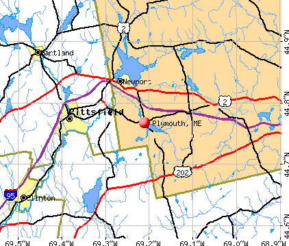
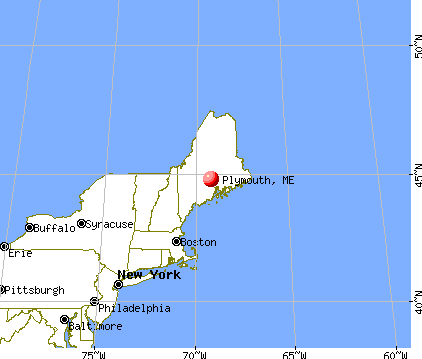
Plymouth, Maine

Submit your own pictures of this town and show them to the world
- OSM Map
- General Map
- Google Map
- MSN Map
Population change since 2000: +9.8%
 |
| Males: 691 | |
| Females: 689 |
| Median resident age: | 41.0 years |
| Maine median age: | 43.0 years |
Zip codes: 04969.
| Plymouth: | $58,448 |
| ME: | $69,543 |
Estimated per capita income in 2022: $31,226 (it was $15,533 in 2000)
Plymouth town income, earnings, and wages data
Estimated median house or condo value in 2022: $179,543 (it was $69,000 in 2000)
| Plymouth: | $179,543 |
| ME: | $290,600 |
Mean prices in 2022: all housing units: $235,563; detached houses: $252,705; townhouses or other attached units: $267,749; in 2-unit structures: $255,332; in 3-to-4-unit structures: $815,300; in 5-or-more-unit structures: $185,873; mobile homes: $93,017; occupied boats, rvs, vans, etc.: $21,333
Detailed information about poverty and poor residents in Plymouth, ME


- 1,32495.9%White alone
- 292.1%Two or more races
- 141.0%American Indian alone
- 80.6%Hispanic
- 30.2%Asian alone
- 20.1%Black alone

Races in Plymouth detailed stats: ancestries, foreign born residents, place of birth
According to our research of Maine and other state lists, there were 5 registered sex offenders living in Plymouth, Maine as of May 23, 2024.
The ratio of all residents to sex offenders in Plymouth is 276 to 1.
 Recent articles from our blog. Our writers, many of them Ph.D. graduates or candidates, create easy-to-read articles on a wide variety of topics.

 | Want Maine? Fill this out. (141 replies) |
| Here They Come (33 replies) |
| off grid living in maine (39 replies) |
| Thinking of relocating to kinda sorta rural Maine (17 replies) |
| Maine weather thread (3207 replies) |
| Backbone (16 replies) |
Latest news from Plymouth, ME collected exclusively by city-data.com from local newspapers, TV, and radio stations
Ancestries: English (17.7%), French (17.3%), United States (12.6%), Irish (12.5%), German (5.0%), Scottish (4.8%).
Current Local Time: EST time zone
Incorporated on 02/21/1826
Elevation: 280 feet
Land area: 29.9 square miles.
Population density: 46 people per square mile (very low).
15 residents are foreign born
| This town: | 1.2% |
| Maine: | 2.9% |
| Plymouth town: | 1.1% ($765) |
| Maine: | 1.5% ($1,417) |
Nearest city with pop. 50,000+: Portland, ME  (92.5 miles , pop. 64,249).
Nearest city with pop. 200,000+: Boston, MA (193.6 miles , pop. 589,141).
Nearest city with pop. 1,000,000+: Bronx, NY (359.7 miles , pop. 1,332,650).
Nearest cities:
), ), ), ), )Latitude: 44.77 N, Longitude: 69.21 W
Area code: 207


Single-family new house construction building permits:
- 2019: 5 buildings, average cost: $159,900
- 2018: 5 buildings, average cost: $159,900
- 2017: 7 buildings, average cost: $118,300
- 2016: 3 buildings, average cost: $53,300
- 2015: 2 buildings, average cost: $62,500
- 2014: 5 buildings, average cost: $88,000
- 2012: 3 buildings, average cost: $103,300
- 2011: 4 buildings, average cost: $91,300
- 2010: 2 buildings, average cost: $65,000
- 2009: 3 buildings, average cost: $133,300
- 2008: 3 buildings, average cost: $75,000
- 2007: 1 building, cost: $80,000
- 2006: 10 buildings, average cost: $85,800
- 2005: 12 buildings, average cost: $85,600
- 2004: 13 buildings, average cost: $29,300
- 2003: 10 buildings, average cost: $62,600
- 2002: 3 buildings, average cost: $56,700
- 2001: 7 buildings, average cost: $42,900
- 2000: 3 buildings, average cost: $53,300
- 1999: 1 building, cost: $50,000
- 1998: 5 buildings, average cost: $14,000
- 1997: 9 buildings, average cost: $24,300


| Here: | 4.7% |
| Maine: | 3.4% |


- Health care (9.0%)
- Educational services (8.5%)
- Construction (7.8%)
- Accommodation & food services (7.3%)
- Administrative & support & waste management services (5.5%)
- Motor vehicle & parts dealers (3.8%)
- Agriculture, forestry, fishing & hunting (3.4%)

- Construction (13.7%)
- Administrative & support & waste management services (6.5%)
- Educational services (6.2%)
- Agriculture, forestry, fishing & hunting (5.9%)
- Motor vehicle & parts dealers (5.0%)
- Wood products (4.3%)
- Public administration (4.0%)

- Health care (17.5%)
- Accommodation & food services (11.3%)
- Educational services (11.0%)
- Finance & insurance (4.8%)
- Administrative & support & waste management services (4.5%)
- Food & beverage stores (3.1%)
- Textile mills & textile products (3.1%)

- Other production occupations, including supervisors (5.7%)
- Driver/sales workers and truck drivers (4.1%)
- Other office and administrative support workers, including supervisors (4.1%)
- Material recording, scheduling, dispatching, and distributing workers (3.8%)
- Electrical equipment mechanics and other installation, maintenance, and repair workers, including supervisors (3.6%)
- Other sales and related occupations, including supervisors (3.6%)
- Secretaries and administrative assistants (2.9%)

- Electrical equipment mechanics and other installation, maintenance, and repair workers, including supervisors (6.8%)
- Driver/sales workers and truck drivers (6.2%)
- Other production occupations, including supervisors (6.2%)
- Carpenters (5.6%)
- Laborers and material movers, hand (5.3%)
- Metal workers and plastic workers (5.0%)
- Vehicle and mobile equipment mechanics, installers, and repairers (4.7%)

- Other office and administrative support workers, including supervisors (7.9%)
- Secretaries and administrative assistants (6.2%)
- Other production occupations, including supervisors (5.2%)
- Preschool, kindergarten, elementary, and middle school teachers (4.8%)
- Nursing, psychiatric, and home health aides (4.5%)
- Information and record clerks, except customer service representatives (4.5%)
- Other sales and related occupations, including supervisors (4.5%)
Average climate in Plymouth, Maine
Based on data reported by over 4,000 weather stations


(lower is better)

Air Quality Index (AQI) level in 2023 was 57.5. This is better than average.
| City: | 57.5 |
| U.S.: | 72.6 |

Particulate Matter (PM2.5) [µg/m3] level in 2023 was 5.62. This is significantly better than average. Closest monitor was 21.8 miles away from the city center.
| City: | 5.62 |
| U.S.: | 8.11 |
Earthquake activity:
Plymouth-area historical earthquake activity is significantly above Maine state average. It is 80% smaller than the overall U.S. average.On 4/20/2002 at 10:50:47, a magnitude 5.3 (5.3 ML, Depth: 3.0 mi, Class: Moderate, Intensity: VI - VII) earthquake occurred 221.4 miles away from Plymouth center
On 10/16/2012 at 23:12:25, a magnitude 4.7 (4.7 ML, Depth: 10.0 mi, Class: Light, Intensity: IV - V) earthquake occurred 108.1 miles away from Plymouth center
On 4/20/2002 at 10:50:47, a magnitude 5.2 (5.2 MB, 4.2 MS, 5.2 MW, 5.0 MW) earthquake occurred 222.6 miles away from the city center
On 10/7/1983 at 10:18:46, a magnitude 5.3 (5.1 MB, 5.3 LG, 5.1 ML) earthquake occurred 259.8 miles away from the city center
On 1/19/1982 at 00:14:42, a magnitude 4.7 (4.5 MB, 4.7 MD, 4.5 LG) earthquake occurred 147.5 miles away from the city center
On 2/26/1999 at 03:38:43, a magnitude 3.8 (3.8 LG, Depth: 2.0 mi, Class: Light, Intensity: II - III) earthquake occurred 25.0 miles away from Plymouth center
Magnitude types: regional Lg-wave magnitude (LG), body-wave magnitude (MB), duration magnitude (MD), local magnitude (ML), surface-wave magnitude (MS), moment magnitude (MW)
Natural disasters:
The number of natural disasters in Penobscot County (19) is greater than the US average (15).Major Disasters (Presidential) Declared: 11
Emergencies Declared: 7
Causes of natural disasters: Floods: 9, Storms: 8, Snows: 5, Heavy Rains: 2, Blizzard: 1, Hurricane: 1, Ice Storm: 1, Snowfall: 1, Wind: 1, Winter Storm: 1, Other: 2 (Note: some incidents may be assigned to more than one category).
Hospitals and medical centers near Plymouth:
- BIRCH GROVE REHAB AND LIVING CTR (Nursing Home, about 8 miles away; PITTSFIELD, ME)
- PITTSFIELD REHAB AND NURSING (Nursing Home, about 8 miles away; PITTSFIELD, ME)
- SEBASTICOOK VALLEY HOSPITAL Critical Access Hospitals (about 9 miles away; PITTSFIELD, ME)
- SQUARE ROAD GROUP HOME (Hospital, about 12 miles away; SAINT ALBANS, ME)
- SANFIELD REHAB AND LIVING CENTER (Nursing Home, about 15 miles away; HARTLAND, ME)
Colleges/universities with over 2000 students nearest to Plymouth:
- Husson University (about 22 miles; Bangor, ME; Full-time enrollment: 2,421)
- University of Maine (about 28 miles; Orono, ME; FT enrollment: 8,931)
- University of Maine at Augusta (about 42 miles; Augusta, ME; FT enrollment: 3,204)
- University of Maine at Farmington (about 47 miles; Farmington, ME; FT enrollment: 2,036)
- Saint Joseph's College of Maine (about 91 miles; Standish, ME; FT enrollment: 2,010)
- Southern Maine Community College (about 93 miles; South Portland, ME; FT enrollment: 4,666)
- University of Southern Maine (about 93 miles; Portland, ME; FT enrollment: 6,647)
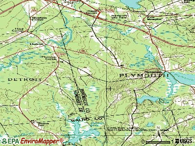
Points of interest:
Notable locations in Plymouth: Hows Corners (A), Plymouth Fire Department (B). Display/hide their locations on the map
Church in Plymouth: Emmanuel Church (A). Display/hide its location on the map
Cemeteries: Sawyer Cemetery (1), North Ridge Cemetery (2). Display/hide their locations on the map
Lakes, reservoirs, and swamps: Round Pond (A), Plymouth Pond (B), Plymouth Bog (C). Display/hide their locations on the map
Streams, rivers, and creeks: Woodman Brook (A). Display/hide its location on the map
Drinking water stations with addresses in Plymouth and their reported violations in the past:
M ROOM-BOIVIN DEVELOPMENT LLC (Population served: 180, Groundwater):Past monitoring violations:PLYMOUTH WATER DISTRICT (Population served: 90, Groundwater):
- 8 routine major monitoring violations
- 2 regular monitoring violations
Past monitoring violations:PJS CHILD CARE (Population served: 49, Groundwater):
- Follow-up Or Routine LCR Tap M/R - In OCT-01-2008, Contaminant: Lead and Copper Rule. Follow-up actions: St Compliance achieved (SEP-25-2008), St Public Notif requested (NOV-18-2008), St Formal NOV issued (NOV-18-2008), St Public Notif received (APR-03-2012)
- Monitoring and Reporting (DBP) - Between JAN-2008 and DEC-2010, Contaminant: Total Haloacetic Acids (HAA5). Follow-up actions: St Public Notif requested (NOV-19-2010), St Formal NOV issued (NOV-19-2010), St Public Notif received (APR-03-2012), St Compliance achieved (SEP-19-2012)
- Monitoring and Reporting (DBP) - Between JAN-2008 and DEC-2010, Contaminant: TTHM. Follow-up actions: St Public Notif requested (NOV-19-2010), St Formal NOV issued (NOV-19-2010), St Public Notif received (APR-03-2012), St Compliance achieved (SEP-19-2012)
- One routine major monitoring violation
Past health violations:Past monitoring violations:
- MCL, Monthly (TCR) - In JUL-2012, Contaminant: Coliform. Follow-up actions: St Public Notif requested (JUL-19-2012), St Formal NOV issued (JUL-19-2012), St Compliance achieved (OCT-15-2012), St Public Notif received (NOV-05-2012)
- MCL, Acute (TCR) - In JUN-2012, Contaminant: Coliform. Follow-up actions: St Boil Water Order (JUN-14-2012), St Public Notif received (JUN-14-2012), St Tech Assistance Visit (JUN-14-2012), St Formal NOV issued (JUN-14-2012), St Public Notif requested (JUN-14-2012), St Compliance Meeting conducted (JUN-14-2012), St Compliance achieved (OCT-15-2012)
- Initial Tap Sampling for Pb and Cu - In JUL-01-2013, Contaminant: Lead and Copper Rule. Follow-up actions: St Public Notif requested (AUG-01-2013), St Formal NOV issued (AUG-01-2013), St Public Notif received (AUG-21-2013), St Compliance achieved (DEC-11-2013)
- Monitoring and Reporting (DBP) - Between JAN-2011 and DEC-2013, Contaminant: TTHM. Follow-up actions: St Formal NOV issued (NOV-25-2013), St Public Notif requested (NOV-25-2013)
- Monitoring and Reporting (DBP) - Between JAN-2011 and DEC-2013, Contaminant: Total Haloacetic Acids (HAA5). Follow-up actions: St Formal NOV issued (NOV-25-2013), St Public Notif requested (NOV-25-2013)
- 5 routine major monitoring violations
- 3 regular monitoring violations
| This town: | 2.5 people |
| Maine: | 2.3 people |
| This town: | 68.2% |
| Whole state: | 62.9% |
| This town: | 13.0% |
| Whole state: | 9.4% |
Likely homosexual households (counted as self-reported same-sex unmarried-partner households)
- Lesbian couples: 0.6% of all households
- Gay men: 0.6% of all households
| This town: | 16.2% |
| Whole state: | 10.9% |
| This town: | 7.4% |
| Whole state: | 4.1% |
8 people in other group homes in 2000
For population 15 years and over in Plymouth:

- Never married: 22.8%
- Now married: 60.9%
- Separated: 0.7%
- Widowed: 4.7%
- Divorced: 10.9%
For population 25 years and over in Plymouth:
- High school or higher: 80.8%
- Bachelor's degree or higher: 12.0%
- Graduate or professional degree: 2.6%
- Unemployed: 6.0%
- Mean travel time to work (commute): 31.9 minutes


| Here: | 9.9 |
| Maine average: | 11.2 |


Graphs represent county-level data. Detailed 2008 Election Results
Religion statistics for Plymouth, ME (based on Penobscot County data)


| Religion | Adherents | Congregations |
|---|---|---|
| Catholic | 16,581 | 15 |
| Mainline Protestant | 9,715 | 59 |
| Evangelical Protestant | 7,523 | 80 |
| Other | 2,936 | 22 |
| Orthodox | 300 | 1 |
| None | 116,868 | - |
Food Environment Statistics:
| Here: | 2.29 / 10,000 pop. |
| State: | 2.80 / 10,000 pop. |
| This county: | 0.13 / 10,000 pop. |
| Maine: | 0.14 / 10,000 pop. |
| This county: | 2.56 / 10,000 pop. |
| State: | 2.20 / 10,000 pop. |
| This county: | 5.72 / 10,000 pop. |
| Maine: | 5.75 / 10,000 pop. |
| Here: | 7.41 / 10,000 pop. |
| Maine: | 11.02 / 10,000 pop. |
| Here: | 9.0% |
| Maine: | 8.2% |
| Penobscot County: | 28.0% |
| Maine: | 25.0% |
Strongest AM radio stations in Plymouth:
- WZON (620 AM; 5 kW; BANGOR, ME; Owner: THE ZONE CORPORATION)
- WSKW (1160 AM; 10 kW; SKOWHEGAN, ME; Owner: MOUNTAIN WIRELESS, INCORPORATED)
- WABI (910 AM; 5 kW; BANGOR, ME; Owner: CLEAR CHANNEL BROADCASTING LICENSES, INC.)
- WTME (780 AM; 10 kW; RUMFORD, ME; Owner: MOUNTAIN VALLEY BROADCASTING, INC.)
- WDEA (1370 AM; 5 kW; ELLSWORTH, ME; Owner: CUMULUS LICENSING CORP.)
- WRKO (680 AM; 50 kW; BOSTON, MA; Owner: ENTERCOM BOSTON LICENSE, LLC)
- WFAU (1280 AM; 5 kW; GARDINER, ME; Owner: CAPSTAR TX LIMITED PARTNERSHIP)
- WEEI (850 AM; 50 kW; BOSTON, MA; Owner: ENTERCOM BOSTON LICENSE, LLC)
- WBZ (1030 AM; 50 kW; BOSTON, MA; Owner: INFINITY BROADCASTING OPERATIONS, INC.)
- WCRN (830 AM; 50 kW; WORCESTER, MA; Owner: CARTER BROADCASTING CORPORATION)
- WTVL (1490 AM; 1 kW; WATERVILLE, ME; Owner: CITADEL BROADCASTING COMPANY)
- WNNZ (640 AM; 50 kW; WESTFIELD, MA; Owner: CLEAR CHANNEL BROADCASTING LICENSES, INC.)
- WMTW (870 AM; 10 kW; GORHAM, ME; Owner: RADIO PARTNERS OF MAINE, L.P.)
Strongest FM radio stations in Plymouth:
- WWBX (97.1 FM; BANGOR, ME; Owner: CLEAR CHANNEL BROADCASTING LICENSES, INC.)
- WJCX (99.5 FM; PITTSFIELD, ME; Owner: CSN INTERNATIONAL)
- WBFB (104.7 FM; BELFAST, ME; Owner: CLEAR CHANNEL BROADCASTING LICENSES, INC.)
- WQCB (106.5 FM; BREWER, ME; Owner: CUMULUS LICENSING CORP.)
- WGUY (102.1 FM; DEXTER, ME; Owner: CONCORD MEDIA GROUP, INC.)
- WKIT-FM (100.3 FM; BREWER, ME; Owner: THE ZONE CORPORATION)
- WFZX (101.7 FM; SEARSPORT, ME; Owner: CLEAR CHANNEL BROADCASTING LICENSES, INC.)
- WTOS-FM (105.1 FM; SKOWHEGAN, ME; Owner: CAPSTAR TX LIMITED PARTNERSHIP)
- WWMJ (95.7 FM; ELLSWORTH, ME; Owner: CUMULUS LICENSING CORP.)
- WCTB (93.5 FM; FAIRFIELD, ME; Owner: MOUNTAIN WIRELESS, INC.)
- WVOM (103.9 FM; HOWLAND, ME; Owner: CLEAR CHANNEL BROADCASTING LICENSES, INC.)
- WMEP (90.5 FM; CAMDEN, ME; Owner: MAINE PUBLIC BROADCASTING CORP.)
- WQSS (102.5 FM; CAMDEN, ME; Owner: CLEAR CHANNEL BROADCASTING LICENSES, INC.)
- WHCF (88.5 FM; BANGOR, ME; Owner: BANGOR BAPTIST CHURCH)
- WHQO (107.9 FM; SKOWHEGAN, ME; Owner: MOUNTAIN WIRELESS, INC.)
- WMEH (90.9 FM; BANGOR, ME; Owner: MAINE PUBLIC BROADCASTING CORPORATION)
- WEZQ (92.9 FM; BANGOR, ME; Owner: CUMULUS LICENSING CORP.)
- WWWA (95.3 FM; WINSLOW, ME; Owner: LIGHT OF LIFE MINISTRIES, INC.)
- WERU-FM (89.9 FM; BLUE HILL, ME; Owner: SALT POND COMMUNITY B/C COMPANY)
- WBZN (107.3 FM; OLD TOWN, ME; Owner: CUMULUS LICENSING CORP.)
TV broadcast stations around Plymouth:
- WABI-TV (Channel 5; BANGOR, ME; Owner: COMMUNITY BROADCASTING SERVICE)
- W36CK (Channel 36; BANGOR, ME; Owner: TRINITY BROADCASTING NETWORK)
- WCKD-LP (Channel 30; BANGOR/DEDHAM, ME; Owner: J. MCLEOD, ME FAMILY B/CING., INC.)
- Plymouth, Maine
- Fatal accident count12
- Vehicles involved in fatal accidents16
- Fatal accidents involving drunk persons:2
- Fatalities14
- Persons involved in fatal accidents24
- Pedestrians involved in fatal accidents0
- Maine average
- Fatal accident count1600
- Vehicles involved in fatal accidents2289
- Fatal accidents involving drunk persons615
- Fatalities1750
- Persons involved in fatal accidents3734
- Pedestrians involved in fatal accidents168
- National Bridge Inventory (NBI) Statistics
- 7Number of bridges
- 92ft / 27.5mTotal length
- 8,158Total average daily traffic
- 404Total average daily truck traffic
- 12,388Total future (year 2036) average daily traffic
FCC Registered Amateur Radio Licenses:
17 (See the full list of FCC Registered Amateur Radio Licenses in Plymouth)FAA Registered Aircraft:
1- Aircraft: CESSNA 182 (Category: Land, Seats: 4, Weight: Up to 12,499 Pounds, Speed: 119 mph), Engine: CONT MOTOR O-470 SERIES (230 HP) (Reciprocating)
N-Number: 6417A, N6417A, N-6417A, Serial Number: 33217, Year manufactured: 1956, Airworthiness Date: 05/02/1956, Certificate Issue Date: 11/02/1994
Registrant (Individual): Peter W Levasseur, 732 Ridge Rd, Plymouth, ME 04969
2005 - 2018 National Fire Incident Reporting System (NFIRS) incidents
- Fire incident types reported to NFIRS in Plymouth, ME
- 11465.1%Structure Fires
- 3218.3%Mobile Property/Vehicle Fires
- 1810.3%Outside Fires
- 116.3%Other
 According to the data from the years 2005 - 2018 the average number of fire incidents per year is 12. The highest number of reported fire incidents - 22 took place in 2018, and the least - 4 in 2005. The data has an increasing trend.
 When looking into fire subcategories, the most incidents belonged to: Structure Fires (65.1%), and Mobile Property/Vehicle Fires (18.3%).
- 77.2%Fuel oil, kerosene, etc.
- 16.5%Wood
- 4.8%Bottled, tank, or LP gas
- 1.4%Electricity

- 86.5%Fuel oil, kerosene, etc.
- 5.8%Bottled, tank, or LP gas
- 3.8%Electricity
- 3.8%Wood
Plymouth compared to Maine state average:
- Median house value below state average.
- Unemployed percentage below state average.
- Black race population percentage significantly below state average.
- Hispanic race population percentage significantly below state average.
- Foreign-born population percentage significantly below state average.
- Renting percentage below state average.
- Length of stay since moving in significantly above state average.
- Number of rooms per house significantly below state average.
- House age significantly below state average.
- Percentage of population with a bachelor's degree or higher below state average.