Oakfield, Maine
Submit your own pictures of this town and show them to the world
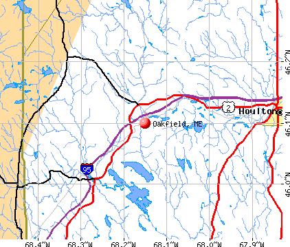
- OSM Map
- General Map
- Google Map
- MSN Map
Population change since 2000: +0.7%
 |
| Males: 367 | |
| Females: 370 |
| Median resident age: | 48.7 years |
| Maine median age: | 43.0 years |
Zip codes: 04763.
| Oakfield: | $46,087 |
| ME: | $69,543 |
Estimated per capita income in 2022: $26,728 (it was $12,951 in 2000)
Oakfield town income, earnings, and wages data
Estimated median house or condo value in 2022: $113,798 (it was $47,000 in 2000)
| Oakfield: | $113,798 |
| ME: | $290,600 |
Mean prices in 2022: all housing units: $179,108; detached houses: $185,023; townhouses or other attached units: $218,327; in 2-unit structures: $262,505; in 3-to-4-unit structures: $121,406; in 5-or-more-unit structures: $185,084; mobile homes: $117,009; occupied boats, rvs, vans, etc.: $12,682
Detailed information about poverty and poor residents in Oakfield, ME


- 70595.7%White alone
- 152.0%American Indian alone
- 101.4%Hispanic
- 60.8%Two or more races
- 10.1%Black alone

Races in Oakfield detailed stats: ancestries, foreign born residents, place of birth
According to our research of Maine and other state lists, there were 2 registered sex offenders living in Oakfield, Maine as of May 23, 2024.
The ratio of all residents to sex offenders in Oakfield is 369 to 1.
 Recent articles from our blog. Our writers, many of them Ph.D. graduates or candidates, create easy-to-read articles on a wide variety of topics.

 | Thinking of moving back to maine (20 replies) |
| Level camp (5 replies) |
| off grid living in maine (39 replies) |
| Modular houses (25 replies) |
| Finally moving to Maine (30 replies) |
| Oakfield, ME Proposed Wind Farm (2 replies) |
Latest news from Oakfield, ME collected exclusively by city-data.com from local newspapers, TV, and radio stations
Ancestries: English (54.4%), French (19.5%), Irish (14.9%), German (6.3%), Scotch-Irish (4.5%), Scottish (4.1%).
Current Local Time: EST time zone
Incorporated on 02/24/1897
Elevation: 565 feet
Land area: 35.3 square miles.
Population density: 21 people per square mile (very low).
11 residents are foreign born
| This town: | 1.5% |
| Maine: | 2.9% |
| Oakfield town: | 1.1% ($532) |
| Maine: | 1.5% ($1,417) |
Nearest city with pop. 50,000+: Portland, ME  (198.5 miles , pop. 64,249).
Nearest city with pop. 200,000+: Boston, MA (299.8 miles , pop. 589,141).
Nearest city with pop. 1,000,000+: Bronx, NY (463.7 miles , pop. 1,332,650).
Nearest cities:
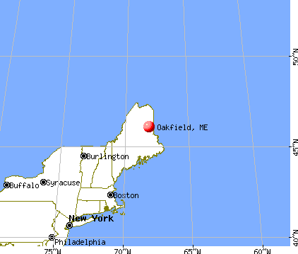
), ), ), Latitude: 46.10 N, Longitude: 68.12 W
Area code commonly used in this area: 207

| Here: | 4.7% |
| Maine: | 3.4% |


- Health care (16.2%)
- Agriculture, forestry, fishing & hunting (11.6%)
- Wood products (9.9%)
- Educational services (6.9%)
- Construction (5.9%)
- Public administration (4.6%)
- Food & beverage stores (4.6%)

- Agriculture, forestry, fishing & hunting (20.8%)
- Wood products (16.7%)
- Construction (10.7%)
- Food (6.5%)
- Religious, grantmaking, civic, professional, similar organizations (4.8%)
- Truck transportation (3.6%)
- Repair & maintenance (3.6%)

- Health care (33.3%)
- Educational services (12.6%)
- Food & beverage stores (8.9%)
- Administrative & support & waste management services (7.4%)
- Public administration (5.9%)
- Finance & insurance (5.9%)
- Department & other general merchandise stores (3.0%)

- Fishing, hunting, and forestry occupations (7.9%)
- Other office and administrative support workers, including supervisors (5.9%)
- Other production occupations, including supervisors (5.9%)
- Nursing, psychiatric, and home health aides (5.6%)
- Driver/sales workers and truck drivers (5.0%)
- Other management occupations, except farmers and farm managers (4.0%)
- Secretaries and administrative assistants (4.0%)

- Fishing, hunting, and forestry occupations (14.3%)
- Other production occupations, including supervisors (9.5%)
- Driver/sales workers and truck drivers (8.9%)
- Material recording, scheduling, dispatching, and distributing workers (4.2%)
- Carpenters (4.2%)
- Vehicle and mobile equipment mechanics, installers, and repairers (4.2%)
- Electrical equipment mechanics and other installation, maintenance, and repair workers, including supervisors (4.2%)

- Nursing, psychiatric, and home health aides (12.6%)
- Other office and administrative support workers, including supervisors (10.4%)
- Secretaries and administrative assistants (8.9%)
- Other management occupations, except farmers and farm managers (5.9%)
- Health technologists and technicians (5.9%)
- Supervisors and other personal care and service workers, except child care workers (5.2%)
- Building and grounds cleaning and maintenance occupations (4.4%)
Average climate in Oakfield, Maine
Based on data reported by over 4,000 weather stations


(lower is better)

Air Quality Index (AQI) level in 2017 was 46.0. This is significantly better than average.
| City: | 46.0 |
| U.S.: | 72.6 |

Particulate Matter (PM2.5) [µg/m3] level in 2017 was 5.39. This is significantly better than average. There were 0 monitors within city limits.
| City: | 5.39 |
| U.S.: | 8.11 |
Earthquake activity:
Oakfield-area historical earthquake activity is above Maine state average. It is 85% smaller than the overall U.S. average.On 4/20/2002 at 10:50:47, a magnitude 5.3 (5.3 ML, Depth: 3.0 mi, Class: Moderate, Intensity: VI - VII) earthquake occurred 292.4 miles away from Oakfield center
On 4/20/2002 at 10:50:47, a magnitude 5.2 (5.2 MB, 4.2 MS, 5.2 MW, 5.0 MW) earthquake occurred 294.1 miles away from Oakfield center
On 10/16/2012 at 23:12:25, a magnitude 4.7 (4.7 ML, Depth: 10.0 mi, Class: Light, Intensity: IV - V) earthquake occurred 213.0 miles away from Oakfield center
On 7/14/2006 at 09:34:48, a magnitude 3.9 (3.9 MD, Depth: 8.6 mi, Class: Light, Intensity: II - III) earthquake occurred 60.0 miles away from the city center
On 10/7/1983 at 10:18:46, a magnitude 5.3 (5.1 MB, 5.3 LG, 5.1 ML) earthquake occurred 338.2 miles away from the city center
On 1/19/1982 at 00:14:42, a magnitude 4.7 (4.5 MB, 4.7 MD, 4.5 LG) earthquake occurred 247.8 miles away from the city center
Magnitude types: regional Lg-wave magnitude (LG), body-wave magnitude (MB), duration magnitude (MD), local magnitude (ML), surface-wave magnitude (MS), moment magnitude (MW)
Natural disasters:
The number of natural disasters in Aroostook County (22) is greater than the US average (15).Major Disasters (Presidential) Declared: 13
Emergencies Declared: 9
Causes of natural disasters: Floods: 10, Storms: 8, Snows: 7, Heavy Rains: 2, Blizzard: 1, Hurricane: 1, Ice Storm: 1, Snowfall: 1, Snowstorm: 1, Wind: 1, Winter Storm: 1, Other: 2 (Note: some incidents may be assigned to more than one category).

Hospitals and medical centers near Oakfield:
- HOULTON REGIONAL HOSPITAL Critical Access Hospitals (about 14 miles away; HOULTON, ME)
- THE HOULTON REG PROG CARE FAC (Nursing Home, about 14 miles away; HOULTON, ME)
- HARMONY (Hospital, about 14 miles away; HOULTON, ME)
- FOREST SPRINGS (Hospital, about 14 miles away; HOULTON, ME)
- MADIGAN HOME HEALTH CARE, INC. (Home Health Center, about 15 miles away; HOULTON, ME)
- MADIGAN ESTATES (Nursing Home, about 15 miles away; HOULTON, ME)
Colleges/universities with over 2000 students nearest to Oakfield:
- University of Maine (about 88 miles; Orono, ME; Full-time enrollment: 8,931)
- Husson University (about 94 miles; Bangor, ME; FT enrollment: 2,421)
- University of Maine at Farmington (about 140 miles; Farmington, ME; FT enrollment: 2,036)
- University of Maine at Augusta (about 147 miles; Augusta, ME; FT enrollment: 3,204)
- Saint Joseph's College of Maine (about 196 miles; Standish, ME; FT enrollment: 2,010)
- Southern Maine Community College (about 199 miles; South Portland, ME; FT enrollment: 4,666)
- University of Southern Maine (about 199 miles; Portland, ME; FT enrollment: 6,647)
Points of interest:
Notable locations in Oakfield: Red Bridge (A), Oakfield Volunteer Fire Department (B). Display/hide their locations on the map
Church in Oakfield: Oakfield Seventh Day Adventist Church (A). Display/hide its location on the map
Cemeteries: Barrows Chambers Cemetery (1), Oakfield Cemetery (2), Timoney Cemetery (3), Oakfield Cemetery (4). Display/hide their locations on the map
Lakes: Timoney Lake (A), Carson Pond (B), Clark Pond (C), Long Lake (D), Spaulding Lake (E). Display/hide their locations on the map
Streams, rivers, and creeks: Thomas Brook (A), Higgins Brook (B), Huntley Brook (C), Downing Brook (D), Moose Brook (E), Morrison Brook (F), Colbroth Brook (G), Bear Brook (H). Display/hide their locations on the map
Drinking water stations with addresses in Oakfield and their reported violations in the past:
A PLACE TO EAT (Population served: 36, Groundwater):Past health violations:Past monitoring violations:
- MCL, Monthly (TCR) - In AUG-2012, Contaminant: Coliform. Follow-up actions: St Public Notif requested (AUG-24-2012), St Formal NOV issued (AUG-24-2012), St Public Notif received (SEP-07-2012), St AO (w/o penalty) issued (OCT-23-2012), St BCA signed (OCT-27-2012), St Compliance achieved (OCT-29-2012)
- MCL, Monthly (TCR) - In JUL-2012, Contaminant: Coliform. Follow-up actions: St Public Notif requested (AUG-03-2012), St Formal NOV issued (AUG-03-2012), St Public Notif received (AUG-28-2012), St AO (w/o penalty) issued (OCT-23-2012), St Compliance achieved (OCT-29-2012)
- 10 routine major monitoring violations
- One minor monitoring violation
- 15 regular monitoring violations
Drinking water stations with addresses in Oakfield that have no violations reported:
- KATAHDIN FOREST PRODUCTS (Population served: 49, Primary Water Source Type: Groundwater)
| This town: | 2.3 people |
| Maine: | 2.3 people |
| This town: | 66.6% |
| Whole state: | 62.9% |
| This town: | 6.5% |
| Whole state: | 9.4% |
Likely homosexual households (counted as self-reported same-sex unmarried-partner households)
- Lesbian couples: 0.3% of all households
- Gay men: 0.0% of all households
| This town: | 14.7% |
| Whole state: | 10.9% |
| This town: | 4.8% |
| Whole state: | 4.1% |
Banks with branches in Oakfield (2011 data):
- Katahdin Trust Company: Oakfield Branch at 200 Oakfield Smyrna Road, branch established on 1976/01/19. Info updated 2007/04/25: Bank assets: $527.8 mil, Deposits: $425.6 mil, headquarters in Patten, ME, positive income, Commercial Lending Specialization, 19 total offices, Holding Company: Katahdin Bankshares Corporation
For population 15 years and over in Oakfield:

- Never married: 17.6%
- Now married: 63.4%
- Separated: 0.0%
- Widowed: 12.2%
- Divorced: 6.8%
For population 25 years and over in Oakfield:
- High school or higher: 78.6%
- Bachelor's degree or higher: 8.3%
- Graduate or professional degree: 1.5%
- Unemployed: 6.8%
- Mean travel time to work (commute): 25.9 minutes


| Here: | 9.3 |
| Maine average: | 11.2 |


Graphs represent county-level data. Detailed 2008 Election Results
Religion statistics for Oakfield, ME (based on Aroostook County data)


| Religion | Adherents | Congregations |
|---|---|---|
| Catholic | 22,200 | 27 |
| Mainline Protestant | 5,845 | 40 |
| Evangelical Protestant | 4,411 | 51 |
| Other | 957 | 7 |
| Orthodox | 10 | 1 |
| None | 38,447 | - |
Food Environment Statistics:
| This county: | 4.03 / 10,000 pop. |
| Maine: | 2.80 / 10,000 pop. |
| This county: | 0.14 / 10,000 pop. |
| State: | 0.14 / 10,000 pop. |
| This county: | 2.22 / 10,000 pop. |
| Maine: | 2.20 / 10,000 pop. |
| Aroostook County: | 7.78 / 10,000 pop. |
| Maine: | 5.75 / 10,000 pop. |
| This county: | 9.17 / 10,000 pop. |
| Maine: | 11.02 / 10,000 pop. |
| Aroostook County: | 11.7% |
| Maine: | 8.2% |
| Here: | 27.6% |
| Maine: | 25.0% |
Businesses in Oakfield, ME
- Circle K: 1
Strongest AM radio stations in Oakfield:
- WREM (710 AM; daytime; 5 kW; MONTICELLO, ME; Owner: ALLAN H WEINER)
- WFST (600 AM; 5 kW; CARIBOU, ME; Owner: NORTHERN BROADCAST MINISTRIES, INC.)
- WEGP (1390 AM; 5 kW; PRESQUE ISLE, ME; Owner: DECELLES/SMITH MEDIA, INC.)
- WZON (620 AM; 5 kW; BANGOR, ME; Owner: THE ZONE CORPORATION)
- WRKO (680 AM; 50 kW; BOSTON, MA; Owner: ENTERCOM BOSTON LICENSE, LLC)
- WCHP (760 AM; 35 kW; CHAMPLAIN, NY; Owner: CHAMPLAIN RADIO, INC.)
- WEEI (850 AM; 50 kW; BOSTON, MA; Owner: ENTERCOM BOSTON LICENSE, LLC)
- WSKW (1160 AM; 10 kW; SKOWHEGAN, ME; Owner: MOUNTAIN WIRELESS, INCORPORATED)
- WABI (910 AM; 5 kW; BANGOR, ME; Owner: CLEAR CHANNEL BROADCASTING LICENSES, INC.)
- WNNZ (640 AM; 50 kW; WESTFIELD, MA; Owner: CLEAR CHANNEL BROADCASTING LICENSES, INC.)
- WCRN (830 AM; 50 kW; WORCESTER, MA; Owner: CARTER BROADCASTING CORPORATION)
- WBZ (1030 AM; 50 kW; BOSTON, MA; Owner: INFINITY BROADCASTING OPERATIONS, INC.)
- WTME (780 AM; 10 kW; RUMFORD, ME; Owner: MOUNTAIN VALLEY BROADCASTING, INC.)
Strongest FM radio stations in Oakfield:
- WHOU-FM (100.1 FM; HOULTON, ME; Owner: COUNTY COMMUNICATIONS, INC.)
- WQHR (96.1 FM; PRESQUE ISLE, ME; Owner: CITADEL BROADCASTING COMPANY)
- WOZI (101.9 FM; PRESQUE ISLE, ME; Owner: CITADEL BROADCASTING COMPANY)
- WMEM (106.1 FM; PRESQUE ISLE, ME; Owner: MAINE PUBLIC BROADCASTING CORPORATION)
- WBPW (96.9 FM; PRESQUE ISLE, ME; Owner: CITADEL BROADCASTING COMPANY)
Oakfield fatal accident list:
May 26, 1985 03:05 PM, 13902113, Vehicles: 1, Persons: 2, Fatalities: 1, Drunk persons involved: 1
- National Bridge Inventory (NBI) Statistics
- 8Number of bridges
- 125ft / 37.9mTotal length
- 15,880Total average daily traffic
- 793Total average daily truck traffic
- 23,962Total future (year 2034) average daily traffic
FCC Registered Antenna Towers:
4- Daniel E Fore, 464 Thompson Settlement Road (Lat: 46.075306 Lon: -68.072722), Type: 85.3, Structure height: 23003 m, Overall height: 85.3 m, Registrant: Atlantic Communications Inc, Joec@atlanticradio.Com, , 596 Bango-r, Phone: (207) 848-7590
- Daniel E Fore, 464 Thompson Settlement Road (Lat: 46.075306 Lon: -68.072722), Type: 85.3, Structure height: 23003 m, Overall height: 85.3 m, Registrant: Atlantic Communications Inc, Joec@atlanticradio.Com, , 596 Bango-r, Phone: (207) 848-7590
- Daniel E Fore, 464 Thompson Settlement Road (Lat: 46.075306 Lon: -68.072722), Type: 85.3, Structure height: 23003 m, Overall height: 85.3 m, Registrant: Atlantic Communications Inc, Joec@atlanticradio.Com, , 596 Bango-r, Phone: (207) 848-7590
- Daniel E Fore, 464 Thompson Settlement Road (Lat: 46.075306 Lon: -68.072722), Type: 85.3, Structure height: 23003 m, Overall height: 85.3 m, Registrant: Atlantic Communications Inc, Joec@atlanticradio.Com, , 596 Bango-r, Phone: (207) 848-7590
FCC Registered Broadcast Land Mobile Towers:
2- Town Office Bldg (Lat: 46.099778 Lon: -68.157806), Call Sign: KYW936,
Assigned Frequencies: 154.055 MHz, Grant Date: 02/26/2005, Expiration Date: 05/23/2015, Cancellation Date: 05/11/2011, Registrant: Aroostook County Emergency Management Agency, 158 Sweden Street, Caribou, ME 04736, Phone: (207) 493-4328, Fax: (207) 493-4357, Email:
- Railroad St (Lat: 46.106722 Lon: -68.146972), Structure height: 9 m, Call Sign: KCA828, Licensee ID: L00084961,
Assigned Frequencies: 160.230 MHz, 160.440 MHz, 160.680 MHz, 160.740 MHz, Grant Date: 11/19/2013, Expiration Date: 11/18/2023, Cancellation Date: 01/20/2024, Registrant: Bangor & Aroostook Railroad Company, Rr 2 Box 45, Bangor, ME 04401-9602, Phone: (207) 848-4242, Email:
FCC Registered Amateur Radio Licenses:
5- Call Sign: W1RSN, Grant Date: 11/10/1994, Expiration Date: 11/10/2004, Cancellation Date: 11/13/2006, Registrant: Robert C Fisher, Smyrna St, Oakfield, ME 04763
- Call Sign: WB1CLR, Grant Date: 04/03/1998, Expiration Date: 04/03/2008, Cancellation Date: 04/06/2010, Registrant: Ronald G Browne, Rr 1 Box 946, Oakfield, ME 04763-9713
- Call Sign: KB1JVO, Licensee ID: L00673637, Grant Date: 04/21/2003, Expiration Date: 04/21/2013, Cancellation Date: 04/22/2015, Certifier: Joy C Botting, Registrant: Joy C Botting, Oakfield, ME 04763
- Call Sign: KC1HVM, Licensee ID: L02115528, Grant Date: 07/05/2017, Expiration Date: 07/05/2027, Certifier: David E Sonderman, Registrant: David E Sonderman, 7 Pleasant St, Oakfield, ME 04763
- Call Sign: N1AIZ, Previous Call Sign: NA7L, Licensee ID: L00260135, Grant Date: 06/23/2018, Expiration Date: 06/23/2028, Certifier: Jeffrey A Miller, Registrant: Jeffrey A Miller, 400 Ridge Road, Oakfield, ME 04763

- 82.2%Fuel oil, kerosene, etc.
- 16.9%Wood
- 0.8%Other fuel

- 90.9%Fuel oil, kerosene, etc.
- 9.1%Wood
Oakfield compared to Maine state average:
- Median household income below state average.
- Median house value significantly below state average.
- Unemployed percentage below state average.
- Black race population percentage significantly below state average.
- Median age above state average.
- Foreign-born population percentage significantly below state average.
- Length of stay since moving in significantly above state average.
- Number of rooms per house significantly below state average.
- House age significantly below state average.
- Percentage of population with a bachelor's degree or higher significantly below state average.