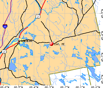
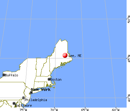
Lee, Maine


Submit your own pictures of this town and show them to the world
- OSM Map
- General Map
- Google Map
- MSN Map
Population change since 2000: +9.1%
 |
| Males: 482 | |
| Females: 440 |
| Median resident age: | 45.9 years |
| Maine median age: | 43.0 years |
Zip codes: 04455.
| Lee: | $61,571 |
| ME: | $69,543 |
Estimated per capita income in 2022: $33,887 (it was $16,857 in 2000)
Lee town income, earnings, and wages data
Estimated median house or condo value in 2022: $165,231 (it was $63,500 in 2000)
| Lee: | $165,231 |
| ME: | $290,600 |
Mean prices in 2022: all housing units: $235,563; detached houses: $252,705; townhouses or other attached units: $267,749; in 2-unit structures: $255,332; in 3-to-4-unit structures: $815,300; in 5-or-more-unit structures: $185,873; mobile homes: $93,017; occupied boats, rvs, vans, etc.: $21,333
Detailed information about poverty and poor residents in Lee, ME
Compare current foreclosures near Lee, ME:
| Photo | Address | Area | Beds / Baths | Price | Details |
|---|---|---|---|---|---|

|
#1
Tar Ridge Rd
Springfield, ME 04487
|
1,120 sq. feet
|
1 baths 2 beds |
$175,000
|
show details |

|
#2
Pea Ridge Rd
Lincoln, ME 04457
|
- sq. feet
|
- baths - beds |
show details | |

|
#3
Cooks Cor
Lincoln, ME 04457
|
- sq. feet
|
- baths - beds |
show details | |

|
#4
Dodlin Rd
West Enfield, ME 04493
|
- sq. feet
|
- baths - beds |
show details | |

|
Check over 1 million property listings on Foreclosure.com!
|
browse all offers | |||

- 82489.4%White alone
- 576.2%Asian alone
- 171.8%Black alone
- 101.1%Two or more races
- 70.8%American Indian alone
- 70.8%Hispanic

Races in Lee detailed stats: ancestries, foreign born residents, place of birth
According to our research of Maine and other state lists, there were 3 registered sex offenders living in Lee, Maine as of May 26, 2024.
The ratio of all residents to sex offenders in Lee is 307 to 1.
 Recent articles from our blog. Our writers, many of them Ph.D. graduates or candidates, create easy-to-read articles on a wide variety of topics.

 | Maine weather thread (3207 replies) |
| upstate NY vs Maine (14 replies) |
| Maine Obituaries (4 replies) |
| Looking to move to York/Wells, ME (2 replies) |
| off grid living in maine (39 replies) |
| Anyone have a good route VA to ME- by Monday (43 replies) |
Latest news from Lee, ME collected exclusively by city-data.com from local newspapers, TV, and radio stations
Ancestries: English (26.4%), United States (13.5%), Irish (13.4%), French (12.3%), Scottish (7.2%), Scotch-Irish (4.3%).
Current Local Time: EST time zone
Incorporated on 02/03/1832
Elevation: 408 feet
Land area: 38.6 square miles.
Population density: 24 people per square mile (very low).
2 residents are foreign born
| This town: | 0.2% |
| Maine: | 2.9% |
| Lee town: | 1.6% ($1,007) |
| Maine: | 1.5% ($1,417) |
Nearest city with pop. 50,000+: Portland, ME  (152.6 miles , pop. 64,249).
Nearest city with pop. 200,000+: Boston, MA (252.4 miles , pop. 589,141).
Nearest city with pop. 1,000,000+: Bronx, NY (420.5 miles , pop. 1,332,650).
Nearest cities:
), ), ), ), ), )Latitude: 45.36 N, Longitude: 68.29 W
Area code: 207


Single-family new house construction building permits:
- 2009: 1 building, cost: $82,500
- 2007: 4 buildings, average cost: $82,500
- 2006: 6 buildings, average cost: $82,500
- 2005: 5 buildings, average cost: $82,500
- 2004: 2 buildings, average cost: $82,500
- 2003: 2 buildings, average cost: $82,500
- 2002: 1 building, cost: $487,000
- 2001: 1 building, cost: $487,000
- 2000: 1 building, cost: $487,000
- 1999: 1 building, cost: $487,000
- 1998: 1 building, cost: $40,000
- 1997: 1 building, cost: $40,000


| Here: | 6.7% |
| Maine: | 3.4% |


- Educational services (16.2%)
- Paper (13.7%)
- Agriculture, forestry, fishing & hunting (9.1%)
- Construction (8.3%)
- Health care (7.1%)
- Motor vehicle & parts dealers (4.8%)
- Wood products (4.6%)

- Paper (18.2%)
- Construction (14.3%)
- Agriculture, forestry, fishing & hunting (12.8%)
- Motor vehicle & parts dealers (8.4%)
- Wood products (7.4%)
- Educational services (5.9%)
- Administrative & support & waste management services (5.4%)

- Educational services (30.4%)
- Health care (15.5%)
- Food & beverage stores (8.1%)
- Paper (7.4%)
- Agriculture, forestry, fishing & hunting (4.1%)
- Public administration (4.1%)
- Pharmacies & drug stores (3.4%)

- Electrical equipment mechanics and other installation, maintenance, and repair workers, including supervisors (7.4%)
- Other production occupations, including supervisors (7.1%)
- Preschool, kindergarten, elementary, and middle school teachers (5.7%)
- Supervisors, construction and extraction workers (5.1%)
- Retail sales workers, except cashiers (5.1%)
- Building and grounds cleaning and maintenance occupations (4.6%)
- Bus drivers (3.4%)

- Electrical equipment mechanics and other installation, maintenance, and repair workers, including supervisors (11.8%)
- Other production occupations, including supervisors (9.4%)
- Supervisors, construction and extraction workers (8.9%)
- Retail sales workers, except cashiers (6.9%)
- Fishing, hunting, and forestry occupations (5.4%)
- Driver/sales workers and truck drivers (3.9%)
- Preschool, kindergarten, elementary, and middle school teachers (3.4%)

- Preschool, kindergarten, elementary, and middle school teachers (8.8%)
- Building and grounds cleaning and maintenance occupations (6.8%)
- Bus drivers (6.1%)
- Other sales and related occupations, including supervisors (5.4%)
- Other office and administrative support workers, including supervisors (5.4%)
- Registered nurses (4.1%)
- Therapists (4.1%)
Average climate in Lee, Maine
Based on data reported by over 4,000 weather stations


Earthquake activity:
Lee-area historical earthquake activity is significantly above Maine state average. It is 83% smaller than the overall U.S. average.On 4/20/2002 at 10:50:47, a magnitude 5.3 (5.3 ML, Depth: 3.0 mi, Class: Moderate, Intensity: VI - VII) earthquake occurred 271.3 miles away from Lee center
On 10/16/2012 at 23:12:25, a magnitude 4.7 (4.7 ML, Depth: 10.0 mi, Class: Light, Intensity: IV - V) earthquake occurred 168.9 miles away from Lee center
On 4/20/2002 at 10:50:47, a magnitude 5.2 (5.2 MB, 4.2 MS, 5.2 MW, 5.0 MW) earthquake occurred 272.7 miles away from Lee center
On 10/7/1983 at 10:18:46, a magnitude 5.3 (5.1 MB, 5.3 LG, 5.1 ML) earthquake occurred 313.4 miles away from Lee center
On 1/19/1982 at 00:14:42, a magnitude 4.7 (4.5 MB, 4.7 MD, 4.5 LG) earthquake occurred 208.1 miles away from the city center
On 9/16/1994 at 04:22:42, a magnitude 3.6 (3.6 LG, Depth: 3.1 mi, Class: Light, Intensity: II - III) earthquake occurred 4.8 miles away from Lee center
Magnitude types: regional Lg-wave magnitude (LG), body-wave magnitude (MB), duration magnitude (MD), local magnitude (ML), surface-wave magnitude (MS), moment magnitude (MW)
Natural disasters:
The number of natural disasters in Penobscot County (19) is greater than the US average (15).Major Disasters (Presidential) Declared: 11
Emergencies Declared: 7
Causes of natural disasters: Floods: 9, Storms: 8, Snows: 5, Heavy Rains: 2, Blizzard: 1, Hurricane: 1, Ice Storm: 1, Snowfall: 1, Wind: 1, Winter Storm: 1, Other: 2 (Note: some incidents may be assigned to more than one category).

Colleges/universities with over 2000 students nearest to Lee:
- University of Maine (about 38 miles; Orono, ME; Full-time enrollment: 8,931)
- Husson University (about 45 miles; Bangor, ME; FT enrollment: 2,421)
- University of Maine at Augusta (about 103 miles; Augusta, ME; FT enrollment: 3,204)
- University of Maine at Farmington (about 103 miles; Farmington, ME; FT enrollment: 2,036)
- Saint Joseph's College of Maine (about 152 miles; Standish, ME; FT enrollment: 2,010)
- Southern Maine Community College (about 153 miles; South Portland, ME; FT enrollment: 4,666)
- University of Southern Maine (about 153 miles; Portland, ME; FT enrollment: 6,647)
Public elementary/middle school in Lee:
- MT JEFFERSON JR HIGH SCHOOL (Location: 61 WINN ROAD, Grades: 5-8)
Points of interest:
Notable location: Lee Volunteer Fire Department (A). Display/hide its location on the map
Churches in Lee include: Christian and Missionary Alliance Church (A), Lee Baptist Church (B). Display/hide their locations on the map
Cemeteries: Academy Cemetery (1), Woodlawn Cemetery (2). Display/hide their locations on the map
Lakes and reservoirs: Weir Pond (A), Cobb Pond (B), Egg Pond (C), House Pond (D), Merrill Pond (E), Park Pond (F), Mill Pond (G), Merrill Pond (H). Display/hide their locations on the map
Streams, rivers, and creeks: Gott Brook (A), Jackson Brook (B), Crocker Brook (C), Pool Brook (D), Beaver Brook (E), Bartlett Stream (F). Display/hide their locations on the map
Drinking water stations with addresses in Lee and their reported violations in the past:
LEE ACADEMY #3 (Population served: 300, Groundwater):Past health violations:LEE ACADEMY - COBB CTR (Population served: 270, Groundwater):Past monitoring violations:
- MCL, Monthly (TCR) - In JAN-2009, Contaminant: Coliform. Follow-up actions: St Formal NOV issued (JAN-20-2009), St Public Notif requested (JAN-20-2009), St Compliance achieved (JAN-11-2010), St Intentional no-action (SEP-15-2011)
- MCL, Monthly (TCR) - In NOV-2008, Contaminant: Coliform. Follow-up actions: St Formal NOV issued (NOV-24-2008), St Public Notif requested (NOV-24-2008), St Compliance achieved (JAN-11-2010), St Intentional no-action (SEP-15-2011)
- MCL, Monthly (TCR) - In OCT-2008, Contaminant: Coliform. Follow-up actions: St Formal NOV issued (OCT-29-2008), St Public Notif requested (OCT-29-2008), St Public Notif received (NOV-06-2008), St Compliance achieved (JAN-11-2010)
- 2 routine major monitoring violations
Past health violations:LEE ACADEMY #1 (Population served: 270, Groundwater):Past monitoring violations:
- MCL, Monthly (TCR) - In OCT-2010, Contaminant: Coliform. Follow-up actions: St Public Notif requested (NOV-01-2010), St Formal NOV issued (NOV-01-2010), St Public Notif received (NOV-08-2010), St Compliance achieved (DEC-13-2011)
- MCL, Monthly (TCR) - In AUG-2007, Contaminant: Coliform. Follow-up actions: St Public Notif requested (SEP-14-2007), St Formal NOV issued (SEP-14-2007), St Public Notif received (SEP-26-2007), St Intentional no-action (SEP-09-2011), St Compliance achieved (SEP-09-2011)
- One minor monitoring violation
Past monitoring violations:RAYMONDS VARIETY & DINER (Population served: 150, Groundwater):
- 2 regular monitoring violations
Past monitoring violations:AOS 90 LEE-WINN ELEMENTARY SCHOOL (Population served: 125, Groundwater):
- 7 routine major monitoring violations
- 2 regular monitoring violations
Past health violations:MSAD 30 MT JEFFERSON JR HI (Population served: 110, Groundwater):Past monitoring violations:
- MCL, Monthly (TCR) - In DEC-2009, Contaminant: Coliform. Follow-up actions: St Public Notif requested (DEC-28-2009), St Formal NOV issued (DEC-28-2009), St Public Notif received (JAN-05-2010), St Compliance achieved (SEP-07-2011)
- One routine major monitoring violation
Past health violations:MSAD 30 EDITH LOMBARD SCHOOL (Population served: 100, Groundwater):Past monitoring violations:
- MCL, Monthly (TCR) - In SEP-2012, Contaminant: Coliform. Follow-up actions: St Public Notif requested (OCT-01-2012), St Formal NOV issued (OCT-01-2012), St Public Notif received (OCT-11-2012), St Compliance achieved (OCT-17-2012)
- OCCT/SOWT Study/Recommendation - In FEB-15-2006, Contaminant: Lead and Copper Rule. Follow-up actions: St Violation/Reminder Notice (MAR-17-2006), St Compliance achieved (OCT-01-2006)
- Follow-up Or Routine LCR Tap M/R - In OCT-01-2008, Contaminant: Lead and Copper Rule. Follow-up actions: St Public Notif requested (NOV-18-2008), St Formal NOV issued (NOV-18-2008), St Compliance achieved (AUG-29-2011), St Intentional no-action (SEP-15-2011)
- Initial, Follow-up, or Routine Source Water M/R - In FEB-25-2006, Contaminant: Lead and Copper Rule. Follow-up actions: St Violation/Reminder Notice (MAR-17-2006), St Compliance achieved (APR-05-2006)
- Water Quality Parameter M/R - Between AUG-15-2005 and FEB-14-2006, Contaminant: Lead and Copper Rule. Follow-up actions: St Violation/Reminder Notice (MAR-17-2006), St Compliance achieved (OCT-01-2006)
- Initial Tap Sampling for Pb and Cu - In JAN-11-2005, Contaminant: Lead and Copper Rule. Follow-up actions: St Violation/Reminder Notice (FEB-23-2005), St Compliance achieved (APR-29-2005)
- One routine major monitoring violation
- 3 regular monitoring violations
Past health violations:
- MCL, Monthly (TCR) - In FEB-2011, Contaminant: Coliform. Follow-up actions: St Public Notif requested (FEB-28-2011), St Formal NOV issued (FEB-28-2011), St Compliance achieved (2 times from APR-25-2011 to JUL-18-2011), St Public Notif received (JUN-11-2013), St Site Visit (enforcement) (JUN-11-2013)
- MCL, Monthly (TCR) - In JAN-2011, Contaminant: Coliform. Follow-up actions: St Public Notif requested (JAN-31-2011), St Formal NOV issued (JAN-31-2011), St Public Notif received (FEB-16-2011), St Compliance achieved (2 times from APR-25-2011 to JUL-18-2011)
- MCL, Monthly (TCR) - In OCT-2010, Contaminant: Coliform. Follow-up actions: St Public Notif requested (NOV-01-2010), St Formal NOV issued (NOV-01-2010), St Public Notif received (NOV-09-2010), St Compliance achieved (2 times from APR-25-2011 to JUL-18-2011)
| This town: | 2.4 people |
| Maine: | 2.3 people |
| This town: | 73.6% |
| Whole state: | 62.9% |
| This town: | 8.4% |
| Whole state: | 9.4% |
Likely homosexual households (counted as self-reported same-sex unmarried-partner households)
- Lesbian couples: 0.6% of all households
- Gay men: 0.0% of all households
| This town: | 12.5% |
| Whole state: | 10.9% |
| This town: | 3.7% |
| Whole state: | 4.1% |
8 people in other noninstitutional group quarters in 2000
For population 15 years and over in Lee:

- Never married: 21.2%
- Now married: 66.7%
- Separated: 0.6%
- Widowed: 6.2%
- Divorced: 5.4%
For population 25 years and over in Lee:
- High school or higher: 85.3%
- Bachelor's degree or higher: 10.4%
- Graduate or professional degree: 1.9%
- Unemployed: 6.1%
- Mean travel time to work (commute): 27.2 minutes


| Here: | 8.2 |
| Maine average: | 11.2 |


Graphs represent county-level data. Detailed 2008 Election Results
Religion statistics for Lee, ME (based on Penobscot County data)


| Religion | Adherents | Congregations |
|---|---|---|
| Catholic | 16,581 | 15 |
| Mainline Protestant | 9,715 | 59 |
| Evangelical Protestant | 7,523 | 80 |
| Other | 2,936 | 22 |
| Orthodox | 300 | 1 |
| None | 116,868 | - |
Food Environment Statistics:
| Penobscot County: | 2.29 / 10,000 pop. |
| Maine: | 2.80 / 10,000 pop. |
| Penobscot County: | 0.13 / 10,000 pop. |
| Maine: | 0.14 / 10,000 pop. |
| Penobscot County: | 2.56 / 10,000 pop. |
| Maine: | 2.20 / 10,000 pop. |
| Penobscot County: | 5.72 / 10,000 pop. |
| Maine: | 5.75 / 10,000 pop. |
| Here: | 7.41 / 10,000 pop. |
| Maine: | 11.02 / 10,000 pop. |
| Here: | 9.0% |
| State: | 8.2% |
| This county: | 28.0% |
| Maine: | 25.0% |
Strongest AM radio stations in Lee:
- WZON (620 AM; 5 kW; BANGOR, ME; Owner: THE ZONE CORPORATION)
- WABI (910 AM; 5 kW; BANGOR, ME; Owner: CLEAR CHANNEL BROADCASTING LICENSES, INC.)
- WSKW (1160 AM; 10 kW; SKOWHEGAN, ME; Owner: MOUNTAIN WIRELESS, INCORPORATED)
- WREM (710 AM; daytime; 5 kW; MONTICELLO, ME; Owner: ALLAN H WEINER)
- WRKO (680 AM; 50 kW; BOSTON, MA; Owner: ENTERCOM BOSTON LICENSE, LLC)
- WDEA (1370 AM; 5 kW; ELLSWORTH, ME; Owner: CUMULUS LICENSING CORP.)
- WSYY (1240 AM; 1 kW; MILLINOCKET, ME; Owner: KATAHDIN BROADCASTING, INC.)
- WEEI (850 AM; 50 kW; BOSTON, MA; Owner: ENTERCOM BOSTON LICENSE, LLC)
- WTME (780 AM; 10 kW; RUMFORD, ME; Owner: MOUNTAIN VALLEY BROADCASTING, INC.)
- WBZ (1030 AM; 50 kW; BOSTON, MA; Owner: INFINITY BROADCASTING OPERATIONS, INC.)
- WNNZ (640 AM; 50 kW; WESTFIELD, MA; Owner: CLEAR CHANNEL BROADCASTING LICENSES, INC.)
- WCRN (830 AM; 50 kW; WORCESTER, MA; Owner: CARTER BROADCASTING CORPORATION)
- WCHP (760 AM; 35 kW; CHAMPLAIN, NY; Owner: CHAMPLAIN RADIO, INC.)
Strongest FM radio stations in Lee:
- WHCF (88.5 FM; BANGOR, ME; Owner: BANGOR BAPTIST CHURCH)
- WVOM (103.9 FM; HOWLAND, ME; Owner: CLEAR CHANNEL BROADCASTING LICENSES, INC.)
- WHMX (105.7 FM; LINCOLN, ME; Owner: BANGOR BAPTIST CHURCH)
- WSYY-FM (94.9 FM; MILLINOCKET, ME; Owner: KATAHDIN COMMUNICATIONS, INC.)
- WBZN (107.3 FM; OLD TOWN, ME; Owner: CUMULUS LICENSING CORP.)
TV broadcast stations around Lee:
- W34CN (Channel 34; MEDWAY, ME; Owner: TRINITY BROADCASTING NETWORK)
- Lee, Maine
- Fatal accident count9
- Vehicles involved in fatal accidents13
- Fatal accidents involving drunk persons:3
- Fatalities10
- Persons involved in fatal accidents19
- Pedestrians involved in fatal accidents0
- Maine average
- Fatal accident count1659
- Vehicles involved in fatal accidents2324
- Fatal accidents involving drunk persons637
- Fatalities1853
- Persons involved in fatal accidents4168
- Pedestrians involved in fatal accidents92
FCC Registered Cell Phone Towers:
1 (See the full list of FCC Registered Cell Phone Towers in Lee)FCC Registered Antenna Towers:
9 (See the full list of FCC Registered Antenna Towers)FCC Registered Broadcast Land Mobile Towers:
2- Lee Academy (Lat: 45.358389 Lon: -68.290861), Call Sign: KRT78, Licensee ID: L00046646,
Assigned Frequencies: 158.760 MHz, Grant Date: 03/04/2014, Expiration Date: 05/23/2024, Registrant: County Of Penobscot
- Mt. Jefferson Jr. Hi, Mt. Jefferson Jr. High School, 61 Winn Road (Lat: 45.363889 Lon: -68.283889), Type: Building, Structure height: 9 m, Call Sign: WRYK290,
Assigned Frequencies: 462.925 MHz, Grant Date: 08/22/2023, Expiration Date: 08/22/2033, Certifier: Joel Peters, Registrant: Visiplex, 1287 Barclay Boulevard, Buffalo Grove, IL 60089, Phone: (847) 229-0250, Email:
FCC Registered Microwave Towers:
3- LEE_USF, Thomas Hill Road (Lat: 45.352083 Lon: -68.279250), Type: Gtower, Structure height: 76.2 m, Overall height: 79.2 m, Call Sign: WQHZ261,
Assigned Frequencies: 5974.85 MHz, Grant Date: 12/05/2017, Expiration Date: 12/04/2027, Certifier: John E Rooney, Registrant: Wilkinson Barker Knauer, LLP, 1800 M Street Nw, Suite 800n, Washington, DC 20036, Phone: (202) 383-3420, Fax: (202) 783-5851, Email:
- Lee, Thomas Hill Road (Lat: 45.352056 Lon: -68.279250), Type: Ltower, Structure height: 77.7 m, Overall height: 78.3 m, Call Sign: WQUF807,
Assigned Frequencies: 10735.0 MHz, 10735.0 MHz, 10735.0 MHz, 10735.0 MHz, 10735.0 MHz, 10735.0 MHz, 10735.0 MHz, 10735.0 MHz, 10735.0 MHz, 11385.0 MHz... (+8 more), Grant Date: 06/25/2014, Expiration Date: 06/25/2024, Cancellation Date: 05/18/2020, Certifier: Jessica B Lyons, Registrant: At&t Services, Inc., 208 S. Akard Street, Room 2100, Dallas, TX 75202, Phone: (855) 699-7073, Email:
- Lee Tower, No Exact Address (Lat: 45.352250 Lon: -68.282028), Type: Ltower, Structure height: 36.6 m, Call Sign: WRWH681,
Assigned Frequencies: 11245.0 MHz, 11325.0 MHz, 11245.0 MHz, 11325.0 MHz, 11245.0 MHz, 11325.0 MHz, 11245.0 MHz, 11325.0 MHz, 11245.0 MHz, 11325.0 MHz, Grant Date: 02/22/2023, Expiration Date: 02/22/2033, Certifier: Thomas Kirby, Registrant: Intelpath, Hinsdale, IL 60522, Phone: (312) 841-9188, Email:
FCC Registered Amateur Radio Licenses:
10 (See the full list of FCC Registered Amateur Radio Licenses in Lee)
- 86.5%Fuel oil, kerosene, etc.
- 12.7%Wood
- 0.7%Bottled, tank, or LP gas

- 54.2%Fuel oil, kerosene, etc.
- 29.2%Wood
- 8.3%Bottled, tank, or LP gas
- 8.3%Electricity
Lee compared to Maine state average:
- Median house value below state average.
- Unemployed percentage below state average.
- Hispanic race population percentage below state average.
- Foreign-born population percentage significantly below state average.
- Renting percentage significantly below state average.
- Length of stay since moving in significantly above state average.
- Number of rooms per house significantly below state average.
- House age significantly below state average.
- Percentage of population with a bachelor's degree or higher significantly below state average.