Westbury neighborhood in Houston, Texas (TX), 77096, 77035 detailed profile
Settings
X


Business Search - 14 Million verified businesses
Area: 3.790 square miles
Population: 15,334
Population density:
| Westbury: | 4,046 people per square mile |
| Houston: | 3,977 people per square mile |

- 6,80339.7%Hispanic or Latino
- 5,32431.1%White
- 2,48814.5%Black
- 1,0786.3%Asian
- 8144.8%Two or more races
- 4292.5%Some other race
- 1821.1%American Indian
- 160.09%Native Hawaiian and Other
Pacific Islander

Median household income in 2022:
| Westbury: | $77,840 |
| Houston: | $60,426 |
Distribution of median household income
![Distribution of median household income]()
- 386Less than $10,000
- 507$10,000 to $19,999
- 828$20,000 to $29,999
- 934$30,000 to $39,999
- 561$40,000 to $49,999
- 457$50,000 to $59,999
- 702$60,000 to $74,999
- 1,201$75,000 to $99,999
- 1,300$100,000 to $124,999
- 526$125,000 to $149,999
- 556$150,000 to $199,999
- 1,030$200,000 or more

Distribution of owner-occupied house/condo value
![Distribution of owner-occupied house/condo value]()
- 2,618Less than $50,000
- 1,865$50,000 to $99,999
- 627$100,000 to $149,999
- 2,400$150,000 to $199,999
- 1,804$200,000 to $249,999
- 799$250,000 to $299,999
- 1,044$300,000 to $399,999
- 1,261$400,000 to $499,999
- 503$500,000 to $749,999
- 291$750,000 to $999,999
- 221$1,000,000 or more

Distribution of rent paid by renters
![Distribution of rent paid by renters]()
- 88Less than $100
- 148$100 to $199
- 520$200 to $299
- 537$500 to $599
- 517$600 to $699
- 1,171$700 to $799
- 603$800 to $899
- 1,072$900 to $999
- 286$1,000 to $1,249
- 1,304$1,250 to $1,499
- 1,378$1,500 to $1,999
- 1,194$2,000 or more

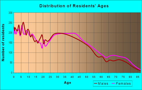
| Males: | 7,407 |
| Females: | 7,927 |
Males:
| This neighborhood: | 37.4 years |
| Whole city: | 34.4 years |
| This neighborhood: | 39.6 years |
| Whole city: | 34.7 years |
Average household size:
| Westbury: | 3.8 people |
| Houston: | 2.4 people |
Percentage of family households:
| Westbury: | 53.8% |
| Houston: | 43.0% |
| Here: | 45.0% |
| Houston: | 34.7% |
Percentage of married-couple families with children (among all households):
| Westbury: | 22.1% |
| Houston: | 23.3% |
Percentage of single-mother households (among all households):
| Westbury: | 15.6% |
| Houston: | 13.9% |
Percentage of never married males 15 years old and over:
Percentage of never married females 15 years old and over:
| Westbury: | 14.5% |
| Houston: | 22.9% |
Percentage of never married females 15 years old and over:
| Westbury: | 16.3% |
| city: | 21.2% |
Percentage of people that speak English not well or not at all:
| Westbury: | 8.6% |
| Houston: | 15.9% |
Percentage of people born in this state:
Percentage of people born in another U.S. state:
Percentage of native residents but born outside the U.S.:
Percentage of foreign born residents:
| Here: | 56.4% |
| Houston: | 51.1% |
Percentage of people born in another U.S. state:
| Westbury: | 17.6% |
| Houston: | 17.7% |
Percentage of native residents but born outside the U.S.:
| Here: | 3.0% |
| city: | 1.8% |
Percentage of foreign born residents:
| Here: | 23.9% |
| Houston: | 29.4% |

Owner-occupied
Renter-occupied


- Rooms in owner-occupied houses and condos in Westbury
- 1571 room
- 7612 rooms
- 3633 rooms
- 5244 rooms
- 8285 rooms
- 1,4956 rooms
- 1,5957 rooms
- 7578 rooms
- 5169+ rooms

- Rooms in renter-occupied apartments in Westbury
- 6051 room
- 5272 rooms
- 1,1173 rooms
- 5164 rooms
- 7315 rooms
- 9556 rooms
- 5317 rooms
- 9848 rooms
- 2289+ rooms
Owner-occupied
Renter-occupied

- Bedrooms in owner-occupied houses and condos in Westbury
- 157no bedroom
- 4861 bedroom
- 6822 bedrooms
- 3,5153 bedrooms
- 7914 bedrooms
- 1655+ bedrooms

- Bedrooms in renter-occupied apartments in Westbury
- 605no bedroom
- 1,1121 bedroom
- 1,3502 bedrooms
- 1,4543 bedrooms
- 5394 bedrooms
- 1005+ bedrooms
Average number of cars or other vehicles available in houses/condos:
Average number of cars or other vehicles available in apartments:
| This neighborhood: | |
| Houston: |
Average number of cars or other vehicles available in apartments:
| Here: | |
| city: |
Percentage of units with a mortgage:
| Westbury: | 60.5% |
| Houston: | 50.8% |

- Year house built in Westbury
- 1552020 or later
- 1842010 to 2019
- 3202000 to 2009
- 5891990 to 1999
- 1,1491980 to 1989
- 1,6651970 to 1979
- 2,5341960 to 1969
- 1,8981950 to 1959
- 4021940 to 1949
- 1921939 or earlier

City-data.com crime index for city in 2020 (higher means more crime):
| City: | 560.9 |
| U.S. average: | 219.5 |
Travel time to work (commute)
![Travel time to work (commute)]()
- 108Less than 5 minutes
- 2745 to 9 minutes
- 51710 to 14 minutes
- 1,18815 to 19 minutes
- 1,39320 to 24 minutes
- 64725 to 29 minutes
- 1,44630 to 34 minutes
- 29535 to 39 minutes
- 38040 to 44 minutes
- 71145 to 59 minutes
- 44560 to 89 minutes
- 21990 or more minutes

Means of transportation to work
![Means of transportation to work]()
- 73.7%5,239Drove a car alone
- 8.1%573Carpooled
- 6.1%433Bus
- 1.9%134Taxi
- 4.0%287Motorcycle
- 4.9%346Bicycle
- 9.5%677Walked
- 9.5%672Other means
- 21.6%1,538Worked at home

Time leaving home to go to work
![Time leaving home to go to work]()
- 27112:00 a.m. to 4:59 a.m.
- 2745:00 a.m. to 5:29 a.m.
- 2925:30 a.m. to 5:59 a.m.
- 7136:00 a.m. to 6:29 a.m.
- 8106:30 a.m. to 6:59 a.m.
- 1,0267:00 a.m. to 7:29 a.m.
- 9827:30 a.m. to 7:59 a.m.
- 1,0698:00 a.m. to 8:29 a.m.
- 6788:30 a.m. to 8:59 a.m.
- 5059:00 a.m. to 9:59 a.m.
- 29110:00 a.m. to 10:59 a.m.
- 27511:00 a.m. to 11:59 a.m.
- 24112:00 p.m. to 3:59 p.m.
- 2404:00 p.m. to 11:59 p.m.

Occupations of males:
- Percentage of males in management occupations (except farmers):
Here: 12.6% city: 10.6%
- Percentage of males in business and financial operations occupations:
Here: 5.4% city: 5.4%
- Percentage of males in computer and mathematical occupations:
Here: 4.0% city: 3.9%
- Percentage of males in architecture and engineering occupations:
Here: 2.3% city: 4.0%
- Percentage of males in life, physical, and social science occupations:
Here: 3.8% city: 1.5%
- Percentage of males in community and social services occupations:
Here: 1.0% city: 0.7%
- Percentage of males in legal occupations:
Here: 2.2% city: 1.4%
- Percentage of males in education, training, and library occupations:
Here: 5.4% city: 3.1%
- Percentage of males in arts, design, entertainment, sports, and media occupations:
Here: 1.2% city: 1.6%
- Percentage of males in healthcare practitioners and technical occupations:
Here: 3.3% city: 2.7%
- Percentage of males in service occupations:
Here: 9.5% city: 12.9%
- Percentage of males in sales and office occupations:
Here: 28.2% city: 13.5%
- Percentage of males in construction, extraction, and maintenance occupations:
Here: 6.0% city: 15.7%
- Percentage of males in production occupations:
Here: 6.8% city: 6.0%
- Percentage of males in transportation occupations:
Here: 1.5% city: 6.1%
- Percentage of males in material moving occupations:
Here: 2.5% city: 5.4%
Occupations of females:
- Percentage of females in management occupations (except farmers):
Here: 8.2% city: 8.6%
- Percentage of females in business and financial operations occupations:
Here: 9.1% city: 6.8%
- Percentage of females in computer and mathematical occupations:
Here: 1.4% city: 1.7%
- Percentage of females in life, physical, and social science occupations:
Here: 1.1% city: 1.4%
- Percentage of females in community and social services occupations:
Here: 2.4% city: 1.8%
- Percentage of females in legal occupations:
Here: 6.7% city: 2.0%
- Percentage of females in education, training, and library occupations:
Here: 14.5% city: 8.5%
- Percentage of females in healthcare practitioners and technical occupations:
Here: 4.4% city: 8.1%
- Percentage of females in service occupations:
Here: 27.3% city: 23.8%
- Percentage of females in sales and office occupations:
Here: 20.7% city: 26.6%
- Percentage of females in farming, fishing, and forestry occupations:
Here: 1.2% city: 0.0%
- Percentage of females in production occupations:
Here: 1.1% city: 2.6%
- Percentage of females in transportation occupations:
Here: 1.8% city: 1.2%
- Percentage of females in material moving occupations:
Here: 1.2% city: 2.5%
Education in this neighborhood (subdivision or community):
- Percentage of people 3 years and older in K-12 schools:
Westbury: 33.3% Houston: 16.6%
- Percentage of people 3 years and older in undergraduate colleges:
Westbury: 6.4% Houston: 4.6%
- Percentage of people 3 years and older in grad. or professional schools:
Westbury: 5.7% Houston: 1.6%
- Percentage of students K-12 enrolled in private schools:
Westbury: 37.2% Houston: 9.0%
Percentage of population below poverty level:
| Westbury: | 15.1% |
| Houston: | 20.7% |
Percentage of married-couple families with both working:
| Westbury: | 91.4% |
| Houston: | 54.9% |

- 49.6%Utility gas
- 46.6%Electricity
- 2.3%Bottled, tank, or LP gas
- 1.5%No fuel used
Highways in this neighborhood:
US Hwy 90 Alt (Main St)
Length: 5.12 miles
Directions: E-W, SW-NE
Address range: 12400 to 14299
Directions: E-W, SW-NE
Address range: 12400 to 14299
Roads and streets:
Hillcroft St (Hillcroft Ave)
Length: 3.58 miles
Directions: N-S, SE-NW, SW-NE
Address range: 10600 to 12731
Directions: N-S, SE-NW, SW-NE
Address range: 10600 to 12731
Chimney Rock Rd
Length: 2.97 miles
Directions: N-S, SE-NW, SW-NE
Address range: 10700 to 12999
Directions: N-S, SE-NW, SW-NE
Address range: 10700 to 12999
W Bellfort St
Length: 1.96 miles
Directions: E-W, SW-NE
Address range: 5200 to 6131
Directions: E-W, SW-NE
Address range: 5200 to 6131
Dryad Dr
Length: 1.57 miles
Directions: E-W, N-S, SE-NW
Address range: 5300 to 6173
Directions: E-W, N-S, SE-NW
Address range: 5300 to 6173
Ashcroft Dr
Length: 1.56 miles
Directions: E-W, N-S, SE-NW, SW-NE
Address range: 10600 to 12699
Directions: E-W, N-S, SE-NW, SW-NE
Address range: 10600 to 12699
Dunlap St
Length: 1.55 miles
Directions: E-W, N-S, SE-NW, SW-NE
Address range: 126 to 12699
Directions: E-W, N-S, SE-NW, SW-NE
Address range: 126 to 12699
W Airport Blvd
Length: 1.53 miles
Directions: E-W, SE-NW
Address range: 5400 to 6213
Directions: E-W, SE-NW
Address range: 5400 to 6213
Braewick Dr
Length: 1.53 miles
Directions: N-S, SE-NW, SW-NE
Address range: 10600 to 12399
Directions: N-S, SE-NW, SW-NE
Address range: 10600 to 12399
Stillbrooke Dr
Length: 1.38 miles
Directions: E-W, SE-NW, SW-NE
Address range: 5000 to 5799
Directions: E-W, SE-NW, SW-NE
Address range: 5000 to 5799
Spellman Rd
Length: 1.29 miles
Directions: E-W, N-S, SE-NW, SW-NE
Address range: 5200 to 6099
Directions: E-W, N-S, SE-NW, SW-NE
Address range: 5200 to 6099
Sanford Rd
Length: 1.28 miles
Directions: E-W, SE-NW
Address range: 5100 to 6099
Directions: E-W, SE-NW
Address range: 5100 to 6099
Gasmer Dr
Length: 1.26 miles
Direction: E-W
Address range: 4901 to 5599
Direction: E-W
Address range: 4901 to 5599
Atwell Dr
Length: 1.25 miles
Directions: E-W, N-S, SE-NW, SW-NE
Address range: 10641 to 12499
Directions: E-W, N-S, SE-NW, SW-NE
Address range: 10641 to 12499
Hummingbird St (Hummingbird Dr)
Length: 1.23 miles
Directions: E-W, N-S, SE-NW, SW-NE
Address range: 5400 to 6199
Directions: E-W, N-S, SE-NW, SW-NE
Address range: 5400 to 6199
Landsdowne Dr
Length: 1.22 miles
Directions: N-S, SE-NW, SW-NE
Address range: 10700 to 12699
Directions: N-S, SE-NW, SW-NE
Address range: 10700 to 12699
Briarbend Dr
Length: 1.21 miles
Directions: E-W, SE-NW
Address range: 5000 to 5699
Directions: E-W, SE-NW
Address range: 5000 to 5699
Benning Dr
Length: 1.19 miles
Directions: E-W, SE-NW
Address range: 5200 to 6069
Directions: E-W, SE-NW
Address range: 5200 to 6069
Creekbend Dr
Length: 1.19 miles
Directions: E-W, N-S, SE-NW, SW-NE
Address range: 5000 to 6199
Directions: E-W, N-S, SE-NW, SW-NE
Address range: 5000 to 6199
Burdine St
Length: 1.18 miles
Directions: E-W, N-S, SE-NW, SW-NE
Address range: 10600 to 12901
Directions: E-W, N-S, SE-NW, SW-NE
Address range: 10600 to 12901
Ludington Dr
Length: 1.15 miles
Directions: E-W, SE-NW
Address range: 5500 to 6153
Directions: E-W, SE-NW
Address range: 5500 to 6153
Mc Knight St
Length: 1.15 miles
Directions: E-W, N-S, SE-NW
Address range: 5201 to 6099
Directions: E-W, N-S, SE-NW
Address range: 5201 to 6099
Mullins Dr
Length: 1.13 miles
Directions: E-W, N-S, SW-NE
Address range: 10616 to 12499
Directions: E-W, N-S, SW-NE
Address range: 10616 to 12499
Bankside Dr
Length: 1.11 miles
Direction: E-W
Address range: 5500 to 6199
Direction: E-W
Address range: 5500 to 6199
S Willow Dr
Length: 1.06 miles
Directions: E-W, SW-NE
Address range: 4900 to 5699
Directions: E-W, SW-NE
Address range: 4900 to 5699
Warm Springs Rd
Length: 1.03 miles
Directions: E-W, SE-NW
Address range: 5200 to 6099
Directions: E-W, SE-NW
Address range: 5200 to 6099
Redstart St
Length: 0.96 miles
Directions: E-W, SE-NW, SW-NE
Address range: 5000 to 5599
Directions: E-W, SE-NW, SW-NE
Address range: 5000 to 5599
Effingham Dr
Length: 0.90 miles
Direction: E-W
Address range: 5400 to 6099
Direction: E-W
Address range: 5400 to 6099
Rampart St
Length: 0.90 miles
Directions: N-S, SE-NW
Address range: 10600 to 12699
Directions: N-S, SE-NW
Address range: 10600 to 12699
Arboles Dr
Length: 0.88 miles
Directions: E-W, SE-NW, SW-NE
Address range: 5200 to 6099
Directions: E-W, SE-NW, SW-NE
Address range: 5200 to 6099
Portal Dr
Length: 0.86 miles
Directions: E-W, N-S, SW-NE
Address range: 5600 to 6099
Directions: E-W, N-S, SW-NE
Address range: 5600 to 6099
Fontenelle Dr
Length: 0.85 miles
Directions: E-W, N-S, SE-NW, SW-NE
Address range: 5500 to 6099
Directions: E-W, N-S, SE-NW, SW-NE
Address range: 5500 to 6099
Cartagena St
Length: 0.85 miles
Directions: E-W, N-S, SE-NW, SW-NE
Address range: 5500 to 6099
Directions: E-W, N-S, SE-NW, SW-NE
Address range: 5500 to 6099
S Post Oak Rd
Length: 0.84 miles
Direction: N-S
Address range: 10901 to 11476
Direction: N-S
Address range: 10901 to 11476
Ettrick Dr
Length: 0.81 miles
Directions: E-W, N-S, SE-NW, SW-NE
Address range: 5500 to 6099
Directions: E-W, N-S, SE-NW, SW-NE
Address range: 5500 to 6099
Endicott Ln
Length: 0.81 miles
Directions: E-W, N-S, SW-NE
Address range: 10800 to 11599
Directions: E-W, N-S, SW-NE
Address range: 10800 to 11599
Kingfisher Dr (Kingfisher St)
Length: 0.80 miles
Directions: E-W, N-S, SE-NW, SW-NE
Address range: 5000 to 5499
Directions: E-W, N-S, SE-NW, SW-NE
Address range: 5000 to 5499
Belrose Dr
Length: 0.79 miles
Directions: E-W, SW-NE
Address range: 5400 to 5999
Directions: E-W, SW-NE
Address range: 5400 to 5999
Greencraig Dr
Length: 0.77 miles
Directions: E-W, SW-NE
Address range: 5600 to 5999
Directions: E-W, SW-NE
Address range: 5600 to 5999
Kinglet St
Length: 0.77 miles
Directions: E-W, N-S, SE-NW
Address range: 5000 to 5599
Directions: E-W, N-S, SE-NW
Address range: 5000 to 5599
Burlinghall Dr
Length: 0.68 miles
Direction: E-W
Address range: 5500 to 5899
Direction: E-W
Address range: 5500 to 5899
Duxbury St
Length: 0.67 miles
Direction: E-W
Address range: 5500 to 6099
Direction: E-W
Address range: 5500 to 6099
Albury Dr
Length: 0.63 miles
Direction: N-S
Address range: 6120 to 11199
Direction: N-S
Address range: 6120 to 11199
Willowbend Blvd
Length: 0.62 miles
Direction: E-W
Address range: 4932 to 6099
Direction: E-W
Address range: 4932 to 6099
Cerritos Dr
Length: 0.62 miles
Directions: E-W, N-S, SE-NW, SW-NE
Address range: 5600 to 6099
Directions: E-W, N-S, SE-NW, SW-NE
Address range: 5600 to 6099
Clematis Ln
Length: 0.55 miles
Direction: N-S
Address range: 10900 to 11399
Direction: N-S
Address range: 10900 to 11399
Farwell Dr
Length: 0.54 miles
Direction: E-W
Address range: 5700 to 5999
Direction: E-W
Address range: 5700 to 5999
Southminster Dr
Length: 0.54 miles
Direction: E-W
Address range: 5400 to 5899
Direction: E-W
Address range: 5400 to 5899
Claridge Dr
Length: 0.52 miles
Directions: E-W, SW-NE
Address range: 5700 to 6099
Directions: E-W, SW-NE
Address range: 5700 to 6099
Alvarado Dr
Length: 0.50 miles
Directions: E-W, N-S, SW-NE
Address range: 5700 to 5899
Directions: E-W, N-S, SW-NE
Address range: 5700 to 5899
Cedarhurst Dr
Length: 0.48 miles
Directions: E-W, SW-NE
Address range: 10900 to 11999
Directions: E-W, SW-NE
Address range: 10900 to 11999
Kirkside Dr
Length: 0.46 miles
Direction: N-S
Address range: 10600 to 12399
Direction: N-S
Address range: 10600 to 12399
Dawnridge Dr
Length: 0.45 miles
Direction: E-W
Address range: 5500 to 6099
Direction: E-W
Address range: 5500 to 6099
Firenza Dr
Length: 0.43 miles
Direction: E-W
Address range: 5700 to 5899
Direction: E-W
Address range: 5700 to 5899
Lattimer Dr
Length: 0.41 miles
Directions: E-W, N-S, SE-NW
Address range: 5900 to 6099
Directions: E-W, N-S, SE-NW
Address range: 5900 to 6099
Oasis Dr
Length: 0.40 miles
Directions: N-S, SW-NE
Address range: 10600 to 11099
Directions: N-S, SW-NE
Address range: 10600 to 11099
Mc Clearen Dr
Length: 0.39 miles
Direction: N-S
Address range: 10600 to 12299
Direction: N-S
Address range: 10600 to 12299
Vickijohn Dr
Length: 0.39 miles
Direction: E-W
Address range: 5900 to 6207
Direction: E-W
Address range: 5900 to 6207
Densmore Dr
Length: 0.38 miles
Direction: E-W
Address range: 5800 to 6099
Direction: E-W
Address range: 5800 to 6099
Gaymoor Dr
Length: 0.38 miles
Direction: SW-NE
Address range: 11300 to 11599
Direction: SW-NE
Address range: 11300 to 11599
Beaudry Dr
Length: 0.37 miles
Directions: SE-NW, SW-NE
Address range: 5900 to 6099
Directions: SE-NW, SW-NE
Address range: 5900 to 6099
Moonlight Dr
Length: 0.35 miles
Directions: N-S, SE-NW
Address range: 10600 to 11099
Directions: N-S, SE-NW
Address range: 10600 to 11099
Hummingbird St
Length: 0.33 miles
Directions: E-W, N-S, SE-NW, SW-NE
Address range: 5100 to 5299
Directions: E-W, N-S, SE-NW, SW-NE
Address range: 5100 to 5299
Renwick Dr
Length: 0.32 miles
Directions: E-W, N-S
Address range: 11000 to 11599
Directions: E-W, N-S
Address range: 11000 to 11599
Starkridge Dr
Length: 0.31 miles
Directions: N-S, SE-NW, SW-NE
Address range: 5201 to 11299
Directions: N-S, SE-NW, SW-NE
Address range: 5201 to 11299
S Renwick Dr
Length: 0.29 miles
Directions: E-W, N-S, SW-NE
Address range: 11900 to 12499
Directions: E-W, N-S, SW-NE
Address range: 11900 to 12499
Doud St
Length: 0.28 miles
Directions: E-W, N-S, SE-NW, SW-NE
Address range: 10800 to 11099
Directions: E-W, N-S, SE-NW, SW-NE
Address range: 10800 to 11099
Haviland St
Length: 0.27 miles
Direction: N-S
Address range: 11300 to 11799
Direction: N-S
Address range: 11300 to 11799
Fondmeadow Dr (Walteria St)
Length: 0.26 miles
Direction: E-W
Address range: 14100 to 14307
Direction: E-W
Address range: 14100 to 14307
Ricecrest St
Length: 0.26 miles
Directions: N-S, SE-NW
Address range: 11200 to 11399
Directions: N-S, SE-NW
Address range: 11200 to 11399
Checkerboard St
Length: 0.24 miles
Directions: E-W, N-S, SE-NW, SW-NE
Address range: 10700 to 11199
Directions: E-W, N-S, SE-NW, SW-NE
Address range: 10700 to 11199
Dellfern Dr
Length: 0.23 miles
Direction: E-W
Address range: 5900 to 6099
Direction: E-W
Address range: 5900 to 6099
Capello Dr
Length: 0.22 miles
Directions: E-W, N-S, SW-NE
Address range: 5700 to 5899
Directions: E-W, N-S, SW-NE
Address range: 5700 to 5899
Stone West Dr
Length: 0.20 miles
Direction: N-S
Address range: 12100 to 12299
Direction: N-S
Address range: 12100 to 12299
Stone East Dr
Length: 0.17 miles
Directions: E-W, N-S, SE-NW
Address range: 12100 to 12199
Directions: E-W, N-S, SE-NW
Address range: 12100 to 12199
S Bowlan Ln
Length: 0.17 miles
Directions: N-S, SE-NW
Address range: 11500 to 11799
Directions: N-S, SE-NW
Address range: 11500 to 11799
Carlota Ct
Length: 0.15 miles
Directions: E-W, N-S, SE-NW
Address range: 10600 to 10799
Directions: E-W, N-S, SE-NW
Address range: 10600 to 10799
Glenfield Ct
Length: 0.15 miles
Direction: N-S
Address range: 10600 to 10799
Direction: N-S
Address range: 10600 to 10799
Torchlight Dr
Length: 0.15 miles
Directions: N-S, SE-NW
Address range: 5100 to 5199
Directions: N-S, SE-NW
Address range: 5100 to 5199
Nesmith Dr
Length: 0.13 miles
Direction: N-S
Address range: 12300 to 12399
Direction: N-S
Address range: 12300 to 12399
Minetta St
Length: 0.13 miles
Direction: E-W
Address range: 14200 to 14313
Direction: E-W
Address range: 14200 to 14313
Fonda St
Length: 0.08 miles
Direction: N-S
Address range: 11100 to 11199
Direction: N-S
Address range: 11100 to 11199
Kit St
Length: 0.07 miles
Directions: E-W, N-S
Address range: 10800 to 10899
Directions: E-W, N-S
Address range: 10800 to 10899
Westbury Sq
Length: 0.07 miles
Directions: N-S, SW-NE
Address range: 500 to 699
Directions: N-S, SW-NE
Address range: 500 to 699
Rollingbrook Dr
Length: 0.06 miles
Direction: E-W
Address range: 6100 to 6199
Direction: E-W
Address range: 6100 to 6199
Manhattan Dr
Length: 0.06 miles
Direction: N-S
Address range: 10900 to 10999
Direction: N-S
Address range: 10900 to 10999
Chimney Rock
Length: 0.04 miles
Direction: SW-NE
Direction: SW-NE
Crestmore St
Length: 0.03 miles
Direction: N-S
Address range: 11000 to 11099
Direction: N-S
Address range: 11000 to 11099
Burdine
Length: 0.03 miles
Direction: SE-NW
Direction: SE-NW
Sagamore St
Length: 0.03 miles
Direction: N-S
Address range: 10800 to 10899
Direction: N-S
Address range: 10800 to 10899
Spellman Ct
Length: 0.02 miles
Direction: N-S
Direction: N-S
Ludington Dr (Ludington Blvd)
Length: 0.02 miles
Direction: N-S
Direction: N-S
Railroad features:
Southern Pacific RR
Length: 2.48 miles
Direction: E-W
Direction: E-W
Other features:
Waterhole Byu
Length: 1.46 miles
Directions: E-W, SE-NW, SW-NE
Directions: E-W, SE-NW, SW-NE
Willow Waterhole Byu
Length: 1.26 miles
Directions: E-W, N-S, SE-NW, SW-NE
Directions: E-W, N-S, SE-NW, SW-NE