Wheeling, Illinois Neighborhood Map - Income, House Prices, Occupations, Boundaries
Settings
X

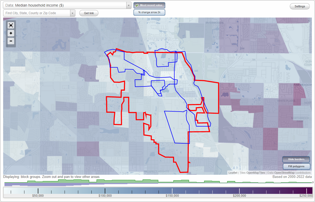
- City boundary
- Neighborhood boundaries
Business Search - 14 Million verified businesses
Neighborhoods:
Dundee Road, Lake Cook Road, McHenry Road, Milwaukee Avenue, Wheeling Town Center, Wolf RidgeDundee Road neighborhood in Wheeling statistics: (Find on map)
Area: 0.489 square miles
Population: 2,601
Population density:
Median household income in 2021:
Median rent in in 2021:
Male vs Females
Median age
Housing prices:
Average estimated value of detached houses in 2021 (68.9% of all units):
Average estimated value of townhouses or other attached units in 2021 (7.6% of all units):
Average estimated '21 value of housing units in 5-or-more-unit structures (9.8% of all units):
Most popular occupations of males: sales and office occupations (23.8%); service occupations (23.3%); production occupations (9.8%); management occupations (except farmers) (6.8%); transportation occupations (5.2%); education, training, and library occupations (4.5%); construction, extraction, and maintenance occupations (4.3%)
Most popular occupations of females: service occupations (30.8%); sales and office occupations (15.0%); material moving occupations (14.8%); healthcare practitioners and technical occupations (7.1%); production occupations (6.8%); business and financial operations occupations (6.3%); education, training, and library occupations (6.2%)
Highways in this neighborhood: W Dundee Rd (State Rte 68); N Elmhurst Rd (State Rte 83); S Elmhurst Rd (State Rte 83).
Roads and streets: Northgate Pkwy; McHenry Rd; Wheeling Rd (S Wheeling Rd); N Norman Ln; Town St; N Wayne Pl; Jenkins Ct; Valley Stream Dr; George Rd; Sandra Ln; N Dennis Rd; E Dennis Rd; W Wayne Pl; King Ct; Catherine Ct; Cedar Dr.
Railroad features: Soo Line RR.
Other features: Wheeling Draining Ditch; Buffalo Crk.
Dundee Road neighborhood detailed profile
Area: 0.489 square miles
Population: 2,601
Population density:
| Dundee Road: | 5,321 people per square mile |
| Wheeling: | 4,655 people per square mile |
Median household income in 2021:
| Dundee Road: | $76,980 |
| Wheeling: | $74,331 |
Median rent in in 2021:
| Dundee Road: | $1,146 |
| Wheeling: | $1,249 |
Male vs Females
| Males: | 1,271 |
| Females: | 1,329 |
Median age
| Males: | 39.1 years |
| Females: | 38.4 years |
Housing prices:
Average estimated value of detached houses in 2021 (68.9% of all units):
| Dundee Road: | $221,905 |
| Wheeling: | $257,315 |
Average estimated value of townhouses or other attached units in 2021 (7.6% of all units):
| This neighborhood: | $319,592 |
| village: | $207,393 |
Average estimated '21 value of housing units in 5-or-more-unit structures (9.8% of all units):
| Dundee Road: | $154,187 |
| Wheeling: | $221,817 |
Most popular occupations of males: sales and office occupations (23.8%); service occupations (23.3%); production occupations (9.8%); management occupations (except farmers) (6.8%); transportation occupations (5.2%); education, training, and library occupations (4.5%); construction, extraction, and maintenance occupations (4.3%)
Most popular occupations of females: service occupations (30.8%); sales and office occupations (15.0%); material moving occupations (14.8%); healthcare practitioners and technical occupations (7.1%); production occupations (6.8%); business and financial operations occupations (6.3%); education, training, and library occupations (6.2%)
Highways in this neighborhood: W Dundee Rd (State Rte 68); N Elmhurst Rd (State Rte 83); S Elmhurst Rd (State Rte 83).
Roads and streets: Northgate Pkwy; McHenry Rd; Wheeling Rd (S Wheeling Rd); N Norman Ln; Town St; N Wayne Pl; Jenkins Ct; Valley Stream Dr; George Rd; Sandra Ln; N Dennis Rd; E Dennis Rd; W Wayne Pl; King Ct; Catherine Ct; Cedar Dr.
Railroad features: Soo Line RR.
Other features: Wheeling Draining Ditch; Buffalo Crk.
Dundee Road neighborhood detailed profile
Lake Cook Road neighborhood in Wheeling statistics: (Find on map)
Area: 0.344 square miles
Population: 1,226
Population density:
Median household income in 2021:
Median rent in in 2021:
Male vs Females
Median age
Housing prices:
Average estimated value of detached houses in 2021 (20.1% of all units):
Average estimated value of townhouses or other attached units in 2021 (1.1% of all units):
Average estimated '21 value of housing units in 5-or-more-unit structures (23.5% of all units):
Most popular occupations of males: management occupations (except farmers) (23.2%); service occupations (19.7%); sales and office occupations (18.7%); production occupations (9.5%); construction, extraction, and maintenance occupations (8.4%); computer and mathematical occupations (5.3%); business and financial operations occupations (3.7%)
Most popular occupations of females: service occupations (25.0%); sales and office occupations (13.6%); business and financial operations occupations (9.1%); education, training, and library occupations (9.1%); management occupations (except farmers) (8.6%); healthcare practitioners and technical occupations (8.6%); production occupations (5.9%)
Roads and streets: Prairie Park Dr; Northgate Pkwy; Lake Cook Rd (Lake-Cook Rd, E Lake Cook Rd, County Line Rd); Meadow Ln; Wolf Ct; N Wolf Rd.
Other features: William Rogers Memorial Diversion Chnnl.
Other features: Buffalo Crk.
Roads and streets: Lake Cook Rd (Lake-Cook Rd, E Lake Cook Rd, County Line Rd); S Chevy Chase Dr; Northgate Pkwy.
Lake Cook Road neighborhood detailed profile
Area: 0.344 square miles
Population: 1,226
Population density:
| Lake Cook Road: | 3,568 people per square mile |
| Wheeling: | 4,655 people per square mile |
Median household income in 2021:
| Lake Cook Road: | $79,873 |
| Wheeling: | $74,331 |
Median rent in in 2021:
| Lake Cook Road: | $1,282 |
| Wheeling: | $1,249 |
Male vs Females
| Males: | 615 |
| Females: | 611 |
Median age
| Males: | 46.0 years |
| Females: | 51.8 years |
Housing prices:
Average estimated value of detached houses in 2021 (20.1% of all units):
| Lake Cook Road: | $244,848 |
| Wheeling: | $257,315 |
Average estimated value of townhouses or other attached units in 2021 (1.1% of all units):
| This neighborhood: | $319,592 |
| village: | $207,393 |
Average estimated '21 value of housing units in 5-or-more-unit structures (23.5% of all units):
| Lake Cook Road: | $152,771 |
| Wheeling: | $221,817 |
Most popular occupations of males: management occupations (except farmers) (23.2%); service occupations (19.7%); sales and office occupations (18.7%); production occupations (9.5%); construction, extraction, and maintenance occupations (8.4%); computer and mathematical occupations (5.3%); business and financial operations occupations (3.7%)
Most popular occupations of females: service occupations (25.0%); sales and office occupations (13.6%); business and financial operations occupations (9.1%); education, training, and library occupations (9.1%); management occupations (except farmers) (8.6%); healthcare practitioners and technical occupations (8.6%); production occupations (5.9%)
Roads and streets: Prairie Park Dr; Northgate Pkwy; Lake Cook Rd (Lake-Cook Rd, E Lake Cook Rd, County Line Rd); Meadow Ln; Wolf Ct; N Wolf Rd.
Other features: William Rogers Memorial Diversion Chnnl.
Other features: Buffalo Crk.
Roads and streets: Lake Cook Rd (Lake-Cook Rd, E Lake Cook Rd, County Line Rd); S Chevy Chase Dr; Northgate Pkwy.
Lake Cook Road neighborhood detailed profile
McHenry Road neighborhood in Wheeling statistics: (Find on map)
Area: 0.494 square miles
Population: 1,845
Population density:
Median household income in 2021:
Median rent in in 2021:
Male vs Females
Median age
Housing prices:
Average estimated value of detached houses in 2021 (55.4% of all units):
Average estimated value of townhouses or other attached units in 2021 (24.5% of all units):
Average estimated '21 value of housing units in 3-to-4-unit structures (3.0% of all units):
Average estimated '21 value of housing units in 5-or-more-unit structures (12.9% of all units):
Most popular occupations of males: sales and office occupations (29.2%); computer and mathematical occupations (16.7%); service occupations (12.3%); management occupations (except farmers) (11.5%); transportation occupations (8.8%); business and financial operations occupations (6.2%); production occupations (6.1%)
Most popular occupations of females: sales and office occupations (22.3%); business and financial operations occupations (18.5%); management occupations (except farmers) (11.8%); service occupations (10.3%); education, training, and library occupations (9.1%); production occupations (7.6%); healthcare practitioners and technical occupations (5.8%)
Highways in this neighborhood: Rte 83 (McHenry Rd, State Rte 83); N Elmhurst Rd (State Rte 83).
Roads and streets: Buffalo Grove Rd (S Buffalo Grove Rd); Manda Ln; Fairway View Dr; Lake Cook Rd; Aptakisic Rd; Colonial Dr; Weiland Rd; Alpine Ct; Chelsea Dr; Spruce Dr; Lexington Dr; Cedar Run Dr.
Other features: Buffalo Crk.
Highways in this neighborhood: State Hwy 83 (Mundelein Rd, McHenry Rd).
Roads and streets: W Lake Cook Rd (Lake Cook Rd); W Lake Cook Rd; Cty W17 (Weiland Rd, Co Hwy 73); E Lake Cook Rd; Steeple Dr.
McHenry Road neighborhood detailed profile
Area: 0.494 square miles
Population: 1,845
Population density:
| McHenry Road: | 3,737 people per square mile |
| Wheeling: | 4,655 people per square mile |
Median household income in 2021:
| McHenry Road: | $113,634 |
| Wheeling: | $74,331 |
Median rent in in 2021:
| McHenry Road: | $1,659 |
| Wheeling: | $1,249 |
Male vs Females
| Males: | 945 |
| Females: | 899 |
Median age
| Males: | 40.1 years |
| Females: | 46.1 years |
Housing prices:
Average estimated value of detached houses in 2021 (55.4% of all units):
| McHenry Road: | $296,163 |
| Wheeling: | $257,315 |
Average estimated value of townhouses or other attached units in 2021 (24.5% of all units):
| This neighborhood: | $1,557,588 |
| village: | $207,393 |
Average estimated '21 value of housing units in 3-to-4-unit structures (3.0% of all units):
| McHenry Road: | $225,102 |
| village: | $190,149 |
Average estimated '21 value of housing units in 5-or-more-unit structures (12.9% of all units):
| McHenry Road: | $184,097 |
| Wheeling: | $221,817 |
Most popular occupations of males: sales and office occupations (29.2%); computer and mathematical occupations (16.7%); service occupations (12.3%); management occupations (except farmers) (11.5%); transportation occupations (8.8%); business and financial operations occupations (6.2%); production occupations (6.1%)
Most popular occupations of females: sales and office occupations (22.3%); business and financial operations occupations (18.5%); management occupations (except farmers) (11.8%); service occupations (10.3%); education, training, and library occupations (9.1%); production occupations (7.6%); healthcare practitioners and technical occupations (5.8%)
Highways in this neighborhood: Rte 83 (McHenry Rd, State Rte 83); N Elmhurst Rd (State Rte 83).
Roads and streets: Buffalo Grove Rd (S Buffalo Grove Rd); Manda Ln; Fairway View Dr; Lake Cook Rd; Aptakisic Rd; Colonial Dr; Weiland Rd; Alpine Ct; Chelsea Dr; Spruce Dr; Lexington Dr; Cedar Run Dr.
Other features: Buffalo Crk.
Highways in this neighborhood: State Hwy 83 (Mundelein Rd, McHenry Rd).
Roads and streets: W Lake Cook Rd (Lake Cook Rd); W Lake Cook Rd; Cty W17 (Weiland Rd, Co Hwy 73); E Lake Cook Rd; Steeple Dr.
McHenry Road neighborhood detailed profile
Milwaukee Avenue neighborhood in Wheeling statistics: (Find on map)
Area: 1.453 square miles
Population: 4,990
Population density:
Median household income in 2021:
Median rent in in 2021:
Male vs Females
Median age
Housing prices:
Average estimated value of detached houses in 2021 (19.1% of all units):
Average estimated value of townhouses or other attached units in 2021 (16.7% of all units):
Average estimated '21 value of housing units in 5-or-more-unit structures (79.7% of all units):
Most popular occupations of males: sales and office occupations (29.7%); service occupations (18.6%); management occupations (except farmers) (12.0%); architecture and engineering occupations (7.4%); production occupations (7.1%); construction, extraction, and maintenance occupations (4.9%); computer and mathematical occupations (4.8%)
Most popular occupations of females: sales and office occupations (29.0%); service occupations (15.4%); management occupations (except farmers) (8.6%); education, training, and library occupations (7.3%); business and financial operations occupations (6.9%); material moving occupations (6.6%); computer and mathematical occupations (6.5%)
Highways in this neighborhood: State Rte 21 (US Hwy 45, S Milwaukee Ave); N Milwaukee Ave (State Rte 21, US Hwy 45); E Dundee Rd (State Rte 68).
Roads and streets: Inland Dr; S Wolf Rd; N Wolf Rd; Plum Creek Dr; Highland Ave; E Manchester Dr; E Hintz Rd; Shadow Bend Dr; Mors Ave; Center Ave; Wille Ave; Sumac Rd; Industrial Ln; E Jeffery Ave; Harmony Dr; E Strong St (E Strong Ave); Wheeling Ave (S Wheeling Ave); County Line Rd (E Lake Cook Rd, Lake-Cook Rd, Lake Cook Rd); Prestwick Ln; Mill Cir; Walnut Ave; Stone Pl; River Mill Pkwy; 1st St; Park Ave; Anita Pl; Crescent Dr; Ferne Dr; Edgewood Dr; Wolf Ct; Krause Ln; Prairie View Ln; Astor Ln; 2nd St; Sunrise Dr; 3rd St; Plant Rd; River Walk Dr; Mayer Ave; Virginia Pl; Jerome Pl; Marvin Pl; Lincoln Ln; Deborah Ln; Buckeye Dr; Maple Dr; Vita Dr; Poplar Dr; Courtesy Dr; S Wheeling Ave (Wheeling Ave, Wheeling); Lilac Ln; Rustic Dr; Honey Locust Dr; Alexia Ct; Foxboro Dr; Hickory Dr; Stavros Rd (Stavros Ln); Alder Dr; Glendale St; 6th St; Partridge Ln; Meadowbrook Ln; Kingswood Ln; Commons Ct; Donna Ct; Forestway Ln; Peggy Ct; Linden Ln; Woodmere Ln; Elm Dr; Oakwood Ln; Stafford Dr; Summerhill Ln; Regent Dr.
Other features: Des Plaines Riv.
Other features: William Rogers Memorial Diversion Chnnl; Wheeling Draining Ditch; Wheeling Drainage Ditch.
Roads and streets: County Line Rd (E Lake Cook Rd, Lake-Cook Rd, Lake Cook Rd).
Milwaukee Avenue neighborhood detailed profile
Area: 1.453 square miles
Population: 4,990
Population density:
| Milwaukee Avenue: | 3,435 people per square mile |
| Wheeling: | 4,655 people per square mile |
Median household income in 2021:
| Milwaukee Avenue: | $70,328 |
| Wheeling: | $74,331 |
Median rent in in 2021:
| Milwaukee Avenue: | $1,691 |
| Wheeling: | $1,249 |
Male vs Females
| Males: | 2,452 |
| Females: | 2,537 |
Median age
| Males: | 48.5 years |
| Females: | 44.9 years |
Housing prices:
Average estimated value of detached houses in 2021 (19.1% of all units):
| Milwaukee Avenue: | $244,848 |
| Wheeling: | $257,315 |
Average estimated value of townhouses or other attached units in 2021 (16.7% of all units):
| This neighborhood: | $319,592 |
| village: | $207,393 |
Average estimated '21 value of housing units in 5-or-more-unit structures (79.7% of all units):
| Milwaukee Avenue: | $154,187 |
| Wheeling: | $221,817 |
Most popular occupations of males: sales and office occupations (29.7%); service occupations (18.6%); management occupations (except farmers) (12.0%); architecture and engineering occupations (7.4%); production occupations (7.1%); construction, extraction, and maintenance occupations (4.9%); computer and mathematical occupations (4.8%)
Most popular occupations of females: sales and office occupations (29.0%); service occupations (15.4%); management occupations (except farmers) (8.6%); education, training, and library occupations (7.3%); business and financial operations occupations (6.9%); material moving occupations (6.6%); computer and mathematical occupations (6.5%)
Highways in this neighborhood: State Rte 21 (US Hwy 45, S Milwaukee Ave); N Milwaukee Ave (State Rte 21, US Hwy 45); E Dundee Rd (State Rte 68).
Roads and streets: Inland Dr; S Wolf Rd; N Wolf Rd; Plum Creek Dr; Highland Ave; E Manchester Dr; E Hintz Rd; Shadow Bend Dr; Mors Ave; Center Ave; Wille Ave; Sumac Rd; Industrial Ln; E Jeffery Ave; Harmony Dr; E Strong St (E Strong Ave); Wheeling Ave (S Wheeling Ave); County Line Rd (E Lake Cook Rd, Lake-Cook Rd, Lake Cook Rd); Prestwick Ln; Mill Cir; Walnut Ave; Stone Pl; River Mill Pkwy; 1st St; Park Ave; Anita Pl; Crescent Dr; Ferne Dr; Edgewood Dr; Wolf Ct; Krause Ln; Prairie View Ln; Astor Ln; 2nd St; Sunrise Dr; 3rd St; Plant Rd; River Walk Dr; Mayer Ave; Virginia Pl; Jerome Pl; Marvin Pl; Lincoln Ln; Deborah Ln; Buckeye Dr; Maple Dr; Vita Dr; Poplar Dr; Courtesy Dr; S Wheeling Ave (Wheeling Ave, Wheeling); Lilac Ln; Rustic Dr; Honey Locust Dr; Alexia Ct; Foxboro Dr; Hickory Dr; Stavros Rd (Stavros Ln); Alder Dr; Glendale St; 6th St; Partridge Ln; Meadowbrook Ln; Kingswood Ln; Commons Ct; Donna Ct; Forestway Ln; Peggy Ct; Linden Ln; Woodmere Ln; Elm Dr; Oakwood Ln; Stafford Dr; Summerhill Ln; Regent Dr.
Other features: Des Plaines Riv.
Other features: William Rogers Memorial Diversion Chnnl; Wheeling Draining Ditch; Wheeling Drainage Ditch.
Roads and streets: County Line Rd (E Lake Cook Rd, Lake-Cook Rd, Lake Cook Rd).
Milwaukee Avenue neighborhood detailed profile
Wheeling Town Center neighborhood in Wheeling statistics: (Find on map)
Area: 0.157 square miles
Population: 560
Population density:
Median household income in 2021:
Median rent in in 2021:
Male vs Females
Median age
Average estimated value of detached houses in 2021 (89.4% of all units):
Most popular occupations of males: sales and office occupations (31.7%); transportation occupations (17.4%); service occupations (9.6%); production occupations (8.1%); construction, extraction, and maintenance occupations (6.0%); business and financial operations occupations (5.2%); computer and mathematical occupations (3.7%)
Most popular occupations of females: sales and office occupations (25.6%); service occupations (25.1%); healthcare practitioners and technical occupations (13.1%); production occupations (10.7%); education, training, and library occupations (7.5%); business and financial operations occupations (6.1%); material moving occupations (4.7%)
Highways in this neighborhood: State Rte 68 (W Dundee Rd).
Roads and streets: Northgate Pkwy; Wheeling Rd (S Wheeling Rd); Town St; Catherine Ct.
Railroad features: Soo Line RR.
Wheeling Town Center neighborhood detailed profile
Area: 0.157 square miles
Population: 560
Population density:
| Wheeling Town Center (Town Center): | 3,563 people per square mile |
| Wheeling: | 4,655 people per square mile |
Median household income in 2021:
| Wheeling Town Center (Town Center): | $78,025 |
| Wheeling: | $74,331 |
Median rent in in 2021:
| Wheeling Town Center (Town Center): | $1,114 |
| Wheeling: | $1,249 |
Male vs Females
| Males: | 299 |
| Females: | 261 |
Median age
| Males: | 39.9 years |
| Females: | 39.4 years |
Average estimated value of detached houses in 2021 (89.4% of all units):
| Wheeling Town Center (Town Center): | $278,159 |
| Wheeling: | $257,315 |
Most popular occupations of males: sales and office occupations (31.7%); transportation occupations (17.4%); service occupations (9.6%); production occupations (8.1%); construction, extraction, and maintenance occupations (6.0%); business and financial operations occupations (5.2%); computer and mathematical occupations (3.7%)
Most popular occupations of females: sales and office occupations (25.6%); service occupations (25.1%); healthcare practitioners and technical occupations (13.1%); production occupations (10.7%); education, training, and library occupations (7.5%); business and financial operations occupations (6.1%); material moving occupations (4.7%)
Highways in this neighborhood: State Rte 68 (W Dundee Rd).
Roads and streets: Northgate Pkwy; Wheeling Rd (S Wheeling Rd); Town St; Catherine Ct.
Railroad features: Soo Line RR.
Wheeling Town Center neighborhood detailed profile
Wolf Ridge neighborhood in Wheeling statistics: (Find on map)
Area: 0.674 square miles
Population: 1,180
Population density:
Median household income in 2021:
Median rent in in 2021:
Male vs Females
Median age
Housing prices:
Average estimated value of detached houses in 2021 (83.1% of all units):
Average estimated value of townhouses or other attached units in 2021 (16.4% of all units):
Average estimated '21 value of housing units in 3-to-4-unit structures (10.2% of all units):
Average estimated '21 value of housing units in 5-or-more-unit structures (13.9% of all units):
Most popular occupations of males: management occupations (except farmers) (41.3%); sales and office occupations (17.9%); production occupations (10.0%); legal occupations (5.7%); education, training, and library occupations (5.6%); transportation occupations (4.1%); computer and mathematical occupations (3.7%)
Most popular occupations of females: business and financial operations occupations (26.9%); sales and office occupations (19.3%); healthcare practitioners and technical occupations (17.4%); management occupations (except farmers) (10.3%); education, training, and library occupations (8.9%); architecture and engineering occupations (6.8%); computer and mathematical occupations (6.2%)
Roads and streets: S Wolf Rd; E Palatine Rd; Chaddick Dr; W Hintz Rd; Capitol Dr; E Messner Dr (W Messner Dr); W Marquardt Dr (E Marquardt Dr); Larkin Dr; E Hintz Rd; Carol Ave; Debra Ln; Peterson Dr; Dean Ave; Fox Ln; Lynn Ln; East Dr; South Dr; Kerry Ln.
Railroad features: Soo Line RR.
Wolf Ridge neighborhood detailed profile
Area: 0.674 square miles
Population: 1,180
Population density:
| Wolf Ridge: | 1,751 people per square mile |
| Wheeling: | 4,655 people per square mile |
Median household income in 2021:
| Wolf Ridge: | $96,700 |
| Wheeling: | $74,331 |
Median rent in in 2021:
| Wolf Ridge: | $1,412 |
| Wheeling: | $1,249 |
Male vs Females
| Males: | 686 |
| Females: | 494 |
Median age
| Males: | 42.6 years |
| Females: | 49.4 years |
Housing prices:
Average estimated value of detached houses in 2021 (83.1% of all units):
| Wolf Ridge: | $278,159 |
| Wheeling: | $257,315 |
Average estimated value of townhouses or other attached units in 2021 (16.4% of all units):
| This neighborhood: | $291,249 |
| village: | $207,393 |
Average estimated '21 value of housing units in 3-to-4-unit structures (10.2% of all units):
| Wolf Ridge: | $264,711 |
| village: | $190,149 |
Average estimated '21 value of housing units in 5-or-more-unit structures (13.9% of all units):
| Wolf Ridge: | $227,235 |
| Wheeling: | $221,817 |
Most popular occupations of males: management occupations (except farmers) (41.3%); sales and office occupations (17.9%); production occupations (10.0%); legal occupations (5.7%); education, training, and library occupations (5.6%); transportation occupations (4.1%); computer and mathematical occupations (3.7%)
Most popular occupations of females: business and financial operations occupations (26.9%); sales and office occupations (19.3%); healthcare practitioners and technical occupations (17.4%); management occupations (except farmers) (10.3%); education, training, and library occupations (8.9%); architecture and engineering occupations (6.8%); computer and mathematical occupations (6.2%)
Roads and streets: S Wolf Rd; E Palatine Rd; Chaddick Dr; W Hintz Rd; Capitol Dr; E Messner Dr (W Messner Dr); W Marquardt Dr (E Marquardt Dr); Larkin Dr; E Hintz Rd; Carol Ave; Debra Ln; Peterson Dr; Dean Ave; Fox Ln; Lynn Ln; East Dr; South Dr; Kerry Ln.
Railroad features: Soo Line RR.
Wolf Ridge neighborhood detailed profile