Upland, California Neighborhood Map - Income, House Prices, Occupations, Boundaries
Settings
X

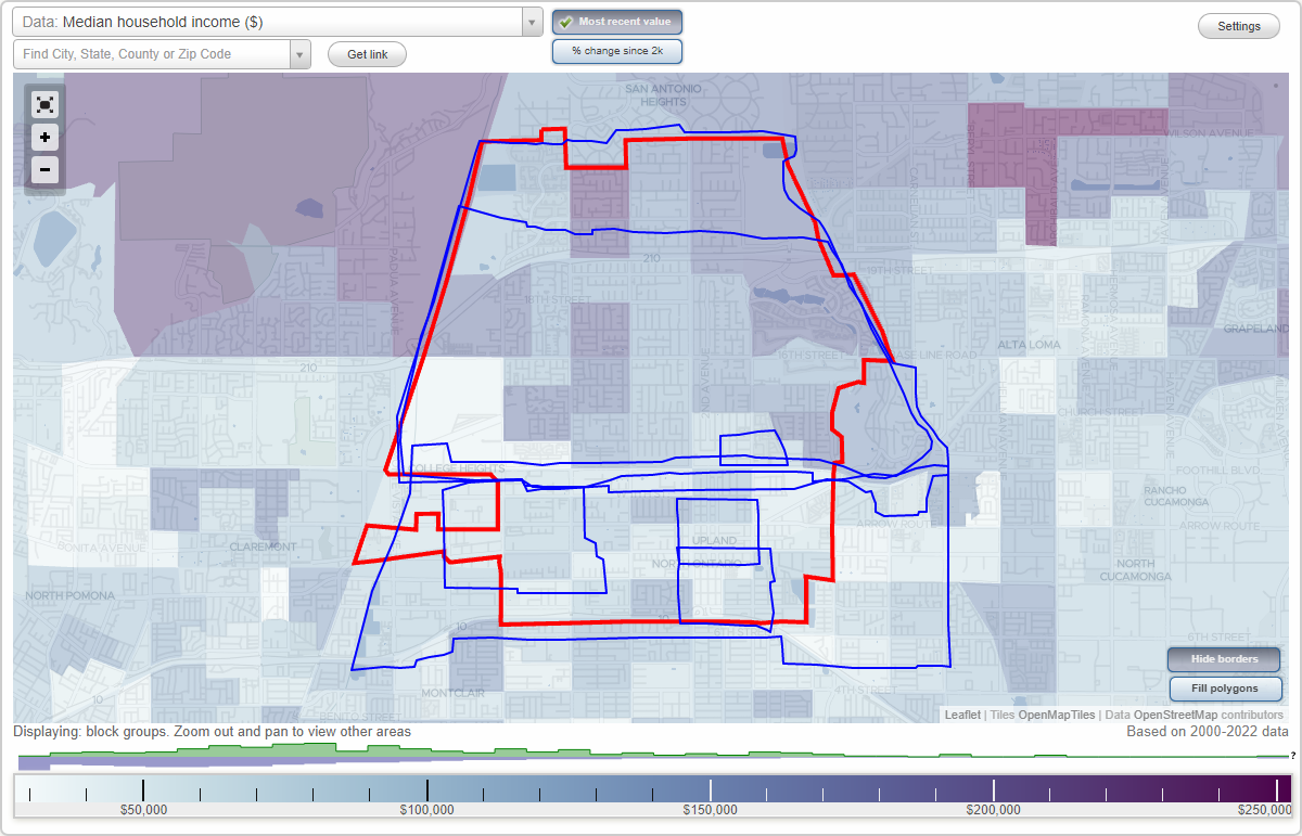
- City boundary
- Neighborhood boundaries
Business Search - 14 Million verified businesses
Neighborhoods:
Dowtown, Los Olivos, North Ontario, North Upland, North of Foothill, South of Foothill, Upland PalmsDowtown neighborhood in Upland statistics: (Find on map)
Area: 0.428 square miles
Highways in this neighborhood: N Euclid Ave (State Hwy 83).
Roads and streets: E A St; E 9th St; E Arrow Hwy; N Campus Ave; N 6th Ave; N 3rd Ave; N 1st Ave; N 2nd Ave; E G St; E F St; N 5th Ave; N Laurel Ave; E C St; E D St; E Washington Blvd; W Vernon Dr; W Arrow Hwy; W G St; W 9th St; N 4th Ave; W A St; Laurel Ave; G St; 2nd Ave.
Railroad features: Burlington Northern Santa Fe Rlwy.
Dowtown neighborhood detailed profile
Los Olivos neighborhood in Upland statistics: (Find on map)
Area: 0.163 square miles
Population: 1,392
Population density:
Median household income in 2021:
Median rent in in 2021:
Male vs Females
Median age
Housing prices:
Average estimated value of detached houses in 2021 (44.5% of all units):
Average estimated value of townhouses or other attached units in 2021 (17.1% of all units):
Average estimated value of mobile home in 2021 (48.3% of all units):
Most popular occupations of males: sales and office occupations (27.8%); service occupations (22.1%); management occupations (except farmers) (15.4%); material moving occupations (14.3%); business and financial operations occupations (5.6%); transportation occupations (4.9%); production occupations (3.6%)
Most popular occupations of females: service occupations (33.3%); sales and office occupations (31.4%); education, training, and library occupations (7.9%); business and financial operations occupations (7.8%); material moving occupations (4.4%); management occupations (except farmers) (4.1%); healthcare practitioners and technical occupations (3.7%)
Roads and streets: E 13th St; West St; N Campus Ave; Cedar; N 5th Ave; E Pine St; Aspen; San Ysidro Dr; N 3rd Ave; Myrtle Dr; Oakwood; Meadowbrook; Guadalupe Dr; Winston Ct; Larkspur; Spruce; Wildrose Ln; Pinecrest; Valadez St; Yellow Rose Way; Red Rose Pl; Poplar; Holly.
Los Olivos neighborhood detailed profile
Area: 0.163 square miles
Population: 1,392
Population density:
| Los Olivos: | 8,525 people per square mile |
| Upland: | 5,243 people per square mile |
Median household income in 2021:
| Los Olivos: | $90,324 |
| Upland: | $88,346 |
Median rent in in 2021:
| Los Olivos: | $1,254 |
| Upland: | $1,610 |
Male vs Females
| Males: | 752 |
| Females: | 639 |
Median age
| Males: | 34.5 years |
| Females: | 36.5 years |
Housing prices:
Average estimated value of detached houses in 2021 (44.5% of all units):
| Los Olivos: | $442,398 |
| Upland: | $668,985 |
Average estimated value of townhouses or other attached units in 2021 (17.1% of all units):
| This neighborhood: | $304,779 |
| city: | $378,765 |
Average estimated value of mobile home in 2021 (48.3% of all units):
| Los Olivos: | $97,545 |
| Upland: | $120,849 |
Most popular occupations of males: sales and office occupations (27.8%); service occupations (22.1%); management occupations (except farmers) (15.4%); material moving occupations (14.3%); business and financial operations occupations (5.6%); transportation occupations (4.9%); production occupations (3.6%)
Most popular occupations of females: service occupations (33.3%); sales and office occupations (31.4%); education, training, and library occupations (7.9%); business and financial operations occupations (7.8%); material moving occupations (4.4%); management occupations (except farmers) (4.1%); healthcare practitioners and technical occupations (3.7%)
Roads and streets: E 13th St; West St; N Campus Ave; Cedar; N 5th Ave; E Pine St; Aspen; San Ysidro Dr; N 3rd Ave; Myrtle Dr; Oakwood; Meadowbrook; Guadalupe Dr; Winston Ct; Larkspur; Spruce; Wildrose Ln; Pinecrest; Valadez St; Yellow Rose Way; Red Rose Pl; Poplar; Holly.
Los Olivos neighborhood detailed profile
North Ontario neighborhood in Upland statistics: (Find on map)
Area: 0.589 square miles
Population: 4,189
Population density:
Median household income in 2021:
Median rent in in 2021:
Male vs Females
Median age
Average estimated value of detached houses in 2021 (99.2% of all units):
Most popular occupations of males: service occupations (15.6%); transportation occupations (10.7%); construction, extraction, and maintenance occupations (8.8%); production occupations (8.8%); sales and office occupations (5.5%); life, physical, and social science occupations (3.8%); management occupations (except farmers) (3.4%)
Most popular occupations of females: sales and office occupations (33.7%); service occupations (13.7%); education, training, and library occupations (11.7%); healthcare practitioners and technical occupations (11.5%); business and financial operations occupations (10.8%); production occupations (7.6%); community and social services occupations (7.5%)
Limited-access highways (interstate or state) in this neighborhood: San Bernardino Fwy (I- 10).
Highways in this neighborhood: S Euclid Ave (State Hwy 83); N Euclid Ave (State Hwy 83).
Roads and streets: E 8th St; E 7th St; E Olive St; E 9th St; E A St; I 10 Fwy E; S Campus Ave; S Sultana Ave; Highland Ct; S 2nd Ave; S 1st Ave; S 3rd Ave; E Stowell St; Raymond St; Richland St; S Berlyn Ave; S Laurel Ave; E Alvarado St; N Campus Ave; S Monterey Ave; E Richland St; N 5th Ave; N 9th Ave; N 8th Ave; W 9th St; W 8th St; Euclid Pl; W 7th St; N 2nd Ave; N 3rd Ave; N 4th Ave; N 1st Ave; N 6th Ave; W A St; Heritage Way; Laurel Ave; 2nd Ave; Gilmore Dr.
Railroad features: Burlington Northern Santa Fe Rlwy.
North Ontario neighborhood detailed profile
Area: 0.589 square miles
Population: 4,189
Population density:
| North Ontario: | 7,107 people per square mile |
| Upland: | 5,243 people per square mile |
Median household income in 2021:
| North Ontario: | $73,391 |
| Upland: | $88,346 |
Median rent in in 2021:
| North Ontario: | $1,482 |
| Upland: | $1,610 |
Male vs Females
| Males: | 2,137 |
| Females: | 2,052 |
Median age
| Males: | 40.7 years |
| Females: | 37.5 years |
Average estimated value of detached houses in 2021 (99.2% of all units):
| North Ontario: | $497,893 |
| Upland: | $668,985 |
Most popular occupations of males: service occupations (15.6%); transportation occupations (10.7%); construction, extraction, and maintenance occupations (8.8%); production occupations (8.8%); sales and office occupations (5.5%); life, physical, and social science occupations (3.8%); management occupations (except farmers) (3.4%)
Most popular occupations of females: sales and office occupations (33.7%); service occupations (13.7%); education, training, and library occupations (11.7%); healthcare practitioners and technical occupations (11.5%); business and financial operations occupations (10.8%); production occupations (7.6%); community and social services occupations (7.5%)
Limited-access highways (interstate or state) in this neighborhood: San Bernardino Fwy (I- 10).
Highways in this neighborhood: S Euclid Ave (State Hwy 83); N Euclid Ave (State Hwy 83).
Roads and streets: E 8th St; E 7th St; E Olive St; E 9th St; E A St; I 10 Fwy E; S Campus Ave; S Sultana Ave; Highland Ct; S 2nd Ave; S 1st Ave; S 3rd Ave; E Stowell St; Raymond St; Richland St; S Berlyn Ave; S Laurel Ave; E Alvarado St; N Campus Ave; S Monterey Ave; E Richland St; N 5th Ave; N 9th Ave; N 8th Ave; W 9th St; W 8th St; Euclid Pl; W 7th St; N 2nd Ave; N 3rd Ave; N 4th Ave; N 1st Ave; N 6th Ave; W A St; Heritage Way; Laurel Ave; 2nd Ave; Gilmore Dr.
Railroad features: Burlington Northern Santa Fe Rlwy.
North Ontario neighborhood detailed profile
North Upland neighborhood in Upland statistics: (Find on map)
Area: 9.428 square miles
Population: 39,764
Population density:
Median household income in 2021:
Median rent in in 2021:
Male vs Females
Median age
Housing prices:
Average estimated value of detached houses in 2021 (70.1% of all units):
Average estimated value of townhouses or other attached units in 2021 (19.9% of all units):
Average estimated value of mobile home in 2021 (20.4% of all units):
Most popular occupations of males: service occupations (19.5%); sales and office occupations (19.2%); management occupations (except farmers) (15.1%); material moving occupations (10.2%); business and financial operations occupations (5.6%); construction, extraction, and maintenance occupations (5.6%); transportation occupations (5.5%)
Most popular occupations of females: sales and office occupations (29.4%); service occupations (26.0%); education, training, and library occupations (11.5%); management occupations (except farmers) (7.3%); business and financial operations occupations (5.4%); arts, design, entertainment, sports, and media occupations (4.7%); healthcare practitioners and technical occupations (4.7%)
Roads and streets: State 210 Fwy E; State 210 Foothill Fwy W; E Baseline Rd.
Other features: San Antonio Creek Chnnl.
Highways in this neighborhood: State Hwy 66 (W Foothill Blvd); W 16th St (State Hwy 30); State Hwy 30 (W 19th St); State Hwy 83 (N Euclid Ave); E Foothill Blvd (State Hwy 66); State Hwy 30 (E 19th St); State Hwy 66 (Foothill Blvd).
Roads and streets: State 210 Fwy E; State 210 Foothill Fwy W; W 18th St; N Benson Ave; W 13th St; N San Antonio Ave; W 15th St; W 17th St; N Mountain Ave; N Campus Ave; E 16th St; W 20th St; W 14th St; N 1st Ave; E 13th St; N 2nd Ave; E 14th St; Colonies Pkwy; E 15th St; E 20th St; N Laurel Ave; N 3rd Ave; W Aster St; Red Hill Country Club Dr; N Vallejo Way; N Albright Ave; N Ukiah Way; Upland Hills Dr S; N Wilson Ave; W Buffington St; Valle Vista Ct; Alta Cuesta Dr; N Tulare Way; N Kelly Ave; N Grove Ave; Erin Ave; Mulberry Ave; W Coronado St; N Alta Ave; N Redding Way; Upland Hills Dr N; Palomino Ave; N Palm Ave; Clark St; Central Ave; Winston Ct; N 13th Ave; Evergreen Dr; E 17th St; Campus Ave; Buena Vista Dr; W Kenwood St; Pebble Beach Dr; Oakwood; N Monte Verde Ave; 1300 W (N North Hills Dr, N Hills Dr); Cll Casino; Tanglewood Ave; N Maywood Ave; Brookdale Dr; E 18th St; W Springfield St; N 5th Ave; W Shannon St; Cam Predera; Omalley Way (N Omalley Way); Golf Club Dr (Tanglewood Dr); Shelley Ave; Cole Ln; Cathedral Dr; Partridge Ave; N Coolcrest Ave; (W Airport Dr); Omalley Ave; Old Baldy Way; Shamrock Ave; W Pine St; Viewpoint St; N Redwood Way; N Quince Ave; Pinnacle Way; W Lemonwood Dr; Augusta Dr; Wedgewood Ave; Tyler Ln; N Mulberry Ave; N Wedgewood Ave; West St; W Harford Pl; W Fremont St; Birkdale Ave; Francis Ave; Cam Sur; W Grant St; Loma Sola Ave; W Notre Dame St; Winged Foot Dr; Red Hill North Dr; Scenic View St; Coolcrest Ave; Carmel Cir W; Carmel Cir E; Airport Dr; W Carson St; Brentwood Ave; Spruce; Golden Rain St; Orangewood Ave; Sunnybrook Ave; el Mirador; Saint Andrews Dr; Resort St; Via Serana; Via Maria; Cll del Prado; Fairwood Way; Rockdale St; Mountain Gate Rd; N 6th Ave; Edgefield Ave; W Clark St; Muirfield Ave; E Jane Ct; Sierra Vista St; Winston Ave; N Columbine Way; Victoria Ave; Cam Norte; Fernbrook Ave; Miramar St; Leggio Ln; Buffington St; Cll Quebrada; E Lemonwood Dr; E Anita St; W Sullivan St; Westridge Ct; Mesa View St; Winslow St; Lakewood Ave; W Alps Dr; E Cumberland St; E Eddington St; W Andes Dr; Calle Carabe St; Meadowbrook; N Glenwood Ave; N Lakewood Ave; Running Creek Ln; Darlington Ave; Laurelwood Dr; Wedgwood Way; Darnell St; N Crawford Ave; Elmhurst Way; Cloverdale Ave; Rosewood St; W Langston St; N Pinebrook Ave; W Cumberland St; Armando St; Falcon View St; Lemon Grove Dr; Mariposa St; Pineridge Dr; Corporate Center Dr; Maywood Ave; Wilson Ave; Glenwood Way; Quince Way; Cll del Sol; Via Ladera; Sawgrass Dr; Cedar; Stanford Ave; Merrimac St; N Winston Way; W Sandra Ct; Ambrosia Ave; W Nancy Ct; W Diana Ct; Fernando Ave; N Kelly Ave (Kelly Ave); Portillo St; N Magnolia Ave; Ponderosa Way; Shamrock St; Carnation Way; Sugarloaf Ave; Spyglass Dr; Via Huerte; Monitor Ct; Ambrosa Ave; N Lakewood Way; Baseline Rd (Base Line Rd); Windemere Ct; Chula Vista Dr; Ranger Ct; Via Serena; E Pine St; Auburn St; Diego Way; Pineridge St; W O Neil St (Oneil St); Solano St; Notre Dame St; Purdue St; Evergreen Way; W Patrick St; Nisbet Dr; Cerrito Rojo Dr; Glen Rosa St; Baldy View Dr; Briarcrest Ln; Oakmont Dr; Majesty St; W Purdue St; Sun River St; Crebs Way; N Rosewood Way; N Erin Ave; Veterans Ct; Cll Feliz; Rancho Rosa Way; Sullivan St; Howard Access Rd; Jeanna Pl; W Dayton St; Candlewood Dr; Fernbrook Way; Vigilant St; E Buffington St; Silver Spur Rd; Aspen; Clearsprings Dr; Cll Clarin; Arturo St; Doral Dr; Riviera Dr; Lisbon St; E Aster St; Bison St; Crestwood Dr; Woodmere Dr; San Ysidro Dr; Oriole Pl; Christopher Ave; Via Airosa; Alpine; Pinecrest; Bridget Ct; Bouquet Dr; Olympic Dr; Myrtle Dr; Richards Pl; Holiday Ave; Sheffield Cir; Kirby Ct; N San Gabriel Rd; Hazel Ct; Mountain Ave (N Mountain Ave); Via Paraiso; Winston Way; Red Hill Country Club Dr E; Lurline Ct; Guadalupe Dr; Kendra Ln; Preston Ct; O Hara Ct; Sunset Ln; Parkview Cir; Howard St; el Arco St; Calle Carabe Ct; Bibiana Way; Juanita Ct; Cll Corazon; Geyser St; Overland Ct; E Memorial Ct; Greenbriar Dr; E Bordeaux Ct; E Cabernet Ct; Helena Ct; Myra Ct; Doreen Ct; Margaret Ct; Molly Ct; Carlos Way; Innisbrook Cir; Nicole Ct; Deerhaven Ct; Woodhaven Ct; Coolcrest Way; Judy Ln; Club Dr; Mulberry Way; Bonita St; W Palm Dr; Danube Way; Wright Pl; Mildura Ave; Tapia Way; N Rocky Rd; N Abbie Way; Redding Way; Stanford Way; Avalon Ct; la Costa Cir; Albright Way; Balboa Way; Adriana Way; Belmar Way; Dickinson Ct; Swan Loop W; Eastview Ave; Via Maraca; Eloise Way; Swan Loop S; Sunrise Way; Flower Ct; Crestlane Cir; Willowbrook Ln; Seth Loop N; Vail Way; Midway Ct; W Brenda Ct; Larkspur; la Palma Ave; W Mammoth Dr; Vis Grande; Hildita Ct; Gertrudita Ct; Wedgewood Ln; Brookside Dr; Wildrose Ln; Palm Way; Isabelita Ct; Cypress Point Dr; Glenhaven; Maywood Ct; Pinehurst Dr; Pinto Ct; Gorgen Ln; Maple; W Katy Ct; Calle Carabe Pl; W Mountain Gate Rd; Arthurs Loop W; Brookside Ct; Felicita Ct; Sheila Ct; Rodeo Ct; Noreen Ct; Edgewood Ln; Rae Ct; E Estrellita Ct; Millsweet Dr; Cornell Ct; N Red Hill Dr; Linden Ln; W Eileen Ct; Springland Ln; W Solano St; Dorita Ct; Hummingbird Ln; Swan Loop E; N Toledo Way; Oak Hill Cir; la Quinta Cir; Overland Ave; Francis Way; Eclipse Way; Tamarisk Cir; W Elgin Ct; W Yale Ct; Butler Way; Excel Ct; Canyon View Ave; Palm Dr; Sycamore; Erika Way; Sunnyfield Cir; Duke St; Seminole Cir; Windemere Way; Leah Ct; Cll Bresca; Camden Ct; Branch Cir; Medinah Cir; Belmont Ct; N Franklin Ave; Shady Brook Way; Derfer Dr; Redwood Way; Drew Pl; Bronco Way; Orchard Cir; Birch; Sunnycreek Ct; Lenwood Cir (Lenwood Sq); Rose Ave; E Brantley Ct; Redgrove Way; Via Salsipuedes; Lucinda Ave; Valadez St; Loma Sola Ct; W Waverly Ct; Deerfield Cir; N Carlos Way; Cajon Rd; Ruth Way; N la Quinta Dr (la Quinta Dr); Looking Glass Way; E Eugene St; Chula Vista Ct; Quail St; Arthurs Loop E; Pine St; N Francis Way; Pitassi Way; Gina Ct; Briar Trl; Cameo Ct; California St; Ridgemont Ct; Camellia Ct; Gardenia Ct; Emily Ct; Live Oak Way; Oceanaire Way; Pluma St; Baltic Ct; Cody Ct; Shadow Cir; W Atlantic Ct; Gabriella Ct; W Oakley Ct; Twig Cir; W Jane Ct; W Dublin Ct; Valle Vista Pl; Pacific Ct; Braewood Cir; W Stetson Ct; Lemon Heights Dr; Emory Ct; Mustang Ct; Yellow Rose Way; Sylvia Ct; Elmer Ct; Wakefield Ct; Seth Loop E; Greenvale Cir; Red Rose Pl; Muir Ct; W Boyd Ct; Coral Tree Way; Poplar; Windsong Ct; Dorian Ct; E Sunnybrook Ct; Henderson Way; Anaby Ct; W Cindy Ct; Pineview Ave; Fairway Cir; Carmelita Ct; Justine Way; Keystone Ct; Merrimac Ct; Eureka Way; Jacaranda Pl; W Colleen Ct; Beth Way; Mia Ct; Albright Ave; Bradford Ct; Rugby Way; Mariposa Ct; Oakview Way; Blossom Cir; Yorktown Ct; Mountain Shadow Dr; Begonia Ct; Azalea Ct; Taylor Way; Camus Ct; Dove Way; Clinton Ct; Creekside Ct; Andover Way; Casey Ct; Savannah Ct; Matsonia Ct; E Palm Dr; Dosh Way; Southwood Ln; N Oxford Way; W Summit Ct; Mimosa Ct; Creek Wood Ln; Colfax Way; Mountain Shadow Rd; White Rabbit Trl; Blake Way; Elaine Way; W Karen Ct; N Benton Way; N Braewood Ln; Elizzbeth Cir; Anton Way; Derby Way; Baxter Way; Brighton Pl; Quince Ave; Cambridge Ave; Eclipse St; Isabella Way; Crestar Ct; Lemon Tree Cir; Di Carlo Ln; Arthurs Loop S; Bark Cir; Califlora St; Elm; Violet Way; N Quince Way; Iris Way; Lilac Way; Oakdale Ct; Schwary Pl; Sutter Way; Honeydale Ct; Moonbeam Cir; Foxdale Ct; N Stacy Way; N Merlot Ct; Predera Ct; N Sirah Ct; Leaf Cir; Lita Corte; Vail Ave; Seth Loop W; Klondike St; Holly; N North Hills Dr (N Hills Dr); Cheshire Way; Celia Ct; Havenhurst Way; Ruby Ct; Gymsheridan Way; Velto Way; Vallejo Way; Ashwood Ct; Calle Carabe Ave; Taos Ct; Springcreek Cir; Danielle Way; N Lemonwood Dr; Silverwood Ave; Fireside Cir.
Other features: Cable Arprt.
Other features: San Antonio Wash.
North Upland neighborhood detailed profile
Area: 9.428 square miles
Population: 39,764
Population density:
| North Upland: | 4,218 people per square mile |
| Upland: | 5,243 people per square mile |
Median household income in 2021:
| North Upland: | $132,889 |
| Upland: | $88,346 |
Median rent in in 2021:
| North Upland: | $1,507 |
| Upland: | $1,610 |
Male vs Females
| Males: | 19,706 |
| Females: | 20,058 |
Median age
| Males: | 41.8 years |
| Females: | 44.7 years |
Housing prices:
Average estimated value of detached houses in 2021 (70.1% of all units):
| North Upland: | $516,429 |
| Upland: | $668,985 |
Average estimated value of townhouses or other attached units in 2021 (19.9% of all units):
| This neighborhood: | $304,779 |
| city: | $378,765 |
Average estimated value of mobile home in 2021 (20.4% of all units):
| North Upland: | $97,545 |
| Upland: | $120,849 |
Most popular occupations of males: service occupations (19.5%); sales and office occupations (19.2%); management occupations (except farmers) (15.1%); material moving occupations (10.2%); business and financial operations occupations (5.6%); construction, extraction, and maintenance occupations (5.6%); transportation occupations (5.5%)
Most popular occupations of females: sales and office occupations (29.4%); service occupations (26.0%); education, training, and library occupations (11.5%); management occupations (except farmers) (7.3%); business and financial operations occupations (5.4%); arts, design, entertainment, sports, and media occupations (4.7%); healthcare practitioners and technical occupations (4.7%)
Roads and streets: State 210 Fwy E; State 210 Foothill Fwy W; E Baseline Rd.
Other features: San Antonio Creek Chnnl.
Highways in this neighborhood: State Hwy 66 (W Foothill Blvd); W 16th St (State Hwy 30); State Hwy 30 (W 19th St); State Hwy 83 (N Euclid Ave); E Foothill Blvd (State Hwy 66); State Hwy 30 (E 19th St); State Hwy 66 (Foothill Blvd).
Roads and streets: State 210 Fwy E; State 210 Foothill Fwy W; W 18th St; N Benson Ave; W 13th St; N San Antonio Ave; W 15th St; W 17th St; N Mountain Ave; N Campus Ave; E 16th St; W 20th St; W 14th St; N 1st Ave; E 13th St; N 2nd Ave; E 14th St; Colonies Pkwy; E 15th St; E 20th St; N Laurel Ave; N 3rd Ave; W Aster St; Red Hill Country Club Dr; N Vallejo Way; N Albright Ave; N Ukiah Way; Upland Hills Dr S; N Wilson Ave; W Buffington St; Valle Vista Ct; Alta Cuesta Dr; N Tulare Way; N Kelly Ave; N Grove Ave; Erin Ave; Mulberry Ave; W Coronado St; N Alta Ave; N Redding Way; Upland Hills Dr N; Palomino Ave; N Palm Ave; Clark St; Central Ave; Winston Ct; N 13th Ave; Evergreen Dr; E 17th St; Campus Ave; Buena Vista Dr; W Kenwood St; Pebble Beach Dr; Oakwood; N Monte Verde Ave; 1300 W (N North Hills Dr, N Hills Dr); Cll Casino; Tanglewood Ave; N Maywood Ave; Brookdale Dr; E 18th St; W Springfield St; N 5th Ave; W Shannon St; Cam Predera; Omalley Way (N Omalley Way); Golf Club Dr (Tanglewood Dr); Shelley Ave; Cole Ln; Cathedral Dr; Partridge Ave; N Coolcrest Ave; (W Airport Dr); Omalley Ave; Old Baldy Way; Shamrock Ave; W Pine St; Viewpoint St; N Redwood Way; N Quince Ave; Pinnacle Way; W Lemonwood Dr; Augusta Dr; Wedgewood Ave; Tyler Ln; N Mulberry Ave; N Wedgewood Ave; West St; W Harford Pl; W Fremont St; Birkdale Ave; Francis Ave; Cam Sur; W Grant St; Loma Sola Ave; W Notre Dame St; Winged Foot Dr; Red Hill North Dr; Scenic View St; Coolcrest Ave; Carmel Cir W; Carmel Cir E; Airport Dr; W Carson St; Brentwood Ave; Spruce; Golden Rain St; Orangewood Ave; Sunnybrook Ave; el Mirador; Saint Andrews Dr; Resort St; Via Serana; Via Maria; Cll del Prado; Fairwood Way; Rockdale St; Mountain Gate Rd; N 6th Ave; Edgefield Ave; W Clark St; Muirfield Ave; E Jane Ct; Sierra Vista St; Winston Ave; N Columbine Way; Victoria Ave; Cam Norte; Fernbrook Ave; Miramar St; Leggio Ln; Buffington St; Cll Quebrada; E Lemonwood Dr; E Anita St; W Sullivan St; Westridge Ct; Mesa View St; Winslow St; Lakewood Ave; W Alps Dr; E Cumberland St; E Eddington St; W Andes Dr; Calle Carabe St; Meadowbrook; N Glenwood Ave; N Lakewood Ave; Running Creek Ln; Darlington Ave; Laurelwood Dr; Wedgwood Way; Darnell St; N Crawford Ave; Elmhurst Way; Cloverdale Ave; Rosewood St; W Langston St; N Pinebrook Ave; W Cumberland St; Armando St; Falcon View St; Lemon Grove Dr; Mariposa St; Pineridge Dr; Corporate Center Dr; Maywood Ave; Wilson Ave; Glenwood Way; Quince Way; Cll del Sol; Via Ladera; Sawgrass Dr; Cedar; Stanford Ave; Merrimac St; N Winston Way; W Sandra Ct; Ambrosia Ave; W Nancy Ct; W Diana Ct; Fernando Ave; N Kelly Ave (Kelly Ave); Portillo St; N Magnolia Ave; Ponderosa Way; Shamrock St; Carnation Way; Sugarloaf Ave; Spyglass Dr; Via Huerte; Monitor Ct; Ambrosa Ave; N Lakewood Way; Baseline Rd (Base Line Rd); Windemere Ct; Chula Vista Dr; Ranger Ct; Via Serena; E Pine St; Auburn St; Diego Way; Pineridge St; W O Neil St (Oneil St); Solano St; Notre Dame St; Purdue St; Evergreen Way; W Patrick St; Nisbet Dr; Cerrito Rojo Dr; Glen Rosa St; Baldy View Dr; Briarcrest Ln; Oakmont Dr; Majesty St; W Purdue St; Sun River St; Crebs Way; N Rosewood Way; N Erin Ave; Veterans Ct; Cll Feliz; Rancho Rosa Way; Sullivan St; Howard Access Rd; Jeanna Pl; W Dayton St; Candlewood Dr; Fernbrook Way; Vigilant St; E Buffington St; Silver Spur Rd; Aspen; Clearsprings Dr; Cll Clarin; Arturo St; Doral Dr; Riviera Dr; Lisbon St; E Aster St; Bison St; Crestwood Dr; Woodmere Dr; San Ysidro Dr; Oriole Pl; Christopher Ave; Via Airosa; Alpine; Pinecrest; Bridget Ct; Bouquet Dr; Olympic Dr; Myrtle Dr; Richards Pl; Holiday Ave; Sheffield Cir; Kirby Ct; N San Gabriel Rd; Hazel Ct; Mountain Ave (N Mountain Ave); Via Paraiso; Winston Way; Red Hill Country Club Dr E; Lurline Ct; Guadalupe Dr; Kendra Ln; Preston Ct; O Hara Ct; Sunset Ln; Parkview Cir; Howard St; el Arco St; Calle Carabe Ct; Bibiana Way; Juanita Ct; Cll Corazon; Geyser St; Overland Ct; E Memorial Ct; Greenbriar Dr; E Bordeaux Ct; E Cabernet Ct; Helena Ct; Myra Ct; Doreen Ct; Margaret Ct; Molly Ct; Carlos Way; Innisbrook Cir; Nicole Ct; Deerhaven Ct; Woodhaven Ct; Coolcrest Way; Judy Ln; Club Dr; Mulberry Way; Bonita St; W Palm Dr; Danube Way; Wright Pl; Mildura Ave; Tapia Way; N Rocky Rd; N Abbie Way; Redding Way; Stanford Way; Avalon Ct; la Costa Cir; Albright Way; Balboa Way; Adriana Way; Belmar Way; Dickinson Ct; Swan Loop W; Eastview Ave; Via Maraca; Eloise Way; Swan Loop S; Sunrise Way; Flower Ct; Crestlane Cir; Willowbrook Ln; Seth Loop N; Vail Way; Midway Ct; W Brenda Ct; Larkspur; la Palma Ave; W Mammoth Dr; Vis Grande; Hildita Ct; Gertrudita Ct; Wedgewood Ln; Brookside Dr; Wildrose Ln; Palm Way; Isabelita Ct; Cypress Point Dr; Glenhaven; Maywood Ct; Pinehurst Dr; Pinto Ct; Gorgen Ln; Maple; W Katy Ct; Calle Carabe Pl; W Mountain Gate Rd; Arthurs Loop W; Brookside Ct; Felicita Ct; Sheila Ct; Rodeo Ct; Noreen Ct; Edgewood Ln; Rae Ct; E Estrellita Ct; Millsweet Dr; Cornell Ct; N Red Hill Dr; Linden Ln; W Eileen Ct; Springland Ln; W Solano St; Dorita Ct; Hummingbird Ln; Swan Loop E; N Toledo Way; Oak Hill Cir; la Quinta Cir; Overland Ave; Francis Way; Eclipse Way; Tamarisk Cir; W Elgin Ct; W Yale Ct; Butler Way; Excel Ct; Canyon View Ave; Palm Dr; Sycamore; Erika Way; Sunnyfield Cir; Duke St; Seminole Cir; Windemere Way; Leah Ct; Cll Bresca; Camden Ct; Branch Cir; Medinah Cir; Belmont Ct; N Franklin Ave; Shady Brook Way; Derfer Dr; Redwood Way; Drew Pl; Bronco Way; Orchard Cir; Birch; Sunnycreek Ct; Lenwood Cir (Lenwood Sq); Rose Ave; E Brantley Ct; Redgrove Way; Via Salsipuedes; Lucinda Ave; Valadez St; Loma Sola Ct; W Waverly Ct; Deerfield Cir; N Carlos Way; Cajon Rd; Ruth Way; N la Quinta Dr (la Quinta Dr); Looking Glass Way; E Eugene St; Chula Vista Ct; Quail St; Arthurs Loop E; Pine St; N Francis Way; Pitassi Way; Gina Ct; Briar Trl; Cameo Ct; California St; Ridgemont Ct; Camellia Ct; Gardenia Ct; Emily Ct; Live Oak Way; Oceanaire Way; Pluma St; Baltic Ct; Cody Ct; Shadow Cir; W Atlantic Ct; Gabriella Ct; W Oakley Ct; Twig Cir; W Jane Ct; W Dublin Ct; Valle Vista Pl; Pacific Ct; Braewood Cir; W Stetson Ct; Lemon Heights Dr; Emory Ct; Mustang Ct; Yellow Rose Way; Sylvia Ct; Elmer Ct; Wakefield Ct; Seth Loop E; Greenvale Cir; Red Rose Pl; Muir Ct; W Boyd Ct; Coral Tree Way; Poplar; Windsong Ct; Dorian Ct; E Sunnybrook Ct; Henderson Way; Anaby Ct; W Cindy Ct; Pineview Ave; Fairway Cir; Carmelita Ct; Justine Way; Keystone Ct; Merrimac Ct; Eureka Way; Jacaranda Pl; W Colleen Ct; Beth Way; Mia Ct; Albright Ave; Bradford Ct; Rugby Way; Mariposa Ct; Oakview Way; Blossom Cir; Yorktown Ct; Mountain Shadow Dr; Begonia Ct; Azalea Ct; Taylor Way; Camus Ct; Dove Way; Clinton Ct; Creekside Ct; Andover Way; Casey Ct; Savannah Ct; Matsonia Ct; E Palm Dr; Dosh Way; Southwood Ln; N Oxford Way; W Summit Ct; Mimosa Ct; Creek Wood Ln; Colfax Way; Mountain Shadow Rd; White Rabbit Trl; Blake Way; Elaine Way; W Karen Ct; N Benton Way; N Braewood Ln; Elizzbeth Cir; Anton Way; Derby Way; Baxter Way; Brighton Pl; Quince Ave; Cambridge Ave; Eclipse St; Isabella Way; Crestar Ct; Lemon Tree Cir; Di Carlo Ln; Arthurs Loop S; Bark Cir; Califlora St; Elm; Violet Way; N Quince Way; Iris Way; Lilac Way; Oakdale Ct; Schwary Pl; Sutter Way; Honeydale Ct; Moonbeam Cir; Foxdale Ct; N Stacy Way; N Merlot Ct; Predera Ct; N Sirah Ct; Leaf Cir; Lita Corte; Vail Ave; Seth Loop W; Klondike St; Holly; N North Hills Dr (N Hills Dr); Cheshire Way; Celia Ct; Havenhurst Way; Ruby Ct; Gymsheridan Way; Velto Way; Vallejo Way; Ashwood Ct; Calle Carabe Ave; Taos Ct; Springcreek Cir; Danielle Way; N Lemonwood Dr; Silverwood Ave; Fireside Cir.
Other features: Cable Arprt.
Other features: San Antonio Wash.
North Upland neighborhood detailed profile
North of Foothill neighborhood in Upland statistics: (Find on map)
Area: 12.553 square miles
Population: 49,034
Population density:
Median household income in 2021:
Median rent in in 2021:
Male vs Females
Median age
Housing prices:
Average estimated value of detached houses in 2021 (71.9% of all units):
Average estimated value of townhouses or other attached units in 2021 (20.2% of all units):
Average estimated value of mobile home in 2021 (19.1% of all units):
Most popular occupations of males: sales and office occupations (18.7%); service occupations (18.6%); management occupations (except farmers) (15.7%); material moving occupations (10.1%); business and financial operations occupations (5.9%); construction, extraction, and maintenance occupations (5.5%); transportation occupations (5.1%)
Most popular occupations of females: sales and office occupations (29.6%); service occupations (24.4%); education, training, and library occupations (12.3%); management occupations (except farmers) (7.4%); business and financial operations occupations (5.1%); healthcare practitioners and technical occupations (5.1%); arts, design, entertainment, sports, and media occupations (4.6%)
Roads and streets: State 210 Fwy E; State 210 Foothill Fwy W; E Baseline Rd.
Other features: San Antonio Creek Chnnl.
Highways in this neighborhood: State Hwy 66 (W Foothill Blvd); State Hwy 83 (N Euclid Ave); W 16th St (State Hwy 30); State Hwy 30 (W 19th St); E Foothill Blvd (State Hwy 66); State Hwy 30 (E 19th St); State Hwy 66 (Foothill Blvd).
Roads and streets: State 210 Fwy E; State 210 Foothill Fwy W; N San Antonio Ave; N Campus Ave; N Benson Ave; W 18th St; N Mountain Ave; W 13th St; N 1st Ave; N 2nd Ave; W 15th St; W 17th St; W 23rd St; E 16th St; W 20th St; W 14th St; N Laurel Ave; N Vallejo Way; E 13th St; E 14th St; Colonies Pkwy; E 15th St; E 20th St; W 21st St; N Kelly Ave; N 3rd Ave; W 22nd St; W Aster St; N Redding Way; Red Hill Country Club Dr; N Ukiah Way; N Palm Ave; N Albright Ave; E 24th St; Upland Hills Dr S; Mildura Ave; N Tulare Way; N Wilson Ave; W Buffington St; Valle Vista Ct; Erin Ave; Alta Cuesta Dr; N Grove Ave; Mulberry Ave; W Coronado St; N Alta Ave; Upland Hills Dr N; Palomino Ave; N Coolcrest Ave; Clark St; Central Ave; Winston Ct; N 13th Ave; Carnelian St; Albright Ave; Evergreen Dr; E 21st St; W 24th St; E 17th St; E 22nd St; Campus Ave; Buena Vista Dr; W Kenwood St; Pebble Beach Dr; Oakwood; N Monte Verde Ave; Omalley Way (N Omalley Way); 1300 W (N North Hills Dr, N Hills Dr); Omalley Ave; Cll Casino; Tanglewood Ave; E 23rd St; W Emerson St; N Maywood Ave; Brookdale Dr; Emerson St; Deborah St; E 18th St; W Springfield St; Mountain Ave (N Mountain Ave); N 5th Ave; W Shannon St; Cam Predera; Golf Club Dr (Tanglewood Dr); Shelley Ave; Deborah Ct; E Mesa Ct; Cole Ln; Cathedral Dr; N 4th Ave; Partridge Ave; (W Airport Dr); Old Baldy Way; Shamrock Ave; W Pine St; Viewpoint St; N Redwood Way; N Quince Ave; Coolcrest Ave; Pinnacle Way; Browning St; Ashbury Ln; W Lemonwood Dr; Augusta Dr; Lemon Grove Dr; Wedgewood Ave; Tyler Ln; N Mulberry Ave; N Wedgewood Ave; Cll del Prado; West St; W Harford Pl; Charmaine Dr; W Fremont St; Birkdale Ave; Francis Ave; Victoria Ave; Cam Sur; W Grant St; Revere St; Loma Sola Ave; W Notre Dame St; Winged Foot Dr; Red Hill North Dr; Scenic View St; Jefferson St; Carmel Cir W; Carmel Cir E; Airport Dr; Forest St; Somerset Way; W Carson St; Brentwood Ave; Quince Way; Spruce; N Magnolia Ave; Golden Rain St; Orangewood Ave; Sunnybrook Ave; el Mirador; Lorraine Dr; N Canon Ave; Saint Andrews Dr; Resort St; Via Serana; Via Maria; Fairwood Way; Rockdale St; Mountain Gate Rd; N 6th Ave; Vineyard Ave; Edgefield Ave; W Clark St; Muirfield Ave; Nicholas St; E Jane Ct; Sierra Vista St; Highridge Pl; Winston Ave; N Columbine Way; Cam Norte; Canterbury Ct; 1st Ave; Fernbrook Ave; Hummingbird Ln; Miramar St; Leggio Ln; Buffington St; Driftwood St; Cll Quebrada; E Lemonwood Dr; E Anita St; Lexington St; W Sullivan St; Westridge Ct; Mesa View St; Winslow St; Lakewood Ave; W Alps Dr; E Cumberland St; E Eddington St; W Andes Dr; Calle Carabe St; Meadowbrook; N Glenwood Ave; Baker Ave; Ravina Curve; N Lakewood Ave; Running Creek Ln; Darlington Ave; Laurelwood Dr; Wedgwood Way; Carissa St; Darnell St; W Sunset Curve; Valley View Ct; N Crawford Ave; Elmhurst Way; W Amber Ct; Peppertree Ln; Cloverdale Ave; Rosewood St; Beringer Pl; W Langston St; Morningside Ave; Mallorca St; N Pinebrook Ave; W Cumberland St; Baseline Rd (Base Line Rd); Armando St; Granada St; Falcon View St; Park Blvd; Mariposa St; Pineridge Dr; Maywood Ave; Wilson Ave; Glenwood Way; Cll del Sol; Via Ladera; Sawgrass Dr; San Diego Ave; Cedar; Stanford Ave; Merrimac St; N Winston Way; W Sandra Ct; Ambrosia Ave; Danube Way; W Rosedale Curve; W Nancy Ct; W Diana Ct; Fernando Ave; N Kelly Ave (Kelly Ave); Portillo St; Ponderosa Way; Shamrock St; Rosedale Curve; Deakin Ave; Shorewood Ave; Carnation Way; Tennyson St; Sugarloaf Ave; Palm Way; Sunrise Cir S; Spyglass Dr; Gabriel St; Via Huerte; Monitor Ct; Alyssum Ave; Ambrosa Ave; N Lakewood Way; Paxton Ct; Windemere Ct; Chula Vista Dr; Ranger Ct; Sunrise Cir N; Via Serena; E Pine St; Auburn St; Diego Way; Pineridge St; W O Neil St (Oneil St); Solano St; Notre Dame St; Purdue St; Evergreen Way; W Patrick St; Nisbet Dr; Cerrito Rojo Dr; Amber Ct; Forest Grove Ln; W Veronica St; Marigold St; Glen Rosa St; Paloma Curve; Baldy View Dr; Briarcrest Ln; Oakmont Dr; Meadowglen Way (Meadowglen St); Hibiscus St; Fox Ridge Way; Daylily St; Wisteria Ave; Majesty St; W Purdue St; Poppy Ave (Poppy St); Sun River St; Crebs Way; N Rosewood Way; N Erin Ave; Veterans Ct; Dogwood St; Cll Feliz; Rancho Rosa Way; Sullivan St; Stoney Hill Dr; Howard Access Rd; Jeanna Pl; W Dayton St; Candlewood Dr; Fernbrook Way; Vigilant St; Verbena Ave; E Buffington St; Silver Spur Rd; Wentworth Way; Panorama St; Fuchsia St (Fuchsia Ave); Zinnia St; Aspen; Clearsprings Dr; Cll Clarin; Arturo St; E Gabriel St; Doral Dr; Riviera Dr; Orchid Ct; Northstar Ln; Lisbon St; E Aster St; Bella Ave; Bison St; Crestwood Dr; Woodmere Dr; Stonebrook Ln; San Ysidro Dr; Moonridge Ct; Lobelia Ave; Chappellet Pl; Oriole Pl; Christopher Ave; Via Airosa; Alpine; Sunrise Cir W; Pinecrest; Bridget Ct; Bouquet Dr; Olympic Dr; Hidden Ln; Myrtle Dr; Richards Pl; Holiday Ave; Lookout Ct; Ashley Pl; Oleander Ave; Sheffield Cir; Jasmine Ave; Kirby Ct; N San Gabriel Rd; Hazel Ct; Broadview Ave; Autumn Leaf Dr; Via Paraiso; Winston Way; Stonegate Dr; Red Hill Country Club Dr E; Lurline Ct; Veronica St; Guadalupe Dr; Kendra Ln; W Orange Dr N; Preston Ct; O Hara Ct; Sunset Ln; Crestview Ave; Parkview Cir; Howard St; Mondavi Pl; el Arco St; Walnut Ave; Calle Carabe Ct; Bibiana Way; Brookhaven Pl; Juanita Ct; Cll Corazon; Geyser St; Overland Ct; E Memorial Ct; Greenbriar Dr; E Bordeaux Ct; E Cabernet Ct; Laurel Way; Alicante; Helena Ct; Sunfield Way; Myra Ct; Doreen Ct; Margaret Ct; Dalton Ct; Molly Ct; Cloverbrook Ln; Carlos Way; Innisbrook Cir; Nicole Ct; San Bernardino Rd; Deerhaven Ct; Grandview St; Woodhaven Ct; Coolcrest Way; Judy Ln; Sonya Way; Club Dr; Mulberry Way; Bonita St; W Palm Dr; Wright Pl; N Coolcrest Way; O'Malley Ave; Cedarwood Ln; Tapia Way; N Rocky Rd; N Abbie Way; Redding Way; Stanford Way; Avalon Ct; la Costa Cir; Albright Way; Chestnut St; Balboa Way; Barbara Way; Adriana Way; Belmar Way; Hillcrest St; Dickinson Ct; Swan Loop W; Eastview Ave; Via Maraca; Eloise Way; Swan Loop S; Sunrise Way; Flower Ct; Crestlane Cir; Paleamo Ave; Willowbrook Ln; N Tulare Ct; Seth Loop N; Vail Way; Midway Ct; W Brenda Ct; Larkspur; Buckingham Way; la Palma Ave; W Mammoth Dr; N Rosewood Ln; Vis Grande; Hildita Ct; Gertrudita Ct; Wedgewood Ln; Brookside Dr; Wildrose Ln; Darlene Ct; N 3rd Pl; Isabelita Ct; Cypress Point Dr; Glenhaven; Maywood Ct; Pinehurst Dr; Daisy St (Daisy Ave); Pinto Ct; Amanda Pl; Shadow Way; Miller Ct (Hastings St); Shane Ct; Tulare Way; Gorgen Ln; Tulip Ave; Maple; W Katy Ct; Calle Carabe Pl; W Mountain Gate Rd; Westwood Pl; Hastings Way; Julia Ct; Arthurs Loop W; Brookside Ct; Felicita Ct; Sheila Ct; Rodeo Ct; Noreen Ct; Naples Ave; Edgewood Ln; Rae Ct; E Estrellita Ct; Millsweet Dr; Palm Ave; Trail View Ct; Meadow Ct; Cornell Ct; N Red Hill Dr; N 11th Ave; Linden Ln; W Eileen Ct; Springland Ln; W Solano St; Dorita Ct; Swan Loop E; N Toledo Way; Oak Hill Cir; la Quinta Cir; Overland Ave; Francis Way; Oak St; Eclipse Way; Sunset Ct; Tamarisk Cir; Lily Ave (Lily St); W Elgin Ct; W Yale Ct; Butler Way; Beverly Way; Ridgeview Ct; Excel Ct; Saint Tropez St; Canyon View Ave; Palm Dr; Sycamore; Erika Way; Sunnyfield Cir; Duke St; Seminole Cir; Windemere Way; Leah Ct; Cll Bresca; Camden Ct; Ajuga Ave (Ajuga St); Amy St; N Orange Dr E; Branch Cir; Sunrise Cir E; Medinah Cir; Belmont Ct; N Franklin Ave; Shady Brook Way; Derfer Dr; Redwood Way; Drew Pl; Bronco Way; Orchard Cir; Birch; Sunnycreek Ct; Lenwood Cir (Lenwood Sq); N Orange Dr W; Rose Ave; E Brantley Ct; Redgrove Way; Via Salsipuedes; Seabrook Ave; Mansfield Ct; Lucinda Ave; Valadez St; Blueberry Ct; Loma Sola Ct; W Waverly Ct; Deerfield Cir; N Carlos Way; Vista Dr; Cajon Rd; Tulip St; Ruth Way; Sunnyglen Ct; Willow Ave; N la Quinta Dr (la Quinta Dr); Looking Glass Way; E Eugene St; Chula Vista Ct; Quail St; Arthurs Loop E; Pine St; N Francis Way; Acer Ct; Pitassi Way; Gina Ct; Briar Trl; Cameo Ct; California St; Ridgemont Ct; Camellia Ct; Gardenia Ct; Emily Ct; Ficus Ct; Live Oak Way; Altura Way; Byron Ct; Oceanaire Way; Pluma St; Sharon Way; Baltic Ct; Cody Ct; Napa Ct; Juliet Ct; Greenleaf Ln; Deborah Way; Shadow Cir; W Atlantic Ct; Kimberly Ct; Gabriella Ct; W Oakley Ct; Twig Cir; W Jane Ct; W Dublin Ct; Elizabeth Ct; Valle Vista Pl; Pacific Ct; Braewood Cir; W Stetson Ct; Lemon Heights Dr; Emory Ct; Creekwood Ln; Cherry Blossom St; Mustang Ct; Yellow Rose Way; Sylvia Ct; Cannes Ave; Elmer Ct; Cabot Ct; Wakefield Ct; Seth Loop E; Greenvale Cir; Red Rose Pl; Muir Ct; W Boyd Ct; Eastgate Ave; Coral Tree Way; Poplar; Windsong Ct; Dorian Ct; E Sunnybrook Ct; Henderson Way; Anaby Ct; Linda Ln; W Cindy Ct; Pineview Ave; Fairway Cir; Carmelita Ct; Keats Ct; Justine Way; Keystone Ct; Merrimac Ct; Eureka Way; Jacaranda Pl; Moss St; W Colleen Ct; Beth Way; Mia Ct; Bradford Ct; Rugby Way; Mariposa Ct; Oakview Way; Blossom Cir; Nichelini Dr; Bridgewood Way; Yorktown Ct; Mountain Shadow Dr; Begonia Ct; Azalea Ct; Taylor Way; Camus Ct; Dove Way; Clinton Ct; Creekside Ct; Andover Way; Casey Ct; Savannah Ct; Matsonia Ct; E Palm Dr; E Sunrise Cir; Oakville Pl; Ash St (Ash Ave); Dosh Way; Skyline Way; Genoa St; Southwood Ln; N Oxford Way; W Summit Ct; Mimosa Ct; Sutter Home Pl; Creek Wood Ln; Colfax Way; Ryan Way; Mountain Shadow Rd; White Rabbit Trl; Blake Way; Elaine Way; W Karen Ct; Plumeria Ave; N Benton Way; Woodcrest Way; Shramsberg Dr; N Braewood Ln; Elizzbeth Cir; Boulder Ct; Anton Way; Wendy Way; Oleander St; Daybreak St; Ridgemont Way; Pansy St; Derby Way; Baxter Way; Brighton Pl; Fairfield Way; Quince Ave; Pansy Ave; Zinnia Ave (Zinnia St); Cambridge Ave; Eclipse St; Isabella Way; Crestar Ct; Lemon Tree Cir; Di Carlo Ln; Arthurs Loop S; Bark Cir; Woodward Ct; Cadiz Ave; Califlora St; Elm; Rita Ct; Violet Way; Gingko Ct; Shirley Way; Inglenook Pl; N Quince Way; Iris Way; Lilac Way; Napa Valley Dr; Oakdale Ct; Lucinda Way; Schwary Pl; Jill Way; Sutter Way; Honeydale Ct; Oakhurst Ct; Moonbeam Cir; Foxdale Ct; Ivy Ct; Timberwood Ct; N Stacy Way; Morus Ct; Pinot Cir; N Merlot Ct; Predera Ct; N Sirah Ct; Leaf Cir; Lita Corte; Springside Ct; Vail Ave; Malati Cir; Seth Loop W; N Ravina Curv; Klondike St; Holly; Roxbury Ct; N North Hills Dr (N Hills Dr); Edna Way; Foxhill Ct; Cheshire Way; Celia Ct; Havenhurst Way; Ruby Ct; Gymsheridan Way; Wetherly Ct; Velto Way; Vallejo Way; la Salle Pl; Wisteria St; Ashwood Ct; Calle Carabe Ave; Taos Ct; Springcreek Cir; Danielle Way; N Lemonwood Dr; Silverwood Ave; Fireside Cir.
Railroad features: Burlington Northern Santa Fe Rlwy.
Other features: Cable Arprt.
Other features: Cucamonga Cyn Wash; San Antonio Wash; Cucamonga Crk.
North of Foothill neighborhood detailed profile
Area: 12.553 square miles
Population: 49,034
Population density:
| North of Foothill (North of Foothill Boulevard): | 3,906 people per square mile |
| Upland: | 5,243 people per square mile |
Median household income in 2021:
| North of Foothill (North of Foothill Boulevard): | $128,391 |
| Upland: | $88,346 |
Median rent in in 2021:
| North of Foothill (North of Foothill Boulevard): | $1,499 |
| Upland: | $1,610 |
Male vs Females
| Males: | 24,205 |
| Females: | 24,829 |
Median age
| Males: | 44.0 years |
| Females: | 44.4 years |
Housing prices:
Average estimated value of detached houses in 2021 (71.9% of all units):
| North of Foothill (North of Foothill Boulevard): | $549,736 |
| Upland: | $668,985 |
Average estimated value of townhouses or other attached units in 2021 (20.2% of all units):
| This neighborhood: | $304,779 |
| city: | $378,765 |
Average estimated value of mobile home in 2021 (19.1% of all units):
| North of Foothill (North of Foothill Boulevard): | $97,545 |
| Upland: | $120,849 |
Most popular occupations of males: sales and office occupations (18.7%); service occupations (18.6%); management occupations (except farmers) (15.7%); material moving occupations (10.1%); business and financial operations occupations (5.9%); construction, extraction, and maintenance occupations (5.5%); transportation occupations (5.1%)
Most popular occupations of females: sales and office occupations (29.6%); service occupations (24.4%); education, training, and library occupations (12.3%); management occupations (except farmers) (7.4%); business and financial operations occupations (5.1%); healthcare practitioners and technical occupations (5.1%); arts, design, entertainment, sports, and media occupations (4.6%)
Roads and streets: State 210 Fwy E; State 210 Foothill Fwy W; E Baseline Rd.
Other features: San Antonio Creek Chnnl.
Highways in this neighborhood: State Hwy 66 (W Foothill Blvd); State Hwy 83 (N Euclid Ave); W 16th St (State Hwy 30); State Hwy 30 (W 19th St); E Foothill Blvd (State Hwy 66); State Hwy 30 (E 19th St); State Hwy 66 (Foothill Blvd).
Roads and streets: State 210 Fwy E; State 210 Foothill Fwy W; N San Antonio Ave; N Campus Ave; N Benson Ave; W 18th St; N Mountain Ave; W 13th St; N 1st Ave; N 2nd Ave; W 15th St; W 17th St; W 23rd St; E 16th St; W 20th St; W 14th St; N Laurel Ave; N Vallejo Way; E 13th St; E 14th St; Colonies Pkwy; E 15th St; E 20th St; W 21st St; N Kelly Ave; N 3rd Ave; W 22nd St; W Aster St; N Redding Way; Red Hill Country Club Dr; N Ukiah Way; N Palm Ave; N Albright Ave; E 24th St; Upland Hills Dr S; Mildura Ave; N Tulare Way; N Wilson Ave; W Buffington St; Valle Vista Ct; Erin Ave; Alta Cuesta Dr; N Grove Ave; Mulberry Ave; W Coronado St; N Alta Ave; Upland Hills Dr N; Palomino Ave; N Coolcrest Ave; Clark St; Central Ave; Winston Ct; N 13th Ave; Carnelian St; Albright Ave; Evergreen Dr; E 21st St; W 24th St; E 17th St; E 22nd St; Campus Ave; Buena Vista Dr; W Kenwood St; Pebble Beach Dr; Oakwood; N Monte Verde Ave; Omalley Way (N Omalley Way); 1300 W (N North Hills Dr, N Hills Dr); Omalley Ave; Cll Casino; Tanglewood Ave; E 23rd St; W Emerson St; N Maywood Ave; Brookdale Dr; Emerson St; Deborah St; E 18th St; W Springfield St; Mountain Ave (N Mountain Ave); N 5th Ave; W Shannon St; Cam Predera; Golf Club Dr (Tanglewood Dr); Shelley Ave; Deborah Ct; E Mesa Ct; Cole Ln; Cathedral Dr; N 4th Ave; Partridge Ave; (W Airport Dr); Old Baldy Way; Shamrock Ave; W Pine St; Viewpoint St; N Redwood Way; N Quince Ave; Coolcrest Ave; Pinnacle Way; Browning St; Ashbury Ln; W Lemonwood Dr; Augusta Dr; Lemon Grove Dr; Wedgewood Ave; Tyler Ln; N Mulberry Ave; N Wedgewood Ave; Cll del Prado; West St; W Harford Pl; Charmaine Dr; W Fremont St; Birkdale Ave; Francis Ave; Victoria Ave; Cam Sur; W Grant St; Revere St; Loma Sola Ave; W Notre Dame St; Winged Foot Dr; Red Hill North Dr; Scenic View St; Jefferson St; Carmel Cir W; Carmel Cir E; Airport Dr; Forest St; Somerset Way; W Carson St; Brentwood Ave; Quince Way; Spruce; N Magnolia Ave; Golden Rain St; Orangewood Ave; Sunnybrook Ave; el Mirador; Lorraine Dr; N Canon Ave; Saint Andrews Dr; Resort St; Via Serana; Via Maria; Fairwood Way; Rockdale St; Mountain Gate Rd; N 6th Ave; Vineyard Ave; Edgefield Ave; W Clark St; Muirfield Ave; Nicholas St; E Jane Ct; Sierra Vista St; Highridge Pl; Winston Ave; N Columbine Way; Cam Norte; Canterbury Ct; 1st Ave; Fernbrook Ave; Hummingbird Ln; Miramar St; Leggio Ln; Buffington St; Driftwood St; Cll Quebrada; E Lemonwood Dr; E Anita St; Lexington St; W Sullivan St; Westridge Ct; Mesa View St; Winslow St; Lakewood Ave; W Alps Dr; E Cumberland St; E Eddington St; W Andes Dr; Calle Carabe St; Meadowbrook; N Glenwood Ave; Baker Ave; Ravina Curve; N Lakewood Ave; Running Creek Ln; Darlington Ave; Laurelwood Dr; Wedgwood Way; Carissa St; Darnell St; W Sunset Curve; Valley View Ct; N Crawford Ave; Elmhurst Way; W Amber Ct; Peppertree Ln; Cloverdale Ave; Rosewood St; Beringer Pl; W Langston St; Morningside Ave; Mallorca St; N Pinebrook Ave; W Cumberland St; Baseline Rd (Base Line Rd); Armando St; Granada St; Falcon View St; Park Blvd; Mariposa St; Pineridge Dr; Maywood Ave; Wilson Ave; Glenwood Way; Cll del Sol; Via Ladera; Sawgrass Dr; San Diego Ave; Cedar; Stanford Ave; Merrimac St; N Winston Way; W Sandra Ct; Ambrosia Ave; Danube Way; W Rosedale Curve; W Nancy Ct; W Diana Ct; Fernando Ave; N Kelly Ave (Kelly Ave); Portillo St; Ponderosa Way; Shamrock St; Rosedale Curve; Deakin Ave; Shorewood Ave; Carnation Way; Tennyson St; Sugarloaf Ave; Palm Way; Sunrise Cir S; Spyglass Dr; Gabriel St; Via Huerte; Monitor Ct; Alyssum Ave; Ambrosa Ave; N Lakewood Way; Paxton Ct; Windemere Ct; Chula Vista Dr; Ranger Ct; Sunrise Cir N; Via Serena; E Pine St; Auburn St; Diego Way; Pineridge St; W O Neil St (Oneil St); Solano St; Notre Dame St; Purdue St; Evergreen Way; W Patrick St; Nisbet Dr; Cerrito Rojo Dr; Amber Ct; Forest Grove Ln; W Veronica St; Marigold St; Glen Rosa St; Paloma Curve; Baldy View Dr; Briarcrest Ln; Oakmont Dr; Meadowglen Way (Meadowglen St); Hibiscus St; Fox Ridge Way; Daylily St; Wisteria Ave; Majesty St; W Purdue St; Poppy Ave (Poppy St); Sun River St; Crebs Way; N Rosewood Way; N Erin Ave; Veterans Ct; Dogwood St; Cll Feliz; Rancho Rosa Way; Sullivan St; Stoney Hill Dr; Howard Access Rd; Jeanna Pl; W Dayton St; Candlewood Dr; Fernbrook Way; Vigilant St; Verbena Ave; E Buffington St; Silver Spur Rd; Wentworth Way; Panorama St; Fuchsia St (Fuchsia Ave); Zinnia St; Aspen; Clearsprings Dr; Cll Clarin; Arturo St; E Gabriel St; Doral Dr; Riviera Dr; Orchid Ct; Northstar Ln; Lisbon St; E Aster St; Bella Ave; Bison St; Crestwood Dr; Woodmere Dr; Stonebrook Ln; San Ysidro Dr; Moonridge Ct; Lobelia Ave; Chappellet Pl; Oriole Pl; Christopher Ave; Via Airosa; Alpine; Sunrise Cir W; Pinecrest; Bridget Ct; Bouquet Dr; Olympic Dr; Hidden Ln; Myrtle Dr; Richards Pl; Holiday Ave; Lookout Ct; Ashley Pl; Oleander Ave; Sheffield Cir; Jasmine Ave; Kirby Ct; N San Gabriel Rd; Hazel Ct; Broadview Ave; Autumn Leaf Dr; Via Paraiso; Winston Way; Stonegate Dr; Red Hill Country Club Dr E; Lurline Ct; Veronica St; Guadalupe Dr; Kendra Ln; W Orange Dr N; Preston Ct; O Hara Ct; Sunset Ln; Crestview Ave; Parkview Cir; Howard St; Mondavi Pl; el Arco St; Walnut Ave; Calle Carabe Ct; Bibiana Way; Brookhaven Pl; Juanita Ct; Cll Corazon; Geyser St; Overland Ct; E Memorial Ct; Greenbriar Dr; E Bordeaux Ct; E Cabernet Ct; Laurel Way; Alicante; Helena Ct; Sunfield Way; Myra Ct; Doreen Ct; Margaret Ct; Dalton Ct; Molly Ct; Cloverbrook Ln; Carlos Way; Innisbrook Cir; Nicole Ct; San Bernardino Rd; Deerhaven Ct; Grandview St; Woodhaven Ct; Coolcrest Way; Judy Ln; Sonya Way; Club Dr; Mulberry Way; Bonita St; W Palm Dr; Wright Pl; N Coolcrest Way; O'Malley Ave; Cedarwood Ln; Tapia Way; N Rocky Rd; N Abbie Way; Redding Way; Stanford Way; Avalon Ct; la Costa Cir; Albright Way; Chestnut St; Balboa Way; Barbara Way; Adriana Way; Belmar Way; Hillcrest St; Dickinson Ct; Swan Loop W; Eastview Ave; Via Maraca; Eloise Way; Swan Loop S; Sunrise Way; Flower Ct; Crestlane Cir; Paleamo Ave; Willowbrook Ln; N Tulare Ct; Seth Loop N; Vail Way; Midway Ct; W Brenda Ct; Larkspur; Buckingham Way; la Palma Ave; W Mammoth Dr; N Rosewood Ln; Vis Grande; Hildita Ct; Gertrudita Ct; Wedgewood Ln; Brookside Dr; Wildrose Ln; Darlene Ct; N 3rd Pl; Isabelita Ct; Cypress Point Dr; Glenhaven; Maywood Ct; Pinehurst Dr; Daisy St (Daisy Ave); Pinto Ct; Amanda Pl; Shadow Way; Miller Ct (Hastings St); Shane Ct; Tulare Way; Gorgen Ln; Tulip Ave; Maple; W Katy Ct; Calle Carabe Pl; W Mountain Gate Rd; Westwood Pl; Hastings Way; Julia Ct; Arthurs Loop W; Brookside Ct; Felicita Ct; Sheila Ct; Rodeo Ct; Noreen Ct; Naples Ave; Edgewood Ln; Rae Ct; E Estrellita Ct; Millsweet Dr; Palm Ave; Trail View Ct; Meadow Ct; Cornell Ct; N Red Hill Dr; N 11th Ave; Linden Ln; W Eileen Ct; Springland Ln; W Solano St; Dorita Ct; Swan Loop E; N Toledo Way; Oak Hill Cir; la Quinta Cir; Overland Ave; Francis Way; Oak St; Eclipse Way; Sunset Ct; Tamarisk Cir; Lily Ave (Lily St); W Elgin Ct; W Yale Ct; Butler Way; Beverly Way; Ridgeview Ct; Excel Ct; Saint Tropez St; Canyon View Ave; Palm Dr; Sycamore; Erika Way; Sunnyfield Cir; Duke St; Seminole Cir; Windemere Way; Leah Ct; Cll Bresca; Camden Ct; Ajuga Ave (Ajuga St); Amy St; N Orange Dr E; Branch Cir; Sunrise Cir E; Medinah Cir; Belmont Ct; N Franklin Ave; Shady Brook Way; Derfer Dr; Redwood Way; Drew Pl; Bronco Way; Orchard Cir; Birch; Sunnycreek Ct; Lenwood Cir (Lenwood Sq); N Orange Dr W; Rose Ave; E Brantley Ct; Redgrove Way; Via Salsipuedes; Seabrook Ave; Mansfield Ct; Lucinda Ave; Valadez St; Blueberry Ct; Loma Sola Ct; W Waverly Ct; Deerfield Cir; N Carlos Way; Vista Dr; Cajon Rd; Tulip St; Ruth Way; Sunnyglen Ct; Willow Ave; N la Quinta Dr (la Quinta Dr); Looking Glass Way; E Eugene St; Chula Vista Ct; Quail St; Arthurs Loop E; Pine St; N Francis Way; Acer Ct; Pitassi Way; Gina Ct; Briar Trl; Cameo Ct; California St; Ridgemont Ct; Camellia Ct; Gardenia Ct; Emily Ct; Ficus Ct; Live Oak Way; Altura Way; Byron Ct; Oceanaire Way; Pluma St; Sharon Way; Baltic Ct; Cody Ct; Napa Ct; Juliet Ct; Greenleaf Ln; Deborah Way; Shadow Cir; W Atlantic Ct; Kimberly Ct; Gabriella Ct; W Oakley Ct; Twig Cir; W Jane Ct; W Dublin Ct; Elizabeth Ct; Valle Vista Pl; Pacific Ct; Braewood Cir; W Stetson Ct; Lemon Heights Dr; Emory Ct; Creekwood Ln; Cherry Blossom St; Mustang Ct; Yellow Rose Way; Sylvia Ct; Cannes Ave; Elmer Ct; Cabot Ct; Wakefield Ct; Seth Loop E; Greenvale Cir; Red Rose Pl; Muir Ct; W Boyd Ct; Eastgate Ave; Coral Tree Way; Poplar; Windsong Ct; Dorian Ct; E Sunnybrook Ct; Henderson Way; Anaby Ct; Linda Ln; W Cindy Ct; Pineview Ave; Fairway Cir; Carmelita Ct; Keats Ct; Justine Way; Keystone Ct; Merrimac Ct; Eureka Way; Jacaranda Pl; Moss St; W Colleen Ct; Beth Way; Mia Ct; Bradford Ct; Rugby Way; Mariposa Ct; Oakview Way; Blossom Cir; Nichelini Dr; Bridgewood Way; Yorktown Ct; Mountain Shadow Dr; Begonia Ct; Azalea Ct; Taylor Way; Camus Ct; Dove Way; Clinton Ct; Creekside Ct; Andover Way; Casey Ct; Savannah Ct; Matsonia Ct; E Palm Dr; E Sunrise Cir; Oakville Pl; Ash St (Ash Ave); Dosh Way; Skyline Way; Genoa St; Southwood Ln; N Oxford Way; W Summit Ct; Mimosa Ct; Sutter Home Pl; Creek Wood Ln; Colfax Way; Ryan Way; Mountain Shadow Rd; White Rabbit Trl; Blake Way; Elaine Way; W Karen Ct; Plumeria Ave; N Benton Way; Woodcrest Way; Shramsberg Dr; N Braewood Ln; Elizzbeth Cir; Boulder Ct; Anton Way; Wendy Way; Oleander St; Daybreak St; Ridgemont Way; Pansy St; Derby Way; Baxter Way; Brighton Pl; Fairfield Way; Quince Ave; Pansy Ave; Zinnia Ave (Zinnia St); Cambridge Ave; Eclipse St; Isabella Way; Crestar Ct; Lemon Tree Cir; Di Carlo Ln; Arthurs Loop S; Bark Cir; Woodward Ct; Cadiz Ave; Califlora St; Elm; Rita Ct; Violet Way; Gingko Ct; Shirley Way; Inglenook Pl; N Quince Way; Iris Way; Lilac Way; Napa Valley Dr; Oakdale Ct; Lucinda Way; Schwary Pl; Jill Way; Sutter Way; Honeydale Ct; Oakhurst Ct; Moonbeam Cir; Foxdale Ct; Ivy Ct; Timberwood Ct; N Stacy Way; Morus Ct; Pinot Cir; N Merlot Ct; Predera Ct; N Sirah Ct; Leaf Cir; Lita Corte; Springside Ct; Vail Ave; Malati Cir; Seth Loop W; N Ravina Curv; Klondike St; Holly; Roxbury Ct; N North Hills Dr (N Hills Dr); Edna Way; Foxhill Ct; Cheshire Way; Celia Ct; Havenhurst Way; Ruby Ct; Gymsheridan Way; Wetherly Ct; Velto Way; Vallejo Way; la Salle Pl; Wisteria St; Ashwood Ct; Calle Carabe Ave; Taos Ct; Springcreek Cir; Danielle Way; N Lemonwood Dr; Silverwood Ave; Fireside Cir.
Railroad features: Burlington Northern Santa Fe Rlwy.
Other features: Cable Arprt.
Other features: Cucamonga Cyn Wash; San Antonio Wash; Cucamonga Crk.
North of Foothill neighborhood detailed profile
South of Foothill neighborhood in Upland statistics: (Find on map)
Area: 8.684 square miles
Population: 37,300
Population density:
Median household income in 2021:
Median rent in in 2021:
Male vs Females
Median age
Housing prices:
Average estimated value of detached houses in 2021 (37.7% of all units):
Average estimated value of townhouses or other attached units in 2021 (41.8% of all units):
Average estimated value of mobile home in 2021 (32.2% of all units):
Most popular occupations of males: service occupations (15.0%); sales and office occupations (13.3%); material moving occupations (11.4%); management occupations (except farmers) (10.1%); construction, extraction, and maintenance occupations (8.1%); production occupations (7.9%); transportation occupations (7.6%)
Most popular occupations of females: sales and office occupations (21.9%); service occupations (21.7%); community and social services occupations (12.2%); architecture and engineering occupations (7.6%); production occupations (7.6%); education, training, and library occupations (7.5%); business and financial operations occupations (5.5%)
Limited-access highways (interstate or state) in this neighborhood: San Bernardino Fwy (I- 10).
Highways in this neighborhood: State Hwy 66 (W Foothill Blvd); E Foothill Blvd (State Hwy 66); State Hwy 66 (Foothill Blvd); N Euclid Ave (State Hwy 83); S Euclid Ave (State Hwy 83).
Roads and streets: (I 10 Fwy E); E 9th St; E 8th St; E 7th St; E 6th St; W 9th St; W 11th St; W 8th St; W Arrow Hwy; W 6th St; W 7th St; E Olive St; N Grove Ave; E 5th St; E Arrow Hwy; Central Ave; Moreno St; W Huntington Dr; E 11th St; Arrow Blvd (Arrow Rte); Arrow Hwy (Arrow Hwy); San Bernardino Rd; E Deodar St; W Arrow Rte; E Washington Blvd; N Campus Ave; E Hawthorne St; Monte Vista Ave; N San Antonio Ave; N Mountain Ave; Vineyard Ave; E A St; W Winn Dr; N Benson Ave; San Jose St; Baker Ave; N 2nd Ave; N 9th Ave; Huntington Dr; N 5th Ave; North Virginia Ave; Olive St; N 3rd Ave; N 1st Ave; N Vineyard Ave; N Baker Ave; S Montclair Plaza Ln; E Raymond St; E Highland Ct; W Vernon Dr; Edwin St; Highland Ct; N 11th Ave; N Laurel Ave; N Palm Ave; Sierra Madre Ave; E F St; N 8th Ave; N 6th Ave; Salina St; N Amador Ave; E Montclair Plaza Ln; Comet St; N 10th Ave; Benson Ave (Benson Ave); S Campus Ave; Chaffee St; N Corona Ave; S Sultana Ave; E Alvarado St; E la Deney Dr; Azure Ct; S Mountain Ave; S San Antonio Ave; Raymond St; E Mesa Ct; Sycamore Ct; Silverwood Ave; N 13th Ave; E G St; Via Carrillo (Via Carrillo Ln); Calaveras Ave; N Glenn Ave; N Redding Way; Highridge Pl; E Bonnie Brae St; Bowen St; S 11th Ave; Sinclair Ave; Deodar St; W Caroline Ct; S 2nd Ave; S 1st Ave; West St; S 3rd Ave; E C St; E D St; N el Dorado Ave; N Vallejo Way; E Caroline St; Tapia Via Dr; N 4th Ave; E Stowell St; W Deodar St; N Shasta Way; E Richland St; W Sheridan St; Huntington Dr S; Primrose St; Vinmar Ave; N Placer Ave; Airport Dr; W Huntington Dr S; W Maxwell St; E Bonnie Brae Ct; Richland St; Main St; Randy St; Golden Rain St; N Lake Ave; Euclid Pl; S Berlyn Ave; N 12th Ave; Vernon Ave; W Alpine St; Greentree Rd; N Marin Ave; S Vallejo Way; Ave Vejar; Lemon Grove Dr; Greenfield Ct; S Spencer Ave; N Leeds Ave; Pearl St; Orchard Ln; Richton St; Fremont Ave; Elizabeth Ln; N Magnolia Ave; Madrone Ave; Hospital Pkwy; S Harrington Ave; N 3rd Pl; W Elmwood St; N Tulare Way; N del Norte Ave; N Ukiah Way; S Laurel Ave; N Madera Ave; S Austin Way; N Orchard Ln; Knollwood Dr; Via Linda; del Mar Ave; N Calaveras Ave; Rancheria Dr; Trinity Loop; Caroline St; N Lassen Ave; W Bennington St; W Amber Ct; Beringer Pl; N Allyn Ave; Sycamore St; Red Hill Country Club Dr; Birch Ave; Brentwood Ave; Settlers Rd; Verdugo Way; N Humboldt Ave; S Van Ness Ave; N Orange Ave; N Quince Ave; Vine Ave; N Fairwood Way; Grayson Way; E Olive Ct; Freedom Ave; Drake Ave; Gabriel St; el Dorado Ave N; N Mulberry Ave; N San Diego Ave; W Emerald St; Via Estrella; Hervey Ave; Stillman Ave; Norwood Ct; Diamond Ct; Hyacinth St; Amber Ct; W Huntington Rd; Jasper St; Forest Grove Ln; Corte Santana; W Seventh St; Corte Hacienda; Fredericks Ln; N Orange Pl; N Orange Grove St; E Caroline Ct; N Holmes Ave (N Holmes Ct); S Fern Ave; N Juniper Ave; E Woodlawn St; Stoney Hill Dr; Wild Horse Dr; N Cottonwood St; Alpine St; Lindero Ave; E Gabriel St; N Orange Tree Ln; S Sierra Pl; Orchid Ct; E Via Luna; Applewood Dr; S Monterey Ave; Rose Ave; Spruce Ave; Chappellet Pl; Loma Pl; N Sultana Ave; N Montclair Plaza Ln; S Alexander Ave; N Columbia Ave; Sandlewood Ct; N Council Ave; Tradition Ln; Corte Caballo; Autumn Leaf Dr; Linden Ct; N Pleasant Ave; Stonegate Dr; Red Hill Country Club Dr E; Cedar Ct; Honeysuckle Pl; Sandstone Pl; Corte Rojo; N Granite Ave; Corte Blanco (N Corte Blanco); N Monterey Ave; Mondavi Pl; Wedgewood Ave; N Boulder Ave; N Garnet Way; S Loma Pl; Betsy Ross Rd; N Bonita Ct; Moonstone Ct; Highland St; N Jasmine Ct; N Amber Ct; N Beverly Ct; E Memorial Ct; N Sacramento Ave; S Benson Ave; San Antonio Pl; N Miramonte Ave; N Oakland Ave; N Cypress Ave; Surrey Ave; N Maple Way; Camphor Way; N Bodenhamer St; N Mariposa Ave; W G St; Palo Verde St; N 14th Ave; Yale St; Armstrong Way; Stagecoach Dr; N Loma Pl; S Ukiah Way; Bayberry Rd; Cedarwood Ln; S Sherman Way; S Comet Ave; N Vista Pl; N Fuchsia Ave; Harrison Ct; Hampden Ct; N Dahlia Ct; Fulton Way; E la Deney Ct; Bixby Way; N Kenmore Ct; N Elderberry Ct; Snow Creek Dr (Mountain View Dr); Washington Blvd; White Ave; S Palm Ave; Sierra Pl; W A St; N Turquoise Way; W Seaboard Ct; S Vista Pl (Vista Pl); S Linda Way; Heritage Way; N Olivewood Dr; N Palmetto Ave; Montrose Ave; N Industry Way; Laurel Ave; N McArthur Way; N Corporate Ct; Lanyard Ct; College Commerce Way; Hallwood Ct; N Parkside Ave; Bayberry Dr; Richwood Dr; N San Diego Pl; N Placer Pl; N Sacramento Pl; Placida Ct; Snow View Pl (Mountain View Pl); Union St; Oakgrove Dr; Genoa Way; Lucerne Way; Geneva Ave; Corte Verde; Sierra View Ct; Spinnaker Way; White Ct; N Franklin Ave; Wiseman Way; Autumnhill Dr; Valadez St; Blueberry Ct; Cedar Point Ct; Columbine Ave; S Concord Way; W Waverly Ct; Baldy Vista Dr; Orangewood Dr; Sunnyglen Ct; Crofton Ct; Grand Oaks Ct; San Jacinto Ct; Woodbury Ct; Acer Ct; Quail Knoll Dr; Ficus Ct; 2nd Ave; Altura Way; Sharon Way; S Barlow Way; Greenleaf Ln; Gilmore Dr; el Dorado; Cherry Blossom St; N Hope Ave; Elm Way; Bel Air Ave; Redwood Ave; S Tulare Way; Opal Ct; Berringer Pl; S White Ave; Mulberry Ave; Old Glory Ln; S Shasta Way; G St; N la Paloma Ave; Patriot Cir; Stillman Way; San Gorgonio Pl; Nichelini Dr; E Sixth St; Raymond Ct; Parkside Ct; N del Norte Ct; N Calaveras Ct; Van Ness Ct; N Iris Ct; N Gardenia Ct; N Helen Ct; N Oaks Ct; N Oak Leaf Dr; Aspen Way; N Pinewood Ln; Oakville Pl; Sutter Home Pl; Via Buena; Lakewood Way; Via Arco; Shramsberg Dr; Boulder Ct; Glenwood Way; Branchwood Pl; Via Lirrio; Shelby Way; N Terry Way; Mercer Way; Mason Way; S Bedford Way; Morgan Way; Cimarron Oaks Dr; Coral Way; Woodward Ct; Maywood Way; Irving Way; Orchard Meadows Ln; Gingko Ct; Inglenook Pl; Napa Valley Dr; Snow Ridge Way (Mountainview Way); Ricardo Dr; Stoneside Dr; Timberwood Ct; Morus Ct; Fernleaf Dr; Via Corona; Tyler Way; W Randy St; Bayberry Way; Springside Ct; N Groveland Way; Lido Way; Foxhill Ct; Via Sur; la Salle Pl; Via Estrada; Placer Ct.
Railroad features: Burlington Northern Santa Fe Rlwy; Metrolink (Scrra) Rlwy; Metrolink (b N S F) Rlwy; Metrolink (Bnsf) Rlwy.
Other features: Cucamonga Crk; San Antonio Wash.
South of Foothill neighborhood detailed profile
Area: 8.684 square miles
Population: 37,300
Population density:
| South of Foothill (South of Foothill Boulevard): | 4,295 people per square mile |
| Upland: | 5,243 people per square mile |
Median household income in 2021:
| South of Foothill (South of Foothill Boulevard): | $86,534 |
| Upland: | $88,346 |
Median rent in in 2021:
| South of Foothill (South of Foothill Boulevard): | $1,563 |
| Upland: | $1,610 |
Male vs Females
| Males: | 18,170 |
| Females: | 19,130 |
Median age
| Males: | 36.2 years |
| Females: | 38.6 years |
Housing prices:
Average estimated value of detached houses in 2021 (37.7% of all units):
| South of Foothill (South of Foothill Boulevard): | $487,302 |
| Upland: | $668,985 |
Average estimated value of townhouses or other attached units in 2021 (41.8% of all units):
| This neighborhood: | $304,779 |
| city: | $378,765 |
Average estimated value of mobile home in 2021 (32.2% of all units):
| South of Foothill (South of Foothill Boulevard): | $97,545 |
| Upland: | $120,849 |
Most popular occupations of males: service occupations (15.0%); sales and office occupations (13.3%); material moving occupations (11.4%); management occupations (except farmers) (10.1%); construction, extraction, and maintenance occupations (8.1%); production occupations (7.9%); transportation occupations (7.6%)
Most popular occupations of females: sales and office occupations (21.9%); service occupations (21.7%); community and social services occupations (12.2%); architecture and engineering occupations (7.6%); production occupations (7.6%); education, training, and library occupations (7.5%); business and financial operations occupations (5.5%)
Limited-access highways (interstate or state) in this neighborhood: San Bernardino Fwy (I- 10).
Highways in this neighborhood: State Hwy 66 (W Foothill Blvd); E Foothill Blvd (State Hwy 66); State Hwy 66 (Foothill Blvd); N Euclid Ave (State Hwy 83); S Euclid Ave (State Hwy 83).
Roads and streets: (I 10 Fwy E); E 9th St; E 8th St; E 7th St; E 6th St; W 9th St; W 11th St; W 8th St; W Arrow Hwy; W 6th St; W 7th St; E Olive St; N Grove Ave; E 5th St; E Arrow Hwy; Central Ave; Moreno St; W Huntington Dr; E 11th St; Arrow Blvd (Arrow Rte); Arrow Hwy (Arrow Hwy); San Bernardino Rd; E Deodar St; W Arrow Rte; E Washington Blvd; N Campus Ave; E Hawthorne St; Monte Vista Ave; N San Antonio Ave; N Mountain Ave; Vineyard Ave; E A St; W Winn Dr; N Benson Ave; San Jose St; Baker Ave; N 2nd Ave; N 9th Ave; Huntington Dr; N 5th Ave; North Virginia Ave; Olive St; N 3rd Ave; N 1st Ave; N Vineyard Ave; N Baker Ave; S Montclair Plaza Ln; E Raymond St; E Highland Ct; W Vernon Dr; Edwin St; Highland Ct; N 11th Ave; N Laurel Ave; N Palm Ave; Sierra Madre Ave; E F St; N 8th Ave; N 6th Ave; Salina St; N Amador Ave; E Montclair Plaza Ln; Comet St; N 10th Ave; Benson Ave (Benson Ave); S Campus Ave; Chaffee St; N Corona Ave; S Sultana Ave; E Alvarado St; E la Deney Dr; Azure Ct; S Mountain Ave; S San Antonio Ave; Raymond St; E Mesa Ct; Sycamore Ct; Silverwood Ave; N 13th Ave; E G St; Via Carrillo (Via Carrillo Ln); Calaveras Ave; N Glenn Ave; N Redding Way; Highridge Pl; E Bonnie Brae St; Bowen St; S 11th Ave; Sinclair Ave; Deodar St; W Caroline Ct; S 2nd Ave; S 1st Ave; West St; S 3rd Ave; E C St; E D St; N el Dorado Ave; N Vallejo Way; E Caroline St; Tapia Via Dr; N 4th Ave; E Stowell St; W Deodar St; N Shasta Way; E Richland St; W Sheridan St; Huntington Dr S; Primrose St; Vinmar Ave; N Placer Ave; Airport Dr; W Huntington Dr S; W Maxwell St; E Bonnie Brae Ct; Richland St; Main St; Randy St; Golden Rain St; N Lake Ave; Euclid Pl; S Berlyn Ave; N 12th Ave; Vernon Ave; W Alpine St; Greentree Rd; N Marin Ave; S Vallejo Way; Ave Vejar; Lemon Grove Dr; Greenfield Ct; S Spencer Ave; N Leeds Ave; Pearl St; Orchard Ln; Richton St; Fremont Ave; Elizabeth Ln; N Magnolia Ave; Madrone Ave; Hospital Pkwy; S Harrington Ave; N 3rd Pl; W Elmwood St; N Tulare Way; N del Norte Ave; N Ukiah Way; S Laurel Ave; N Madera Ave; S Austin Way; N Orchard Ln; Knollwood Dr; Via Linda; del Mar Ave; N Calaveras Ave; Rancheria Dr; Trinity Loop; Caroline St; N Lassen Ave; W Bennington St; W Amber Ct; Beringer Pl; N Allyn Ave; Sycamore St; Red Hill Country Club Dr; Birch Ave; Brentwood Ave; Settlers Rd; Verdugo Way; N Humboldt Ave; S Van Ness Ave; N Orange Ave; N Quince Ave; Vine Ave; N Fairwood Way; Grayson Way; E Olive Ct; Freedom Ave; Drake Ave; Gabriel St; el Dorado Ave N; N Mulberry Ave; N San Diego Ave; W Emerald St; Via Estrella; Hervey Ave; Stillman Ave; Norwood Ct; Diamond Ct; Hyacinth St; Amber Ct; W Huntington Rd; Jasper St; Forest Grove Ln; Corte Santana; W Seventh St; Corte Hacienda; Fredericks Ln; N Orange Pl; N Orange Grove St; E Caroline Ct; N Holmes Ave (N Holmes Ct); S Fern Ave; N Juniper Ave; E Woodlawn St; Stoney Hill Dr; Wild Horse Dr; N Cottonwood St; Alpine St; Lindero Ave; E Gabriel St; N Orange Tree Ln; S Sierra Pl; Orchid Ct; E Via Luna; Applewood Dr; S Monterey Ave; Rose Ave; Spruce Ave; Chappellet Pl; Loma Pl; N Sultana Ave; N Montclair Plaza Ln; S Alexander Ave; N Columbia Ave; Sandlewood Ct; N Council Ave; Tradition Ln; Corte Caballo; Autumn Leaf Dr; Linden Ct; N Pleasant Ave; Stonegate Dr; Red Hill Country Club Dr E; Cedar Ct; Honeysuckle Pl; Sandstone Pl; Corte Rojo; N Granite Ave; Corte Blanco (N Corte Blanco); N Monterey Ave; Mondavi Pl; Wedgewood Ave; N Boulder Ave; N Garnet Way; S Loma Pl; Betsy Ross Rd; N Bonita Ct; Moonstone Ct; Highland St; N Jasmine Ct; N Amber Ct; N Beverly Ct; E Memorial Ct; N Sacramento Ave; S Benson Ave; San Antonio Pl; N Miramonte Ave; N Oakland Ave; N Cypress Ave; Surrey Ave; N Maple Way; Camphor Way; N Bodenhamer St; N Mariposa Ave; W G St; Palo Verde St; N 14th Ave; Yale St; Armstrong Way; Stagecoach Dr; N Loma Pl; S Ukiah Way; Bayberry Rd; Cedarwood Ln; S Sherman Way; S Comet Ave; N Vista Pl; N Fuchsia Ave; Harrison Ct; Hampden Ct; N Dahlia Ct; Fulton Way; E la Deney Ct; Bixby Way; N Kenmore Ct; N Elderberry Ct; Snow Creek Dr (Mountain View Dr); Washington Blvd; White Ave; S Palm Ave; Sierra Pl; W A St; N Turquoise Way; W Seaboard Ct; S Vista Pl (Vista Pl); S Linda Way; Heritage Way; N Olivewood Dr; N Palmetto Ave; Montrose Ave; N Industry Way; Laurel Ave; N McArthur Way; N Corporate Ct; Lanyard Ct; College Commerce Way; Hallwood Ct; N Parkside Ave; Bayberry Dr; Richwood Dr; N San Diego Pl; N Placer Pl; N Sacramento Pl; Placida Ct; Snow View Pl (Mountain View Pl); Union St; Oakgrove Dr; Genoa Way; Lucerne Way; Geneva Ave; Corte Verde; Sierra View Ct; Spinnaker Way; White Ct; N Franklin Ave; Wiseman Way; Autumnhill Dr; Valadez St; Blueberry Ct; Cedar Point Ct; Columbine Ave; S Concord Way; W Waverly Ct; Baldy Vista Dr; Orangewood Dr; Sunnyglen Ct; Crofton Ct; Grand Oaks Ct; San Jacinto Ct; Woodbury Ct; Acer Ct; Quail Knoll Dr; Ficus Ct; 2nd Ave; Altura Way; Sharon Way; S Barlow Way; Greenleaf Ln; Gilmore Dr; el Dorado; Cherry Blossom St; N Hope Ave; Elm Way; Bel Air Ave; Redwood Ave; S Tulare Way; Opal Ct; Berringer Pl; S White Ave; Mulberry Ave; Old Glory Ln; S Shasta Way; G St; N la Paloma Ave; Patriot Cir; Stillman Way; San Gorgonio Pl; Nichelini Dr; E Sixth St; Raymond Ct; Parkside Ct; N del Norte Ct; N Calaveras Ct; Van Ness Ct; N Iris Ct; N Gardenia Ct; N Helen Ct; N Oaks Ct; N Oak Leaf Dr; Aspen Way; N Pinewood Ln; Oakville Pl; Sutter Home Pl; Via Buena; Lakewood Way; Via Arco; Shramsberg Dr; Boulder Ct; Glenwood Way; Branchwood Pl; Via Lirrio; Shelby Way; N Terry Way; Mercer Way; Mason Way; S Bedford Way; Morgan Way; Cimarron Oaks Dr; Coral Way; Woodward Ct; Maywood Way; Irving Way; Orchard Meadows Ln; Gingko Ct; Inglenook Pl; Napa Valley Dr; Snow Ridge Way (Mountainview Way); Ricardo Dr; Stoneside Dr; Timberwood Ct; Morus Ct; Fernleaf Dr; Via Corona; Tyler Way; W Randy St; Bayberry Way; Springside Ct; N Groveland Way; Lido Way; Foxhill Ct; Via Sur; la Salle Pl; Via Estrada; Placer Ct.
Railroad features: Burlington Northern Santa Fe Rlwy; Metrolink (Scrra) Rlwy; Metrolink (b N S F) Rlwy; Metrolink (Bnsf) Rlwy.
Other features: Cucamonga Crk; San Antonio Wash.
South of Foothill neighborhood detailed profile
Upland Palms neighborhood in Upland statistics: (Find on map)
Area: 1.303 square miles
Population: 1,675
Population density:
Median household income in 2021:
Median rent in in 2021:
Male vs Females
Median age
Average estimated value of detached houses in 2021 (18.8% of all units):
Most popular occupations of males: service occupations (29.2%); management occupations (except farmers) (27.9%); material moving occupations (22.6%); education, training, and library occupations (12.3%); construction, extraction, and maintenance occupations (11.3%); production occupations (11.0%); computer and mathematical occupations (9.6%)
Most popular occupations of females: community and social services occupations (44.7%); education, training, and library occupations (37.8%); architecture and engineering occupations (29.1%); service occupations (28.1%); sales and office occupations (28.1%); production occupations (26.2%); management occupations (except farmers) (14.5%)
Roads and streets: W 11th St; W 9th St; W 8th St; N Benson Ave; Central Ave; W Arrow Hwy; N Mountain Ave; W Huntington Dr; W Arrow Rte; Arrow Hwy (Arrow Hwy); Silverwood Ave; Primrose St; W Winn Dr; W Maxwell St; Randy St; W Elmwood St; Huntington Dr; Sinclair Ave; Brentwood Ave; N Fairwood Way; Grayson Way; Drake Ave; Hervey Ave; Norwood Ct; Corte Santana; Corte Hacienda; E Woodlawn St; S Mountain Ave; S Sierra Pl; Spruce Ave; Loma Pl; Corte Caballo; Corte Rojo; Corte Blanco (N Corte Blanco); Wedgewood Ave; S Loma Pl; Benson Ave (S Benson Ave); Armstrong Way; N Loma Pl; S Sherman Way; N Vista Pl; Fulton Way; S Spencer Ave; Sierra Pl; S Vista Pl (Vista Pl); S Linda Way; Montrose Ave; W Bennington St; N McArthur Way; Hallwood Ct; Genoa Way; Corte Verde; Spinnaker Way; Crofton Ct; Woodbury Ct; Redwood Ave; Stillman Way; Lakewood Way; Glenwood Way; N Terry Way; Coral Way; Maywood Way; Irving Way; Tyler Way; W Randy St; Lido Way.
Railroad features: Burlington Northern Santa Fe Rlwy; Metrolink (Scrra) Rlwy; Metrolink (Bnsf) Rlwy.
Upland Palms neighborhood detailed profile
Area: 1.303 square miles
Population: 1,675
Population density:
| Upland Palms: | 1,285 people per square mile |
| Upland: | 5,243 people per square mile |
Median household income in 2021:
| Upland Palms: | $82,538 |
| Upland: | $88,346 |
Median rent in in 2021:
| Upland Palms: | $1,134 |
| Upland: | $1,610 |
Male vs Females
| Males: | 984 |
| Females: | 691 |
Median age
| Males: | 35.0 years |
| Females: | 34.2 years |
Average estimated value of detached houses in 2021 (18.8% of all units):
| Upland Palms: | $444,186 |
| Upland: | $668,985 |
Most popular occupations of males: service occupations (29.2%); management occupations (except farmers) (27.9%); material moving occupations (22.6%); education, training, and library occupations (12.3%); construction, extraction, and maintenance occupations (11.3%); production occupations (11.0%); computer and mathematical occupations (9.6%)
Most popular occupations of females: community and social services occupations (44.7%); education, training, and library occupations (37.8%); architecture and engineering occupations (29.1%); service occupations (28.1%); sales and office occupations (28.1%); production occupations (26.2%); management occupations (except farmers) (14.5%)
Roads and streets: W 11th St; W 9th St; W 8th St; N Benson Ave; Central Ave; W Arrow Hwy; N Mountain Ave; W Huntington Dr; W Arrow Rte; Arrow Hwy (Arrow Hwy); Silverwood Ave; Primrose St; W Winn Dr; W Maxwell St; Randy St; W Elmwood St; Huntington Dr; Sinclair Ave; Brentwood Ave; N Fairwood Way; Grayson Way; Drake Ave; Hervey Ave; Norwood Ct; Corte Santana; Corte Hacienda; E Woodlawn St; S Mountain Ave; S Sierra Pl; Spruce Ave; Loma Pl; Corte Caballo; Corte Rojo; Corte Blanco (N Corte Blanco); Wedgewood Ave; S Loma Pl; Benson Ave (S Benson Ave); Armstrong Way; N Loma Pl; S Sherman Way; N Vista Pl; Fulton Way; S Spencer Ave; Sierra Pl; S Vista Pl (Vista Pl); S Linda Way; Montrose Ave; W Bennington St; N McArthur Way; Hallwood Ct; Genoa Way; Corte Verde; Spinnaker Way; Crofton Ct; Woodbury Ct; Redwood Ave; Stillman Way; Lakewood Way; Glenwood Way; N Terry Way; Coral Way; Maywood Way; Irving Way; Tyler Way; W Randy St; Lido Way.
Railroad features: Burlington Northern Santa Fe Rlwy; Metrolink (Scrra) Rlwy; Metrolink (Bnsf) Rlwy.
Upland Palms neighborhood detailed profile