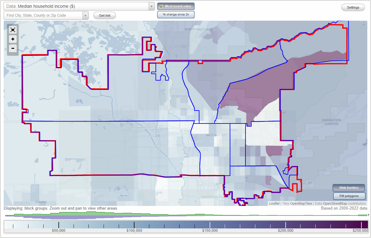
Salt Lake City, Utah Neighborhood Map - Income, House Prices, Occupations, Boundaries
Settings
X

- City boundary
- Neighborhood boundaries
Business Search - 14 Million verified businesses
Neighborhoods:
Avenues, Capitol Hill, Downtown, East Bench, East Central, Northwest Coalition, Sugarhouse, West Salt LakeAvenues neighborhood in Salt Lake City statistics: (Find on map)
Area: 18.059 square miles
Population: 18,224
Population density:
Median household income in 2021:
Median rent in in 2021:
Male vs Females
Median age
Housing prices:
Average estimated value of detached houses in 2021 (55.8% of all units):
Average estimated value of townhouses or other attached units in 2021 (4.6% of all units):
Most popular occupations of males: sales and office occupations (16.0%); computer and mathematical occupations (14.5%); management occupations (except farmers) (12.9%); service occupations (11.4%); construction, extraction, and maintenance occupations (6.8%); education, training, and library occupations (6.0%); architecture and engineering occupations (5.5%)
Most popular occupations of females: education, training, and library occupations (22.3%); business and financial operations occupations (12.2%); sales and office occupations (12.1%); healthcare practitioners and technical occupations (11.3%); service occupations (10.9%); management occupations (except farmers) (7.3%); life, physical, and social science occupations (7.2%)
Roads and streets: E 2nd Ave (2nd Ave); E 3rd Ave; E 200 N (E 4th Ave); E 1st Ave; 11th Ave (E 11th Ave); 5th Ave; Chandler Dr (E Chandler Dr); 7th Ave; E 300 N (6th Ave); 9th Ave; 13th Ave (E 13th Ave); 10th Ave (E 500 N); E 400 N (8th Ave); N F St (F St); N I St (I St); N G St (G St); N H St (H St); N Virginia St (Virginia St); J St; K St; D St; E St; L St; E Federal Heights Dr (Federal Heights Dr); N Terrace Hills Dr (Terrace Hills Dr); E 600 N (12th Ave); B St; C St; Popperton Park Way; M St; 16th Ave (E 16th Ave); E Perrys Hollow Rd (Perrys Hollow Rd); Northbonneville Dr (E North Bonneville Dr); 18th Ave (E 18th Ave); E Tomahawk Dr (Tomahawk Dr); Northcrest Dr (E Northcrest Dr); Hilltop Rd (N Hilltop Rd); A St; 17th Ave (E 17th Ave); E Northmont Way (Northmont Way); Arlington Dr (E Arlington Dr); N St; E Military Way (Military Way); Northcliffe Dr (E Northcliffe Dr); Capitol Park Ave; U St; Penrose Dr (E Penrose Dr); Bonneville Blvd; N Alta St (Alta St); E North Hills Dr; Fairfax Rd (E Fairfax Rd); Perrys Hollow Cir (Perrys Hollow Dr); Federal Pointe Dr; Federal Way; Sigsbee Ave; Edgehill Dr (E Edgehill Rd); N Northland Dr (Northland Dr); Perry Ave; Hanover Dr (E Hanover Dr); Sunrise Ave (N Sunrise Ave); Circle Way; E Fort Douglas Cir (Fort Douglas Cir); N Medical Dr; O St; S St; Q St; P St; R St; T St; E South Temple St (E South Temple); New Bedford Dr; N Campus Dr; Kristianna Cir (Katrinka); Connecticut Dr (Connecticut Ln); Northview Dr (N Northview Dr); Little Valley Rd (N Little Valley Rd); E Aloha Rd (Aloha Rd); Northpoint Dr; Cambridge Way; Chandler Cir; Tomahawk; Grandridge Dr (N Grandridge Dr); 1250 E (N New Bonneville Pl); Federal Heights Cir (N Federal Heights Cir); N Wolcott St; E North Medical Dr; Sallie Ave; E 14th Ave (14th Ave); Vianna Ave; Penny Parade Dr; Crestline Cir (N Crestline Cir); E Alta Cir (Alta Cir); Saddle Hill Rd; N Juniperpoint Dr (Juniper Point Dr); Cambridge Cir; Richland Dr; S Wolcott St; Northview Cir (N Northview Cir); Laurel St; Northshore St (Northshore Dr, N Northshore St); Hilldon Ave; Connecticut Ln; Wasatch Dr; Victoria Pl; Charity Cove; N Fairfax Cir (Fairfax Cir); Isom Pl; 4th Ave; Grandridge Ct (N Grandridge Ct); Northvale Way; Juniperpoint Ct (N Juniperpoint Ct); Caring Cove; Arlington Cir; Northpoint Ct; E Perry Ave (30 N); 1 N (E Sigsbee Ave); Fort Doulas Cir.
Other features: City Crk; Dry Creek No Frk; Dry Creek So Frk; Dry Crk.
Avenues neighborhood detailed profile
Area: 18.059 square miles
Population: 18,224
Population density:
| Avenues: | 1,009 people per square mile |
| Salt Lake City: | 1,838 people per square mile |
Median household income in 2021:
| Avenues: | $114,147 |
| Salt Lake City: | $66,658 |
Median rent in in 2021:
| Avenues: | $1,094 |
| Salt Lake City: | $1,096 |
Male vs Females
| Males: | 9,524 |
| Females: | 8,700 |
Median age
| Males: | 39.0 years |
| Females: | 42.8 years |
Housing prices:
Average estimated value of detached houses in 2021 (55.8% of all units):
| Avenues: | $664,407 |
| Salt Lake City: | $670,211 |
Average estimated value of townhouses or other attached units in 2021 (4.6% of all units):
| This neighborhood: | $450,172 |
| city: | $508,996 |
Most popular occupations of males: sales and office occupations (16.0%); computer and mathematical occupations (14.5%); management occupations (except farmers) (12.9%); service occupations (11.4%); construction, extraction, and maintenance occupations (6.8%); education, training, and library occupations (6.0%); architecture and engineering occupations (5.5%)
Most popular occupations of females: education, training, and library occupations (22.3%); business and financial operations occupations (12.2%); sales and office occupations (12.1%); healthcare practitioners and technical occupations (11.3%); service occupations (10.9%); management occupations (except farmers) (7.3%); life, physical, and social science occupations (7.2%)
Roads and streets: E 2nd Ave (2nd Ave); E 3rd Ave; E 200 N (E 4th Ave); E 1st Ave; 11th Ave (E 11th Ave); 5th Ave; Chandler Dr (E Chandler Dr); 7th Ave; E 300 N (6th Ave); 9th Ave; 13th Ave (E 13th Ave); 10th Ave (E 500 N); E 400 N (8th Ave); N F St (F St); N I St (I St); N G St (G St); N H St (H St); N Virginia St (Virginia St); J St; K St; D St; E St; L St; E Federal Heights Dr (Federal Heights Dr); N Terrace Hills Dr (Terrace Hills Dr); E 600 N (12th Ave); B St; C St; Popperton Park Way; M St; 16th Ave (E 16th Ave); E Perrys Hollow Rd (Perrys Hollow Rd); Northbonneville Dr (E North Bonneville Dr); 18th Ave (E 18th Ave); E Tomahawk Dr (Tomahawk Dr); Northcrest Dr (E Northcrest Dr); Hilltop Rd (N Hilltop Rd); A St; 17th Ave (E 17th Ave); E Northmont Way (Northmont Way); Arlington Dr (E Arlington Dr); N St; E Military Way (Military Way); Northcliffe Dr (E Northcliffe Dr); Capitol Park Ave; U St; Penrose Dr (E Penrose Dr); Bonneville Blvd; N Alta St (Alta St); E North Hills Dr; Fairfax Rd (E Fairfax Rd); Perrys Hollow Cir (Perrys Hollow Dr); Federal Pointe Dr; Federal Way; Sigsbee Ave; Edgehill Dr (E Edgehill Rd); N Northland Dr (Northland Dr); Perry Ave; Hanover Dr (E Hanover Dr); Sunrise Ave (N Sunrise Ave); Circle Way; E Fort Douglas Cir (Fort Douglas Cir); N Medical Dr; O St; S St; Q St; P St; R St; T St; E South Temple St (E South Temple); New Bedford Dr; N Campus Dr; Kristianna Cir (Katrinka); Connecticut Dr (Connecticut Ln); Northview Dr (N Northview Dr); Little Valley Rd (N Little Valley Rd); E Aloha Rd (Aloha Rd); Northpoint Dr; Cambridge Way; Chandler Cir; Tomahawk; Grandridge Dr (N Grandridge Dr); 1250 E (N New Bonneville Pl); Federal Heights Cir (N Federal Heights Cir); N Wolcott St; E North Medical Dr; Sallie Ave; E 14th Ave (14th Ave); Vianna Ave; Penny Parade Dr; Crestline Cir (N Crestline Cir); E Alta Cir (Alta Cir); Saddle Hill Rd; N Juniperpoint Dr (Juniper Point Dr); Cambridge Cir; Richland Dr; S Wolcott St; Northview Cir (N Northview Cir); Laurel St; Northshore St (Northshore Dr, N Northshore St); Hilldon Ave; Connecticut Ln; Wasatch Dr; Victoria Pl; Charity Cove; N Fairfax Cir (Fairfax Cir); Isom Pl; 4th Ave; Grandridge Ct (N Grandridge Ct); Northvale Way; Juniperpoint Ct (N Juniperpoint Ct); Caring Cove; Arlington Cir; Northpoint Ct; E Perry Ave (30 N); 1 N (E Sigsbee Ave); Fort Doulas Cir.
Other features: City Crk; Dry Creek No Frk; Dry Creek So Frk; Dry Crk.
Avenues neighborhood detailed profile
Capitol Hill neighborhood in Salt Lake City statistics: (Find on map)
Area: 11.834 square miles
Population: 8,319
Population density:
Median household income in 2021:
Median rent in in 2021:
Male vs Females
Median age
Housing prices:
Average estimated value of detached houses in 2021 (26.3% of all units):
Average estimated value of townhouses or other attached units in 2021 (4.1% of all units):
Average estimated '21 value of housing units in 5-or-more-unit structures (106.2% of all units):
Most popular occupations of males: sales and office occupations (16.7%); management occupations (except farmers) (16.2%); service occupations (10.4%); computer and mathematical occupations (7.8%); business and financial operations occupations (7.5%); production occupations (6.0%); construction, extraction, and maintenance occupations (5.8%)
Most popular occupations of females: sales and office occupations (18.9%); management occupations (except farmers) (15.8%); education, training, and library occupations (12.3%); healthcare practitioners and technical occupations (10.5%); arts, design, entertainment, sports, and media occupations (9.5%); service occupations (7.9%); business and financial operations occupations (5.5%)
Highways in this neighborhood: Beck St (US Hwy 89); Victory Rd (State Rte 184); N 300 W (N 3rd W, State Rte 186); W 600 N; Columbus St (State Rte 184); W North Temple (US Hwy 89); State Rte 184 (E 3rd N, E 300 N); N State St (State Rte 184); N Temple St (W 100 N, State Rte 186, W North Temple); E North Temple St (US Hwy 89); N State St (US Hwy 89, State St).
Roads and streets: N Canyon Rd (120 E); E Capitol Blvd (E Capitol St); N 400 W (N 4th W); W 700 N (W 7th N); N 200 W (N 2nd W); Wall St; Bonneville Blvd; W 300 N; W 4th N (W 400 N); W 500 N (W 5th N); Oak Forest Rd; Center St; Sandhurst Dr; N Main St; Warm Springs Rd; Ensign Vista Dr; Dorchester Dr; N 500 W; W Capitol St; Canyon Oaks Way; N 9th W (N 900 West St, N 900 W); W Girard Ave; Everett Ave; W 2nd N (W 200 N); W 1500 N (W 15th North St, W 1500 North St); W 800 N (W 8th N); Pugsley St; N Sandrun Rd; Reed Ave; W 1600 N (W 16th North St); N West Temple; Capitol Oaks Ln; Chicago St; W Apricot Ave (Apricot Ave, W 350 N); E Girard Ave; Cortez St; de Soto St (Desoto St); Duluth Ave; Hillside Ave; Hot Springs St; 500 N (E 500 N, E 5th N); Edgecomb Dr; Quince St (N Quince St); N Almond St (Almond St); W 1700 N; W 900 N (W 9th N); Clinton Ave (W Clinton Ave); S Sandrun Rd; E Capitol St; Darwin St; W 2180 N; W Zane Ave; E Churchill Dr; E 200 N (E 2nd N); Vine St; Fern Ave; Ardmore Pl (W Ardmore Pl); Dexter St; E Zane Ave; Braewick Rd; Twickenham Dr; Dartmoor Way; W 1800 N (W 18th North St); N Quince St; (N Beck St, 940 W); Roundoft Dr; Alida Pl; Warm Springs Rd (N 700 W); 4th Ave; Chartwell Ct; Bishop Pl (W Bishop Pl); Girard Pl; Knightsbridge Ln; Ouray Ave; E 700 N; 2nd Ave (E 2nd Ave); Dartmoor Ln; N Baltic Ct; E Greenstoke Dr; Arctic Ct; W 2nd North St (W 200 N); N Churchill Dr; Canyon Side St; N 8th W (N 800 W, N 800 West St); Crags Ct; N 6th W (N 600 W); 130 E (Canyon Rd); Gray Ave; Dartmoor Pl; E 3rd Ave; Loma Ln; N Warm Springs Rd (525 W); N 6th W; 220 N.
Railroad features: Union Pacific RR.
Other features: City Crk; North Frk.
Capitol Hill neighborhood detailed profile
Area: 11.834 square miles
Population: 8,319
Population density:
| Capitol Hill: | 703 people per square mile |
| Salt Lake City: | 1,838 people per square mile |
Median household income in 2021:
| Capitol Hill: | $91,738 |
| Salt Lake City: | $66,658 |
Median rent in in 2021:
| Capitol Hill: | $1,086 |
| Salt Lake City: | $1,096 |
Male vs Females
| Males: | 4,291 |
| Females: | 4,028 |
Median age
| Males: | 35.5 years |
| Females: | 36.4 years |
Housing prices:
Average estimated value of detached houses in 2021 (26.3% of all units):
| Capitol Hill: | $704,731 |
| Salt Lake City: | $670,211 |
Average estimated value of townhouses or other attached units in 2021 (4.1% of all units):
| This neighborhood: | $450,172 |
| city: | $508,996 |
Average estimated '21 value of housing units in 5-or-more-unit structures (106.2% of all units):
| Capitol Hill: | $336,506 |
| Salt Lake City: | $392,695 |
Most popular occupations of males: sales and office occupations (16.7%); management occupations (except farmers) (16.2%); service occupations (10.4%); computer and mathematical occupations (7.8%); business and financial operations occupations (7.5%); production occupations (6.0%); construction, extraction, and maintenance occupations (5.8%)
Most popular occupations of females: sales and office occupations (18.9%); management occupations (except farmers) (15.8%); education, training, and library occupations (12.3%); healthcare practitioners and technical occupations (10.5%); arts, design, entertainment, sports, and media occupations (9.5%); service occupations (7.9%); business and financial operations occupations (5.5%)
Highways in this neighborhood: Beck St (US Hwy 89); Victory Rd (State Rte 184); N 300 W (N 3rd W, State Rte 186); W 600 N; Columbus St (State Rte 184); W North Temple (US Hwy 89); State Rte 184 (E 3rd N, E 300 N); N State St (State Rte 184); N Temple St (W 100 N, State Rte 186, W North Temple); E North Temple St (US Hwy 89); N State St (US Hwy 89, State St).
Roads and streets: N Canyon Rd (120 E); E Capitol Blvd (E Capitol St); N 400 W (N 4th W); W 700 N (W 7th N); N 200 W (N 2nd W); Wall St; Bonneville Blvd; W 300 N; W 4th N (W 400 N); W 500 N (W 5th N); Oak Forest Rd; Center St; Sandhurst Dr; N Main St; Warm Springs Rd; Ensign Vista Dr; Dorchester Dr; N 500 W; W Capitol St; Canyon Oaks Way; N 9th W (N 900 West St, N 900 W); W Girard Ave; Everett Ave; W 2nd N (W 200 N); W 1500 N (W 15th North St, W 1500 North St); W 800 N (W 8th N); Pugsley St; N Sandrun Rd; Reed Ave; W 1600 N (W 16th North St); N West Temple; Capitol Oaks Ln; Chicago St; W Apricot Ave (Apricot Ave, W 350 N); E Girard Ave; Cortez St; de Soto St (Desoto St); Duluth Ave; Hillside Ave; Hot Springs St; 500 N (E 500 N, E 5th N); Edgecomb Dr; Quince St (N Quince St); N Almond St (Almond St); W 1700 N; W 900 N (W 9th N); Clinton Ave (W Clinton Ave); S Sandrun Rd; E Capitol St; Darwin St; W 2180 N; W Zane Ave; E Churchill Dr; E 200 N (E 2nd N); Vine St; Fern Ave; Ardmore Pl (W Ardmore Pl); Dexter St; E Zane Ave; Braewick Rd; Twickenham Dr; Dartmoor Way; W 1800 N (W 18th North St); N Quince St; (N Beck St, 940 W); Roundoft Dr; Alida Pl; Warm Springs Rd (N 700 W); 4th Ave; Chartwell Ct; Bishop Pl (W Bishop Pl); Girard Pl; Knightsbridge Ln; Ouray Ave; E 700 N; 2nd Ave (E 2nd Ave); Dartmoor Ln; N Baltic Ct; E Greenstoke Dr; Arctic Ct; W 2nd North St (W 200 N); N Churchill Dr; Canyon Side St; N 8th W (N 800 W, N 800 West St); Crags Ct; N 6th W (N 600 W); 130 E (Canyon Rd); Gray Ave; Dartmoor Pl; E 3rd Ave; Loma Ln; N Warm Springs Rd (525 W); N 6th W; 220 N.
Railroad features: Union Pacific RR.
Other features: City Crk; North Frk.
Capitol Hill neighborhood detailed profile
Downtown neighborhood in Salt Lake City statistics: (Find on map)
Area: 5.928 square miles
Population: 40,346
Population density:
Median household income in 2021:
Median rent in in 2021:
Male vs Females
Median age
Housing prices:
Average estimated value of detached houses in 2021 (35.0% of all units):
Average estimated '21 value of housing units in 5-or-more-unit structures (31.2% of all units):
Most popular occupations of males: sales and office occupations (16.9%); service occupations (14.4%); management occupations (except farmers) (9.7%); computer and mathematical occupations (9.4%); construction, extraction, and maintenance occupations (6.8%); material moving occupations (6.2%); production occupations (5.6%)
Most popular occupations of females: service occupations (23.0%); sales and office occupations (22.4%); education, training, and library occupations (11.0%); management occupations (except farmers) (7.6%); healthcare practitioners and technical occupations (7.5%); business and financial operations occupations (5.1%); community and social services occupations (3.9%)
Limited-access highways (interstate or state) in this neighborhood: I- 80.
Highways in this neighborhood: State St (S State St, US Hwy 89, N 20 E); State Rte 71 (S 735 E, S 7th E, S 700 E); W 4th S (W 400 S); E 4th S (State Rte 186, E 400 S); W 600 S (W 6th S, State Rte 269); State Rte 270.
Roads and streets: S Main St; S 500 E (S 5th E); S 4th E (S 400 E); S 3rd E (S 300 E); S 100 W (S West Temple St, S West Temple); S 300 W; S 600 E (S 6th E); 4th W (S 400 W); S 200 W (S 2nd W); S 200 E (S 2nd E); S 5th W (S 500 W); E 7th S (E 700 S); E South Temple St (E South Temple); E Broadway (E 3rd S, E 300 S); E 100 S; E 2nd S (E 200 S); E 500 S (E 5th South St); Martin Luther King Jr Blvd (E 600 S, E 6th S); E 9th S (E 900 S); E 800 S (E 8th S); E 1300 S; W 200 S (W 2nd S); Kensington Ave; 17th S (E 1700 S); S 6th W (S 600 W); W 700 S (W 7th S); W 8th S (W 800 S); W 500 S (W 5th S); W 1st S (W 100 S); Denver St; W 3rd S (W 300 S); Coatsville Ave; Park St; W 9th S (W 900 S); Downington Ave; Wilson Ave; S 2nd East St (S 200 E); Major St; Herbert Ave; Cleveland Ave; Garfield Ave; Redondo Ave; Edison St; Richards St; Hollywood Ave; W 17th South St (W 1700 S); W 1300 S (13th S); Jefferson St; Roberta St; W South Temple; Paxton Ave; Williams Ave; Edith Ave; Westminster Ave; Harvard Ave; Harrison Ave; Bryan Ave; Ramona Ave; S Constitution Dr W (520 E); S Constitution Dr E (680 E); Green St; Rio Grande St; Fayette Ave; Blair St; Kelsey Ave; Hampton Ave; Browning Ave; Sherman Ave; Lucy Ave; S 7th W (S 700 W); Harris Ave; Emerson Ave; Milton Ave; Hartwell Ave; Belmont Ave; Hubbard Ave; Fremont Ave; Pierpont Ave; Wood Ave; Andrew Ave; Blaine Ave; Roosevelt Ave; Van Buren Ave; Layton Ave; Washington St; Sego Ave; Brooklyn Ave; Washington St (S 240 West St); Gale St; W 1830 S (1830 S); Cottage Ave; W 1400 S (14th S); Pacific Ave; S 8th W (S 800 W, S 800 West St); Lowell Ave; California Ave; American Ave; Rosewood Ave; Grove Ave; Blvd Gardens; Quayle Ave; Merrimac Ave; Montague Ave; Exchange Pl; Social Hall Ave; Market St (Post Office Pl); Hope Ave; Montrose Ave; 15th South St (W 1500 S); Whitney Ave; W 1370 S (Albermarle Ave); Mead Ave; Paramount Ave; Goltz Ave; Yale Ave; Hansen Ave; Logan Ave; Hidden Villa Rd; Venture Way; Tyler St; E 1020 S; W 16th South St (W 1600 S); E 1040 S; Grace Ct; Westwood Ave; Macarthur Ave; Woodbine St; Regent St; E Gallivan Ave (260 S); 1 S (W South Temple St); Shelmerdine Ct; Gallivan Ave; Aspen Ave; Orchard Pl; Bishop Federal Ln; Stanton Ave; High Ave; S 450 W; Ely Pl; Beldon Pl; Debs Pl; Orpheum Ave; Jefferson Cir; Wilson Ave (1760 S); W Eccles Ave (225 S); 650 S (W Portola Ave); Plum Alley St; Lang Pl; Colfax Ave; Hoover Pl; Gallagher Pl; Hawthorne Ave; Van Ness Pl; Vernier Pl; Chapman Pl; Wasatch Ave (Wasatch Pl); Slade Pl; Gregory Pl; Upton Pl; Markea Ave; Floral St; Albermarle Ave; Fuller Ave; Alameda Ave; Arnold Pl; S 465 E (James Ct); Strongfellow Ct; Dubei Ct; Kilby Ct; Laconia Ct; Pleasant Ct; 230 E (S Mortensen Ct); Marguerite Ct; Gudgell Ct (Gudgel Ct); Delmar Ct; Vincent Ct; Poplar Ct; Wayne Ct; Hawkes Ct; Moffat Ct; Volney Ct; Conway Ct; Bailey Pl; Iverson St; Wright Ct; Delwood Ct; Elwood Pl; S Weechquootee Pl (15 E); Clawson Pl; Heather St; Acorn Ct; Foulger St; E 640 S; Cactus St; Kilbourne Ct; E 1150 S; 535 W (S Woodbine St); S Butterworth Ct (560 W); Eardley Pl; Graham Ct; E 935 S; Front St.
Railroad features: Union Pacific RR; Salt Lake Garfield and Western Rlwy.
Downtown neighborhood detailed profile
Area: 5.928 square miles
Population: 40,346
Population density:
| Downtown (Central): | 6,806 people per square mile |
| Salt Lake City: | 1,838 people per square mile |
Median household income in 2021:
| Downtown (Central): | $59,511 |
| Salt Lake City: | $66,658 |
Median rent in in 2021:
| Downtown (Central): | $924 |
| Salt Lake City: | $1,096 |
Male vs Females
| Males: | 20,795 |
| Females: | 19,551 |
Median age
| Males: | 35.8 years |
| Females: | 36.8 years |
Housing prices:
Average estimated value of detached houses in 2021 (35.0% of all units):
| Downtown (Central): | $617,172 |
| Salt Lake City: | $670,211 |
Average estimated '21 value of housing units in 5-or-more-unit structures (31.2% of all units):
| Downtown (Central): | $223,524 |
| Salt Lake City: | $392,695 |
Most popular occupations of males: sales and office occupations (16.9%); service occupations (14.4%); management occupations (except farmers) (9.7%); computer and mathematical occupations (9.4%); construction, extraction, and maintenance occupations (6.8%); material moving occupations (6.2%); production occupations (5.6%)
Most popular occupations of females: service occupations (23.0%); sales and office occupations (22.4%); education, training, and library occupations (11.0%); management occupations (except farmers) (7.6%); healthcare practitioners and technical occupations (7.5%); business and financial operations occupations (5.1%); community and social services occupations (3.9%)
Limited-access highways (interstate or state) in this neighborhood: I- 80.
Highways in this neighborhood: State St (S State St, US Hwy 89, N 20 E); State Rte 71 (S 735 E, S 7th E, S 700 E); W 4th S (W 400 S); E 4th S (State Rte 186, E 400 S); W 600 S (W 6th S, State Rte 269); State Rte 270.
Roads and streets: S Main St; S 500 E (S 5th E); S 4th E (S 400 E); S 3rd E (S 300 E); S 100 W (S West Temple St, S West Temple); S 300 W; S 600 E (S 6th E); 4th W (S 400 W); S 200 W (S 2nd W); S 200 E (S 2nd E); S 5th W (S 500 W); E 7th S (E 700 S); E South Temple St (E South Temple); E Broadway (E 3rd S, E 300 S); E 100 S; E 2nd S (E 200 S); E 500 S (E 5th South St); Martin Luther King Jr Blvd (E 600 S, E 6th S); E 9th S (E 900 S); E 800 S (E 8th S); E 1300 S; W 200 S (W 2nd S); Kensington Ave; 17th S (E 1700 S); S 6th W (S 600 W); W 700 S (W 7th S); W 8th S (W 800 S); W 500 S (W 5th S); W 1st S (W 100 S); Denver St; W 3rd S (W 300 S); Coatsville Ave; Park St; W 9th S (W 900 S); Downington Ave; Wilson Ave; S 2nd East St (S 200 E); Major St; Herbert Ave; Cleveland Ave; Garfield Ave; Redondo Ave; Edison St; Richards St; Hollywood Ave; W 17th South St (W 1700 S); W 1300 S (13th S); Jefferson St; Roberta St; W South Temple; Paxton Ave; Williams Ave; Edith Ave; Westminster Ave; Harvard Ave; Harrison Ave; Bryan Ave; Ramona Ave; S Constitution Dr W (520 E); S Constitution Dr E (680 E); Green St; Rio Grande St; Fayette Ave; Blair St; Kelsey Ave; Hampton Ave; Browning Ave; Sherman Ave; Lucy Ave; S 7th W (S 700 W); Harris Ave; Emerson Ave; Milton Ave; Hartwell Ave; Belmont Ave; Hubbard Ave; Fremont Ave; Pierpont Ave; Wood Ave; Andrew Ave; Blaine Ave; Roosevelt Ave; Van Buren Ave; Layton Ave; Washington St; Sego Ave; Brooklyn Ave; Washington St (S 240 West St); Gale St; W 1830 S (1830 S); Cottage Ave; W 1400 S (14th S); Pacific Ave; S 8th W (S 800 W, S 800 West St); Lowell Ave; California Ave; American Ave; Rosewood Ave; Grove Ave; Blvd Gardens; Quayle Ave; Merrimac Ave; Montague Ave; Exchange Pl; Social Hall Ave; Market St (Post Office Pl); Hope Ave; Montrose Ave; 15th South St (W 1500 S); Whitney Ave; W 1370 S (Albermarle Ave); Mead Ave; Paramount Ave; Goltz Ave; Yale Ave; Hansen Ave; Logan Ave; Hidden Villa Rd; Venture Way; Tyler St; E 1020 S; W 16th South St (W 1600 S); E 1040 S; Grace Ct; Westwood Ave; Macarthur Ave; Woodbine St; Regent St; E Gallivan Ave (260 S); 1 S (W South Temple St); Shelmerdine Ct; Gallivan Ave; Aspen Ave; Orchard Pl; Bishop Federal Ln; Stanton Ave; High Ave; S 450 W; Ely Pl; Beldon Pl; Debs Pl; Orpheum Ave; Jefferson Cir; Wilson Ave (1760 S); W Eccles Ave (225 S); 650 S (W Portola Ave); Plum Alley St; Lang Pl; Colfax Ave; Hoover Pl; Gallagher Pl; Hawthorne Ave; Van Ness Pl; Vernier Pl; Chapman Pl; Wasatch Ave (Wasatch Pl); Slade Pl; Gregory Pl; Upton Pl; Markea Ave; Floral St; Albermarle Ave; Fuller Ave; Alameda Ave; Arnold Pl; S 465 E (James Ct); Strongfellow Ct; Dubei Ct; Kilby Ct; Laconia Ct; Pleasant Ct; 230 E (S Mortensen Ct); Marguerite Ct; Gudgell Ct (Gudgel Ct); Delmar Ct; Vincent Ct; Poplar Ct; Wayne Ct; Hawkes Ct; Moffat Ct; Volney Ct; Conway Ct; Bailey Pl; Iverson St; Wright Ct; Delwood Ct; Elwood Pl; S Weechquootee Pl (15 E); Clawson Pl; Heather St; Acorn Ct; Foulger St; E 640 S; Cactus St; Kilbourne Ct; E 1150 S; 535 W (S Woodbine St); S Butterworth Ct (560 W); Eardley Pl; Graham Ct; E 935 S; Front St.
Railroad features: Union Pacific RR; Salt Lake Garfield and Western Rlwy.
Downtown neighborhood detailed profile
East Bench neighborhood in Salt Lake City statistics: (Find on map)
Area: 6.844 square miles
Population: 30,753
Population density:
Median household income in 2021:
Median rent in in 2021:
Male vs Females
Median age
Housing prices:
Average estimated value of detached houses in 2021 (78.8% of all units):
Average estimated value of townhouses or other attached units in 2021 (6.2% of all units):
Average estimated '21 value of housing units in 5-or-more-unit structures (6.1% of all units):
Most popular occupations of males: management occupations (except farmers) (19.8%); sales and office occupations (15.1%); business and financial operations occupations (11.4%); healthcare practitioners and technical occupations (9.1%); education, training, and library occupations (8.8%); service occupations (7.2%); computer and mathematical occupations (6.4%)
Most popular occupations of females: sales and office occupations (20.9%); management occupations (except farmers) (15.6%); healthcare practitioners and technical occupations (15.3%); education, training, and library occupations (10.5%); business and financial operations occupations (8.2%); service occupations (7.8%); arts, design, entertainment, sports, and media occupations (4.8%)
Highways in this neighborhood: Foothill Dr (State Rte 186); State Rte 186 (E 5th South St); State Rte 186 (E 5th South St, E 500 S).
Roads and streets: Wasatch Dr; E Sunnyside Ave (Sunnyside Ave); E 1300 S; Kensington Ave; E 9th S (E 900 S); Princeton Ave; Logan Ave; Emerson Ave; University Village; Bryan Ave; Browning Ave; Yale Ave; S 2100 E (S 21st E); S 1900 E (S 19th E); Michigan Ave; Hubbard Ave; Laird Ave; Sherwood Dr; Harvard Ave; S 15th East St (S 1500 E); S 1700 E (S 17th East St); Harrison Ave; Roosevelt Ave; S 2000 E (S 20th E); St Marys Dr; Yalecrest Ave; Emigration Canyon (Burr's Ln, Emigration Canyon Rd); University St; Devonshire Dr; Chipeta Way; Herbert Ave; W Village (University Village); E South Campus Dr; Kennedy Dr; S 18th E (S 1800 E); Comanche Dr; S 14th E (S 1400 E); Connor Rd; Sherman Ave; St Marys Way; Wakara Way; Skyline Dr; Campus Center Dr; Scenic Dr; Canterbury Dr; S 23rd E (S 2300 E); Beacon Dr; Crestview Dr (E Crestview Dr); Arapeen Dr; Fort Douglas Blvd; S 2200 E (S 22nd East St); Guardsman Way; Sheridan Rd; Pollock Rd; S Donner Way (S 2985 East St, Donner Way); Carrigan Canyon Dr; Laird Dr; 1400 E (S 1400 E); Presidents Cir; Roxbury Rd; N 1900 E (Medical Dr); S 1600 E (S 1600 East St, S 16th East St); N Campus Dr; Military Dr; Hempstead Rd; Komas Dr; E 100 S; Commonwealth Ave; Carrigan Canyon Dr (Lakeline Dr); Eagle Way; Mohawk Way; Wilton Way; Oquirrh Dr; S Medical; Belaire Dr; E 4th S (S Campus Dr, E 400 S); Gilmer Dr; Diestel Rd; Ambassador Way; Bonneville Dr; Colorow Dr; Vista View Dr (S Vista View Dr); 1900 E (1900 East St, S 1900 E); Lancaster Dr; Oak Hills Way; E 2100 S; Oakhurst Dr; S 1460 E; Village Cir; S 1500 E (1500 E); Promontory Dr; Blaine Ave; Laird Way; Hyland Hills Rd; Nottingham Way; Embassy Way; Federal Way; Research Rd; Summit Cir; Bonneview Dr; Alton Way; 2030 E (S 2030 E); Indian Hills Dr; Millicent Dr; Red Butte Canyon Rd; Ambassador Way E; Le Grand St; Officers Cir; Central Campus Dr; Ballif Rd; Yuma St; E 1700 S (17th S); 1620 S (Logan Ave); 1570 S (Bryan Ave); Sunset Oaks Dr; Stansbury Way; Glen Oaks Dr; Connor St (S Connor St); Greenwood Ter; S 22nd East St (S 2200 E); Chancellor Way; Thornton Ave; Soldiers Cir; Augusta Way; Fairview Ave (S 1580 E); Potter St; Soldier (E); Claremont Way; S 2000 E (2000 E); Tabby Ln; Mercedes Way; Preston St; 230 S (E 230 S); St Marys Cir; S 1820 E (1820 E); Lewis; S 1850 E (1850 E); Detrobriand St (de Trobriand St); Ken Rey St; Emigration St; Chase St; 1st; S 26th E (S 2600 E); S 1452 E; Austin Rd; Blackhawk Way; Vollum; E Tartan Ave; Crestview Cir; Benchmark Dr; Stover St; Cornell Cir; Colonial Dr; S Shirecliff Rd (Shirecliff Rd); Dover Rd; Ute Dr; Finch Ln; S 2400 E (S 24th E); Donner Cir; el Rey St; Signal Point Cir; Rosecrest Dr; Westmorland Dr; Oak Springs Dr; Bryan Cir; S 2690 East St (Oak Spring Dr); Devonshire Cir; Lakeline Cir; Chancellor Pl; Woodruff Way (S Woodruff Way); Amanda Ave; S 1530 E (1530 E); S Newberry Rd (Newberry Rd); Shannon St (S 1615 E); Penn St (S 1660 E); Monument Park Cir; Benchmark Cir; S Conner St (Connor Rd); Glenmare St; Fillmore St; Logan Way; Mohawk Cir; Padley St; S Connor Rd (2050 E); Aldo Cir; Shakespeare Pl; Dickens Pl; Chaucer Pl; Gibbon St; 1575 S (E Skyline Dr S); 2765 E (S Oak Hills Way); Thackeray Pl; Park Row St; 1700 E (S 1700 E); Comanche Cir; Kristie Ln; 1778 E (S 1778 E); Skyline Cir; Oak Brook Cir; Jaren Cir; Harvard Oaks Cir; Carrigan Cir; Arcadia Heights Cir; Mines Building; Cherokee Cir; Roxbury Cir; Royal Cir; Sherwood Cir; 2400 E; Apache Cir; Dern St; S Tartan Ave; Scenic Cir; S Mohawk Way (2690 E); Oak Spring Dr; Skyridge Cir; 290 S (E Peel St); Peel St; Normandie Cir; Emigration Cir; Indian Hills Cir; Nerual Cir; Colonial Cir; E 4th S (E 400 S); E Blaine Ave (1720 S); Embassy Cir; Hiawatha Cir; James Fletcher Building; Sunset Cir; Logan Cir; Laird Cir; Uintah Cir; Mayfair Cir; Wasatch Cir; Chancellor Cir; Foothill Cir; 2600 E.
Other features: Emigration Crk; Red Butte Crk.
East Bench neighborhood detailed profile
Area: 6.844 square miles
Population: 30,753
Population density:
| East Bench: | 4,494 people per square mile |
| Salt Lake City: | 1,838 people per square mile |
Median household income in 2021:
| East Bench: | $119,037 |
| Salt Lake City: | $66,658 |
Median rent in in 2021:
| East Bench: | $1,495 |
| Salt Lake City: | $1,096 |
Male vs Females
| Males: | 14,957 |
| Females: | 15,795 |
Median age
| Males: | 38.6 years |
| Females: | 37.7 years |
Housing prices:
Average estimated value of detached houses in 2021 (78.8% of all units):
| East Bench: | $826,574 |
| Salt Lake City: | $670,211 |
Average estimated value of townhouses or other attached units in 2021 (6.2% of all units):
| This neighborhood: | $605,026 |
| city: | $508,996 |
Average estimated '21 value of housing units in 5-or-more-unit structures (6.1% of all units):
| East Bench: | $364,032 |
| Salt Lake City: | $392,695 |
Most popular occupations of males: management occupations (except farmers) (19.8%); sales and office occupations (15.1%); business and financial operations occupations (11.4%); healthcare practitioners and technical occupations (9.1%); education, training, and library occupations (8.8%); service occupations (7.2%); computer and mathematical occupations (6.4%)
Most popular occupations of females: sales and office occupations (20.9%); management occupations (except farmers) (15.6%); healthcare practitioners and technical occupations (15.3%); education, training, and library occupations (10.5%); business and financial operations occupations (8.2%); service occupations (7.8%); arts, design, entertainment, sports, and media occupations (4.8%)
Highways in this neighborhood: Foothill Dr (State Rte 186); State Rte 186 (E 5th South St); State Rte 186 (E 5th South St, E 500 S).
Roads and streets: Wasatch Dr; E Sunnyside Ave (Sunnyside Ave); E 1300 S; Kensington Ave; E 9th S (E 900 S); Princeton Ave; Logan Ave; Emerson Ave; University Village; Bryan Ave; Browning Ave; Yale Ave; S 2100 E (S 21st E); S 1900 E (S 19th E); Michigan Ave; Hubbard Ave; Laird Ave; Sherwood Dr; Harvard Ave; S 15th East St (S 1500 E); S 1700 E (S 17th East St); Harrison Ave; Roosevelt Ave; S 2000 E (S 20th E); St Marys Dr; Yalecrest Ave; Emigration Canyon (Burr's Ln, Emigration Canyon Rd); University St; Devonshire Dr; Chipeta Way; Herbert Ave; W Village (University Village); E South Campus Dr; Kennedy Dr; S 18th E (S 1800 E); Comanche Dr; S 14th E (S 1400 E); Connor Rd; Sherman Ave; St Marys Way; Wakara Way; Skyline Dr; Campus Center Dr; Scenic Dr; Canterbury Dr; S 23rd E (S 2300 E); Beacon Dr; Crestview Dr (E Crestview Dr); Arapeen Dr; Fort Douglas Blvd; S 2200 E (S 22nd East St); Guardsman Way; Sheridan Rd; Pollock Rd; S Donner Way (S 2985 East St, Donner Way); Carrigan Canyon Dr; Laird Dr; 1400 E (S 1400 E); Presidents Cir; Roxbury Rd; N 1900 E (Medical Dr); S 1600 E (S 1600 East St, S 16th East St); N Campus Dr; Military Dr; Hempstead Rd; Komas Dr; E 100 S; Commonwealth Ave; Carrigan Canyon Dr (Lakeline Dr); Eagle Way; Mohawk Way; Wilton Way; Oquirrh Dr; S Medical; Belaire Dr; E 4th S (S Campus Dr, E 400 S); Gilmer Dr; Diestel Rd; Ambassador Way; Bonneville Dr; Colorow Dr; Vista View Dr (S Vista View Dr); 1900 E (1900 East St, S 1900 E); Lancaster Dr; Oak Hills Way; E 2100 S; Oakhurst Dr; S 1460 E; Village Cir; S 1500 E (1500 E); Promontory Dr; Blaine Ave; Laird Way; Hyland Hills Rd; Nottingham Way; Embassy Way; Federal Way; Research Rd; Summit Cir; Bonneview Dr; Alton Way; 2030 E (S 2030 E); Indian Hills Dr; Millicent Dr; Red Butte Canyon Rd; Ambassador Way E; Le Grand St; Officers Cir; Central Campus Dr; Ballif Rd; Yuma St; E 1700 S (17th S); 1620 S (Logan Ave); 1570 S (Bryan Ave); Sunset Oaks Dr; Stansbury Way; Glen Oaks Dr; Connor St (S Connor St); Greenwood Ter; S 22nd East St (S 2200 E); Chancellor Way; Thornton Ave; Soldiers Cir; Augusta Way; Fairview Ave (S 1580 E); Potter St; Soldier (E); Claremont Way; S 2000 E (2000 E); Tabby Ln; Mercedes Way; Preston St; 230 S (E 230 S); St Marys Cir; S 1820 E (1820 E); Lewis; S 1850 E (1850 E); Detrobriand St (de Trobriand St); Ken Rey St; Emigration St; Chase St; 1st; S 26th E (S 2600 E); S 1452 E; Austin Rd; Blackhawk Way; Vollum; E Tartan Ave; Crestview Cir; Benchmark Dr; Stover St; Cornell Cir; Colonial Dr; S Shirecliff Rd (Shirecliff Rd); Dover Rd; Ute Dr; Finch Ln; S 2400 E (S 24th E); Donner Cir; el Rey St; Signal Point Cir; Rosecrest Dr; Westmorland Dr; Oak Springs Dr; Bryan Cir; S 2690 East St (Oak Spring Dr); Devonshire Cir; Lakeline Cir; Chancellor Pl; Woodruff Way (S Woodruff Way); Amanda Ave; S 1530 E (1530 E); S Newberry Rd (Newberry Rd); Shannon St (S 1615 E); Penn St (S 1660 E); Monument Park Cir; Benchmark Cir; S Conner St (Connor Rd); Glenmare St; Fillmore St; Logan Way; Mohawk Cir; Padley St; S Connor Rd (2050 E); Aldo Cir; Shakespeare Pl; Dickens Pl; Chaucer Pl; Gibbon St; 1575 S (E Skyline Dr S); 2765 E (S Oak Hills Way); Thackeray Pl; Park Row St; 1700 E (S 1700 E); Comanche Cir; Kristie Ln; 1778 E (S 1778 E); Skyline Cir; Oak Brook Cir; Jaren Cir; Harvard Oaks Cir; Carrigan Cir; Arcadia Heights Cir; Mines Building; Cherokee Cir; Roxbury Cir; Royal Cir; Sherwood Cir; 2400 E; Apache Cir; Dern St; S Tartan Ave; Scenic Cir; S Mohawk Way (2690 E); Oak Spring Dr; Skyridge Cir; 290 S (E Peel St); Peel St; Normandie Cir; Emigration Cir; Indian Hills Cir; Nerual Cir; Colonial Cir; E 4th S (E 400 S); E Blaine Ave (1720 S); Embassy Cir; Hiawatha Cir; James Fletcher Building; Sunset Cir; Logan Cir; Laird Cir; Uintah Cir; Mayfair Cir; Wasatch Cir; Chancellor Cir; Foothill Cir; 2600 E.
Other features: Emigration Crk; Red Butte Crk.
East Bench neighborhood detailed profile
East Central neighborhood in Salt Lake City statistics: (Find on map)
Area: 2.226 square miles
Population: 20,591
Population density:
Median household income in 2021:
Median rent in in 2021:
Male vs Females
Median age
Housing prices:
Average estimated value of detached houses in 2021 (38.6% of all units):
Average estimated value of housing units in 2-unit structures in 2021 (9.5% of all units):
Average estimated '21 value of housing units in 5-or-more-unit structures (19.6% of all units):
Most popular occupations of males: sales and office occupations (16.5%); management occupations (except farmers) (12.6%); computer and mathematical occupations (11.1%); service occupations (10.6%); education, training, and library occupations (9.7%); healthcare practitioners and technical occupations (6.6%); life, physical, and social science occupations (4.7%)
Most popular occupations of females: sales and office occupations (21.2%); service occupations (15.2%); management occupations (except farmers) (11.9%); healthcare practitioners and technical occupations (10.8%); education, training, and library occupations (9.1%); business and financial operations occupations (5.5%); arts, design, entertainment, sports, and media occupations (4.4%)
Highways in this neighborhood: S 1300 E (S 13th E, State Rte 181); E 4th S (State Rte 186, E 400 S); State Rte 186.
Roads and streets: S 1100 E (S 11th E); S 8th E (S 800 East St, S 800 E); S 900 E (S 9th E); S 1000 E (S 10th E); S 12th E (S 1200 E); E 8th S (E 800 S); E 6th S (E 600 S); E 300 S (E 3rd S, E Broadway); E 700 S (E 7th S); E 900 S (E 9th S); E 1300 S; Yale Ave; Douglas St; Mc Clelland St (McClelland St); Lake St; Windsor St; Princeton Ave; E 100 S; E 200 S (E 2nd S); Lincoln St; E 500 S (E 5th South St); E South Temple St (E South Temple); Elizabeth St; Browning Ave; Harvard Ave; Harrison Ave; Gilmer Dr; Belmont Ave; Laird Ave; Kensington Ave; Bryan Ave; Emerson Ave; Sherman Ave; Roosevelt Ave; Logan Ave; Herbert Ave; 1560 S (Bryan Ave); 1580 S (Wood Ave); Lowell Ave; E South Temple St (E South Temple); Milton Ave; Kensington Ave (1545 S); Bueno Ave; Menlo Ave; Sego Ave; 1490 S (Emerson Ave); Kensington Ave (1530 S); Logan Ave (1602 S); Alameda Ave; Mc Clelland St (McClelland St, 1040 E); Sunnyside Ave; Barbara Pl; Michigan Ave; Markea Ave; Grand St; Brixen Ct; Linden Ave; 1000 E Frontage; Mc Clelland St; Iowa St; Fuller Ave; 1455 S (Roosevelt Ave); Thistle Ave; East St (East Pl); Voyles Pl; 25 S (E Hanover Pl); Dooley Ct; Liberty Ave; Norris Pl; Wilshire Pl; Hawthorne Ave; Harrison Ave (1370 S); Colonial Pl (Colonial Ave); Fenway Ave; Williams Ave; Mc Donald Pl; Chase Ave; Isabella Ct; Harmony Ct; Fletcher Ct; Mendon Ct; Strongs Ct (Strong Ct); Koneta Ct; Laker Ct; Haxton Pl (Haxton Ct); Pennsylvania Pl; S West Ct (West Ct); Alpine Pl; Naylor Ct; Lyman Ct; Noble Pl; Ivan Ct; Banks Ct; Musser Ct; Reeves Ter; Inglewood Ct.
Other features: Red Butte Crk.
East Central neighborhood detailed profile
Area: 2.226 square miles
Population: 20,591
Population density:
| East Central: | 9,249 people per square mile |
| Salt Lake City: | 1,838 people per square mile |
Median household income in 2021:
| East Central: | $77,281 |
| Salt Lake City: | $66,658 |
Median rent in in 2021:
| East Central: | $1,087 |
| Salt Lake City: | $1,096 |
Male vs Females
| Males: | 10,107 |
| Females: | 10,484 |
Median age
| Males: | 33.6 years |
| Females: | 32.9 years |
Housing prices:
Average estimated value of detached houses in 2021 (38.6% of all units):
| East Central: | $521,820 |
| Salt Lake City: | $670,211 |
Average estimated value of housing units in 2-unit structures in 2021 (9.5% of all units):
| This neighborhood: | $252,500 |
| Salt Lake City: | $557,731 |
Average estimated '21 value of housing units in 5-or-more-unit structures (19.6% of all units):
| East Central: | $336,660 |
| Salt Lake City: | $392,695 |
Most popular occupations of males: sales and office occupations (16.5%); management occupations (except farmers) (12.6%); computer and mathematical occupations (11.1%); service occupations (10.6%); education, training, and library occupations (9.7%); healthcare practitioners and technical occupations (6.6%); life, physical, and social science occupations (4.7%)
Most popular occupations of females: sales and office occupations (21.2%); service occupations (15.2%); management occupations (except farmers) (11.9%); healthcare practitioners and technical occupations (10.8%); education, training, and library occupations (9.1%); business and financial operations occupations (5.5%); arts, design, entertainment, sports, and media occupations (4.4%)
Highways in this neighborhood: S 1300 E (S 13th E, State Rte 181); E 4th S (State Rte 186, E 400 S); State Rte 186.
Roads and streets: S 1100 E (S 11th E); S 8th E (S 800 East St, S 800 E); S 900 E (S 9th E); S 1000 E (S 10th E); S 12th E (S 1200 E); E 8th S (E 800 S); E 6th S (E 600 S); E 300 S (E 3rd S, E Broadway); E 700 S (E 7th S); E 900 S (E 9th S); E 1300 S; Yale Ave; Douglas St; Mc Clelland St (McClelland St); Lake St; Windsor St; Princeton Ave; E 100 S; E 200 S (E 2nd S); Lincoln St; E 500 S (E 5th South St); E South Temple St (E South Temple); Elizabeth St; Browning Ave; Harvard Ave; Harrison Ave; Gilmer Dr; Belmont Ave; Laird Ave; Kensington Ave; Bryan Ave; Emerson Ave; Sherman Ave; Roosevelt Ave; Logan Ave; Herbert Ave; 1560 S (Bryan Ave); 1580 S (Wood Ave); Lowell Ave; E South Temple St (E South Temple); Milton Ave; Kensington Ave (1545 S); Bueno Ave; Menlo Ave; Sego Ave; 1490 S (Emerson Ave); Kensington Ave (1530 S); Logan Ave (1602 S); Alameda Ave; Mc Clelland St (McClelland St, 1040 E); Sunnyside Ave; Barbara Pl; Michigan Ave; Markea Ave; Grand St; Brixen Ct; Linden Ave; 1000 E Frontage; Mc Clelland St; Iowa St; Fuller Ave; 1455 S (Roosevelt Ave); Thistle Ave; East St (East Pl); Voyles Pl; 25 S (E Hanover Pl); Dooley Ct; Liberty Ave; Norris Pl; Wilshire Pl; Hawthorne Ave; Harrison Ave (1370 S); Colonial Pl (Colonial Ave); Fenway Ave; Williams Ave; Mc Donald Pl; Chase Ave; Isabella Ct; Harmony Ct; Fletcher Ct; Mendon Ct; Strongs Ct (Strong Ct); Koneta Ct; Laker Ct; Haxton Pl (Haxton Ct); Pennsylvania Pl; S West Ct (West Ct); Alpine Pl; Naylor Ct; Lyman Ct; Noble Pl; Ivan Ct; Banks Ct; Musser Ct; Reeves Ter; Inglewood Ct.
Other features: Red Butte Crk.
East Central neighborhood detailed profile
Northwest Coalition neighborhood in Salt Lake City statistics: (Find on map)
Area: 32.851 square miles
Population: 203,432
Population density:
Median household income in 2021:
Median rent in in 2021:
Male vs Females
Median age
Housing prices:
Average estimated value of detached houses in 2021 (61.6% of all units):
Average estimated value of townhouses or other attached units in 2021 (4.7% of all units):
Average estimated '21 value of housing units in 5-or-more-unit structures (21.7% of all units):
Most popular occupations of males: construction, extraction, and maintenance occupations (20.9%); service occupations (14.3%); sales and office occupations (13.5%); transportation occupations (8.7%); material moving occupations (6.2%); management occupations (except farmers) (6.1%); business and financial operations occupations (5.8%)
Most popular occupations of females: service occupations (27.9%); sales and office occupations (27.4%); healthcare practitioners and technical occupations (9.2%); management occupations (except farmers) (7.6%); production occupations (5.4%); education, training, and library occupations (4.7%); business and financial operations occupations (4.6%)
Roads and streets: W 1100 S.
Limited-access highways (interstate or state) in this neighborhood: I- 15; State Rte 5 (Bonneville Fwy, I- 215); I- 80 (State Rte 2, N Temple St).
Highways in this neighborhood: N 1700 W (N Redwood Rd, State Rte 68); Terminal Dr (State Rte 54); N 4000 W; W 2100 N; W 2300 North St (W 23rd North St, State Hwy 249); W North Temple (N Temple St, State Rte 186, W 100 N); 4000 W.
Roads and streets: N Temple Frontage (Frontage Rd); N 2200 W (N 22nd West St); W 500 N (W 5th N); Amelia Earhart Dr; Morton Dr; W 400 N (W 4th N); Harold Gatty Dr; W 6th N (W 600 N); W 700 N; N 1200 W (N 12th W); Oakley St; W 1000 N; N I-15 Sb Fwy (I-15); N 1300 W; W 300 N; Colorado St; Wiley Post Way; Catherine St; N 900 W (N 900 West St); N I-215W Nb Fwy (I-215W); Starcrest Dr; N 1400 W; I-15; W 800 N; Dupont Ave; W 900 N (W 900 North St); W 1200 N; American Beauty Dr; N 8th W (N 800 W, N 800 West St); W 1700 N (W 17th N); W 200 N; N 1500 W; W Talisman Dr; W 1100 N; Warm Springs Rd (N 700 W); N 5600 W; Wright Brothers Dr; N 3200 W; Lafayette Dr; N 600 W (N 6th W); Sunset Dr; Reclamation Rd; 3700 W; Nocturne Dr; Independence Blvd; 4200 W; N 1000 W (N 1000 West St, N 10th W); Crossbar Rd; N 500 W (N 5th W); Jimmy Doolittle Rd; Victoria Way; Mandalay Rd; Sonata St; W 370 N (Walnut Dr); Riverside Dr; Ouray Ave; Sterling Dr; Chicago St; N 2360 W (N 2360 West St); N 1100 W; W North Star Dr; John Glenn Rd; N 2450 W; Rambler Dr (N 1100 W); N 1870 W (N Dorthea Way); 1525 W (Garnette St); Colonel Rd; Douglas Corrigan Way (W Douglas Corrigan Way); Apollo Rd; Marion St; Capistrano Dr; Buccaneer Dr; W 1300 N; Billy Mitchell Rd; Dale Ridge Ave; Sun Arbor Ter; I-215; I- 80 Wb 5600 W Off Rmp; W 800 North St (W 800 N, W 8th N); General Dr (N General Dr); Simondi Ave; Signora Dr; N Star Dr; N 2300 West St (N 2300 W); N Miami Rd (N 1830 W); W Quarter Horse Ave; W 3300 North St; 3800 W; N Sir Michael Dr; Goodwin Ave; Cornell St (N 1520 W); W Springfield Rd; I-15 (I-15 Sb Fwy); W 2800 North St; Sir Philip Dr (N Sir Philip Dr); Charles Lindbergh Dr; Cornell St; 1580 N; Macfarland Dr; Grant St; W 200 N (W 2nd North St); Poinsetta Dr; W Valentine St; Sir Charles Dr; Pamela Way; Briarcliff Ave; W Douglas Corrigan Way (100 N); Leadville Ave; Prosperity Dr; Indian Summer Dr; W 2670 North St (W 2670 N); Taffeta Dr; N 2380 West St; Clinton Ave (W 650 N); W 340 North St; Jackson Ave; Topaz Dr; 470 N (W 470 N); Sergeant Dr; 1200 N; Jennifer Way; New York Dr; N Morton Dr; W Sir Timothy Ave (W 1015 N); N 1460 W (Garside St, 1460 W); Admiral Byrd Rd; Niles Ave; New Star Dr; Riverview Ave; Challenger Rd; Carousel St; Antilles Dr (W Antilles Dr); N 2370 W (N 2370 West St); N Sir Patrick Dr; Picture Dr; Sir Philip Dr (N 1990 W); Sir Michael Dr; N 1925 W (Sir Patrick Dr); W 280 N (W 260 N); W Spring St; W Girard Ave; W Cavallo Dr; Debonair Dr; N 1330 W; Tally Ho Dr (Tally Ho St); Neil Armstrong Rd; Eclipse Way; N 3950 W; Fernleaf St; N 1800 W; W 1900 N (W 20th North St); Mojave Dr; Gertie Ave; W Baroness Pl (Baroness Pl); Northwood Ave; N 4030 W; N 2265 W (Crater St); New Star Dr (N 1785 W); Sir James Dr; W Red Angus Dr (Red Angus Dr); S 7200 W; Black Angus Dr; Patricia Way; Pinnocchio Dr; Sir Anthony Cir; N Omni Dr; W 510 N (510 N); Yeager Rd; Alps Way; Village Park Ave; Dexter St; Wooden Ln; Dorothea Way; Fig Tree Pl; Sir Joseph Way; W Dauntless Ave (1000 N); W 1550 N (W New Hampshire Ave); N 2200 W (2200 W); Crystal Rock Ave; Satori Cir; Jensen Meadow Ln; Beck St; W Irie Ln (Irie Ln); Autumn Ave; Sir Timothy Ave; Crater St; N Fall St; 9th N; N 2100 West St (N 2100 W); Midland St; Stallion Ln; Lieutenant Rd; Polaris Way; Maple Tree Ct; Sir Robert Dr (W 550 N); N Diamond Rose Cir; 160 N (W 160 N); Sir James Way; Sir Jefferey Way; Bridge Stone Ln; N 1730 W (Baroness St); W 975 N (W Omni Ave); Hoyt Pl; Havenstone Ln; Neloula Way (W 250 N, Nebula Way); Montgomery St (N 1580 W); N Flyer Way (2120 W); 1665 W (N Turin Dr, Turin Dr); W 680 N (Sir James Dr); Warm Springs Rd; Sir Anthony Dr; Newton Park St; 455 N (W Hodges Ln); Sir Jeffrey Dr; Milan Dr (W Milan Dr); Village Hill Ave; Clark Ave; W North Temple (W North Temple St, N Temple St); Oak Tree Ct; W Bloomfield Pl (Bloomfield Pl, N 1755 W); W 10th N (W 1000 N, 1000 N); Livingston Ave; Falling Star Cir; Featherstone Cir; N 2300 W (N 2300 West St); N Winter St; Bliss Ct; Village View St; S 1820 W (Silver Star Dr); W Wild Flower Dr (W 765 N); Pearl Harbor St; Unnamed Rd; Los Angeles St; Lamarne St; Zachary Dr; N Split Rail Ln (Split Rail Ln); I- 80 Wb 5600W on Rmp; Jackson Park Pl; W 715 N; W Turin Dr (Turin Dr); W Trafalga Way; N Hodges Ln (650 W); Chaz Ct; Libby Way (N 1895 W); Aries Cir; Gander Ln; N Rendon Ct (635 W); Elm Tree Pl; Harvest St; Edmonds Pl; 1225 N (Nobility Cir); Gunnell Pl; W 3130 N; Duder St; N 1280 W; Laxon Ct (N 917 West St); N Tuttle Ct; Erie Pl (Erie St); Beaumont Ct; Centennial Cir; Argyle Ct; Grenoble St; I-15 (I-15 Nb Fwy); Reveille Cir; Bangerter Sb I- 80 Eb Ramp; Kress Cir; W 1400 N (Miami Cir); N Summer St; 240 N (W 240 N); W 13th N; Cornwell Pl; Talisman Cir; N Branding Cir (1910 W); Gemini Rd; W Red Angus Dr (1820 N); W 180 N; Morton Hill Cir; W Zachary Dr; Hyde Park Way; Forbes Park Way; Shortline Ave; 1375 N (W Joust Ct); Doralma St; Walnut Cir; Sir Andrew Way; Harold St (N 1775 W); N 900 W (900 W); N 1465 W; 235 N (W Seward Ave); 1800 W (N 1800 W); W Major Ave; Rose Park Cir; Redclover Dr (Red Clover Dr, W 870 N); N Bright Ct (700 W); Ivy Cir; Coventry View Dr; Corral Ln; W 925 North St; N 1875 W; Irving St; Gelding Ln; N 4200 W; W 975 North St; W 1530 N; Riverside Cir; Bright Ct; N 2350 West St; Antilles Cir; Brigadier Cir; Roundup Cir; Sir James Cir; Sir Jeffrey Cir; 500 N (W 5th N, W 500 N); Catherine Cir; Kimberly Cir; Shannon Cir; Haslam Cir; Sienna Cir (W Sienna Cir); N 1830 W (N Miami Rd); Taurus Cir; 200 N (W 200 N); Westpointe Cir; W 140 N; Captain Cir (Captain Rd); Featherstone Dr; Gemini Dr; 870 N (W 870 N); N Terminal Dr; N 1650 W (1650 W); 560 W (N Phoenix Cir); Gem Cir; W Altair Cir; Rose Park Ln; N Emily Cir; Goodwin Cir; N Andrea Cir; Bridgecrest Cir; Garnette Cir; 3950 W; N Miami Cir; W 2670 N; Bridge Stone Cir; N Village Hill Cir (Village Hill Cir); 4030 W; N Star Crest Dr (1840 W).
Railroad features: Union Pacific RR.
Other features: Goggin Drn.
Other features: West Branch Brighton Cnl; Surplus Cnl.
Other features: Jordan Riv.
Other features: North Point Consolidated Cnl.
Other features: Salt Lake City Canal Sewage.
Northwest Coalition neighborhood detailed profile
Area: 32.851 square miles
Population: 203,432
Population density:
| Northwest Coalition: | 6,193 people per square mile |
| Salt Lake City: | 1,838 people per square mile |
Median household income in 2021:
| Northwest Coalition: | $81,420 |
| Salt Lake City: | $66,658 |
Median rent in in 2021:
| Northwest Coalition: | $1,051 |
| Salt Lake City: | $1,096 |
Male vs Females
| Males: | 110,781 |
| Females: | 92,651 |
Median age
| Males: | 33.3 years |
| Females: | 32.6 years |
Housing prices:
Average estimated value of detached houses in 2021 (61.6% of all units):
| Northwest Coalition: | $255,825 |
| Salt Lake City: | $670,211 |
Average estimated value of townhouses or other attached units in 2021 (4.7% of all units):
| This neighborhood: | $323,621 |
| city: | $508,996 |
Average estimated '21 value of housing units in 5-or-more-unit structures (21.7% of all units):
| Northwest Coalition: | $120,086 |
| Salt Lake City: | $392,695 |
Most popular occupations of males: construction, extraction, and maintenance occupations (20.9%); service occupations (14.3%); sales and office occupations (13.5%); transportation occupations (8.7%); material moving occupations (6.2%); management occupations (except farmers) (6.1%); business and financial operations occupations (5.8%)
Most popular occupations of females: service occupations (27.9%); sales and office occupations (27.4%); healthcare practitioners and technical occupations (9.2%); management occupations (except farmers) (7.6%); production occupations (5.4%); education, training, and library occupations (4.7%); business and financial operations occupations (4.6%)
Roads and streets: W 1100 S.
Limited-access highways (interstate or state) in this neighborhood: I- 15; State Rte 5 (Bonneville Fwy, I- 215); I- 80 (State Rte 2, N Temple St).
Highways in this neighborhood: N 1700 W (N Redwood Rd, State Rte 68); Terminal Dr (State Rte 54); N 4000 W; W 2100 N; W 2300 North St (W 23rd North St, State Hwy 249); W North Temple (N Temple St, State Rte 186, W 100 N); 4000 W.
Roads and streets: N Temple Frontage (Frontage Rd); N 2200 W (N 22nd West St); W 500 N (W 5th N); Amelia Earhart Dr; Morton Dr; W 400 N (W 4th N); Harold Gatty Dr; W 6th N (W 600 N); W 700 N; N 1200 W (N 12th W); Oakley St; W 1000 N; N I-15 Sb Fwy (I-15); N 1300 W; W 300 N; Colorado St; Wiley Post Way; Catherine St; N 900 W (N 900 West St); N I-215W Nb Fwy (I-215W); Starcrest Dr; N 1400 W; I-15; W 800 N; Dupont Ave; W 900 N (W 900 North St); W 1200 N; American Beauty Dr; N 8th W (N 800 W, N 800 West St); W 1700 N (W 17th N); W 200 N; N 1500 W; W Talisman Dr; W 1100 N; Warm Springs Rd (N 700 W); N 5600 W; Wright Brothers Dr; N 3200 W; Lafayette Dr; N 600 W (N 6th W); Sunset Dr; Reclamation Rd; 3700 W; Nocturne Dr; Independence Blvd; 4200 W; N 1000 W (N 1000 West St, N 10th W); Crossbar Rd; N 500 W (N 5th W); Jimmy Doolittle Rd; Victoria Way; Mandalay Rd; Sonata St; W 370 N (Walnut Dr); Riverside Dr; Ouray Ave; Sterling Dr; Chicago St; N 2360 W (N 2360 West St); N 1100 W; W North Star Dr; John Glenn Rd; N 2450 W; Rambler Dr (N 1100 W); N 1870 W (N Dorthea Way); 1525 W (Garnette St); Colonel Rd; Douglas Corrigan Way (W Douglas Corrigan Way); Apollo Rd; Marion St; Capistrano Dr; Buccaneer Dr; W 1300 N; Billy Mitchell Rd; Dale Ridge Ave; Sun Arbor Ter; I-215; I- 80 Wb 5600 W Off Rmp; W 800 North St (W 800 N, W 8th N); General Dr (N General Dr); Simondi Ave; Signora Dr; N Star Dr; N 2300 West St (N 2300 W); N Miami Rd (N 1830 W); W Quarter Horse Ave; W 3300 North St; 3800 W; N Sir Michael Dr; Goodwin Ave; Cornell St (N 1520 W); W Springfield Rd; I-15 (I-15 Sb Fwy); W 2800 North St; Sir Philip Dr (N Sir Philip Dr); Charles Lindbergh Dr; Cornell St; 1580 N; Macfarland Dr; Grant St; W 200 N (W 2nd North St); Poinsetta Dr; W Valentine St; Sir Charles Dr; Pamela Way; Briarcliff Ave; W Douglas Corrigan Way (100 N); Leadville Ave; Prosperity Dr; Indian Summer Dr; W 2670 North St (W 2670 N); Taffeta Dr; N 2380 West St; Clinton Ave (W 650 N); W 340 North St; Jackson Ave; Topaz Dr; 470 N (W 470 N); Sergeant Dr; 1200 N; Jennifer Way; New York Dr; N Morton Dr; W Sir Timothy Ave (W 1015 N); N 1460 W (Garside St, 1460 W); Admiral Byrd Rd; Niles Ave; New Star Dr; Riverview Ave; Challenger Rd; Carousel St; Antilles Dr (W Antilles Dr); N 2370 W (N 2370 West St); N Sir Patrick Dr; Picture Dr; Sir Philip Dr (N 1990 W); Sir Michael Dr; N 1925 W (Sir Patrick Dr); W 280 N (W 260 N); W Spring St; W Girard Ave; W Cavallo Dr; Debonair Dr; N 1330 W; Tally Ho Dr (Tally Ho St); Neil Armstrong Rd; Eclipse Way; N 3950 W; Fernleaf St; N 1800 W; W 1900 N (W 20th North St); Mojave Dr; Gertie Ave; W Baroness Pl (Baroness Pl); Northwood Ave; N 4030 W; N 2265 W (Crater St); New Star Dr (N 1785 W); Sir James Dr; W Red Angus Dr (Red Angus Dr); S 7200 W; Black Angus Dr; Patricia Way; Pinnocchio Dr; Sir Anthony Cir; N Omni Dr; W 510 N (510 N); Yeager Rd; Alps Way; Village Park Ave; Dexter St; Wooden Ln; Dorothea Way; Fig Tree Pl; Sir Joseph Way; W Dauntless Ave (1000 N); W 1550 N (W New Hampshire Ave); N 2200 W (2200 W); Crystal Rock Ave; Satori Cir; Jensen Meadow Ln; Beck St; W Irie Ln (Irie Ln); Autumn Ave; Sir Timothy Ave; Crater St; N Fall St; 9th N; N 2100 West St (N 2100 W); Midland St; Stallion Ln; Lieutenant Rd; Polaris Way; Maple Tree Ct; Sir Robert Dr (W 550 N); N Diamond Rose Cir; 160 N (W 160 N); Sir James Way; Sir Jefferey Way; Bridge Stone Ln; N 1730 W (Baroness St); W 975 N (W Omni Ave); Hoyt Pl; Havenstone Ln; Neloula Way (W 250 N, Nebula Way); Montgomery St (N 1580 W); N Flyer Way (2120 W); 1665 W (N Turin Dr, Turin Dr); W 680 N (Sir James Dr); Warm Springs Rd; Sir Anthony Dr; Newton Park St; 455 N (W Hodges Ln); Sir Jeffrey Dr; Milan Dr (W Milan Dr); Village Hill Ave; Clark Ave; W North Temple (W North Temple St, N Temple St); Oak Tree Ct; W Bloomfield Pl (Bloomfield Pl, N 1755 W); W 10th N (W 1000 N, 1000 N); Livingston Ave; Falling Star Cir; Featherstone Cir; N 2300 W (N 2300 West St); N Winter St; Bliss Ct; Village View St; S 1820 W (Silver Star Dr); W Wild Flower Dr (W 765 N); Pearl Harbor St; Unnamed Rd; Los Angeles St; Lamarne St; Zachary Dr; N Split Rail Ln (Split Rail Ln); I- 80 Wb 5600W on Rmp; Jackson Park Pl; W 715 N; W Turin Dr (Turin Dr); W Trafalga Way; N Hodges Ln (650 W); Chaz Ct; Libby Way (N 1895 W); Aries Cir; Gander Ln; N Rendon Ct (635 W); Elm Tree Pl; Harvest St; Edmonds Pl; 1225 N (Nobility Cir); Gunnell Pl; W 3130 N; Duder St; N 1280 W; Laxon Ct (N 917 West St); N Tuttle Ct; Erie Pl (Erie St); Beaumont Ct; Centennial Cir; Argyle Ct; Grenoble St; I-15 (I-15 Nb Fwy); Reveille Cir; Bangerter Sb I- 80 Eb Ramp; Kress Cir; W 1400 N (Miami Cir); N Summer St; 240 N (W 240 N); W 13th N; Cornwell Pl; Talisman Cir; N Branding Cir (1910 W); Gemini Rd; W Red Angus Dr (1820 N); W 180 N; Morton Hill Cir; W Zachary Dr; Hyde Park Way; Forbes Park Way; Shortline Ave; 1375 N (W Joust Ct); Doralma St; Walnut Cir; Sir Andrew Way; Harold St (N 1775 W); N 900 W (900 W); N 1465 W; 235 N (W Seward Ave); 1800 W (N 1800 W); W Major Ave; Rose Park Cir; Redclover Dr (Red Clover Dr, W 870 N); N Bright Ct (700 W); Ivy Cir; Coventry View Dr; Corral Ln; W 925 North St; N 1875 W; Irving St; Gelding Ln; N 4200 W; W 975 North St; W 1530 N; Riverside Cir; Bright Ct; N 2350 West St; Antilles Cir; Brigadier Cir; Roundup Cir; Sir James Cir; Sir Jeffrey Cir; 500 N (W 5th N, W 500 N); Catherine Cir; Kimberly Cir; Shannon Cir; Haslam Cir; Sienna Cir (W Sienna Cir); N 1830 W (N Miami Rd); Taurus Cir; 200 N (W 200 N); Westpointe Cir; W 140 N; Captain Cir (Captain Rd); Featherstone Dr; Gemini Dr; 870 N (W 870 N); N Terminal Dr; N 1650 W (1650 W); 560 W (N Phoenix Cir); Gem Cir; W Altair Cir; Rose Park Ln; N Emily Cir; Goodwin Cir; N Andrea Cir; Bridgecrest Cir; Garnette Cir; 3950 W; N Miami Cir; W 2670 N; Bridge Stone Cir; N Village Hill Cir (Village Hill Cir); 4030 W; N Star Crest Dr (1840 W).
Railroad features: Union Pacific RR.
Other features: Goggin Drn.
Other features: West Branch Brighton Cnl; Surplus Cnl.
Other features: Jordan Riv.
Other features: North Point Consolidated Cnl.
Other features: Salt Lake City Canal Sewage.
Northwest Coalition neighborhood detailed profile
Sugarhouse neighborhood in Salt Lake City statistics: (Find on map)
Area: 5.689 square miles
Population: 36,620
Population density:
Median household income in 2021:
Median rent in in 2021:
Male vs Females
Median age
Housing prices:
Average estimated value of detached houses in 2021 (65.3% of all units):
Average estimated value of townhouses or other attached units in 2021 (5.6% of all units):
Average estimated value of housing units in 2-unit structures in 2021 (6.5% of all units):
Most popular occupations of males: management occupations (except farmers) (15.3%); sales and office occupations (13.4%); service occupations (9.8%); business and financial operations occupations (8.9%); computer and mathematical occupations (7.9%); healthcare practitioners and technical occupations (7.3%); education, training, and library occupations (5.2%)
Most popular occupations of females: sales and office occupations (24.3%); management occupations (except farmers) (12.2%); healthcare practitioners and technical occupations (12.0%); education, training, and library occupations (11.7%); service occupations (11.0%); business and financial operations occupations (8.7%); community and social services occupations (4.7%)
Limited-access highways (interstate or state) in this neighborhood: I- 80.
Highways in this neighborhood: State Rte 181 (S 1300 E); Foothill Dr (State Rte 186); State Rte 71 (S 7th E, S 735 E, S 700 E); State Rte 195; S 1300 E (Richmond St, State Rte 181); State Rte 181 (Edgehill St); S 23rd East St (State Rte 195).
Roads and streets: E 21st S (E 2100 S); E 2700 S; E I-80E Eb Fwy (I-80, I-80E Eb Fwy); Wilson Ave; E 1700 S (17th S); Blaine Ave; Westminster Ave; Downington Ave; Redondo Ave; Garfield Ave; Ramona Ave; Wilmington Ave; Stratford Ave; S 9th E (S 900 E); S 1700 E (Imperial St); Parkway Ave; S 20th East St (S 2000 E); Simpson Ave; Hollywood Ave; Parleys Way; Highland Dr; Atkin Ave; Stringham Ave; S 2300 E; S 15th East St (S 1500 E); S 1100 E (S 11th E); S 1000 E; Lake St; Crandall Ave; Zenith Ave; McClelland St (Mc Clelland St); S 1900 E (S 19th East St); Hudson Ave; S 800 E (S 800 East St, S 8th E); S 21st E (S 2100 E); Hartford St; Berkeley St; Fillmore St; Glenmare St; S 600 E (S 6th E); Crystal Ave; S 1800 E (S 18th East St); Lincoln St; Elm Ave; Parleys Canyon Blvd; E Claybourne Ave; Maywood Dr; Dearborn St; Beverly St; Chadwick St; Wellington St; Preston St; Imperial St; Texas St; S 1400 E (S 14th E); Alden St; Wyoming St; Country Club Dr; Lynwood Dr; Melbourne St; S 2500 E (S 25th East St); S 1200 E (S 12th E); I- 80 Westbound 1300 E on Rmp; Hillcrest Ave; Commonwealth Ave; Ashton Ave; Green St; Elizabeth St; S 2200 E (S 22nd E); Parleys Ter; Wilshire Dr; Warnock Ave; Dallin St; 1300 E Frontage; Oneida St; Nevada St; Sugarmont Dr; S 800 E (S 8th E); Douglas St; Driggs Ave; S 16th East St (S 1600 East St, S 1600 E); I- 80 Westbound 1300 E Off Rmp; Windsor St; Hannibal St; Charlton Ave; Kenwood St; E Graystone Way (2775 S); Sylvan Ave; Laurelhurst Dr; Bernadine Dr; S Park St; S 18th East St (S 1800 E); King St; I- 80 Eastbound 1300 E on Rmp; Wilshire Cir; Yuma St; Yermo Ave; Broadmoor St; Whitlock Ave; Stratford Dr; Miller Ave; View St; Wilmington Cir; E Woodland Ave (Woodland Ave); Malvern Ave; Loveland Ave; Division Ln; Allen Park Dr; Coatsville Ave; Hollywood Ave (1955 S); Mabey Dr; 1700 E Frontage; Glen Arbor St; Yuma St (S 2030 E); Wasatch Dr; E 3000 S (E 30th S); Forest View Ave; Latimer View Ct; S 1935 E (Preston St); S 2600 E (S 26th E); Brentwood Cir; Connor St; I- 80 Eastbound 1300 E Off Rmp; Sonnet Dr; E 2930 South St (Mary Dott Way); Charlton Cir; Park St; Crandall Cir; Ashton Cir; 2100 S Frontage; Zenith Cir; Austin Ave; Quail Estates Way; Up and L Co Access Rd; Forest Park Ct; Caton Way; S 5th E (S 500 E); Judith Ave (Judith St); Pasadena St; Meadow Ln; Forest Spring Way; Hudson Cir; Fairmont Cir; Angelita Ct; Yuma View Dr; Sage Way; E 2100 S (E 21st South St); Jasper St; Forest Dale Cir; S Sugarhouse Greenhouse Rd (1400 E); S 2060 E; Grandview Cir; Kierstin Pl; Mark Ave; Forest Farm Cir; Windsor St (Windsor Cir); Highland View Cir (E 2790 South St); Phebe Ln; Brickyard Rd; Bambrough Pl; Jasper Cir; Country Club Cir; Lincoln Cir; Redondo Pl; Berkeley Cir; Monte Vista Cir; Parleys Cir; E Welby Ave; Thunderbird Dr; Sierra Park Cir; (S 1300 Nb E); Paschal Cir; Covey View Ct; S Yuma Cir; Quail Haven Cir; Ida Cir; Vimont Ave; S 2100 E (S 2090 E); 2670 S (E Angelita Ct); Blaine Cir; Maywood Cir; Kaywood Cir; S 10th E; I-215 Collector (I-215, S I-215E Nb Col); S Brickyard Ln; E Gunn Ave.
Railroad features: Union Pacific RR.
Other features: Parleys Crk; Emigration Crk.
Other features: Jordan and Slc Cnl.
Other features: Sugarhouse Park Lk.
Sugarhouse neighborhood detailed profile
Area: 5.689 square miles
Population: 36,620
Population density:
| Sugarhouse: | 6,437 people per square mile |
| Salt Lake City: | 1,838 people per square mile |
Median household income in 2021:
| Sugarhouse: | $98,614 |
| Salt Lake City: | $66,658 |
Median rent in in 2021:
| Sugarhouse: | $1,314 |
| Salt Lake City: | $1,096 |
Male vs Females
| Males: | 18,243 |
| Females: | 18,376 |
Median age
| Males: | 34.2 years |
| Females: | 34.8 years |
Housing prices:
Average estimated value of detached houses in 2021 (65.3% of all units):
| Sugarhouse: | $456,379 |
| Salt Lake City: | $670,211 |
Average estimated value of townhouses or other attached units in 2021 (5.6% of all units):
| This neighborhood: | $610,635 |
| city: | $508,996 |
Average estimated value of housing units in 2-unit structures in 2021 (6.5% of all units):
| This neighborhood: | $252,500 |
| Salt Lake City: | $557,731 |
Most popular occupations of males: management occupations (except farmers) (15.3%); sales and office occupations (13.4%); service occupations (9.8%); business and financial operations occupations (8.9%); computer and mathematical occupations (7.9%); healthcare practitioners and technical occupations (7.3%); education, training, and library occupations (5.2%)
Most popular occupations of females: sales and office occupations (24.3%); management occupations (except farmers) (12.2%); healthcare practitioners and technical occupations (12.0%); education, training, and library occupations (11.7%); service occupations (11.0%); business and financial operations occupations (8.7%); community and social services occupations (4.7%)
Limited-access highways (interstate or state) in this neighborhood: I- 80.
Highways in this neighborhood: State Rte 181 (S 1300 E); Foothill Dr (State Rte 186); State Rte 71 (S 7th E, S 735 E, S 700 E); State Rte 195; S 1300 E (Richmond St, State Rte 181); State Rte 181 (Edgehill St); S 23rd East St (State Rte 195).
Roads and streets: E 21st S (E 2100 S); E 2700 S; E I-80E Eb Fwy (I-80, I-80E Eb Fwy); Wilson Ave; E 1700 S (17th S); Blaine Ave; Westminster Ave; Downington Ave; Redondo Ave; Garfield Ave; Ramona Ave; Wilmington Ave; Stratford Ave; S 9th E (S 900 E); S 1700 E (Imperial St); Parkway Ave; S 20th East St (S 2000 E); Simpson Ave; Hollywood Ave; Parleys Way; Highland Dr; Atkin Ave; Stringham Ave; S 2300 E; S 15th East St (S 1500 E); S 1100 E (S 11th E); S 1000 E; Lake St; Crandall Ave; Zenith Ave; McClelland St (Mc Clelland St); S 1900 E (S 19th East St); Hudson Ave; S 800 E (S 800 East St, S 8th E); S 21st E (S 2100 E); Hartford St; Berkeley St; Fillmore St; Glenmare St; S 600 E (S 6th E); Crystal Ave; S 1800 E (S 18th East St); Lincoln St; Elm Ave; Parleys Canyon Blvd; E Claybourne Ave; Maywood Dr; Dearborn St; Beverly St; Chadwick St; Wellington St; Preston St; Imperial St; Texas St; S 1400 E (S 14th E); Alden St; Wyoming St; Country Club Dr; Lynwood Dr; Melbourne St; S 2500 E (S 25th East St); S 1200 E (S 12th E); I- 80 Westbound 1300 E on Rmp; Hillcrest Ave; Commonwealth Ave; Ashton Ave; Green St; Elizabeth St; S 2200 E (S 22nd E); Parleys Ter; Wilshire Dr; Warnock Ave; Dallin St; 1300 E Frontage; Oneida St; Nevada St; Sugarmont Dr; S 800 E (S 8th E); Douglas St; Driggs Ave; S 16th East St (S 1600 East St, S 1600 E); I- 80 Westbound 1300 E Off Rmp; Windsor St; Hannibal St; Charlton Ave; Kenwood St; E Graystone Way (2775 S); Sylvan Ave; Laurelhurst Dr; Bernadine Dr; S Park St; S 18th East St (S 1800 E); King St; I- 80 Eastbound 1300 E on Rmp; Wilshire Cir; Yuma St; Yermo Ave; Broadmoor St; Whitlock Ave; Stratford Dr; Miller Ave; View St; Wilmington Cir; E Woodland Ave (Woodland Ave); Malvern Ave; Loveland Ave; Division Ln; Allen Park Dr; Coatsville Ave; Hollywood Ave (1955 S); Mabey Dr; 1700 E Frontage; Glen Arbor St; Yuma St (S 2030 E); Wasatch Dr; E 3000 S (E 30th S); Forest View Ave; Latimer View Ct; S 1935 E (Preston St); S 2600 E (S 26th E); Brentwood Cir; Connor St; I- 80 Eastbound 1300 E Off Rmp; Sonnet Dr; E 2930 South St (Mary Dott Way); Charlton Cir; Park St; Crandall Cir; Ashton Cir; 2100 S Frontage; Zenith Cir; Austin Ave; Quail Estates Way; Up and L Co Access Rd; Forest Park Ct; Caton Way; S 5th E (S 500 E); Judith Ave (Judith St); Pasadena St; Meadow Ln; Forest Spring Way; Hudson Cir; Fairmont Cir; Angelita Ct; Yuma View Dr; Sage Way; E 2100 S (E 21st South St); Jasper St; Forest Dale Cir; S Sugarhouse Greenhouse Rd (1400 E); S 2060 E; Grandview Cir; Kierstin Pl; Mark Ave; Forest Farm Cir; Windsor St (Windsor Cir); Highland View Cir (E 2790 South St); Phebe Ln; Brickyard Rd; Bambrough Pl; Jasper Cir; Country Club Cir; Lincoln Cir; Redondo Pl; Berkeley Cir; Monte Vista Cir; Parleys Cir; E Welby Ave; Thunderbird Dr; Sierra Park Cir; (S 1300 Nb E); Paschal Cir; Covey View Ct; S Yuma Cir; Quail Haven Cir; Ida Cir; Vimont Ave; S 2100 E (S 2090 E); 2670 S (E Angelita Ct); Blaine Cir; Maywood Cir; Kaywood Cir; S 10th E; I-215 Collector (I-215, S I-215E Nb Col); S Brickyard Ln; E Gunn Ave.
Railroad features: Union Pacific RR.
Other features: Parleys Crk; Emigration Crk.
Other features: Jordan and Slc Cnl.
Other features: Sugarhouse Park Lk.
Sugarhouse neighborhood detailed profile
West Salt Lake neighborhood in Salt Lake City statistics: (Find on map)
Area: 27.502 square miles
Population: 149,781
Population density:
Median household income in 2021:
Median rent in in 2021:
Male vs Females
Median age
Average estimated value of detached houses in 2021 (83.5% of all units):
Most popular occupations of males: service occupations (22.4%); construction, extraction, and maintenance occupations (19.6%); production occupations (14.1%); material moving occupations (10.4%); sales and office occupations (8.0%); business and financial operations occupations (4.5%); transportation occupations (4.3%)
Most popular occupations of females: service occupations (32.5%); sales and office occupations (23.2%); healthcare practitioners and technical occupations (8.8%); material moving occupations (6.9%); production occupations (5.6%); management occupations (except farmers) (4.8%); education, training, and library occupations (3.9%)
Limited-access highways (interstate or state) in this neighborhood: State Rte 2 (I- 80); I- 15 (I- 80); I- 215; State Rte 201 (2100 South Fwy, W 2100 S Expy); State Rte 2.
Highways in this neighborhood: S 5600 W (State Rte 172); S Redwood Rd (S 1700 W, State Rte 68, Redwood Rd); S 4000 W (Bangerter Hwy, W Valley Blvd, State Rte 154); N Temple St (W 100 N, State Rte 186, W North Temple); State Rte 54 (Terminal Dr); N Redwood Rd (N 1700 W, State Rte 68).
Roads and streets: W 2100 S; W I-80W Eb Fwy; W 500 S; W 1300 S (W 1300 South St); California Ave; W 700 S (W 7th S); W 900 S (W 9th S, W 900 South St); W 1700 S (W 17th South St); W 1330 S (California Ave); S 900 W (S 9th W, S 900 West St); I-15 Sb Fwy (S I-15 Sb Fwy, I-15); I-215 (I-215W Nb Fwy, S I-215W Nb Fwy); S Bangerter Sb Hwy; Indiana Ave; I-80 (I-80 Eb Fwy); W 200 S (W 2nd S); 4800 W (S 4800 W); W 1730 S; 7200 W; Directors Row; W 300 S; S 700 W (S 7th W); S 1170 W (Emery St); W 8th S (W 800 South St, W 800 S); W 400 S (W 4th S); S 10th W (S 1000 W, S 1000 West St); Navajo St; Gladiola St; S 8th W (S 800 W); N Temple Ramp; W 1820 S; S 2350 W (Pioneer Rd); S 13th W (S 1300 W); S 1200 W (S 12th W); W 600 S (W 6th S); S 5500 W; W 150 S; W 1500 S; Cheyenne St; Concord St; S 5th W (S 500 W); Arapahoe Ave; W 1987 S; Montgomery St; 4400 W (S 4400 W); Industrial Rd (S 1900 W); Bangerter Sb I- 80 Eb Ramp; Pueblo St; 3600 W (S 3600 W); Jeremy St; S 7200 W; 1980 S (W 1980 S); W I-80 Eb Fwy (I-80); Fremont Ave; Navajo St (S 1335 W); S 1100 W; Andrew Ave; Pacific Ave (W 440 S); Orange St (900 West St); Empire Rd (S 1825 W); S 4650 W; S 1400 W (S 14th W); S 3200 W (S 3200 West St); Glendale St; Prospect St; Glendale Dr; W 15th South St (W 1500 S, W 1500 South St); Swaner Rd; Hayes Ave; S 1250 W (Concord St); S 4490 W; 1270 S (Fortune Rd); W 850 S; Legacy View St; American Ave; Stewart St; W South Temple; S 3800 W (3800 W); W 540 S (Gillespie Ave); Wasatch Ave; Genesee Ave; S 3230 W; Delong St (2105 West St); Illinois Ave; S 1045 W; Goshen St (Jake Garn Blvd); Milestone Dr; Wallace Rd; Glenrose Dr; Harris Ave; S 5350 W; W 14th S (W 1400 South St); W 470 S (400 S); S 1500 W (S 15th West St); Mead Ave (W 1000 S); S 4130 W (4130 W); Fremont Dr; Dalton Ave; S 940 W (Post St); W 100 S (W 1st S); 300 S; I- 80 Wb Bangerter Nb Rmp; S 5200 W; S 5070 W; S 4250 W (4250 W); S 4370 W; Custer Rd; W North Temple St (N Temple St, W North Temple); Associated Ave (W 1900 S); Layton Ave; I- 80 Eb 5600 W on Rmp; Montague Ave; Bridger Rd; Jake Garn Blvd; Euclid Ave; W Pierpont Ave (Pierpont Ave); Utah St; Clayton St; Redwood Dr; W 2nd St (2nd Frontage Rd, Pierpont Ave); 345 S; 5200 W; Van Buren Ave; Iola Ave (W 340 S); Riverside Dr; Bennett Rd; S 3730 W; Paxton Ave; S 2650 W (S 2300 W, S Monterey St); Modesto Ave; S 3600 W St (S 3600 W); S 3850 W; Jewell Ave; Colmar Ave; Margaret Ave; S 4190 W; Fulton St (2350 West St); W 1250 S; S 3480 W (S 3480 W St); I-80; Utahna Dr; Brampton Way; 2120 S (Swaner Rd); W 800 S (800 S); March St; Decade Dr; Sr 154 Hwy; Wenco Dr; W 1525 S; W Industrial Cir; S 2400 W; S 4150 W; 5300 W; I-15; Post St; W 1520 S; S 5370 W; I- 80 Westbound I- 215 Northbound Rmp; S 4050 W; Emelia St (2810 West St); Emeril Ave; Mead Ave; Lucy Ave; Folsom Ave; Fayette Ave; W 1355 S; W 1390 S (1390 S); Mission Rd; Remington Way; I- 80 Wb 5600W Off Rmp; 500 W; Gillespie Ave; Loxwood Ave; 1200 W (S 1200 W); Bunbury Ln; N 700 W (700 W); Brooklyn Ave; Learned St; S 3090 W; Lexington Ave; S 3030 W; S 3750 W (S 3760 W); Stetson Way (1650 South Cir); I- 80 Eb 5600 W Off Rmp; Quayle Ave; N 800 West St (N 8th W, N 800 W); N 1000 West St (N 10th W, N 1000 W); Chicago St; N 900 W (N 900 West St); W Commons Ln (1255 S); Foss St; 870 W (S 870 W); S 1085 W (Onrario Dr); S Garn Way; Chestnut St; High Ave; N 24th West St (N 2400 W); Burbank Ave; Secret Garden Pl; S 2760 W (S 2700 W); Amiga Dr; S 4700 W; S 3150 W; Bell Ave; 770 S (W Shea Dr); 1510 S (W Cannon Oaks Pl); Indiana Cir; S 1000 West St (1000 W, S 1000 W); Hwy 201 Westbound 3200 W Off Rmp; Butte St; Grant St; Pioneer Cir; Glendale St (S 1135 W); Learned Ave; Dale Ave; 2200 W; S 2475 W (S 2250 W); W 1625 S; S 2650 W; Jetway Ave; S 1485 W (Stewart St); Pearl St; Cannon Ave; 1650 South Cir (Stetson Way, Stetson Cir); W 1880 S; S 1440 W (Pueblo St); Earl Dr; Gold Pl; Bothwell Ct (Bothwell St, S Bothwell St); Ontario Dr (W 1230 S); Duder St; S 1260 W (Sharp Cir); S Commons Ln (3710 W); Pickett Cir; W Justin Kay Ct (1250 S); Fortune Rd; W Indiana Ave (850 S); S 5300 W; Shea Dr; Anthony Cir; Emery Cir; W Garn Way; Glenrose Cir; Stewart Cir; S 11th W; Snow Queen Pl; State Rte 5 (Ramp, Bonneville Fwy); Riley Cir; W Fremont Ave S (1120 S); S Justin Kay Ct (730 W); N 1160 W; I-15 Sb Col (S I-15 Sb Col); Brava St; I-80 Wb Fwy; W 100 N; Natura St; W Briar Rose Pl; S Gladiola St (3230 W); 2975 W (S 2975 W); Modesto Cir; 1175 S (1050 W, Santa Ynez); Liljay Cir; Utahna Cir; Hwy 201 Westbound 3200 W on Rmp; W 1120 S (Prospect Cir); State Cir; Ingleby Cir; Bunbury Cove; I-15 (N I-15 Sb Fwy); Franke Cir; Senate Cir; Glendale Cir; Tackie Cir; W 345 S; Camarilla Cir; Von Baron Pl; 1900 W (S Industrial Rd); N Orange St (1850 W); (W North Temple St, 100 N); I-215 (S I-215W Sb Fwy, I-215W Sb Fwy); S Navajo St (1350 W).
Railroad features: Union Pacific RR; Salt Lake Garfield and Western Rlwy.
Other features: Jordan Riv.
Other features: Surplus Cnl; Brighton Irr Cnl; Ridgeland Cnl; West Branch Brighton Cnl.
Other features: Lee Crk.
Other features: West Branch Cnl; Middle Branch Cnl; Middle Branch Brighton Cnl.
Other features: Brighton Drn.
Other features: Goggin Drn; Brighton Cnl.
West Salt Lake neighborhood detailed profile
Area: 27.502 square miles
Population: 149,781
Population density:
| West Salt Lake: | 5,446 people per square mile |
| Salt Lake City: | 1,838 people per square mile |
Median household income in 2021:
| West Salt Lake: | $55,374 |
| Salt Lake City: | $66,658 |
Median rent in in 2021:
| West Salt Lake: | $993 |
| Salt Lake City: | $1,096 |
Male vs Females
| Males: | 74,424 |
| Females: | 75,357 |
Median age
| Males: | 34.5 years |
| Females: | 34.5 years |
Average estimated value of detached houses in 2021 (83.5% of all units):
| West Salt Lake: | $213,698 |
| Salt Lake City: | $670,211 |
Most popular occupations of males: service occupations (22.4%); construction, extraction, and maintenance occupations (19.6%); production occupations (14.1%); material moving occupations (10.4%); sales and office occupations (8.0%); business and financial operations occupations (4.5%); transportation occupations (4.3%)
Most popular occupations of females: service occupations (32.5%); sales and office occupations (23.2%); healthcare practitioners and technical occupations (8.8%); material moving occupations (6.9%); production occupations (5.6%); management occupations (except farmers) (4.8%); education, training, and library occupations (3.9%)
Limited-access highways (interstate or state) in this neighborhood: State Rte 2 (I- 80); I- 15 (I- 80); I- 215; State Rte 201 (2100 South Fwy, W 2100 S Expy); State Rte 2.
Highways in this neighborhood: S 5600 W (State Rte 172); S Redwood Rd (S 1700 W, State Rte 68, Redwood Rd); S 4000 W (Bangerter Hwy, W Valley Blvd, State Rte 154); N Temple St (W 100 N, State Rte 186, W North Temple); State Rte 54 (Terminal Dr); N Redwood Rd (N 1700 W, State Rte 68).
Roads and streets: W 2100 S; W I-80W Eb Fwy; W 500 S; W 1300 S (W 1300 South St); California Ave; W 700 S (W 7th S); W 900 S (W 9th S, W 900 South St); W 1700 S (W 17th South St); W 1330 S (California Ave); S 900 W (S 9th W, S 900 West St); I-15 Sb Fwy (S I-15 Sb Fwy, I-15); I-215 (I-215W Nb Fwy, S I-215W Nb Fwy); S Bangerter Sb Hwy; Indiana Ave; I-80 (I-80 Eb Fwy); W 200 S (W 2nd S); 4800 W (S 4800 W); W 1730 S; 7200 W; Directors Row; W 300 S; S 700 W (S 7th W); S 1170 W (Emery St); W 8th S (W 800 South St, W 800 S); W 400 S (W 4th S); S 10th W (S 1000 W, S 1000 West St); Navajo St; Gladiola St; S 8th W (S 800 W); N Temple Ramp; W 1820 S; S 2350 W (Pioneer Rd); S 13th W (S 1300 W); S 1200 W (S 12th W); W 600 S (W 6th S); S 5500 W; W 150 S; W 1500 S; Cheyenne St; Concord St; S 5th W (S 500 W); Arapahoe Ave; W 1987 S; Montgomery St; 4400 W (S 4400 W); Industrial Rd (S 1900 W); Bangerter Sb I- 80 Eb Ramp; Pueblo St; 3600 W (S 3600 W); Jeremy St; S 7200 W; 1980 S (W 1980 S); W I-80 Eb Fwy (I-80); Fremont Ave; Navajo St (S 1335 W); S 1100 W; Andrew Ave; Pacific Ave (W 440 S); Orange St (900 West St); Empire Rd (S 1825 W); S 4650 W; S 1400 W (S 14th W); S 3200 W (S 3200 West St); Glendale St; Prospect St; Glendale Dr; W 15th South St (W 1500 S, W 1500 South St); Swaner Rd; Hayes Ave; S 1250 W (Concord St); S 4490 W; 1270 S (Fortune Rd); W 850 S; Legacy View St; American Ave; Stewart St; W South Temple; S 3800 W (3800 W); W 540 S (Gillespie Ave); Wasatch Ave; Genesee Ave; S 3230 W; Delong St (2105 West St); Illinois Ave; S 1045 W; Goshen St (Jake Garn Blvd); Milestone Dr; Wallace Rd; Glenrose Dr; Harris Ave; S 5350 W; W 14th S (W 1400 South St); W 470 S (400 S); S 1500 W (S 15th West St); Mead Ave (W 1000 S); S 4130 W (4130 W); Fremont Dr; Dalton Ave; S 940 W (Post St); W 100 S (W 1st S); 300 S; I- 80 Wb Bangerter Nb Rmp; S 5200 W; S 5070 W; S 4250 W (4250 W); S 4370 W; Custer Rd; W North Temple St (N Temple St, W North Temple); Associated Ave (W 1900 S); Layton Ave; I- 80 Eb 5600 W on Rmp; Montague Ave; Bridger Rd; Jake Garn Blvd; Euclid Ave; W Pierpont Ave (Pierpont Ave); Utah St; Clayton St; Redwood Dr; W 2nd St (2nd Frontage Rd, Pierpont Ave); 345 S; 5200 W; Van Buren Ave; Iola Ave (W 340 S); Riverside Dr; Bennett Rd; S 3730 W; Paxton Ave; S 2650 W (S 2300 W, S Monterey St); Modesto Ave; S 3600 W St (S 3600 W); S 3850 W; Jewell Ave; Colmar Ave; Margaret Ave; S 4190 W; Fulton St (2350 West St); W 1250 S; S 3480 W (S 3480 W St); I-80; Utahna Dr; Brampton Way; 2120 S (Swaner Rd); W 800 S (800 S); March St; Decade Dr; Sr 154 Hwy; Wenco Dr; W 1525 S; W Industrial Cir; S 2400 W; S 4150 W; 5300 W; I-15; Post St; W 1520 S; S 5370 W; I- 80 Westbound I- 215 Northbound Rmp; S 4050 W; Emelia St (2810 West St); Emeril Ave; Mead Ave; Lucy Ave; Folsom Ave; Fayette Ave; W 1355 S; W 1390 S (1390 S); Mission Rd; Remington Way; I- 80 Wb 5600W Off Rmp; 500 W; Gillespie Ave; Loxwood Ave; 1200 W (S 1200 W); Bunbury Ln; N 700 W (700 W); Brooklyn Ave; Learned St; S 3090 W; Lexington Ave; S 3030 W; S 3750 W (S 3760 W); Stetson Way (1650 South Cir); I- 80 Eb 5600 W Off Rmp; Quayle Ave; N 800 West St (N 8th W, N 800 W); N 1000 West St (N 10th W, N 1000 W); Chicago St; N 900 W (N 900 West St); W Commons Ln (1255 S); Foss St; 870 W (S 870 W); S 1085 W (Onrario Dr); S Garn Way; Chestnut St; High Ave; N 24th West St (N 2400 W); Burbank Ave; Secret Garden Pl; S 2760 W (S 2700 W); Amiga Dr; S 4700 W; S 3150 W; Bell Ave; 770 S (W Shea Dr); 1510 S (W Cannon Oaks Pl); Indiana Cir; S 1000 West St (1000 W, S 1000 W); Hwy 201 Westbound 3200 W Off Rmp; Butte St; Grant St; Pioneer Cir; Glendale St (S 1135 W); Learned Ave; Dale Ave; 2200 W; S 2475 W (S 2250 W); W 1625 S; S 2650 W; Jetway Ave; S 1485 W (Stewart St); Pearl St; Cannon Ave; 1650 South Cir (Stetson Way, Stetson Cir); W 1880 S; S 1440 W (Pueblo St); Earl Dr; Gold Pl; Bothwell Ct (Bothwell St, S Bothwell St); Ontario Dr (W 1230 S); Duder St; S 1260 W (Sharp Cir); S Commons Ln (3710 W); Pickett Cir; W Justin Kay Ct (1250 S); Fortune Rd; W Indiana Ave (850 S); S 5300 W; Shea Dr; Anthony Cir; Emery Cir; W Garn Way; Glenrose Cir; Stewart Cir; S 11th W; Snow Queen Pl; State Rte 5 (Ramp, Bonneville Fwy); Riley Cir; W Fremont Ave S (1120 S); S Justin Kay Ct (730 W); N 1160 W; I-15 Sb Col (S I-15 Sb Col); Brava St; I-80 Wb Fwy; W 100 N; Natura St; W Briar Rose Pl; S Gladiola St (3230 W); 2975 W (S 2975 W); Modesto Cir; 1175 S (1050 W, Santa Ynez); Liljay Cir; Utahna Cir; Hwy 201 Westbound 3200 W on Rmp; W 1120 S (Prospect Cir); State Cir; Ingleby Cir; Bunbury Cove; I-15 (N I-15 Sb Fwy); Franke Cir; Senate Cir; Glendale Cir; Tackie Cir; W 345 S; Camarilla Cir; Von Baron Pl; 1900 W (S Industrial Rd); N Orange St (1850 W); (W North Temple St, 100 N); I-215 (S I-215W Sb Fwy, I-215W Sb Fwy); S Navajo St (1350 W).
Railroad features: Union Pacific RR; Salt Lake Garfield and Western Rlwy.
Other features: Jordan Riv.
Other features: Surplus Cnl; Brighton Irr Cnl; Ridgeland Cnl; West Branch Brighton Cnl.
Other features: Lee Crk.
Other features: West Branch Cnl; Middle Branch Cnl; Middle Branch Brighton Cnl.
Other features: Brighton Drn.
Other features: Goggin Drn; Brighton Cnl.
West Salt Lake neighborhood detailed profile