Omaha, Nebraska Neighborhood Map - Income, House Prices, Occupations, Boundaries
Settings
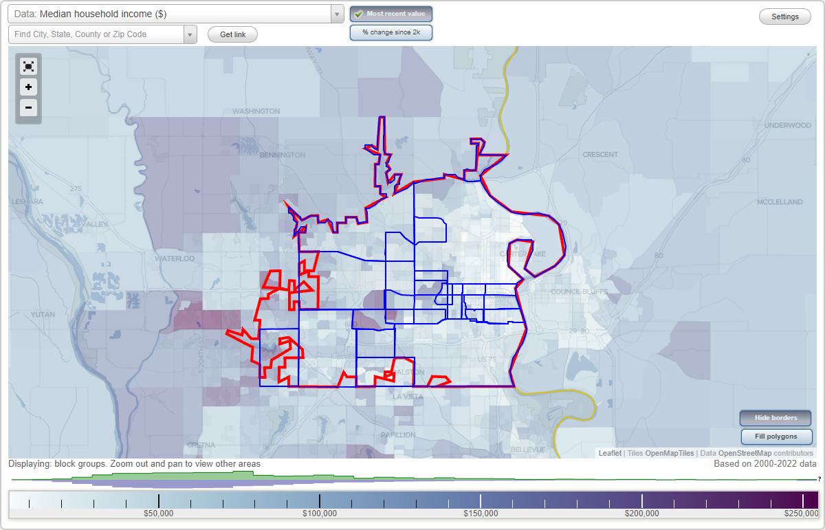
X

- City boundary
- Neighborhood boundaries
Business Search - 14 Million verified businesses
Neighborhoods:
Aksarben, Benson, Cathedral, Central, Downtown, Dundee, Fairacres, Field Club, Florence, Holy Cross, Keystone, Millard, Near South, North Omaha, Northwest Omaha, Old Market, Ralston, Rockbrook, South Central Omaha, Southeast Omaha, Southwest Omaha, West Omaha, WestsideAksarben neighborhood in Omaha statistics: (Find on map)
Area: 1.169 square miles
Population: 5,319
Population density:
Median household income in 2021:
Median rent in in 2021:
Male vs Females
Median age
Housing prices:
Average estimated value of detached houses in 2021 (71.8% of all units):
Average estimated value of townhouses or other attached units in 2021 (4.6% of all units):
Average estimated '21 value of housing units in 5-or-more-unit structures (18.3% of all units):
Most popular occupations of males: sales and office occupations (16.9%); service occupations (10.3%); management occupations (except farmers) (9.0%); computer and mathematical occupations (8.8%); construction, extraction, and maintenance occupations (8.0%); education, training, and library occupations (7.4%); business and financial operations occupations (7.1%)
Most popular occupations of females: sales and office occupations (23.9%); management occupations (except farmers) (16.5%); healthcare practitioners and technical occupations (13.4%); service occupations (8.9%); business and financial operations occupations (7.9%); education, training, and library occupations (6.5%); community and social services occupations (5.1%)
Roads and streets: Pacific St; Pine St; Poppleton Ave; Pierce St; Woolworth Ave; William St; Walnut St; Hickory St; Frances St; S 56th St; S 58th St; S 55th St; S 60th St; Center St (S 52nd St); S 63rd St; Cedar St; Shirley St; S 51st St; S 54th St; Ak-Sar-Ben Dr; S 62nd St; Center St; S 61st St; S 61st Ave; S 67th St; Briggs St; Dorcas St; S 55th Ave; S 64th Ave; S 66th St; S 52nd Ave; S 51st Ave; S 64th St; S 59th St; Askarben Entrance Rd; Marinda St; Dorcas Plz; S 62nd Ave; S 57th St; Mercy Rd.
Other features: Little Papillion Crk.
Aksarben neighborhood detailed profile
Area: 1.169 square miles
Population: 5,319
Population density:
| Aksarben: | 4,550 people per square mile |
| Omaha: | 4,212 people per square mile |
Median household income in 2021:
| Aksarben: | $68,955 |
| Omaha: | $62,948 |
Median rent in in 2021:
| Aksarben: | $952 |
| Omaha: | $855 |
Male vs Females
| Males: | 2,716 |
| Females: | 2,602 |
Median age
| Males: | 34.5 years |
| Females: | 39.1 years |
Housing prices:
Average estimated value of detached houses in 2021 (71.8% of all units):
| Aksarben: | $187,161 |
| Omaha: | $249,098 |
Average estimated value of townhouses or other attached units in 2021 (4.6% of all units):
| This neighborhood: | $156,138 |
| city: | $186,544 |
Average estimated '21 value of housing units in 5-or-more-unit structures (18.3% of all units):
| Aksarben: | $57,905 |
| Omaha: | $319,464 |
Most popular occupations of males: sales and office occupations (16.9%); service occupations (10.3%); management occupations (except farmers) (9.0%); computer and mathematical occupations (8.8%); construction, extraction, and maintenance occupations (8.0%); education, training, and library occupations (7.4%); business and financial operations occupations (7.1%)
Most popular occupations of females: sales and office occupations (23.9%); management occupations (except farmers) (16.5%); healthcare practitioners and technical occupations (13.4%); service occupations (8.9%); business and financial operations occupations (7.9%); education, training, and library occupations (6.5%); community and social services occupations (5.1%)
Roads and streets: Pacific St; Pine St; Poppleton Ave; Pierce St; Woolworth Ave; William St; Walnut St; Hickory St; Frances St; S 56th St; S 58th St; S 55th St; S 60th St; Center St (S 52nd St); S 63rd St; Cedar St; Shirley St; S 51st St; S 54th St; Ak-Sar-Ben Dr; S 62nd St; Center St; S 61st St; S 61st Ave; S 67th St; Briggs St; Dorcas St; S 55th Ave; S 64th Ave; S 66th St; S 52nd Ave; S 51st Ave; S 64th St; S 59th St; Askarben Entrance Rd; Marinda St; Dorcas Plz; S 62nd Ave; S 57th St; Mercy Rd.
Other features: Little Papillion Crk.
Aksarben neighborhood detailed profile
Benson neighborhood in Omaha statistics: (Find on map)
Area: 2.052 square miles
Population: 9,723
Population density:
Median household income in 2021:
Median rent in in 2021:
Male vs Females
Median age
Average estimated value of detached houses in 2021 (63.4% of all units):
Most popular occupations of males: production occupations (19.7%); service occupations (18.4%); sales and office occupations (18.0%); material moving occupations (8.7%); transportation occupations (5.9%); business and financial operations occupations (3.9%); construction, extraction, and maintenance occupations (3.9%)
Most popular occupations of females: service occupations (24.7%); sales and office occupations (22.4%); business and financial operations occupations (13.8%); production occupations (11.6%); management occupations (except farmers) (6.2%); healthcare practitioners and technical occupations (4.9%); education, training, and library occupations (3.6%)
Roads and streets: Hartman Ave; Ames Ave; Kansas Ave; Fowler Ave; Grand Ave; N 60th St; N 52nd St; N 56th St; Fort St; N 66th St; Ogden St; Camden Ave; N 60th Ave; N 54th St; Curtis Ave; Nebraska Ave; N 70th Plz; N 63rd St; Laurel Ave; N 68th St; Park View Ln (Parkview Ln); Crown Point Ave; Ville de Sante Dr; Ellison Ave; N 61st St; Larimore Ave; Jaynes St; Browne St; N 62nd St; N 65th St; N 64th St; Park Lane Dr; Himebaugh Ave; N 50th Ave; N 61st Ave; N 51st St; N 53rd St; Sorensen Pkwy; N 69th St; Benson Park Dr; Vernon Ave; N 57th Ave; N 55th St; 69th Ave; N 65th Ave; 66th St Exd (Ogden St); Ville de Sante Plz; Henninger Dr; N 71st St; N 58th St; Raymond Ave; N 60th Pl; N 54th Cir; Northampton Blvd; N 57th St; N 59th St; Norwick Dr; N 67th St; Arcadia Ave; Newport Ave; Cole Creek Park St; Vernon Plz; Redick Ave; N 50th Ave Cir.
Other features: Forest Lawn Crk; Cole Crk.
Benson neighborhood detailed profile
Area: 2.052 square miles
Population: 9,723
Population density:
| Benson: | 4,737 people per square mile |
| Omaha: | 4,212 people per square mile |
Median household income in 2021:
| Benson: | $45,783 |
| Omaha: | $62,948 |
Median rent in in 2021:
| Benson: | $745 |
| Omaha: | $855 |
Male vs Females
| Males: | 4,559 |
| Females: | 5,163 |
Median age
| Males: | 37.0 years |
| Females: | 38.5 years |
Average estimated value of detached houses in 2021 (63.4% of all units):
| Benson: | $118,148 |
| Omaha: | $249,098 |
Most popular occupations of males: production occupations (19.7%); service occupations (18.4%); sales and office occupations (18.0%); material moving occupations (8.7%); transportation occupations (5.9%); business and financial operations occupations (3.9%); construction, extraction, and maintenance occupations (3.9%)
Most popular occupations of females: service occupations (24.7%); sales and office occupations (22.4%); business and financial operations occupations (13.8%); production occupations (11.6%); management occupations (except farmers) (6.2%); healthcare practitioners and technical occupations (4.9%); education, training, and library occupations (3.6%)
Roads and streets: Hartman Ave; Ames Ave; Kansas Ave; Fowler Ave; Grand Ave; N 60th St; N 52nd St; N 56th St; Fort St; N 66th St; Ogden St; Camden Ave; N 60th Ave; N 54th St; Curtis Ave; Nebraska Ave; N 70th Plz; N 63rd St; Laurel Ave; N 68th St; Park View Ln (Parkview Ln); Crown Point Ave; Ville de Sante Dr; Ellison Ave; N 61st St; Larimore Ave; Jaynes St; Browne St; N 62nd St; N 65th St; N 64th St; Park Lane Dr; Himebaugh Ave; N 50th Ave; N 61st Ave; N 51st St; N 53rd St; Sorensen Pkwy; N 69th St; Benson Park Dr; Vernon Ave; N 57th Ave; N 55th St; 69th Ave; N 65th Ave; 66th St Exd (Ogden St); Ville de Sante Plz; Henninger Dr; N 71st St; N 58th St; Raymond Ave; N 60th Pl; N 54th Cir; Northampton Blvd; N 57th St; N 59th St; Norwick Dr; N 67th St; Arcadia Ave; Newport Ave; Cole Creek Park St; Vernon Plz; Redick Ave; N 50th Ave Cir.
Other features: Forest Lawn Crk; Cole Crk.
Benson neighborhood detailed profile
Cathedral neighborhood in Omaha statistics: (Find on map)
Area: 0.681 square miles
Population: 10,910
Population density:
Median household income in 2021:
Median rent in in 2021:
Male vs Females
Median age
Average estimated value of detached houses in 2021 (31.9% of all units):
Most popular occupations of males: service occupations (17.1%); construction, extraction, and maintenance occupations (11.9%); sales and office occupations (11.4%); management occupations (except farmers) (8.6%); education, training, and library occupations (8.3%); business and financial operations occupations (8.0%); production occupations (7.3%)
Most popular occupations of females: sales and office occupations (24.6%); service occupations (19.8%); education, training, and library occupations (11.1%); management occupations (except farmers) (9.1%); production occupations (8.0%); healthcare practitioners and technical occupations (7.2%); community and social services occupations (6.4%)
Limited-access highways (interstate or state) in this neighborhood: US Hwy 75 (I- 480).
Highways in this neighborhood: US Hwy 75 (North Fwy); N 30th St (State Hwy 64); Dodge St (US Hwy 6); Cuming St (State Hwy 64).
Roads and streets: Burt St; Cass St; California St; Davenport St; Webster St; Chicago St; N 36th St; N 40th St; N 38th St; N 41st St; N 33rd St; 64 (Cuming St); N 37th St; N 38th Ave; N 35th Ave; N 28th Ave; N 32nd St; Cottage Grove Ave; Webster Plz; N 39th St; Lincoln Blvd; Capitol Ave; N 34th St; N 36th Ave; N 35th St; N 31st St; Page St; N 27th Ave; Capital Ave; N 28th Plz; N 31st Ave; N 23rd St.
Cathedral neighborhood detailed profile
Area: 0.681 square miles
Population: 10,910
Population density:
| Cathedral: | 16,023 people per square mile |
| Omaha: | 4,212 people per square mile |
Median household income in 2021:
| Cathedral: | $47,073 |
| Omaha: | $62,948 |
Median rent in in 2021:
| Cathedral: | $811 |
| Omaha: | $855 |
Male vs Females
| Males: | 5,100 |
| Females: | 5,810 |
Median age
| Males: | 29.8 years |
| Females: | 34.0 years |
Average estimated value of detached houses in 2021 (31.9% of all units):
| Cathedral: | $132,950 |
| Omaha: | $249,098 |
Most popular occupations of males: service occupations (17.1%); construction, extraction, and maintenance occupations (11.9%); sales and office occupations (11.4%); management occupations (except farmers) (8.6%); education, training, and library occupations (8.3%); business and financial operations occupations (8.0%); production occupations (7.3%)
Most popular occupations of females: sales and office occupations (24.6%); service occupations (19.8%); education, training, and library occupations (11.1%); management occupations (except farmers) (9.1%); production occupations (8.0%); healthcare practitioners and technical occupations (7.2%); community and social services occupations (6.4%)
Limited-access highways (interstate or state) in this neighborhood: US Hwy 75 (I- 480).
Highways in this neighborhood: US Hwy 75 (North Fwy); N 30th St (State Hwy 64); Dodge St (US Hwy 6); Cuming St (State Hwy 64).
Roads and streets: Burt St; Cass St; California St; Davenport St; Webster St; Chicago St; N 36th St; N 40th St; N 38th St; N 41st St; N 33rd St; 64 (Cuming St); N 37th St; N 38th Ave; N 35th Ave; N 28th Ave; N 32nd St; Cottage Grove Ave; Webster Plz; N 39th St; Lincoln Blvd; Capitol Ave; N 34th St; N 36th Ave; N 35th St; N 31st St; Page St; N 27th Ave; Capital Ave; N 28th Plz; N 31st Ave; N 23rd St.
Cathedral neighborhood detailed profile
Central neighborhood in Omaha statistics: (Find on map)
Area: 9.958 square miles
Population: 43,002
Population density:
Median household income in 2021:
Median rent in in 2021:
Male vs Females
Median age
Housing prices:
Average estimated value of detached houses in 2021 (63.8% of all units):
Average estimated value of townhouses or other attached units in 2021 (6.0% of all units):
Average estimated '21 value of housing units in 5-or-more-unit structures (12.0% of all units):
Most popular occupations of males: sales and office occupations (14.5%); service occupations (13.0%); management occupations (except farmers) (11.9%); computer and mathematical occupations (8.0%); construction, extraction, and maintenance occupations (6.6%); business and financial operations occupations (6.3%); healthcare practitioners and technical occupations (5.7%)
Most popular occupations of females: sales and office occupations (23.3%); service occupations (15.7%); healthcare practitioners and technical occupations (13.6%); management occupations (except farmers) (10.8%); education, training, and library occupations (10.6%); business and financial operations occupations (8.0%); computer and mathematical occupations (3.9%)
Highways in this neighborhood: W Dodge Rd (US Hwy 6).
Roads and streets: Pacific St; Dodge St; Woolworth Ave; Hickory St; Burt St; Cass St; Poppleton Ave; Pine St; Underwood Ave; Leavenworth St; Farnam St; Elmwood Park Rd; Howard St; Pierce St; Walnut St; William St; Webster St; Chicago St; Davenport St; California St; Western Ave; Holy Sepulchre Cemetery Rd; Blondo St; Mason St; Center St; Izard St; Shirley St; N 72nd St; Cemetery Rd; Harney St; Mayberry St; Cedar St; Jones St; Seward St; S Saddle Creek Rd; Cuming St; Jackson St; S 55th St; S 72nd St; Center St (S 52nd St); Douglas St; S 84th St; Lake St; S 78th St; S 51st St; S 48th St; S 50th St; S 42nd St; Marcy St; N 85th St; Capitol Ave; N 75th St; S 56th St; N Happy Hollow Blvd; Ridgewood Ave; Nicholas St; S 58th St; N 78th St; S 88th St; N 87th St; Grant St; N 84th St; Dorcas St; Frances St; Loveland Dr; S 67th St; N 76th St; S 45th St; S 54th St; S 75th St; N 83rd St; S 76th St; S 60th St; Miami St; S 44th St; Hamilton St; S 89th St; Elmwood Park Dr; S 87th St; Parker St; S 49th St; N 73rd St; Cole Creek Dr; S 68th St; S 51st Ave; Emile St; S 69th St; S 50th Ave; S 63rd St; N 52nd St; Broadmoor Dr; Beverly Dr; Glenwood Rd; N 69nd St (N 69th St); N 66th St (N Elmwood Rd); S 80th St; S 85th Ave; N 88th St; University Drive Rd N; N 51st St; Farnam Dr; Jones Plz; S 85th St; Hillside Dr; Charles St; Lafayette Ave; J E George Blvd; Decatur St; N 81st St; S 57th St; University Drive Rd S; N 74th St; S 46th Ave; Benson Gardens Blvd; Bowie Dr; S 86th St; Wakeley St; Twin Ridge Blvd; Shamrock Rd; Dewey Ave; N Saddle Creek Rd; Mayfield Ave; Indian Hls Dr; N 77th Ave; Robert H Storz Dr; S 43rd St; Robertson Dr; N 48th St; S 70th St; S 68th Ave; S 61st Ave; S 61st St; S 62nd St; N 50th St; S Happy Hollow Blvd; N 49th St; Franklin St; Maenner Dr; N 74th Ave; Corby St; S 67th Ave; S 79th St; N 43rd St; N 44th St; S 49th Ave; N 58th St; Ak-Sar-Ben Dr; Fairacres Rd (N 64th St); N 56th St; Briggs St; Frontage Rd; Parkwood Ln; Dillon Dr; University of Neb at Omaha Rd; Rees St; N 62nd St; S 53rd St; S 76th Ave; Hackberry Rd (N 68th St); S 59th St; N 57th Ave; Miami Plz; S 74th St; Davis Cir; N 47th St; N 75th Ave; N 46th St; Richmond Dr; Fairwood Ln; Barker Ave; Brentwood Rd; N 41st Ave; Morton St; S 46th St; S 77th St; N 88th Plz; N 57th St; N 61st St; S 83rd St; Windsor Dr; Fairacres Rd; S 66th St; N 86th St; S 80th Ave; Capitol Ct; Sunset Trl; N 79th St; S 87th Ave; N 54th St; Happy Hollow Blvd; N 72nd Ave; N 77th St; Jones Cir; N 70th Ct; S 70th Ave; S 55th Ave; N 55th St; S 64th Ave; Prairie Ave; N 89th Plz; Poppleton Plz; Sherman Dr; N 59th St; S 70th Plz; S 74th Plz; N 80th St; N 42nd St; Leavenworth Plz; Pine Cir; S 71st St; N 89th St; Schuyler Dr; Walnut Cir; 75th St; Springfield Dr; Pierce Plz; S 73rd St; S 86th Ave; W Benson Trlr Prk Rd; Blondo Dr; Erskine St; N 63rd St; N 77th Cir; S 82nd St; Parker Ct; Pierce Cir; Post Dr; S 52nd Ave; S 64th St; Izard Cir; Marbee Dr; S 87th Cir; Burdette St; Martha St; Countryside Plz; N 78th Ave; S 78th Ave; Webster Plz; N 60th St; N 53rd St; Woolworth Plz; N 67th St; Jackson Plz; S 81st St; Cole Creek Cir; Page St; Westover Rd; N 43rd Ave; Corby Cir; Park Rd; N 70th Ave; S 43rd Ave; N 89th Cir; N 65th Ave; Wakeley Plz; Askarben Entrance Rd; University Drive Rd W; Dewey Ct; Chicago Ct; Edgevale Pl; N 88th Ave; N 65th St; Ohio St; Chicago Plz; Capitol Plz; William Plz; Marinda St; S 86th Cir; Dorcas Plz; N 85th Ave; Cuming Cir; Shirley Cir (Shirley St); S 62nd Ave; Hickory Cir; N 67th Cir; S 75th Plz; S 48th Ave; N 81st Ct; N 67th Ave; Nicholas Cir; Joneswalk; N 74th Cir; S 79th Ave; Mercy Rd; S 83rd Cir; Nicholas Cir Park (Nicholas Cir); California Plz; N 84th Ave; Davenport Plz; Dewey Cir.
Other features: Little Papillion Crk; Elmwood Crk.
Central neighborhood detailed profile
Area: 9.958 square miles
Population: 43,002
Population density:
| Central (Midtown): | 4,318 people per square mile |
| Omaha: | 4,212 people per square mile |
Median household income in 2021:
| Central (Midtown): | $78,067 |
| Omaha: | $62,948 |
Median rent in in 2021:
| Central (Midtown): | $879 |
| Omaha: | $855 |
Male vs Females
| Males: | 21,448 |
| Females: | 21,554 |
Median age
| Males: | 35.8 years |
| Females: | 37.2 years |
Housing prices:
Average estimated value of detached houses in 2021 (63.8% of all units):
| Central (Midtown): | $239,696 |
| Omaha: | $249,098 |
Average estimated value of townhouses or other attached units in 2021 (6.0% of all units):
| This neighborhood: | $636,000 |
| city: | $186,544 |
Average estimated '21 value of housing units in 5-or-more-unit structures (12.0% of all units):
| Central (Midtown): | $75,113 |
| Omaha: | $319,464 |
Most popular occupations of males: sales and office occupations (14.5%); service occupations (13.0%); management occupations (except farmers) (11.9%); computer and mathematical occupations (8.0%); construction, extraction, and maintenance occupations (6.6%); business and financial operations occupations (6.3%); healthcare practitioners and technical occupations (5.7%)
Most popular occupations of females: sales and office occupations (23.3%); service occupations (15.7%); healthcare practitioners and technical occupations (13.6%); management occupations (except farmers) (10.8%); education, training, and library occupations (10.6%); business and financial operations occupations (8.0%); computer and mathematical occupations (3.9%)
Highways in this neighborhood: W Dodge Rd (US Hwy 6).
Roads and streets: Pacific St; Dodge St; Woolworth Ave; Hickory St; Burt St; Cass St; Poppleton Ave; Pine St; Underwood Ave; Leavenworth St; Farnam St; Elmwood Park Rd; Howard St; Pierce St; Walnut St; William St; Webster St; Chicago St; Davenport St; California St; Western Ave; Holy Sepulchre Cemetery Rd; Blondo St; Mason St; Center St; Izard St; Shirley St; N 72nd St; Cemetery Rd; Harney St; Mayberry St; Cedar St; Jones St; Seward St; S Saddle Creek Rd; Cuming St; Jackson St; S 55th St; S 72nd St; Center St (S 52nd St); Douglas St; S 84th St; Lake St; S 78th St; S 51st St; S 48th St; S 50th St; S 42nd St; Marcy St; N 85th St; Capitol Ave; N 75th St; S 56th St; N Happy Hollow Blvd; Ridgewood Ave; Nicholas St; S 58th St; N 78th St; S 88th St; N 87th St; Grant St; N 84th St; Dorcas St; Frances St; Loveland Dr; S 67th St; N 76th St; S 45th St; S 54th St; S 75th St; N 83rd St; S 76th St; S 60th St; Miami St; S 44th St; Hamilton St; S 89th St; Elmwood Park Dr; S 87th St; Parker St; S 49th St; N 73rd St; Cole Creek Dr; S 68th St; S 51st Ave; Emile St; S 69th St; S 50th Ave; S 63rd St; N 52nd St; Broadmoor Dr; Beverly Dr; Glenwood Rd; N 69nd St (N 69th St); N 66th St (N Elmwood Rd); S 80th St; S 85th Ave; N 88th St; University Drive Rd N; N 51st St; Farnam Dr; Jones Plz; S 85th St; Hillside Dr; Charles St; Lafayette Ave; J E George Blvd; Decatur St; N 81st St; S 57th St; University Drive Rd S; N 74th St; S 46th Ave; Benson Gardens Blvd; Bowie Dr; S 86th St; Wakeley St; Twin Ridge Blvd; Shamrock Rd; Dewey Ave; N Saddle Creek Rd; Mayfield Ave; Indian Hls Dr; N 77th Ave; Robert H Storz Dr; S 43rd St; Robertson Dr; N 48th St; S 70th St; S 68th Ave; S 61st Ave; S 61st St; S 62nd St; N 50th St; S Happy Hollow Blvd; N 49th St; Franklin St; Maenner Dr; N 74th Ave; Corby St; S 67th Ave; S 79th St; N 43rd St; N 44th St; S 49th Ave; N 58th St; Ak-Sar-Ben Dr; Fairacres Rd (N 64th St); N 56th St; Briggs St; Frontage Rd; Parkwood Ln; Dillon Dr; University of Neb at Omaha Rd; Rees St; N 62nd St; S 53rd St; S 76th Ave; Hackberry Rd (N 68th St); S 59th St; N 57th Ave; Miami Plz; S 74th St; Davis Cir; N 47th St; N 75th Ave; N 46th St; Richmond Dr; Fairwood Ln; Barker Ave; Brentwood Rd; N 41st Ave; Morton St; S 46th St; S 77th St; N 88th Plz; N 57th St; N 61st St; S 83rd St; Windsor Dr; Fairacres Rd; S 66th St; N 86th St; S 80th Ave; Capitol Ct; Sunset Trl; N 79th St; S 87th Ave; N 54th St; Happy Hollow Blvd; N 72nd Ave; N 77th St; Jones Cir; N 70th Ct; S 70th Ave; S 55th Ave; N 55th St; S 64th Ave; Prairie Ave; N 89th Plz; Poppleton Plz; Sherman Dr; N 59th St; S 70th Plz; S 74th Plz; N 80th St; N 42nd St; Leavenworth Plz; Pine Cir; S 71st St; N 89th St; Schuyler Dr; Walnut Cir; 75th St; Springfield Dr; Pierce Plz; S 73rd St; S 86th Ave; W Benson Trlr Prk Rd; Blondo Dr; Erskine St; N 63rd St; N 77th Cir; S 82nd St; Parker Ct; Pierce Cir; Post Dr; S 52nd Ave; S 64th St; Izard Cir; Marbee Dr; S 87th Cir; Burdette St; Martha St; Countryside Plz; N 78th Ave; S 78th Ave; Webster Plz; N 60th St; N 53rd St; Woolworth Plz; N 67th St; Jackson Plz; S 81st St; Cole Creek Cir; Page St; Westover Rd; N 43rd Ave; Corby Cir; Park Rd; N 70th Ave; S 43rd Ave; N 89th Cir; N 65th Ave; Wakeley Plz; Askarben Entrance Rd; University Drive Rd W; Dewey Ct; Chicago Ct; Edgevale Pl; N 88th Ave; N 65th St; Ohio St; Chicago Plz; Capitol Plz; William Plz; Marinda St; S 86th Cir; Dorcas Plz; N 85th Ave; Cuming Cir; Shirley Cir (Shirley St); S 62nd Ave; Hickory Cir; N 67th Cir; S 75th Plz; S 48th Ave; N 81st Ct; N 67th Ave; Nicholas Cir; Joneswalk; N 74th Cir; S 79th Ave; Mercy Rd; S 83rd Cir; Nicholas Cir Park (Nicholas Cir); California Plz; N 84th Ave; Davenport Plz; Dewey Cir.
Other features: Little Papillion Crk; Elmwood Crk.
Central neighborhood detailed profile
Downtown neighborhood in Omaha statistics: (Find on map)
Area: 5.871 square miles
Population: 34,108
Population density:
Median household income in 2021:
Median rent in in 2021:
Male vs Females
Median age
Housing prices:
Average estimated value of detached houses in 2021 (35.9% of all units):
Average estimated value of townhouses or other attached units in 2021 (13.6% of all units):
Average estimated '21 value of housing units in 5-or-more-unit structures (38.4% of all units):
Most popular occupations of males: service occupations (15.1%); sales and office occupations (12.5%); construction, extraction, and maintenance occupations (10.7%); production occupations (8.7%); management occupations (except farmers) (8.2%); business and financial operations occupations (7.1%); material moving occupations (7.1%)
Most popular occupations of females: sales and office occupations (24.3%); service occupations (20.4%); healthcare practitioners and technical occupations (10.1%); education, training, and library occupations (8.4%); management occupations (except farmers) (7.4%); production occupations (6.2%); business and financial operations occupations (4.8%)
Limited-access highways (interstate or state) in this neighborhood: US Hwy 75 (I- 480).
Highways in this neighborhood: Dodge St (US Hwy 6); North Fwy (US Hwy 75); N 30th St (State Hwy 64).
Roads and streets: Leavenworth St; Farnam St; Harney St; Pacific St; Woolworth Ave; Hickory St; Douglas St; Burt St; Cass St; Mason St; Center St; Davenport St; Jones St; California St; Jackson St; Webster St; Poppleton Ave; Pierce St; Dewey Ave; Howard St; Marcy St; Chicago St; S 20th St; S 16th St; S 14th St; S 10th St; S 13th St; S 28th St; Saint Marys Ave (St Marys Ave); Capitol Ave; Park Ave; S 27th St; S 33rd St; Martha St; William St; S 24th St; S 15th St; S 29th St; S 11th St; S 36th St; Dorcas St; Turner Blvd; S 35th St; S 17th St; S 26th St; S 12th St; S 19th St; Pine St; S 25th Ave; S 35th Ave; S 18th St; S 31st St; S 40th St; S 41st St; S 22nd St; S 7th St; S 25th St; S 9th St; S 37th St; S 38th Ave; S 38th St; S 8th St; S 6th St; Conagra Dr; 64 (Cuming St); S 30th St; S 32nd Ave; Cuming St; S 34th St; S 21st St; S 4th St; Hanscom Park Dr; Cedar St; N 17th St; N 14th St; N 24th St; N 36th St; N 16th St; N 19th St; N 20th St; N 15th St; Abbott Dr; N 33rd St; N 40th St; S 5th St; N 38th St; N 41st St; California Plz; N 10th St; W Hanscom Park Dr; N 13th St; N 23rd St; Frances St; S 2nd St; N 12th St; S 39th St; Walnut St; S 30th Ave; S 31st Ave; N 21st St; N 18th St; S 26th Ave; S 24th Ave; N 22nd St; Power Cir; N 34th St; S 32nd St; S 19th Ave; N 37th St; N 38th Ave; Lincoln Blvd; N 35th Ave; N 35th St; N 28th Ave; N 31st St; S 23rd St; Riverfront Rd; Rees St; N 32nd St; Nemitz Dr; Webster Plz; S 3rd St; Cottage Grove Ave; N 39th St; Forest Ave; N 11th St; N 31st Ave; County Hospital Dr; Shirley St; Briggs St; Worthington St (Worthington Ave); Landon Ct; Park Wild Ave; N 36th Ave; Eisenhower Dr; S 17th Ave; N 32nd Ave; S 27th Ave; Leavenworth Ct; Hillcrest Ct; Harris St; Ed Creighton Ave; S 21st Ave; Puller Dr; S 29th Cir; Waesche Dr; Emile St; S 37th Ave; Mitchell Plz; Page St; Florence Blvd; N 27th Ave; Capital Ave; N 25th Ave; S 3rd Plz; N 28th Plz; N 9th St; 13th St; 25th St (S 25th Ave); S 15th Cir; S 36th Ct; N 8th St; Paxton Ct; Dewey Plz.
Railroad features: Union Pacific RR; Burlington Northern Santa Fe Rlwy.
Other features: Missouri River Levee; Burt St Outfall.
Downtown neighborhood detailed profile
Area: 5.871 square miles
Population: 34,108
Population density:
| Downtown: | 5,810 people per square mile |
| Omaha: | 4,212 people per square mile |
Median household income in 2021:
| Downtown: | $48,362 |
| Omaha: | $62,948 |
Median rent in in 2021:
| Downtown: | $818 |
| Omaha: | $855 |
Male vs Females
| Males: | 17,406 |
| Females: | 16,701 |
Median age
| Males: | 34.0 years |
| Females: | 33.3 years |
Housing prices:
Average estimated value of detached houses in 2021 (35.9% of all units):
| Downtown: | $166,424 |
| Omaha: | $249,098 |
Average estimated value of townhouses or other attached units in 2021 (13.6% of all units):
| This neighborhood: | $333,426 |
| city: | $186,544 |
Average estimated '21 value of housing units in 5-or-more-unit structures (38.4% of all units):
| Downtown: | $327,306 |
| Omaha: | $319,464 |
Most popular occupations of males: service occupations (15.1%); sales and office occupations (12.5%); construction, extraction, and maintenance occupations (10.7%); production occupations (8.7%); management occupations (except farmers) (8.2%); business and financial operations occupations (7.1%); material moving occupations (7.1%)
Most popular occupations of females: sales and office occupations (24.3%); service occupations (20.4%); healthcare practitioners and technical occupations (10.1%); education, training, and library occupations (8.4%); management occupations (except farmers) (7.4%); production occupations (6.2%); business and financial operations occupations (4.8%)
Limited-access highways (interstate or state) in this neighborhood: US Hwy 75 (I- 480).
Highways in this neighborhood: Dodge St (US Hwy 6); North Fwy (US Hwy 75); N 30th St (State Hwy 64).
Roads and streets: Leavenworth St; Farnam St; Harney St; Pacific St; Woolworth Ave; Hickory St; Douglas St; Burt St; Cass St; Mason St; Center St; Davenport St; Jones St; California St; Jackson St; Webster St; Poppleton Ave; Pierce St; Dewey Ave; Howard St; Marcy St; Chicago St; S 20th St; S 16th St; S 14th St; S 10th St; S 13th St; S 28th St; Saint Marys Ave (St Marys Ave); Capitol Ave; Park Ave; S 27th St; S 33rd St; Martha St; William St; S 24th St; S 15th St; S 29th St; S 11th St; S 36th St; Dorcas St; Turner Blvd; S 35th St; S 17th St; S 26th St; S 12th St; S 19th St; Pine St; S 25th Ave; S 35th Ave; S 18th St; S 31st St; S 40th St; S 41st St; S 22nd St; S 7th St; S 25th St; S 9th St; S 37th St; S 38th Ave; S 38th St; S 8th St; S 6th St; Conagra Dr; 64 (Cuming St); S 30th St; S 32nd Ave; Cuming St; S 34th St; S 21st St; S 4th St; Hanscom Park Dr; Cedar St; N 17th St; N 14th St; N 24th St; N 36th St; N 16th St; N 19th St; N 20th St; N 15th St; Abbott Dr; N 33rd St; N 40th St; S 5th St; N 38th St; N 41st St; California Plz; N 10th St; W Hanscom Park Dr; N 13th St; N 23rd St; Frances St; S 2nd St; N 12th St; S 39th St; Walnut St; S 30th Ave; S 31st Ave; N 21st St; N 18th St; S 26th Ave; S 24th Ave; N 22nd St; Power Cir; N 34th St; S 32nd St; S 19th Ave; N 37th St; N 38th Ave; Lincoln Blvd; N 35th Ave; N 35th St; N 28th Ave; N 31st St; S 23rd St; Riverfront Rd; Rees St; N 32nd St; Nemitz Dr; Webster Plz; S 3rd St; Cottage Grove Ave; N 39th St; Forest Ave; N 11th St; N 31st Ave; County Hospital Dr; Shirley St; Briggs St; Worthington St (Worthington Ave); Landon Ct; Park Wild Ave; N 36th Ave; Eisenhower Dr; S 17th Ave; N 32nd Ave; S 27th Ave; Leavenworth Ct; Hillcrest Ct; Harris St; Ed Creighton Ave; S 21st Ave; Puller Dr; S 29th Cir; Waesche Dr; Emile St; S 37th Ave; Mitchell Plz; Page St; Florence Blvd; N 27th Ave; Capital Ave; N 25th Ave; S 3rd Plz; N 28th Plz; N 9th St; 13th St; 25th St (S 25th Ave); S 15th Cir; S 36th Ct; N 8th St; Paxton Ct; Dewey Plz.
Railroad features: Union Pacific RR; Burlington Northern Santa Fe Rlwy.
Other features: Missouri River Levee; Burt St Outfall.
Downtown neighborhood detailed profile
Dundee neighborhood in Omaha statistics: (Find on map)
Area: 0.786 square miles
Population: 5,608
Population density:
Median household income in 2021:
Median rent in in 2021:
Male vs Females
Median age
Average estimated value of detached houses in 2021 (41.1% of all units):
Most popular occupations of males: sales and office occupations (13.1%); education, training, and library occupations (9.9%); computer and mathematical occupations (9.6%); service occupations (9.6%); architecture and engineering occupations (9.0%); construction, extraction, and maintenance occupations (7.9%); arts, design, entertainment, sports, and media occupations (6.1%)
Most popular occupations of females: sales and office occupations (19.8%); healthcare practitioners and technical occupations (14.3%); management occupations (except farmers) (13.7%); service occupations (13.1%); education, training, and library occupations (10.6%); computer and mathematical occupations (10.2%); business and financial operations occupations (8.9%)
Highways in this neighborhood: US Hwy 6 (Dodge St).
Roads and streets: Holy Sepulchre Cemetery Rd; Howard St; Farnam St; Davenport St; Chicago St; Jackson St; Capitol Ave; Burt St; Webster St; Underwood Ave; California St; Cass St; N 50th St; N 52nd St; N 51st St; N 48th St; N 49th St; S 52nd St; S 51st Ave; S 55th St; S 56th St; S 53rd St; S 51st St; S 50th Ave; Cuming St; Harney St; Jones St; N 54th St; S 54th St; S 50th St; S 49th Ave; S 49th St; S 48th St; Douglas St; N 55th St; N 53rd St; Emile St; S 57th St; N 50th Ave; S 48th Ave.
Dundee neighborhood detailed profile
Area: 0.786 square miles
Population: 5,608
Population density:
| Dundee: | 7,138 people per square mile |
| Omaha: | 4,212 people per square mile |
Median household income in 2021:
| Dundee: | $90,969 |
| Omaha: | $62,948 |
Median rent in in 2021:
| Dundee: | $772 |
| Omaha: | $855 |
Male vs Females
| Males: | 2,832 |
| Females: | 2,776 |
Median age
| Males: | 37.4 years |
| Females: | 37.4 years |
Average estimated value of detached houses in 2021 (41.1% of all units):
| Dundee: | $265,754 |
| Omaha: | $249,098 |
Most popular occupations of males: sales and office occupations (13.1%); education, training, and library occupations (9.9%); computer and mathematical occupations (9.6%); service occupations (9.6%); architecture and engineering occupations (9.0%); construction, extraction, and maintenance occupations (7.9%); arts, design, entertainment, sports, and media occupations (6.1%)
Most popular occupations of females: sales and office occupations (19.8%); healthcare practitioners and technical occupations (14.3%); management occupations (except farmers) (13.7%); service occupations (13.1%); education, training, and library occupations (10.6%); computer and mathematical occupations (10.2%); business and financial operations occupations (8.9%)
Highways in this neighborhood: US Hwy 6 (Dodge St).
Roads and streets: Holy Sepulchre Cemetery Rd; Howard St; Farnam St; Davenport St; Chicago St; Jackson St; Capitol Ave; Burt St; Webster St; Underwood Ave; California St; Cass St; N 50th St; N 52nd St; N 51st St; N 48th St; N 49th St; S 52nd St; S 51st Ave; S 55th St; S 56th St; S 53rd St; S 51st St; S 50th Ave; Cuming St; Harney St; Jones St; N 54th St; S 54th St; S 50th St; S 49th Ave; S 49th St; S 48th St; Douglas St; N 55th St; N 53rd St; Emile St; S 57th St; N 50th Ave; S 48th Ave.
Dundee neighborhood detailed profile
Fairacres neighborhood in Omaha statistics: (Find on map)
Area: 2.156 square miles
Population: 14,142
Population density:
Median household income in 2021:
Median rent in in 2021:
Male vs Females
Median age
Average estimated value of detached houses in 2021 (79.7% of all units):
Most popular occupations of males: sales and office occupations (15.6%); service occupations (14.7%); management occupations (except farmers) (12.4%); computer and mathematical occupations (7.2%); business and financial operations occupations (6.7%); construction, extraction, and maintenance occupations (6.2%); architecture and engineering occupations (6.1%)
Most popular occupations of females: healthcare practitioners and technical occupations (23.5%); sales and office occupations (18.6%); service occupations (18.5%); education, training, and library occupations (12.0%); management occupations (except farmers) (7.4%); business and financial operations occupations (4.3%); legal occupations (4.0%)
Highways in this neighborhood: Dodge St (US Hwy 6).
Roads and streets: Hamilton St; Western Ave; Underwood Ave; Charles St; Lafayette Ave; Seward St; Decatur St; N Happy Hollow Blvd; Franklin St; Parker St; N 66th St (N Elmwood Rd); Cuming St; N 51st St; N 52nd St; N 50th St; Burt St; N 69nd St (N 69th St); Chicago St; Davenport St; Webster St; N 56th St; N 58th St; Nicholas St; N 63rd St; Izard St; Glenwood Rd; N 61st St; J E George Blvd; Cass St; N 54th St; Hackberry Rd (N 68th St); N 64th St; N 60th St; California St; Robert H Storz Dr; Mayfield Ave; N 65th St; N 70th Ave; Dillon Dr; N 53rd St; N 57th Ave; Parkwood Ln; N 62nd St; N 50th Ave; N 57th St; Fairwood Ln; Capitol Ave; Sunset Trl; N 55th St; Fairacres Rd; N 70th Ct; Prairie Ave; Country Club Ave; N 59th St; Hillcrest Dr; N 67th Ave; N 67th St; Park Rd; N 65th Ave; Capitol Plz; N 67th Cir; Caldwell St; Nicholas Cir Park (Nicholas Cir); Davenport Plz; Lafayette Ct; N 69th St.
Fairacres neighborhood detailed profile
Area: 2.156 square miles
Population: 14,142
Population density:
| Fairacres (Memorial Park): | 6,559 people per square mile |
| Omaha: | 4,212 people per square mile |
Median household income in 2021:
| Fairacres (Memorial Park): | $95,512 |
| Omaha: | $62,948 |
Median rent in in 2021:
| Fairacres (Memorial Park): | $834 |
| Omaha: | $855 |
Male vs Females
| Males: | 7,490 |
| Females: | 6,652 |
Median age
| Males: | 36.1 years |
| Females: | 36.4 years |
Average estimated value of detached houses in 2021 (79.7% of all units):
| Fairacres (Memorial Park): | $275,825 |
| Omaha: | $249,098 |
Most popular occupations of males: sales and office occupations (15.6%); service occupations (14.7%); management occupations (except farmers) (12.4%); computer and mathematical occupations (7.2%); business and financial operations occupations (6.7%); construction, extraction, and maintenance occupations (6.2%); architecture and engineering occupations (6.1%)
Most popular occupations of females: healthcare practitioners and technical occupations (23.5%); sales and office occupations (18.6%); service occupations (18.5%); education, training, and library occupations (12.0%); management occupations (except farmers) (7.4%); business and financial operations occupations (4.3%); legal occupations (4.0%)
Highways in this neighborhood: Dodge St (US Hwy 6).
Roads and streets: Hamilton St; Western Ave; Underwood Ave; Charles St; Lafayette Ave; Seward St; Decatur St; N Happy Hollow Blvd; Franklin St; Parker St; N 66th St (N Elmwood Rd); Cuming St; N 51st St; N 52nd St; N 50th St; Burt St; N 69nd St (N 69th St); Chicago St; Davenport St; Webster St; N 56th St; N 58th St; Nicholas St; N 63rd St; Izard St; Glenwood Rd; N 61st St; J E George Blvd; Cass St; N 54th St; Hackberry Rd (N 68th St); N 64th St; N 60th St; California St; Robert H Storz Dr; Mayfield Ave; N 65th St; N 70th Ave; Dillon Dr; N 53rd St; N 57th Ave; Parkwood Ln; N 62nd St; N 50th Ave; N 57th St; Fairwood Ln; Capitol Ave; Sunset Trl; N 55th St; Fairacres Rd; N 70th Ct; Prairie Ave; Country Club Ave; N 59th St; Hillcrest Dr; N 67th Ave; N 67th St; Park Rd; N 65th Ave; Capitol Plz; N 67th Cir; Caldwell St; Nicholas Cir Park (Nicholas Cir); Davenport Plz; Lafayette Ct; N 69th St.
Fairacres neighborhood detailed profile
Field Club neighborhood in Omaha statistics: (Find on map)
Area: 0.526 square miles
Population: 3,296
Population density:
Median household income in 2021:
Median rent in in 2021:
Male vs Females
Median age
Housing prices:
Average estimated value of detached houses in 2021 (47.7% of all units):
Average estimated value of townhouses or other attached units in 2021 (10.7% of all units):
Most popular occupations of males: service occupations (25.5%); production occupations (17.2%); material moving occupations (6.6%); sales and office occupations (6.3%); education, training, and library occupations (6.2%); management occupations (except farmers) (6.1%); transportation occupations (5.1%)
Most popular occupations of females: sales and office occupations (29.5%); service occupations (20.5%); management occupations (except farmers) (12.3%); education, training, and library occupations (8.7%); legal occupations (6.7%); healthcare practitioners and technical occupations (4.6%); business and financial operations occupations (3.6%)
Limited-access highways (interstate or state) in this neighborhood: I- 480 (US Hwy 75).
Roads and streets: Woolworth Ave; Pacific St; Poppleton Ave; Hanscom Park Dr; Park Ave; Hickory St; S 33rd St; S 36th St; W Hanscom Park Dr; S 29th St; S 32nd Ave; S 35th St; Walnut St; Pine St; Turner Blvd; S 35th Ave; S 32nd St; S 31st St; S 30th Ave; Shirley St; Harris St; S 29th Cir.
Field Club neighborhood detailed profile
Area: 0.526 square miles
Population: 3,296
Population density:
| Field Club: | 6,269 people per square mile |
| Omaha: | 4,212 people per square mile |
Median household income in 2021:
| Field Club: | $51,342 |
| Omaha: | $62,948 |
Median rent in in 2021:
| Field Club: | $670 |
| Omaha: | $855 |
Male vs Females
| Males: | 1,614 |
| Females: | 1,681 |
Median age
| Males: | 36.6 years |
| Females: | 34.3 years |
Housing prices:
Average estimated value of detached houses in 2021 (47.7% of all units):
| Field Club: | $207,695 |
| Omaha: | $249,098 |
Average estimated value of townhouses or other attached units in 2021 (10.7% of all units):
| This neighborhood: | $265,000 |
| city: | $186,544 |
Most popular occupations of males: service occupations (25.5%); production occupations (17.2%); material moving occupations (6.6%); sales and office occupations (6.3%); education, training, and library occupations (6.2%); management occupations (except farmers) (6.1%); transportation occupations (5.1%)
Most popular occupations of females: sales and office occupations (29.5%); service occupations (20.5%); management occupations (except farmers) (12.3%); education, training, and library occupations (8.7%); legal occupations (6.7%); healthcare practitioners and technical occupations (4.6%); business and financial operations occupations (3.6%)
Limited-access highways (interstate or state) in this neighborhood: I- 480 (US Hwy 75).
Roads and streets: Woolworth Ave; Pacific St; Poppleton Ave; Hanscom Park Dr; Park Ave; Hickory St; S 33rd St; S 36th St; W Hanscom Park Dr; S 29th St; S 32nd Ave; S 35th St; Walnut St; Pine St; Turner Blvd; S 35th Ave; S 32nd St; S 31st St; S 30th Ave; Shirley St; Harris St; S 29th Cir.
Field Club neighborhood detailed profile
Florence neighborhood in Omaha statistics: (Find on map)
Area: 1.692 square miles
Population: 854
Population density:
Median household income in 2021:
Median rent in in 2021:
Male vs Females
Median age
Average estimated value of detached houses in 2021 (100.0% of all units):
Most popular occupations of males: management occupations (except farmers) (17.5%); service occupations (17.3%); construction, extraction, and maintenance occupations (10.6%); transportation occupations (8.5%); architecture and engineering occupations (7.0%); healthcare practitioners and technical occupations (6.9%); computer and mathematical occupations (6.3%)
Most popular occupations of females: sales and office occupations (39.5%); healthcare practitioners and technical occupations (14.1%); management occupations (except farmers) (10.2%); service occupations (9.1%); education, training, and library occupations (8.8%); community and social services occupations (6.5%); business and financial operations occupations (5.4%)
Limited-access highways (interstate or state) in this neighborhood: I- 680.
Roads and streets: John J Pershing Dr; Dodge Park Rd; Calhoun Rd; Joshua Rd; N 31st St; Florence Heights Blvd; Cook St; N 34th St; N 30th St; N 29th St; Ponca Rd; Ferry St; Rainwood Rd; Woodney Blvd; Sargent St; High Point Cir; N 35th St; N 34th Cir; Hummel Rd; N 30th Ave; Canyon Rd; Oakridge Rd; N 30th Cir; N 29th Ave.
Other features: Ponca Crk.
Florence neighborhood detailed profile
Area: 1.692 square miles
Population: 854
Population density:
| Florence: | 505 people per square mile |
| Omaha: | 4,212 people per square mile |
Median household income in 2021:
| Florence: | $82,049 |
| Omaha: | $62,948 |
Median rent in in 2021:
| Florence: | $723 |
| Omaha: | $855 |
Male vs Females
| Males: | 421 |
| Females: | 432 |
Median age
| Males: | 51.9 years |
| Females: | 49.6 years |
Average estimated value of detached houses in 2021 (100.0% of all units):
| Florence: | $406,065 |
| Omaha: | $249,098 |
Most popular occupations of males: management occupations (except farmers) (17.5%); service occupations (17.3%); construction, extraction, and maintenance occupations (10.6%); transportation occupations (8.5%); architecture and engineering occupations (7.0%); healthcare practitioners and technical occupations (6.9%); computer and mathematical occupations (6.3%)
Most popular occupations of females: sales and office occupations (39.5%); healthcare practitioners and technical occupations (14.1%); management occupations (except farmers) (10.2%); service occupations (9.1%); education, training, and library occupations (8.8%); community and social services occupations (6.5%); business and financial operations occupations (5.4%)
Limited-access highways (interstate or state) in this neighborhood: I- 680.
Roads and streets: John J Pershing Dr; Dodge Park Rd; Calhoun Rd; Joshua Rd; N 31st St; Florence Heights Blvd; Cook St; N 34th St; N 30th St; N 29th St; Ponca Rd; Ferry St; Rainwood Rd; Woodney Blvd; Sargent St; High Point Cir; N 35th St; N 34th Cir; Hummel Rd; N 30th Ave; Canyon Rd; Oakridge Rd; N 30th Cir; N 29th Ave.
Other features: Ponca Crk.
Florence neighborhood detailed profile
Holy Cross neighborhood in Omaha statistics: (Find on map)
Area: 1.132 square miles
Population: 6,216
Population density:
Median household income in 2021:
Median rent in in 2021:
Male vs Females
Median age
Average estimated value of detached houses in 2021 (69.0% of all units):
Most popular occupations of males: management occupations (except farmers) (14.6%); service occupations (12.2%); sales and office occupations (12.1%); computer and mathematical occupations (8.1%); education, training, and library occupations (7.4%); construction, extraction, and maintenance occupations (6.6%); material moving occupations (6.1%)
Most popular occupations of females: sales and office occupations (21.8%); healthcare practitioners and technical occupations (15.6%); service occupations (15.1%); management occupations (except farmers) (12.5%); education, training, and library occupations (10.3%); business and financial operations occupations (7.0%); arts, design, entertainment, sports, and media occupations (5.1%)
Roads and streets: Holy Sepulchre Cemetery Rd; Pacific St; S 48th St; S 42nd St; Leavenworth St; Woolworth Ave; Farnam St; S Saddle Creek Rd; S 45th St; Marcy St; Mason St; Poppleton Ave; Pierce St; Douglas St; Hickory St; Pine St; S 44th St; S 40th St; S 41st St; William St; Mayberry St; S 49th St; Walnut St; Emile St; Shirley St; S 46th Ave; Twin Ridge Blvd; County Hospital Dr; Dewey Ave; S 43rd St; Jones St; Jones Plz; Harney St; Barker Ave; S 49th Ave; Power Cir; Morton St; Howard St; S 46th St; Nemitz Dr; S 39th St; Eisenhower Dr; Jackson St; S 43rd Ave; Dewey Ct; Waesche Dr; Mitchell Plz; Puller Dr; S 48th Ave.
Holy Cross neighborhood detailed profile
Area: 1.132 square miles
Population: 6,216
Population density:
| Holy Cross: | 5,491 people per square mile |
| Omaha: | 4,212 people per square mile |
Median household income in 2021:
| Holy Cross: | $64,544 |
| Omaha: | $62,948 |
Median rent in in 2021:
| Holy Cross: | $896 |
| Omaha: | $855 |
Male vs Females
| Males: | 2,791 |
| Females: | 3,424 |
Median age
| Males: | 38.0 years |
| Females: | 36.0 years |
Average estimated value of detached houses in 2021 (69.0% of all units):
| Holy Cross: | $181,981 |
| Omaha: | $249,098 |
Most popular occupations of males: management occupations (except farmers) (14.6%); service occupations (12.2%); sales and office occupations (12.1%); computer and mathematical occupations (8.1%); education, training, and library occupations (7.4%); construction, extraction, and maintenance occupations (6.6%); material moving occupations (6.1%)
Most popular occupations of females: sales and office occupations (21.8%); healthcare practitioners and technical occupations (15.6%); service occupations (15.1%); management occupations (except farmers) (12.5%); education, training, and library occupations (10.3%); business and financial operations occupations (7.0%); arts, design, entertainment, sports, and media occupations (5.1%)
Roads and streets: Holy Sepulchre Cemetery Rd; Pacific St; S 48th St; S 42nd St; Leavenworth St; Woolworth Ave; Farnam St; S Saddle Creek Rd; S 45th St; Marcy St; Mason St; Poppleton Ave; Pierce St; Douglas St; Hickory St; Pine St; S 44th St; S 40th St; S 41st St; William St; Mayberry St; S 49th St; Walnut St; Emile St; Shirley St; S 46th Ave; Twin Ridge Blvd; County Hospital Dr; Dewey Ave; S 43rd St; Jones St; Jones Plz; Harney St; Barker Ave; S 49th Ave; Power Cir; Morton St; Howard St; S 46th St; Nemitz Dr; S 39th St; Eisenhower Dr; Jackson St; S 43rd Ave; Dewey Ct; Waesche Dr; Mitchell Plz; Puller Dr; S 48th Ave.
Holy Cross neighborhood detailed profile
Keystone neighborhood in Omaha statistics: (Find on map)
Area: 1.995 square miles
Population: 5,453
Population density:
Median household income in 2021:
Median rent in in 2021:
Male vs Females
Median age
Average estimated value of detached houses in 2021 (71.0% of all units):
Most popular occupations of males: sales and office occupations (23.8%); production occupations (14.3%); business and financial operations occupations (9.0%); management occupations (except farmers) (6.0%); computer and mathematical occupations (5.6%); service occupations (5.5%); material moving occupations (5.2%)
Most popular occupations of females: sales and office occupations (38.1%); management occupations (except farmers) (16.5%); service occupations (14.2%); healthcare practitioners and technical occupations (8.6%); education, training, and library occupations (8.4%); computer and mathematical occupations (3.6%); arts, design, entertainment, sports, and media occupations (2.1%)
Highways in this neighborhood: State Hwy 64 (Maple St); Military Ave (State Hwy 133).
Roads and streets: Keystone Dr; Pinkney St; Evans St; Templeton Dr; Boyd St; N 80th St; Browne St; Pratt St; Grand Ave; Meredith Ave; N 83rd St; N 72nd St; Bedford Ave; N 84th St; Aurora Dr; N 78th St; Glenvale Dr; Lawndale Dr; Clifton Dr; Graceland Dr; N 79th St; Wirt St; N 82nd St; N 76th St; Camden Ave; N 81st St; Fowler Ave; Ames Ave; N 85th St; N 88th Ave; N 75th St; Manderson Cir; Larimore Ave; Manderson St; Spaulding Cir; Emmet St; Wirt St (Wirt Cir); N 87th Ave; N 87th St; N 78th Ave; N 81st Ave; N 73rd St; Sprague St; Ruggles St; N 86th St; Bedford Plz; N 88th St; N 85th Ave; N 83rd Ave Cir; N 88th Plz; Ruggles Cir; N 75th Ave; Sprague Cir; Ames Cir; N 80th Ave; N 81st Ave Cir; N 81st St (N 81 St); N 80th Ave (N 80 Ave); N 77th Cir (N 77th St); N 84th St (N 84th Cir); Spencer St; N 77th St; Spaulding St; 72nd Frontage Rd; Sahler Cir (Sahler St); Taylor St; N 80th St (N 80 St); Taylor Cir; N 82nd Cir; N 86th Cir; N 85th Cir (N 85th Ave Cir); N 88th Cir; Fort St (Fort Frontage Rd).
Other features: Little Papillion Crk.
Keystone neighborhood detailed profile
Area: 1.995 square miles
Population: 5,453
Population density:
| Keystone: | 2,733 people per square mile |
| Omaha: | 4,212 people per square mile |
Median household income in 2021:
| Keystone: | $54,180 |
| Omaha: | $62,948 |
Median rent in in 2021:
| Keystone: | $802 |
| Omaha: | $855 |
Male vs Females
| Males: | 2,557 |
| Females: | 2,895 |
Median age
| Males: | 38.7 years |
| Females: | 41.8 years |
Average estimated value of detached houses in 2021 (71.0% of all units):
| Keystone: | $166,187 |
| Omaha: | $249,098 |
Most popular occupations of males: sales and office occupations (23.8%); production occupations (14.3%); business and financial operations occupations (9.0%); management occupations (except farmers) (6.0%); computer and mathematical occupations (5.6%); service occupations (5.5%); material moving occupations (5.2%)
Most popular occupations of females: sales and office occupations (38.1%); management occupations (except farmers) (16.5%); service occupations (14.2%); healthcare practitioners and technical occupations (8.6%); education, training, and library occupations (8.4%); computer and mathematical occupations (3.6%); arts, design, entertainment, sports, and media occupations (2.1%)
Highways in this neighborhood: State Hwy 64 (Maple St); Military Ave (State Hwy 133).
Roads and streets: Keystone Dr; Pinkney St; Evans St; Templeton Dr; Boyd St; N 80th St; Browne St; Pratt St; Grand Ave; Meredith Ave; N 83rd St; N 72nd St; Bedford Ave; N 84th St; Aurora Dr; N 78th St; Glenvale Dr; Lawndale Dr; Clifton Dr; Graceland Dr; N 79th St; Wirt St; N 82nd St; N 76th St; Camden Ave; N 81st St; Fowler Ave; Ames Ave; N 85th St; N 88th Ave; N 75th St; Manderson Cir; Larimore Ave; Manderson St; Spaulding Cir; Emmet St; Wirt St (Wirt Cir); N 87th Ave; N 87th St; N 78th Ave; N 81st Ave; N 73rd St; Sprague St; Ruggles St; N 86th St; Bedford Plz; N 88th St; N 85th Ave; N 83rd Ave Cir; N 88th Plz; Ruggles Cir; N 75th Ave; Sprague Cir; Ames Cir; N 80th Ave; N 81st Ave Cir; N 81st St (N 81 St); N 80th Ave (N 80 Ave); N 77th Cir (N 77th St); N 84th St (N 84th Cir); Spencer St; N 77th St; Spaulding St; 72nd Frontage Rd; Sahler Cir (Sahler St); Taylor St; N 80th St (N 80 St); Taylor Cir; N 82nd Cir; N 86th Cir; N 85th Cir (N 85th Ave Cir); N 88th Cir; Fort St (Fort Frontage Rd).
Other features: Little Papillion Crk.
Keystone neighborhood detailed profile
Millard neighborhood in Omaha statistics: (Find on map)
Area: 6.012 square miles
Population: 20,984
Population density:
Median household income in 2021:
Median rent in in 2021:
Male vs Females
Median age
Housing prices:
Average estimated value of detached houses in 2021 (74.6% of all units):
Average estimated value of townhouses or other attached units in 2021 (14.2% of all units):
Average estimated value of mobile home in 2021 (22.6% of all units):
Most popular occupations of males: sales and office occupations (20.0%); management occupations (except farmers) (15.5%); service occupations (11.2%); computer and mathematical occupations (9.0%); business and financial operations occupations (8.1%); construction, extraction, and maintenance occupations (7.7%); production occupations (4.2%)
Most popular occupations of females: sales and office occupations (32.1%); service occupations (16.0%); healthcare practitioners and technical occupations (11.1%); management occupations (except farmers) (10.6%); business and financial operations occupations (9.7%); education, training, and library occupations (7.4%); community and social services occupations (2.2%)
Highways in this neighborhood: State Hwy 50 (S 144th St); US Hwy 275 (W Center Rd, State Hwy 92); State Hwy 92 (Industrial Rd, US Hwy 275).
Roads and streets: Q St; S 156th St; S 149th St; Grover St; Monroe St; S 147th St; Adams St; S 153rd St; S 162nd Ave; S 163rd St; Elm St; Stony Brook Blvd; Y St; L St; Rolling Ridge Rd; Drexel St; F St; R St; S 148th St; Walnut Grove Park Rd; S 167th St; S 150th St; Polk St; U St; S 157th St; S St; Hillsdale St (Hillsdale Ave); S 165th Ave; S 167th Ave; Holmes St; Madison St; S 151st St; Industrial Frontage Rd S; Jefferson St; S 145th St; Z St; Weir St; S 155th St; S 152nd St; S 163rd Ave; S 159th St (Monroe St); W St; M St; S 160th St; 156th St; Hascall St; S 161st St; ; S 159th Ave; Spring St; Valley St; Blackwell Dr; Riggs St; Orchard Ave; S 162nd St; S 161st Ave; Washington St; S 165th St; V St; S 158th St; Wright St; N St; S 146th St; Summerwood Dr; S 150th Plz; S 154th St; Dayton St; Ohern St; N Cir; S 164th Ave; Karen St; S 148th Plz; O Cir; Spring Cir; Orchard Cir; S 166th St; Drexel Cir; Bancroft St; S 152nd Cir; S 164th St; Polk Cir; H St; Oak Cir; S 148th Cir (S 148th Avenue Cir); Oak St; X St; Wright Plz; S 160th Ave; D Plz; Ontario St; K St; Wright Cir; S 153rd Cir; A Cir; Ehlers St; Lakeshore Dr; Atlas Plz; Howe Ct; S 161st Cir; 151st St; Patterson Dr; S 159th Cir; Garfield St; Weir Cir; Englewood Ave; Howe St; Madison Cir; Allan Dr; 144th Frontage Rd; Holmes Cir; Walnut Grove Dr; Nina St; S 147th Plz; Lakeside Dr; Frederick Cir; Sharp St; S 152nd Ave; Westfield Cir; Monroe Cir; S 151st Plz; S 149th Ct; S 160th Plz; S 157th Cir; S 144th Ave; S 149th Ave; D St; W Center Frontage Rd; S 151 St Pla; U Plz; Howe Plz; Bancroft Ct; S 159th Avenue Cir; B Cir; Z Cir; S 145th Ave; S 162nd Cir; Pasadena Cir; Pasadena Ave; S 150th Ave; S 156th Avenue Cir; I Cir; S 145th Plz; Berry Cir; Nina Cir; Jefferson Cir; Frederick St; Walnut Grove Cir; W Plz; S 152nd Plz; Patterson Cir; S 149th Ter; Adams Cir; 163rd St; S 162nd Plz; S 158th Cir; Y Cir; D Ct; G St; S 166th Cir; Bancroft Cir; S 156th Ave Cir (S 156th Cir); Hayes St; Ontario Cir; O St; Karen Cir; S 163rd Cir; K Cir; Orchard Plz; S 160th Cir; S 147th Ct; C St; S 166th Ave; S 147th Cir; J Cir; T Cir; Atlas Ct; S 154th Cir; E Plz; Valley Cir; S 149th Cir; Krug Cir; Elm Cir; S 166th Ave Cir; S 167th Cir; Ontario Plz; S 151st Ave; Vinton Cir; Orchard Ave Cir; Barbara Cir; M Cir; Ohem St; Sarpy Cir; 154th Avenue Cir; Berry St (Y St); S 148th Ct; Hascall Cir; U Cir; S 154th Cir (154 Cir); S 152nd Ave Cir; S 150st St; V Cir; S 149th Ave Cir; Grover Cir; 153rd St; Ohern Plz; S 167th Plz; S 164th Cir; V Plz; Frederick Plz; L Cir; Weir Plz; Oak Plz; S 160th Ct; S 155th Cir; O Plz; S 162nd Terrace Cir; Washington Cir; S 151st Avenue Cir; Lakeside Cir; S 149th Avenue Cir; Woodcrest Cir; S 151st Cir; S 161st Plz; S 167th Ave Cir; S 146th Cir; R Cir; S 152nd Avenue Cir; S 163rd Plz; S 145th Cir; 157th St; S 165th Cir; H Cir; G Cir; S Cir; Ohern Cir; Borman Ct.
Railroad features: Union Pacific RR.
Other features: Boxelder Crk; West Papillion Crk.
Millard neighborhood detailed profile
Area: 6.012 square miles
Population: 20,984
Population density:
| Millard: | 3,491 people per square mile |
| Omaha: | 4,212 people per square mile |
Median household income in 2021:
| Millard: | $97,322 |
| Omaha: | $62,948 |
Median rent in in 2021:
| Millard: | $1,225 |
| Omaha: | $855 |
Male vs Females
| Males: | 10,575 |
| Females: | 10,409 |
Median age
| Males: | 39.4 years |
| Females: | 44.2 years |
Housing prices:
Average estimated value of detached houses in 2021 (74.6% of all units):
| Millard: | $236,167 |
| Omaha: | $249,098 |
Average estimated value of townhouses or other attached units in 2021 (14.2% of all units):
| This neighborhood: | $157,628 |
| city: | $186,544 |
Average estimated value of mobile home in 2021 (22.6% of all units):
| Millard: | $42,416 |
| Omaha: | $35,876 |
Most popular occupations of males: sales and office occupations (20.0%); management occupations (except farmers) (15.5%); service occupations (11.2%); computer and mathematical occupations (9.0%); business and financial operations occupations (8.1%); construction, extraction, and maintenance occupations (7.7%); production occupations (4.2%)
Most popular occupations of females: sales and office occupations (32.1%); service occupations (16.0%); healthcare practitioners and technical occupations (11.1%); management occupations (except farmers) (10.6%); business and financial operations occupations (9.7%); education, training, and library occupations (7.4%); community and social services occupations (2.2%)
Highways in this neighborhood: State Hwy 50 (S 144th St); US Hwy 275 (W Center Rd, State Hwy 92); State Hwy 92 (Industrial Rd, US Hwy 275).
Roads and streets: Q St; S 156th St; S 149th St; Grover St; Monroe St; S 147th St; Adams St; S 153rd St; S 162nd Ave; S 163rd St; Elm St; Stony Brook Blvd; Y St; L St; Rolling Ridge Rd; Drexel St; F St; R St; S 148th St; Walnut Grove Park Rd; S 167th St; S 150th St; Polk St; U St; S 157th St; S St; Hillsdale St (Hillsdale Ave); S 165th Ave; S 167th Ave; Holmes St; Madison St; S 151st St; Industrial Frontage Rd S; Jefferson St; S 145th St; Z St; Weir St; S 155th St; S 152nd St; S 163rd Ave; S 159th St (Monroe St); W St; M St; S 160th St; 156th St; Hascall St; S 161st St; ; S 159th Ave; Spring St; Valley St; Blackwell Dr; Riggs St; Orchard Ave; S 162nd St; S 161st Ave; Washington St; S 165th St; V St; S 158th St; Wright St; N St; S 146th St; Summerwood Dr; S 150th Plz; S 154th St; Dayton St; Ohern St; N Cir; S 164th Ave; Karen St; S 148th Plz; O Cir; Spring Cir; Orchard Cir; S 166th St; Drexel Cir; Bancroft St; S 152nd Cir; S 164th St; Polk Cir; H St; Oak Cir; S 148th Cir (S 148th Avenue Cir); Oak St; X St; Wright Plz; S 160th Ave; D Plz; Ontario St; K St; Wright Cir; S 153rd Cir; A Cir; Ehlers St; Lakeshore Dr; Atlas Plz; Howe Ct; S 161st Cir; 151st St; Patterson Dr; S 159th Cir; Garfield St; Weir Cir; Englewood Ave; Howe St; Madison Cir; Allan Dr; 144th Frontage Rd; Holmes Cir; Walnut Grove Dr; Nina St; S 147th Plz; Lakeside Dr; Frederick Cir; Sharp St; S 152nd Ave; Westfield Cir; Monroe Cir; S 151st Plz; S 149th Ct; S 160th Plz; S 157th Cir; S 144th Ave; S 149th Ave; D St; W Center Frontage Rd; S 151 St Pla; U Plz; Howe Plz; Bancroft Ct; S 159th Avenue Cir; B Cir; Z Cir; S 145th Ave; S 162nd Cir; Pasadena Cir; Pasadena Ave; S 150th Ave; S 156th Avenue Cir; I Cir; S 145th Plz; Berry Cir; Nina Cir; Jefferson Cir; Frederick St; Walnut Grove Cir; W Plz; S 152nd Plz; Patterson Cir; S 149th Ter; Adams Cir; 163rd St; S 162nd Plz; S 158th Cir; Y Cir; D Ct; G St; S 166th Cir; Bancroft Cir; S 156th Ave Cir (S 156th Cir); Hayes St; Ontario Cir; O St; Karen Cir; S 163rd Cir; K Cir; Orchard Plz; S 160th Cir; S 147th Ct; C St; S 166th Ave; S 147th Cir; J Cir; T Cir; Atlas Ct; S 154th Cir; E Plz; Valley Cir; S 149th Cir; Krug Cir; Elm Cir; S 166th Ave Cir; S 167th Cir; Ontario Plz; S 151st Ave; Vinton Cir; Orchard Ave Cir; Barbara Cir; M Cir; Ohem St; Sarpy Cir; 154th Avenue Cir; Berry St (Y St); S 148th Ct; Hascall Cir; U Cir; S 154th Cir (154 Cir); S 152nd Ave Cir; S 150st St; V Cir; S 149th Ave Cir; Grover Cir; 153rd St; Ohern Plz; S 167th Plz; S 164th Cir; V Plz; Frederick Plz; L Cir; Weir Plz; Oak Plz; S 160th Ct; S 155th Cir; O Plz; S 162nd Terrace Cir; Washington Cir; S 151st Avenue Cir; Lakeside Cir; S 149th Avenue Cir; Woodcrest Cir; S 151st Cir; S 161st Plz; S 167th Ave Cir; S 146th Cir; R Cir; S 152nd Avenue Cir; S 163rd Plz; S 145th Cir; 157th St; S 165th Cir; H Cir; G Cir; S Cir; Ohern Cir; Borman Ct.
Railroad features: Union Pacific RR.
Other features: Boxelder Crk; West Papillion Crk.
Millard neighborhood detailed profile
Near South neighborhood in Omaha statistics: (Find on map)
Area: 1.450 square miles
Population: 6,581
Population density:
Median household income in 2021:
Median rent in in 2021:
Male vs Females
Median age
Housing prices:
Average estimated value of detached houses in 2021 (67.5% of all units):
Average estimated value of townhouses or other attached units in 2021 (12.6% of all units):
Most popular occupations of males: construction, extraction, and maintenance occupations (18.4%); sales and office occupations (15.4%); service occupations (13.0%); production occupations (10.4%); community and social services occupations (6.2%); management occupations (except farmers) (6.1%); material moving occupations (5.9%)
Most popular occupations of females: sales and office occupations (27.0%); service occupations (16.4%); healthcare practitioners and technical occupations (11.4%); production occupations (10.9%); education, training, and library occupations (7.4%); business and financial operations occupations (6.7%); material moving occupations (3.9%)
Roads and streets: Hickory St; Pierce St; Center St; William St; Poppleton Ave; Dorcas St; Woolworth Ave; Pine St; S 16th St; S 15th St; S 14th St; S 13th St; S 12th St; S 11th St; S 10th St; S 6th St; S 20th St; Pacific St; S 27th St; S 17th St; S 4th St; Cedar St; S 24th St; S 8th St; S 26th St; S 28th St; S 5th St; S 18th St; S 7th St; S 25th Ave; S 9th St; Martha St; S 2nd St; S 22nd St; Frances St; S 21st St; S 19th St; S 25th St; S 3rd St; Forest Ave; Briggs St; Worthington St (Worthington Ave); Park Wild Ave; Shirley St; Walnut St; S 3rd Plz; S 19th Ave; S 15th Cir.
Railroad features: Burlington Northern Santa Fe Rlwy; Union Pacific RR.
Other features: Missouri River Levee.
Near South neighborhood detailed profile
Area: 1.450 square miles
Population: 6,581
Population density:
| Near South: | 4,537 people per square mile |
| Omaha: | 4,212 people per square mile |
Median household income in 2021:
| Near South: | $50,893 |
| Omaha: | $62,948 |
Median rent in in 2021:
| Near South: | $700 |
| Omaha: | $855 |
Male vs Females
| Males: | 3,370 |
| Females: | 3,210 |
Median age
| Males: | 31.3 years |
| Females: | 31.8 years |
Housing prices:
Average estimated value of detached houses in 2021 (67.5% of all units):
| Near South: | $137,806 |
| Omaha: | $249,098 |
Average estimated value of townhouses or other attached units in 2021 (12.6% of all units):
| This neighborhood: | $265,172 |
| city: | $186,544 |
Most popular occupations of males: construction, extraction, and maintenance occupations (18.4%); sales and office occupations (15.4%); service occupations (13.0%); production occupations (10.4%); community and social services occupations (6.2%); management occupations (except farmers) (6.1%); material moving occupations (5.9%)
Most popular occupations of females: sales and office occupations (27.0%); service occupations (16.4%); healthcare practitioners and technical occupations (11.4%); production occupations (10.9%); education, training, and library occupations (7.4%); business and financial operations occupations (6.7%); material moving occupations (3.9%)
Roads and streets: Hickory St; Pierce St; Center St; William St; Poppleton Ave; Dorcas St; Woolworth Ave; Pine St; S 16th St; S 15th St; S 14th St; S 13th St; S 12th St; S 11th St; S 10th St; S 6th St; S 20th St; Pacific St; S 27th St; S 17th St; S 4th St; Cedar St; S 24th St; S 8th St; S 26th St; S 28th St; S 5th St; S 18th St; S 7th St; S 25th Ave; S 9th St; Martha St; S 2nd St; S 22nd St; Frances St; S 21st St; S 19th St; S 25th St; S 3rd St; Forest Ave; Briggs St; Worthington St (Worthington Ave); Park Wild Ave; Shirley St; Walnut St; S 3rd Plz; S 19th Ave; S 15th Cir.
Railroad features: Burlington Northern Santa Fe Rlwy; Union Pacific RR.
Other features: Missouri River Levee.
Near South neighborhood detailed profile
North Omaha neighborhood in Omaha statistics: (Find on map)
Area: 31.607 square miles
Population: 104,603
Population density:
Median household income in 2021:
Median rent in in 2021:
Male vs Females
Median age
Housing prices:
Average estimated value of detached houses in 2021 (72.4% of all units):
Average estimated value of townhouses or other attached units in 2021 (8.5% of all units):
Average estimated '21 value of housing units in 5-or-more-unit structures (12.1% of all units):
Average estimated value of mobile home in 2021 (5.5% of all units):
Most popular occupations of males: sales and office occupations (15.1%); service occupations (14.8%); construction, extraction, and maintenance occupations (13.1%); production occupations (9.7%); material moving occupations (9.0%); management occupations (except farmers) (7.0%); transportation occupations (7.0%)
Most popular occupations of females: service occupations (25.1%); sales and office occupations (24.7%); healthcare practitioners and technical occupations (8.8%); education, training, and library occupations (8.3%); production occupations (6.7%); management occupations (except farmers) (6.4%); business and financial operations occupations (6.3%)
Limited-access highways (interstate or state) in this neighborhood: I- 680.
Highways in this neighborhood: North Fwy (US Hwy 75); State Hwy 64 (Maple St); N 30th St (US Hwy 75); State Hwy 133 (NW Radial Hwy); Military Ave (State Hwy 133); US Hwy 75 (Mc Kinley St, State Hwy 36, McKinley St); State Hwy 36 (Mc Kinley St); US Hwy 75 (N 30th Ave); US Hwy 75; N 30th St (Historical Main, US Hwy 75).
Roads and streets: Forest Lawn Cemetery Dr; Ames Ave; Abbott Dr; Arthur C Storz Expy; Pratt St; Pinkney St; Fort St; N 60th St; Lake St; Grant St; Lindbergh Plz; Hamilton St; Seward St; Sprague St; Fowler Ave; Miami St; Charles St; Kansas Ave; Ida St; Hartman Ave; Grand Ave; Decatur St; Spaulding St; N 36th St; Franklin St; Browne St; N 40th St; Blondo St; N 33rd St; N 66th St; Bedford Ave; N 16th St; N 28th Ave; Sorensen Pkwy; N 24th St; Ohio St; Parker St; Corby St; Wirt St; N 48th St; N 42nd St; Lafayette Ave; N 56th St; Curtis Ave; Laurel Ave; Cuming St; Binney St; N 52nd St; Spencer St; Evans St; Jaynes St; Read St; N 45th St; John J Pershing Dr; Emmet St; N 50th St; Newport Ave; Redick Ave; Fontenelle Blvd; N 37th St; Crown Point Ave; Ellison Ave; Camden Ave; Burdette St; Carter Lake Dr; N 63rd St; Manderson St; N 65th St; Nicholas St; N 49th St; Saratoga St; N 34th St; Whitmore St; State St; N 39th St; N 54th St; N 18th St; Erskine St; N 29th St; N 61st St; Larimore Ave; N 19th St; Florence Blvd; Nebraska Ave; N 20th St; Newport Ave (N 41st St); Mormon Bridge Rd; N 58th St; N 27th St; N 51st St; Ogden St; Ruggles St; Western Ave; N 28th St; N 53rd St; John A Creighton Blvd; Raven Oaks Dr; Izard St; N 31st St; N 22nd St; N 25th St; Himebaugh Ave; N 25th Ave; Meredith Ave; N 55th St; Young St; Redman Ave; Sahler St; N 35th St; King St; Craig Ave; N 17th St (Ohio St); N 65th Ave; N 21st St; N 26th St; Paxton Blvd; N 48th Ave; N 69th St (N 69nd St); N 70th Ave; Boyd St; Taylor St; Girard St; N 60th Ave; N 32nd St; N 44th St; Mary St; N 49th Ave; N 46th St; N 34th Ave; N 31st Ave; N 50th Ave; Vane St; Northridge Dr; N 57th St; N 64th St; N 14th Ave; N 62nd St; Willit St; N 47th St; Martin Ave; Ave J; Ernst St; N 59th St; N 47th Ave; N 12th St; Miller Park Dr; N 13th St; Locust St; Country Club Rd; N 43rd St; Grace St; N 11th St; N 68th St; Vernon Ave; Ave L; N 36th Ave; Adams Ave; Patrick Ave; N 9th St; N 40th Ave; Metro Tech College Rd; Lincoln Blvd; Cemetery Rd; N 33rd Ave; Sheffield St; N Happy Hollow Blvd; Clay St; N 67th Ave; Grebe St; N 25th St E; Lockheed Ct; Iowa St; Sorenson Pkwy; N 14th St; N 52nd Ave; Tucker St; Carter Blvd; Bauman Ave; Lothrop St; Forest Lawn Ave; Belvedere Blvd; Clark St; Country Club Ave; N Saddle Creek Rd; Titus Ave; Willis Ave; E Locust St; N 23rd St; Ave G; N 70th Plz; Lindbergh Dr; N 71st St; Reynolds St; Laird St; Ave K; N 15th St; Ave H E; Garvin St; N 23rd St E; Mormon St; Northwest Dr; Minne Lusa Blvd; Country Club Oaks Pl; N 67th St; E Fort St; Historical Briggs (Weber St); Bristol St; 64 (Cuming St); Freedom Pk Rd; Caldwell St; Park View Ln (Parkview Ln); N 45th Ave; Weber St; Ville de Sante Dr; Town Country Trlr Pk Rd; Village Est Trlr Prk Rd; N 44th Ave; Sharon Dr; N 46th Ave; Perkins Ave; Arcadia Ave; Pleasant Hill Cemetary Rd; Myrtle Ave; Battlefield Dr; N 28th St E; N 70th St; Benson Park Dr; N 6th St; Potter St; N 21st St E; Ida St (Ida Plz); Paul St; N 27th Ave; N 29th St (N 29th Cir); E Hartman Ave; Boeing Ct; Park Lane Dr; Sorensen Expy; Hanover St; N Ridge Dr; Bondesson St; Hawthorne Ave; Fairway Dr; N 68th Plz; Huntington Ave; Laurel Plz; N 61st Ave; N Ridge Dr E; Park Rd; Scott St; Timberline Dr; Cornish Blvd; N 69th St; Starlite Dr; N 3rd St; Parker Cir; E Camden Ave; Wyoming St; Commercial Ave; Wilbur Plz; N 4th Ave; Stone Ave; N 5th St; N 43rd Ave; Wayne Lowden Ave; N 7th St; N 8th St; N 57th Ave; N 6th Ave; Summit St; Fillmore St; N 19th St E; Carr Ave; Northampton Blvd; N 15th Ave; Orville Plz; N 2nd St; Nathan Hale Jr High Rd; Sigwart St; E Browne St; Historical Taylor (Forest Lawn Ave); Doolittle Plz; Indiana Ave; Abbott Ave; Dick Collins Rd; Amelia Earhart Dr (Amelia Earhart Plz); St Richards Rd; Ave I; N 50th St (N 50th Plz); N 66th Ave; N 20th St E; N 55th Ave; N 22nd St E; Templeton St; Fairchild Ct; N 16th St E; N 17th St E; Arthur C Storz Expy (Storz Expy); Nakoma Ave; Mayfield Ave; Abbott Frontage Rd E; Scott Cir; N 15th St E; N 17th Ave E; 69th Ave; N 18th St E; N 24th St E; Glendale Ave; N 38th Ave; Redick Plz; N 33rd St E; Mary Plz; Rainwood Rd; 66th St Exd (Ogden St); N 4th St; N 42nd Ave; Norwick Dr; Ville de Sante Plz; Mc Kinley Rd Rmp; Henninger Dr; Abbott Frontage Rd W; N 51st Ave; Gretchen Ave; Fort Ct; Sherwood Ave; Glenwood Ave; Birch St; E Pinkney St; Vennely St Park Rd; Idledale Ln; N 4th Cir; Oregon Trl; Izard Ct; Nicholas Ct; Lindsay Ave; Irving Ct; Raymond Ave; Victor Ave; Sargent Plz; Howell St; N 26th Ave; Carter Ct; Mormon Cir; N 29th Ave; Cady Ave; N 12th St E; N 60th Pl; Pratt Ct; N 54th Cir; Tucker Cir; N 51st Ct; Mercer Blvd; N 54th Ave; N 56th Avenue Cir (56th Ave Cir N); N 41st Ave; Historical 3rd (N 28th St); Historical 4th (N 28th Ave); N 29th St (Historical 5th); N 27th St E; N 26th St E; N 34th St E; N 71st Ave; N 35th Street Cir (N 35th Cir); Mercer Park Rd; Hanover Cir; N 20th Ct; N 35th St E; Yates St; Hartman Cir; N 13th St E; N 14th St E; N 70th Cir; N 19th Ave; N 64th Ave; E Hartman Ct; Michigan Ave; N 10th St; Goff Ave; N 26th Ct E; Huntington Cir; Ave H; N 37th Avenue Cir; Irving St; Hanover Plz; N 48th Cir; Orchard Ln; 39th Ave; Riverfront Rd; N 67th Plz; N 51st; N 36th Ave Cir; N 62nd Ave; N 64th Plz; Hunt St; Butler Ave; 54th Plz; Fort Cir (Fort St); Charles Plz; Dill Field Rd; N 39th Ter; Wood Ave; Ida Cir; Dock St; 66th St; N 11th St E; N 10th St E; N 9th St E; N 8th St E; N 39th Cir; N 27th Park St; Saratoga Cir; Camden Ct; Silver Valley Rd; Bridge St; State Cir; Airport Dr; Edward R Danner Plz; Jaynes Cir (Jaynes St); S 2nd St; Florence Mills Plz; N 28th Cir; Carter Lake Dr N; Ogden Ave; Clay Cir; N 24th Ave Cir (N 24th Ave); N 39th Ave; Cole Creek Park St; N 26th Pl; Taylor Cir; N 21st Ave; Woodland Rd; Fillmore Cir; N 51st Ave Cir; N 55th Plz; Potter Plz; Young Plz; Vernon Plz; 13th St; N 60th Ct; N 56th Ave Cir W; Fowler Cir; N 41st Cir; N 71st Cir; S Park St; Weber Cir; N 68th Ave; 26th Cir (N 26th Cir); Quest Cir; N 59th Cir; Lafayette Ct; N 53rd St (53rd Cir); Ferry St; 35th St; N Park St; Raven Oaks Cir; N 50th Ave Cir; Freedom Park Rd; Vane Cir; Carter Lake Dr E; N 27th Cir (N 27th St); Meredith Cir; Locust Plz.
Railroad features: Union Pacific RR; Illinois Central RR.
Other features: N 38th St.
Other features: Forest Lawn Crk; Cole Crk; Mill Crk.
North Omaha neighborhood detailed profile
Area: 31.607 square miles
Population: 104,603
Population density:
| North Omaha: | 3,309 people per square mile |
| Omaha: | 4,212 people per square mile |
Median household income in 2021:
| North Omaha: | $53,225 |
| Omaha: | $62,948 |
Median rent in in 2021:
| North Omaha: | $732 |
| Omaha: | $855 |
Male vs Females
| Males: | 51,424 |
| Females: | 53,178 |
Median age
| Males: | 34.4 years |
| Females: | 37.0 years |
Housing prices:
Average estimated value of detached houses in 2021 (72.4% of all units):
| North Omaha: | $149,687 |
| Omaha: | $249,098 |
Average estimated value of townhouses or other attached units in 2021 (8.5% of all units):
| This neighborhood: | $211,600 |
| city: | $186,544 |
Average estimated '21 value of housing units in 5-or-more-unit structures (12.1% of all units):
| North Omaha: | $321,013 |
| Omaha: | $319,464 |
Average estimated value of mobile home in 2021 (5.5% of all units):
| North Omaha: | $52,872 |
| Omaha: | $35,876 |
Most popular occupations of males: sales and office occupations (15.1%); service occupations (14.8%); construction, extraction, and maintenance occupations (13.1%); production occupations (9.7%); material moving occupations (9.0%); management occupations (except farmers) (7.0%); transportation occupations (7.0%)
Most popular occupations of females: service occupations (25.1%); sales and office occupations (24.7%); healthcare practitioners and technical occupations (8.8%); education, training, and library occupations (8.3%); production occupations (6.7%); management occupations (except farmers) (6.4%); business and financial operations occupations (6.3%)
Limited-access highways (interstate or state) in this neighborhood: I- 680.
Highways in this neighborhood: North Fwy (US Hwy 75); State Hwy 64 (Maple St); N 30th St (US Hwy 75); State Hwy 133 (NW Radial Hwy); Military Ave (State Hwy 133); US Hwy 75 (Mc Kinley St, State Hwy 36, McKinley St); State Hwy 36 (Mc Kinley St); US Hwy 75 (N 30th Ave); US Hwy 75; N 30th St (Historical Main, US Hwy 75).
Roads and streets: Forest Lawn Cemetery Dr; Ames Ave; Abbott Dr; Arthur C Storz Expy; Pratt St; Pinkney St; Fort St; N 60th St; Lake St; Grant St; Lindbergh Plz; Hamilton St; Seward St; Sprague St; Fowler Ave; Miami St; Charles St; Kansas Ave; Ida St; Hartman Ave; Grand Ave; Decatur St; Spaulding St; N 36th St; Franklin St; Browne St; N 40th St; Blondo St; N 33rd St; N 66th St; Bedford Ave; N 16th St; N 28th Ave; Sorensen Pkwy; N 24th St; Ohio St; Parker St; Corby St; Wirt St; N 48th St; N 42nd St; Lafayette Ave; N 56th St; Curtis Ave; Laurel Ave; Cuming St; Binney St; N 52nd St; Spencer St; Evans St; Jaynes St; Read St; N 45th St; John J Pershing Dr; Emmet St; N 50th St; Newport Ave; Redick Ave; Fontenelle Blvd; N 37th St; Crown Point Ave; Ellison Ave; Camden Ave; Burdette St; Carter Lake Dr; N 63rd St; Manderson St; N 65th St; Nicholas St; N 49th St; Saratoga St; N 34th St; Whitmore St; State St; N 39th St; N 54th St; N 18th St; Erskine St; N 29th St; N 61st St; Larimore Ave; N 19th St; Florence Blvd; Nebraska Ave; N 20th St; Newport Ave (N 41st St); Mormon Bridge Rd; N 58th St; N 27th St; N 51st St; Ogden St; Ruggles St; Western Ave; N 28th St; N 53rd St; John A Creighton Blvd; Raven Oaks Dr; Izard St; N 31st St; N 22nd St; N 25th St; Himebaugh Ave; N 25th Ave; Meredith Ave; N 55th St; Young St; Redman Ave; Sahler St; N 35th St; King St; Craig Ave; N 17th St (Ohio St); N 65th Ave; N 21st St; N 26th St; Paxton Blvd; N 48th Ave; N 69th St (N 69nd St); N 70th Ave; Boyd St; Taylor St; Girard St; N 60th Ave; N 32nd St; N 44th St; Mary St; N 49th Ave; N 46th St; N 34th Ave; N 31st Ave; N 50th Ave; Vane St; Northridge Dr; N 57th St; N 64th St; N 14th Ave; N 62nd St; Willit St; N 47th St; Martin Ave; Ave J; Ernst St; N 59th St; N 47th Ave; N 12th St; Miller Park Dr; N 13th St; Locust St; Country Club Rd; N 43rd St; Grace St; N 11th St; N 68th St; Vernon Ave; Ave L; N 36th Ave; Adams Ave; Patrick Ave; N 9th St; N 40th Ave; Metro Tech College Rd; Lincoln Blvd; Cemetery Rd; N 33rd Ave; Sheffield St; N Happy Hollow Blvd; Clay St; N 67th Ave; Grebe St; N 25th St E; Lockheed Ct; Iowa St; Sorenson Pkwy; N 14th St; N 52nd Ave; Tucker St; Carter Blvd; Bauman Ave; Lothrop St; Forest Lawn Ave; Belvedere Blvd; Clark St; Country Club Ave; N Saddle Creek Rd; Titus Ave; Willis Ave; E Locust St; N 23rd St; Ave G; N 70th Plz; Lindbergh Dr; N 71st St; Reynolds St; Laird St; Ave K; N 15th St; Ave H E; Garvin St; N 23rd St E; Mormon St; Northwest Dr; Minne Lusa Blvd; Country Club Oaks Pl; N 67th St; E Fort St; Historical Briggs (Weber St); Bristol St; 64 (Cuming St); Freedom Pk Rd; Caldwell St; Park View Ln (Parkview Ln); N 45th Ave; Weber St; Ville de Sante Dr; Town Country Trlr Pk Rd; Village Est Trlr Prk Rd; N 44th Ave; Sharon Dr; N 46th Ave; Perkins Ave; Arcadia Ave; Pleasant Hill Cemetary Rd; Myrtle Ave; Battlefield Dr; N 28th St E; N 70th St; Benson Park Dr; N 6th St; Potter St; N 21st St E; Ida St (Ida Plz); Paul St; N 27th Ave; N 29th St (N 29th Cir); E Hartman Ave; Boeing Ct; Park Lane Dr; Sorensen Expy; Hanover St; N Ridge Dr; Bondesson St; Hawthorne Ave; Fairway Dr; N 68th Plz; Huntington Ave; Laurel Plz; N 61st Ave; N Ridge Dr E; Park Rd; Scott St; Timberline Dr; Cornish Blvd; N 69th St; Starlite Dr; N 3rd St; Parker Cir; E Camden Ave; Wyoming St; Commercial Ave; Wilbur Plz; N 4th Ave; Stone Ave; N 5th St; N 43rd Ave; Wayne Lowden Ave; N 7th St; N 8th St; N 57th Ave; N 6th Ave; Summit St; Fillmore St; N 19th St E; Carr Ave; Northampton Blvd; N 15th Ave; Orville Plz; N 2nd St; Nathan Hale Jr High Rd; Sigwart St; E Browne St; Historical Taylor (Forest Lawn Ave); Doolittle Plz; Indiana Ave; Abbott Ave; Dick Collins Rd; Amelia Earhart Dr (Amelia Earhart Plz); St Richards Rd; Ave I; N 50th St (N 50th Plz); N 66th Ave; N 20th St E; N 55th Ave; N 22nd St E; Templeton St; Fairchild Ct; N 16th St E; N 17th St E; Arthur C Storz Expy (Storz Expy); Nakoma Ave; Mayfield Ave; Abbott Frontage Rd E; Scott Cir; N 15th St E; N 17th Ave E; 69th Ave; N 18th St E; N 24th St E; Glendale Ave; N 38th Ave; Redick Plz; N 33rd St E; Mary Plz; Rainwood Rd; 66th St Exd (Ogden St); N 4th St; N 42nd Ave; Norwick Dr; Ville de Sante Plz; Mc Kinley Rd Rmp; Henninger Dr; Abbott Frontage Rd W; N 51st Ave; Gretchen Ave; Fort Ct; Sherwood Ave; Glenwood Ave; Birch St; E Pinkney St; Vennely St Park Rd; Idledale Ln; N 4th Cir; Oregon Trl; Izard Ct; Nicholas Ct; Lindsay Ave; Irving Ct; Raymond Ave; Victor Ave; Sargent Plz; Howell St; N 26th Ave; Carter Ct; Mormon Cir; N 29th Ave; Cady Ave; N 12th St E; N 60th Pl; Pratt Ct; N 54th Cir; Tucker Cir; N 51st Ct; Mercer Blvd; N 54th Ave; N 56th Avenue Cir (56th Ave Cir N); N 41st Ave; Historical 3rd (N 28th St); Historical 4th (N 28th Ave); N 29th St (Historical 5th); N 27th St E; N 26th St E; N 34th St E; N 71st Ave; N 35th Street Cir (N 35th Cir); Mercer Park Rd; Hanover Cir; N 20th Ct; N 35th St E; Yates St; Hartman Cir; N 13th St E; N 14th St E; N 70th Cir; N 19th Ave; N 64th Ave; E Hartman Ct; Michigan Ave; N 10th St; Goff Ave; N 26th Ct E; Huntington Cir; Ave H; N 37th Avenue Cir; Irving St; Hanover Plz; N 48th Cir; Orchard Ln; 39th Ave; Riverfront Rd; N 67th Plz; N 51st; N 36th Ave Cir; N 62nd Ave; N 64th Plz; Hunt St; Butler Ave; 54th Plz; Fort Cir (Fort St); Charles Plz; Dill Field Rd; N 39th Ter; Wood Ave; Ida Cir; Dock St; 66th St; N 11th St E; N 10th St E; N 9th St E; N 8th St E; N 39th Cir; N 27th Park St; Saratoga Cir; Camden Ct; Silver Valley Rd; Bridge St; State Cir; Airport Dr; Edward R Danner Plz; Jaynes Cir (Jaynes St); S 2nd St; Florence Mills Plz; N 28th Cir; Carter Lake Dr N; Ogden Ave; Clay Cir; N 24th Ave Cir (N 24th Ave); N 39th Ave; Cole Creek Park St; N 26th Pl; Taylor Cir; N 21st Ave; Woodland Rd; Fillmore Cir; N 51st Ave Cir; N 55th Plz; Potter Plz; Young Plz; Vernon Plz; 13th St; N 60th Ct; N 56th Ave Cir W; Fowler Cir; N 41st Cir; N 71st Cir; S Park St; Weber Cir; N 68th Ave; 26th Cir (N 26th Cir); Quest Cir; N 59th Cir; Lafayette Ct; N 53rd St (53rd Cir); Ferry St; 35th St; N Park St; Raven Oaks Cir; N 50th Ave Cir; Freedom Park Rd; Vane Cir; Carter Lake Dr E; N 27th Cir (N 27th St); Meredith Cir; Locust Plz.
Railroad features: Union Pacific RR; Illinois Central RR.
Other features: N 38th St.
Other features: Forest Lawn Crk; Cole Crk; Mill Crk.
North Omaha neighborhood detailed profile
Northwest Omaha neighborhood in Omaha statistics: (Find on map)
Area: 14.851 square miles
Population: 59,469
Population density:
Median household income in 2021:
Median rent in in 2021:
Male vs Females
Median age
Housing prices:
Average estimated value of detached houses in 2021 (56.9% of all units):
Average estimated value of townhouses or other attached units in 2021 (8.8% of all units):
Average estimated value of mobile home in 2021 (7.2% of all units):
Most popular occupations of males: sales and office occupations (18.0%); service occupations (13.3%); management occupations (except farmers) (11.7%); production occupations (8.8%); construction, extraction, and maintenance occupations (8.4%); transportation occupations (6.4%); material moving occupations (5.1%)
Most popular occupations of females: sales and office occupations (29.0%); service occupations (21.6%); healthcare practitioners and technical occupations (10.4%); management occupations (except farmers) (9.4%); education, training, and library occupations (9.3%); business and financial operations occupations (7.3%); community and social services occupations (2.4%)
Limited-access highways (interstate or state) in this neighborhood: I- 680.
Highways in this neighborhood: Blair High Rd (State Hwy 133); Bennington Rd (State Hwy 36); State Hwy 64 (W Maple Rd); Maple St (State Hwy 64).
Roads and streets: Fort St; Crown Point Ave; Fowler Ave; State St (Co Rd 17); Camden Ave; N 72nd St; Military Rd; Sahler St; Grand Ave; Park Rd; N 78th St; Irvington Rd (N 90th St); Ames Ave; Larimore Ave; Ellison Ave; N 108th St; Meredith Ave; Taylor St; Sprague St; Hartman Ave; N 93rd St; Old Maple Rd; Wenninghoff Rd; N 132nd St; Sorensen Pkwy; Browne St; Vernon Ave; Parkview Dr; N 129th St; Boyd St; Terrace Dr; Laurel Ave; N 114th St; Spaulding St; Maplewood Blvd; Bedford Ave; Ida St; Rapid Line Rd; Hillsborough Dr; Himebaugh Ave; Emmet St; N 80th St; Mount Hope Cemetery Rd; Jaynes St; Manderson St; N 138th St; N 120th St; N 99th St; Manderson Plz; N 127th St; N 126th Ave; Redick Ave; Ruggles St; N 92nd Ave; Irvington Rd; Potter St; Hilltop Rd; N 75th St; Tomahawk Blvd; Vane St; N 93rd Ave; Girard St; N 105th St; N 101st St; Papio Lake 16 Rd N; N 97th St; N 103rd St; Raleigh Dr; Curtis Ave; Roanoke Blvd; N 95th St; N 79th St; Evans St; N 139th Ave; N 113th St; Newport Ave; N 96th St; World Communications Dr; N 136th St; N 140th St; Saratoga St; N 144th St; Bauman Ave; N 77th St; Hanover St; N 107th St; Spaulding Plz; Ogden St; N 134th Ave; N 126th St; Nebraska Ave; N 131st St; Pratt Plz; Rambleridge Rd; N 139th St; Eastridge Dr; N 100th Plz; N 118th St; N 94th St; Binney St; Redman Ave; Queens Dr; N 142nd Ave; Sunburst St; Read St; Kansas Ave; Wirt St; N 128th St; N 78th Ave; Soresen Pkwy; N 142nd St; Mary St; N 79th Ave; Cottonwood Ln; Arlington Dr; N 134th St; N 91st St; Spencer St; N 104th Ave; N 85th St; Maple St Frontage Rd; N 116th Cir; Ames Plz; N Oaks Blvd; Papio Lake 16 Rd S; N 76th St; N 135th St; N 104th St; Sahler Plz; 90th Frontage Rd E; N 128th Ct; Browne Cir; N 127th Plz; Co Rd 47B; Ogden Plz; N 130th St; Evans Plz; N 82nd Ave; N 92nd St; N 81st St; N 135th Ave; N 106th Plz; N 109th St; Ruggles Plz; N 108th Ave Cir; Crestline Dr; N 91st Plz; N 112th St; Pratt St; N 129th Ave; N 107th Plz; Lake Forest Dr; 86th St; N 82nd St; Ellison Plz; N 100th St; N 137th Ave; N 105th Plz; Sprague Plz; Pinkney St; Ernst St; N 115th Cir; Fremont St; N 91st Ave; Reynolds St; N 97th Cir; Jaynes Plz; N 106th St; Weber St; Wyoming St; Laurel Cir; Boyd Cir; Jessie Ave; Arlington; Ridgeway Rd; N 137th St; N 141th St; N 97th Plz; Sheffield St; Saratoga Plz; Aurora Plz; Wiesman Dr; Prairie Rd; Ames Cir; Nebraska Cir; Pratt Cir; Meredith Cir; N 127th Ct; Himebaugh Cir; N 110th Cir; N 112th Ave; N 89th Cir; Redman Cir; Military Rd (Military Ave); Iowa St; Papio Lake Rd; Morningside Dr; N 79th Ct; N 109th Plz; N 117th St; N 133rd Plz; Baker St; 83rd St; Glenvale Plz; Birch St; Ruggles Cir (Ruggles St); 91 Plz; Grand Plz; N 78th Ter; N 104th Plz; Beacon Hill Dr (N 93rd St W); 141st St; Spaulding St (Spaulding Cir); N 99th Plz; N 130th Cir; N 96th Ave; Craig Ave; N 130th Ave; Sunny Slope Ave; Fort Plz; N 102nd St; N 115th St; N 112th Cir; Larimore Cir; Kansas Plz; Himebaugh Plz; N 79th Plz; Taylor Cir; N 116th Ave; N 126th Plz; N 100th Ave; Arcadia Plz; King St; Read Plz; Manderson Cir; Ellison Cir; Lark St; N 103rd Ave; N 126th Ct; Kansas Cir; Co Rd 5 (Pawnee Rd); N 103rd Plz; Crown Point Plz; N 114th Ave; N 109th Cir; Fowler Cir; Laurel Plz; N 108th Plz; N 93rd St E; Armstrong Plz; Arlington St; N 117th Cir; Bedford Plz; N 104th Ct; N 128th Plz; N 111th Cir; N 111th Plz; N 113th Ct; Weber Plz; Birch Plz; N 116th St; N 111th St; N 113th Plz; Hartman Cir; N 117th Ct; N 102nd Plz; 74th St; N 115th Ave Cir; Whitmore Plz; Girard Plz; Sprague Cir; N 110th Plz; N View Dr (Northview Dr); Grand Cir; Pinkney Plz; N 116th Ave Cir; Potter Plz; 107th St; Browne Plz; Sunburst Cir; 134th St; N 87th Cir; 110th Plz; N 78th Ct; N 117th Ave Cir; Ogden Cir; N 136th Ave; N 76th Cir (N 76 Cir); 100th Plz; Mt Sinai Cemetery Rd; N 97th Ave; N 99th Cir; Saratoga Cir; Jaynes Cir; Beaumanoir Dr; N 80th Plz; N 143rd St; Menke Cir; N 92nd Cir; Himebaugh St; 78th Ave; 101st Plz; N 82nd Cir; N 114th Cir; N 94th Ave; N 129th Avenue Cir; Wirt Plz; N 73rd Plaza Cir; Curtis Cir; Arcadia Ave; Norwick Plz; N 110th Avenue Cir; Military Plz; Park Lane Cir; N 83rd St; Craig Cir; Hilltop Ave; 127th Ave Cir; Curtis Avenue Cir; N 101st Plz; 95th St (N 95th St); Redman Plz; N 131st Ave; N 80th Ave; N 80 St (N 80th St); N 82nd Plz; Yort Cir; N 95th Cir; N 113th Cir; N 84th St; 79th Cir; Lawndale Plz; Boyd Plz; N 116th Ct (116th Ct); N 109th Plz (109 Plz); N 74 Cir (N 74th Cir); 94th St (N 94th St); Arcadia Plz S; Girard Cir; N 76th Cir; N 81st St (N 81 St); Ogden Ave; N 81st Plz; N 126th Plz (126th Plz); N 129th Ave Cir; Stone St; N 109th Avenue Cir; N 140th Cir; N 108th Cir; Pratt Ct; 140 Creek; N 141st Cir; 130th Ave; N 106th Cir; N 129th Cir; Ernst Cir; N 112th Plz; N 79th Cir; Lake Forest Ct; 127th St; 141st Cir; N 80th Cir; N 80th Ave Cir.
Other features: Papio Lake 11 Inlt 3; Little Papillion Crk; Papio Lake 16 Outlet; Spring Branch Crk; Little Papillion Inlt; Thomas Crk; Papio Lake 11 Inlt 1.
Northwest Omaha neighborhood detailed profile
Area: 14.851 square miles
Population: 59,469
Population density:
| Northwest Omaha: | 4,004 people per square mile |
| Omaha: | 4,212 people per square mile |
Median household income in 2021:
| Northwest Omaha: | $71,830 |
| Omaha: | $62,948 |
Median rent in in 2021:
| Northwest Omaha: | $1,010 |
| Omaha: | $855 |
Male vs Females
| Males: | 29,182 |
| Females: | 30,286 |
Median age
| Males: | 36.3 years |
| Females: | 39.2 years |
Housing prices:
Average estimated value of detached houses in 2021 (56.9% of all units):
| Northwest Omaha: | $176,736 |
| Omaha: | $249,098 |
Average estimated value of townhouses or other attached units in 2021 (8.8% of all units):
| This neighborhood: | $133,984 |
| city: | $186,544 |
Average estimated value of mobile home in 2021 (7.2% of all units):
| Northwest Omaha: | $30,003 |
| Omaha: | $35,876 |
Most popular occupations of males: sales and office occupations (18.0%); service occupations (13.3%); management occupations (except farmers) (11.7%); production occupations (8.8%); construction, extraction, and maintenance occupations (8.4%); transportation occupations (6.4%); material moving occupations (5.1%)
Most popular occupations of females: sales and office occupations (29.0%); service occupations (21.6%); healthcare practitioners and technical occupations (10.4%); management occupations (except farmers) (9.4%); education, training, and library occupations (9.3%); business and financial operations occupations (7.3%); community and social services occupations (2.4%)
Limited-access highways (interstate or state) in this neighborhood: I- 680.
Highways in this neighborhood: Blair High Rd (State Hwy 133); Bennington Rd (State Hwy 36); State Hwy 64 (W Maple Rd); Maple St (State Hwy 64).
Roads and streets: Fort St; Crown Point Ave; Fowler Ave; State St (Co Rd 17); Camden Ave; N 72nd St; Military Rd; Sahler St; Grand Ave; Park Rd; N 78th St; Irvington Rd (N 90th St); Ames Ave; Larimore Ave; Ellison Ave; N 108th St; Meredith Ave; Taylor St; Sprague St; Hartman Ave; N 93rd St; Old Maple Rd; Wenninghoff Rd; N 132nd St; Sorensen Pkwy; Browne St; Vernon Ave; Parkview Dr; N 129th St; Boyd St; Terrace Dr; Laurel Ave; N 114th St; Spaulding St; Maplewood Blvd; Bedford Ave; Ida St; Rapid Line Rd; Hillsborough Dr; Himebaugh Ave; Emmet St; N 80th St; Mount Hope Cemetery Rd; Jaynes St; Manderson St; N 138th St; N 120th St; N 99th St; Manderson Plz; N 127th St; N 126th Ave; Redick Ave; Ruggles St; N 92nd Ave; Irvington Rd; Potter St; Hilltop Rd; N 75th St; Tomahawk Blvd; Vane St; N 93rd Ave; Girard St; N 105th St; N 101st St; Papio Lake 16 Rd N; N 97th St; N 103rd St; Raleigh Dr; Curtis Ave; Roanoke Blvd; N 95th St; N 79th St; Evans St; N 139th Ave; N 113th St; Newport Ave; N 96th St; World Communications Dr; N 136th St; N 140th St; Saratoga St; N 144th St; Bauman Ave; N 77th St; Hanover St; N 107th St; Spaulding Plz; Ogden St; N 134th Ave; N 126th St; Nebraska Ave; N 131st St; Pratt Plz; Rambleridge Rd; N 139th St; Eastridge Dr; N 100th Plz; N 118th St; N 94th St; Binney St; Redman Ave; Queens Dr; N 142nd Ave; Sunburst St; Read St; Kansas Ave; Wirt St; N 128th St; N 78th Ave; Soresen Pkwy; N 142nd St; Mary St; N 79th Ave; Cottonwood Ln; Arlington Dr; N 134th St; N 91st St; Spencer St; N 104th Ave; N 85th St; Maple St Frontage Rd; N 116th Cir; Ames Plz; N Oaks Blvd; Papio Lake 16 Rd S; N 76th St; N 135th St; N 104th St; Sahler Plz; 90th Frontage Rd E; N 128th Ct; Browne Cir; N 127th Plz; Co Rd 47B; Ogden Plz; N 130th St; Evans Plz; N 82nd Ave; N 92nd St; N 81st St; N 135th Ave; N 106th Plz; N 109th St; Ruggles Plz; N 108th Ave Cir; Crestline Dr; N 91st Plz; N 112th St; Pratt St; N 129th Ave; N 107th Plz; Lake Forest Dr; 86th St; N 82nd St; Ellison Plz; N 100th St; N 137th Ave; N 105th Plz; Sprague Plz; Pinkney St; Ernst St; N 115th Cir; Fremont St; N 91st Ave; Reynolds St; N 97th Cir; Jaynes Plz; N 106th St; Weber St; Wyoming St; Laurel Cir; Boyd Cir; Jessie Ave; Arlington; Ridgeway Rd; N 137th St; N 141th St; N 97th Plz; Sheffield St; Saratoga Plz; Aurora Plz; Wiesman Dr; Prairie Rd; Ames Cir; Nebraska Cir; Pratt Cir; Meredith Cir; N 127th Ct; Himebaugh Cir; N 110th Cir; N 112th Ave; N 89th Cir; Redman Cir; Military Rd (Military Ave); Iowa St; Papio Lake Rd; Morningside Dr; N 79th Ct; N 109th Plz; N 117th St; N 133rd Plz; Baker St; 83rd St; Glenvale Plz; Birch St; Ruggles Cir (Ruggles St); 91 Plz; Grand Plz; N 78th Ter; N 104th Plz; Beacon Hill Dr (N 93rd St W); 141st St; Spaulding St (Spaulding Cir); N 99th Plz; N 130th Cir; N 96th Ave; Craig Ave; N 130th Ave; Sunny Slope Ave; Fort Plz; N 102nd St; N 115th St; N 112th Cir; Larimore Cir; Kansas Plz; Himebaugh Plz; N 79th Plz; Taylor Cir; N 116th Ave; N 126th Plz; N 100th Ave; Arcadia Plz; King St; Read Plz; Manderson Cir; Ellison Cir; Lark St; N 103rd Ave; N 126th Ct; Kansas Cir; Co Rd 5 (Pawnee Rd); N 103rd Plz; Crown Point Plz; N 114th Ave; N 109th Cir; Fowler Cir; Laurel Plz; N 108th Plz; N 93rd St E; Armstrong Plz; Arlington St; N 117th Cir; Bedford Plz; N 104th Ct; N 128th Plz; N 111th Cir; N 111th Plz; N 113th Ct; Weber Plz; Birch Plz; N 116th St; N 111th St; N 113th Plz; Hartman Cir; N 117th Ct; N 102nd Plz; 74th St; N 115th Ave Cir; Whitmore Plz; Girard Plz; Sprague Cir; N 110th Plz; N View Dr (Northview Dr); Grand Cir; Pinkney Plz; N 116th Ave Cir; Potter Plz; 107th St; Browne Plz; Sunburst Cir; 134th St; N 87th Cir; 110th Plz; N 78th Ct; N 117th Ave Cir; Ogden Cir; N 136th Ave; N 76th Cir (N 76 Cir); 100th Plz; Mt Sinai Cemetery Rd; N 97th Ave; N 99th Cir; Saratoga Cir; Jaynes Cir; Beaumanoir Dr; N 80th Plz; N 143rd St; Menke Cir; N 92nd Cir; Himebaugh St; 78th Ave; 101st Plz; N 82nd Cir; N 114th Cir; N 94th Ave; N 129th Avenue Cir; Wirt Plz; N 73rd Plaza Cir; Curtis Cir; Arcadia Ave; Norwick Plz; N 110th Avenue Cir; Military Plz; Park Lane Cir; N 83rd St; Craig Cir; Hilltop Ave; 127th Ave Cir; Curtis Avenue Cir; N 101st Plz; 95th St (N 95th St); Redman Plz; N 131st Ave; N 80th Ave; N 80 St (N 80th St); N 82nd Plz; Yort Cir; N 95th Cir; N 113th Cir; N 84th St; 79th Cir; Lawndale Plz; Boyd Plz; N 116th Ct (116th Ct); N 109th Plz (109 Plz); N 74 Cir (N 74th Cir); 94th St (N 94th St); Arcadia Plz S; Girard Cir; N 76th Cir; N 81st St (N 81 St); Ogden Ave; N 81st Plz; N 126th Plz (126th Plz); N 129th Ave Cir; Stone St; N 109th Avenue Cir; N 140th Cir; N 108th Cir; Pratt Ct; 140 Creek; N 141st Cir; 130th Ave; N 106th Cir; N 129th Cir; Ernst Cir; N 112th Plz; N 79th Cir; Lake Forest Ct; 127th St; 141st Cir; N 80th Cir; N 80th Ave Cir.
Other features: Papio Lake 11 Inlt 3; Little Papillion Crk; Papio Lake 16 Outlet; Spring Branch Crk; Little Papillion Inlt; Thomas Crk; Papio Lake 11 Inlt 1.
Northwest Omaha neighborhood detailed profile
Old Market neighborhood in Omaha statistics: (Find on map)
Area: 1.296 square miles
Population: 6,021
Population density:
Median household income in 2021:
Median rent in in 2021:
Male vs Females
Median age
Housing prices:
Average estimated value of detached houses in 2021 (19.6% of all units):
Average estimated value of townhouses or other attached units in 2021 (10.5% of all units):
Average estimated '21 value of housing units in 5-or-more-unit structures (58.0% of all units):
Most popular occupations of males: sales and office occupations (15.7%); transportation occupations (11.6%); management occupations (except farmers) (11.2%); production occupations (10.5%); business and financial operations occupations (10.0%); service occupations (9.9%); material moving occupations (7.5%)
Most popular occupations of females: service occupations (19.3%); sales and office occupations (18.7%); healthcare practitioners and technical occupations (16.7%); management occupations (except farmers) (10.0%); production occupations (9.8%); legal occupations (7.2%); education, training, and library occupations (5.5%)
Limited-access highways (interstate or state) in this neighborhood: I- 480.
Highways in this neighborhood: US Hwy 6 (Dodge St).
Roads and streets: Douglas St; Leavenworth St; Farnam St; Harney St; Jones St; Howard St; Mason St; St Marys Ave (Saint Marys Ave); Jackson St; S 28th St; S 24th St; S 20th St; S 27th St; S 19th St; Conagra Dr; S 16th St; Marcy St; S 26th St; S 10th St; S 13th St; S 14th St; S 25th Ave; S 15th St; S 17th St; S 25th St; S 22nd St; S 18th St; S 11th St; S 26th Ave; S 24th Ave; Dewey Ave; S 12th St; S 7th St; S 19th Ave; S 21st St; S 23rd St; Rees St; S 9th St; Landon Ct; S 17th Ave; S 27th Ave; S 8th St; Hillcrest Ct; S 21st Ave; Pacific St; S 6th St; 25th St (S 25th Ave); Paxton Ct; Dewey Plz.
Railroad features: Union Pacific RR; Burlington Northern Santa Fe Rlwy.
Old Market neighborhood detailed profile
Area: 1.296 square miles
Population: 6,021
Population density:
| Old Market: | 4,644 people per square mile |
| Omaha: | 4,212 people per square mile |
Median household income in 2021:
| Old Market: | $49,774 |
| Omaha: | $62,948 |
Median rent in in 2021:
| Old Market: | $917 |
| Omaha: | $855 |
Male vs Females
| Males: | 3,643 |
| Females: | 2,378 |
Median age
| Males: | 31.8 years |
| Females: | 32.6 years |
Housing prices:
Average estimated value of detached houses in 2021 (19.6% of all units):
| Old Market: | $92,777 |
| Omaha: | $249,098 |
Average estimated value of townhouses or other attached units in 2021 (10.5% of all units):
| This neighborhood: | $450,847 |
| city: | $186,544 |
Average estimated '21 value of housing units in 5-or-more-unit structures (58.0% of all units):
| Old Market: | $327,306 |
| Omaha: | $319,464 |
Most popular occupations of males: sales and office occupations (15.7%); transportation occupations (11.6%); management occupations (except farmers) (11.2%); production occupations (10.5%); business and financial operations occupations (10.0%); service occupations (9.9%); material moving occupations (7.5%)
Most popular occupations of females: service occupations (19.3%); sales and office occupations (18.7%); healthcare practitioners and technical occupations (16.7%); management occupations (except farmers) (10.0%); production occupations (9.8%); legal occupations (7.2%); education, training, and library occupations (5.5%)
Limited-access highways (interstate or state) in this neighborhood: I- 480.
Highways in this neighborhood: US Hwy 6 (Dodge St).
Roads and streets: Douglas St; Leavenworth St; Farnam St; Harney St; Jones St; Howard St; Mason St; St Marys Ave (Saint Marys Ave); Jackson St; S 28th St; S 24th St; S 20th St; S 27th St; S 19th St; Conagra Dr; S 16th St; Marcy St; S 26th St; S 10th St; S 13th St; S 14th St; S 25th Ave; S 15th St; S 17th St; S 25th St; S 22nd St; S 18th St; S 11th St; S 26th Ave; S 24th Ave; Dewey Ave; S 12th St; S 7th St; S 19th Ave; S 21st St; S 23rd St; Rees St; S 9th St; Landon Ct; S 17th Ave; S 27th Ave; S 8th St; Hillcrest Ct; S 21st Ave; Pacific St; S 6th St; 25th St (S 25th Ave); Paxton Ct; Dewey Plz.
Railroad features: Union Pacific RR; Burlington Northern Santa Fe Rlwy.
Old Market neighborhood detailed profile
Ralston neighborhood in Omaha statistics: (Find on map)
Area: 4.503 square miles
Population: 24,700
Population density:
Median household income in 2021:
Median rent in in 2021:
Male vs Females
Median age
Housing prices:
Average estimated value of detached houses in 2021 (47.1% of all units):
Average estimated value of townhouses or other attached units in 2021 (6.5% of all units):
Most popular occupations of males: sales and office occupations (19.1%); service occupations (14.0%); construction, extraction, and maintenance occupations (12.7%); production occupations (8.9%); management occupations (except farmers) (7.0%); business and financial operations occupations (6.5%); computer and mathematical occupations (6.3%)
Most popular occupations of females: sales and office occupations (32.1%); service occupations (17.9%); healthcare practitioners and technical occupations (10.5%); education, training, and library occupations (10.2%); management occupations (except farmers) (7.8%); business and financial operations occupations (7.7%); computer and mathematical occupations (3.2%)
Highways in this neighborhood: State Hwy 92 (US Hwy 275, L St).
Roads and streets: Q St; Park Dr; Mockingbird Dr; S 72nd St; S 96th St; S 84th St; Madison St; Main St; S 99th St; Polk St; O St; Drexel St; Monroe St; Oakwood St; M St; Maywood St; State St; Adams St; S 90th St; S 107th St; S 93rd St; Washington St; N St; Weir St; S 102nd St; U St; Berry St; S 91st St; L Frontage Rd S; R St; Lakeview Dr; Lakeview St; S 104th St; Ralston Ave; Highland St; Ohern St; Serum Ave; Seymour St; S 81st St; S 80th St; L St Frontage Rd; Y St; S 104th Ave; Z St; S 82nd St; Orchard Ave; S 77th St; S 105th St; S 91st Ave; Jefferson St; S 78th St; S 79th St; Sunset Dr; S Plz; S 75th St; S 77th Ave; Washington Dr; Country Club Rd; V Plz; V St; Q Plz; S 100th St; S 83rd St; S 87th St; S 96th Ct; S 100th Plz; Ohern Plz; Bay Meadows Rd; S 73rd Ave; S 97th Plz; Suffolk Plz; S 94th St; S 79th Ave; 90th St (S 90th St); S 86th Pkwy; W St; P St; S 76th St; S 98th Ct; Washington Cir; S 92nd St; S 95th Plz; Wildewood Dr; Heritage Cir; S 86th St; S 85th St; Park Ln; S 95th St; S 79th Cir; S 98th Plz; S 107th Ave; Berry Plz; Miller Ave; S 92nd Ave; Country Club Cir; T Plz; S 86th Cir; S 106th St; Robin Hill Ave; S 101st Plz; S 99th Plz; R Plz; S 86th Plz; Wilson Dr; S 83rd Ave; S 95th Ct; S 86th Ct; Woodlawn Ave; S 84th Ave; Adams Dr; S 94th Plz; S 93rd Ave; S 102nd Ave; S 72nd Ave; S 78th Ave; Walnut Ln; Geiler Ave; Weir Plz; U Plz; S 99th Ct; S 95th Ave; Sadler Cir; N Avenue Plz; 84th St Frontage Rd; L Frontage Rd N; S 103rd St; S 106th Cir; S 89th St; S Cir; S 86th Pkwy W; S 75th Ave; U Ct; Holmes St; Holmes Plz; Jefferson Plz; S 88th St; S 98th St; S 73rd Street Cir (S 73rd Cir); S 93rd Cir; S 74th St; S 94th Ave; Belmont Dr; 73rd St; S 92nd Cir; S 97th St; Park Drive Plz; S 99th Cir; S 85th Ave; Hayes Cir; S St; Orchard Cir; S 94th Ct; 106th St; Woodbine Cir; Drexel Cir; O Cir; S 94th Cir; Y Plz; 72nd St; S 88th Plz; Weir Ct; 95th St; S 102nd Ter; Z Plz; Hayes St; S 92nd Plz; S 97th Ct; S 77th Cir; S 87th Plz; S 86th Ave Cir; S 106th Ave; P Cir; S 95th Cir; S 91st Ave Cir; Weir Ter; Tilford Cir; S 102nd Cir; Morton St; S 96th Plz; Madison Plz; S 75th Cir; S 73rd Ter Cir; S 76th Cir; S 98th Ave Cir; Adams Plz; Sarpy Cir; Monroe Cir; T Cir; 93rd Ave; S 95th Ter; Dodson Cir; Z Cir; Daly Cir; 103rd St; S 84th Ct; R Cir; S 104th Avenue Cir; Clairmont Ave; 79th Cir; Oak Pl; S 103rd Cir; Suffolk Cir; Jefferson Cir; S 76th Ave; S 75th Avenue Cir; S 105th Cir; S 101st Cir; S 107th Cir; S 92nd Ave Cir; S 75th Ave Cir; S Monroe St; S 89th Cir; Monroe Plz; S 73rd St; S 104th Cir.
Railroad features: Burlington Northern Santa Fe Rlwy; Union Pacific RR.
Other features: Big Papillion Crk.
Ralston neighborhood detailed profile
Area: 4.503 square miles
Population: 24,700
Population density:
| Ralston: | 5,485 people per square mile |
| Omaha: | 4,212 people per square mile |
Median household income in 2021:
| Ralston: | $66,600 |
| Omaha: | $62,948 |
Median rent in in 2021:
| Ralston: | $770 |
| Omaha: | $855 |
Male vs Females
| Males: | 12,582 |
| Females: | 12,117 |
Median age
| Males: | 37.5 years |
| Females: | 39.2 years |
Housing prices:
Average estimated value of detached houses in 2021 (47.1% of all units):
| Ralston: | $203,447 |
| Omaha: | $249,098 |
Average estimated value of townhouses or other attached units in 2021 (6.5% of all units):
| This neighborhood: | $179,308 |
| city: | $186,544 |
Most popular occupations of males: sales and office occupations (19.1%); service occupations (14.0%); construction, extraction, and maintenance occupations (12.7%); production occupations (8.9%); management occupations (except farmers) (7.0%); business and financial operations occupations (6.5%); computer and mathematical occupations (6.3%)
Most popular occupations of females: sales and office occupations (32.1%); service occupations (17.9%); healthcare practitioners and technical occupations (10.5%); education, training, and library occupations (10.2%); management occupations (except farmers) (7.8%); business and financial operations occupations (7.7%); computer and mathematical occupations (3.2%)
Highways in this neighborhood: State Hwy 92 (US Hwy 275, L St).
Roads and streets: Q St; Park Dr; Mockingbird Dr; S 72nd St; S 96th St; S 84th St; Madison St; Main St; S 99th St; Polk St; O St; Drexel St; Monroe St; Oakwood St; M St; Maywood St; State St; Adams St; S 90th St; S 107th St; S 93rd St; Washington St; N St; Weir St; S 102nd St; U St; Berry St; S 91st St; L Frontage Rd S; R St; Lakeview Dr; Lakeview St; S 104th St; Ralston Ave; Highland St; Ohern St; Serum Ave; Seymour St; S 81st St; S 80th St; L St Frontage Rd; Y St; S 104th Ave; Z St; S 82nd St; Orchard Ave; S 77th St; S 105th St; S 91st Ave; Jefferson St; S 78th St; S 79th St; Sunset Dr; S Plz; S 75th St; S 77th Ave; Washington Dr; Country Club Rd; V Plz; V St; Q Plz; S 100th St; S 83rd St; S 87th St; S 96th Ct; S 100th Plz; Ohern Plz; Bay Meadows Rd; S 73rd Ave; S 97th Plz; Suffolk Plz; S 94th St; S 79th Ave; 90th St (S 90th St); S 86th Pkwy; W St; P St; S 76th St; S 98th Ct; Washington Cir; S 92nd St; S 95th Plz; Wildewood Dr; Heritage Cir; S 86th St; S 85th St; Park Ln; S 95th St; S 79th Cir; S 98th Plz; S 107th Ave; Berry Plz; Miller Ave; S 92nd Ave; Country Club Cir; T Plz; S 86th Cir; S 106th St; Robin Hill Ave; S 101st Plz; S 99th Plz; R Plz; S 86th Plz; Wilson Dr; S 83rd Ave; S 95th Ct; S 86th Ct; Woodlawn Ave; S 84th Ave; Adams Dr; S 94th Plz; S 93rd Ave; S 102nd Ave; S 72nd Ave; S 78th Ave; Walnut Ln; Geiler Ave; Weir Plz; U Plz; S 99th Ct; S 95th Ave; Sadler Cir; N Avenue Plz; 84th St Frontage Rd; L Frontage Rd N; S 103rd St; S 106th Cir; S 89th St; S Cir; S 86th Pkwy W; S 75th Ave; U Ct; Holmes St; Holmes Plz; Jefferson Plz; S 88th St; S 98th St; S 73rd Street Cir (S 73rd Cir); S 93rd Cir; S 74th St; S 94th Ave; Belmont Dr; 73rd St; S 92nd Cir; S 97th St; Park Drive Plz; S 99th Cir; S 85th Ave; Hayes Cir; S St; Orchard Cir; S 94th Ct; 106th St; Woodbine Cir; Drexel Cir; O Cir; S 94th Cir; Y Plz; 72nd St; S 88th Plz; Weir Ct; 95th St; S 102nd Ter; Z Plz; Hayes St; S 92nd Plz; S 97th Ct; S 77th Cir; S 87th Plz; S 86th Ave Cir; S 106th Ave; P Cir; S 95th Cir; S 91st Ave Cir; Weir Ter; Tilford Cir; S 102nd Cir; Morton St; S 96th Plz; Madison Plz; S 75th Cir; S 73rd Ter Cir; S 76th Cir; S 98th Ave Cir; Adams Plz; Sarpy Cir; Monroe Cir; T Cir; 93rd Ave; S 95th Ter; Dodson Cir; Z Cir; Daly Cir; 103rd St; S 84th Ct; R Cir; S 104th Avenue Cir; Clairmont Ave; 79th Cir; Oak Pl; S 103rd Cir; Suffolk Cir; Jefferson Cir; S 76th Ave; S 75th Avenue Cir; S 105th Cir; S 101st Cir; S 107th Cir; S 92nd Ave Cir; S 75th Ave Cir; S Monroe St; S 89th Cir; Monroe Plz; S 73rd St; S 104th Cir.
Railroad features: Burlington Northern Santa Fe Rlwy; Union Pacific RR.
Other features: Big Papillion Crk.
Ralston neighborhood detailed profile
Rockbrook neighborhood in Omaha statistics: (Find on map)
Area: 2.920 square miles
Population: 4,815
Population density:
Median household income in 2021:
Median rent in in 2021:
Male vs Females
Median age
Housing prices:
Average estimated value of detached houses in 2021 (81.9% of all units):
Average estimated value of townhouses or other attached units in 2021 (2.2% of all units):
Most popular occupations of males: sales and office occupations (17.7%); management occupations (except farmers) (14.5%); service occupations (8.0%); construction, extraction, and maintenance occupations (7.4%); education, training, and library occupations (7.0%); transportation occupations (6.4%); healthcare practitioners and technical occupations (5.6%)
Most popular occupations of females: sales and office occupations (24.9%); education, training, and library occupations (14.9%); service occupations (13.2%); management occupations (except farmers) (11.2%); healthcare practitioners and technical occupations (11.0%); business and financial operations occupations (9.9%); community and social services occupations (4.5%)
Limited-access highways (interstate or state) in this neighborhood: I- 80.
Roads and streets: F St; J St; S 96th St; Grover St; I St; S 84th St; Frederick St; S 102nd St; Paddock Rd; Westridge Dr; Nina St; Valley St; K St; Hascall St; S 89th St; S 94th St; S 90th St; Spring St; Cornhusker Dr; S 88th St; Bridgeford Rd; Oak St; Krug Ave; S 91st St; S 105th Ave; Armbrust Dr; S 107th Avenue Cir (S 107th Ave); S 101st St; S 106th St; C St; Hansen Ave; Pauline St; S 107th St; S 87th St; Paddock Plz; S 104th St; Ontario St; S 104th Ave; B St; Oak Plz; Papillion Pkwy; Pasadena Ave; Laurie Cir; H St; G St; S 100th St; S 95th St; S 87th Ave; S 99th Ave; S 94th Ave; S 90th Ave; F St Access Rd; Wright St; A St; Oak Cir; S 97th St; F Plz; Lamont St; Southby Plz; S 86th St; S 105th St; S 100th Ave; Frontage Rd; Elm St; 96th Ave Cir; G Ct; H Ct; Frederick Cir; S 92nd St; S 93rd Plz; S 98th St; Spring St (Spring Cir); S 93rd Ave; S 85th St; Wright Cir (Wright St); 97th Ave; S 96th Ave Cir; S 97th Cir (S 97th Ave); Fredrick Cir; S 100th Cir; Susan Cir; Valley Cir; S 98th Cir (S 98th St); S 94th Cir; S 95th Cir; Ontario Cir; Adel Cir.
Railroad features: Union Pacific RR.
Other features: Big Papillion Crk.
Rockbrook neighborhood detailed profile
Area: 2.920 square miles
Population: 4,815
Population density:
| Rockbrook: | 1,649 people per square mile |
| Omaha: | 4,212 people per square mile |
Median household income in 2021:
| Rockbrook: | $82,152 |
| Omaha: | $62,948 |
Median rent in in 2021:
| Rockbrook: | $979 |
| Omaha: | $855 |
Male vs Females
| Males: | 2,540 |
| Females: | 2,274 |
Median age
| Males: | 38.7 years |
| Females: | 39.3 years |
Housing prices:
Average estimated value of detached houses in 2021 (81.9% of all units):
| Rockbrook: | $247,012 |
| Omaha: | $249,098 |
Average estimated value of townhouses or other attached units in 2021 (2.2% of all units):
| This neighborhood: | $138,966 |
| city: | $186,544 |
Most popular occupations of males: sales and office occupations (17.7%); management occupations (except farmers) (14.5%); service occupations (8.0%); construction, extraction, and maintenance occupations (7.4%); education, training, and library occupations (7.0%); transportation occupations (6.4%); healthcare practitioners and technical occupations (5.6%)
Most popular occupations of females: sales and office occupations (24.9%); education, training, and library occupations (14.9%); service occupations (13.2%); management occupations (except farmers) (11.2%); healthcare practitioners and technical occupations (11.0%); business and financial operations occupations (9.9%); community and social services occupations (4.5%)
Limited-access highways (interstate or state) in this neighborhood: I- 80.
Roads and streets: F St; J St; S 96th St; Grover St; I St; S 84th St; Frederick St; S 102nd St; Paddock Rd; Westridge Dr; Nina St; Valley St; K St; Hascall St; S 89th St; S 94th St; S 90th St; Spring St; Cornhusker Dr; S 88th St; Bridgeford Rd; Oak St; Krug Ave; S 91st St; S 105th Ave; Armbrust Dr; S 107th Avenue Cir (S 107th Ave); S 101st St; S 106th St; C St; Hansen Ave; Pauline St; S 107th St; S 87th St; Paddock Plz; S 104th St; Ontario St; S 104th Ave; B St; Oak Plz; Papillion Pkwy; Pasadena Ave; Laurie Cir; H St; G St; S 100th St; S 95th St; S 87th Ave; S 99th Ave; S 94th Ave; S 90th Ave; F St Access Rd; Wright St; A St; Oak Cir; S 97th St; F Plz; Lamont St; Southby Plz; S 86th St; S 105th St; S 100th Ave; Frontage Rd; Elm St; 96th Ave Cir; G Ct; H Ct; Frederick Cir; S 92nd St; S 93rd Plz; S 98th St; Spring St (Spring Cir); S 93rd Ave; S 85th St; Wright Cir (Wright St); 97th Ave; S 96th Ave Cir; S 97th Cir (S 97th Ave); Fredrick Cir; S 100th Cir; Susan Cir; Valley Cir; S 98th Cir (S 98th St); S 94th Cir; S 95th Cir; Ontario Cir; Adel Cir.
Railroad features: Union Pacific RR.
Other features: Big Papillion Crk.
Rockbrook neighborhood detailed profile
South Central Omaha neighborhood in Omaha statistics: (Find on map)
Area: 1.902 square miles
Population: 3,048
Population density:
Median household income in 2021:
Median rent in in 2021:
Male vs Females
Median age
Average estimated value of detached houses in 2021 (77.7% of all units):
Most popular occupations of males: management occupations (except farmers) (21.1%); sales and office occupations (19.1%); business and financial operations occupations (14.9%); service occupations (8.1%); healthcare practitioners and technical occupations (7.5%); construction, extraction, and maintenance occupations (5.7%); architecture and engineering occupations (5.1%)
Most popular occupations of females: sales and office occupations (29.3%); healthcare practitioners and technical occupations (16.2%); business and financial operations occupations (15.3%); management occupations (except farmers) (13.4%); education, training, and library occupations (7.6%); service occupations (5.9%); legal occupations (4.0%)
Roads and streets: W Center Rd; Poppleton Ave; S 105th St; Shirley St; Rockbrook Rd; Frances St; Pine St; Arbor St; S 109th St; S 90th St; S 108th St; Woolworth Ave; Walnut St; S 110th St; Woodridge Ln; S 93rd St; S 91st Ave; S 107th St; W Center Frontage Rd; Forrest Dr; Brookside Ave; Martha St; S 96th St; Mullen Rd; S 106th St; Dorcas St; S 91st St; S 94th St; Hickory St; S 93rd Ave; S 95th St; S 98th St; S 87th St; S 99th St; S 97th St; S 105th Ave; Pinehurst Ave; S 97th Ave; S 101st Ave; S 88th St; Brookside Ln; S 102nd St; S 99th Ave; S 98th Ave; S 96th Cir; S 95th Cir; Cedar St; Frontage Rd; S 84th St; Bel Air Dr; Dupont St; S 100th St; S 87th Ave; Garden Rd; Castelar St; S 103rd St; Towl Park Rd; Pine Cir; Pierce St; Pine Plz; Pacific St; S 92nd Cir (S 92nd St); S 106th Ave; S 92nd Plz; Gold St; Walling Cir; Pinehurst Cir.
Other features: Rockbrook Crk.
South Central Omaha neighborhood detailed profile
Area: 1.902 square miles
Population: 3,048
Population density:
| South Central Omaha: | 1,603 people per square mile |
| Omaha: | 4,212 people per square mile |
Median household income in 2021:
| South Central Omaha: | $117,833 |
| Omaha: | $62,948 |
Median rent in in 2021:
| South Central Omaha: | $1,506 |
| Omaha: | $855 |
Male vs Females
| Males: | 1,547 |
| Females: | 1,500 |
Median age
| Males: | 41.8 years |
| Females: | 43.2 years |
Average estimated value of detached houses in 2021 (77.7% of all units):
| South Central Omaha: | $346,433 |
| Omaha: | $249,098 |
Most popular occupations of males: management occupations (except farmers) (21.1%); sales and office occupations (19.1%); business and financial operations occupations (14.9%); service occupations (8.1%); healthcare practitioners and technical occupations (7.5%); construction, extraction, and maintenance occupations (5.7%); architecture and engineering occupations (5.1%)
Most popular occupations of females: sales and office occupations (29.3%); healthcare practitioners and technical occupations (16.2%); business and financial operations occupations (15.3%); management occupations (except farmers) (13.4%); education, training, and library occupations (7.6%); service occupations (5.9%); legal occupations (4.0%)
Roads and streets: W Center Rd; Poppleton Ave; S 105th St; Shirley St; Rockbrook Rd; Frances St; Pine St; Arbor St; S 109th St; S 90th St; S 108th St; Woolworth Ave; Walnut St; S 110th St; Woodridge Ln; S 93rd St; S 91st Ave; S 107th St; W Center Frontage Rd; Forrest Dr; Brookside Ave; Martha St; S 96th St; Mullen Rd; S 106th St; Dorcas St; S 91st St; S 94th St; Hickory St; S 93rd Ave; S 95th St; S 98th St; S 87th St; S 99th St; S 97th St; S 105th Ave; Pinehurst Ave; S 97th Ave; S 101st Ave; S 88th St; Brookside Ln; S 102nd St; S 99th Ave; S 98th Ave; S 96th Cir; S 95th Cir; Cedar St; Frontage Rd; S 84th St; Bel Air Dr; Dupont St; S 100th St; S 87th Ave; Garden Rd; Castelar St; S 103rd St; Towl Park Rd; Pine Cir; Pierce St; Pine Plz; Pacific St; S 92nd Cir (S 92nd St); S 106th Ave; S 92nd Plz; Gold St; Walling Cir; Pinehurst Cir.
Other features: Rockbrook Crk.
South Central Omaha neighborhood detailed profile
Southeast Omaha neighborhood in Omaha statistics: (Find on map)
Area: 19.722 square miles
Population: 74,153
Population density:
Median household income in 2021:
Median rent in in 2021:
Male vs Females
Median age
Housing prices:
Average estimated value of detached houses in 2021 (74.1% of all units):
Average estimated value of townhouses or other attached units in 2021 (9.4% of all units):
Average estimated value of mobile home in 2021 (6.1% of all units):
Most popular occupations of males: construction, extraction, and maintenance occupations (18.8%); service occupations (14.6%); sales and office occupations (11.6%); production occupations (10.6%); material moving occupations (8.2%); management occupations (except farmers) (6.6%); transportation occupations (6.4%)
Most popular occupations of females: service occupations (27.9%); sales and office occupations (27.6%); education, training, and library occupations (8.4%); healthcare practitioners and technical occupations (7.7%); production occupations (7.7%); management occupations (except farmers) (6.2%); business and financial operations occupations (3.4%)
Limited-access highways (interstate or state) in this neighborhood: I- 80; John F Kennedy Fwy (US Hwy 75); John F Kennedy Expy (US Hwy 75, I- 480).
Highways in this neighborhood: US Hwy 275 (L St, State Hwy 92); State Hwy 92 (Missouri Ave, US Hwy 275); S Omaha Brg (State Hwy 92, US Hwy 275).
Roads and streets: Cemetery Rd; F St; W Lawn Cemetery Rd; Q St; Grover St; Spring St; Vinton St; Drexel St; J St; Bancroft St; Madison St; S St; Martha St; Monroe St; Y St; Tangier Way (Oak St); Arbor St; I St; S 42nd St; U St; O St; Hascall St; Castelar St; S 60th St; Polk St; S 13th St; S 36th St; Frederick St; S 39th St; W St; G St; S 50th St; Washington St; S 38th St; D St; S 48th St; S 23rd St; M St; S 24th St (Railroad Ave); Valley St; S 33rd St; B St; H St; Gifford Dr; P St; S 20th St; S 25th St; S 41st St; S 10th St; A St; S 17th St; N St; Frances St; S 15th St; S 19th St; S 49th St; S 21st St; S 16th St; W Center Rd; S 52nd St; S 45th St; S 27th St; S 49th Ave; T St; S 48th Ave; S 37th St; C St; S 34th St; Jefferson St; S 46th Ave; Orchard Ave; S 18th St; S 40th St; Edward Babe Gomez Ave; K St; S 35th St; S 31st St; E St; S 30th St; S 72nd St; S 32nd St; S 8th St (Gibson Rd); S 12th St; S 22nd St; Gold St; S 26th St; S 51st St; Elm St; X St; S 46th St; R St; V St; Wright St; Deer Park Blvd; Weir St; Center St; S 62nd St; Ontario St; S 44th St; S 61st Ave; Holmes St; S 43rd St; Dahlman Ave; Z St; Dayton St; S 32nd Ave; S 28th St; S 61st St; S 47th St; Spring Lake Dr; S 67th St; Hillsdale Ave; S 56th St; S 41st Ave; S 53rd St; Mercy Rd; Hanscom Blvd; S 36th Ave; Bohemian Cemetery Rd; Railroad Ave; Patterson St; S 14th St; R St (R Ave); S 38th Ave; S 28th Ave (S 28th St); S 50th Ave; S 70th St; Nina St; Marinda St; S 58th St; Westgate Rd; S 33rd Ave; Pasadena Ave; L Frontage Rd N; S 44th Ave; S 29th St; S 51st Ave; Westbrook Ave; S 78th St; S 54th St; Dupont St; Gilmore Ave; Hoctor Blvd; Krug Ave; Ohern St; S 35th Ave; S 39th Ave; S 74th St; S 82nd St; S 72nd Ave; S 57th St; T St (T Ave); Mud Dr; S 69th St; Ed Creighton Ave; Riverview Blvd; Fay Blvd; Buckingham Ave; N Deer Park Blvd; S 9th St (S River Dr); U St (U Ave); S 63rd St; S 4th St; S 11th St; S 80th St; L Frontage Rd; S 60th Ave; S 68th Plz; S 29th St (S 29th Ave); Barbara St; Gordon St; Kavan St; S 80th Ave; 14th St (S 14th St); S 26th Ave (S 26th St); L Frontage Rd S; Arbor Plz (Arbor St); S 82nd Ave; Upland Pkwy; S 27th Ave; S 68th Ct; S 76th Cir; Phelps St; S 66th Plz; S 42nd Ave; S 6th St; O St (S 29th Plz, Stockyards Via, Buckingham Blvd); S 73rd St; S 5th St; Atlas St; S 2nd St; S 64th Ave; Karen St; Miller St; Mount Vernon Gardens Dr; S 79th St; Sunshine Dr; Ryan High School Rd; W Center Rd Rmp; Archer Ave; Elm Plz; Campbell Ave; Hitchcock Park Rd; S 40th Ave; Olin Ave; S 20th Ave; Oak Plz; Bert Murphy Ave S; Valley Cir; Wright Plz; S 66th St; Shady Ln Cir; Ridgewood Ave; S 55th St; Dorcas St; 3rd Street Plz (Third Street Plz); Homer St; S 59th St; Wilson Cir; K Cir (K St); Van Camp Ave; Rogers Rd; Spring Lake Park Rd; Southern Manor Dr; S 81st Ave; S 76th Ave; Mid City Ave; S 43rd Ave; S 34th Ave; Aksarben Trailer Prk Rd; S 77th St; S 3rd St; 13th Plz; Joseph St; Curlew Ln; S 62nd Ave; Rite Trailer Park Rd; Adams St; Burlington St; S 50th Ter; A Plz; S 7th St; B Plz; Robin Hill Dr; Richelieu Ave; Funston Ave; Clarkson Ave; Berry Ave; Gifford Park Dr; Arbor Ct; Arbor Cir; Bancroft Cir; S 37th Plz; S 68th St; Spring Cir; S 71st St; Frederick Cir; S 66th Ave Cir; Hugo St; S 77th Ave; S 79th Cir; Garfield St; S 75th St; Pipal Park St; U Plz; S 69th Ave; S 30th Ave; S 65th Ave; Bancroft Plz; S 66th Cir; Arthur St; S 7th Ave; Blaine St; Ridge Ave; Phelps Plz; Center Frontage Rd; W Center Frontage Rd; Burlington Ave; S 72nd Ct; Connell Ct; Blake St; S 71st Plz; Hansen Plz; S 57th Cir; Avenue N; Spring St (S 1st Ave); S 59th Ave; S 69th Plz; S 1st St; Atwood Ave; Woodland Dr; S 83rd Plz; S 25th Plz; Hascall Plz; S 56th Plz; Kent St; S 67th Ct; S 81st St; Hazel St; Fay Blvd N; S 50th Ave Cir; S 65th St; Holmes Ave (Holmes St); S 51st Ave Cir; Madison Cir; Westgate Cir; I Plz; Pasadena Cir; Dean Cir; S 12th Ave; Stanford Cir; Taylor Ave; S 69th Ct; S 57th Plz; O St (O Plz); S 52nd Avenue Cir; S 51st Cir; S 21st Plz; Jefferson St (Jefferson Cir); S 48th Avenue Cir; 54th St; Wright Cir (Wright St); Jfk N To L Ramp.
Railroad features: Union Pacific RR; Burlington Northern Santa Fe Rlwy.
Other features: Missouri River Levee; Saddle Crk; Little Papillion Crk.
Southeast Omaha neighborhood detailed profile
Area: 19.722 square miles
Population: 74,153
Population density:
| Southeast Omaha (South Omaha): | 3,760 people per square mile |
| Omaha: | 4,212 people per square mile |
Median household income in 2021:
| Southeast Omaha (South Omaha): | $57,575 |
| Omaha: | $62,948 |
Median rent in in 2021:
| Southeast Omaha (South Omaha): | $790 |
| Omaha: | $855 |
Male vs Females
| Males: | 37,233 |
| Females: | 36,920 |
Median age
| Males: | 32.8 years |
| Females: | 35.0 years |
Housing prices:
Average estimated value of detached houses in 2021 (74.1% of all units):
| Southeast Omaha (South Omaha): | $135,453 |
| Omaha: | $249,098 |
Average estimated value of townhouses or other attached units in 2021 (9.4% of all units):
| This neighborhood: | $104,424 |
| city: | $186,544 |
Average estimated value of mobile home in 2021 (6.1% of all units):
| Southeast Omaha (South Omaha): | $49,977 |
| Omaha: | $35,876 |
Most popular occupations of males: construction, extraction, and maintenance occupations (18.8%); service occupations (14.6%); sales and office occupations (11.6%); production occupations (10.6%); material moving occupations (8.2%); management occupations (except farmers) (6.6%); transportation occupations (6.4%)
Most popular occupations of females: service occupations (27.9%); sales and office occupations (27.6%); education, training, and library occupations (8.4%); healthcare practitioners and technical occupations (7.7%); production occupations (7.7%); management occupations (except farmers) (6.2%); business and financial operations occupations (3.4%)
Limited-access highways (interstate or state) in this neighborhood: I- 80; John F Kennedy Fwy (US Hwy 75); John F Kennedy Expy (US Hwy 75, I- 480).
Highways in this neighborhood: US Hwy 275 (L St, State Hwy 92); State Hwy 92 (Missouri Ave, US Hwy 275); S Omaha Brg (State Hwy 92, US Hwy 275).
Roads and streets: Cemetery Rd; F St; W Lawn Cemetery Rd; Q St; Grover St; Spring St; Vinton St; Drexel St; J St; Bancroft St; Madison St; S St; Martha St; Monroe St; Y St; Tangier Way (Oak St); Arbor St; I St; S 42nd St; U St; O St; Hascall St; Castelar St; S 60th St; Polk St; S 13th St; S 36th St; Frederick St; S 39th St; W St; G St; S 50th St; Washington St; S 38th St; D St; S 48th St; S 23rd St; M St; S 24th St (Railroad Ave); Valley St; S 33rd St; B St; H St; Gifford Dr; P St; S 20th St; S 25th St; S 41st St; S 10th St; A St; S 17th St; N St; Frances St; S 15th St; S 19th St; S 49th St; S 21st St; S 16th St; W Center Rd; S 52nd St; S 45th St; S 27th St; S 49th Ave; T St; S 48th Ave; S 37th St; C St; S 34th St; Jefferson St; S 46th Ave; Orchard Ave; S 18th St; S 40th St; Edward Babe Gomez Ave; K St; S 35th St; S 31st St; E St; S 30th St; S 72nd St; S 32nd St; S 8th St (Gibson Rd); S 12th St; S 22nd St; Gold St; S 26th St; S 51st St; Elm St; X St; S 46th St; R St; V St; Wright St; Deer Park Blvd; Weir St; Center St; S 62nd St; Ontario St; S 44th St; S 61st Ave; Holmes St; S 43rd St; Dahlman Ave; Z St; Dayton St; S 32nd Ave; S 28th St; S 61st St; S 47th St; Spring Lake Dr; S 67th St; Hillsdale Ave; S 56th St; S 41st Ave; S 53rd St; Mercy Rd; Hanscom Blvd; S 36th Ave; Bohemian Cemetery Rd; Railroad Ave; Patterson St; S 14th St; R St (R Ave); S 38th Ave; S 28th Ave (S 28th St); S 50th Ave; S 70th St; Nina St; Marinda St; S 58th St; Westgate Rd; S 33rd Ave; Pasadena Ave; L Frontage Rd N; S 44th Ave; S 29th St; S 51st Ave; Westbrook Ave; S 78th St; S 54th St; Dupont St; Gilmore Ave; Hoctor Blvd; Krug Ave; Ohern St; S 35th Ave; S 39th Ave; S 74th St; S 82nd St; S 72nd Ave; S 57th St; T St (T Ave); Mud Dr; S 69th St; Ed Creighton Ave; Riverview Blvd; Fay Blvd; Buckingham Ave; N Deer Park Blvd; S 9th St (S River Dr); U St (U Ave); S 63rd St; S 4th St; S 11th St; S 80th St; L Frontage Rd; S 60th Ave; S 68th Plz; S 29th St (S 29th Ave); Barbara St; Gordon St; Kavan St; S 80th Ave; 14th St (S 14th St); S 26th Ave (S 26th St); L Frontage Rd S; Arbor Plz (Arbor St); S 82nd Ave; Upland Pkwy; S 27th Ave; S 68th Ct; S 76th Cir; Phelps St; S 66th Plz; S 42nd Ave; S 6th St; O St (S 29th Plz, Stockyards Via, Buckingham Blvd); S 73rd St; S 5th St; Atlas St; S 2nd St; S 64th Ave; Karen St; Miller St; Mount Vernon Gardens Dr; S 79th St; Sunshine Dr; Ryan High School Rd; W Center Rd Rmp; Archer Ave; Elm Plz; Campbell Ave; Hitchcock Park Rd; S 40th Ave; Olin Ave; S 20th Ave; Oak Plz; Bert Murphy Ave S; Valley Cir; Wright Plz; S 66th St; Shady Ln Cir; Ridgewood Ave; S 55th St; Dorcas St; 3rd Street Plz (Third Street Plz); Homer St; S 59th St; Wilson Cir; K Cir (K St); Van Camp Ave; Rogers Rd; Spring Lake Park Rd; Southern Manor Dr; S 81st Ave; S 76th Ave; Mid City Ave; S 43rd Ave; S 34th Ave; Aksarben Trailer Prk Rd; S 77th St; S 3rd St; 13th Plz; Joseph St; Curlew Ln; S 62nd Ave; Rite Trailer Park Rd; Adams St; Burlington St; S 50th Ter; A Plz; S 7th St; B Plz; Robin Hill Dr; Richelieu Ave; Funston Ave; Clarkson Ave; Berry Ave; Gifford Park Dr; Arbor Ct; Arbor Cir; Bancroft Cir; S 37th Plz; S 68th St; Spring Cir; S 71st St; Frederick Cir; S 66th Ave Cir; Hugo St; S 77th Ave; S 79th Cir; Garfield St; S 75th St; Pipal Park St; U Plz; S 69th Ave; S 30th Ave; S 65th Ave; Bancroft Plz; S 66th Cir; Arthur St; S 7th Ave; Blaine St; Ridge Ave; Phelps Plz; Center Frontage Rd; W Center Frontage Rd; Burlington Ave; S 72nd Ct; Connell Ct; Blake St; S 71st Plz; Hansen Plz; S 57th Cir; Avenue N; Spring St (S 1st Ave); S 59th Ave; S 69th Plz; S 1st St; Atwood Ave; Woodland Dr; S 83rd Plz; S 25th Plz; Hascall Plz; S 56th Plz; Kent St; S 67th Ct; S 81st St; Hazel St; Fay Blvd N; S 50th Ave Cir; S 65th St; Holmes Ave (Holmes St); S 51st Ave Cir; Madison Cir; Westgate Cir; I Plz; Pasadena Cir; Dean Cir; S 12th Ave; Stanford Cir; Taylor Ave; S 69th Ct; S 57th Plz; O St (O Plz); S 52nd Avenue Cir; S 51st Cir; S 21st Plz; Jefferson St (Jefferson Cir); S 48th Avenue Cir; 54th St; Wright Cir (Wright St); Jfk N To L Ramp.
Railroad features: Union Pacific RR; Burlington Northern Santa Fe Rlwy.
Other features: Missouri River Levee; Saddle Crk; Little Papillion Crk.
Southeast Omaha neighborhood detailed profile
Southwest Omaha neighborhood in Omaha statistics: (Find on map)
Area: 11.721 square miles
Population: 46,470
Population density:
Median household income in 2021:
Median rent in in 2021:
Male vs Females
Median age
Housing prices:
Average estimated value of detached houses in 2021 (63.0% of all units):
Average estimated value of townhouses or other attached units in 2021 (5.7% of all units):
Most popular occupations of males: sales and office occupations (16.8%); service occupations (11.7%); management occupations (except farmers) (10.8%); computer and mathematical occupations (10.6%); construction, extraction, and maintenance occupations (8.5%); production occupations (7.5%); business and financial operations occupations (5.9%)
Most popular occupations of females: sales and office occupations (30.0%); service occupations (18.9%); education, training, and library occupations (9.5%); healthcare practitioners and technical occupations (8.4%); management occupations (except farmers) (7.7%); business and financial operations occupations (7.7%); production occupations (3.6%)
Limited-access highways (interstate or state) in this neighborhood: I- 80; I- 680.
Highways in this neighborhood: Millard Ave (State Hwy 50); US Hwy 275 (Industrial Rd, State Hwy 92).
Roads and streets: L St; S 132nd St; Q St; W Center Rd; Pacific St; S 120th St; Shirley St; S 138th St; S 108th St; S 114th St; Westwood Ln; S 118th St; Arbor St; S 136th St; I St; Frances St; S 133rd St; S 139th St; O St; S 116th St; Ohern St; S 117th St; N St; S 122nd St; Weir St; C St; Hascall St; Valley St; Pierce St; P St; S 135th St; A St; S 123rd St; S 112th St; S 121st St; S 126th St; S 134th St; Polk St; Cryer Ave; V St; Harry Andersen Ave; B St; S 137th St; S 115th St; Augusta Ave; S 142nd St; Y St; S 119th St; S 113th St; S 124th St; Hickory Rd; Grover St; S 109th St; U St; Woolworth Ave; Industrial Frontage Rd N; Orchard Ave; S 140th Ave; Birchwood Ave; S 116th Ave; Spring St; Oak Hills Dr; S 143rd St; Elm St; Mayfair Dr; S 118th Plz; Z St; Sky Park Cir (Sky Park Dr); Pedersen Dr; Skylark Dr; S 110th St; Marinda St; Millard Airport Plz; S 129th St; S 140th St; Prairie Lane Dr; Gold St; Washington St; Oak St; F St; Cedar St; S 130th St; Madison St; W St; Oak View Dr; Pine St; S 135th Ave; S 143rd Plz; Atwood Ave; Crawford Rd; John Galt Blvd; Discovery Dr; Anne St; X St; Prairie View Dr; Kingswood Dr; M St; Bel Dr; S 111th St; Martha St; Monroe St; Marshall Dr; S 122nd Ave; Frederick St; Deauville Dr; Jefferson Cir; Bartels Dr; Southdale Dr; Oaks Ln; Howe St; Holling Dr; Cottner St; R St; Seldin Dr; Industrial Frontage Rd S; S 131st St; S 125th Ave (S 125th Ave Cir); Montclair Dr; William Plz; Magnolia St; S 115th Ave; Ponderosa Dr; S 140th Plz; William Cir; S 114th Ave; R Plz; E Cir; William St; W Center Frontage Rd N; Golfing Green Dr; Mockingbird Dr; S 127th St; Pine Rd; S 126th Ave; Pierce Plz; Roxbury Dr; S 123rd Ave; Drexel St; S 113th Ave; Walnut St; Washington Cir; Holmes St; Trendwood Dr; Potwin St; 120th St Frontage Rd; S 134th Ave; Gail Ave; S 120th Plz; Oakair Dr (Oak Air Dr); S 133rd Ave; S 108 St; A Plz; S 108th Ave; Wright Plz; S Plz; Old Cherry Rd; Lamont St; Prairie Hills Dr; Borman Ave; W Cir; Prairie Brook Rd; Olin Ave; Jefferson St; Castelar Cir; Wright St; Pinewood Dr; Cypress Dr; Prairie Village Dr; Woolworth Cir; Pine Plz; Royal Wood Dr; Poppleton Plz; Marinda Plz; Allan Dr; Bel Air Dr; S 126th Plz; 139th St; Stevens St; Jefferson Plz; S 129th Ave; Arbor Cir; Poppleton Cir; S 141st Ct; C Plz; S 139th Cir; S 132nd Frontage Rd; S 115th Cir; Adams St; S St; I St Frontage Rd; S 119th Plz; Woodcrest Plz; S 131st Ct; S 128th St; S 137th Ave; Gold Plz; Signal Dr; Gold Cir; S 140th Cir; Oakair Plz; S 132nd Ave; S 113th Plz; Stanford St; Roxbury Plz; Pierce Cir; S 108th Ter; V Plz; S 141st Plz; Polk Cir; Washington Plz; Madison Cir; T Cir; S 142nd Ct; Martha Cir; Hickory Cir; Woodcrest Dr; S 133rd Plz; S 130th Cir; S 141st St; Crawford Cir; S 128th Cir; Oak Hills Plz; I Frontage Rd S; Sandra Ln; S 130th Avenue Cir (S 130th Ave); T St; Renfro Cir; Winslow Pl; D Plz; S 139th Avenue Cir; S 118th Cir; Polk Plz; Drexel Cir; S 139th Plz; 122nd Ave; J St; Q Plz; Berry Cir; Holmes Cir; Oakcrest Plz; Krug Ave; S 127th Ave; Woodridge Plz; Adams Cir; S 141st Cir; Cedar Cir; S 131st Cir; Marinda Cir; I Cir; S 125th Ct; Y Cir; Gail Plz; Z Cir; X Cir; Monroe Cir; M Cir (M St); Riggs St; T Plz; S 119th Cir; V Cir; S 121st Plz; S 135th Cir; Elm Plz; Brookridge Dr; Lloyd St; Morning View Dr; Clarkson Ave; Harrison Plz; Industrial Frontage Rd; Woolworth Plz; Arbor Plz; 113th Ct; Link St; Castelar Plz; Briggs Cir; Oak Plz; Andresen St; Hickory St; Tyler St; S 131st Ave; S 142nd Plz; Poppleton Ave; S 139th Ct; Dupont Plz; S 121st Ave; Walnut Cir; Wright Cir; S Cir; 112th Plz; C Cir; Prairie Hls Dr; 113th Plz; Kent Plz; Karl St; S 123rd Ct; Arbor Ct; S 119th Ct; Castelar St; S 130th Avenue Cir; Y Plz; S 122nd Plz; Cindy Cir; S 125th St; S 135th Ter; S 110th Ct; S 125th Cir; Fawn Parkway Plz; S 109th Ct (S 109 Ct); Woodcrest Cir; Martha Plz; Berry Plz; Pinewood Circle Dr; Welch St; S 110th Cir; Mullen Cir; S 112th Plz; Ash St; S 141st Avenue Cir; Kuehl Cir; Ponderosa Cir; Sandra Cir; Adams Plz; S 143rd Cir; Dorcas St; Normandy Cir; Nancy Cir; Dayton Cir; Southdale Cir; S 136th Ave; Woodsdale Cir; Hillsdale Cir; Pierce Ct; Oak Hills Cir; S 126th Ct; S 127th Cir; Frances Cir; S 137th Plz; S 137th Ct; Grover Plz; Lisa Cir; S 109th Av Cir; Valley Plz; B Plz; S 136th Cir; Westfield Ct (Westfield Cir); S 117th Cir; Amy Cir; S 129th Plz; S 142nd Cir; S 133rd Ct; Schroder Cir; S 137th Cir; Oak Cir; S 111th Cir (S 111th St); S 110th Plz; Winthrop Cir; Oakview Dr; S 122nd Ct; Vin Cir; Dorcas Plz; S 128th Ave; Washington Dr; S 132nd Ct; Village Ct; S 138th Avenue Cir; S 126th Cir; Old Cherry Cir; Elm Cir; Birchwood Cir; Krug Cir; Orchard Cir; Hascall Cir (Hascall St); Bel Ct; S 124th Ave; Suffolk Cir; Circle Dr; Oak Air Dr; S 116th Ave Cir; S 118th Ct; Drexel Plz; Kent Cir; Stratford Cir; S 123rd Avenue Cir; S 140th Avenue Cir; S 116th Plz; Weir Cir; S Oakair Plz; S 109th Street Cir (S 109th Cir); S 133rd Av Cir; Laci Cir; Oak Air Cir (Oakair Cir); 104th Ave; S 138th Ave.
Railroad features: Union Pacific RR.
Other features: Hell Crk.
Other features: W Papio Trl.
Southwest Omaha neighborhood detailed profile
Area: 11.721 square miles
Population: 46,470
Population density:
| Southwest Omaha: | 3,965 people per square mile |
| Omaha: | 4,212 people per square mile |
Median household income in 2021:
| Southwest Omaha: | $96,420 |
| Omaha: | $62,948 |
Median rent in in 2021:
| Southwest Omaha: | $1,103 |
| Omaha: | $855 |
Male vs Females
| Males: | 23,473 |
| Females: | 22,996 |
Median age
| Males: | 47.2 years |
| Females: | 49.2 years |
Housing prices:
Average estimated value of detached houses in 2021 (63.0% of all units):
| Southwest Omaha: | $191,123 |
| Omaha: | $249,098 |
Average estimated value of townhouses or other attached units in 2021 (5.7% of all units):
| This neighborhood: | $183,158 |
| city: | $186,544 |
Most popular occupations of males: sales and office occupations (16.8%); service occupations (11.7%); management occupations (except farmers) (10.8%); computer and mathematical occupations (10.6%); construction, extraction, and maintenance occupations (8.5%); production occupations (7.5%); business and financial operations occupations (5.9%)
Most popular occupations of females: sales and office occupations (30.0%); service occupations (18.9%); education, training, and library occupations (9.5%); healthcare practitioners and technical occupations (8.4%); management occupations (except farmers) (7.7%); business and financial operations occupations (7.7%); production occupations (3.6%)
Limited-access highways (interstate or state) in this neighborhood: I- 80; I- 680.
Highways in this neighborhood: Millard Ave (State Hwy 50); US Hwy 275 (Industrial Rd, State Hwy 92).
Roads and streets: L St; S 132nd St; Q St; W Center Rd; Pacific St; S 120th St; Shirley St; S 138th St; S 108th St; S 114th St; Westwood Ln; S 118th St; Arbor St; S 136th St; I St; Frances St; S 133rd St; S 139th St; O St; S 116th St; Ohern St; S 117th St; N St; S 122nd St; Weir St; C St; Hascall St; Valley St; Pierce St; P St; S 135th St; A St; S 123rd St; S 112th St; S 121st St; S 126th St; S 134th St; Polk St; Cryer Ave; V St; Harry Andersen Ave; B St; S 137th St; S 115th St; Augusta Ave; S 142nd St; Y St; S 119th St; S 113th St; S 124th St; Hickory Rd; Grover St; S 109th St; U St; Woolworth Ave; Industrial Frontage Rd N; Orchard Ave; S 140th Ave; Birchwood Ave; S 116th Ave; Spring St; Oak Hills Dr; S 143rd St; Elm St; Mayfair Dr; S 118th Plz; Z St; Sky Park Cir (Sky Park Dr); Pedersen Dr; Skylark Dr; S 110th St; Marinda St; Millard Airport Plz; S 129th St; S 140th St; Prairie Lane Dr; Gold St; Washington St; Oak St; F St; Cedar St; S 130th St; Madison St; W St; Oak View Dr; Pine St; S 135th Ave; S 143rd Plz; Atwood Ave; Crawford Rd; John Galt Blvd; Discovery Dr; Anne St; X St; Prairie View Dr; Kingswood Dr; M St; Bel Dr; S 111th St; Martha St; Monroe St; Marshall Dr; S 122nd Ave; Frederick St; Deauville Dr; Jefferson Cir; Bartels Dr; Southdale Dr; Oaks Ln; Howe St; Holling Dr; Cottner St; R St; Seldin Dr; Industrial Frontage Rd S; S 131st St; S 125th Ave (S 125th Ave Cir); Montclair Dr; William Plz; Magnolia St; S 115th Ave; Ponderosa Dr; S 140th Plz; William Cir; S 114th Ave; R Plz; E Cir; William St; W Center Frontage Rd N; Golfing Green Dr; Mockingbird Dr; S 127th St; Pine Rd; S 126th Ave; Pierce Plz; Roxbury Dr; S 123rd Ave; Drexel St; S 113th Ave; Walnut St; Washington Cir; Holmes St; Trendwood Dr; Potwin St; 120th St Frontage Rd; S 134th Ave; Gail Ave; S 120th Plz; Oakair Dr (Oak Air Dr); S 133rd Ave; S 108 St; A Plz; S 108th Ave; Wright Plz; S Plz; Old Cherry Rd; Lamont St; Prairie Hills Dr; Borman Ave; W Cir; Prairie Brook Rd; Olin Ave; Jefferson St; Castelar Cir; Wright St; Pinewood Dr; Cypress Dr; Prairie Village Dr; Woolworth Cir; Pine Plz; Royal Wood Dr; Poppleton Plz; Marinda Plz; Allan Dr; Bel Air Dr; S 126th Plz; 139th St; Stevens St; Jefferson Plz; S 129th Ave; Arbor Cir; Poppleton Cir; S 141st Ct; C Plz; S 139th Cir; S 132nd Frontage Rd; S 115th Cir; Adams St; S St; I St Frontage Rd; S 119th Plz; Woodcrest Plz; S 131st Ct; S 128th St; S 137th Ave; Gold Plz; Signal Dr; Gold Cir; S 140th Cir; Oakair Plz; S 132nd Ave; S 113th Plz; Stanford St; Roxbury Plz; Pierce Cir; S 108th Ter; V Plz; S 141st Plz; Polk Cir; Washington Plz; Madison Cir; T Cir; S 142nd Ct; Martha Cir; Hickory Cir; Woodcrest Dr; S 133rd Plz; S 130th Cir; S 141st St; Crawford Cir; S 128th Cir; Oak Hills Plz; I Frontage Rd S; Sandra Ln; S 130th Avenue Cir (S 130th Ave); T St; Renfro Cir; Winslow Pl; D Plz; S 139th Avenue Cir; S 118th Cir; Polk Plz; Drexel Cir; S 139th Plz; 122nd Ave; J St; Q Plz; Berry Cir; Holmes Cir; Oakcrest Plz; Krug Ave; S 127th Ave; Woodridge Plz; Adams Cir; S 141st Cir; Cedar Cir; S 131st Cir; Marinda Cir; I Cir; S 125th Ct; Y Cir; Gail Plz; Z Cir; X Cir; Monroe Cir; M Cir (M St); Riggs St; T Plz; S 119th Cir; V Cir; S 121st Plz; S 135th Cir; Elm Plz; Brookridge Dr; Lloyd St; Morning View Dr; Clarkson Ave; Harrison Plz; Industrial Frontage Rd; Woolworth Plz; Arbor Plz; 113th Ct; Link St; Castelar Plz; Briggs Cir; Oak Plz; Andresen St; Hickory St; Tyler St; S 131st Ave; S 142nd Plz; Poppleton Ave; S 139th Ct; Dupont Plz; S 121st Ave; Walnut Cir; Wright Cir; S Cir; 112th Plz; C Cir; Prairie Hls Dr; 113th Plz; Kent Plz; Karl St; S 123rd Ct; Arbor Ct; S 119th Ct; Castelar St; S 130th Avenue Cir; Y Plz; S 122nd Plz; Cindy Cir; S 125th St; S 135th Ter; S 110th Ct; S 125th Cir; Fawn Parkway Plz; S 109th Ct (S 109 Ct); Woodcrest Cir; Martha Plz; Berry Plz; Pinewood Circle Dr; Welch St; S 110th Cir; Mullen Cir; S 112th Plz; Ash St; S 141st Avenue Cir; Kuehl Cir; Ponderosa Cir; Sandra Cir; Adams Plz; S 143rd Cir; Dorcas St; Normandy Cir; Nancy Cir; Dayton Cir; Southdale Cir; S 136th Ave; Woodsdale Cir; Hillsdale Cir; Pierce Ct; Oak Hills Cir; S 126th Ct; S 127th Cir; Frances Cir; S 137th Plz; S 137th Ct; Grover Plz; Lisa Cir; S 109th Av Cir; Valley Plz; B Plz; S 136th Cir; Westfield Ct (Westfield Cir); S 117th Cir; Amy Cir; S 129th Plz; S 142nd Cir; S 133rd Ct; Schroder Cir; S 137th Cir; Oak Cir; S 111th Cir (S 111th St); S 110th Plz; Winthrop Cir; Oakview Dr; S 122nd Ct; Vin Cir; Dorcas Plz; S 128th Ave; Washington Dr; S 132nd Ct; Village Ct; S 138th Avenue Cir; S 126th Cir; Old Cherry Cir; Elm Cir; Birchwood Cir; Krug Cir; Orchard Cir; Hascall Cir (Hascall St); Bel Ct; S 124th Ave; Suffolk Cir; Circle Dr; Oak Air Dr; S 116th Ave Cir; S 118th Ct; Drexel Plz; Kent Cir; Stratford Cir; S 123rd Avenue Cir; S 140th Avenue Cir; S 116th Plz; Weir Cir; S Oakair Plz; S 109th Street Cir (S 109th Cir); S 133rd Av Cir; Laci Cir; Oak Air Cir (Oakair Cir); 104th Ave; S 138th Ave.
Railroad features: Union Pacific RR.
Other features: Hell Crk.
Other features: W Papio Trl.
Southwest Omaha neighborhood detailed profile
West Omaha neighborhood in Omaha statistics: (Find on map)
Area: 12.635 square miles
Population: 39,171
Population density:
Median household income in 2021:
Median rent in in 2021:
Male vs Females
Median age
Housing prices:
Average estimated value of detached houses in 2021 (54.1% of all units):
Average estimated value of townhouses or other attached units in 2021 (7.3% of all units):
Average estimated '21 value of housing units in 5-or-more-unit structures (9.2% of all units):
Average estimated value of mobile home in 2021 (2.4% of all units):
Most popular occupations of males: sales and office occupations (22.1%); management occupations (except farmers) (12.9%); service occupations (9.7%); construction, extraction, and maintenance occupations (6.9%); business and financial operations occupations (6.7%); computer and mathematical occupations (6.7%); production occupations (4.7%)
Most popular occupations of females: sales and office occupations (31.2%); service occupations (14.1%); healthcare practitioners and technical occupations (11.2%); management occupations (except farmers) (10.0%); education, training, and library occupations (8.4%); business and financial operations occupations (7.8%); computer and mathematical occupations (3.9%)
Limited-access highways (interstate or state) in this neighborhood: I- 680.
Highways in this neighborhood: W Dodge Rd (US Hwy 6); W Maple Rd (State Hwy 64); State Hwy 64 (Maple St).
Roads and streets: Blondo St; Pacific St; Burt St; Nicholas St; Seward St; Corby St; Frontage Rd; N 132nd St; N 120th St; Eagle Run Dr; Miami St; Cuming St; Farnam St; Charles St; Fieldcrest Dr; Hamilton St; Franklin St; Ohio St; Leavenworth Rd; W Dodge Frontage Rd S; N 96th St; Harney St; Davenport St; Regency Parkway Dr (Regency Pkwy); N 108th St; Papillion Pkwy; Erskine St; Burke St; N 102nd St; N 93rd St; N 90th St; Walsh Dr; Decatur St; Patrick Ave; California St; W Dodge Frontage Rd N; Parker St; Binney St; Izard St; Jones St; Cady Ave; N 135th St; Jackson St; Westover Rd; Grant St; N 138th St; Leavenworth St; Meadow Dr; N 141st Ave; Lake St; Stonegate Dr; N 130th St; Lafayette Ave; Rose Ln; Webster St; Harney Pkwy N; Harney Pkwy S; S 132nd St; Devonshire Dr; N 133rd St; N 141st St; S 129th St (N 129th St); N 137th St; S 120th St; N 121st St; Locust St; Ascot Dr; N 126th St; S 96th St; S 93rd St; N 136th St; Miracle Hills Dr; Capitol Ave; Douglas St; Burdette St; Doyle Dr; N 98th St; Flanagan Blvd; Louis Dr; Parker Cir; Regency Cir; N 115th St; Decatur Plz; S 108th Ct (S 108th Ave); Western Ave; S 114th St; Yates St; N 115th Plz; N 125th Ave; Morrison Dr; Patrick Cir; S 123rd St; Shamrock Rd; Crestridge Rd; N 113th Plz; N 124th St; N 143rd St; N 114th St; N 123rd St; Burdette Cir; Heflinger Park Rd; Western Plz; S 126th St; S 122nd St; N 112th Plz; N 117th Ave; N 131st Cir; N 102nd Ave; Heavenly Dr; Broadmoor Rd; Bedford Ave; N 105th St; S 90th St (90th St); S 92nd St; S 90th St; Meadow Rd; N 94th St; N 140th St; N 113th Ct; Cottonwood Plz; N 94th Plz; Miami Cir; N 99th St; S 111th St; Grey Fawn Dr; Hamilton Plz; S 130th St; N 97th St; Brownley Dr; S 127th St; N 132nd Ave; N 113th St; N 125th St; Essex Dr; N 127th St; N 139th St; N 100th St; Lafayette Plz; Deer Hollow Dr; Westchester Dr; Old Mill Rd; Ohio Cir; N 108th Ave; Crawford St; Birch Dr; N 91st St; N 131st St; Chicago St; Pacific Plz; Jackson Rd; Davenport Plz; N 91st Plz; N 104th Plz; Miller Dr; Howard Rd; N 112th Ct; N 107th Ave; N 128th Cir; Fawn Pkwy; N 120th Ave; Nottingham Dr; Emmet St; Bloomfield Dr; N 117th St; N 122nd St; Dewey Ave; N 134th St; Mill Valley Rd; N 129th Cir; Mason Plz; Leawood Dr; S 112th Plz; Kuhn Dr; S 124th St; N 92nd St; N 127th Cir (N 127th Ave); N 124th Cir; N 142nd St; Mayberry Plz; N 125th Cir; Cass Plz; S 121st St; Wirt St; S 91st Cir; Marcy Plz; N 140th Ave; Franklin Cir; N 109th Plz; N 98th Ave; Wakeley Plz; Regency Dr; Seward Plz; Norton Dr; N 97th Plz; Spencer St; Embassy Row; N 111th Plz; N 106th St; N 131st Plz; N 143rd Cir; Palamino Rd; N 96th Dr; Brentwood Rd; S 93rd Ave; N 112th St; Livingstone Plz; N 103rd Ave; Farnam Dr; Franklin Plz; N 122nd Cir; N 102nd St Frontage Rd; S 113th St; Maple Dr; N 131st Ave; Parker Plz; N Mill Rd; N 97th Ct; N 109th Ct; S 94th St; Underwood Ave; Maher Cir; S 92nd Ave; S 94th Ave; Grant Cir; Marcy St; 129th Cir; Evans St; Willis Ave; N 136th Ave; S 131st St; N 95th Plz; N 110th Plz; Bucher Cir (Sheehand Dr, Gutowski Rd); N 127th Cir; N 101st St; N 111th St; Cottonwood Ln; Erskine Cir; S 129th Ave; 111th St; Mayberry St; S 106th Plz; N 126th Ave Cir; S 110th St; N 106th Ct; Westchester Ln; Mason St; S 113th Avenue Cir; N 96th Ave; Decatur Cir; N 116th St; Sudyka Dr; Cuming Plz; John D Wear Ave; Stonegate Cir; N 143rd Avenue Cir; Erskine; N 101st Cir; S 120th Ave; S 131st Ave; Charles Plz; S 118th St; 90th St Frontage Rd; N 100th Ave; N 93rd Ct; Mother Theresa Ln; N Mill Ct; Paul St; Sheehan Dr; N 115th Ct; Lafayette Ct; N 97th Ave; N 123rd Cir; N 142nd Cir; 132nd Frontage Rd E; Seward Cir; N 92nd Ave; Lamp St; N 112th Ave; Burt Cir; N 107th St; Grodinsky Creek; N 104th Cir; 136th Ct (Hamilton St); N 139th Ave; Field House de; N 95th Ave; N 131st Ct; S 124th Ave; Gutowski Rd; S 116th St; N 132nd Avenue Cir; S 117th Ct (117 Ct); Kimberly Dr; Chicago Cir; Paul Plz; Shamrock Plz; Western Cir; N 110th Avenue Cir; S 111th Plz; Old Mill Shopping Plz; N 122nd Plz; Harney Pkwy; N 124th Ave; Oakbrook Dr; McBreen Cir; Fieldcrest Ct; Mahoney Rd; Corby Plz; N Miami St; Douglas Cir; N 95th St; N 128th St; S 117th St; N 92nd Ct; N 120th Plz; Centennial Mall (Cortina Ln); N 110th St; Burt Plz; N 118th Cir; Harney Cir; Sherwood Ave; S 91st Ave; N 135th Ave; N 98th Ct; S 95th St; N 124th Ct; Chicago Plz; N 118th St; N 119th St; Maher Dr; S 119th St; S 110th Plz; Heroes Blvd; Broadmoor Ct; Hawthorne Ct; S 126th Ave; S 119th Ct; 118th St; N 92nd Plz; N 103rd St; Dowd Dr; S 118th Plz; Westchester Cir; N 121st Plz; N 143rd Plz; Jones Cir; N 120th Ct; N 143rd Ave; N 125th Av Cir; 132nd Frontage Rd; Ascot Cir1; S 93rd Ct; N 94th Ct; 140th Cir; California Plz; N 124th Plz; Stoffel Rd; Harney Plaza Cir; Burt Ct; N 143rd Ave Cir; Westchester Plz; Paul Cir; N 124th Ave Cir; N 90th Ave; 137th St; N 121st Ave; Hamilton Cir; Capital Plz; Lafayette Cir; Kathy Dr; S 107th Ave; Thomas Rd; Lachimia Rd; S 127th Plz; N 91st Ave; N 127th Plz; Rose Lane Plz; N 108th Ct; N 103rd Cir; Izard Plz; N 117th Ct; N 130th Plz; S 95th Cir (S 95th St); N 120th Av Cir; Douglas Ct; Blondo Plz; N 91st Ct; S 128th Plz; Nottington Cir; S 117th Ave; Bemis Plz; Jackson Cir; Cady Ct; N 124th Av Cir; Farnum Ct; Corby Cir; Oakbrook Cir (Oakbrook Dr); Farnam Cir; S 113th Ave; Hamilton Plz (N 107th Plz); Webster Plz; Irving Plz; S 109th Ct; 109th Ct (N 109th Plz); N 108th Plz; N 134th Cir; N 121st Cir (N 121st St); Ohio Plz (Ohio St); N 133rd Cir; Bedford Plz; N 116th Plz; Charles Cir; N 130th Cir; Essex Ct; S 119th Plz; 117th St; N 128th Plz; Emile Cir; Oddo Rd; N 129th Av Cir; N 103rd Ct; Dewey Cir; N 126th Cir; Plewa Plz; Grodinsky Cir; 133rd Cir; Mason Ave Cir; Hillside Plz; N 138th Cir; N 129th Ct; S 117th Cir; 140th St; N 116th Ct; Nicholas Cir; N 99th Cir; 134th Cir; Unity Dr; N 122nd Ct; 127 Ct; 109th Plz; S 117th Plz; Franciscan Cir; Erskine Plz; N 129th Ave Cir; 100th Cir; Alexian Cir; Willis Cir; Brownley Cir; 131st Ave; N 118th Plz; N 90th Plz; N 128th Avenue Cir (128th Cir); N 119th Plz; Cady Cir; S 126th St (S 126th Cir); Indian Hls Dr; Wirt Cir; Marcy Cir; N 123rd Ct; N 97th Cir; N 120th Ave Cir; Harvey Cir; 130th Av Cir; S 129th St; N 123rd Plz; S 123rd Cir; 128th Ave Cir; Bristol Cir; N 129th Plz (N 129th St); Regency Parkway Dr; 130th Cir; Sherwood Cir; 142nd Cir; N 131st Av Cir; N 108th Cir; 129th Ave Cir; Decatur Plaza Cir; S 105th Plz; S 119th Cir; Blondo Ct; 138th Cir.
Other features: Hell Crk; West Maple Crk.
West Omaha neighborhood detailed profile
Area: 12.635 square miles
Population: 39,171
Population density:
| West Omaha: | 3,100 people per square mile |
| Omaha: | 4,212 people per square mile |
Median household income in 2021:
| West Omaha: | $92,132 |
| Omaha: | $62,948 |
Median rent in in 2021:
| West Omaha: | $932 |
| Omaha: | $855 |
Male vs Females
| Males: | 19,272 |
| Females: | 19,899 |
Median age
| Males: | 37.8 years |
| Females: | 42.1 years |
Housing prices:
Average estimated value of detached houses in 2021 (54.1% of all units):
| West Omaha: | $309,803 |
| Omaha: | $249,098 |
Average estimated value of townhouses or other attached units in 2021 (7.3% of all units):
| This neighborhood: | $263,158 |
| city: | $186,544 |
Average estimated '21 value of housing units in 5-or-more-unit structures (9.2% of all units):
| West Omaha: | $308,235 |
| Omaha: | $319,464 |
Average estimated value of mobile home in 2021 (2.4% of all units):
| West Omaha: | $30,003 |
| Omaha: | $35,876 |
Most popular occupations of males: sales and office occupations (22.1%); management occupations (except farmers) (12.9%); service occupations (9.7%); construction, extraction, and maintenance occupations (6.9%); business and financial operations occupations (6.7%); computer and mathematical occupations (6.7%); production occupations (4.7%)
Most popular occupations of females: sales and office occupations (31.2%); service occupations (14.1%); healthcare practitioners and technical occupations (11.2%); management occupations (except farmers) (10.0%); education, training, and library occupations (8.4%); business and financial operations occupations (7.8%); computer and mathematical occupations (3.9%)
Limited-access highways (interstate or state) in this neighborhood: I- 680.
Highways in this neighborhood: W Dodge Rd (US Hwy 6); W Maple Rd (State Hwy 64); State Hwy 64 (Maple St).
Roads and streets: Blondo St; Pacific St; Burt St; Nicholas St; Seward St; Corby St; Frontage Rd; N 132nd St; N 120th St; Eagle Run Dr; Miami St; Cuming St; Farnam St; Charles St; Fieldcrest Dr; Hamilton St; Franklin St; Ohio St; Leavenworth Rd; W Dodge Frontage Rd S; N 96th St; Harney St; Davenport St; Regency Parkway Dr (Regency Pkwy); N 108th St; Papillion Pkwy; Erskine St; Burke St; N 102nd St; N 93rd St; N 90th St; Walsh Dr; Decatur St; Patrick Ave; California St; W Dodge Frontage Rd N; Parker St; Binney St; Izard St; Jones St; Cady Ave; N 135th St; Jackson St; Westover Rd; Grant St; N 138th St; Leavenworth St; Meadow Dr; N 141st Ave; Lake St; Stonegate Dr; N 130th St; Lafayette Ave; Rose Ln; Webster St; Harney Pkwy N; Harney Pkwy S; S 132nd St; Devonshire Dr; N 133rd St; N 141st St; S 129th St (N 129th St); N 137th St; S 120th St; N 121st St; Locust St; Ascot Dr; N 126th St; S 96th St; S 93rd St; N 136th St; Miracle Hills Dr; Capitol Ave; Douglas St; Burdette St; Doyle Dr; N 98th St; Flanagan Blvd; Louis Dr; Parker Cir; Regency Cir; N 115th St; Decatur Plz; S 108th Ct (S 108th Ave); Western Ave; S 114th St; Yates St; N 115th Plz; N 125th Ave; Morrison Dr; Patrick Cir; S 123rd St; Shamrock Rd; Crestridge Rd; N 113th Plz; N 124th St; N 143rd St; N 114th St; N 123rd St; Burdette Cir; Heflinger Park Rd; Western Plz; S 126th St; S 122nd St; N 112th Plz; N 117th Ave; N 131st Cir; N 102nd Ave; Heavenly Dr; Broadmoor Rd; Bedford Ave; N 105th St; S 90th St (90th St); S 92nd St; S 90th St; Meadow Rd; N 94th St; N 140th St; N 113th Ct; Cottonwood Plz; N 94th Plz; Miami Cir; N 99th St; S 111th St; Grey Fawn Dr; Hamilton Plz; S 130th St; N 97th St; Brownley Dr; S 127th St; N 132nd Ave; N 113th St; N 125th St; Essex Dr; N 127th St; N 139th St; N 100th St; Lafayette Plz; Deer Hollow Dr; Westchester Dr; Old Mill Rd; Ohio Cir; N 108th Ave; Crawford St; Birch Dr; N 91st St; N 131st St; Chicago St; Pacific Plz; Jackson Rd; Davenport Plz; N 91st Plz; N 104th Plz; Miller Dr; Howard Rd; N 112th Ct; N 107th Ave; N 128th Cir; Fawn Pkwy; N 120th Ave; Nottingham Dr; Emmet St; Bloomfield Dr; N 117th St; N 122nd St; Dewey Ave; N 134th St; Mill Valley Rd; N 129th Cir; Mason Plz; Leawood Dr; S 112th Plz; Kuhn Dr; S 124th St; N 92nd St; N 127th Cir (N 127th Ave); N 124th Cir; N 142nd St; Mayberry Plz; N 125th Cir; Cass Plz; S 121st St; Wirt St; S 91st Cir; Marcy Plz; N 140th Ave; Franklin Cir; N 109th Plz; N 98th Ave; Wakeley Plz; Regency Dr; Seward Plz; Norton Dr; N 97th Plz; Spencer St; Embassy Row; N 111th Plz; N 106th St; N 131st Plz; N 143rd Cir; Palamino Rd; N 96th Dr; Brentwood Rd; S 93rd Ave; N 112th St; Livingstone Plz; N 103rd Ave; Farnam Dr; Franklin Plz; N 122nd Cir; N 102nd St Frontage Rd; S 113th St; Maple Dr; N 131st Ave; Parker Plz; N Mill Rd; N 97th Ct; N 109th Ct; S 94th St; Underwood Ave; Maher Cir; S 92nd Ave; S 94th Ave; Grant Cir; Marcy St; 129th Cir; Evans St; Willis Ave; N 136th Ave; S 131st St; N 95th Plz; N 110th Plz; Bucher Cir (Sheehand Dr, Gutowski Rd); N 127th Cir; N 101st St; N 111th St; Cottonwood Ln; Erskine Cir; S 129th Ave; 111th St; Mayberry St; S 106th Plz; N 126th Ave Cir; S 110th St; N 106th Ct; Westchester Ln; Mason St; S 113th Avenue Cir; N 96th Ave; Decatur Cir; N 116th St; Sudyka Dr; Cuming Plz; John D Wear Ave; Stonegate Cir; N 143rd Avenue Cir; Erskine; N 101st Cir; S 120th Ave; S 131st Ave; Charles Plz; S 118th St; 90th St Frontage Rd; N 100th Ave; N 93rd Ct; Mother Theresa Ln; N Mill Ct; Paul St; Sheehan Dr; N 115th Ct; Lafayette Ct; N 97th Ave; N 123rd Cir; N 142nd Cir; 132nd Frontage Rd E; Seward Cir; N 92nd Ave; Lamp St; N 112th Ave; Burt Cir; N 107th St; Grodinsky Creek; N 104th Cir; 136th Ct (Hamilton St); N 139th Ave; Field House de; N 95th Ave; N 131st Ct; S 124th Ave; Gutowski Rd; S 116th St; N 132nd Avenue Cir; S 117th Ct (117 Ct); Kimberly Dr; Chicago Cir; Paul Plz; Shamrock Plz; Western Cir; N 110th Avenue Cir; S 111th Plz; Old Mill Shopping Plz; N 122nd Plz; Harney Pkwy; N 124th Ave; Oakbrook Dr; McBreen Cir; Fieldcrest Ct; Mahoney Rd; Corby Plz; N Miami St; Douglas Cir; N 95th St; N 128th St; S 117th St; N 92nd Ct; N 120th Plz; Centennial Mall (Cortina Ln); N 110th St; Burt Plz; N 118th Cir; Harney Cir; Sherwood Ave; S 91st Ave; N 135th Ave; N 98th Ct; S 95th St; N 124th Ct; Chicago Plz; N 118th St; N 119th St; Maher Dr; S 119th St; S 110th Plz; Heroes Blvd; Broadmoor Ct; Hawthorne Ct; S 126th Ave; S 119th Ct; 118th St; N 92nd Plz; N 103rd St; Dowd Dr; S 118th Plz; Westchester Cir; N 121st Plz; N 143rd Plz; Jones Cir; N 120th Ct; N 143rd Ave; N 125th Av Cir; 132nd Frontage Rd; Ascot Cir1; S 93rd Ct; N 94th Ct; 140th Cir; California Plz; N 124th Plz; Stoffel Rd; Harney Plaza Cir; Burt Ct; N 143rd Ave Cir; Westchester Plz; Paul Cir; N 124th Ave Cir; N 90th Ave; 137th St; N 121st Ave; Hamilton Cir; Capital Plz; Lafayette Cir; Kathy Dr; S 107th Ave; Thomas Rd; Lachimia Rd; S 127th Plz; N 91st Ave; N 127th Plz; Rose Lane Plz; N 108th Ct; N 103rd Cir; Izard Plz; N 117th Ct; N 130th Plz; S 95th Cir (S 95th St); N 120th Av Cir; Douglas Ct; Blondo Plz; N 91st Ct; S 128th Plz; Nottington Cir; S 117th Ave; Bemis Plz; Jackson Cir; Cady Ct; N 124th Av Cir; Farnum Ct; Corby Cir; Oakbrook Cir (Oakbrook Dr); Farnam Cir; S 113th Ave; Hamilton Plz (N 107th Plz); Webster Plz; Irving Plz; S 109th Ct; 109th Ct (N 109th Plz); N 108th Plz; N 134th Cir; N 121st Cir (N 121st St); Ohio Plz (Ohio St); N 133rd Cir; Bedford Plz; N 116th Plz; Charles Cir; N 130th Cir; Essex Ct; S 119th Plz; 117th St; N 128th Plz; Emile Cir; Oddo Rd; N 129th Av Cir; N 103rd Ct; Dewey Cir; N 126th Cir; Plewa Plz; Grodinsky Cir; 133rd Cir; Mason Ave Cir; Hillside Plz; N 138th Cir; N 129th Ct; S 117th Cir; 140th St; N 116th Ct; Nicholas Cir; N 99th Cir; 134th Cir; Unity Dr; N 122nd Ct; 127 Ct; 109th Plz; S 117th Plz; Franciscan Cir; Erskine Plz; N 129th Ave Cir; 100th Cir; Alexian Cir; Willis Cir; Brownley Cir; 131st Ave; N 118th Plz; N 90th Plz; N 128th Avenue Cir (128th Cir); N 119th Plz; Cady Cir; S 126th St (S 126th Cir); Indian Hls Dr; Wirt Cir; Marcy Cir; N 123rd Ct; N 97th Cir; N 120th Ave Cir; Harvey Cir; 130th Av Cir; S 129th St; N 123rd Plz; S 123rd Cir; 128th Ave Cir; Bristol Cir; N 129th Plz (N 129th St); Regency Parkway Dr; 130th Cir; Sherwood Cir; 142nd Cir; N 131st Av Cir; N 108th Cir; 129th Ave Cir; Decatur Plaza Cir; S 105th Plz; S 119th Cir; Blondo Ct; 138th Cir.
Other features: Hell Crk; West Maple Crk.
West Omaha neighborhood detailed profile
Westside neighborhood in Omaha statistics: (Find on map)
Area: 1.309 square miles
Population: 2,326
Population density:
Median household income in 2021:
Median rent in in 2021:
Male vs Females
Median age
Housing prices:
Average estimated value of detached houses in 2021 (48.9% of all units):
Average estimated value of townhouses or other attached units in 2021 (7.6% of all units):
Average estimated '21 value of housing units in 5-or-more-unit structures (11.5% of all units):
Most popular occupations of males: sales and office occupations (22.5%); service occupations (13.7%); healthcare practitioners and technical occupations (10.8%); management occupations (except farmers) (10.5%); business and financial operations occupations (9.1%); legal occupations (8.5%); life, physical, and social science occupations (5.8%)
Most popular occupations of females: sales and office occupations (31.9%); service occupations (15.2%); healthcare practitioners and technical occupations (15.0%); business and financial operations occupations (13.0%); arts, design, entertainment, sports, and media occupations (6.5%); education, training, and library occupations (5.9%); community and social services occupations (5.5%)
Highways in this neighborhood: US Hwy 6 (W Dodge Rd).
Roads and streets: Harney St; Pacific St; Howard St; S 84th St; Broadmoor Dr; S 89th St; Indian Hls Dr; Farnam Dr; S 85th St; Frontage Rd; Jackson St; S 88th St; Beverly Dr; S 72nd St; S 86th St; S 78th St; Shamrock Rd; Loveland Dr; Leavenworth St; Douglas St; Jones St; Dodge St; Ridgewood Ave; Farnam St; Brentwood Rd; Jones Plz; S 76th St; S 80th St; Capitol Ave; Dewey Ave; S 71st St; Westover Rd; S 82nd St; S 87th St; N 84th St; S 77th St; S 87th Cir; Countryside Plz; Jackson Plz; S 81st St; N 89th St; S 87th Ave; W Dodge Frontage Rd S; N 90th St (90th St); S 75th St; Edgevale Pl; Farnum Ct; S 74th St; S 85th Ave; Douglas Ct; N 87th St; S 73rd St; S 83rd Cir; S 89th Ct; Dewey Cir.
Westside neighborhood detailed profile
Area: 1.309 square miles
Population: 2,326
Population density:
| Westside: | 1,776 people per square mile |
| Omaha: | 4,212 people per square mile |
Median household income in 2021:
| Westside: | $150,785 |
| Omaha: | $62,948 |
Median rent in in 2021:
| Westside: | $963 |
| Omaha: | $855 |
Male vs Females
| Males: | 1,172 |
| Females: | 1,154 |
Median age
| Males: | 33.9 years |
| Females: | 40.3 years |
Housing prices:
Average estimated value of detached houses in 2021 (48.9% of all units):
| Westside: | $332,316 |
| Omaha: | $249,098 |
Average estimated value of townhouses or other attached units in 2021 (7.6% of all units):
| This neighborhood: | $636,000 |
| city: | $186,544 |
Average estimated '21 value of housing units in 5-or-more-unit structures (11.5% of all units):
| Westside: | $308,235 |
| Omaha: | $319,464 |
Most popular occupations of males: sales and office occupations (22.5%); service occupations (13.7%); healthcare practitioners and technical occupations (10.8%); management occupations (except farmers) (10.5%); business and financial operations occupations (9.1%); legal occupations (8.5%); life, physical, and social science occupations (5.8%)
Most popular occupations of females: sales and office occupations (31.9%); service occupations (15.2%); healthcare practitioners and technical occupations (15.0%); business and financial operations occupations (13.0%); arts, design, entertainment, sports, and media occupations (6.5%); education, training, and library occupations (5.9%); community and social services occupations (5.5%)
Highways in this neighborhood: US Hwy 6 (W Dodge Rd).
Roads and streets: Harney St; Pacific St; Howard St; S 84th St; Broadmoor Dr; S 89th St; Indian Hls Dr; Farnam Dr; S 85th St; Frontage Rd; Jackson St; S 88th St; Beverly Dr; S 72nd St; S 86th St; S 78th St; Shamrock Rd; Loveland Dr; Leavenworth St; Douglas St; Jones St; Dodge St; Ridgewood Ave; Farnam St; Brentwood Rd; Jones Plz; S 76th St; S 80th St; Capitol Ave; Dewey Ave; S 71st St; Westover Rd; S 82nd St; S 87th St; N 84th St; S 77th St; S 87th Cir; Countryside Plz; Jackson Plz; S 81st St; N 89th St; S 87th Ave; W Dodge Frontage Rd S; N 90th St (90th St); S 75th St; Edgevale Pl; Farnum Ct; S 74th St; S 85th Ave; Douglas Ct; N 87th St; S 73rd St; S 83rd Cir; S 89th Ct; Dewey Cir.
Westside neighborhood detailed profile