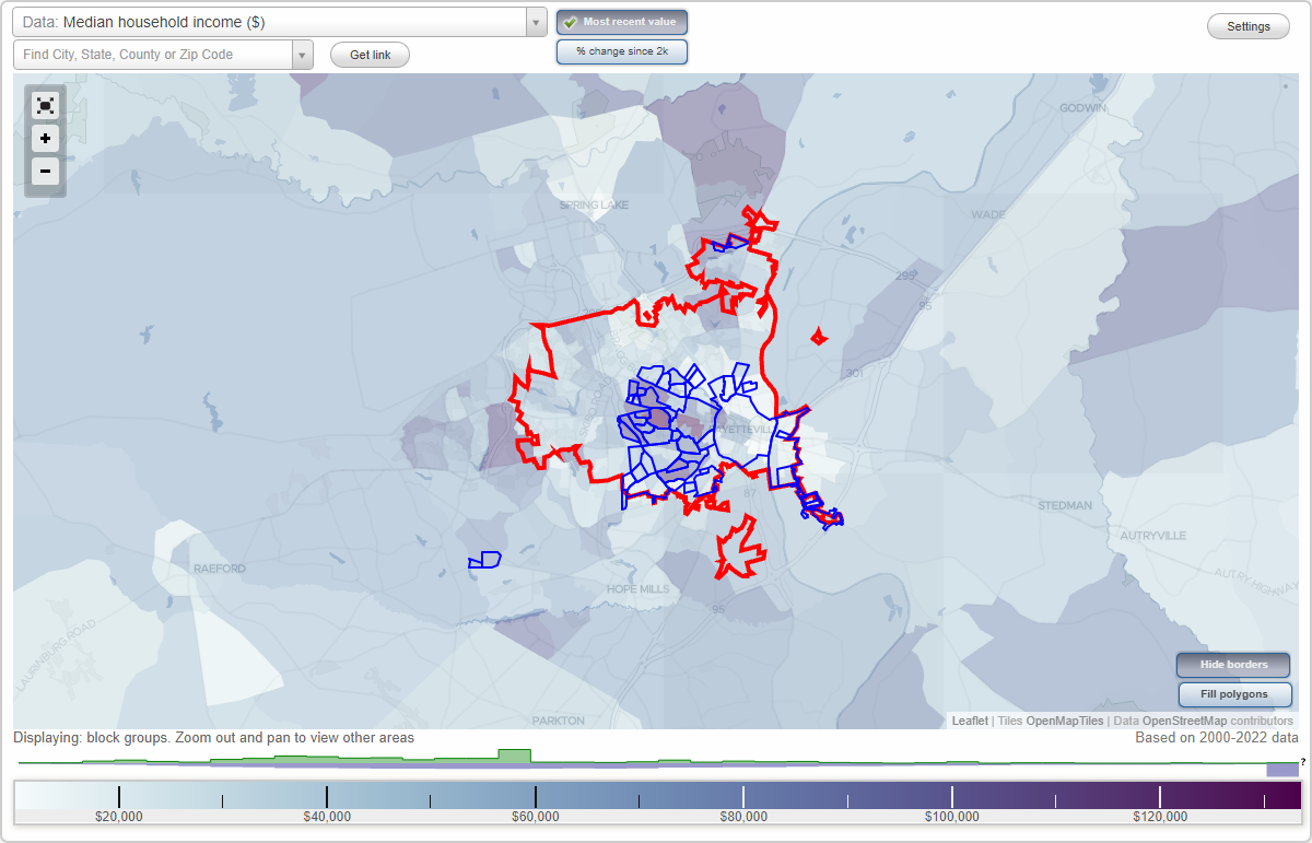
Fayetteville, North Carolina Neighborhood Map - Income, House Prices, Occupations, Boundaries
Settings
X

- City boundary
- Neighborhood boundaries
Business Search - 14 Million verified businesses
Neighborhoods:
Bordeaux, Borden Heights, Briarwood, Broad Acres, Brookwood, Buckhead, Cade Hill, Cedar Falls, Clairwood, Courtyards, Cumberland Heights, Downtown, Drake Park, East Fayetteville, Edenroc, Eutaw, Evergreen Estates, Fairview Park, Glendale Acres, Greenwood Homes, Haymount, Highland Acres, Highland Country Club, Highland Village, Holiday Park, Howard Acres, Huntington Park, King's Grant, Kingsford, Kingswood, Lake Francis, Lock's Creek, Lockwood, Massey Hill, McPherson Estates, Murray Hills, Porter Place, Savoy Heights, Scotty Hills, Seabrook Hills, Stonebridge, Stonewood, Stratford Hills, Summertime, Tallywood, Vanstory Hills, Welmar, Windsor Terrace, WoodlandsBordeaux neighborhood in Fayetteville statistics: (Find on map)
Area: 0.849 square miles
Population: 1,409
Population density:
Median household income in 2021:
Median rent in in 2021:
Male vs Females
Median age
Most popular occupations of males: production occupations (21.8%); material moving occupations (17.8%); service occupations (16.1%); management occupations (except farmers) (6.1%); arts, design, entertainment, sports, and media occupations (3.2%); construction, extraction, and maintenance occupations (3.2%); computer and mathematical occupations (2.8%)
Most popular occupations of females: sales and office occupations (29.3%); service occupations (25.7%); material moving occupations (11.1%); healthcare practitioners and technical occupations (9.9%); production occupations (8.6%); transportation occupations (6.4%); management occupations (except farmers) (4.7%)
Roads and streets: Madison Ave; Carlos Ave; Fargo Dr; Roxie Ave; Wyatt St; Village Dr; Boone Trl; Sandhill Dr; Welmont Dr; Faber St; Dellwood Dr; Nato Rd; State Rd 1219 (Ireland Dr); Westhill Dr; Glenridge Rd; Dillon Dr; Glenridge Dr; Crestview Dr; Wayne Ln; Paladin St; Little Beaver Dr; Redstone Dr; Goins Dr; Brentwood Dr; Tina Dr; Pinelawn Ct; Como St; Brandywine Ct; Mitchell Blvd; Wyatt Ct; Waco Dr; Wavetree Dr; Logan Ct; Yasmin Ave.
Other features: Blounts Crk.
Bordeaux neighborhood detailed profile
Area: 0.849 square miles
Population: 1,409
Population density:
| Bordeaux: | 1,661 people per square mile |
| Fayetteville: | 3,553 people per square mile |
Median household income in 2021:
| Bordeaux: | $44,018 |
| Fayetteville: | $51,629 |
Median rent in in 2021:
| Bordeaux: | $703 |
| Fayetteville: | $874 |
Male vs Females
| Males: | 711 |
| Females: | 698 |
Median age
| Males: | 36.4 years |
| Females: | 46.0 years |
Most popular occupations of males: production occupations (21.8%); material moving occupations (17.8%); service occupations (16.1%); management occupations (except farmers) (6.1%); arts, design, entertainment, sports, and media occupations (3.2%); construction, extraction, and maintenance occupations (3.2%); computer and mathematical occupations (2.8%)
Most popular occupations of females: sales and office occupations (29.3%); service occupations (25.7%); material moving occupations (11.1%); healthcare practitioners and technical occupations (9.9%); production occupations (8.6%); transportation occupations (6.4%); management occupations (except farmers) (4.7%)
Roads and streets: Madison Ave; Carlos Ave; Fargo Dr; Roxie Ave; Wyatt St; Village Dr; Boone Trl; Sandhill Dr; Welmont Dr; Faber St; Dellwood Dr; Nato Rd; State Rd 1219 (Ireland Dr); Westhill Dr; Glenridge Rd; Dillon Dr; Glenridge Dr; Crestview Dr; Wayne Ln; Paladin St; Little Beaver Dr; Redstone Dr; Goins Dr; Brentwood Dr; Tina Dr; Pinelawn Ct; Como St; Brandywine Ct; Mitchell Blvd; Wyatt Ct; Waco Dr; Wavetree Dr; Logan Ct; Yasmin Ave.
Other features: Blounts Crk.
Bordeaux neighborhood detailed profile
Borden Heights neighborhood in Fayetteville statistics: (Find on map)
Area: 0.128 square miles
Population: 46
Population density:
Median household income in 2021:
Median rent in in 2021:
Male vs Females
Median age
Average estimated value of detached houses in 2021 (95.5% of all units):
Most popular occupations of males: material moving occupations (75.4%); service occupations (36.4%); management occupations (except farmers) (27.8%); sales and office occupations (24.7%); production occupations (24.6%); transportation occupations (22.1%); construction, extraction, and maintenance occupations (17.8%)
Most popular occupations of females: service occupations (37.9%); legal occupations (19.7%); production occupations (17.6%); construction, extraction, and maintenance occupations (16.7%); sales and office occupations (13.6%); business and financial operations occupations (12.1%); community and social services occupations (9.4%)
Roads and streets: Eugene St; Cumberland Rd (State Rd 1141); Coffman St; Dimmont Cir.
Borden Heights neighborhood detailed profile
Area: 0.128 square miles
Population: 46
Population density:
| Borden Heights: | 359 people per square mile |
| Fayetteville: | 3,553 people per square mile |
Median household income in 2021:
| Borden Heights: | $30,395 |
| Fayetteville: | $51,629 |
Median rent in in 2021:
| Borden Heights: | $542 |
| Fayetteville: | $874 |
Male vs Females
| Males: | 25 |
| Females: | 20 |
Median age
| Males: | 50.8 years |
| Females: | 43.8 years |
Average estimated value of detached houses in 2021 (95.5% of all units):
| Borden Heights: | $112,758 |
| North Carolina: | $316,354 |
Most popular occupations of males: material moving occupations (75.4%); service occupations (36.4%); management occupations (except farmers) (27.8%); sales and office occupations (24.7%); production occupations (24.6%); transportation occupations (22.1%); construction, extraction, and maintenance occupations (17.8%)
Most popular occupations of females: service occupations (37.9%); legal occupations (19.7%); production occupations (17.6%); construction, extraction, and maintenance occupations (16.7%); sales and office occupations (13.6%); business and financial operations occupations (12.1%); community and social services occupations (9.4%)
Roads and streets: Eugene St; Cumberland Rd (State Rd 1141); Coffman St; Dimmont Cir.
Borden Heights neighborhood detailed profile
Briarwood neighborhood in Fayetteville statistics: (Find on map)
Area: 0.542 square miles
Population: 1,001
Population density:
Median household income in 2021:
Median rent in in 2021:
Male vs Females
Median age
Housing prices:
Average estimated value of detached houses in 2021 (41.2% of all units):
Average estimated '21 value of housing units in 5-or-more-unit structures (4.2% of all units):
Most popular occupations of males: sales and office occupations (35.1%); management occupations (except farmers) (17.3%); business and financial operations occupations (15.4%); production occupations (14.3%); construction, extraction, and maintenance occupations (10.7%); education, training, and library occupations (9.1%); computer and mathematical occupations (5.1%)
Most popular occupations of females: service occupations (48.6%); sales and office occupations (28.3%); legal occupations (5.9%); arts, design, entertainment, sports, and media occupations (5.0%); healthcare practitioners and technical occupations (4.8%); management occupations (except farmers) (3.4%); farming, fishing, and forestry occupations (3.2%)
Roads and streets: Colgate Dr; Rolling Hills Rd; Dartmouth Dr; Elmhurst Dr; Fordham Dr; Boone Trl Exd; Vandemere Ave; Briar Cir; Owen Dr; Trenton Rd; Briarcreek Pl; Edmonton Rd; Sydney Dr; Bryn Mawr Dr; Purdue Dr; Quiet Cove; Notre Dame Pl; Compton Pl; Hanbury Ln; Lake Club Dr; Fashion Ln; Alberry Pl; Spring Ct; Plainfield Ct; Stride Ln; Cottingham Ct; Cranton Cir.
Other features: Blounts Crk; Blount's Creek.
Briarwood neighborhood detailed profile
Area: 0.542 square miles
Population: 1,001
Population density:
| Briarwood: | 1,847 people per square mile |
| Fayetteville: | 3,553 people per square mile |
Median household income in 2021:
| Briarwood: | $49,035 |
| Fayetteville: | $51,629 |
Median rent in in 2021:
| Briarwood: | $657 |
| Fayetteville: | $874 |
Male vs Females
| Males: | 399 |
| Females: | 601 |
Median age
| Males: | 31.0 years |
| Females: | 44.8 years |
Housing prices:
Average estimated value of detached houses in 2021 (41.2% of all units):
| Briarwood: | $268,939 |
| North Carolina: | $316,354 |
Average estimated '21 value of housing units in 5-or-more-unit structures (4.2% of all units):
| Briarwood: | $131,321 |
| North Carolina: | $258,822 |
Most popular occupations of males: sales and office occupations (35.1%); management occupations (except farmers) (17.3%); business and financial operations occupations (15.4%); production occupations (14.3%); construction, extraction, and maintenance occupations (10.7%); education, training, and library occupations (9.1%); computer and mathematical occupations (5.1%)
Most popular occupations of females: service occupations (48.6%); sales and office occupations (28.3%); legal occupations (5.9%); arts, design, entertainment, sports, and media occupations (5.0%); healthcare practitioners and technical occupations (4.8%); management occupations (except farmers) (3.4%); farming, fishing, and forestry occupations (3.2%)
Roads and streets: Colgate Dr; Rolling Hills Rd; Dartmouth Dr; Elmhurst Dr; Fordham Dr; Boone Trl Exd; Vandemere Ave; Briar Cir; Owen Dr; Trenton Rd; Briarcreek Pl; Edmonton Rd; Sydney Dr; Bryn Mawr Dr; Purdue Dr; Quiet Cove; Notre Dame Pl; Compton Pl; Hanbury Ln; Lake Club Dr; Fashion Ln; Alberry Pl; Spring Ct; Plainfield Ct; Stride Ln; Cottingham Ct; Cranton Cir.
Other features: Blounts Crk; Blount's Creek.
Briarwood neighborhood detailed profile
Broad Acres neighborhood in Fayetteville statistics: (Find on map)
Area: 0.102 square miles
Population: 205
Population density:
Median household income in 2021:
Median rent in in 2021:
Male vs Females
Median age
Average estimated value of detached houses in 2021 (72.1% of all units):
Most popular occupations of males: service occupations (34.4%); production occupations (11.8%); construction, extraction, and maintenance occupations (9.8%); architecture and engineering occupations (7.8%); arts, design, entertainment, sports, and media occupations (7.3%); transportation occupations (6.2%); material moving occupations (6.1%)
Most popular occupations of females: service occupations (33.4%); sales and office occupations (29.4%); production occupations (8.3%); material moving occupations (6.1%); computer and mathematical occupations (5.6%); education, training, and library occupations (5.5%); transportation occupations (3.6%)
Roads and streets: Pennsylvania Ave; Temple Ave; Drexel Rd; University Ave; Macdougald Dr; Providence Rd.
Broad Acres neighborhood detailed profile
Area: 0.102 square miles
Population: 205
Population density:
| Broad Acres: | 2,019 people per square mile |
| Fayetteville: | 3,553 people per square mile |
Median household income in 2021:
| Broad Acres: | $28,223 |
| Fayetteville: | $51,629 |
Median rent in in 2021:
| Broad Acres: | $513 |
| Fayetteville: | $874 |
Male vs Females
| Males: | 96 |
| Females: | 108 |
Median age
| Males: | 33.6 years |
| Females: | 43.3 years |
Average estimated value of detached houses in 2021 (72.1% of all units):
| Broad Acres: | $76,023 |
| North Carolina: | $316,354 |
Most popular occupations of males: service occupations (34.4%); production occupations (11.8%); construction, extraction, and maintenance occupations (9.8%); architecture and engineering occupations (7.8%); arts, design, entertainment, sports, and media occupations (7.3%); transportation occupations (6.2%); material moving occupations (6.1%)
Most popular occupations of females: service occupations (33.4%); sales and office occupations (29.4%); production occupations (8.3%); material moving occupations (6.1%); computer and mathematical occupations (5.6%); education, training, and library occupations (5.5%); transportation occupations (3.6%)
Roads and streets: Pennsylvania Ave; Temple Ave; Drexel Rd; University Ave; Macdougald Dr; Providence Rd.
Broad Acres neighborhood detailed profile
Brookwood neighborhood in Fayetteville statistics: (Find on map)
Area: 0.297 square miles
Population: 557
Population density:
Median household income in 2021:
Median rent in in 2021:
Male vs Females
Median age
Average estimated value of detached houses in 2021 (52.8% of all units):
Most popular occupations of males: service occupations (42.2%); sales and office occupations (13.2%); transportation occupations (10.2%); management occupations (except farmers) (5.8%); production occupations (4.9%); life, physical, and social science occupations (3.4%); community and social services occupations (2.9%)
Most popular occupations of females: sales and office occupations (36.8%); service occupations (25.9%); production occupations (9.5%); material moving occupations (8.3%); education, training, and library occupations (5.1%); community and social services occupations (4.5%); healthcare practitioners and technical occupations (2.9%)
Highways in this neighborhood: US Hwy 401 Bus (Ramsey St).
Roads and streets: North St Exn; Blake St; Gibson St; Gilmore St; Sherman Dr; Brookwood Ave; Facility Dr; Taylor Dr; Dogwood St; Buckingham Ave; Colonial Dr; Williston St; Mimosa Ln; Kellogg St; Hoffer Dr; Fayette Ave; Evergreen Dr; River Basin Ct; Louada Ct; Bainbridge Ct; Ridgeline Ct.
Brookwood neighborhood detailed profile
Area: 0.297 square miles
Population: 557
Population density:
| Brookwood: | 1,876 people per square mile |
| Fayetteville: | 3,553 people per square mile |
Median household income in 2021:
| Brookwood: | $42,095 |
| Fayetteville: | $51,629 |
Median rent in in 2021:
| Brookwood: | $638 |
| Fayetteville: | $874 |
Male vs Females
| Males: | 258 |
| Females: | 298 |
Median age
| Males: | 31.1 years |
| Females: | 34.4 years |
Average estimated value of detached houses in 2021 (52.8% of all units):
| Brookwood: | $108,847 |
| North Carolina: | $316,354 |
Most popular occupations of males: service occupations (42.2%); sales and office occupations (13.2%); transportation occupations (10.2%); management occupations (except farmers) (5.8%); production occupations (4.9%); life, physical, and social science occupations (3.4%); community and social services occupations (2.9%)
Most popular occupations of females: sales and office occupations (36.8%); service occupations (25.9%); production occupations (9.5%); material moving occupations (8.3%); education, training, and library occupations (5.1%); community and social services occupations (4.5%); healthcare practitioners and technical occupations (2.9%)
Highways in this neighborhood: US Hwy 401 Bus (Ramsey St).
Roads and streets: North St Exn; Blake St; Gibson St; Gilmore St; Sherman Dr; Brookwood Ave; Facility Dr; Taylor Dr; Dogwood St; Buckingham Ave; Colonial Dr; Williston St; Mimosa Ln; Kellogg St; Hoffer Dr; Fayette Ave; Evergreen Dr; River Basin Ct; Louada Ct; Bainbridge Ct; Ridgeline Ct.
Brookwood neighborhood detailed profile
Buckhead neighborhood in Fayetteville statistics: (Find on map)
Area: 0.246 square miles
Population: 333
Population density:
Median household income in 2021:
Median rent in in 2021:
Male vs Females
Median age
Most popular occupations of males: material moving occupations (30.0%); service occupations (21.1%); management occupations (except farmers) (10.0%); construction, extraction, and maintenance occupations (7.4%); production occupations (7.4%); sales and office occupations (6.8%); community and social services occupations (6.3%)
Most popular occupations of females: sales and office occupations (51.6%); service occupations (20.8%); business and financial operations occupations (9.8%); education, training, and library occupations (6.2%); transportation occupations (4.7%); material moving occupations (4.1%); healthcare practitioners and technical occupations (3.6%)
Roads and streets: Ferncreek Dr; Huntsfield Rd; Weaverhall Dr; Broyhill Rd; Milden Rd; Norwick Dr; Longwood Dr; Brisbane Ct; Ravencroft Ct; Ambrose Pl; Longwood Pl; Larkfield Ct; Humbolt Pl; Braemar Pl.
Railroad features: Aberdeen and Rockfish RR.
Other features: Buckhead Crk.
Buckhead neighborhood detailed profile
Area: 0.246 square miles
Population: 333
Population density:
| Buckhead: | 1,353 people per square mile |
| Fayetteville: | 3,553 people per square mile |
Median household income in 2021:
| Buckhead: | $44,135 |
| Fayetteville: | $51,629 |
Median rent in in 2021:
| Buckhead: | $684 |
| Fayetteville: | $874 |
Male vs Females
| Males: | 131 |
| Females: | 201 |
Median age
| Males: | 34.5 years |
| Females: | 41.5 years |
Most popular occupations of males: material moving occupations (30.0%); service occupations (21.1%); management occupations (except farmers) (10.0%); construction, extraction, and maintenance occupations (7.4%); production occupations (7.4%); sales and office occupations (6.8%); community and social services occupations (6.3%)
Most popular occupations of females: sales and office occupations (51.6%); service occupations (20.8%); business and financial operations occupations (9.8%); education, training, and library occupations (6.2%); transportation occupations (4.7%); material moving occupations (4.1%); healthcare practitioners and technical occupations (3.6%)
Roads and streets: Ferncreek Dr; Huntsfield Rd; Weaverhall Dr; Broyhill Rd; Milden Rd; Norwick Dr; Longwood Dr; Brisbane Ct; Ravencroft Ct; Ambrose Pl; Longwood Pl; Larkfield Ct; Humbolt Pl; Braemar Pl.
Railroad features: Aberdeen and Rockfish RR.
Other features: Buckhead Crk.
Buckhead neighborhood detailed profile
Cade Hill neighborhood in Fayetteville statistics: (Find on map)
Area: 0.377 square miles
Highways in this neighborhood: State Hwy 53 (Cedar Creek Rd, State Hwy 210).
Roads and streets: Deep Creek Rd; Troy Dr; Little Ave; Cade Hill Ave; Rhone St (State Rd 2294); Oxford St; Community Dr (State Rd 2214); Englewood Dr; Abraham Ave; Jacob St; Shadbush Ln; Rosebud Dr; Griffin St; Elba St.
Other features: Locks Crk.
Cade Hill neighborhood detailed profile
Cedar Falls neighborhood in Fayetteville statistics: (Find on map)
Area: 0.122 square miles
Roads and streets: Locks Creek Rd; Whisker Lake Dr; Bombay Dr; Jereens Creek; Royal Spring St; Bridgeton Way; Belews Creek Ln; Turkey Run; Whiskerlake Dr; Ludin Ln.
Cedar Falls neighborhood detailed profile
Area: 0.122 square miles
Roads and streets: Locks Creek Rd; Whisker Lake Dr; Bombay Dr; Jereens Creek; Royal Spring St; Bridgeton Way; Belews Creek Ln; Turkey Run; Whiskerlake Dr; Ludin Ln.
Cedar Falls neighborhood detailed profile
Clairwood neighborhood in Fayetteville statistics: (Find on map)
Area: 0.192 square miles
Population: 400
Population density:
Median household income in 2021:
Median rent in in 2021:
Male vs Females
Median age
Housing prices:
Average estimated value of detached houses in 2021 (37.2% of all units):
Average estimated '21 value of housing units in 5-or-more-unit structures (4.1% of all units):
Most popular occupations of males: sales and office occupations (35.8%); management occupations (except farmers) (17.5%); business and financial operations occupations (15.4%); production occupations (14.2%); construction, extraction, and maintenance occupations (11.0%); computer and mathematical occupations (5.3%)
Most popular occupations of females: service occupations (49.0%); sales and office occupations (28.8%); legal occupations (6.2%); arts, design, entertainment, sports, and media occupations (5.2%); healthcare practitioners and technical occupations (5.0%); management occupations (except farmers) (3.3%); transportation occupations (2.0%)
Roads and streets: Banbury Dr; Torcross Dr; Fordham Dr; Clinchfield Dr; Hatherleigh Dr; Purdue Dr; Stetson Ln; Yonkers Ct; Hatherleigh Pl; Tregony Pl; Kempton Pl; Bryn Mawr Dr; Argosy Ct; Banbury Ct; Bismark Ct; Bendix Pl.
Clairwood neighborhood detailed profile
Area: 0.192 square miles
Population: 400
Population density:
| Clairwood: | 2,085 people per square mile |
| Fayetteville: | 3,553 people per square mile |
Median household income in 2021:
| Clairwood: | $53,470 |
| Fayetteville: | $51,629 |
Median rent in in 2021:
| Clairwood: | $728 |
| Fayetteville: | $874 |
Male vs Females
| Males: | 157 |
| Females: | 243 |
Median age
| Males: | 28.8 years |
| Females: | 43.6 years |
Housing prices:
Average estimated value of detached houses in 2021 (37.2% of all units):
| Clairwood: | $314,058 |
| North Carolina: | $316,354 |
Average estimated '21 value of housing units in 5-or-more-unit structures (4.1% of all units):
| Clairwood: | $131,321 |
| North Carolina: | $258,822 |
Most popular occupations of males: sales and office occupations (35.8%); management occupations (except farmers) (17.5%); business and financial operations occupations (15.4%); production occupations (14.2%); construction, extraction, and maintenance occupations (11.0%); computer and mathematical occupations (5.3%)
Most popular occupations of females: service occupations (49.0%); sales and office occupations (28.8%); legal occupations (6.2%); arts, design, entertainment, sports, and media occupations (5.2%); healthcare practitioners and technical occupations (5.0%); management occupations (except farmers) (3.3%); transportation occupations (2.0%)
Roads and streets: Banbury Dr; Torcross Dr; Fordham Dr; Clinchfield Dr; Hatherleigh Dr; Purdue Dr; Stetson Ln; Yonkers Ct; Hatherleigh Pl; Tregony Pl; Kempton Pl; Bryn Mawr Dr; Argosy Ct; Banbury Ct; Bismark Ct; Bendix Pl.
Clairwood neighborhood detailed profile
Courtyards neighborhood in Fayetteville statistics: (Find on map)
Area: 0.052 square miles
Population: 81
Population density:
Median household income in 2021:
Median rent in in 2021:
Male vs Females
Median age
Average estimated value of detached houses in 2021 (18.5% of all units):
Most popular occupations of males: service occupations (37.1%); production occupations (14.9%); material moving occupations (12.5%); education, training, and library occupations (10.6%); sales and office occupations (7.9%); arts, design, entertainment, sports, and media occupations (4.1%); legal occupations (3.0%)
Most popular occupations of females: service occupations (36.9%); production occupations (24.7%); sales and office occupations (21.9%); education, training, and library occupations (7.4%); healthcare practitioners and technical occupations (4.4%); material moving occupations (4.2%); arts, design, entertainment, sports, and media occupations (3.1%)
Roads and streets: Courtyard Ln; Morganton Rd (State Rd 1404); Farmbrook Rd; Seven Oaks Ct.
Courtyards neighborhood detailed profile
Area: 0.052 square miles
Population: 81
Population density:
| Courtyards: | 1,560 people per square mile |
| Fayetteville: | 3,553 people per square mile |
Median household income in 2021:
| Courtyards: | $27,104 |
| Fayetteville: | $51,629 |
Median rent in in 2021:
| Courtyards: | $627 |
| Fayetteville: | $874 |
Male vs Females
| Males: | 40 |
| Females: | 41 |
Median age
| Males: | 31.1 years |
| Females: | 28.7 years |
Average estimated value of detached houses in 2021 (18.5% of all units):
| Courtyards: | $295,686 |
| North Carolina: | $316,354 |
Most popular occupations of males: service occupations (37.1%); production occupations (14.9%); material moving occupations (12.5%); education, training, and library occupations (10.6%); sales and office occupations (7.9%); arts, design, entertainment, sports, and media occupations (4.1%); legal occupations (3.0%)
Most popular occupations of females: service occupations (36.9%); production occupations (24.7%); sales and office occupations (21.9%); education, training, and library occupations (7.4%); healthcare practitioners and technical occupations (4.4%); material moving occupations (4.2%); arts, design, entertainment, sports, and media occupations (3.1%)
Roads and streets: Courtyard Ln; Morganton Rd (State Rd 1404); Farmbrook Rd; Seven Oaks Ct.
Courtyards neighborhood detailed profile
Cumberland Heights neighborhood in Fayetteville statistics: (Find on map)
Area: 0.238 square miles
Population: 512
Population density:
Median household income in 2021:
Median rent in in 2021:
Male vs Females
Median age
Average estimated value of detached houses in 2021 (82.3% of all units):
Most popular occupations of males: sales and office occupations (29.1%); service occupations (15.0%); transportation occupations (12.1%); management occupations (except farmers) (11.7%); education, training, and library occupations (9.2%); architecture and engineering occupations (8.9%); arts, design, entertainment, sports, and media occupations (4.1%)
Most popular occupations of females: service occupations (33.0%); education, training, and library occupations (16.4%); community and social services occupations (15.3%); business and financial operations occupations (9.6%); life, physical, and social science occupations (8.0%); legal occupations (5.2%); sales and office occupations (5.1%)
Highways in this neighborhood: State Hwy 24 (State Hwy 87, Bragg Blvd).
Roads and streets: McKimmon Rd; Poole Dr; Chester Cir; Mc Pherson Rd (McPherson Ave); Lyon Rd; Pecan Dr; Lewis St; Ethelored St; Winston Ave; Barrington Cross St; Calvin Cir; Ivy Rd; Don Pl; Barrington Cir.
Cumberland Heights neighborhood detailed profile
Area: 0.238 square miles
Population: 512
Population density:
| Cumberland Heights: | 2,147 people per square mile |
| Fayetteville: | 3,553 people per square mile |
Median household income in 2021:
| Cumberland Heights: | $51,041 |
| Fayetteville: | $51,629 |
Median rent in in 2021:
| Cumberland Heights: | $727 |
| Fayetteville: | $874 |
Male vs Females
| Males: | 242 |
| Females: | 270 |
Median age
| Males: | 35.9 years |
| Females: | 48.2 years |
Average estimated value of detached houses in 2021 (82.3% of all units):
| Cumberland Heights: | $197,989 |
| North Carolina: | $316,354 |
Most popular occupations of males: sales and office occupations (29.1%); service occupations (15.0%); transportation occupations (12.1%); management occupations (except farmers) (11.7%); education, training, and library occupations (9.2%); architecture and engineering occupations (8.9%); arts, design, entertainment, sports, and media occupations (4.1%)
Most popular occupations of females: service occupations (33.0%); education, training, and library occupations (16.4%); community and social services occupations (15.3%); business and financial operations occupations (9.6%); life, physical, and social science occupations (8.0%); legal occupations (5.2%); sales and office occupations (5.1%)
Highways in this neighborhood: State Hwy 24 (State Hwy 87, Bragg Blvd).
Roads and streets: McKimmon Rd; Poole Dr; Chester Cir; Mc Pherson Rd (McPherson Ave); Lyon Rd; Pecan Dr; Lewis St; Ethelored St; Winston Ave; Barrington Cross St; Calvin Cir; Ivy Rd; Don Pl; Barrington Cir.
Cumberland Heights neighborhood detailed profile
Downtown neighborhood in Fayetteville statistics: (Find on map)
Area: 4.294 square miles
Population: 6,145
Population density:
Median household income in 2021:
Median rent in in 2021:
Male vs Females
Median age
Housing prices:
Average estimated value of detached houses in 2021 (44.4% of all units):
Average estimated value of townhouses or other attached units in 2021 (18.1% of all units):
Average estimated value of mobile home in 2021 (2.6% of all units):
Most popular occupations of males: service occupations (27.7%); production occupations (15.6%); management occupations (except farmers) (12.3%); construction, extraction, and maintenance occupations (9.9%); sales and office occupations (9.3%); education, training, and library occupations (6.2%); transportation occupations (6.1%)
Most popular occupations of females: sales and office occupations (24.1%); service occupations (23.3%); production occupations (11.5%); education, training, and library occupations (10.3%); management occupations (except farmers) (9.8%); transportation occupations (4.2%); healthcare practitioners and technical occupations (3.5%)
Limited-access highways (interstate or state) in this neighborhood: US Hwy 301 (S Eastern Blvd, I- 95 Bus).
Highways in this neighborhood: State Hwy 87 (Martin Luther King Jr Fwy); Grove St (State Hwy 210, State Hwy 24); State Hwy 210 (Murchison Rd); Ramsey St (US Hwy 401 Bus); State Hwy 24 (Rowan St); State Hwy 87 (Market Sq).
Roads and streets: Person St; E Russell St; Winslow St; Gillespie St; Hay St; Old Wilmington Rd; Hillsboro St; Cumberland St; Ann St; Lamon St; Robeson St; Franklin St; Grove View Ter; W Russell St; Blount St; Ray Ave; Moore St; S King St; Bragg Blvd; Edgecombe Ave Exd; Dick St; W Rowan St; Campbell Ave; Adam St; North St; Martin Luther King Dr; Drum Cir (Grace Black Cir); Marsh St; Mc Iver St; B St; Maiden Ln; S Cool Spring St; Southern Ave; Chance St; Williams St; Elementary Dr; Vanstory St; Campbell Ter; S Racepath St; School St; Buxton Blvd; Cool Spring St; Orange St; N Cool Spring St; Rankin St; Woodside Ave; S C St; Gale St; Alexander St; Transportation Dr; Milan Rd; Worth St; Hawley Ln; Green St; Washington Dr; Cross Creek St; Delona Gardens (Tropical Dr); N Racepath St; Old St; Glidden St; McArthur St (Irene Ave); Locust St; Frink St; Mann St; Chestnut St; Mason St; S Eastern Blvd; N Broad St; Hillside Ave; Gray St; W Orange St; Link St; Italy St; Mechanic St; Silk Ln; Fisher St; Mary T Eldridge St; E Orange St; Curtis Ln; Minor St; S Broad St; McGilvary St; Chase St; Bradford Ave; Poe St; Maloney Ave; Holt Williamson St; Wall St; Teachers Dr; Pine St; Wright St; Ellis St; Sessoms St; Tillinghast St; Vogel St; Webb St; Athens Ave; Edwards St; Fountainhead Ln; N Water St; Drake St; Kingdom Estates Dr; Mary St; Mc Millan St; Pepsi Ln; Montgomery St; Philadelphia St; 1824 (Bradford Ave); Tolar St; Blue St; Stadium Dr; Bow St; Sam Cameron Ave; Greensboro St; Durham St; Scarborough St; Nimocks Ave; Smith St; Chatham St; McDaniel St; N King St; Simmons St; Guthrie St; Maxwell St; Donaldson St; S Kennedy St; Burns St; Turners Ln; Humphrey Ln; Kyle St; Lincoln Dr; Barges Ln; Hedgepeth St; Bevil St; Underwood St; Union St; Harrison St; Butler St; Alfred St; Anderson St; Gorham Aly; Arch St; Wiley St; McDuffie St; Telegraph Cir; Byrd St; Eufaula St; Franklin St (Otis F Jones Pwky); Currie St; Carbonton St; Point Pl; Pershing St; Stevens St; Pope St; Burgess St; Hall St; Brandts Ln; Plum St; W Oak St; Bell St; Walter St; Lucas St; Branson St; Bruner St; Cheer Ln; Pittman St; Emmett St; Beale St; Victorian Pl; Browns Ln; Raymond St; N C St; Hale St; Weiseger St; Halliday St; Barrett St; Candleberry Ct; Grace Ave; N Kennedy St; Canal St; Plummers Ln; Upton St; German St; Alfalfa St; Cook St; Wayde St; Cityview Ln; Stella St; Camden Rd; Hubbard St; Barnes St; Hill St; Arsenal Ave; Sycamore Ct; George St; Albert St; Lauvina Ave; Short St; Bullard St; Meeting St; Marketview Ct; Raleigh St; Pond St; Howards Ln; Doris Dr; Hadley Ct; Dupont St; Crawford St; Capitol Pear Ln; Cross St; Carthage Dr; Martin Luther King Jr Dr.
Railroad features: Atlantic Coast Line RR; Aberdeen and Rockfish RR; Norfolk Southern Rlwy.
Other features: Cross Crk; Blounts Crk; Little Cross Crk; Blount's Creek.
Downtown neighborhood detailed profile
Area: 4.294 square miles
Population: 6,145
Population density:
| Downtown: | 1,431 people per square mile |
| Fayetteville: | 3,553 people per square mile |
Median household income in 2021:
| Downtown: | $35,435 |
| Fayetteville: | $51,629 |
Median rent in in 2021:
| Downtown: | $620 |
| Fayetteville: | $874 |
Male vs Females
| Males: | 2,608 |
| Females: | 3,537 |
Median age
| Males: | 34.3 years |
| Females: | 38.9 years |
Housing prices:
Average estimated value of detached houses in 2021 (44.4% of all units):
| Downtown: | $143,654 |
| North Carolina: | $316,354 |
Average estimated value of townhouses or other attached units in 2021 (18.1% of all units):
| This neighborhood: | $505,605 |
| North Carolina: | $269,203 |
Average estimated value of mobile home in 2021 (2.6% of all units):
| Downtown: | $5,289 |
| North Carolina: | $90,232 |
Most popular occupations of males: service occupations (27.7%); production occupations (15.6%); management occupations (except farmers) (12.3%); construction, extraction, and maintenance occupations (9.9%); sales and office occupations (9.3%); education, training, and library occupations (6.2%); transportation occupations (6.1%)
Most popular occupations of females: sales and office occupations (24.1%); service occupations (23.3%); production occupations (11.5%); education, training, and library occupations (10.3%); management occupations (except farmers) (9.8%); transportation occupations (4.2%); healthcare practitioners and technical occupations (3.5%)
Limited-access highways (interstate or state) in this neighborhood: US Hwy 301 (S Eastern Blvd, I- 95 Bus).
Highways in this neighborhood: State Hwy 87 (Martin Luther King Jr Fwy); Grove St (State Hwy 210, State Hwy 24); State Hwy 210 (Murchison Rd); Ramsey St (US Hwy 401 Bus); State Hwy 24 (Rowan St); State Hwy 87 (Market Sq).
Roads and streets: Person St; E Russell St; Winslow St; Gillespie St; Hay St; Old Wilmington Rd; Hillsboro St; Cumberland St; Ann St; Lamon St; Robeson St; Franklin St; Grove View Ter; W Russell St; Blount St; Ray Ave; Moore St; S King St; Bragg Blvd; Edgecombe Ave Exd; Dick St; W Rowan St; Campbell Ave; Adam St; North St; Martin Luther King Dr; Drum Cir (Grace Black Cir); Marsh St; Mc Iver St; B St; Maiden Ln; S Cool Spring St; Southern Ave; Chance St; Williams St; Elementary Dr; Vanstory St; Campbell Ter; S Racepath St; School St; Buxton Blvd; Cool Spring St; Orange St; N Cool Spring St; Rankin St; Woodside Ave; S C St; Gale St; Alexander St; Transportation Dr; Milan Rd; Worth St; Hawley Ln; Green St; Washington Dr; Cross Creek St; Delona Gardens (Tropical Dr); N Racepath St; Old St; Glidden St; McArthur St (Irene Ave); Locust St; Frink St; Mann St; Chestnut St; Mason St; S Eastern Blvd; N Broad St; Hillside Ave; Gray St; W Orange St; Link St; Italy St; Mechanic St; Silk Ln; Fisher St; Mary T Eldridge St; E Orange St; Curtis Ln; Minor St; S Broad St; McGilvary St; Chase St; Bradford Ave; Poe St; Maloney Ave; Holt Williamson St; Wall St; Teachers Dr; Pine St; Wright St; Ellis St; Sessoms St; Tillinghast St; Vogel St; Webb St; Athens Ave; Edwards St; Fountainhead Ln; N Water St; Drake St; Kingdom Estates Dr; Mary St; Mc Millan St; Pepsi Ln; Montgomery St; Philadelphia St; 1824 (Bradford Ave); Tolar St; Blue St; Stadium Dr; Bow St; Sam Cameron Ave; Greensboro St; Durham St; Scarborough St; Nimocks Ave; Smith St; Chatham St; McDaniel St; N King St; Simmons St; Guthrie St; Maxwell St; Donaldson St; S Kennedy St; Burns St; Turners Ln; Humphrey Ln; Kyle St; Lincoln Dr; Barges Ln; Hedgepeth St; Bevil St; Underwood St; Union St; Harrison St; Butler St; Alfred St; Anderson St; Gorham Aly; Arch St; Wiley St; McDuffie St; Telegraph Cir; Byrd St; Eufaula St; Franklin St (Otis F Jones Pwky); Currie St; Carbonton St; Point Pl; Pershing St; Stevens St; Pope St; Burgess St; Hall St; Brandts Ln; Plum St; W Oak St; Bell St; Walter St; Lucas St; Branson St; Bruner St; Cheer Ln; Pittman St; Emmett St; Beale St; Victorian Pl; Browns Ln; Raymond St; N C St; Hale St; Weiseger St; Halliday St; Barrett St; Candleberry Ct; Grace Ave; N Kennedy St; Canal St; Plummers Ln; Upton St; German St; Alfalfa St; Cook St; Wayde St; Cityview Ln; Stella St; Camden Rd; Hubbard St; Barnes St; Hill St; Arsenal Ave; Sycamore Ct; George St; Albert St; Lauvina Ave; Short St; Bullard St; Meeting St; Marketview Ct; Raleigh St; Pond St; Howards Ln; Doris Dr; Hadley Ct; Dupont St; Crawford St; Capitol Pear Ln; Cross St; Carthage Dr; Martin Luther King Jr Dr.
Railroad features: Atlantic Coast Line RR; Aberdeen and Rockfish RR; Norfolk Southern Rlwy.
Other features: Cross Crk; Blounts Crk; Little Cross Crk; Blount's Creek.
Downtown neighborhood detailed profile
Drake Park neighborhood in Fayetteville statistics: (Find on map)
Area: 0.330 square miles
Population: 486
Population density:
Median household income in 2021:
Median rent in in 2021:
Male vs Females
Median age
Most popular occupations of males: material moving occupations (24.7%); service occupations (18.9%); production occupations (13.6%); management occupations (except farmers) (8.3%); construction, extraction, and maintenance occupations (5.6%); sales and office occupations (3.9%); community and social services occupations (3.6%)
Most popular occupations of females: sales and office occupations (45.2%); service occupations (22.2%); business and financial operations occupations (7.0%); healthcare practitioners and technical occupations (5.4%); transportation occupations (5.2%); education, training, and library occupations (4.5%); material moving occupations (3.2%)
Roads and streets: State Rd 1219 (Ireland Dr); Rodie Ave; David St; Hicks Ave; Faison Ave; Roxie Ave; Joel St; Miller Ave; E Shepard St; ; Hanna St; Isham St; John Marshall Rd; Jane St; Lydia St; Crestwood St (Jane St); Cape Center Dr.
Drake Park neighborhood detailed profile
Area: 0.330 square miles
Population: 486
Population density:
| Drake Park: | 1,471 people per square mile |
| Fayetteville: | 3,553 people per square mile |
Median household income in 2021:
| Drake Park: | $44,018 |
| Fayetteville: | $51,629 |
Median rent in in 2021:
| Drake Park: | $690 |
| Fayetteville: | $874 |
Male vs Females
| Males: | 215 |
| Females: | 270 |
Median age
| Males: | 36.4 years |
| Females: | 46.0 years |
Most popular occupations of males: material moving occupations (24.7%); service occupations (18.9%); production occupations (13.6%); management occupations (except farmers) (8.3%); construction, extraction, and maintenance occupations (5.6%); sales and office occupations (3.9%); community and social services occupations (3.6%)
Most popular occupations of females: sales and office occupations (45.2%); service occupations (22.2%); business and financial operations occupations (7.0%); healthcare practitioners and technical occupations (5.4%); transportation occupations (5.2%); education, training, and library occupations (4.5%); material moving occupations (3.2%)
Roads and streets: State Rd 1219 (Ireland Dr); Rodie Ave; David St; Hicks Ave; Faison Ave; Roxie Ave; Joel St; Miller Ave; E Shepard St; ; Hanna St; Isham St; John Marshall Rd; Jane St; Lydia St; Crestwood St (Jane St); Cape Center Dr.
Drake Park neighborhood detailed profile
East Fayetteville neighborhood in Fayetteville statistics: (Find on map)
Area: 2.993 square miles
Population: 236
Population density:
Median household income in 2021:
Median rent in in 2021:
Male vs Females
Median age
Housing prices:
Average estimated value of detached houses in 2021 (87.0% of all units):
Average estimated value of mobile home in 2021 (12.0% of all units):
Most popular occupations of males: service occupations (32.9%); sales and office occupations (22.9%); management occupations (except farmers) (17.7%); community and social services occupations (16.9%); production occupations (13.9%); architecture and engineering occupations (13.8%); business and financial operations occupations (10.9%)
Most popular occupations of females: service occupations (36.8%); sales and office occupations (31.6%); education, training, and library occupations (27.0%); healthcare practitioners and technical occupations (16.0%); material moving occupations (13.5%); production occupations (9.9%); management occupations (except farmers) (5.7%)
Limited-access highways (interstate or state) in this neighborhood: N Eastern Blvd (I- 95 Bus, US Hwy 301); I- 95.
Highways in this neighborhood: State Hwy 210 (State Hwy 53, Cedar Creek Rd); State Hwy 24 (State Hwy 210, Grove St); State Hwy 24; Grove St Exd (State Hwy 210, State Hwy 53).
Roads and streets: Deep Creek Rd; Dunn Rd; Sapona Rd (State Rd 2000); State Rd 1006 (Clinton Rd); State Rd 1728 (Middle Rd); S Plymouth St; Locks Creek Rd; Troy Dr; State Rd 1735 (Fort Worth Ave); Middle River Loop (State Rd 1738); Cardinal Cir; Farrell Ave; Little Ave; Sloan Ave; Harper St; Neal St; Haywood St; Jim Johnson Rd (Williams Rd, State Rd 2007); Cade Hill Ave; Samuel St; N Plymouth St; Eleanor Ave; Rhone St (State Rd 2294); Whisker Lake Dr; Windmill Dr; ; Railroad St; Open View Dr; Coldwater Dr (Whisker Lake Dr); Oxford St; Fairview St; Mateo Cir; Community Dr (State Rd 2214); Triangle Pl; Blackwell St; Sage St; Englewood Dr; Abraham Ave; Soffe Dr; Jacob St; Carriage Rd; Pasture Ln; Bureau Dr; Baldwin Ave; Shadbush Ln; Lock Trl; Breece Trl; Douglas St; Ardmore Dr; Staley St; Duggins Way; Alphin St; Whitaker Dr; Hammond St; Breece Dr; Long St; Haigh St; Person St; Cross Anchor Dr; Rosebud Dr; David J Rd; Christian St; Bombay Dr; Faircloth St; Lark St; Martin Rd; Griffin St; Warren St; McDonald St; Vander St; Robin St; Jereens Creek; Martin St; L A Dunham Rd (State Rd 2005); Downing St; Oscar St; Coburn St; Fields Rd (State Rd 2215); Breece St; Peteland Dr (State Rd 2006); Royal Spring St; Bridgeton Way; Belews Creek Ln; Elba St; Turkey Run; Whiskerlake Dr; Greenmont Dr; Ludin Ln.
Railroad features: Atlantic Coast Line RR.
Other features: Locks Crk.
East Fayetteville neighborhood detailed profile
Area: 2.993 square miles
Population: 236
Population density:
| East Fayetteville: | 79 people per square mile |
| Fayetteville: | 3,553 people per square mile |
Median household income in 2021:
| East Fayetteville: | $43,839 |
| Fayetteville: | $51,629 |
Median rent in in 2021:
| East Fayetteville: | $529 |
| Fayetteville: | $874 |
Male vs Females
| Males: | 124 |
| Females: | 112 |
Median age
| Males: | 28.2 years |
| Females: | 42.0 years |
Housing prices:
Average estimated value of detached houses in 2021 (87.0% of all units):
| East Fayetteville: | $208,562 |
| North Carolina: | $316,354 |
Average estimated value of mobile home in 2021 (12.0% of all units):
| East Fayetteville: | $116,094 |
| North Carolina: | $90,232 |
Most popular occupations of males: service occupations (32.9%); sales and office occupations (22.9%); management occupations (except farmers) (17.7%); community and social services occupations (16.9%); production occupations (13.9%); architecture and engineering occupations (13.8%); business and financial operations occupations (10.9%)
Most popular occupations of females: service occupations (36.8%); sales and office occupations (31.6%); education, training, and library occupations (27.0%); healthcare practitioners and technical occupations (16.0%); material moving occupations (13.5%); production occupations (9.9%); management occupations (except farmers) (5.7%)
Limited-access highways (interstate or state) in this neighborhood: N Eastern Blvd (I- 95 Bus, US Hwy 301); I- 95.
Highways in this neighborhood: State Hwy 210 (State Hwy 53, Cedar Creek Rd); State Hwy 24 (State Hwy 210, Grove St); State Hwy 24; Grove St Exd (State Hwy 210, State Hwy 53).
Roads and streets: Deep Creek Rd; Dunn Rd; Sapona Rd (State Rd 2000); State Rd 1006 (Clinton Rd); State Rd 1728 (Middle Rd); S Plymouth St; Locks Creek Rd; Troy Dr; State Rd 1735 (Fort Worth Ave); Middle River Loop (State Rd 1738); Cardinal Cir; Farrell Ave; Little Ave; Sloan Ave; Harper St; Neal St; Haywood St; Jim Johnson Rd (Williams Rd, State Rd 2007); Cade Hill Ave; Samuel St; N Plymouth St; Eleanor Ave; Rhone St (State Rd 2294); Whisker Lake Dr; Windmill Dr; ; Railroad St; Open View Dr; Coldwater Dr (Whisker Lake Dr); Oxford St; Fairview St; Mateo Cir; Community Dr (State Rd 2214); Triangle Pl; Blackwell St; Sage St; Englewood Dr; Abraham Ave; Soffe Dr; Jacob St; Carriage Rd; Pasture Ln; Bureau Dr; Baldwin Ave; Shadbush Ln; Lock Trl; Breece Trl; Douglas St; Ardmore Dr; Staley St; Duggins Way; Alphin St; Whitaker Dr; Hammond St; Breece Dr; Long St; Haigh St; Person St; Cross Anchor Dr; Rosebud Dr; David J Rd; Christian St; Bombay Dr; Faircloth St; Lark St; Martin Rd; Griffin St; Warren St; McDonald St; Vander St; Robin St; Jereens Creek; Martin St; L A Dunham Rd (State Rd 2005); Downing St; Oscar St; Coburn St; Fields Rd (State Rd 2215); Breece St; Peteland Dr (State Rd 2006); Royal Spring St; Bridgeton Way; Belews Creek Ln; Elba St; Turkey Run; Whiskerlake Dr; Greenmont Dr; Ludin Ln.
Railroad features: Atlantic Coast Line RR.
Other features: Locks Crk.
East Fayetteville neighborhood detailed profile
Edenroc neighborhood in Fayetteville statistics: (Find on map)
Area: 0.099 square miles
Population: 188
Population density:
Median household income in 2021:
Median rent in in 2021:
Male vs Females
Median age
Average estimated value of detached houses in 2021 (93.8% of all units):
Most popular occupations of males: sales and office occupations (39.2%); service occupations (24.2%); transportation occupations (12.0%); architecture and engineering occupations (10.2%); construction, extraction, and maintenance occupations (6.9%); education, training, and library occupations (2.0%)
Most popular occupations of females: service occupations (52.4%); life, physical, and social science occupations (18.6%); education, training, and library occupations (11.2%); business and financial operations occupations (8.0%); production occupations (6.1%); legal occupations (2.2%); sales and office occupations (2.0%)
Roads and streets: Anarine Rd; Edenwood Dr; Shadowlawn Dr; N Pearl St; Creek Side Run; Havilah Rd; Bellemeade Rd; McPherson Ave (Mc Pherson Rd); Lyon Rd.
Edenroc neighborhood detailed profile
Area: 0.099 square miles
Population: 188
Population density:
| Edenroc: | 1,898 people per square mile |
| Fayetteville: | 3,553 people per square mile |
Median household income in 2021:
| Edenroc: | $31,843 |
| Fayetteville: | $51,629 |
Median rent in in 2021:
| Edenroc: | $845 |
| Fayetteville: | $874 |
Male vs Females
| Males: | 95 |
| Females: | 93 |
Median age
| Males: | 33.8 years |
| Females: | 45.2 years |
Average estimated value of detached houses in 2021 (93.8% of all units):
| Edenroc: | $76,023 |
| North Carolina: | $316,354 |
Most popular occupations of males: sales and office occupations (39.2%); service occupations (24.2%); transportation occupations (12.0%); architecture and engineering occupations (10.2%); construction, extraction, and maintenance occupations (6.9%); education, training, and library occupations (2.0%)
Most popular occupations of females: service occupations (52.4%); life, physical, and social science occupations (18.6%); education, training, and library occupations (11.2%); business and financial operations occupations (8.0%); production occupations (6.1%); legal occupations (2.2%); sales and office occupations (2.0%)
Roads and streets: Anarine Rd; Edenwood Dr; Shadowlawn Dr; N Pearl St; Creek Side Run; Havilah Rd; Bellemeade Rd; McPherson Ave (Mc Pherson Rd); Lyon Rd.
Edenroc neighborhood detailed profile
Eutaw neighborhood in Fayetteville statistics: (Find on map)
Area: 0.217 square miles
Population: 423
Population density:
Median household income in 2021:
Median rent in in 2021:
Male vs Females
Median age
Average estimated value of detached houses in 2021 (54.4% of all units):
Most popular occupations of males: management occupations (except farmers) (40.4%); service occupations (31.1%); sales and office occupations (26.5%); architecture and engineering occupations (10.0%)
Most popular occupations of females: sales and office occupations (29.5%); service occupations (25.8%); business and financial operations occupations (24.6%); education, training, and library occupations (18.7%); life, physical, and social science occupations (13.3%)
Highways in this neighborhood: Bragg Blvd (State Hwy 87, State Hwy 24).
Roads and streets: Elm St; Rogers Dr; Beech St; Cain Rd; Willow St; Hickory St; Laurel St; Sigman St; Florence St; Starling St.
Eutaw neighborhood detailed profile
Area: 0.217 square miles
Population: 423
Population density:
| Eutaw: | 1,946 people per square mile |
| Fayetteville: | 3,553 people per square mile |
Median household income in 2021:
| Eutaw: | $37,196 |
| Fayetteville: | $51,629 |
Median rent in in 2021:
| Eutaw: | $670 |
| Fayetteville: | $874 |
Male vs Females
| Males: | 157 |
| Females: | 265 |
Median age
| Males: | 42.1 years |
| Females: | 46.5 years |
Average estimated value of detached houses in 2021 (54.4% of all units):
| Eutaw: | $196,970 |
| North Carolina: | $316,354 |
Most popular occupations of males: management occupations (except farmers) (40.4%); service occupations (31.1%); sales and office occupations (26.5%); architecture and engineering occupations (10.0%)
Most popular occupations of females: sales and office occupations (29.5%); service occupations (25.8%); business and financial operations occupations (24.6%); education, training, and library occupations (18.7%); life, physical, and social science occupations (13.3%)
Highways in this neighborhood: Bragg Blvd (State Hwy 87, State Hwy 24).
Roads and streets: Elm St; Rogers Dr; Beech St; Cain Rd; Willow St; Hickory St; Laurel St; Sigman St; Florence St; Starling St.
Eutaw neighborhood detailed profile
Evergreen Estates neighborhood in Fayetteville statistics: (Find on map)
Area: 0.201 square miles
Population: 271
Population density:
Median household income in 2021:
Median rent in in 2021:
Male vs Females
Median age
Housing prices:
Average estimated value of detached houses in 2021 (53.3% of all units):
Average estimated value of townhouses or other attached units in 2021 (1.3% of all units):
Most popular occupations of males: material moving occupations (28.9%); service occupations (20.7%); management occupations (except farmers) (9.9%); construction, extraction, and maintenance occupations (7.6%); production occupations (7.5%); sales and office occupations (7.4%); community and social services occupations (6.0%)
Most popular occupations of females: sales and office occupations (50.6%); service occupations (20.8%); business and financial operations occupations (9.3%); education, training, and library occupations (6.2%); transportation occupations (4.5%); healthcare practitioners and technical occupations (3.6%); community and social services occupations (2.1%)
Roads and streets: Martindale Dr; Wendover Dr; Edgedale Dr; St Paul Ave; Stratford Rd; Coventry Rd; Gatewood Dr; Glenwick Dr; Faison Ave.
Evergreen Estates neighborhood detailed profile
Area: 0.201 square miles
Population: 271
Population density:
| Evergreen Estates: | 1,346 people per square mile |
| Fayetteville: | 3,553 people per square mile |
Median household income in 2021:
| Evergreen Estates: | $36,320 |
| Fayetteville: | $51,629 |
Median rent in in 2021:
| Evergreen Estates: | $687 |
| Fayetteville: | $874 |
Male vs Females
| Males: | 107 |
| Females: | 164 |
Median age
| Males: | 36.3 years |
| Females: | 38.8 years |
Housing prices:
Average estimated value of detached houses in 2021 (53.3% of all units):
| Evergreen Estates: | $129,524 |
| North Carolina: | $316,354 |
Average estimated value of townhouses or other attached units in 2021 (1.3% of all units):
| This neighborhood: | $92,429 |
| North Carolina: | $269,203 |
Most popular occupations of males: material moving occupations (28.9%); service occupations (20.7%); management occupations (except farmers) (9.9%); construction, extraction, and maintenance occupations (7.6%); production occupations (7.5%); sales and office occupations (7.4%); community and social services occupations (6.0%)
Most popular occupations of females: sales and office occupations (50.6%); service occupations (20.8%); business and financial operations occupations (9.3%); education, training, and library occupations (6.2%); transportation occupations (4.5%); healthcare practitioners and technical occupations (3.6%); community and social services occupations (2.1%)
Roads and streets: Martindale Dr; Wendover Dr; Edgedale Dr; St Paul Ave; Stratford Rd; Coventry Rd; Gatewood Dr; Glenwick Dr; Faison Ave.
Evergreen Estates neighborhood detailed profile
Fairview Park neighborhood in Fayetteville statistics: (Find on map)
Area: 0.139 square miles
Roads and streets: Ingram St; Neville St; Brinkley St; North St; Sewell St; Thad St; Autry St.
Fairview Park neighborhood detailed profile
Area: 0.139 square miles
Roads and streets: Ingram St; Neville St; Brinkley St; North St; Sewell St; Thad St; Autry St.
Fairview Park neighborhood detailed profile
Glendale Acres neighborhood in Fayetteville statistics: (Find on map)
Area: 0.903 square miles
Population: 3,644
Population density:
Median household income in 2021:
Median rent in in 2021:
Male vs Females
Median age
Housing prices:
Average estimated value of detached houses in 2021 (66.7% of all units):
Average estimated '21 value of housing units in 5-or-more-unit structures (3.7% of all units):
Most popular occupations of males: education, training, and library occupations (15.3%); sales and office occupations (11.3%); service occupations (9.5%); material moving occupations (8.6%); production occupations (8.0%); business and financial operations occupations (7.4%); management occupations (except farmers) (7.1%)
Most popular occupations of females: healthcare practitioners and technical occupations (30.5%); sales and office occupations (22.2%); service occupations (13.6%); community and social services occupations (6.5%); computer and mathematical occupations (5.6%); farming, fishing, and forestry occupations (5.6%); education, training, and library occupations (4.4%)
Highways in this neighborhood: US Hwy 401 Bus (Raeford Rd).
Roads and streets: Owen Dr; Marlborough Rd; Village Dr; Purdue Dr; Turtle Point Dr; Berkshire Rd; Skycrest Dr; Breezewood Ave; Forsythe St; Player Ave; Fordham Dr; Habersham Dr; Preston Woods Ln; Alden Dr; Terry Cir; Hunter Cir; All American Expy; Hermitage Ave; Arlington Ave; Ancestry Dr; Cardiff Dr; Metromedical Dr; Tarwick Ave; Helaman Ct; Castlerock Dr; Gordons Way; Buie Ct; Wentworth Pl; Friendly Rd; Trentwood Ct; Woodwind Dr; Berkley Pl; Gordon Way; Beckham Pl; Hasbrook Ct; Dover Ct; Owen Park Ln; Alred Ln.
Railroad features: Aberdeen and Rockfish RR.
Glendale Acres neighborhood detailed profile
Area: 0.903 square miles
Population: 3,644
Population density:
| Glendale Acres: | 4,034 people per square mile |
| Fayetteville: | 3,553 people per square mile |
Median household income in 2021:
| Glendale Acres: | $60,227 |
| Fayetteville: | $51,629 |
Median rent in in 2021:
| Glendale Acres: | $729 |
| Fayetteville: | $874 |
Male vs Females
| Males: | 1,912 |
| Females: | 1,731 |
Median age
| Males: | 36.2 years |
| Females: | 49.8 years |
Housing prices:
Average estimated value of detached houses in 2021 (66.7% of all units):
| Glendale Acres: | $215,254 |
| North Carolina: | $316,354 |
Average estimated '21 value of housing units in 5-or-more-unit structures (3.7% of all units):
| Glendale Acres: | $131,321 |
| North Carolina: | $258,822 |
Most popular occupations of males: education, training, and library occupations (15.3%); sales and office occupations (11.3%); service occupations (9.5%); material moving occupations (8.6%); production occupations (8.0%); business and financial operations occupations (7.4%); management occupations (except farmers) (7.1%)
Most popular occupations of females: healthcare practitioners and technical occupations (30.5%); sales and office occupations (22.2%); service occupations (13.6%); community and social services occupations (6.5%); computer and mathematical occupations (5.6%); farming, fishing, and forestry occupations (5.6%); education, training, and library occupations (4.4%)
Highways in this neighborhood: US Hwy 401 Bus (Raeford Rd).
Roads and streets: Owen Dr; Marlborough Rd; Village Dr; Purdue Dr; Turtle Point Dr; Berkshire Rd; Skycrest Dr; Breezewood Ave; Forsythe St; Player Ave; Fordham Dr; Habersham Dr; Preston Woods Ln; Alden Dr; Terry Cir; Hunter Cir; All American Expy; Hermitage Ave; Arlington Ave; Ancestry Dr; Cardiff Dr; Metromedical Dr; Tarwick Ave; Helaman Ct; Castlerock Dr; Gordons Way; Buie Ct; Wentworth Pl; Friendly Rd; Trentwood Ct; Woodwind Dr; Berkley Pl; Gordon Way; Beckham Pl; Hasbrook Ct; Dover Ct; Owen Park Ln; Alred Ln.
Railroad features: Aberdeen and Rockfish RR.
Glendale Acres neighborhood detailed profile
Greenwood Homes neighborhood in Fayetteville statistics: (Find on map)
Area: 0.215 square miles
Population: 404
Population density:
Median household income in 2021:
Median rent in in 2021:
Male vs Females
Median age
Average estimated value of detached houses in 2021 (79.6% of all units):
Most popular occupations of males: service occupations (26.3%); arts, design, entertainment, sports, and media occupations (22.0%); education, training, and library occupations (4.8%); sales and office occupations (4.1%)
Most popular occupations of females: education, training, and library occupations (29.6%); service occupations (27.0%); sales and office occupations (18.7%); management occupations (except farmers) (8.7%); community and social services occupations (8.3%); production occupations (7.4%); life, physical, and social science occupations (2.7%)
Roads and streets: Spruce St; Mc Gougan Rd; Rogers Dr; Cherokee Dr; Catawba St; Stamper Rd; Mohawk Ave; Manteo St; Mulberry St; Acorn St; Ivy Rd.
Greenwood Homes neighborhood detailed profile
Area: 0.215 square miles
Population: 404
Population density:
| Greenwood Homes: | 1,882 people per square mile |
| Fayetteville: | 3,553 people per square mile |
Median household income in 2021:
| Greenwood Homes: | $29,764 |
| Fayetteville: | $51,629 |
Median rent in in 2021:
| Greenwood Homes: | $621 |
| Fayetteville: | $874 |
Male vs Females
| Males: | 146 |
| Females: | 258 |
Median age
| Males: | 38.6 years |
| Females: | 46.0 years |
Average estimated value of detached houses in 2021 (79.6% of all units):
| Greenwood Homes: | $193,569 |
| North Carolina: | $316,354 |
Most popular occupations of males: service occupations (26.3%); arts, design, entertainment, sports, and media occupations (22.0%); education, training, and library occupations (4.8%); sales and office occupations (4.1%)
Most popular occupations of females: education, training, and library occupations (29.6%); service occupations (27.0%); sales and office occupations (18.7%); management occupations (except farmers) (8.7%); community and social services occupations (8.3%); production occupations (7.4%); life, physical, and social science occupations (2.7%)
Roads and streets: Spruce St; Mc Gougan Rd; Rogers Dr; Cherokee Dr; Catawba St; Stamper Rd; Mohawk Ave; Manteo St; Mulberry St; Acorn St; Ivy Rd.
Greenwood Homes neighborhood detailed profile
Haymount neighborhood in Fayetteville statistics: (Find on map)
Area: 1.688 square miles
Population: 6,327
Population density:
Median household income in 2021:
Median rent in in 2021:
Male vs Females
Median age
Housing prices:
Average estimated value of detached houses in 2021 (45.2% of all units):
Average estimated value of townhouses or other attached units in 2021 (9.5% of all units):
Most popular occupations of males: service occupations (17.1%); sales and office occupations (12.9%); management occupations (except farmers) (11.9%); transportation occupations (10.1%); production occupations (8.0%); material moving occupations (7.7%); education, training, and library occupations (7.2%)
Most popular occupations of females: sales and office occupations (28.0%); service occupations (25.6%); management occupations (except farmers) (14.1%); community and social services occupations (7.5%); material moving occupations (4.9%); business and financial operations occupations (3.7%); healthcare practitioners and technical occupations (3.6%)
Highways in this neighborhood: State Hwy 87 (US Hwy 401 Bus, Martin Luther King Jr Fwy); State Hwy 24 (State Hwy 87, Bragg Blvd).
Roads and streets: Morganton Rd (State Rd 1404); Raeford Rd; Fort Bragg Rd; Valley Rd; Lakeshore Dr; Devane St; Rush Rd; Oakridge Ave; Pinecrest Dr; W Rowan St; Westmont Dr; Branson St; Turnpike Rd; Pine Valley Loop; Broadfoot Ave; General Lee Ave; Arsenal Ave; Norwood St; Greenland Dr; Winterlochen Rd; Parkview Ave; Hay St; Summit Ave; Pearl St; Woodcrest Rd; Mirror Lake Dr; Hinsdale Ave; Woodland Dr; Hilltop Ave; Pugh St; Vista Dr; Westlawn Ave; Clarendon St; Dobbin Ave; Davis St; Pilot Ave; Manchester St; Bryan St; Rollingwood Cir; Brook St; Westview Dr; Highland Ave; Carolina Ave; Cape Fear Ave; Ellington St; Jordan St; North Virginia Ave; Myrover St; John St; Queen St; Forest Lake Rd; Stedman St; Martine Rd; Twin Oaks Dr; Judd St; Ruth St; Kooler Cir; Bethune St; Meadow Wood Rd; Lakeview Dr; Morgan Ln; Circle Dr; Ames St; Myrtle St; Spring St; Belmont Ave; Huske St; Forest Rd; Hillcrest Ave; Sutton St; Brookside Ave; Goodview Ave; Magnolia Ave; Lamb St; W Park Dr; Clark St; Morgan St; Simpson St; Calcutt St; E Park Dr; Kingswood Rd; Crescent Ave; Olive Rd; Sylvan Rd; Rockledge Ave; Finnegan St; Sedberry St; McBain Dr; Mc Allister St; Glenwood Dr; Peach Tree St; Pine Hill Rd; Pate Dr; Weldon Ave; Maywood St; E Dobbin Ave; Stonebrook Pl; Monticello Ave; W Dobbin Ave; Westhaven Dr; Azalea Dr; Holly Ln; Litchfield Pl; Park St; Appamatox Ct; Park Ave; Fuller St; Haymount Ct; Lambert St; Fairwood Ct; Sherwood Dr; Groton St; South Virginia Ave; Kelly St; Claremont Ave; Springbrook Pl; Wilson St; Southampton Ct; Malloy St; Appomattox Ct; White St; Lilly Dr; Glen Pl; Birnam Dr; Sunnyside Cir; Claremont St (Claremont Ave); Millan Dr; Olive Pl; Calamint Ln; Grace View Pl; Azalea Bluff Dr; Fairington Ln; Charlotte Dr; Canopy Ln; Fig Ct; Belmont Cir; Lakewood Ct; Carriage Ln; Brett Ct.
Other features: Branson Crk.
Haymount neighborhood detailed profile
Area: 1.688 square miles
Population: 6,327
Population density:
| Haymount: | 3,749 people per square mile |
| Fayetteville: | 3,553 people per square mile |
Median household income in 2021:
| Haymount: | $51,717 |
| Fayetteville: | $51,629 |
Median rent in in 2021:
| Haymount: | $661 |
| Fayetteville: | $874 |
Male vs Females
| Males: | 2,766 |
| Females: | 3,561 |
Median age
| Males: | 34.6 years |
| Females: | 42.9 years |
Housing prices:
Average estimated value of detached houses in 2021 (45.2% of all units):
| Haymount: | $182,169 |
| North Carolina: | $316,354 |
Average estimated value of townhouses or other attached units in 2021 (9.5% of all units):
| This neighborhood: | $505,605 |
| North Carolina: | $269,203 |
Most popular occupations of males: service occupations (17.1%); sales and office occupations (12.9%); management occupations (except farmers) (11.9%); transportation occupations (10.1%); production occupations (8.0%); material moving occupations (7.7%); education, training, and library occupations (7.2%)
Most popular occupations of females: sales and office occupations (28.0%); service occupations (25.6%); management occupations (except farmers) (14.1%); community and social services occupations (7.5%); material moving occupations (4.9%); business and financial operations occupations (3.7%); healthcare practitioners and technical occupations (3.6%)
Highways in this neighborhood: State Hwy 87 (US Hwy 401 Bus, Martin Luther King Jr Fwy); State Hwy 24 (State Hwy 87, Bragg Blvd).
Roads and streets: Morganton Rd (State Rd 1404); Raeford Rd; Fort Bragg Rd; Valley Rd; Lakeshore Dr; Devane St; Rush Rd; Oakridge Ave; Pinecrest Dr; W Rowan St; Westmont Dr; Branson St; Turnpike Rd; Pine Valley Loop; Broadfoot Ave; General Lee Ave; Arsenal Ave; Norwood St; Greenland Dr; Winterlochen Rd; Parkview Ave; Hay St; Summit Ave; Pearl St; Woodcrest Rd; Mirror Lake Dr; Hinsdale Ave; Woodland Dr; Hilltop Ave; Pugh St; Vista Dr; Westlawn Ave; Clarendon St; Dobbin Ave; Davis St; Pilot Ave; Manchester St; Bryan St; Rollingwood Cir; Brook St; Westview Dr; Highland Ave; Carolina Ave; Cape Fear Ave; Ellington St; Jordan St; North Virginia Ave; Myrover St; John St; Queen St; Forest Lake Rd; Stedman St; Martine Rd; Twin Oaks Dr; Judd St; Ruth St; Kooler Cir; Bethune St; Meadow Wood Rd; Lakeview Dr; Morgan Ln; Circle Dr; Ames St; Myrtle St; Spring St; Belmont Ave; Huske St; Forest Rd; Hillcrest Ave; Sutton St; Brookside Ave; Goodview Ave; Magnolia Ave; Lamb St; W Park Dr; Clark St; Morgan St; Simpson St; Calcutt St; E Park Dr; Kingswood Rd; Crescent Ave; Olive Rd; Sylvan Rd; Rockledge Ave; Finnegan St; Sedberry St; McBain Dr; Mc Allister St; Glenwood Dr; Peach Tree St; Pine Hill Rd; Pate Dr; Weldon Ave; Maywood St; E Dobbin Ave; Stonebrook Pl; Monticello Ave; W Dobbin Ave; Westhaven Dr; Azalea Dr; Holly Ln; Litchfield Pl; Park St; Appamatox Ct; Park Ave; Fuller St; Haymount Ct; Lambert St; Fairwood Ct; Sherwood Dr; Groton St; South Virginia Ave; Kelly St; Claremont Ave; Springbrook Pl; Wilson St; Southampton Ct; Malloy St; Appomattox Ct; White St; Lilly Dr; Glen Pl; Birnam Dr; Sunnyside Cir; Claremont St (Claremont Ave); Millan Dr; Olive Pl; Calamint Ln; Grace View Pl; Azalea Bluff Dr; Fairington Ln; Charlotte Dr; Canopy Ln; Fig Ct; Belmont Cir; Lakewood Ct; Carriage Ln; Brett Ct.
Other features: Branson Crk.
Haymount neighborhood detailed profile
Highland Acres neighborhood in Fayetteville statistics: (Find on map)
Area: 0.079 square miles
Roads and streets: Samuel St; Open View Dr; Douglas St; Breece St.
Highland Acres neighborhood detailed profile
Area: 0.079 square miles
Roads and streets: Samuel St; Open View Dr; Douglas St; Breece St.
Highland Acres neighborhood detailed profile
Highland Country Club neighborhood in Fayetteville statistics: (Find on map)
Area: 0.375 square miles
Highways in this neighborhood: Robeson St (US Hwy 401 Bus).
Roads and streets: Longleaf Dr; Offshore Dr; Fairway Dr; Raeford Rd; Bayview Dr; Winterlochen Rd; Amigo Dr; Cross St.
Other features: Branson Crk.
Highland Country Club neighborhood detailed profile
Area: 0.375 square miles
Highways in this neighborhood: Robeson St (US Hwy 401 Bus).
Roads and streets: Longleaf Dr; Offshore Dr; Fairway Dr; Raeford Rd; Bayview Dr; Winterlochen Rd; Amigo Dr; Cross St.
Other features: Branson Crk.
Highland Country Club neighborhood detailed profile
Highland Village neighborhood in Fayetteville statistics: (Find on map)
Area: 0.107 square miles
Roads and streets: McRae Dr; Mc Phee Dr; McBain Dr; McGill Dr.
Highland Village neighborhood detailed profile
Area: 0.107 square miles
Roads and streets: McRae Dr; Mc Phee Dr; McBain Dr; McGill Dr.
Highland Village neighborhood detailed profile
Holiday Park neighborhood in Fayetteville statistics: (Find on map)
Area: 0.188 square miles
Population: 607
Population density:
Median household income in 2021:
Median rent in in 2021:
Male vs Females
Median age
Housing prices:
Average estimated value of detached houses in 2021 (60.5% of all units):
Average estimated '21 value of housing units in 5-or-more-unit structures (10.1% of all units):
Most popular occupations of males: service occupations (30.5%); education, training, and library occupations (17.7%); sales and office occupations (15.4%); business and financial operations occupations (15.3%); healthcare practitioners and technical occupations (15.3%); management occupations (except farmers) (12.1%); transportation occupations (11.2%)
Most popular occupations of females: education, training, and library occupations (41.3%); sales and office occupations (19.1%); community and social services occupations (11.8%); healthcare practitioners and technical occupations (9.8%); business and financial operations occupations (9.2%); management occupations (except farmers) (8.5%); computer and mathematical occupations (6.4%)
Roads and streets: Enterprise Ave; Coronado Pkwy; Eldorado Rd; Owen Dr; Poinciana Ln; Catalina Rd; Emerson Ave; Balboa St; Hyde Pl; Toledo Ct.
Holiday Park neighborhood detailed profile
Area: 0.188 square miles
Population: 607
Population density:
| Holiday Park: | 3,225 people per square mile |
| Fayetteville: | 3,553 people per square mile |
Median household income in 2021:
| Holiday Park: | $57,941 |
| Fayetteville: | $51,629 |
Median rent in in 2021:
| Holiday Park: | $873 |
| Fayetteville: | $874 |
Male vs Females
| Males: | 248 |
| Females: | 359 |
Median age
| Males: | 39.3 years |
| Females: | 50.2 years |
Housing prices:
Average estimated value of detached houses in 2021 (60.5% of all units):
| Holiday Park: | $195,665 |
| North Carolina: | $316,354 |
Average estimated '21 value of housing units in 5-or-more-unit structures (10.1% of all units):
| Holiday Park: | $131,321 |
| North Carolina: | $258,822 |
Most popular occupations of males: service occupations (30.5%); education, training, and library occupations (17.7%); sales and office occupations (15.4%); business and financial operations occupations (15.3%); healthcare practitioners and technical occupations (15.3%); management occupations (except farmers) (12.1%); transportation occupations (11.2%)
Most popular occupations of females: education, training, and library occupations (41.3%); sales and office occupations (19.1%); community and social services occupations (11.8%); healthcare practitioners and technical occupations (9.8%); business and financial operations occupations (9.2%); management occupations (except farmers) (8.5%); computer and mathematical occupations (6.4%)
Roads and streets: Enterprise Ave; Coronado Pkwy; Eldorado Rd; Owen Dr; Poinciana Ln; Catalina Rd; Emerson Ave; Balboa St; Hyde Pl; Toledo Ct.
Holiday Park neighborhood detailed profile
Howard Acres neighborhood in Fayetteville statistics: (Find on map)
Area: 0.070 square miles
Population: 109
Population density:
Median household income in 2021:
Median rent in in 2021:
Male vs Females
Median age
Average estimated value of detached houses in 2021 (17.8% of all units):
Most popular occupations of males: service occupations (37.1%); production occupations (14.9%); material moving occupations (12.5%); education, training, and library occupations (10.6%); sales and office occupations (7.9%); arts, design, entertainment, sports, and media occupations (4.4%); legal occupations (3.2%)
Most popular occupations of females: service occupations (36.9%); production occupations (24.7%); sales and office occupations (21.9%); education, training, and library occupations (7.9%); healthcare practitioners and technical occupations (4.4%); material moving occupations (4.2%); arts, design, entertainment, sports, and media occupations (3.1%)
Roads and streets: Quarry Dr; Rustburg Dr; Queensberry Dr; Woodsage Cir; Stokes Ct.
Howard Acres neighborhood detailed profile
Area: 0.070 square miles
Population: 109
Population density:
| Howard Acres: | 1,563 people per square mile |
| Fayetteville: | 3,553 people per square mile |
Median household income in 2021:
| Howard Acres: | $27,104 |
| Fayetteville: | $51,629 |
Median rent in in 2021:
| Howard Acres: | $627 |
| Fayetteville: | $874 |
Male vs Females
| Males: | 53 |
| Females: | 56 |
Median age
| Males: | 31.1 years |
| Females: | 28.7 years |
Average estimated value of detached houses in 2021 (17.8% of all units):
| Howard Acres: | $295,686 |
| North Carolina: | $316,354 |
Most popular occupations of males: service occupations (37.1%); production occupations (14.9%); material moving occupations (12.5%); education, training, and library occupations (10.6%); sales and office occupations (7.9%); arts, design, entertainment, sports, and media occupations (4.4%); legal occupations (3.2%)
Most popular occupations of females: service occupations (36.9%); production occupations (24.7%); sales and office occupations (21.9%); education, training, and library occupations (7.9%); healthcare practitioners and technical occupations (4.4%); material moving occupations (4.2%); arts, design, entertainment, sports, and media occupations (3.1%)
Roads and streets: Quarry Dr; Rustburg Dr; Queensberry Dr; Woodsage Cir; Stokes Ct.
Howard Acres neighborhood detailed profile
Huntington Park neighborhood in Fayetteville statistics: (Find on map)
Area: 0.068 square miles
Population: 106
Population density:
Median household income in 2021:
Median rent in in 2021:
Male vs Females
Median age
Average estimated value of detached houses in 2021 (18.3% of all units):
Most popular occupations of males: service occupations (37.1%); production occupations (14.9%); material moving occupations (12.5%); education, training, and library occupations (10.6%); sales and office occupations (7.9%); arts, design, entertainment, sports, and media occupations (5.1%); legal occupations (3.7%)
Most popular occupations of females: service occupations (36.9%); production occupations (24.7%); sales and office occupations (21.9%); education, training, and library occupations (9.0%); healthcare practitioners and technical occupations (4.4%); material moving occupations (4.2%); arts, design, entertainment, sports, and media occupations (3.1%)
Roads and streets: St Marys Pkwy; Granville Dr; Morganton Rd (State Rd 1404); Granville (Granville Dr); Guilford Pl; Rivenoak Dr.
Huntington Park neighborhood detailed profile
Area: 0.068 square miles
Population: 106
Population density:
| Huntington Park: | 1,566 people per square mile |
| Fayetteville: | 3,553 people per square mile |
Median household income in 2021:
| Huntington Park: | $27,104 |
| Fayetteville: | $51,629 |
Median rent in in 2021:
| Huntington Park: | $627 |
| Fayetteville: | $874 |
Male vs Females
| Males: | 52 |
| Females: | 54 |
Median age
| Males: | 31.1 years |
| Females: | 28.7 years |
Average estimated value of detached houses in 2021 (18.3% of all units):
| Huntington Park: | $295,686 |
| North Carolina: | $316,354 |
Most popular occupations of males: service occupations (37.1%); production occupations (14.9%); material moving occupations (12.5%); education, training, and library occupations (10.6%); sales and office occupations (7.9%); arts, design, entertainment, sports, and media occupations (5.1%); legal occupations (3.7%)
Most popular occupations of females: service occupations (36.9%); production occupations (24.7%); sales and office occupations (21.9%); education, training, and library occupations (9.0%); healthcare practitioners and technical occupations (4.4%); material moving occupations (4.2%); arts, design, entertainment, sports, and media occupations (3.1%)
Roads and streets: St Marys Pkwy; Granville Dr; Morganton Rd (State Rd 1404); Granville (Granville Dr); Guilford Pl; Rivenoak Dr.
Huntington Park neighborhood detailed profile
King's Grant neighborhood in Fayetteville statistics: (Find on map)
Area: 0.290 square miles
Population: 445
Population density:
Median household income in 2021:
Median rent in in 2021:
Male vs Females
Median age
Most popular occupations of males: sales and office occupations (24.5%); service occupations (12.4%); computer and mathematical occupations (11.7%); management occupations (except farmers) (11.0%); transportation occupations (9.4%); education, training, and library occupations (8.3%); construction, extraction, and maintenance occupations (7.2%)
Most popular occupations of females: service occupations (25.0%); sales and office occupations (22.8%); business and financial operations occupations (12.8%); healthcare practitioners and technical occupations (12.1%); management occupations (except farmers) (10.9%); education, training, and library occupations (9.5%); production occupations (5.4%)
Roads and streets: Shawcroft Rd; Iverleigh Cir; Burnside Pl; Williwood Rd; Swan Island Ct; Lochview Dr; Dunbane Ct; Kirkwall Rd; Sandwedge Dr; Moncreiffe Rd; Captains Pl; Gregg Ct; Darrock Ct; Dunleith Pl; Hollyrod Ct; Stonehouse Ct; Martinleer Ct; Killcare Ct (Guildhall Pl); Guildhall Pl.
King's Grant neighborhood detailed profile
Area: 0.290 square miles
Population: 445
Population density:
| King's Grant: | 1,533 people per square mile |
| Fayetteville: | 3,553 people per square mile |
Median household income in 2021:
| King's Grant: | $79,719 |
| Fayetteville: | $51,629 |
Median rent in in 2021:
| King's Grant: | $1,060 |
| Fayetteville: | $874 |
Male vs Females
| Males: | 225 |
| Females: | 220 |
Median age
| Males: | 33.1 years |
| Females: | 30.3 years |
Most popular occupations of males: sales and office occupations (24.5%); service occupations (12.4%); computer and mathematical occupations (11.7%); management occupations (except farmers) (11.0%); transportation occupations (9.4%); education, training, and library occupations (8.3%); construction, extraction, and maintenance occupations (7.2%)
Most popular occupations of females: service occupations (25.0%); sales and office occupations (22.8%); business and financial operations occupations (12.8%); healthcare practitioners and technical occupations (12.1%); management occupations (except farmers) (10.9%); education, training, and library occupations (9.5%); production occupations (5.4%)
Roads and streets: Shawcroft Rd; Iverleigh Cir; Burnside Pl; Williwood Rd; Swan Island Ct; Lochview Dr; Dunbane Ct; Kirkwall Rd; Sandwedge Dr; Moncreiffe Rd; Captains Pl; Gregg Ct; Darrock Ct; Dunleith Pl; Hollyrod Ct; Stonehouse Ct; Martinleer Ct; Killcare Ct (Guildhall Pl); Guildhall Pl.
King's Grant neighborhood detailed profile
Kingsford neighborhood in Fayetteville statistics: (Find on map)
Area: 0.297 square miles
Population: 493
Population density:
Median household income in 2021:
Median rent in in 2021:
Male vs Females
Median age
Most popular occupations of males: production occupations (21.8%); material moving occupations (17.7%); service occupations (16.1%); management occupations (except farmers) (6.0%); arts, design, entertainment, sports, and media occupations (3.2%); construction, extraction, and maintenance occupations (3.2%); computer and mathematical occupations (2.8%)
Most popular occupations of females: sales and office occupations (29.2%); service occupations (25.8%); material moving occupations (11.2%); healthcare practitioners and technical occupations (9.9%); production occupations (8.6%); business and financial operations occupations (7.6%); transportation occupations (6.4%)
Highways in this neighborhood: Raeford Rd (US Hwy 401 Bus).
Roads and streets: All American Expy; Harlow Dr; Levenhall Dr; Kingsford Rd; Glenbarry Cir; Raeburn Ct; Lainey Ln; Old McPherson Church Rd; Graylyn Pl; Murray Hill Rd; Kingsford Ct; Macqueen Ct; Glenbarry Pl; State Rd 1400.
Railroad features: Aberdeen and Rockfish RR.
Kingsford neighborhood detailed profile
Area: 0.297 square miles
Population: 493
Population density:
| Kingsford: | 1,662 people per square mile |
| Fayetteville: | 3,553 people per square mile |
Median household income in 2021:
| Kingsford: | $43,892 |
| Fayetteville: | $51,629 |
Median rent in in 2021:
| Kingsford: | $703 |
| Fayetteville: | $874 |
Male vs Females
| Males: | 249 |
| Females: | 244 |
Median age
| Males: | 38.5 years |
| Females: | 50.8 years |
Most popular occupations of males: production occupations (21.8%); material moving occupations (17.7%); service occupations (16.1%); management occupations (except farmers) (6.0%); arts, design, entertainment, sports, and media occupations (3.2%); construction, extraction, and maintenance occupations (3.2%); computer and mathematical occupations (2.8%)
Most popular occupations of females: sales and office occupations (29.2%); service occupations (25.8%); material moving occupations (11.2%); healthcare practitioners and technical occupations (9.9%); production occupations (8.6%); business and financial operations occupations (7.6%); transportation occupations (6.4%)
Highways in this neighborhood: Raeford Rd (US Hwy 401 Bus).
Roads and streets: All American Expy; Harlow Dr; Levenhall Dr; Kingsford Rd; Glenbarry Cir; Raeburn Ct; Lainey Ln; Old McPherson Church Rd; Graylyn Pl; Murray Hill Rd; Kingsford Ct; Macqueen Ct; Glenbarry Pl; State Rd 1400.
Railroad features: Aberdeen and Rockfish RR.
Kingsford neighborhood detailed profile
Kingswood neighborhood in Fayetteville statistics: (Find on map)
Area: 0.105 square miles
Roads and streets: King Rd (State Rd 1112); Eunice Dr; Elnoray Rd; Marcelle Dr; Savannah Dr.
Kingswood neighborhood detailed profile
Area: 0.105 square miles
Roads and streets: King Rd (State Rd 1112); Eunice Dr; Elnoray Rd; Marcelle Dr; Savannah Dr.
Kingswood neighborhood detailed profile
Lake Francis neighborhood in Fayetteville statistics: (Find on map)
Area: 0.112 square miles
Population: 144
Population density:
Median household income in 2021:
Median rent in in 2021:
Male vs Females
Median age
Housing prices:
Average estimated value of detached houses in 2021 (77.8% of all units):
Average estimated value of townhouses or other attached units in 2021 (2.8% of all units):
Most popular occupations of males: sales and office occupations (16.9%); service occupations (13.6%); construction, extraction, and maintenance occupations (11.8%); production occupations (10.1%); material moving occupations (9.5%); management occupations (except farmers) (7.7%); arts, design, entertainment, sports, and media occupations (7.4%)
Most popular occupations of females: sales and office occupations (30.3%); production occupations (22.9%); service occupations (21.1%); community and social services occupations (7.2%); education, training, and library occupations (5.5%); healthcare practitioners and technical occupations (5.0%); management occupations (except farmers) (3.6%)
Roads and streets: Skyview Dr; Glenwick Dr; Park Knoll Ln; Plainview Ct; Gladstone Ct; Durango Ct; Lake Francis Pl.
Other features: Buckhead Crk.
Lake Francis neighborhood detailed profile
Area: 0.112 square miles
Population: 144
Population density:
| Lake Francis: | 1,289 people per square mile |
| Fayetteville: | 3,553 people per square mile |
Median household income in 2021:
| Lake Francis: | $32,144 |
| Fayetteville: | $51,629 |
Median rent in in 2021:
| Lake Francis: | $737 |
| Fayetteville: | $874 |
Male vs Females
| Males: | 55 |
| Females: | 89 |
Median age
| Males: | 37.2 years |
| Females: | 37.3 years |
Housing prices:
Average estimated value of detached houses in 2021 (77.8% of all units):
| Lake Francis: | $182,733 |
| North Carolina: | $316,354 |
Average estimated value of townhouses or other attached units in 2021 (2.8% of all units):
| This neighborhood: | $112,023 |
| North Carolina: | $269,203 |
Most popular occupations of males: sales and office occupations (16.9%); service occupations (13.6%); construction, extraction, and maintenance occupations (11.8%); production occupations (10.1%); material moving occupations (9.5%); management occupations (except farmers) (7.7%); arts, design, entertainment, sports, and media occupations (7.4%)
Most popular occupations of females: sales and office occupations (30.3%); production occupations (22.9%); service occupations (21.1%); community and social services occupations (7.2%); education, training, and library occupations (5.5%); healthcare practitioners and technical occupations (5.0%); management occupations (except farmers) (3.6%)
Roads and streets: Skyview Dr; Glenwick Dr; Park Knoll Ln; Plainview Ct; Gladstone Ct; Durango Ct; Lake Francis Pl.
Other features: Buckhead Crk.
Lake Francis neighborhood detailed profile
Lock's Creek neighborhood in Fayetteville statistics: (Find on map)
Area: 0.141 square miles
Roads and streets: Windmill Dr; Coldwater Dr (Whisker Lake Dr); Carriage Rd; Pasture Ln (Whisker Lake Dr); L A Dunham Rd (State Rd 2005); Locks Creek Rd; Division Pl; Greenmont Dr.
Lock's Creek neighborhood detailed profile
Area: 0.141 square miles
Roads and streets: Windmill Dr; Coldwater Dr (Whisker Lake Dr); Carriage Rd; Pasture Ln (Whisker Lake Dr); L A Dunham Rd (State Rd 2005); Locks Creek Rd; Division Pl; Greenmont Dr.
Lock's Creek neighborhood detailed profile
Lockwood neighborhood in Fayetteville statistics: (Find on map)
Area: 0.122 square miles
Roads and streets: Lockwood Rd; S Churchill Dr; Westdale Dr; Gunston Ct; Grey Fox Ln; Blueridge Rd; Lockwood Ct.
Lockwood neighborhood detailed profile
Area: 0.122 square miles
Roads and streets: Lockwood Rd; S Churchill Dr; Westdale Dr; Gunston Ct; Grey Fox Ln; Blueridge Rd; Lockwood Ct.
Lockwood neighborhood detailed profile
Massey Hill neighborhood in Fayetteville statistics: (Find on map)
Area: 0.625 square miles
Population: 867
Population density:
Median household income in 2021:
Median rent in in 2021:
Male vs Females
Median age
Housing prices:
Average estimated value of detached houses in 2021 (86.9% of all units):
Average estimated value of mobile home in 2021 (8.6% of all units):
Most popular occupations of males: production occupations (19.2%); service occupations (17.3%); management occupations (except farmers) (12.5%); material moving occupations (12.0%); sales and office occupations (11.8%); transportation occupations (10.8%); construction, extraction, and maintenance occupations (8.7%)
Most popular occupations of females: sales and office occupations (36.9%); service occupations (18.9%); production occupations (11.5%); construction, extraction, and maintenance occupations (8.3%); community and social services occupations (6.5%); healthcare practitioners and technical occupations (4.4%); management occupations (except farmers) (4.0%)
Limited-access highways (interstate or state) in this neighborhood: US Hwy 301 (I- 95 Bus).
Roads and streets: Southern Ave; State Rd 1003 (Camden Rd); Gillespie St; Progress St; Powell St; Center St; W Jenkins St; Cowan St; Trade St; Burnett Ave; Cude St; Reeves St; Dallas St; Owen Dr; Quality Rd; Delcross St; State Rd 1141 (Cumberland Rd); Craven St; May St; Henry St; Orlando St; Foch St; Ferndale Ln; ; Diana St; Teague St; Jumalon St; Warbler Ln; Shedd Ave; Pitt St; Hamlet St; Ira St; Eugene St.
Other features: Bugaboo Br.
Massey Hill neighborhood detailed profile
Area: 0.625 square miles
Population: 867
Population density:
| Massey Hill: | 1,388 people per square mile |
| Fayetteville: | 3,553 people per square mile |
Median household income in 2021:
| Massey Hill: | $29,624 |
| Fayetteville: | $51,629 |
Median rent in in 2021:
| Massey Hill: | $514 |
| Fayetteville: | $874 |
Male vs Females
| Males: | 431 |
| Females: | 435 |
Median age
| Males: | 41.7 years |
| Females: | 43.8 years |
Housing prices:
Average estimated value of detached houses in 2021 (86.9% of all units):
| Massey Hill: | $150,551 |
| North Carolina: | $316,354 |
Average estimated value of mobile home in 2021 (8.6% of all units):
| Massey Hill: | $5,289 |
| North Carolina: | $90,232 |
Most popular occupations of males: production occupations (19.2%); service occupations (17.3%); management occupations (except farmers) (12.5%); material moving occupations (12.0%); sales and office occupations (11.8%); transportation occupations (10.8%); construction, extraction, and maintenance occupations (8.7%)
Most popular occupations of females: sales and office occupations (36.9%); service occupations (18.9%); production occupations (11.5%); construction, extraction, and maintenance occupations (8.3%); community and social services occupations (6.5%); healthcare practitioners and technical occupations (4.4%); management occupations (except farmers) (4.0%)
Limited-access highways (interstate or state) in this neighborhood: US Hwy 301 (I- 95 Bus).
Roads and streets: Southern Ave; State Rd 1003 (Camden Rd); Gillespie St; Progress St; Powell St; Center St; W Jenkins St; Cowan St; Trade St; Burnett Ave; Cude St; Reeves St; Dallas St; Owen Dr; Quality Rd; Delcross St; State Rd 1141 (Cumberland Rd); Craven St; May St; Henry St; Orlando St; Foch St; Ferndale Ln; ; Diana St; Teague St; Jumalon St; Warbler Ln; Shedd Ave; Pitt St; Hamlet St; Ira St; Eugene St.
Other features: Bugaboo Br.
Massey Hill neighborhood detailed profile
McPherson Estates neighborhood in Fayetteville statistics: (Find on map)
Area: 0.162 square miles
Roads and streets: Jura Dr; Argyll Rd; S McPherson Church Rd; Murray Hill Rd; Glassgow Dr; Cluny Dr; Shopton Ct.
McPherson Estates neighborhood detailed profile
Area: 0.162 square miles
Roads and streets: Jura Dr; Argyll Rd; S McPherson Church Rd; Murray Hill Rd; Glassgow Dr; Cluny Dr; Shopton Ct.
McPherson Estates neighborhood detailed profile
Murray Hills neighborhood in Fayetteville statistics: (Find on map)
Area: 0.124 square miles
Roads and streets: Brechin Rd; Glenburney Dr; Westwood Dr; Fairfield Rd; Murray Hill Rd.
Other features: Hybards Br.
Murray Hills neighborhood detailed profile
Area: 0.124 square miles
Roads and streets: Brechin Rd; Glenburney Dr; Westwood Dr; Fairfield Rd; Murray Hill Rd.
Other features: Hybards Br.
Murray Hills neighborhood detailed profile
Porter Place neighborhood in Fayetteville statistics: (Find on map)
Area: 0.318 square miles
Roads and streets: State Rd 1112 (King Rd); Wayne Ln; Braddy Rd (State Rd 1111); Bagdad Rd; Alforodo St; Yarmouth Dr; Lupin Dr; Gilabend Dr; Boahn St; Smith St; Racefan Rd; Glen Raven Rd; Sherman; Cleo Pl.
Porter Place neighborhood detailed profile
Area: 0.318 square miles
Roads and streets: State Rd 1112 (King Rd); Wayne Ln; Braddy Rd (State Rd 1111); Bagdad Rd; Alforodo St; Yarmouth Dr; Lupin Dr; Gilabend Dr; Boahn St; Smith St; Racefan Rd; Glen Raven Rd; Sherman; Cleo Pl.
Porter Place neighborhood detailed profile
Savoy Heights neighborhood in Fayetteville statistics: (Find on map)
Area: 0.266 square miles
Population: 1,456
Population density:
Median household income in 2021:
Median rent in in 2021:
Male vs Females
Median age
Most popular occupations of males: service occupations (22.5%); education, training, and library occupations (18.3%); construction, extraction, and maintenance occupations (13.6%); transportation occupations (10.5%); sales and office occupations (9.4%); material moving occupations (8.9%); management occupations (except farmers) (5.2%)
Most popular occupations of females: sales and office occupations (27.8%); service occupations (21.0%); management occupations (except farmers) (20.5%); community and social services occupations (9.7%); production occupations (7.4%); healthcare practitioners and technical occupations (5.1%); education, training, and library occupations (4.5%)
Roads and streets: Chesterfield Dr; Weiss Ave; Rochester Dr; Dwain Dr; Commerce St; Augusta Dr; Fleetwood Dr; Perley St; Pierce St; Isley St; Davis Ct; Ashley St; Ellis St.
Other features: Branson Crk.
Savoy Heights neighborhood detailed profile
Area: 0.266 square miles
Population: 1,456
Population density:
| Savoy Heights: | 5,478 people per square mile |
| Fayetteville: | 3,553 people per square mile |
Median household income in 2021:
| Savoy Heights: | $39,318 |
| Fayetteville: | $51,629 |
Median rent in in 2021:
| Savoy Heights: | $643 |
| Fayetteville: | $874 |
Male vs Females
| Males: | 700 |
| Females: | 756 |
Median age
| Males: | 34.9 years |
| Females: | 40.8 years |
Most popular occupations of males: service occupations (22.5%); education, training, and library occupations (18.3%); construction, extraction, and maintenance occupations (13.6%); transportation occupations (10.5%); sales and office occupations (9.4%); material moving occupations (8.9%); management occupations (except farmers) (5.2%)
Most popular occupations of females: sales and office occupations (27.8%); service occupations (21.0%); management occupations (except farmers) (20.5%); community and social services occupations (9.7%); production occupations (7.4%); healthcare practitioners and technical occupations (5.1%); education, training, and library occupations (4.5%)
Roads and streets: Chesterfield Dr; Weiss Ave; Rochester Dr; Dwain Dr; Commerce St; Augusta Dr; Fleetwood Dr; Perley St; Pierce St; Isley St; Davis Ct; Ashley St; Ellis St.
Other features: Branson Crk.
Savoy Heights neighborhood detailed profile
Scotty Hills neighborhood in Fayetteville statistics: (Find on map)
Area: 0.424 square miles
Population: 785
Population density:
Median household income in 2021:
Median rent in in 2021:
Male vs Females
Median age
Average estimated value of detached houses in 2021 (59.3% of all units):
Most popular occupations of males: service occupations (26.9%); sales and office occupations (10.4%); production occupations (9.8%); arts, design, entertainment, sports, and media occupations (9.4%); material moving occupations (8.8%); management occupations (except farmers) (8.1%); transportation occupations (5.0%)
Most popular occupations of females: service occupations (32.6%); sales and office occupations (20.6%); production occupations (19.5%); education, training, and library occupations (7.1%); transportation occupations (4.3%); material moving occupations (3.5%); legal occupations (3.2%)
Highways in this neighborhood: State Hwy 87 (Bragg Blvd, State Hwy 24).
Roads and streets: Drayton Rd; Scotty Hill Rd; Rogers Dr; Shannon Dr; Ridgecrest Ave; Carol St; Scottywood Dr; N Hill Rd; Tallyho Dr; William Clark Rd; Brookhaven Dr; Orchard Dr; Lucerne St; Chandler St; Oglethorp Ct; Pedro Dr; Cain Rd; Doll St; Frankfort Cir; Claude St; Duff Ct; Marchland; Tally Dr.
Scotty Hills neighborhood detailed profile
Area: 0.424 square miles
Population: 785
Population density:
| Scotty Hills: | 1,853 people per square mile |
| Fayetteville: | 3,553 people per square mile |
Median household income in 2021:
| Scotty Hills: | $31,087 |
| Fayetteville: | $51,629 |
Median rent in in 2021:
| Scotty Hills: | $789 |
| Fayetteville: | $874 |
Male vs Females
| Males: | 445 |
| Females: | 339 |
Median age
| Males: | 30.0 years |
| Females: | 32.5 years |
Average estimated value of detached houses in 2021 (59.3% of all units):
| Scotty Hills: | $141,176 |
| North Carolina: | $316,354 |
Most popular occupations of males: service occupations (26.9%); sales and office occupations (10.4%); production occupations (9.8%); arts, design, entertainment, sports, and media occupations (9.4%); material moving occupations (8.8%); management occupations (except farmers) (8.1%); transportation occupations (5.0%)
Most popular occupations of females: service occupations (32.6%); sales and office occupations (20.6%); production occupations (19.5%); education, training, and library occupations (7.1%); transportation occupations (4.3%); material moving occupations (3.5%); legal occupations (3.2%)
Highways in this neighborhood: State Hwy 87 (Bragg Blvd, State Hwy 24).
Roads and streets: Drayton Rd; Scotty Hill Rd; Rogers Dr; Shannon Dr; Ridgecrest Ave; Carol St; Scottywood Dr; N Hill Rd; Tallyho Dr; William Clark Rd; Brookhaven Dr; Orchard Dr; Lucerne St; Chandler St; Oglethorp Ct; Pedro Dr; Cain Rd; Doll St; Frankfort Cir; Claude St; Duff Ct; Marchland; Tally Dr.
Scotty Hills neighborhood detailed profile
Seabrook Hills neighborhood in Fayetteville statistics: (Find on map)
Area: 0.223 square miles
Population: 488
Population density:
Median household income in 2021:
Median rent in in 2021:
Male vs Females
Median age
Average estimated value of detached houses in 2021 (78.6% of all units):
Most popular occupations of males: service occupations (36.8%); construction, extraction, and maintenance occupations (11.6%); production occupations (8.8%); arts, design, entertainment, sports, and media occupations (8.2%); architecture and engineering occupations (8.1%); transportation occupations (6.6%); material moving occupations (6.2%)
Most popular occupations of females: service occupations (35.3%); sales and office occupations (31.5%); production occupations (9.0%); computer and mathematical occupations (6.5%); material moving occupations (6.0%); legal occupations (5.8%); education, training, and library occupations (4.9%)
Roads and streets: Torrey Dr; Thelbert Dr; Elliotte Cir; Bridger St; Essex Pl; Bain Dr; Armstrong St; Henderson Ave; Harris St; Hood Ave; Stout St; Ernest St; Coley Dr.
Seabrook Hills neighborhood detailed profile
Area: 0.223 square miles
Population: 488
Population density:
| Seabrook Hills: | 2,185 people per square mile |
| Fayetteville: | 3,553 people per square mile |
Median household income in 2021:
| Seabrook Hills: | $27,122 |
| Fayetteville: | $51,629 |
Median rent in in 2021:
| Seabrook Hills: | $482 |
| Fayetteville: | $874 |
Male vs Females
| Males: | 224 |
| Females: | 263 |
Median age
| Males: | 34.2 years |
| Females: | 45.4 years |
Average estimated value of detached houses in 2021 (78.6% of all units):
| Seabrook Hills: | $76,023 |
| North Carolina: | $316,354 |
Most popular occupations of males: service occupations (36.8%); construction, extraction, and maintenance occupations (11.6%); production occupations (8.8%); arts, design, entertainment, sports, and media occupations (8.2%); architecture and engineering occupations (8.1%); transportation occupations (6.6%); material moving occupations (6.2%)
Most popular occupations of females: service occupations (35.3%); sales and office occupations (31.5%); production occupations (9.0%); computer and mathematical occupations (6.5%); material moving occupations (6.0%); legal occupations (5.8%); education, training, and library occupations (4.9%)
Roads and streets: Torrey Dr; Thelbert Dr; Elliotte Cir; Bridger St; Essex Pl; Bain Dr; Armstrong St; Henderson Ave; Harris St; Hood Ave; Stout St; Ernest St; Coley Dr.
Seabrook Hills neighborhood detailed profile
Stonebridge neighborhood in Fayetteville statistics: (Find on map)
Area: 0.305 square miles
Population: 319
Population density:
Median household income in 2021:
Median rent in in 2021:
Male vs Females
Median age
Housing prices:
Average estimated value of detached houses in 2021 (62.7% of all units):
Average estimated '21 value of housing units in 5-or-more-unit structures (4.7% of all units):
Most popular occupations of males: production occupations (39.2%); sales and office occupations (17.1%); business and financial operations occupations (9.1%); management occupations (except farmers) (8.3%); education, training, and library occupations (6.9%); construction, extraction, and maintenance occupations (5.5%); computer and mathematical occupations (2.0%)
Most popular occupations of females: service occupations (70.1%); sales and office occupations (19.6%); healthcare practitioners and technical occupations (4.1%); farming, fishing, and forestry occupations (1.0%)
Highways in this neighborhood: US Hwy 401 Bus (Robeson St).
Roads and streets: Valleygate Dr; Delaware Dr; Levy Dr; Duval Dr; Trainer Dr; Dixon Dr; Potomac Dr; Amelia Dr; Sage Creek Ln; Dark Branch Rd; Mazie Loop; Rosecroft Dr; Fledger St; Darien Dr; Lake Clair Pl; Litho Pl; Weiss Ave; Roanoke Rd; Saxony Pl; Village Dr; Hammock Ct; Entre; Dougkirk Ct.
Railroad features: Aberdeen and Rockfish RR.
Other features: Blounts Crk.
Stonebridge neighborhood detailed profile
Area: 0.305 square miles
Population: 319
Population density:
| Stonebridge: | 1,045 people per square mile |
| Fayetteville: | 3,553 people per square mile |
Median household income in 2021:
| Stonebridge: | $53,561 |
| Fayetteville: | $51,629 |
Median rent in in 2021:
| Stonebridge: | $352 |
| Fayetteville: | $874 |
Male vs Females
| Males: | 142 |
| Females: | 177 |
Median age
| Males: | 29.3 years |
| Females: | 46.2 years |
Housing prices:
Average estimated value of detached houses in 2021 (62.7% of all units):
| Stonebridge: | $67,706 |
| North Carolina: | $316,354 |
Average estimated '21 value of housing units in 5-or-more-unit structures (4.7% of all units):
| Stonebridge: | $131,321 |
| North Carolina: | $258,822 |
Most popular occupations of males: production occupations (39.2%); sales and office occupations (17.1%); business and financial operations occupations (9.1%); management occupations (except farmers) (8.3%); education, training, and library occupations (6.9%); construction, extraction, and maintenance occupations (5.5%); computer and mathematical occupations (2.0%)
Most popular occupations of females: service occupations (70.1%); sales and office occupations (19.6%); healthcare practitioners and technical occupations (4.1%); farming, fishing, and forestry occupations (1.0%)
Highways in this neighborhood: US Hwy 401 Bus (Robeson St).
Roads and streets: Valleygate Dr; Delaware Dr; Levy Dr; Duval Dr; Trainer Dr; Dixon Dr; Potomac Dr; Amelia Dr; Sage Creek Ln; Dark Branch Rd; Mazie Loop; Rosecroft Dr; Fledger St; Darien Dr; Lake Clair Pl; Litho Pl; Weiss Ave; Roanoke Rd; Saxony Pl; Village Dr; Hammock Ct; Entre; Dougkirk Ct.
Railroad features: Aberdeen and Rockfish RR.
Other features: Blounts Crk.
Stonebridge neighborhood detailed profile
Stonewood neighborhood in Fayetteville statistics: (Find on map)
Area: 0.050 square miles
Population: 17
Population density:
Median household income in 2021:
Median rent in in 2021:
Male vs Females
Median age
Average estimated value of detached houses in 2021 (100.0% of all units):
Most popular occupations of males: material moving occupations (75.4%); service occupations (36.4%); management occupations (except farmers) (27.7%); sales and office occupations (24.7%); production occupations (24.6%); transportation occupations (22.1%); construction, extraction, and maintenance occupations (17.8%)
Most popular occupations of females: service occupations (37.9%); legal occupations (19.7%); production occupations (17.6%); construction, extraction, and maintenance occupations (16.7%); sales and office occupations (13.6%); business and financial operations occupations (12.1%); community and social services occupations (9.4%)
Roads and streets: Stonewood Dr; Fair St; Deal St; Rocktree Ct; Timber Rock Ct.
Stonewood neighborhood detailed profile
Area: 0.050 square miles
Population: 17
Population density:
| Stonewood: | 342 people per square mile |
| Fayetteville: | 3,553 people per square mile |
Median household income in 2021:
| Stonewood: | $19,563 |
| Fayetteville: | $51,629 |
Median rent in in 2021:
| Stonewood: | $541 |
| Fayetteville: | $874 |
Male vs Females
| Males: | 10 |
| Females: | 7 |
Median age
| Males: | 24.9 years |
| Females: | 35.1 years |
Average estimated value of detached houses in 2021 (100.0% of all units):
| Stonewood: | $112,445 |
| North Carolina: | $316,354 |
Most popular occupations of males: material moving occupations (75.4%); service occupations (36.4%); management occupations (except farmers) (27.7%); sales and office occupations (24.7%); production occupations (24.6%); transportation occupations (22.1%); construction, extraction, and maintenance occupations (17.8%)
Most popular occupations of females: service occupations (37.9%); legal occupations (19.7%); production occupations (17.6%); construction, extraction, and maintenance occupations (16.7%); sales and office occupations (13.6%); business and financial operations occupations (12.1%); community and social services occupations (9.4%)
Roads and streets: Stonewood Dr; Fair St; Deal St; Rocktree Ct; Timber Rock Ct.
Stonewood neighborhood detailed profile
Stratford Hills neighborhood in Fayetteville statistics: (Find on map)
Area: 0.178 square miles
Roads and streets: Lennox Dr; Brightwood Dr; Edinburgh Dr; S McPherson Church Rd; Dwirewood Dr; Collingwood Dr; Murray Hill Rd; Oberlin Ct; Tuxford Pl; Krista Dr; Hyman Pl; Bateman Ct; Loch Stone Ct; Inwood Ct.
Stratford Hills neighborhood detailed profile
Area: 0.178 square miles
Roads and streets: Lennox Dr; Brightwood Dr; Edinburgh Dr; S McPherson Church Rd; Dwirewood Dr; Collingwood Dr; Murray Hill Rd; Oberlin Ct; Tuxford Pl; Krista Dr; Hyman Pl; Bateman Ct; Loch Stone Ct; Inwood Ct.
Stratford Hills neighborhood detailed profile
Summertime neighborhood in Fayetteville statistics: (Find on map)
Area: 0.401 square miles
Population: 972
Population density:
Median household income in 2021:
Median rent in in 2021:
Male vs Females
Median age
Average estimated value of detached houses in 2021 (71.5% of all units):
Most popular occupations of males: management occupations (except farmers) (27.0%); education, training, and library occupations (22.6%); legal occupations (19.3%); business and financial operations occupations (18.2%); sales and office occupations (16.4%); transportation occupations (12.9%); architecture and engineering occupations (7.4%)
Most popular occupations of females: community and social services occupations (27.8%); service occupations (17.9%); education, training, and library occupations (17.6%); business and financial operations occupations (12.0%); legal occupations (10.2%); sales and office occupations (6.2%); healthcare practitioners and technical occupations (5.9%)
Roads and streets: Skye Dr; Ellerslie Dr; Summertime Rd; State Rd 1404 (Morganton Rd); Hybart St; Willow Bend Ln; Ehco Ln; Herndon St; Dundee Rd; Farley Pl; Stokes Ct; Windwood on Skye; Rathburn Ct; Maffitt Ct; Skye Pl; Hutton Pl.
Other features: Branson Crk.
Summertime neighborhood detailed profile
Area: 0.401 square miles
Population: 972
Population density:
| Summertime: | 2,423 people per square mile |
| Fayetteville: | 3,553 people per square mile |
Median household income in 2021:
| Summertime: | $40,844 |
| Fayetteville: | $51,629 |
Median rent in in 2021:
| Summertime: | $683 |
| Fayetteville: | $874 |
Male vs Females
| Males: | 449 |
| Females: | 523 |
Median age
| Males: | 30.7 years |
| Females: | 30.3 years |
Average estimated value of detached houses in 2021 (71.5% of all units):
| Summertime: | $295,686 |
| North Carolina: | $316,354 |
Most popular occupations of males: management occupations (except farmers) (27.0%); education, training, and library occupations (22.6%); legal occupations (19.3%); business and financial operations occupations (18.2%); sales and office occupations (16.4%); transportation occupations (12.9%); architecture and engineering occupations (7.4%)
Most popular occupations of females: community and social services occupations (27.8%); service occupations (17.9%); education, training, and library occupations (17.6%); business and financial operations occupations (12.0%); legal occupations (10.2%); sales and office occupations (6.2%); healthcare practitioners and technical occupations (5.9%)
Roads and streets: Skye Dr; Ellerslie Dr; Summertime Rd; State Rd 1404 (Morganton Rd); Hybart St; Willow Bend Ln; Ehco Ln; Herndon St; Dundee Rd; Farley Pl; Stokes Ct; Windwood on Skye; Rathburn Ct; Maffitt Ct; Skye Pl; Hutton Pl.
Other features: Branson Crk.
Summertime neighborhood detailed profile
Tallywood neighborhood in Fayetteville statistics: (Find on map)
Area: 0.488 square miles
Population: 811
Population density:
Median household income in 2021:
Median rent in in 2021:
Male vs Females
Median age
Most popular occupations of males: production occupations (21.8%); material moving occupations (17.7%); service occupations (16.1%); management occupations (except farmers) (6.0%); arts, design, entertainment, sports, and media occupations (3.2%); construction, extraction, and maintenance occupations (3.2%); sales and office occupations (2.9%)
Most popular occupations of females: sales and office occupations (29.2%); service occupations (25.8%); material moving occupations (11.2%); healthcare practitioners and technical occupations (9.9%); production occupations (8.6%); business and financial operations occupations (7.9%); transportation occupations (6.4%)
Highways in this neighborhood: Raeford Rd (US Hwy 401 Bus).
Roads and streets: Ravenhill Dr; Fairfield Rd; Guy Cir; S McPherson Church Rd; Emeline Ave; Executive Pl; Star Hill Ave; Tallywood Dr; Winding Creek Rd; Kentyre Dr; Michael St; Willborough Ave; Cowles St; Cambridge St; Twin Acres Dr; Swiftcreek Dr; Drury Ln.
Railroad features: Aberdeen and Rockfish RR.
Tallywood neighborhood detailed profile
Area: 0.488 square miles
Population: 811
Population density:
| Tallywood: | 1,662 people per square mile |
| Fayetteville: | 3,553 people per square mile |
Median household income in 2021:
| Tallywood: | $43,892 |
| Fayetteville: | $51,629 |
Median rent in in 2021:
| Tallywood: | $703 |
| Fayetteville: | $874 |
Male vs Females
| Males: | 409 |
| Females: | 401 |
Median age
| Males: | 38.5 years |
| Females: | 50.8 years |
Most popular occupations of males: production occupations (21.8%); material moving occupations (17.7%); service occupations (16.1%); management occupations (except farmers) (6.0%); arts, design, entertainment, sports, and media occupations (3.2%); construction, extraction, and maintenance occupations (3.2%); sales and office occupations (2.9%)
Most popular occupations of females: sales and office occupations (29.2%); service occupations (25.8%); material moving occupations (11.2%); healthcare practitioners and technical occupations (9.9%); production occupations (8.6%); business and financial operations occupations (7.9%); transportation occupations (6.4%)
Highways in this neighborhood: Raeford Rd (US Hwy 401 Bus).
Roads and streets: Ravenhill Dr; Fairfield Rd; Guy Cir; S McPherson Church Rd; Emeline Ave; Executive Pl; Star Hill Ave; Tallywood Dr; Winding Creek Rd; Kentyre Dr; Michael St; Willborough Ave; Cowles St; Cambridge St; Twin Acres Dr; Swiftcreek Dr; Drury Ln.
Railroad features: Aberdeen and Rockfish RR.
Tallywood neighborhood detailed profile
Vanstory Hills neighborhood in Fayetteville statistics: (Find on map)
Area: 0.463 square miles
Roads and streets: Mirror Lake Dr; N Edgewater Dr; Huntington Rd; Northview Dr; S Edgewater Dr; Thorncliff Dr; Millbrook Rd; Foxhall Rd; Bennington Rd; Westchester Dr; Wayberry Dr; Dunbar Dr; Saint Johns Wood; Old Colony Pl; White Oak Ct; Greenbay Rd; Cliffside Dr; Barkley Dr; Mirror Lake Pl; Charleston Pl; St Georges Hill (Saint Georges Hill); Spring Valley Rd; Hartford Pl.
Other features: Hybards Br.
Vanstory Hills neighborhood detailed profile
Welmar neighborhood in Fayetteville statistics: (Find on map)
Area: 0.217 square miles
Population: 324
Population density:
Median household income in 2021:
Median rent in in 2021:
Male vs Females
Median age
Most popular occupations of males: material moving occupations (23.7%); service occupations (18.5%); production occupations (14.8%); management occupations (except farmers) (8.0%); construction, extraction, and maintenance occupations (5.2%); sales and office occupations (3.3%); community and social services occupations (3.1%)
Most popular occupations of females: sales and office occupations (43.6%); service occupations (22.6%); business and financial operations occupations (6.3%); healthcare practitioners and technical occupations (5.8%); transportation occupations (5.4%); education, training, and library occupations (4.0%); material moving occupations (4.0%)
Roads and streets: Sandra Dr; Martindale Dr; Roxie Ave; Village Dr; Wellons Dr; State Rd 1219 (Ireland Dr); Faison Ave; Wayne Ln; Furman Dr; Berger Dr; Thomas Dr; Hartwell Rd; Melrose Rd; Hartwell Ct; Martin Ct.
Welmar neighborhood detailed profile
Area: 0.217 square miles
Population: 324
Population density:
| Welmar: | 1,496 people per square mile |
| Fayetteville: | 3,553 people per square mile |
Median household income in 2021:
| Welmar: | $44,018 |
| Fayetteville: | $51,629 |
Median rent in in 2021:
| Welmar: | $691 |
| Fayetteville: | $874 |
Male vs Females
| Males: | 146 |
| Females: | 177 |
Median age
| Males: | 36.4 years |
| Females: | 46.0 years |
Most popular occupations of males: material moving occupations (23.7%); service occupations (18.5%); production occupations (14.8%); management occupations (except farmers) (8.0%); construction, extraction, and maintenance occupations (5.2%); sales and office occupations (3.3%); community and social services occupations (3.1%)
Most popular occupations of females: sales and office occupations (43.6%); service occupations (22.6%); business and financial operations occupations (6.3%); healthcare practitioners and technical occupations (5.8%); transportation occupations (5.4%); education, training, and library occupations (4.0%); material moving occupations (4.0%)
Roads and streets: Sandra Dr; Martindale Dr; Roxie Ave; Village Dr; Wellons Dr; State Rd 1219 (Ireland Dr); Faison Ave; Wayne Ln; Furman Dr; Berger Dr; Thomas Dr; Hartwell Rd; Melrose Rd; Hartwell Ct; Martin Ct.
Welmar neighborhood detailed profile
Windsor Terrace neighborhood in Fayetteville statistics: (Find on map)
Area: 0.332 square miles
Population: 1,309
Population density:
Median household income in 2021:
Median rent in in 2021:
Male vs Females
Median age
Average estimated value of detached houses in 2021 (52.7% of all units):
Most popular occupations of males: service occupations (48.6%); transportation occupations (13.4%); sales and office occupations (11.9%); architecture and engineering occupations (4.1%); life, physical, and social science occupations (4.0%); management occupations (except farmers) (3.9%); production occupations (3.9%)
Most popular occupations of females: sales and office occupations (37.2%); service occupations (28.4%); production occupations (10.3%); material moving occupations (8.0%); education, training, and library occupations (6.6%); transportation occupations (3.5%); business and financial operations occupations (3.3%)
Highways in this neighborhood: Martin Luther King Jr Fwy (US Hwy 401 Bus).
Roads and streets: Windsor Dr (S Windsor Dr); Hillsboro St; Monagan St; Oakland Dr; Boundary Ln; Central Dr; Hawthorne Rd; Rexdale St; Fontana St; Irving Dr; Donovan St; Liberty St; West Dr; Gentry St; Barbour Ct; Vernon Ct; Trinity Dr; Peace St; Julia St; Ijams St; Tipperary Ct.
Railroad features: Norfolk Southern Rlwy.
Windsor Terrace neighborhood detailed profile
Area: 0.332 square miles
Population: 1,309
Population density:
| Windsor Terrace: | 3,937 people per square mile |
| Fayetteville: | 3,553 people per square mile |
Median household income in 2021:
| Windsor Terrace: | $37,039 |
| Fayetteville: | $51,629 |
Median rent in in 2021:
| Windsor Terrace: | $639 |
| Fayetteville: | $874 |
Male vs Females
| Males: | 602 |
| Females: | 706 |
Median age
| Males: | 31.6 years |
| Females: | 37.2 years |
Average estimated value of detached houses in 2021 (52.7% of all units):
| Windsor Terrace: | $108,863 |
| North Carolina: | $316,354 |
Most popular occupations of males: service occupations (48.6%); transportation occupations (13.4%); sales and office occupations (11.9%); architecture and engineering occupations (4.1%); life, physical, and social science occupations (4.0%); management occupations (except farmers) (3.9%); production occupations (3.9%)
Most popular occupations of females: sales and office occupations (37.2%); service occupations (28.4%); production occupations (10.3%); material moving occupations (8.0%); education, training, and library occupations (6.6%); transportation occupations (3.5%); business and financial operations occupations (3.3%)
Highways in this neighborhood: Martin Luther King Jr Fwy (US Hwy 401 Bus).
Roads and streets: Windsor Dr (S Windsor Dr); Hillsboro St; Monagan St; Oakland Dr; Boundary Ln; Central Dr; Hawthorne Rd; Rexdale St; Fontana St; Irving Dr; Donovan St; Liberty St; West Dr; Gentry St; Barbour Ct; Vernon Ct; Trinity Dr; Peace St; Julia St; Ijams St; Tipperary Ct.
Railroad features: Norfolk Southern Rlwy.
Windsor Terrace neighborhood detailed profile
Woodlands neighborhood in Fayetteville statistics: (Find on map)
Area: 0.149 square miles
Population: 234
Population density:
Median household income in 2021:
Median rent in in 2021:
Male vs Females
Median age
Average estimated value of detached houses in 2021 (18.6% of all units):
Most popular occupations of males: service occupations (37.1%); production occupations (14.9%); material moving occupations (12.5%); education, training, and library occupations (10.6%); sales and office occupations (7.9%); arts, design, entertainment, sports, and media occupations (4.2%); legal occupations (3.0%)
Most popular occupations of females: service occupations (36.9%); production occupations (24.7%); sales and office occupations (21.9%); education, training, and library occupations (7.4%); healthcare practitioners and technical occupations (4.4%); material moving occupations (4.2%); arts, design, entertainment, sports, and media occupations (3.1%)
Roads and streets: Sugarcane Cir; Turnberry Cir; Regiment Dr; Prestwick Dr; Youngstown Dr; Wagoner Dr; Viking Dr (Viking Rd); Birkdale Ct; Edgeside Ct; Admiral Dr; Troll Ct; Toronto Ct.
Woodlands neighborhood detailed profile
Area: 0.149 square miles
Population: 234
Population density:
| Woodlands: | 1,570 people per square mile |
| Fayetteville: | 3,553 people per square mile |
Median household income in 2021:
| Woodlands: | $27,104 |
| Fayetteville: | $51,629 |
Median rent in in 2021:
| Woodlands: | $627 |
| Fayetteville: | $874 |
Male vs Females
| Males: | 114 |
| Females: | 119 |
Median age
| Males: | 31.1 years |
| Females: | 28.7 years |
Average estimated value of detached houses in 2021 (18.6% of all units):
| Woodlands: | $295,686 |
| North Carolina: | $316,354 |
Most popular occupations of males: service occupations (37.1%); production occupations (14.9%); material moving occupations (12.5%); education, training, and library occupations (10.6%); sales and office occupations (7.9%); arts, design, entertainment, sports, and media occupations (4.2%); legal occupations (3.0%)
Most popular occupations of females: service occupations (36.9%); production occupations (24.7%); sales and office occupations (21.9%); education, training, and library occupations (7.4%); healthcare practitioners and technical occupations (4.4%); material moving occupations (4.2%); arts, design, entertainment, sports, and media occupations (3.1%)
Roads and streets: Sugarcane Cir; Turnberry Cir; Regiment Dr; Prestwick Dr; Youngstown Dr; Wagoner Dr; Viking Dr (Viking Rd); Birkdale Ct; Edgeside Ct; Admiral Dr; Troll Ct; Toronto Ct.
Woodlands neighborhood detailed profile