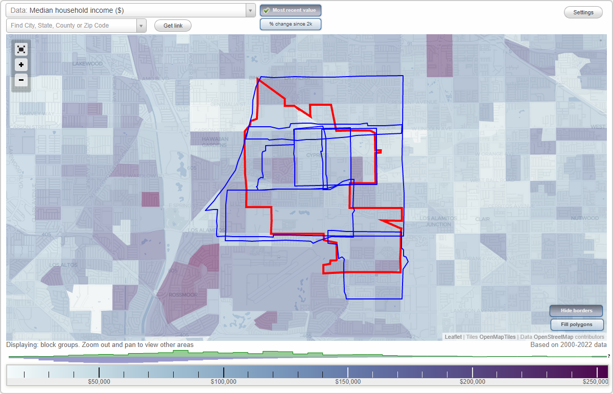
Cypress, California Neighborhood Map - Income, House Prices, Occupations, Boundaries
Settings
X

- City boundary
- Neighborhood boundaries
Business Search - 14 Million verified businesses
Neighborhoods:
Civic Center, Halcon, Lincoln Avenue, Los Alamitos Race Course, North of Katella, Shirley, South of KatellaCivic Center neighborhood in Cypress statistics: (Find on map)
Area: 1.264 square miles
Population: 11,986
Population density:
Median household income in 2021:
Median rent in in 2021:
Male vs Females
Median age
Housing prices:
Average estimated value of detached houses in 2021 (65.0% of all units):
Average estimated value of townhouses or other attached units in 2021 (23.9% of all units):
Average estimated '21 value of housing units in 5-or-more-unit structures (22.1% of all units):
Average estimated value of mobile home in 2021 (28.9% of all units):
Most popular occupations of males: sales and office occupations (17.6%); management occupations (except farmers) (12.1%); service occupations (10.6%); computer and mathematical occupations (8.6%); architecture and engineering occupations (7.9%); healthcare practitioners and technical occupations (6.7%); education, training, and library occupations (6.6%)
Most popular occupations of females: sales and office occupations (27.1%); service occupations (16.3%); education, training, and library occupations (11.4%); healthcare practitioners and technical occupations (10.8%); management occupations (except farmers) (10.3%); business and financial operations occupations (7.6%); life, physical, and social science occupations (3.8%)
Roads and streets: Ball Rd; Orange Ave; Moody St; Walker St; Grindlay St; Larwin Ave; Denni St; Belle Ave; Sorrento Dr; Lincoln Ave; Cumberland Dr; Canterbury Dr; Newman Ave; Oxford Dr; Corsica Dr; Ariano Dr; Hanover Dr; Ave Granada; Evergreen Ave; Bishop St; Rome Ave; Sequoia Ave; Brunswick Dr; Yorkshire Dr; Melbourne Dr; Firenza Dr; Ave Monterey; Julie Beth St; Ravari Dr; Tuscani Dr; Alderbury St; Ashbury Ave; Esther St; Seville Way; Camp St; Montefino Dr; Linaro Dr; Via Majorca; Danbury St; Fernbury St; Normandy Way; Vis Hermosa; Watson St; Nelson St; Dina Ct; Ethel St; Corso Cir; Tremezzo Dr; Vis Real; Ave Carmel; Fairfield Way; Lemon Ave; Halifax Dr; Salisbury Ln; Trevi St; Vis Sierra; Hickory Cir; Amalfi St; Fonte Rd; Gregory St; Christopher St; Santorini Dr; Via Linda; Spruce Ct; Vis Mesa; Glenbrook St; Edgemont Cir; Portofino Cir; Carrara Cir; Vis del Mar; Chelsea Ct; Ambruzzi Dr; Sherington Ct; Middlebury Cir; Lemon Cir; Maybury Cir; Silvretta Dr; Plumeria Ln; Barcelona Ln; Rome St; Novara Ln; Naples Dr; Newcastle Ln; Alcamo Ln; Eucalyptus Cir; Saint George Cir; Saint John Cir; Vis del Sol; Adagio Ln; Augusta Ct; Vis Bonita; Vis Serena; Monaco Dr; Weybridge Ct; Ave Mateo; Westbourne Ct; Tivoli Cir; Victoria Ct; Amberwick Cir; Wellington Ct; Lipari Cir; Napoli Pl; Chantry Ct; Vis Fortuna; Ravenna Way; Messina Cir; Windsor Cir; Halifax Cir; Hanover Cir; Lindsey Ln; Evergreen Dr; Via Largo; Madrid Cir; Capri Cir; Oakmount St; Trentino Dr; Palermo Way; Saint Charles Ave; Dresden Cir; Sowma Way; Electric St; Basilica Ct; Pecan St; Saint Stephen Cir; Saint Sophia Cir; Saint Vincent Cir; Delano Ln; Ortano Ln; St Francis Cir; Alice Cir; Saint Michael Cir; Redwood St; St Elizabeth Cir; St Agnes Cir; Villa Way; Arbor Ln; Palm Ct; Park Ave; Piazza Ct; Newman St; Anzio Ct; Aspen St; Walker Ct.
Other features: Carbon Crk.
Civic Center neighborhood detailed profile
Area: 1.264 square miles
Population: 11,986
Population density:
| Civic Center: | 9,483 people per square mile |
| Cypress: | 7,604 people per square mile |
Median household income in 2021:
| Civic Center: | $109,872 |
| Cypress: | $109,180 |
Median rent in in 2021:
| Civic Center: | $1,992 |
| Cypress: | $1,946 |
Male vs Females
| Males: | 5,870 |
| Females: | 6,115 |
Median age
| Males: | 41.3 years |
| Females: | 41.3 years |
Housing prices:
Average estimated value of detached houses in 2021 (65.0% of all units):
| Civic Center: | $1,053,638 |
| California: | $881,672 |
Average estimated value of townhouses or other attached units in 2021 (23.9% of all units):
| This neighborhood: | $576,605 |
| California: | $745,373 |
Average estimated '21 value of housing units in 5-or-more-unit structures (22.1% of all units):
| Civic Center: | $331,152 |
| California: | $701,962 |
Average estimated value of mobile home in 2021 (28.9% of all units):
| Civic Center: | $35,821 |
| California: | $174,181 |
Most popular occupations of males: sales and office occupations (17.6%); management occupations (except farmers) (12.1%); service occupations (10.6%); computer and mathematical occupations (8.6%); architecture and engineering occupations (7.9%); healthcare practitioners and technical occupations (6.7%); education, training, and library occupations (6.6%)
Most popular occupations of females: sales and office occupations (27.1%); service occupations (16.3%); education, training, and library occupations (11.4%); healthcare practitioners and technical occupations (10.8%); management occupations (except farmers) (10.3%); business and financial operations occupations (7.6%); life, physical, and social science occupations (3.8%)
Roads and streets: Ball Rd; Orange Ave; Moody St; Walker St; Grindlay St; Larwin Ave; Denni St; Belle Ave; Sorrento Dr; Lincoln Ave; Cumberland Dr; Canterbury Dr; Newman Ave; Oxford Dr; Corsica Dr; Ariano Dr; Hanover Dr; Ave Granada; Evergreen Ave; Bishop St; Rome Ave; Sequoia Ave; Brunswick Dr; Yorkshire Dr; Melbourne Dr; Firenza Dr; Ave Monterey; Julie Beth St; Ravari Dr; Tuscani Dr; Alderbury St; Ashbury Ave; Esther St; Seville Way; Camp St; Montefino Dr; Linaro Dr; Via Majorca; Danbury St; Fernbury St; Normandy Way; Vis Hermosa; Watson St; Nelson St; Dina Ct; Ethel St; Corso Cir; Tremezzo Dr; Vis Real; Ave Carmel; Fairfield Way; Lemon Ave; Halifax Dr; Salisbury Ln; Trevi St; Vis Sierra; Hickory Cir; Amalfi St; Fonte Rd; Gregory St; Christopher St; Santorini Dr; Via Linda; Spruce Ct; Vis Mesa; Glenbrook St; Edgemont Cir; Portofino Cir; Carrara Cir; Vis del Mar; Chelsea Ct; Ambruzzi Dr; Sherington Ct; Middlebury Cir; Lemon Cir; Maybury Cir; Silvretta Dr; Plumeria Ln; Barcelona Ln; Rome St; Novara Ln; Naples Dr; Newcastle Ln; Alcamo Ln; Eucalyptus Cir; Saint George Cir; Saint John Cir; Vis del Sol; Adagio Ln; Augusta Ct; Vis Bonita; Vis Serena; Monaco Dr; Weybridge Ct; Ave Mateo; Westbourne Ct; Tivoli Cir; Victoria Ct; Amberwick Cir; Wellington Ct; Lipari Cir; Napoli Pl; Chantry Ct; Vis Fortuna; Ravenna Way; Messina Cir; Windsor Cir; Halifax Cir; Hanover Cir; Lindsey Ln; Evergreen Dr; Via Largo; Madrid Cir; Capri Cir; Oakmount St; Trentino Dr; Palermo Way; Saint Charles Ave; Dresden Cir; Sowma Way; Electric St; Basilica Ct; Pecan St; Saint Stephen Cir; Saint Sophia Cir; Saint Vincent Cir; Delano Ln; Ortano Ln; St Francis Cir; Alice Cir; Saint Michael Cir; Redwood St; St Elizabeth Cir; St Agnes Cir; Villa Way; Arbor Ln; Palm Ct; Park Ave; Piazza Ct; Newman St; Anzio Ct; Aspen St; Walker Ct.
Other features: Carbon Crk.
Civic Center neighborhood detailed profile
Halcon neighborhood in Cypress statistics: (Find on map)
Area: 1.186 square miles
Population: 10,086
Population density:
Median household income in 2021:
Median rent in in 2021:
Male vs Females
Median age
Housing prices:
Average estimated value of detached houses in 2021 (63.8% of all units):
Average estimated value of townhouses or other attached units in 2021 (10.6% of all units):
Average estimated '21 value of housing units in 3-to-4-unit structures (5.4% of all units):
Average estimated '21 value of housing units in 5-or-more-unit structures (23.4% of all units):
Most popular occupations of males: sales and office occupations (18.8%); management occupations (except farmers) (14.6%); service occupations (9.8%); production occupations (9.7%); computer and mathematical occupations (6.7%); business and financial operations occupations (6.0%); transportation occupations (5.4%)
Most popular occupations of females: sales and office occupations (25.9%); service occupations (20.5%); management occupations (except farmers) (10.0%); education, training, and library occupations (9.4%); healthcare practitioners and technical occupations (8.9%); business and financial operations occupations (6.9%); computer and mathematical occupations (4.9%)
Roads and streets: Orange Ave; Lincoln Ave; Ball Rd; Walker St; Moody St; Grindlay St; Valley View St; Karen Ave; Graham St; Lime Ave; Bishop St; Newman St; Cumberland Dr; Camp St; Canterbury Dr; Nelson St; Lemon Ave; Oxford Dr; Hanover Dr; Evergreen Ave; Rome Ave; Walker Ct; Aspen St; Sequoia Ave; Brunswick Dr; Yorkshire Dr; Melbourne Dr; Montecito Dr; Peach St; Ravari Dr; Shirl St; Esther St; Lakeshore Dr; Citrus Ct; Vis Hermosa; Watson St; Cedar Ct; Cabrillo Way; Vis Real; Halifax Dr; Salisbury Ln; Vis Sierra; Hickory Cir; Maxson Dr; Wellson Dr; Spruce Ct; Vis Mesa; Glenbrook St; Edgemont Cir; Pine Ct; Vis del Mar; Plumeria Ln; Peartree Ln; Barcelona Ln; Rome St; Lime Cir; la Jolla Way; Sonwell Pl; Playa Way; Nancy St; Naples Dr; Newcastle Ln; Laguna Way; Eucalyptus Cir; Vis del Sol; Vis Bonita; Vis Serena; Amberwick Cir; Vis Fortuna; del Rio Way; Windsor Cir; Halifax Cir; Hanover Cir; Lindsey Ln; Evergreen Dr; Madrid Cir; Capri Cir; Oakmount St; Dresden Cir; Sowma Way; Newport Way; Pecan St; Redwood St; Villa Way; Arbor Ln; Pacifico Way; Lido Way; Palm Ct; Saint George Cir; Saint John Cir; Park Ave; Balboa Way; Newman Ave; Graham Cir.
Railroad features: Pacific Electric Rlwy.
Other features: Carbon Crk.
Halcon neighborhood detailed profile
Area: 1.186 square miles
Population: 10,086
Population density:
| Halcon: | 8,507 people per square mile |
| Cypress: | 7,604 people per square mile |
Median household income in 2021:
| Halcon: | $109,011 |
| Cypress: | $109,180 |
Median rent in in 2021:
| Halcon: | $1,831 |
| Cypress: | $1,946 |
Male vs Females
| Males: | 4,860 |
| Females: | 5,226 |
Median age
| Males: | 37.5 years |
| Females: | 40.9 years |
Housing prices:
Average estimated value of detached houses in 2021 (63.8% of all units):
| Halcon: | $864,940 |
| California: | $881,672 |
Average estimated value of townhouses or other attached units in 2021 (10.6% of all units):
| This neighborhood: | $501,517 |
| California: | $745,373 |
Average estimated '21 value of housing units in 3-to-4-unit structures (5.4% of all units):
| Halcon: | $304,074 |
| California: | $689,397 |
Average estimated '21 value of housing units in 5-or-more-unit structures (23.4% of all units):
| Halcon: | $405,583 |
| California: | $701,962 |
Most popular occupations of males: sales and office occupations (18.8%); management occupations (except farmers) (14.6%); service occupations (9.8%); production occupations (9.7%); computer and mathematical occupations (6.7%); business and financial operations occupations (6.0%); transportation occupations (5.4%)
Most popular occupations of females: sales and office occupations (25.9%); service occupations (20.5%); management occupations (except farmers) (10.0%); education, training, and library occupations (9.4%); healthcare practitioners and technical occupations (8.9%); business and financial operations occupations (6.9%); computer and mathematical occupations (4.9%)
Roads and streets: Orange Ave; Lincoln Ave; Ball Rd; Walker St; Moody St; Grindlay St; Valley View St; Karen Ave; Graham St; Lime Ave; Bishop St; Newman St; Cumberland Dr; Camp St; Canterbury Dr; Nelson St; Lemon Ave; Oxford Dr; Hanover Dr; Evergreen Ave; Rome Ave; Walker Ct; Aspen St; Sequoia Ave; Brunswick Dr; Yorkshire Dr; Melbourne Dr; Montecito Dr; Peach St; Ravari Dr; Shirl St; Esther St; Lakeshore Dr; Citrus Ct; Vis Hermosa; Watson St; Cedar Ct; Cabrillo Way; Vis Real; Halifax Dr; Salisbury Ln; Vis Sierra; Hickory Cir; Maxson Dr; Wellson Dr; Spruce Ct; Vis Mesa; Glenbrook St; Edgemont Cir; Pine Ct; Vis del Mar; Plumeria Ln; Peartree Ln; Barcelona Ln; Rome St; Lime Cir; la Jolla Way; Sonwell Pl; Playa Way; Nancy St; Naples Dr; Newcastle Ln; Laguna Way; Eucalyptus Cir; Vis del Sol; Vis Bonita; Vis Serena; Amberwick Cir; Vis Fortuna; del Rio Way; Windsor Cir; Halifax Cir; Hanover Cir; Lindsey Ln; Evergreen Dr; Madrid Cir; Capri Cir; Oakmount St; Dresden Cir; Sowma Way; Newport Way; Pecan St; Redwood St; Villa Way; Arbor Ln; Pacifico Way; Lido Way; Palm Ct; Saint George Cir; Saint John Cir; Park Ave; Balboa Way; Newman Ave; Graham Cir.
Railroad features: Pacific Electric Rlwy.
Other features: Carbon Crk.
Halcon neighborhood detailed profile
Lincoln Avenue neighborhood in Cypress statistics: (Find on map)
Area: 0.710 square miles
Population: 6,703
Population density:
Median household income in 2021:
Median rent in in 2021:
Male vs Females
Median age
Housing prices:
Average estimated value of detached houses in 2021 (42.5% of all units):
Average estimated value of townhouses or other attached units in 2021 (11.6% of all units):
Average estimated '21 value of housing units in 5-or-more-unit structures (22.3% of all units):
Average estimated value of mobile home in 2021 (35.2% of all units):
Most popular occupations of males: sales and office occupations (16.3%); service occupations (11.6%); computer and mathematical occupations (10.8%); management occupations (except farmers) (10.3%); construction, extraction, and maintenance occupations (6.9%); transportation occupations (6.5%); business and financial operations occupations (6.4%)
Most popular occupations of females: sales and office occupations (23.7%); service occupations (22.5%); education, training, and library occupations (8.7%); business and financial operations occupations (7.7%); healthcare practitioners and technical occupations (7.5%); management occupations (except farmers) (6.9%); production occupations (5.4%)
Roads and streets: Lincoln Ave; Bishop St; Camp St; Lincoln Plaza Way; Lincoln Ct; Danny Ave; Moody St; Watson St; Alaska Ave; Walker St; Lincoln Center Dr; York Dr (Chapman York Dr, Chapman Dr); Grindlay St; Rainier Dr; Denni St; Fieldbrook Ln; Shasta Cir; Cypress St; Cobblestone Ln; Valley View St; Stonehenge Ln; Bloomfield Ave; Evergreen Ave; Electric St; Candlestick Ln; Vis del Sol; Hoffman St; New Mexico Ln; Embassy Way; Los Altos Dr; Philo St; Sonora; Holder St; Vassar Dr; Kentucky Dr; Adams Ave; Van Buren Ave; Taylor Ave; Knott Ave (S Knott Ave); Los Indios Cir; Rancho Bernardo; Madison Ave; Polk Ave; Duke Dr; Cll de Camino; Grand Cir; Brownstone Cir; Whitney Way; Lanett St; Harvard Ave; Cll de Carlos; Dartmouth Way; Stanford Way; Don Diego; Mesa Verde; Princeton Way.
Railroad features: Pacific Electric Rlwy.
Lincoln Avenue neighborhood detailed profile
Area: 0.710 square miles
Population: 6,703
Population density:
| Lincoln Avenue: | 9,444 people per square mile |
| Cypress: | 7,604 people per square mile |
Median household income in 2021:
| Lincoln Avenue: | $81,946 |
| Cypress: | $109,180 |
Median rent in in 2021:
| Lincoln Avenue: | $1,920 |
| Cypress: | $1,946 |
Male vs Females
| Males: | 3,170 |
| Females: | 3,533 |
Median age
| Males: | 37.2 years |
| Females: | 38.2 years |
Housing prices:
Average estimated value of detached houses in 2021 (42.5% of all units):
| Lincoln Avenue: | $775,230 |
| California: | $881,672 |
Average estimated value of townhouses or other attached units in 2021 (11.6% of all units):
| This neighborhood: | $412,182 |
| California: | $745,373 |
Average estimated '21 value of housing units in 5-or-more-unit structures (22.3% of all units):
| Lincoln Avenue: | $364,191 |
| California: | $701,962 |
Average estimated value of mobile home in 2021 (35.2% of all units):
| Lincoln Avenue: | $51,096 |
| California: | $174,181 |
Most popular occupations of males: sales and office occupations (16.3%); service occupations (11.6%); computer and mathematical occupations (10.8%); management occupations (except farmers) (10.3%); construction, extraction, and maintenance occupations (6.9%); transportation occupations (6.5%); business and financial operations occupations (6.4%)
Most popular occupations of females: sales and office occupations (23.7%); service occupations (22.5%); education, training, and library occupations (8.7%); business and financial operations occupations (7.7%); healthcare practitioners and technical occupations (7.5%); management occupations (except farmers) (6.9%); production occupations (5.4%)
Roads and streets: Lincoln Ave; Bishop St; Camp St; Lincoln Plaza Way; Lincoln Ct; Danny Ave; Moody St; Watson St; Alaska Ave; Walker St; Lincoln Center Dr; York Dr (Chapman York Dr, Chapman Dr); Grindlay St; Rainier Dr; Denni St; Fieldbrook Ln; Shasta Cir; Cypress St; Cobblestone Ln; Valley View St; Stonehenge Ln; Bloomfield Ave; Evergreen Ave; Electric St; Candlestick Ln; Vis del Sol; Hoffman St; New Mexico Ln; Embassy Way; Los Altos Dr; Philo St; Sonora; Holder St; Vassar Dr; Kentucky Dr; Adams Ave; Van Buren Ave; Taylor Ave; Knott Ave (S Knott Ave); Los Indios Cir; Rancho Bernardo; Madison Ave; Polk Ave; Duke Dr; Cll de Camino; Grand Cir; Brownstone Cir; Whitney Way; Lanett St; Harvard Ave; Cll de Carlos; Dartmouth Way; Stanford Way; Don Diego; Mesa Verde; Princeton Way.
Railroad features: Pacific Electric Rlwy.
Lincoln Avenue neighborhood detailed profile
Los Alamitos Race Course neighborhood in Cypress statistics: (Find on map)
Area: 2.447 square miles
Population: 11,737
Population density:
Median household income in 2021:
Median rent in in 2021:
Male vs Females
Median age
Housing prices:
Average estimated value of detached houses in 2021 (69.7% of all units):
Average estimated value of townhouses or other attached units in 2021 (10.7% of all units):
Average estimated '21 value of housing units in 3-to-4-unit structures (41.4% of all units):
Average estimated '21 value of housing units in 5-or-more-unit structures (1.8% of all units):
Most popular occupations of males: management occupations (except farmers) (16.2%); sales and office occupations (14.5%); service occupations (14.4%); business and financial operations occupations (7.0%); material moving occupations (6.4%); education, training, and library occupations (6.3%); production occupations (5.3%)
Most popular occupations of females: sales and office occupations (22.9%); service occupations (20.3%); education, training, and library occupations (13.1%); healthcare practitioners and technical occupations (12.6%); management occupations (except farmers) (11.3%); business and financial operations occupations (8.3%); arts, design, entertainment, sports, and media occupations (3.0%)
Roads and streets: Katella Ave; Cerritos Ave; Myra Ave; Marion Ave; Green Ave; Valley View St; Bloomfield St; Walker St; Cathy Ave; Reagan St; Marcella Ave; Humbolt St; Noel St; Corporate Ave; Plaza Dr; Cll Lee; Lexington Dr; Angela Ave; Saint Alban St; Moody St; Denni St; Olga Ave; Catalina St; Citation Ave; Aurelia St (Aurelia Ave); Lorraine Ln; Christopher St; Barbara Anne St; Antietam Ave; Kearsarge Ave; Saratoga Ave; Camden Dr; Progress Way; Nestle Ave; Rexford Ave; Cherry St; Kings St; Florista St; Portal Dr; Ball Rd; Los Vaqueros Cir; Longden St; Corporate Center Dr; Kaylor St; San Joaquin Way (San Joaquin Ave); Teresa Ave; Saltair Dr; Sausalito St; Laurel Ave; Gregory St; Sande St; Ethel St; Julie Beth St; Janice Lynn St; Whirlaway St; Ponder St; Winners Cir; St Bernard St; Tanforan Dr; Hialeah Dr; Pimlico Dr; Aqueduct Dr; Delano Dr; Mardel Dr; Via el Mercado; San Bonito Ave; Maple St; San Mateo Ave; Douglas Dr; Cynthia Cir; Cathy Cir; Santa Clara St; Santa Elise St; Marcella Cir; Kyle St; Stratmore Ave; Abraham St (Abraham Ave); Mildred Ave; Carlyle Ct; McDonnell Dr; Beaver Cir; del Norte Way; Barclay Dr; Miranda Ave; St Joan St; Corporate Dr; Condee St; William Ave; Kristen St; Shasta Ave; Executive Dr; Cary Cir; Patricia Dr; Marion Cir; Roxbury Ct; Cynthia Ln; Comstock Ct; Mildred Ln; Elinora Ln; Cathy Ln; Colgate Dr; Holmby Ct; Doris Cir; Patricia Cir; Siboney St; Santa Rita St; Mildred Cir; Santa Marta St; Julie Beth Cir; Jeanine Ln; Ethel Cir; Janice Lynn Cir; el Dorado Way; Gregory Cir; Bryant Ct; Rose Ann Cir; Ticonderoga Dr; Midway Dr; Enterprise Dr; Rexford Dr; Market Pl; Lassen St; Bennington St; Mindora St; Saratoga St; Saratoga Dr; Churchill Ct; Hampshire Ct; Laurel St; Kanel Cir; Sierra Cir; Virgil Cir; Marian Ave; Stratton Ct; Rodeo Ct; Rutgers Ct; Rexford Ct; Vernon Ct; Bedford Ct; Esther Cir; Mohawk Ct.
Railroad features: Union Pacific RR.
Other features: Carbon Crk.
Los Alamitos Race Course neighborhood detailed profile
Area: 2.447 square miles
Population: 11,737
Population density:
| Los Alamitos Race Course (Race Course): | 4,797 people per square mile |
| Cypress: | 7,604 people per square mile |
Median household income in 2021:
| Los Alamitos Race Course (Race Course): | $118,959 |
| Cypress: | $109,180 |
Median rent in in 2021:
| Los Alamitos Race Course (Race Course): | $2,182 |
| Cypress: | $1,946 |
Male vs Females
| Males: | 5,684 |
| Females: | 6,053 |
Median age
| Males: | 38.1 years |
| Females: | 42.0 years |
Housing prices:
Average estimated value of detached houses in 2021 (69.7% of all units):
| Los Alamitos Race Course (Race Course): | $767,011 |
| California: | $881,672 |
Average estimated value of townhouses or other attached units in 2021 (10.7% of all units):
| This neighborhood: | $470,789 |
| California: | $745,373 |
Average estimated '21 value of housing units in 3-to-4-unit structures (41.4% of all units):
| Los Alamitos Race Course (Race Course): | $304,074 |
| California: | $689,397 |
Average estimated '21 value of housing units in 5-or-more-unit structures (1.8% of all units):
| Los Alamitos Race Course (Race Course): | $74,929 |
| California: | $701,962 |
Most popular occupations of males: management occupations (except farmers) (16.2%); sales and office occupations (14.5%); service occupations (14.4%); business and financial operations occupations (7.0%); material moving occupations (6.4%); education, training, and library occupations (6.3%); production occupations (5.3%)
Most popular occupations of females: sales and office occupations (22.9%); service occupations (20.3%); education, training, and library occupations (13.1%); healthcare practitioners and technical occupations (12.6%); management occupations (except farmers) (11.3%); business and financial operations occupations (8.3%); arts, design, entertainment, sports, and media occupations (3.0%)
Roads and streets: Katella Ave; Cerritos Ave; Myra Ave; Marion Ave; Green Ave; Valley View St; Bloomfield St; Walker St; Cathy Ave; Reagan St; Marcella Ave; Humbolt St; Noel St; Corporate Ave; Plaza Dr; Cll Lee; Lexington Dr; Angela Ave; Saint Alban St; Moody St; Denni St; Olga Ave; Catalina St; Citation Ave; Aurelia St (Aurelia Ave); Lorraine Ln; Christopher St; Barbara Anne St; Antietam Ave; Kearsarge Ave; Saratoga Ave; Camden Dr; Progress Way; Nestle Ave; Rexford Ave; Cherry St; Kings St; Florista St; Portal Dr; Ball Rd; Los Vaqueros Cir; Longden St; Corporate Center Dr; Kaylor St; San Joaquin Way (San Joaquin Ave); Teresa Ave; Saltair Dr; Sausalito St; Laurel Ave; Gregory St; Sande St; Ethel St; Julie Beth St; Janice Lynn St; Whirlaway St; Ponder St; Winners Cir; St Bernard St; Tanforan Dr; Hialeah Dr; Pimlico Dr; Aqueduct Dr; Delano Dr; Mardel Dr; Via el Mercado; San Bonito Ave; Maple St; San Mateo Ave; Douglas Dr; Cynthia Cir; Cathy Cir; Santa Clara St; Santa Elise St; Marcella Cir; Kyle St; Stratmore Ave; Abraham St (Abraham Ave); Mildred Ave; Carlyle Ct; McDonnell Dr; Beaver Cir; del Norte Way; Barclay Dr; Miranda Ave; St Joan St; Corporate Dr; Condee St; William Ave; Kristen St; Shasta Ave; Executive Dr; Cary Cir; Patricia Dr; Marion Cir; Roxbury Ct; Cynthia Ln; Comstock Ct; Mildred Ln; Elinora Ln; Cathy Ln; Colgate Dr; Holmby Ct; Doris Cir; Patricia Cir; Siboney St; Santa Rita St; Mildred Cir; Santa Marta St; Julie Beth Cir; Jeanine Ln; Ethel Cir; Janice Lynn Cir; el Dorado Way; Gregory Cir; Bryant Ct; Rose Ann Cir; Ticonderoga Dr; Midway Dr; Enterprise Dr; Rexford Dr; Market Pl; Lassen St; Bennington St; Mindora St; Saratoga St; Saratoga Dr; Churchill Ct; Hampshire Ct; Laurel St; Kanel Cir; Sierra Cir; Virgil Cir; Marian Ave; Stratton Ct; Rodeo Ct; Rutgers Ct; Rexford Ct; Vernon Ct; Bedford Ct; Esther Cir; Mohawk Ct.
Railroad features: Union Pacific RR.
Other features: Carbon Crk.
Los Alamitos Race Course neighborhood detailed profile
North of Katella neighborhood in Cypress statistics: (Find on map)
Area: 9.866 square miles
Population: 76,120
Population density:
Median household income in 2021:
Median rent in in 2021:
Male vs Females
Median age
Housing prices:
Average estimated value of detached houses in 2021 (61.5% of all units):
Average estimated value of townhouses or other attached units in 2021 (16.7% of all units):
Average estimated '21 value of housing units in 3-to-4-unit structures (12.8% of all units):
Average estimated '21 value of housing units in 5-or-more-unit structures (18.9% of all units):
Average estimated value of mobile home in 2021 (16.6% of all units):
Most popular occupations of males: sales and office occupations (17.0%); management occupations (except farmers) (13.7%); service occupations (13.7%); computer and mathematical occupations (7.0%); production occupations (5.7%); business and financial operations occupations (5.5%); construction, extraction, and maintenance occupations (5.5%)
Most popular occupations of females: sales and office occupations (27.5%); service occupations (18.6%); healthcare practitioners and technical occupations (10.1%); education, training, and library occupations (9.4%); management occupations (except farmers) (9.3%); business and financial operations occupations (7.7%); computer and mathematical occupations (2.6%)
Roads and streets: Halbrite Ave; Bloomfield Ave (Buena Way, Bloomfield St); Bloomfield St (Bloomfield Ave); la Palma Ave (del Amo Blvd); E Littlefield St; E Ellerford St; E Woodson St (226th St); E Hendri St; Farnham Ave; Centralia St; E Kinmount St; E Wardlow Rd; E Carburton St; E Decca St; E Blithedale St; Opal Ave; Pearl Cir; Jade Ave; E Valeport Ave; Garnet Ave; E Kevin St; Fontainbleau Ave; Kaylor Ave.
Other features: Moody Crk.
Roads and streets: Cerritos Ave; Katella Ave; Lincoln Ave; Ball Rd; Orange Ave; Myra Ave; Holder St; Crescent Ave; Knott Ave (S Knott Ave); la Palma Ave; Walker St; Valley View St; Moody St; Marion Ave; Denni St; Belle Ave; College Circle Dr; Bloomfield St; Larwin Ave; Grindlay St; Los Altos Dr; Lakeshore Dr; Los Alamitos Blvd; W Greentree Cir (Greentree Cir); San Diego Dr; Lime Ave; San Lorenzo Dr; San Marino Dr; Cathy Ave; Bishop St; Santa Margarita Ln; Watson St; Lemon Ave; la Luna Dr; Gateway Dr; Sorrento Dr; Bloomfield Ave (Bloomfield St); Karen Ave; Camp St; San Francisco Dr; Graham St; Ferne Ave; Marcella Way; Newman Ave; Julie Beth St; Rosemary Dr; Catalina St; Juanita St; San Marcos Way; Sumner Pl; Marcella Ave; Elm Ave; Christopher St; Newman St; Cumberland Dr; Humbolt St; Ethel St; Jonathan Ave; Los Angeles Way; San Rafael Dr; Los Arcos Way; San Clemente Way; Corporate Ave; Plaza Dr; San Homero Way; San Haroldo Way; Los Santos Way; Canterbury Dr; Reagan St; Florista St; Pso de Oro; San Ricardo Way; Windsong Ave; San Ramon Way; Yosemite Dr; San Helice Cir; Via Largo; San Antonio Dr; Via Irana; la Salle St; Sausalito St; Nelson St; Gregory St; Elben Dr; Cll Lee; Amberwood Ave; San Pablo Dr; Noel St; San Rio Dr; Via Arroyo Dr; Via Vista Dr; Los Amigos St; Mount Waterman Dr; Los Alamos St; Oxford Dr; New York Ave; San Harco Cir; Mount Ripley Dr; S Fremont St (Fremont St); Florence Ave; Belmont St; Mount Whitney Dr; Ave Sevilla; Gay St; San Alto Way; Carob St; Bloomfield Ave (Bloomfield St, Buena Way); San Bruno Dr; Corsica Dr; Angela Ave; S Berkley St; Saint Ann Ave; San Capistrano Way; Saint Alban St; Ariano Dr; Hanover Dr; Alaska Ave; Embassy Cir; Lincoln Plaza Way; Fontainbleau Way; Merten Ave; Ave Granada; Grace Ave; Evergreen Ave; W Savanna St; San Pasqual Cir; Lexington Dr; University Way; Carlotta Ave; Rome Ave; Delong St; Lincoln Ct; Miranda Ave; Olga Ave; Verner Dr; Mount Lowe Dr; Claudia Ave; Citation Ave; Sequoia Dr; Moonstone St (S Moonstone St); Los Ranchos Dr; Walker Ct; Marian Ave; el Pescador Ln; Los Feliz Dr; Park Ave; Los Molinos Dr; Hoffman St; San Huerta Cir; Hope St; W Kingsway Ave (Kingsway Ave); Aspen St; Surrey Dr; Los Palos Cir; Sprague Ave; Aurelia St (Aurelia Ave); Suffield St; Lorraine Ln; San Carlos Way; S Oriole St; Sequoia Ave; Brunswick Dr; Barbara Anne St; Yorkshire Dr; Melbourne Dr; S Pvt Rd; Vonnie Ln; Danny Ave; Cypress Ave; Redford Ln; Lawrence St; Toland Ave; Cheshire Dr; Firenza Dr; James Alan St; del Amo Blvd (la Palma Ave); Montecito Dr; Maple St; Peach St; Pauline Dr; Lee Dr; Ave Monterey; Los Encinos St; San Alano Cir; Adams Ave; Ravari Dr; Polk Ave; Tuscani Dr; Taylor Ave; Madison Ave; Van Buren Ave; Acacia Dr; Bellhaven St; W Ball Rd; Shirl St; Salisbury Ln; San Hugo Way; Eudora Ave; Malaga Dr; Diane Ave; Fred Dr; Walnut St; Teakwood St; Cornelia Cir; Fenley Dr; Alderbury St; Cambridge St; Saratoga Ave; Ashbury Ave; Kathleen Dr; Somerset Ln; Robin Dr; San Martin Way; Esther St; Seville Way; S Goldstone Cir; Camden Dr; San Paco Cir; San Mateo Cir; Acacia St; Pine St; Regency St; Via Verde; Progress Way; Nestle Ave; San Rolando Way; Montefino Dr; Rexford Ave; Christine Cir (W Christine Cir); San Dimas Cir; Via Norte; Cherry St; Linaro Dr; Cll de Camino; Kings St; W Mungall Dr; Via Balboa Cir; San Simeon Cir; Ritter St; Via Majorca; Lincoln Center Dr; Via Riviera Way; Danbury St; Los Pacos St; Citrus Ct; Fernbury St; Chip Ave; Lassen Dr; Los Nietos Dr; Bernadette Ave; Normandy Way; Vis Hermosa; Serpentine Dr; Doreen Dr; Jackson Ave; Bus Center Dr; Greta Ave; Lorinda Ave; Via Sonoma; Hester Ave; Kaylor Ave; Portal Dr; Chestnut St; San Benito Way; Dina Ct; Jefferson Dr; Jeffrey Mark St; Somerdale Ln; la Homa St; Pineridge Dr; San Pedro Cir; Los Vaqueros Cir; San Hernando Way; Via Kannela; Longden St; W Bouquet Ave; Mount Palomar Dr; San Miguel Cir; Corporate Center Dr; Kaylor St; Fleetwood St; San Bernardo Cir; Via Encinas; San Joaquin Way (San Joaquin Ave); Monique Way; Glenroy Ave (W Glenroy Ave); Teresa Ave; Dorset Dr; S Latona St; Saltair Dr; Jade Ave; Opal Ave; Notre Dame Dr; Cedar Ct; Fontainbleau Ave; Garnet Ave; Laurel Ave; Tammy St; Corso Cir; Vinevale Cir; Cabrillo Way; Blanche Cir; Cambury Dr; Sande St; Jill St; Pamela St; Tremezzo Dr; Vis Real; Ave Carmel; Janice Lynn St; Pso de Plata; Ave Madrid; Marquette Dr; York Dr (Chapman York Dr, Chapman Dr); Whirlaway St; Pepperdine Dr; Ponder St; San Jose Cir; Rainier Dr; San Salvador Cir; San Yuba Way; Barbara Cir; Fairfield Way; San Hilario Cir; San Hacienda Cir; Blanca Dr; Younger Dr; San Heron Cir; Bernice Cir; Wickham Ln; Vnr; Halifax Dr; International Ave; San Adriano Way; Brenda Ave; Kyle St; St Bernard St; San Ysidro Cir; Trevi St; Park West Cir; Vis Sierra; Birch St; Hickory Cir; San Remo Way; Whitney Way; Ave de Andra; Twin Lakes Dr; del Monte Dr (W del Monte Dr); Amalfi St; Tanforan Dr; Hialeah Dr; Ainsworth Ln; Global Dr; Maxson Dr; Pimlico Dr; Aqueduct Dr; Alta Vis; Delano Dr; Mardel Dr; Cardiff Dr; Fieldbrook Ln; Casa Grande Cir; Avenido de Marcia; Shasta Cir; Fonte Rd; Wellson Dr; Barry Dr; Everest Cir; Yamaha Way; Devon Cir; San Bonito Ave; Harvard Ave; San Mateo Ave; Via Media; Lanett St; Santorini Dr; Via Linda; Spruce Ct; Cypress St; Solano Dr; Cobblestone Ln; Vis Mesa; Matalon Ln; Douglas Dr; Cynthia Cir; Glenbrook St; San Juan Cir; San Padre Cir; Cathy Cir; Beatrice Cir; San Julian Cir; Florence St; Edgemont Cir; Pine Ct; Toland Cir; Portofino Cir; San Joaquin Cir; San Lazaro Cir; Carrara Cir; Vis del Mar; Commerce Dr; Carolina Cir; Sparrow Ln; Chelsea Ct; Cathay Cir; Ronald Dr; Cecilia Cir; Simone Way; Ambruzzi Dr; Sherington Ct; Celeste Cir; Belday St; Middlebury Cir; Casa Verde Dr; Lemon Cir; Windsor Cir; Maybury Cir; Campesina Dr; Petite Ln; Stonehenge Ln; Holden Cir; Silvretta Dr; Trafalgar Dr; Carrotwood Ct; Dabny Ln; Elizabeth Ct; Marilyn Dr; Plumeria Ln; S Marian Way (Marian Way); Santa Clara St; Peartree Ln; Via Sevilla Dr; New Mexico Ln; Santa Elise St; Via Entrada; Dartmouth Way; de Vries Ln; San Arturo Cir; Bluebird Ln; Marcella Cir; Barcelona Ln; San Ruben Cir; San Rolando Cir; San Renaldo Cir; Via Media Cir; Via Gancho Cir; W Stadco Dr; Via Sola Cir; W Cornelia Cir; Louise Ln; San Roberto Cir; Meridian Dr; Rome St; Via Norte Cir; Via Jacara; Stratmore Ave; Thomas Cir; Charles Cir; San Rodolfo Way; Lime Cir; Banbury Cir; Abraham St (Abraham Ave); la Jolla Way; Willow Dr; Rose St; Sonwell Pl; Mildred Ave; Livermore Pl; Ave de Trina; Playa Way; Nancy St; Corinne Cir; Carlyle Ct; Manchester Pl; Kinmount St; Forest St; McDonnell Dr; Clementine Cir; del Sur Cir; Constance Cir; Beaver Cir; Novara Ln; del Norte Way; del Este Cir; del Serra Cir; San Romolo Way; Naples Dr; Lynn Cir; del Sol Cir; del Norte Cir; Hummingbird Cir; Mount Barnard Dr; Barclay Dr; Newcastle Ln; Alcamo Ln; Los Flores Ave; Madia Cir; Via Vico Cir; Martinique Way; Laguna Way; Lexington St; Joan Cir; Loyola Way; Eucalyptus Cir; St Joan St; Janeen Cir; Dover Dr; Corporate Dr; Via Brenda; Condee St; William Ave; Kristen St; Dover Cir; Shasta Ave; Electric St; Saint George Cir; Candlestick Ln; Saint John Cir; Executive Dr; Sussex Cir; Vis del Sol; Los Amores St; Sorbonne Way; Adagio Ln; Cary Cir; Patricia Dr; Marion Cir; Margaret St; Via Ingresso; Augusta Ct; Gene St; Roxbury Ct; San Rufo Cir; Cynthia Ln; Vis Bonita; Lolina Ln; Cartagena Cir; Daisy Cir; Cordoba Cir; Sausalito Cir; Comstock Ct; Emerald Cir; Vis Serena; Mildred Ln; Monaco Dr; Weybridge Ct; Elinora Ln; Priest Dr; Cathy Ln; Acacia Cir; Sonora Way; Colgate Dr; Holmby Ct; Ave Mateo; Doris Cir; Hampshire Cir; W Eureka Dr; Lancashire Cir; Westbourne Ct; Tivoli Cir; San Marcello Cir; Patricia Cir; Cheshire Cir; Claudia Cir; Frese Ln; Yorkshire Cir; Santa Rita St; Cll de William; Pepper Tree Ln; Embassy Way; Mildred Cir; Ave de Jano; Victoria Ct; Amberwick Cir; Wellington Ct; Lipari Cir; Napoli Pl; Santa Marta St; Lawrence Dr; Joel Cir; Mesa Verde; Don Diego; Chantry Ct; Cll de Carlos; Vis Fortuna; Philo St; Ravenna Way; del Rio Way; Messina Cir; Fleetwood Ave; Dawn Cir; Sonora; Halifax Cir; Ronald Cir; Hanover Cir; Riva Ct; Lindsey Ln; Evergreen Dr; Vassar Dr; Monterra Way; Beatrice St; Mount Dana Cir; San Leon Cir; Kermore Ln; Meadowlark Ln; Kentucky Dr; Lena Dr; Madrid Cir; Julie Beth Cir; Jeanine Ln; Ethel Cir; Capri Cir; Janice Lynn Cir; Quail Dr; Beach Cir; San Lucas Cir; Oakmount St; el Dorado Way; Gregory Cir; San Leandro Cir; San Luis Cir; Trentino Dr; Cll de David; Bryant Ct; Cll de Howard; Georgetown Way; Palermo Way; Farnham Ave; Saint Charles Ave; Dresden Cir; Sowma Way; Sundance Ln; Gem Ave; Rose Ann Cir; Pearl Ct; Princeton Way; Brittany Way; Stanford Way; San Marino Cir; Hester St; Woodglen Cir; Andre Ln; Mulberry St; Leone Way; San Alfredo Cir; Manzanita Cir; Montanza Way; Newport Way; Via Tina; Kington Way; del Oro Ln; Starling Way; San Mateo Ln; Mount Shasta Cir; Los Indios Cir; Cedarview Ct; Cornwall Dr; Rexford Dr; Linda Ln; San Gabriel Cir; Basilica Ct; Rancho Bernardo; Meadowlark Dr; Pecan St; Pearl Cir; Stratford Cir; Market Pl; Athenia Cir; Alicia Way; Lassen St; Winners Cir; Saint Stephen Cir; Duke Dr; Saint Sophia Cir; Saint Vincent Cir; Delano Ln; Los Encantos Cir; Ortano Ln; St Francis Cir; Berwick Ct; Brighton Cir; Alice Cir; Saint Michael Cir; Redwood St; Saratoga St; S Stadco Dr; St Elizabeth Cir; St Agnes Cir; Villa Way; Lee St; Partridge Cir; Milton Cir; San Alano Ln; Arbor Ln; Selkirk Ct; Pacifico Way; Grand Cir; Crystal Cir; Churchill Ct; Brownstone Cir; San Paco Ln; Ward Cir; Crocus Cir; Agate Cir; Greta Cir; Hampshire Ct; Laurel St; Cll del Rio; Diane Cir; Scott Cir; Lido Way; Sunny Cir; San Pasqual Ln; Dove Cir; Syracuse Ave; W Sweetbay Ct; Adore Cir; San Felipe Cir; Deborah St; Cadiz Cir; Palm Ct; Kanel Cir; Sierra Cir; San Fabio Cir; Piazza Ct; Sandpiper Dr; Balboa Way; S Arc Way; Virgil Cir; Via Helena; Wesenberg Cir; Cornwall Cir; Anzio Ct; Moorgate Dr; York Cir; Salisbury Cir; Stratton Ct; Via Jardin; Graham Cir; Kent Cir; Cll de Lewis; Avon Cir; Almond St; Cornell Way; Pepper Tree Way; Venada Dr; Rodeo Ct; Rutgers Ct; Kline Cir; Mamota Way; Bravo Ln; Eudora Cir; San Pacifico Cir; San Palo Cir; San Calvino Cir; Santa Marta Cir; San Diego Cir; Santa Paula Cir; Yorktown Pl; Los Cientos Cir; Los Ramos Cir; Los Rapidos Cir; Mount Baldy Cir; Rexford Ct; Vernon Ct; Santa Anita Cir; Bedford Ct; S Oriole Pl; Esther Cir; Swan Cir; Crest Cir; Mohawk Ct; Holly Dr.
Railroad features: Union Pacific RR; Pacific Electric Rlwy.
Other features: Carbon Crk.
Other features: Moody Creek Flood Control Chnnl.
Other features: Carbon Creek Chnnl.
North of Katella neighborhood detailed profile
Area: 9.866 square miles
Population: 76,120
Population density:
| North of Katella: | 7,716 people per square mile |
| Cypress: | 7,604 people per square mile |
Median household income in 2021:
| North of Katella: | $102,844 |
| Cypress: | $109,180 |
Median rent in in 2021:
| North of Katella: | $2,015 |
| Cypress: | $1,946 |
Male vs Females
| Males: | 36,929 |
| Females: | 39,191 |
Median age
| Males: | 39.3 years |
| Females: | 41.5 years |
Housing prices:
Average estimated value of detached houses in 2021 (61.5% of all units):
| North of Katella: | $799,094 |
| California: | $881,672 |
Average estimated value of townhouses or other attached units in 2021 (16.7% of all units):
| This neighborhood: | $506,181 |
| California: | $745,373 |
Average estimated '21 value of housing units in 3-to-4-unit structures (12.8% of all units):
| North of Katella: | $304,074 |
| California: | $689,397 |
Average estimated '21 value of housing units in 5-or-more-unit structures (18.9% of all units):
| North of Katella: | $205,486 |
| California: | $701,962 |
Average estimated value of mobile home in 2021 (16.6% of all units):
| North of Katella: | $56,542 |
| California: | $174,181 |
Most popular occupations of males: sales and office occupations (17.0%); management occupations (except farmers) (13.7%); service occupations (13.7%); computer and mathematical occupations (7.0%); production occupations (5.7%); business and financial operations occupations (5.5%); construction, extraction, and maintenance occupations (5.5%)
Most popular occupations of females: sales and office occupations (27.5%); service occupations (18.6%); healthcare practitioners and technical occupations (10.1%); education, training, and library occupations (9.4%); management occupations (except farmers) (9.3%); business and financial operations occupations (7.7%); computer and mathematical occupations (2.6%)
Roads and streets: Halbrite Ave; Bloomfield Ave (Buena Way, Bloomfield St); Bloomfield St (Bloomfield Ave); la Palma Ave (del Amo Blvd); E Littlefield St; E Ellerford St; E Woodson St (226th St); E Hendri St; Farnham Ave; Centralia St; E Kinmount St; E Wardlow Rd; E Carburton St; E Decca St; E Blithedale St; Opal Ave; Pearl Cir; Jade Ave; E Valeport Ave; Garnet Ave; E Kevin St; Fontainbleau Ave; Kaylor Ave.
Other features: Moody Crk.
Roads and streets: Cerritos Ave; Katella Ave; Lincoln Ave; Ball Rd; Orange Ave; Myra Ave; Holder St; Crescent Ave; Knott Ave (S Knott Ave); la Palma Ave; Walker St; Valley View St; Moody St; Marion Ave; Denni St; Belle Ave; College Circle Dr; Bloomfield St; Larwin Ave; Grindlay St; Los Altos Dr; Lakeshore Dr; Los Alamitos Blvd; W Greentree Cir (Greentree Cir); San Diego Dr; Lime Ave; San Lorenzo Dr; San Marino Dr; Cathy Ave; Bishop St; Santa Margarita Ln; Watson St; Lemon Ave; la Luna Dr; Gateway Dr; Sorrento Dr; Bloomfield Ave (Bloomfield St); Karen Ave; Camp St; San Francisco Dr; Graham St; Ferne Ave; Marcella Way; Newman Ave; Julie Beth St; Rosemary Dr; Catalina St; Juanita St; San Marcos Way; Sumner Pl; Marcella Ave; Elm Ave; Christopher St; Newman St; Cumberland Dr; Humbolt St; Ethel St; Jonathan Ave; Los Angeles Way; San Rafael Dr; Los Arcos Way; San Clemente Way; Corporate Ave; Plaza Dr; San Homero Way; San Haroldo Way; Los Santos Way; Canterbury Dr; Reagan St; Florista St; Pso de Oro; San Ricardo Way; Windsong Ave; San Ramon Way; Yosemite Dr; San Helice Cir; Via Largo; San Antonio Dr; Via Irana; la Salle St; Sausalito St; Nelson St; Gregory St; Elben Dr; Cll Lee; Amberwood Ave; San Pablo Dr; Noel St; San Rio Dr; Via Arroyo Dr; Via Vista Dr; Los Amigos St; Mount Waterman Dr; Los Alamos St; Oxford Dr; New York Ave; San Harco Cir; Mount Ripley Dr; S Fremont St (Fremont St); Florence Ave; Belmont St; Mount Whitney Dr; Ave Sevilla; Gay St; San Alto Way; Carob St; Bloomfield Ave (Bloomfield St, Buena Way); San Bruno Dr; Corsica Dr; Angela Ave; S Berkley St; Saint Ann Ave; San Capistrano Way; Saint Alban St; Ariano Dr; Hanover Dr; Alaska Ave; Embassy Cir; Lincoln Plaza Way; Fontainbleau Way; Merten Ave; Ave Granada; Grace Ave; Evergreen Ave; W Savanna St; San Pasqual Cir; Lexington Dr; University Way; Carlotta Ave; Rome Ave; Delong St; Lincoln Ct; Miranda Ave; Olga Ave; Verner Dr; Mount Lowe Dr; Claudia Ave; Citation Ave; Sequoia Dr; Moonstone St (S Moonstone St); Los Ranchos Dr; Walker Ct; Marian Ave; el Pescador Ln; Los Feliz Dr; Park Ave; Los Molinos Dr; Hoffman St; San Huerta Cir; Hope St; W Kingsway Ave (Kingsway Ave); Aspen St; Surrey Dr; Los Palos Cir; Sprague Ave; Aurelia St (Aurelia Ave); Suffield St; Lorraine Ln; San Carlos Way; S Oriole St; Sequoia Ave; Brunswick Dr; Barbara Anne St; Yorkshire Dr; Melbourne Dr; S Pvt Rd; Vonnie Ln; Danny Ave; Cypress Ave; Redford Ln; Lawrence St; Toland Ave; Cheshire Dr; Firenza Dr; James Alan St; del Amo Blvd (la Palma Ave); Montecito Dr; Maple St; Peach St; Pauline Dr; Lee Dr; Ave Monterey; Los Encinos St; San Alano Cir; Adams Ave; Ravari Dr; Polk Ave; Tuscani Dr; Taylor Ave; Madison Ave; Van Buren Ave; Acacia Dr; Bellhaven St; W Ball Rd; Shirl St; Salisbury Ln; San Hugo Way; Eudora Ave; Malaga Dr; Diane Ave; Fred Dr; Walnut St; Teakwood St; Cornelia Cir; Fenley Dr; Alderbury St; Cambridge St; Saratoga Ave; Ashbury Ave; Kathleen Dr; Somerset Ln; Robin Dr; San Martin Way; Esther St; Seville Way; S Goldstone Cir; Camden Dr; San Paco Cir; San Mateo Cir; Acacia St; Pine St; Regency St; Via Verde; Progress Way; Nestle Ave; San Rolando Way; Montefino Dr; Rexford Ave; Christine Cir (W Christine Cir); San Dimas Cir; Via Norte; Cherry St; Linaro Dr; Cll de Camino; Kings St; W Mungall Dr; Via Balboa Cir; San Simeon Cir; Ritter St; Via Majorca; Lincoln Center Dr; Via Riviera Way; Danbury St; Los Pacos St; Citrus Ct; Fernbury St; Chip Ave; Lassen Dr; Los Nietos Dr; Bernadette Ave; Normandy Way; Vis Hermosa; Serpentine Dr; Doreen Dr; Jackson Ave; Bus Center Dr; Greta Ave; Lorinda Ave; Via Sonoma; Hester Ave; Kaylor Ave; Portal Dr; Chestnut St; San Benito Way; Dina Ct; Jefferson Dr; Jeffrey Mark St; Somerdale Ln; la Homa St; Pineridge Dr; San Pedro Cir; Los Vaqueros Cir; San Hernando Way; Via Kannela; Longden St; W Bouquet Ave; Mount Palomar Dr; San Miguel Cir; Corporate Center Dr; Kaylor St; Fleetwood St; San Bernardo Cir; Via Encinas; San Joaquin Way (San Joaquin Ave); Monique Way; Glenroy Ave (W Glenroy Ave); Teresa Ave; Dorset Dr; S Latona St; Saltair Dr; Jade Ave; Opal Ave; Notre Dame Dr; Cedar Ct; Fontainbleau Ave; Garnet Ave; Laurel Ave; Tammy St; Corso Cir; Vinevale Cir; Cabrillo Way; Blanche Cir; Cambury Dr; Sande St; Jill St; Pamela St; Tremezzo Dr; Vis Real; Ave Carmel; Janice Lynn St; Pso de Plata; Ave Madrid; Marquette Dr; York Dr (Chapman York Dr, Chapman Dr); Whirlaway St; Pepperdine Dr; Ponder St; San Jose Cir; Rainier Dr; San Salvador Cir; San Yuba Way; Barbara Cir; Fairfield Way; San Hilario Cir; San Hacienda Cir; Blanca Dr; Younger Dr; San Heron Cir; Bernice Cir; Wickham Ln; Vnr; Halifax Dr; International Ave; San Adriano Way; Brenda Ave; Kyle St; St Bernard St; San Ysidro Cir; Trevi St; Park West Cir; Vis Sierra; Birch St; Hickory Cir; San Remo Way; Whitney Way; Ave de Andra; Twin Lakes Dr; del Monte Dr (W del Monte Dr); Amalfi St; Tanforan Dr; Hialeah Dr; Ainsworth Ln; Global Dr; Maxson Dr; Pimlico Dr; Aqueduct Dr; Alta Vis; Delano Dr; Mardel Dr; Cardiff Dr; Fieldbrook Ln; Casa Grande Cir; Avenido de Marcia; Shasta Cir; Fonte Rd; Wellson Dr; Barry Dr; Everest Cir; Yamaha Way; Devon Cir; San Bonito Ave; Harvard Ave; San Mateo Ave; Via Media; Lanett St; Santorini Dr; Via Linda; Spruce Ct; Cypress St; Solano Dr; Cobblestone Ln; Vis Mesa; Matalon Ln; Douglas Dr; Cynthia Cir; Glenbrook St; San Juan Cir; San Padre Cir; Cathy Cir; Beatrice Cir; San Julian Cir; Florence St; Edgemont Cir; Pine Ct; Toland Cir; Portofino Cir; San Joaquin Cir; San Lazaro Cir; Carrara Cir; Vis del Mar; Commerce Dr; Carolina Cir; Sparrow Ln; Chelsea Ct; Cathay Cir; Ronald Dr; Cecilia Cir; Simone Way; Ambruzzi Dr; Sherington Ct; Celeste Cir; Belday St; Middlebury Cir; Casa Verde Dr; Lemon Cir; Windsor Cir; Maybury Cir; Campesina Dr; Petite Ln; Stonehenge Ln; Holden Cir; Silvretta Dr; Trafalgar Dr; Carrotwood Ct; Dabny Ln; Elizabeth Ct; Marilyn Dr; Plumeria Ln; S Marian Way (Marian Way); Santa Clara St; Peartree Ln; Via Sevilla Dr; New Mexico Ln; Santa Elise St; Via Entrada; Dartmouth Way; de Vries Ln; San Arturo Cir; Bluebird Ln; Marcella Cir; Barcelona Ln; San Ruben Cir; San Rolando Cir; San Renaldo Cir; Via Media Cir; Via Gancho Cir; W Stadco Dr; Via Sola Cir; W Cornelia Cir; Louise Ln; San Roberto Cir; Meridian Dr; Rome St; Via Norte Cir; Via Jacara; Stratmore Ave; Thomas Cir; Charles Cir; San Rodolfo Way; Lime Cir; Banbury Cir; Abraham St (Abraham Ave); la Jolla Way; Willow Dr; Rose St; Sonwell Pl; Mildred Ave; Livermore Pl; Ave de Trina; Playa Way; Nancy St; Corinne Cir; Carlyle Ct; Manchester Pl; Kinmount St; Forest St; McDonnell Dr; Clementine Cir; del Sur Cir; Constance Cir; Beaver Cir; Novara Ln; del Norte Way; del Este Cir; del Serra Cir; San Romolo Way; Naples Dr; Lynn Cir; del Sol Cir; del Norte Cir; Hummingbird Cir; Mount Barnard Dr; Barclay Dr; Newcastle Ln; Alcamo Ln; Los Flores Ave; Madia Cir; Via Vico Cir; Martinique Way; Laguna Way; Lexington St; Joan Cir; Loyola Way; Eucalyptus Cir; St Joan St; Janeen Cir; Dover Dr; Corporate Dr; Via Brenda; Condee St; William Ave; Kristen St; Dover Cir; Shasta Ave; Electric St; Saint George Cir; Candlestick Ln; Saint John Cir; Executive Dr; Sussex Cir; Vis del Sol; Los Amores St; Sorbonne Way; Adagio Ln; Cary Cir; Patricia Dr; Marion Cir; Margaret St; Via Ingresso; Augusta Ct; Gene St; Roxbury Ct; San Rufo Cir; Cynthia Ln; Vis Bonita; Lolina Ln; Cartagena Cir; Daisy Cir; Cordoba Cir; Sausalito Cir; Comstock Ct; Emerald Cir; Vis Serena; Mildred Ln; Monaco Dr; Weybridge Ct; Elinora Ln; Priest Dr; Cathy Ln; Acacia Cir; Sonora Way; Colgate Dr; Holmby Ct; Ave Mateo; Doris Cir; Hampshire Cir; W Eureka Dr; Lancashire Cir; Westbourne Ct; Tivoli Cir; San Marcello Cir; Patricia Cir; Cheshire Cir; Claudia Cir; Frese Ln; Yorkshire Cir; Santa Rita St; Cll de William; Pepper Tree Ln; Embassy Way; Mildred Cir; Ave de Jano; Victoria Ct; Amberwick Cir; Wellington Ct; Lipari Cir; Napoli Pl; Santa Marta St; Lawrence Dr; Joel Cir; Mesa Verde; Don Diego; Chantry Ct; Cll de Carlos; Vis Fortuna; Philo St; Ravenna Way; del Rio Way; Messina Cir; Fleetwood Ave; Dawn Cir; Sonora; Halifax Cir; Ronald Cir; Hanover Cir; Riva Ct; Lindsey Ln; Evergreen Dr; Vassar Dr; Monterra Way; Beatrice St; Mount Dana Cir; San Leon Cir; Kermore Ln; Meadowlark Ln; Kentucky Dr; Lena Dr; Madrid Cir; Julie Beth Cir; Jeanine Ln; Ethel Cir; Capri Cir; Janice Lynn Cir; Quail Dr; Beach Cir; San Lucas Cir; Oakmount St; el Dorado Way; Gregory Cir; San Leandro Cir; San Luis Cir; Trentino Dr; Cll de David; Bryant Ct; Cll de Howard; Georgetown Way; Palermo Way; Farnham Ave; Saint Charles Ave; Dresden Cir; Sowma Way; Sundance Ln; Gem Ave; Rose Ann Cir; Pearl Ct; Princeton Way; Brittany Way; Stanford Way; San Marino Cir; Hester St; Woodglen Cir; Andre Ln; Mulberry St; Leone Way; San Alfredo Cir; Manzanita Cir; Montanza Way; Newport Way; Via Tina; Kington Way; del Oro Ln; Starling Way; San Mateo Ln; Mount Shasta Cir; Los Indios Cir; Cedarview Ct; Cornwall Dr; Rexford Dr; Linda Ln; San Gabriel Cir; Basilica Ct; Rancho Bernardo; Meadowlark Dr; Pecan St; Pearl Cir; Stratford Cir; Market Pl; Athenia Cir; Alicia Way; Lassen St; Winners Cir; Saint Stephen Cir; Duke Dr; Saint Sophia Cir; Saint Vincent Cir; Delano Ln; Los Encantos Cir; Ortano Ln; St Francis Cir; Berwick Ct; Brighton Cir; Alice Cir; Saint Michael Cir; Redwood St; Saratoga St; S Stadco Dr; St Elizabeth Cir; St Agnes Cir; Villa Way; Lee St; Partridge Cir; Milton Cir; San Alano Ln; Arbor Ln; Selkirk Ct; Pacifico Way; Grand Cir; Crystal Cir; Churchill Ct; Brownstone Cir; San Paco Ln; Ward Cir; Crocus Cir; Agate Cir; Greta Cir; Hampshire Ct; Laurel St; Cll del Rio; Diane Cir; Scott Cir; Lido Way; Sunny Cir; San Pasqual Ln; Dove Cir; Syracuse Ave; W Sweetbay Ct; Adore Cir; San Felipe Cir; Deborah St; Cadiz Cir; Palm Ct; Kanel Cir; Sierra Cir; San Fabio Cir; Piazza Ct; Sandpiper Dr; Balboa Way; S Arc Way; Virgil Cir; Via Helena; Wesenberg Cir; Cornwall Cir; Anzio Ct; Moorgate Dr; York Cir; Salisbury Cir; Stratton Ct; Via Jardin; Graham Cir; Kent Cir; Cll de Lewis; Avon Cir; Almond St; Cornell Way; Pepper Tree Way; Venada Dr; Rodeo Ct; Rutgers Ct; Kline Cir; Mamota Way; Bravo Ln; Eudora Cir; San Pacifico Cir; San Palo Cir; San Calvino Cir; Santa Marta Cir; San Diego Cir; Santa Paula Cir; Yorktown Pl; Los Cientos Cir; Los Ramos Cir; Los Rapidos Cir; Mount Baldy Cir; Rexford Ct; Vernon Ct; Santa Anita Cir; Bedford Ct; S Oriole Pl; Esther Cir; Swan Cir; Crest Cir; Mohawk Ct; Holly Dr.
Railroad features: Union Pacific RR; Pacific Electric Rlwy.
Other features: Carbon Crk.
Other features: Moody Creek Flood Control Chnnl.
Other features: Carbon Creek Chnnl.
North of Katella neighborhood detailed profile
Shirley neighborhood in Cypress statistics: (Find on map)
Area: 1.150 square miles
Population: 10,134
Population density:
Median household income in 2021:
Median rent in in 2021:
Male vs Females
Median age
Housing prices:
Average estimated value of detached houses in 2021 (54.4% of all units):
Average estimated value of townhouses or other attached units in 2021 (9.9% of all units):
Average estimated '21 value of housing units in 3-to-4-unit structures (8.2% of all units):
Average estimated '21 value of housing units in 5-or-more-unit structures (17.1% of all units):
Average estimated value of mobile home in 2021 (1.3% of all units):
Most popular occupations of males: sales and office occupations (17.2%); management occupations (except farmers) (15.7%); service occupations (11.5%); computer and mathematical occupations (8.9%); production occupations (8.9%); business and financial operations occupations (5.7%); healthcare practitioners and technical occupations (5.3%)
Most popular occupations of females: sales and office occupations (19.6%); service occupations (17.5%); management occupations (except farmers) (13.2%); healthcare practitioners and technical occupations (12.9%); education, training, and library occupations (9.8%); business and financial operations occupations (7.5%); computer and mathematical occupations (4.6%)
Roads and streets: Lincoln Ave; College Circle Dr; Orange Ave; Ball Rd; Walker St; Holder St; Valley View St; Lakeshore Dr; Lime Ave; Karen Ave; Graham St; Rosemary Dr; Juanita St; Newman St; Lemon Ave; Walker Ct; Camp St; Aspen St; Lawrence St; Belle Ave; James Alan St; Montecito Dr; Peach St; Pauline Dr; Lee Dr; Nelson St; Shirl St; Mount Ripley Dr; Fred Dr; Kathleen Dr; Citrus Ct; Doreen Dr; Bishop St; Jeffrey Mark St; Cedar Ct; Cabrillo Way; Maxson Dr; Wellson Dr; Barry Dr; Spruce Ct; Pine Ct; Ronald Dr; Casa Verde Dr; Marilyn Dr; Peartree Ln; Lime Cir; la Jolla Way; Sonwell Pl; Playa Way; Nancy St; Laguna Way; Margaret St; Gene St; Sonora Way; Lawrence Dr; Joel Cir; del Rio Way; Ronald Cir; Newport Way; Linda Ln; Athenia Cir; Alice Cir; Lee St; Milton Cir; Pacifico Way; Grand Cir; Lido Way; Sunny Cir; Adore Cir; Deborah St; Palm Ct; Balboa Way; Graham Cir; Mamota Way.
Railroad features: Pacific Electric Rlwy.
Other features: Carbon Crk.
Shirley neighborhood detailed profile
Area: 1.150 square miles
Population: 10,134
Population density:
| Shirley: | 8,814 people per square mile |
| Cypress: | 7,604 people per square mile |
Median household income in 2021:
| Shirley: | $93,673 |
| Cypress: | $109,180 |
Median rent in in 2021:
| Shirley: | $1,803 |
| Cypress: | $1,946 |
Male vs Females
| Males: | 5,010 |
| Females: | 5,124 |
Median age
| Males: | 37.2 years |
| Females: | 39.7 years |
Housing prices:
Average estimated value of detached houses in 2021 (54.4% of all units):
| Shirley: | $729,620 |
| California: | $881,672 |
Average estimated value of townhouses or other attached units in 2021 (9.9% of all units):
| This neighborhood: | $545,141 |
| California: | $745,373 |
Average estimated '21 value of housing units in 3-to-4-unit structures (8.2% of all units):
| Shirley: | $304,074 |
| California: | $689,397 |
Average estimated '21 value of housing units in 5-or-more-unit structures (17.1% of all units):
| Shirley: | $390,978 |
| California: | $701,962 |
Average estimated value of mobile home in 2021 (1.3% of all units):
| Shirley: | $77,557 |
| California: | $174,181 |
Most popular occupations of males: sales and office occupations (17.2%); management occupations (except farmers) (15.7%); service occupations (11.5%); computer and mathematical occupations (8.9%); production occupations (8.9%); business and financial operations occupations (5.7%); healthcare practitioners and technical occupations (5.3%)
Most popular occupations of females: sales and office occupations (19.6%); service occupations (17.5%); management occupations (except farmers) (13.2%); healthcare practitioners and technical occupations (12.9%); education, training, and library occupations (9.8%); business and financial operations occupations (7.5%); computer and mathematical occupations (4.6%)
Roads and streets: Lincoln Ave; College Circle Dr; Orange Ave; Ball Rd; Walker St; Holder St; Valley View St; Lakeshore Dr; Lime Ave; Karen Ave; Graham St; Rosemary Dr; Juanita St; Newman St; Lemon Ave; Walker Ct; Camp St; Aspen St; Lawrence St; Belle Ave; James Alan St; Montecito Dr; Peach St; Pauline Dr; Lee Dr; Nelson St; Shirl St; Mount Ripley Dr; Fred Dr; Kathleen Dr; Citrus Ct; Doreen Dr; Bishop St; Jeffrey Mark St; Cedar Ct; Cabrillo Way; Maxson Dr; Wellson Dr; Barry Dr; Spruce Ct; Pine Ct; Ronald Dr; Casa Verde Dr; Marilyn Dr; Peartree Ln; Lime Cir; la Jolla Way; Sonwell Pl; Playa Way; Nancy St; Laguna Way; Margaret St; Gene St; Sonora Way; Lawrence Dr; Joel Cir; del Rio Way; Ronald Cir; Newport Way; Linda Ln; Athenia Cir; Alice Cir; Lee St; Milton Cir; Pacifico Way; Grand Cir; Lido Way; Sunny Cir; Adore Cir; Deborah St; Palm Ct; Balboa Way; Graham Cir; Mamota Way.
Railroad features: Pacific Electric Rlwy.
Other features: Carbon Crk.
Shirley neighborhood detailed profile
South of Katella neighborhood in Cypress statistics: (Find on map)
Area: 1.584 square miles
Population: 9,822
Population density:
Median household income in 2021:
Median rent in in 2021:
Male vs Females
Median age
Housing prices:
Average estimated value of detached houses in 2021 (78.1% of all units):
Average estimated value of townhouses or other attached units in 2021 (30.8% of all units):
Most popular occupations of males: sales and office occupations (15.0%); management occupations (except farmers) (13.6%); service occupations (9.8%); architecture and engineering occupations (8.7%); computer and mathematical occupations (7.7%); business and financial operations occupations (7.5%); education, training, and library occupations (7.1%)
Most popular occupations of females: sales and office occupations (29.1%); service occupations (13.1%); education, training, and library occupations (13.0%); management occupations (except farmers) (11.3%); business and financial operations occupations (6.8%); healthcare practitioners and technical occupations (6.5%); computer and mathematical occupations (4.8%)
Roads and streets: Katella Ave; Orangewood Ave; Knott St; Valley View St; W Chapman Ave; Santa Rita Ave; Belgrave Ave; Vanguard Ave; Santa Catalina Ave; Holder St; Warland Dr; Amy Ave; Grand Manan Dr; Santa Barbara Ave; Reefton Ave; Springdale St; Pitcairn St; Onyx St; Laurelton Ave; Emerald St; Southampton Dr; Wutzke St; Scandia St; Lamplighter St; Wild Goose St; Phyllis Dr; Diamond St; Leilani Ln; Trinidad Ave; Tiki Dr; San Andres Ave; Barbados Ave; Dominica Ave; Molokai Dr; Bataan St; Providencia St; Grenada Ave; Turquoise St; New Zealand St; Tahiti Dr; Cozumel Ave; Anguilla Ave; Sombrero Ave; Cantiles Ave; Darin Way; Palau St; Breton Way; Montserrat St; Anegada St; Luzon St; Halawa Ln; Saipan St; Malden St; Mindanao St; Tokelau St; Sapphire St; Nauru St; Madeira St; Culebra St; Tortuga St; Samoa St; Noumea St; Leyte St; Hope St; Cara Way; Garnet Cir; Topaz Cir; Seabrook Way; Matinicus Ct; Capers Way; Biak St; Miscou Way; Jaluit St; Santa Monica Ave; Panay St; Carlotta St; Amethyst St; McNutt Way; Jasper St; Ulithi St; Canter St; Chamois Cir; Timaru Cir; Sambar Cir; Kiwi Cir; Amherst Way; Savaii St; Jamaica St; Anticost Way; Dana Way; Grosse Ct; Tonga Cir; Pritchard Way; Andrew Way; Tangier Way; Miranda St; Ellesmere Way; Jekyll Way; Amelia Way; Fichot Way; Weaver Cir; Canter Cir; Ossabaw Ct; Brewster Ct; Kent Way; Bylot Way; Quirpon Way; Saint Pierre Way; Amethyst Cir; Onyx Cir; Luau Ln; Rosario Ave; Weaver St; Sarco St; Fogo Way; Palawan St; Merasheen Way; Suva St; Vinalhaven Ct; Douglas Dr; Fiji St; Jade St; Talaud St; Bikini St; Tarawa St; Tilghman Way; Outer Way; Grindstone Way; Dana Cir; Wadham Way; Gull Way; Lahave Way; Hart Way; Paradise Cir; Cape Way; Guam Cir; Aruba Ct; Dalca Ct; Fripps Way; Mono Kai St; Cottel Way; Morgen Way; Shippigan Way; Necatina Way; Tulagi St; Andros St; Pinckney Way; Magalen Way; Yap St; Tobago St; Maraca St; Orchila St; Sapelo Way; Cuttyhunk Ct; Lowell Ct; Nashawena Ct; Gardiners Ct.
Other features: Stanton Storm Chnnl.
South of Katella neighborhood detailed profile
Area: 1.584 square miles
Population: 9,822
Population density:
| South of Katella: | 6,203 people per square mile |
| Cypress: | 7,604 people per square mile |
Median household income in 2021:
| South of Katella: | $122,307 |
| Cypress: | $109,180 |
Median rent in in 2021:
| South of Katella: | $2,475 |
| Cypress: | $1,946 |
Male vs Females
| Males: | 5,105 |
| Females: | 4,716 |
Median age
| Males: | 41.0 years |
| Females: | 46.6 years |
Housing prices:
Average estimated value of detached houses in 2021 (78.1% of all units):
| South of Katella: | $706,914 |
| California: | $881,672 |
Average estimated value of townhouses or other attached units in 2021 (30.8% of all units):
| This neighborhood: | $514,709 |
| California: | $745,373 |
Most popular occupations of males: sales and office occupations (15.0%); management occupations (except farmers) (13.6%); service occupations (9.8%); architecture and engineering occupations (8.7%); computer and mathematical occupations (7.7%); business and financial operations occupations (7.5%); education, training, and library occupations (7.1%)
Most popular occupations of females: sales and office occupations (29.1%); service occupations (13.1%); education, training, and library occupations (13.0%); management occupations (except farmers) (11.3%); business and financial operations occupations (6.8%); healthcare practitioners and technical occupations (6.5%); computer and mathematical occupations (4.8%)
Roads and streets: Katella Ave; Orangewood Ave; Knott St; Valley View St; W Chapman Ave; Santa Rita Ave; Belgrave Ave; Vanguard Ave; Santa Catalina Ave; Holder St; Warland Dr; Amy Ave; Grand Manan Dr; Santa Barbara Ave; Reefton Ave; Springdale St; Pitcairn St; Onyx St; Laurelton Ave; Emerald St; Southampton Dr; Wutzke St; Scandia St; Lamplighter St; Wild Goose St; Phyllis Dr; Diamond St; Leilani Ln; Trinidad Ave; Tiki Dr; San Andres Ave; Barbados Ave; Dominica Ave; Molokai Dr; Bataan St; Providencia St; Grenada Ave; Turquoise St; New Zealand St; Tahiti Dr; Cozumel Ave; Anguilla Ave; Sombrero Ave; Cantiles Ave; Darin Way; Palau St; Breton Way; Montserrat St; Anegada St; Luzon St; Halawa Ln; Saipan St; Malden St; Mindanao St; Tokelau St; Sapphire St; Nauru St; Madeira St; Culebra St; Tortuga St; Samoa St; Noumea St; Leyte St; Hope St; Cara Way; Garnet Cir; Topaz Cir; Seabrook Way; Matinicus Ct; Capers Way; Biak St; Miscou Way; Jaluit St; Santa Monica Ave; Panay St; Carlotta St; Amethyst St; McNutt Way; Jasper St; Ulithi St; Canter St; Chamois Cir; Timaru Cir; Sambar Cir; Kiwi Cir; Amherst Way; Savaii St; Jamaica St; Anticost Way; Dana Way; Grosse Ct; Tonga Cir; Pritchard Way; Andrew Way; Tangier Way; Miranda St; Ellesmere Way; Jekyll Way; Amelia Way; Fichot Way; Weaver Cir; Canter Cir; Ossabaw Ct; Brewster Ct; Kent Way; Bylot Way; Quirpon Way; Saint Pierre Way; Amethyst Cir; Onyx Cir; Luau Ln; Rosario Ave; Weaver St; Sarco St; Fogo Way; Palawan St; Merasheen Way; Suva St; Vinalhaven Ct; Douglas Dr; Fiji St; Jade St; Talaud St; Bikini St; Tarawa St; Tilghman Way; Outer Way; Grindstone Way; Dana Cir; Wadham Way; Gull Way; Lahave Way; Hart Way; Paradise Cir; Cape Way; Guam Cir; Aruba Ct; Dalca Ct; Fripps Way; Mono Kai St; Cottel Way; Morgen Way; Shippigan Way; Necatina Way; Tulagi St; Andros St; Pinckney Way; Magalen Way; Yap St; Tobago St; Maraca St; Orchila St; Sapelo Way; Cuttyhunk Ct; Lowell Ct; Nashawena Ct; Gardiners Ct.
Other features: Stanton Storm Chnnl.
South of Katella neighborhood detailed profile