Berkeley, California Neighborhood Map - Income, House Prices, Occupations, Boundaries
Settings
X

- City boundary
- Neighborhood boundaries
Business Search - 14 Million verified businesses
Neighborhoods:
Berkeley Hills, Central, Claremont, Claremont, College Avenue, Downtown, East Solano Avenue, Elmwood, Fourth Street, Fourth Street, Gourmet Ghetto, Gourmet Ghetto, Marina, North, North Berkeley, North Berkeley Hills, Northbrae, Northwest Berkeley, Panoramic Hill, South, South Berkeley, Southside, Southwest Berkeley, Telegraph Avenue, Thousand Oaks, UC Berkeley, UC Campus Area, University Village, West Berkeley, WestbraeBerkeley Hills neighborhood in Berkeley statistics: (Find on map)
Area: 1.689 square miles
Population: 15,943
Population density:
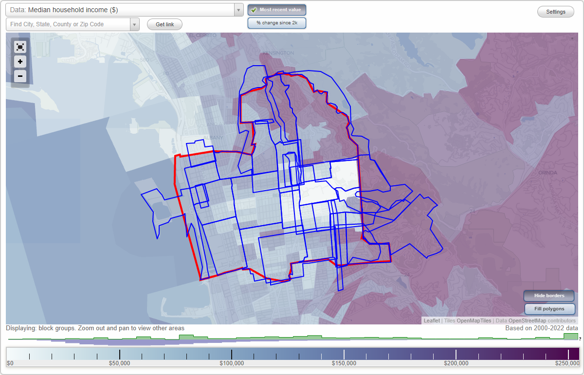
Median household income in 2021:
Median rent in in 2021:
Male vs Females
Median age
Housing prices:
Average estimated value of detached houses in 2021 (65.4% of all units):
Average estimated value of townhouses or other attached units in 2021 (5.0% of all units):
Average estimated value of housing units in 2-unit structures in 2021 (7.1% of all units):
Average estimated '21 value of housing units in 3-to-4-unit structures (8.3% of all units):
Average estimated '21 value of housing units in 5-or-more-unit structures (3.8% of all units):
Most popular occupations of males: sales and office occupations (17.4%); management occupations (except farmers) (16.7%); education, training, and library occupations (11.9%); computer and mathematical occupations (7.8%); architecture and engineering occupations (7.6%); life, physical, and social science occupations (6.8%); service occupations (6.4%)
Most popular occupations of females: management occupations (except farmers) (15.0%); sales and office occupations (14.9%); service occupations (13.8%); education, training, and library occupations (12.0%); arts, design, entertainment, sports, and media occupations (10.2%); business and financial operations occupations (8.8%); healthcare practitioners and technical occupations (8.1%)
Roads and streets: Grizzly Peak Blvd; Euclid Ave; Spruce St; Cragmont Ave; Shasta Rd; Keeler Ave; Buena Vista Way; Creston Rd; Arch St; Keith Ave; la Loma Ave; Marin Ave; Woodmont Ave; Miller Ave; Park Hills Rd; Scenic Ave; Regal Rd; Le Roy Ave (Leroy Ave); Hilldale Ave; Wildcat Canyon Rd; Fairlawn Dr; Virginia St; Cedar St; Campus Dr; Hilgard Ave; Vistamont Ave; Le Conte Ave; Hearst Ave; Queens Rd; Sterling Ave; Ridge Rd; Woodside Rd; Hill Rd; Tamalpais Rd; Woodhaven Rd; Overlook Rd; Avenida Dr; Glen Ave; Hawthorne Ter; Rose St; Vassar Ave; la Vereda Rd; Summit Rd; Glendale Ave; Forest Ln; Eunice St; Olympus Ave; Hillview Rd; Poplar St; Parnassus Rd; del Mar Ave; Middlefield Rd; Easter Way; Vine St; Poppy Ln; The Crescent; Oak St; Colusa Ave (Woodmont Ave); Northgate Ave; Maybeck Twin Dr; Alamo Ave; Sunset Ln; Latham Ln; Bayview Pl; Twain Ave; Rock Ln; Bonnie Ln; Summer St; Quail Ave; Acacia Walk; Bret Harte Rd; Senior Ave; Highland Pl; Halkin Ln; Santa Barbara Rd; Acacia Ave; Whitaker Ave; Crystal Way; Greenwood Com; Rosemont Ave; Codornices Rd; Poppy Path; Stevenson Ave; Laurel St; Rosemont Pt; Greenwood Ter; Alta Rd; Billie Jean Path; Martinez Path; Vine Ln; Bret Harte Path; Corona Ct; Muir Way; Baytree Ln; High Ct; el Mirador Path; Oak Street Path; Pinnacle Path; Poplar Path; Bret Harte Way; Rose Walk; Redwood Ter; Arcade Ave; Centennial Dr; My Way; Holmes Path; Tamalpais Path; Acacia Steps; W Parnassus Ct; Hawthorne Ter Steps W; Hill Ct; E Parnassus Ct; The Short Cut; Rock Walk; Stoddard Way; The Crossways; Atlas Pl; Park Gate; Summit Ln; Columbia Cir; Spring Way; Rochdale Way; Vistamont Ct; Ajax Pl; Wilson Cir; Harding Cir; el Portal Ct; Latham Walk; Harvard Cir; Eleanor Walk; Golf Course Dr.
Roads and streets: Wildcat Canyon Rd; Summit Rd; Spruce St; Colusa Ave; Woodmont Ave.
Berkeley Hills neighborhood detailed profile
Area: 1.689 square miles
Population: 15,943
Population density:
| Berkeley Hills: | 9,442 people per square mile |
| Berkeley: | 11,201 people per square mile |
Median household income in 2021:
| Berkeley Hills: | $166,830 |
| Berkeley: | $101,048 |
Median rent in in 2021:
| Berkeley Hills: | $2,134 |
| Berkeley: | $1,867 |
Male vs Females
| Males: | 8,567 |
| Females: | 7,376 |
Median age
| Males: | 41.5 years |
| Females: | 42.0 years |
Housing prices:
Average estimated value of detached houses in 2021 (65.4% of all units):
| Berkeley Hills: | $1,379,579 |
| Berkeley: | $1,496,419 |
Average estimated value of townhouses or other attached units in 2021 (5.0% of all units):
| This neighborhood: | $1,134,783 |
| city: | $1,154,234 |
Average estimated value of housing units in 2-unit structures in 2021 (7.1% of all units):
| This neighborhood: | $1,001,449 |
| Berkeley: | $864,846 |
Average estimated '21 value of housing units in 3-to-4-unit structures (8.3% of all units):
| Berkeley Hills: | $874,156 |
| city: | $795,296 |
Average estimated '21 value of housing units in 5-or-more-unit structures (3.8% of all units):
| Berkeley Hills: | $906,818 |
| Berkeley: | $671,857 |
Most popular occupations of males: sales and office occupations (17.4%); management occupations (except farmers) (16.7%); education, training, and library occupations (11.9%); computer and mathematical occupations (7.8%); architecture and engineering occupations (7.6%); life, physical, and social science occupations (6.8%); service occupations (6.4%)
Most popular occupations of females: management occupations (except farmers) (15.0%); sales and office occupations (14.9%); service occupations (13.8%); education, training, and library occupations (12.0%); arts, design, entertainment, sports, and media occupations (10.2%); business and financial operations occupations (8.8%); healthcare practitioners and technical occupations (8.1%)
Roads and streets: Grizzly Peak Blvd; Euclid Ave; Spruce St; Cragmont Ave; Shasta Rd; Keeler Ave; Buena Vista Way; Creston Rd; Arch St; Keith Ave; la Loma Ave; Marin Ave; Woodmont Ave; Miller Ave; Park Hills Rd; Scenic Ave; Regal Rd; Le Roy Ave (Leroy Ave); Hilldale Ave; Wildcat Canyon Rd; Fairlawn Dr; Virginia St; Cedar St; Campus Dr; Hilgard Ave; Vistamont Ave; Le Conte Ave; Hearst Ave; Queens Rd; Sterling Ave; Ridge Rd; Woodside Rd; Hill Rd; Tamalpais Rd; Woodhaven Rd; Overlook Rd; Avenida Dr; Glen Ave; Hawthorne Ter; Rose St; Vassar Ave; la Vereda Rd; Summit Rd; Glendale Ave; Forest Ln; Eunice St; Olympus Ave; Hillview Rd; Poplar St; Parnassus Rd; del Mar Ave; Middlefield Rd; Easter Way; Vine St; Poppy Ln; The Crescent; Oak St; Colusa Ave (Woodmont Ave); Northgate Ave; Maybeck Twin Dr; Alamo Ave; Sunset Ln; Latham Ln; Bayview Pl; Twain Ave; Rock Ln; Bonnie Ln; Summer St; Quail Ave; Acacia Walk; Bret Harte Rd; Senior Ave; Highland Pl; Halkin Ln; Santa Barbara Rd; Acacia Ave; Whitaker Ave; Crystal Way; Greenwood Com; Rosemont Ave; Codornices Rd; Poppy Path; Stevenson Ave; Laurel St; Rosemont Pt; Greenwood Ter; Alta Rd; Billie Jean Path; Martinez Path; Vine Ln; Bret Harte Path; Corona Ct; Muir Way; Baytree Ln; High Ct; el Mirador Path; Oak Street Path; Pinnacle Path; Poplar Path; Bret Harte Way; Rose Walk; Redwood Ter; Arcade Ave; Centennial Dr; My Way; Holmes Path; Tamalpais Path; Acacia Steps; W Parnassus Ct; Hawthorne Ter Steps W; Hill Ct; E Parnassus Ct; The Short Cut; Rock Walk; Stoddard Way; The Crossways; Atlas Pl; Park Gate; Summit Ln; Columbia Cir; Spring Way; Rochdale Way; Vistamont Ct; Ajax Pl; Wilson Cir; Harding Cir; el Portal Ct; Latham Walk; Harvard Cir; Eleanor Walk; Golf Course Dr.
Roads and streets: Wildcat Canyon Rd; Summit Rd; Spruce St; Colusa Ave; Woodmont Ave.
Berkeley Hills neighborhood detailed profile
Central neighborhood in Berkeley statistics: (Find on map)
Area: 0.887 square miles
Population: 13,189
Population density:
Median household income in 2021:
Median rent in in 2021:
Male vs Females
Median age
Housing prices:
Average estimated value of detached houses in 2021 (35.9% of all units):
Average estimated value of townhouses or other attached units in 2021 (6.3% of all units):
Average estimated value of housing units in 2-unit structures in 2021 (13.2% of all units):
Average estimated '21 value of housing units in 5-or-more-unit structures (15.6% of all units):
Most popular occupations of males: computer and mathematical occupations (17.9%); sales and office occupations (12.9%); education, training, and library occupations (10.6%); management occupations (except farmers) (9.7%); life, physical, and social science occupations (9.5%); arts, design, entertainment, sports, and media occupations (6.6%); service occupations (6.6%)
Most popular occupations of females: education, training, and library occupations (18.1%); sales and office occupations (15.9%); management occupations (except farmers) (13.8%); service occupations (11.9%); arts, design, entertainment, sports, and media occupations (10.0%); business and financial operations occupations (5.9%); computer and mathematical occupations (5.9%)
Roads and streets: Sacramento St; University Ave; Delaware St; Allston Way; Virginia St; Bancroft Way; Hearst Ave; Addison St; Dwight Way; Channing Way; California St; McGee Ave; Grant St; Acton St; Berkeley Way; Francisco St; West St; Lincoln St; Curtis St; Bonar St; Jefferson Ave; Spaulding Ave; Browning St; Roosevelt Ave; McKinley Ave; Chestnut St; Short St; Franklin St; Edwards St; Valley St; Cedar St; Belvedere Ave; Acton Cres; Acroft Ct; Virginia Gardens; N Valley St; Eola St; Edith St; Poe St; Acton Cir.
Railroad features: Bay Area Rapid Transit RR.
Central neighborhood detailed profile
Area: 0.887 square miles
Population: 13,189
Population density:
| Central: | 14,876 people per square mile |
| Berkeley: | 11,201 people per square mile |
Median household income in 2021:
| Central: | $99,050 |
| Berkeley: | $101,048 |
Median rent in in 2021:
| Central: | $1,881 |
| Berkeley: | $1,867 |
Male vs Females
| Males: | 6,562 |
| Females: | 6,626 |
Median age
| Males: | 37.6 years |
| Females: | 41.6 years |
Housing prices:
Average estimated value of detached houses in 2021 (35.9% of all units):
| Central: | $977,778 |
| Berkeley: | $1,496,419 |
Average estimated value of townhouses or other attached units in 2021 (6.3% of all units):
| This neighborhood: | $1,156,304 |
| city: | $1,154,234 |
Average estimated value of housing units in 2-unit structures in 2021 (13.2% of all units):
| This neighborhood: | $658,081 |
| Berkeley: | $864,846 |
Average estimated '21 value of housing units in 5-or-more-unit structures (15.6% of all units):
| Central: | $180,362 |
| Berkeley: | $671,857 |
Most popular occupations of males: computer and mathematical occupations (17.9%); sales and office occupations (12.9%); education, training, and library occupations (10.6%); management occupations (except farmers) (9.7%); life, physical, and social science occupations (9.5%); arts, design, entertainment, sports, and media occupations (6.6%); service occupations (6.6%)
Most popular occupations of females: education, training, and library occupations (18.1%); sales and office occupations (15.9%); management occupations (except farmers) (13.8%); service occupations (11.9%); arts, design, entertainment, sports, and media occupations (10.0%); business and financial operations occupations (5.9%); computer and mathematical occupations (5.9%)
Roads and streets: Sacramento St; University Ave; Delaware St; Allston Way; Virginia St; Bancroft Way; Hearst Ave; Addison St; Dwight Way; Channing Way; California St; McGee Ave; Grant St; Acton St; Berkeley Way; Francisco St; West St; Lincoln St; Curtis St; Bonar St; Jefferson Ave; Spaulding Ave; Browning St; Roosevelt Ave; McKinley Ave; Chestnut St; Short St; Franklin St; Edwards St; Valley St; Cedar St; Belvedere Ave; Acton Cres; Acroft Ct; Virginia Gardens; N Valley St; Eola St; Edith St; Poe St; Acton Cir.
Railroad features: Bay Area Rapid Transit RR.
Central neighborhood detailed profile
Claremont neighborhood in Berkeley statistics: (Find on map)
Area: 1.396 square miles
Population: 1,416
Population density:
Median household income in 2021:
Median rent in in 2021:
Male vs Females
Median age
Housing prices:
Average estimated value of detached houses in 2021 (68.2% of all units):
Average estimated value of townhouses or other attached units in 2021 (2.4% of all units):
Most popular occupations of males: management occupations (except farmers) (17.2%); education, training, and library occupations (14.6%); computer and mathematical occupations (9.4%); life, physical, and social science occupations (9.0%); service occupations (8.5%); sales and office occupations (7.6%); construction, extraction, and maintenance occupations (6.9%)
Most popular occupations of females: management occupations (except farmers) (20.8%); education, training, and library occupations (13.8%); life, physical, and social science occupations (12.3%); sales and office occupations (11.1%); healthcare practitioners and technical occupations (9.0%); arts, design, entertainment, sports, and media occupations (7.4%); service occupations (6.9%)
Limited-access highways (interstate or state) in this neighborhood: State Hwy 24 (Caldecott Tunl); State Hwy 24.
Roads and streets: Tunnel Rd; Alvarado Rd; Gravatt Dr; Claremont Ave; Grand View Dr; The Uplands; Ashby Ave; Hillcrest Rd; Buckingham Blvd; Claremont Blvd; el Camino Real; Parkside Dr; Drury Rd; Norfolk Rd; Marlborough Ter; Westview Dr; Bristol Dr; Avalon Ave; Plaza Dr (The Plaza Dr); Russell St; Oakridge Rd; Domingo Ave; Oakvale Ave; Derby St; Strathmoor Dr; Caldecott Ln; Claremont; Evergreen Ln; Southwest Pl; Drury Ct; Amito Ave (Amito Dr); Westmoorland Dr; Besito Ave; Hazel Rd; Tanglewood Rd; Siler Pl; Pine Ave; Charing Cross Rd; Roble Rd; Kenilworth Rd; Belrose Ave; Sherwick Dr; Garber St; Webster St; Slater Ln; Magnolia St; Eucalyptus Path; Grizzly Peak Blvd; Sport Ln; Eastway Dr; Tanglewood Path; Devon Way; Perth Pl; Gypsy Ln; Bridge Rd; Roble Ct; Vicente Pl; Oak Ridge Path (Oak Ridge Rd); Claremont Cres; Brookside Ave; Oak Knoll Ter; Chabolyn Ter; The Cut Off; Doris Pl; Stephens Way; The Crossways; Dorothy Pl; Eucalyptus Rd; Pine Path; Roanoke Rd; Encina Pl; South St; Drury Ln; Oak Knoll Path; Elmwood Ct; The Footway; Nogales St; Live Oak Rd; Alvarado Pl; The South Crossways; Dartmouth Dr; Kent Rd; Avalon Walk; Park Path; Encina Walk; Westview Pl; Hillcrest Ct; Chancellor Pl; Roslyn Ct; Dawn St; Willard Pl; Vicente Rd; The Steps.
Railroad features: Bay Area Rapid Transit RR.
Claremont neighborhood detailed profile
Area: 1.396 square miles
Population: 1,416
Population density:
| Claremont: | 1,014 people per square mile |
| Berkeley: | 11,201 people per square mile |
Median household income in 2021:
| Claremont: | $117,940 |
| Berkeley: | $101,048 |
Median rent in in 2021:
| Claremont: | $1,931 |
| Berkeley: | $1,867 |
Male vs Females
| Males: | 660 |
| Females: | 755 |
Median age
| Males: | 29.2 years |
| Females: | 28.9 years |
Housing prices:
Average estimated value of detached houses in 2021 (68.2% of all units):
| Claremont: | $1,844,849 |
| Berkeley: | $1,496,419 |
Average estimated value of townhouses or other attached units in 2021 (2.4% of all units):
| This neighborhood: | $1,114,980 |
| city: | $1,154,234 |
Most popular occupations of males: management occupations (except farmers) (17.2%); education, training, and library occupations (14.6%); computer and mathematical occupations (9.4%); life, physical, and social science occupations (9.0%); service occupations (8.5%); sales and office occupations (7.6%); construction, extraction, and maintenance occupations (6.9%)
Most popular occupations of females: management occupations (except farmers) (20.8%); education, training, and library occupations (13.8%); life, physical, and social science occupations (12.3%); sales and office occupations (11.1%); healthcare practitioners and technical occupations (9.0%); arts, design, entertainment, sports, and media occupations (7.4%); service occupations (6.9%)
Limited-access highways (interstate or state) in this neighborhood: State Hwy 24 (Caldecott Tunl); State Hwy 24.
Roads and streets: Tunnel Rd; Alvarado Rd; Gravatt Dr; Claremont Ave; Grand View Dr; The Uplands; Ashby Ave; Hillcrest Rd; Buckingham Blvd; Claremont Blvd; el Camino Real; Parkside Dr; Drury Rd; Norfolk Rd; Marlborough Ter; Westview Dr; Bristol Dr; Avalon Ave; Plaza Dr (The Plaza Dr); Russell St; Oakridge Rd; Domingo Ave; Oakvale Ave; Derby St; Strathmoor Dr; Caldecott Ln; Claremont; Evergreen Ln; Southwest Pl; Drury Ct; Amito Ave (Amito Dr); Westmoorland Dr; Besito Ave; Hazel Rd; Tanglewood Rd; Siler Pl; Pine Ave; Charing Cross Rd; Roble Rd; Kenilworth Rd; Belrose Ave; Sherwick Dr; Garber St; Webster St; Slater Ln; Magnolia St; Eucalyptus Path; Grizzly Peak Blvd; Sport Ln; Eastway Dr; Tanglewood Path; Devon Way; Perth Pl; Gypsy Ln; Bridge Rd; Roble Ct; Vicente Pl; Oak Ridge Path (Oak Ridge Rd); Claremont Cres; Brookside Ave; Oak Knoll Ter; Chabolyn Ter; The Cut Off; Doris Pl; Stephens Way; The Crossways; Dorothy Pl; Eucalyptus Rd; Pine Path; Roanoke Rd; Encina Pl; South St; Drury Ln; Oak Knoll Path; Elmwood Ct; The Footway; Nogales St; Live Oak Rd; Alvarado Pl; The South Crossways; Dartmouth Dr; Kent Rd; Avalon Walk; Park Path; Encina Walk; Westview Pl; Hillcrest Ct; Chancellor Pl; Roslyn Ct; Dawn St; Willard Pl; Vicente Rd; The Steps.
Railroad features: Bay Area Rapid Transit RR.
Claremont neighborhood detailed profile
College Avenue neighborhood in Berkeley statistics: (Find on map)
Area: 0.145 square miles
Population: 3,219
Population density:
Median household income in 2021:
Median rent in in 2021:
Male vs Females
Median age
Most popular occupations of males: management occupations (except farmers) (14.2%); education, training, and library occupations (12.5%); computer and mathematical occupations (11.5%); sales and office occupations (11.3%); service occupations (9.6%); arts, design, entertainment, sports, and media occupations (8.5%); business and financial operations occupations (5.9%)
Most popular occupations of females: sales and office occupations (18.3%); education, training, and library occupations (17.7%); service occupations (16.7%); management occupations (except farmers) (11.2%); arts, design, entertainment, sports, and media occupations (9.4%); business and financial operations occupations (7.3%); community and social services occupations (5.2%)
Limited-access highways (interstate or state) in this neighborhood: State Hwy 24 (Grove Shafter Fwy).
Roads and streets: College Ave; College; Claremont Ave; Webster St; Ashby Ave; Russell St; Alcatraz Ave; Birch Ct.
College Avenue neighborhood detailed profile
Area: 0.145 square miles
Population: 3,219
Population density:
| College Avenue (College): | 22,156 people per square mile |
| Berkeley: | 11,201 people per square mile |
Median household income in 2021:
| College Avenue (College): | $148,103 |
| Berkeley: | $101,048 |
Median rent in in 2021:
| College Avenue (College): | $2,270 |
| Berkeley: | $1,867 |
Male vs Females
| Males: | 1,546 |
| Females: | 1,673 |
Median age
| Males: | 34.9 years |
| Females: | 35.5 years |
Most popular occupations of males: management occupations (except farmers) (14.2%); education, training, and library occupations (12.5%); computer and mathematical occupations (11.5%); sales and office occupations (11.3%); service occupations (9.6%); arts, design, entertainment, sports, and media occupations (8.5%); business and financial operations occupations (5.9%)
Most popular occupations of females: sales and office occupations (18.3%); education, training, and library occupations (17.7%); service occupations (16.7%); management occupations (except farmers) (11.2%); arts, design, entertainment, sports, and media occupations (9.4%); business and financial operations occupations (7.3%); community and social services occupations (5.2%)
Limited-access highways (interstate or state) in this neighborhood: State Hwy 24 (Grove Shafter Fwy).
Roads and streets: College Ave; College; Claremont Ave; Webster St; Ashby Ave; Russell St; Alcatraz Ave; Birch Ct.
College Avenue neighborhood detailed profile
Downtown neighborhood in Berkeley statistics: (Find on map)
Area: 0.253 square miles
Population: 4,253
Population density:
Median household income in 2021:
Median rent in in 2021:
Male vs Females
Median age
Housing prices:
Average estimated value of detached houses in 2021 (22.5% of all units):
Average estimated value of housing units in 2-unit structures in 2021 (7.9% of all units):
Most popular occupations of males: computer and mathematical occupations (13.5%); life, physical, and social science occupations (12.3%); management occupations (except farmers) (10.9%); service occupations (10.7%); education, training, and library occupations (10.6%); sales and office occupations (8.9%); architecture and engineering occupations (6.8%)
Most popular occupations of females: sales and office occupations (23.1%); education, training, and library occupations (21.5%); business and financial operations occupations (10.2%); service occupations (9.2%); arts, design, entertainment, sports, and media occupations (7.9%); management occupations (except farmers) (7.8%); community and social services occupations (4.7%)
Roads and streets: Martin Luther King Jr Way; Shattuck Ave; Milvia St; Dwight Way; Allston Way; University Ave; Center St; Addison St; Channing Way; Blake St; Haste St; Shattuck Ave (Berkeley Sq); Kittredge St; Durant Ave; Bancroft Way; Harold Way; Terminal Pl.
Downtown neighborhood detailed profile
Area: 0.253 square miles
Population: 4,253
Population density:
| Downtown: | 16,807 people per square mile |
| Berkeley: | 11,201 people per square mile |
Median household income in 2021:
| Downtown: | $83,169 |
| Berkeley: | $101,048 |
Median rent in in 2021:
| Downtown: | $1,883 |
| Berkeley: | $1,867 |
Male vs Females
| Males: | 2,206 |
| Females: | 2,046 |
Median age
| Males: | 32.4 years |
| Females: | 35.3 years |
Housing prices:
Average estimated value of detached houses in 2021 (22.5% of all units):
| Downtown: | $977,778 |
| Berkeley: | $1,496,419 |
Average estimated value of housing units in 2-unit structures in 2021 (7.9% of all units):
| This neighborhood: | $658,081 |
| Berkeley: | $864,846 |
Most popular occupations of males: computer and mathematical occupations (13.5%); life, physical, and social science occupations (12.3%); management occupations (except farmers) (10.9%); service occupations (10.7%); education, training, and library occupations (10.6%); sales and office occupations (8.9%); architecture and engineering occupations (6.8%)
Most popular occupations of females: sales and office occupations (23.1%); education, training, and library occupations (21.5%); business and financial operations occupations (10.2%); service occupations (9.2%); arts, design, entertainment, sports, and media occupations (7.9%); management occupations (except farmers) (7.8%); community and social services occupations (4.7%)
Roads and streets: Martin Luther King Jr Way; Shattuck Ave; Milvia St; Dwight Way; Allston Way; University Ave; Center St; Addison St; Channing Way; Blake St; Haste St; Shattuck Ave (Berkeley Sq); Kittredge St; Durant Ave; Bancroft Way; Harold Way; Terminal Pl.
Downtown neighborhood detailed profile
East Solano Avenue neighborhood in Berkeley statistics: (Find on map)
Area: 0.023 square miles
Population: 181
Population density:
Median household income in 2021:
Median rent in in 2021:
Male vs Females
Median age
Average estimated value of detached houses in 2021 (86.6% of all units):
Most popular occupations of males: management occupations (except farmers) (15.2%); computer and mathematical occupations (11.0%); arts, design, entertainment, sports, and media occupations (9.6%); sales and office occupations (8.9%); life, physical, and social science occupations (8.6%); business and financial operations occupations (8.4%); legal occupations (6.4%)
Most popular occupations of females: management occupations (except farmers) (16.8%); education, training, and library occupations (14.7%); sales and office occupations (14.7%); service occupations (10.2%); legal occupations (8.7%); healthcare practitioners and technical occupations (8.5%); life, physical, and social science occupations (8.1%)
Roads and streets: Solano Ave; Indian Rock Path; Fresno Ave.
East Solano Avenue neighborhood detailed profile
Area: 0.023 square miles
Population: 181
Population density:
| East Solano Avenue (East Solano Ave): | 8,011 people per square mile |
| Berkeley: | 11,201 people per square mile |
Median household income in 2021:
| East Solano Avenue (East Solano Ave): | $160,704 |
| Berkeley: | $101,048 |
Median rent in in 2021:
| East Solano Avenue (East Solano Ave): | $1,386 |
| Berkeley: | $1,867 |
Male vs Females
| Males: | 86 |
| Females: | 95 |
Median age
| Males: | 46.5 years |
| Females: | 57.0 years |
Average estimated value of detached houses in 2021 (86.6% of all units):
| East Solano Avenue (East Solano Ave): | $2,258,596 |
| Berkeley: | $1,496,419 |
Most popular occupations of males: management occupations (except farmers) (15.2%); computer and mathematical occupations (11.0%); arts, design, entertainment, sports, and media occupations (9.6%); sales and office occupations (8.9%); life, physical, and social science occupations (8.6%); business and financial operations occupations (8.4%); legal occupations (6.4%)
Most popular occupations of females: management occupations (except farmers) (16.8%); education, training, and library occupations (14.7%); sales and office occupations (14.7%); service occupations (10.2%); legal occupations (8.7%); healthcare practitioners and technical occupations (8.5%); life, physical, and social science occupations (8.1%)
Roads and streets: Solano Ave; Indian Rock Path; Fresno Ave.
East Solano Avenue neighborhood detailed profile
Elmwood neighborhood in Berkeley statistics: (Find on map)
Area: 0.283 square miles
Population: 4,267
Population density:
Median household income in 2021:
Median rent in in 2021:
Male vs Females
Median age
Average estimated value of detached houses in 2021 (31.5% of all units):
Most popular occupations of males: management occupations (except farmers) (15.8%); education, training, and library occupations (12.5%); computer and mathematical occupations (11.0%); arts, design, entertainment, sports, and media occupations (11.0%); sales and office occupations (10.0%); service occupations (6.2%); life, physical, and social science occupations (5.5%)
Most popular occupations of females: sales and office occupations (16.0%); service occupations (15.8%); management occupations (except farmers) (14.4%); education, training, and library occupations (14.2%); arts, design, entertainment, sports, and media occupations (9.2%); business and financial operations occupations (7.8%); healthcare practitioners and technical occupations (6.5%)
Roads and streets: College Ave; Benvenue Ave; Piedmont Ave; Ashby Ave; Warring St; Derby St; Dwight Way; Parker St; Webster St; Stuart St; Russell St; Etna St; Woolsey St; Lewiston Ave; Garber St; Forest Ave; Alcatraz Ave; Eton Ave; Elmwood Ave; Piedmont Cres; Linden Ave; Ashby Pl; Claremont Ave; Kelsey St; Cherry St; Alcatraz; Eton Ct; College; Brookside Ct; Prince St.
Elmwood neighborhood detailed profile
Area: 0.283 square miles
Population: 4,267
Population density:
| Elmwood: | 15,052 people per square mile |
| Berkeley: | 11,201 people per square mile |
Median household income in 2021:
| Elmwood: | $115,975 |
| Berkeley: | $101,048 |
Median rent in in 2021:
| Elmwood: | $1,957 |
| Berkeley: | $1,867 |
Male vs Females
| Males: | 2,023 |
| Females: | 2,243 |
Median age
| Males: | 33.3 years |
| Females: | 32.9 years |
Average estimated value of detached houses in 2021 (31.5% of all units):
| Elmwood: | $1,696,614 |
| Berkeley: | $1,496,419 |
Most popular occupations of males: management occupations (except farmers) (15.8%); education, training, and library occupations (12.5%); computer and mathematical occupations (11.0%); arts, design, entertainment, sports, and media occupations (11.0%); sales and office occupations (10.0%); service occupations (6.2%); life, physical, and social science occupations (5.5%)
Most popular occupations of females: sales and office occupations (16.0%); service occupations (15.8%); management occupations (except farmers) (14.4%); education, training, and library occupations (14.2%); arts, design, entertainment, sports, and media occupations (9.2%); business and financial operations occupations (7.8%); healthcare practitioners and technical occupations (6.5%)
Roads and streets: College Ave; Benvenue Ave; Piedmont Ave; Ashby Ave; Warring St; Derby St; Dwight Way; Parker St; Webster St; Stuart St; Russell St; Etna St; Woolsey St; Lewiston Ave; Garber St; Forest Ave; Alcatraz Ave; Eton Ave; Elmwood Ave; Piedmont Cres; Linden Ave; Ashby Pl; Claremont Ave; Kelsey St; Cherry St; Alcatraz; Eton Ct; College; Brookside Ct; Prince St.
Elmwood neighborhood detailed profile
Fourth Street neighborhood in Berkeley statistics: (Find on map)
Area: 0.099 square miles
Population: 364
Population density:
Median household income in 2021:
Median rent in in 2021:
Male vs Females
Median age
Most popular occupations of males: management occupations (except farmers) (25.3%); computer and mathematical occupations (23.2%); sales and office occupations (14.7%); business and financial operations occupations (9.1%); education, training, and library occupations (8.2%); service occupations (7.8%); arts, design, entertainment, sports, and media occupations (4.1%)
Most popular occupations of females: sales and office occupations (21.7%); education, training, and library occupations (19.3%); business and financial operations occupations (10.4%); arts, design, entertainment, sports, and media occupations (10.3%); service occupations (10.3%); management occupations (except farmers) (7.6%); computer and mathematical occupations (7.2%)
Roads and streets: Virginia St; 5th St; 4th St; 3rd St (Union Pacific RR, Union Pacific RR, 3rd Street); Delaware St; Hearst Ave.
Fourth Street neighborhood detailed profile
Area: 0.099 square miles
Population: 364
Population density:
| Fourth Street (4th Street): | 3,664 people per square mile |
| Berkeley: | 11,201 people per square mile |
Median household income in 2021:
| Fourth Street (4th Street): | $157,853 |
| Berkeley: | $101,048 |
Median rent in in 2021:
| Fourth Street (4th Street): | $3,291 |
| Berkeley: | $1,867 |
Male vs Females
| Males: | 160 |
| Females: | 203 |
Median age
| Males: | 38.2 years |
| Females: | 46.4 years |
Most popular occupations of males: management occupations (except farmers) (25.3%); computer and mathematical occupations (23.2%); sales and office occupations (14.7%); business and financial operations occupations (9.1%); education, training, and library occupations (8.2%); service occupations (7.8%); arts, design, entertainment, sports, and media occupations (4.1%)
Most popular occupations of females: sales and office occupations (21.7%); education, training, and library occupations (19.3%); business and financial operations occupations (10.4%); arts, design, entertainment, sports, and media occupations (10.3%); service occupations (10.3%); management occupations (except farmers) (7.6%); computer and mathematical occupations (7.2%)
Roads and streets: Virginia St; 5th St; 4th St; 3rd St (Union Pacific RR, Union Pacific RR, 3rd Street); Delaware St; Hearst Ave.
Fourth Street neighborhood detailed profile
Gourmet Ghetto neighborhood in Berkeley statistics: (Find on map)
Area: 0.102 square miles
Population: 2,729
Population density:
Median household income in 2021:
Median rent in in 2021:
Male vs Females
Median age
Housing prices:
Average estimated value of detached houses in 2021 (15.7% of all units):
Average estimated value of townhouses or other attached units in 2021 (6.1% of all units):
Average estimated value of housing units in 2-unit structures in 2021 (10.3% of all units):
Average estimated '21 value of housing units in 3-to-4-unit structures (21.4% of all units):
Average estimated '21 value of housing units in 5-or-more-unit structures (1.9% of all units):
Most popular occupations of males: education, training, and library occupations (20.4%); computer and mathematical occupations (18.9%); service occupations (12.4%); life, physical, and social science occupations (10.7%); management occupations (except farmers) (9.7%); sales and office occupations (4.8%); arts, design, entertainment, sports, and media occupations (4.7%)
Most popular occupations of females: education, training, and library occupations (19.4%); sales and office occupations (17.8%); life, physical, and social science occupations (15.3%); arts, design, entertainment, sports, and media occupations (12.6%); service occupations (11.2%); business and financial operations occupations (8.2%); management occupations (except farmers) (6.5%)
Roads and streets: Shattuck Ave; Walnut St; Hearst Ave; Virginia St; Rose St; Shattuck Pl; Cedar St; Vine St; Delaware St; Henry St; Francisco St.
Gourmet Ghetto neighborhood detailed profile
Area: 0.102 square miles
Population: 2,729
Population density:
| Gourmet Ghetto: | 26,701 people per square mile |
| Berkeley: | 11,201 people per square mile |
Median household income in 2021:
| Gourmet Ghetto: | $97,684 |
| Berkeley: | $101,048 |
Median rent in in 2021:
| Gourmet Ghetto: | $2,076 |
| Berkeley: | $1,867 |
Male vs Females
| Males: | 1,373 |
| Females: | 1,356 |
Median age
| Males: | 37.5 years |
| Females: | 36.2 years |
Housing prices:
Average estimated value of detached houses in 2021 (15.7% of all units):
| Gourmet Ghetto: | $1,276,700 |
| Berkeley: | $1,496,419 |
Average estimated value of townhouses or other attached units in 2021 (6.1% of all units):
| This neighborhood: | $1,134,783 |
| city: | $1,154,234 |
Average estimated value of housing units in 2-unit structures in 2021 (10.3% of all units):
| This neighborhood: | $1,001,449 |
| Berkeley: | $864,846 |
Average estimated '21 value of housing units in 3-to-4-unit structures (21.4% of all units):
| Gourmet Ghetto: | $874,156 |
| city: | $795,296 |
Average estimated '21 value of housing units in 5-or-more-unit structures (1.9% of all units):
| Gourmet Ghetto: | $306,748 |
| Berkeley: | $671,857 |
Most popular occupations of males: education, training, and library occupations (20.4%); computer and mathematical occupations (18.9%); service occupations (12.4%); life, physical, and social science occupations (10.7%); management occupations (except farmers) (9.7%); sales and office occupations (4.8%); arts, design, entertainment, sports, and media occupations (4.7%)
Most popular occupations of females: education, training, and library occupations (19.4%); sales and office occupations (17.8%); life, physical, and social science occupations (15.3%); arts, design, entertainment, sports, and media occupations (12.6%); service occupations (11.2%); business and financial operations occupations (8.2%); management occupations (except farmers) (6.5%)
Roads and streets: Shattuck Ave; Walnut St; Hearst Ave; Virginia St; Rose St; Shattuck Pl; Cedar St; Vine St; Delaware St; Henry St; Francisco St.
Gourmet Ghetto neighborhood detailed profile
Marina neighborhood in Berkeley statistics: (Find on map)
Area: 0.615 square miles
Population: 2,252
Population density:
Median household income in 2021:
Median rent in in 2021:
Male vs Females
Median age
Most popular occupations of males: management occupations (except farmers) (25.3%); computer and mathematical occupations (23.2%); sales and office occupations (14.7%); business and financial operations occupations (9.1%); education, training, and library occupations (8.2%); service occupations (7.8%); arts, design, entertainment, sports, and media occupations (4.1%)
Most popular occupations of females: sales and office occupations (21.7%); education, training, and library occupations (19.3%); business and financial operations occupations (10.4%); arts, design, entertainment, sports, and media occupations (10.3%); service occupations (10.3%); management occupations (except farmers) (7.6%); computer and mathematical occupations (7.2%)
Limited-access highways (interstate or state) in this neighborhood: I- 80 (I- 580, Eastshore Fwy).
Roads and streets: University Ave; Frontage Rd; Virginia St Exd; W Bolivar Dr; Marina Blvd; Seawall Dr; Bolivar Dr; Spinnaker Way; Breakwater Dr.
Marina neighborhood detailed profile
Area: 0.615 square miles
Population: 2,252
Population density:
| Marina: | 3,661 people per square mile |
| Berkeley: | 11,201 people per square mile |
Median household income in 2021:
| Marina: | $126,750 |
| Berkeley: | $101,048 |
Median rent in in 2021:
| Marina: | $2,884 |
| Berkeley: | $1,867 |
Male vs Females
| Males: | 995 |
| Females: | 1,257 |
Median age
| Males: | 31.5 years |
| Females: | 35.8 years |
Most popular occupations of males: management occupations (except farmers) (25.3%); computer and mathematical occupations (23.2%); sales and office occupations (14.7%); business and financial operations occupations (9.1%); education, training, and library occupations (8.2%); service occupations (7.8%); arts, design, entertainment, sports, and media occupations (4.1%)
Most popular occupations of females: sales and office occupations (21.7%); education, training, and library occupations (19.3%); business and financial operations occupations (10.4%); arts, design, entertainment, sports, and media occupations (10.3%); service occupations (10.3%); management occupations (except farmers) (7.6%); computer and mathematical occupations (7.2%)
Limited-access highways (interstate or state) in this neighborhood: I- 80 (I- 580, Eastshore Fwy).
Roads and streets: University Ave; Frontage Rd; Virginia St Exd; W Bolivar Dr; Marina Blvd; Seawall Dr; Bolivar Dr; Spinnaker Way; Breakwater Dr.
Marina neighborhood detailed profile
North neighborhood in Berkeley statistics: (Find on map)
Area: 0.409 square miles
Population: 6,908
Population density:
Median household income in 2021:
Median rent in in 2021:
Male vs Females
Median age
Housing prices:
Average estimated value of detached houses in 2021 (24.2% of all units):
Average estimated value of townhouses or other attached units in 2021 (6.1% of all units):
Average estimated value of housing units in 2-unit structures in 2021 (10.7% of all units):
Average estimated '21 value of housing units in 3-to-4-unit structures (19.2% of all units):
Average estimated '21 value of housing units in 5-or-more-unit structures (3.5% of all units):
Most popular occupations of males: education, training, and library occupations (18.2%); computer and mathematical occupations (17.0%); management occupations (except farmers) (10.6%); life, physical, and social science occupations (10.3%); service occupations (10.0%); sales and office occupations (7.0%); arts, design, entertainment, sports, and media occupations (6.0%)
Most popular occupations of females: education, training, and library occupations (20.2%); sales and office occupations (17.8%); life, physical, and social science occupations (15.7%); service occupations (11.9%); arts, design, entertainment, sports, and media occupations (11.4%); management occupations (except farmers) (7.9%); business and financial operations occupations (6.6%)
Roads and streets: Martin Luther King Jr Way; Shattuck Ave; Milvia St; Walnut St; Henry St; Oxford St; Bonita Ave; Hearst Ave; Cedar St; Rose St; Virginia St; Vine St; University Ave; Berkeley Way; Delaware St; Francisco St; Berryman St; Eunice St; Shattuck Pl; Lincoln St; Yolo Ave; Berryman Path.
North neighborhood detailed profile
Area: 0.409 square miles
Population: 6,908
Population density:
| North: | 16,893 people per square mile |
| Berkeley: | 11,201 people per square mile |
Median household income in 2021:
| North: | $109,641 |
| Berkeley: | $101,048 |
Median rent in in 2021:
| North: | $1,805 |
| Berkeley: | $1,867 |
Male vs Females
| Males: | 3,516 |
| Females: | 3,391 |
Median age
| Males: | 36.9 years |
| Females: | 37.2 years |
Housing prices:
Average estimated value of detached houses in 2021 (24.2% of all units):
| North: | $1,276,700 |
| Berkeley: | $1,496,419 |
Average estimated value of townhouses or other attached units in 2021 (6.1% of all units):
| This neighborhood: | $1,134,783 |
| city: | $1,154,234 |
Average estimated value of housing units in 2-unit structures in 2021 (10.7% of all units):
| This neighborhood: | $1,001,449 |
| Berkeley: | $864,846 |
Average estimated '21 value of housing units in 3-to-4-unit structures (19.2% of all units):
| North: | $874,156 |
| city: | $795,296 |
Average estimated '21 value of housing units in 5-or-more-unit structures (3.5% of all units):
| North: | $906,818 |
| Berkeley: | $671,857 |
Most popular occupations of males: education, training, and library occupations (18.2%); computer and mathematical occupations (17.0%); management occupations (except farmers) (10.6%); life, physical, and social science occupations (10.3%); service occupations (10.0%); sales and office occupations (7.0%); arts, design, entertainment, sports, and media occupations (6.0%)
Most popular occupations of females: education, training, and library occupations (20.2%); sales and office occupations (17.8%); life, physical, and social science occupations (15.7%); service occupations (11.9%); arts, design, entertainment, sports, and media occupations (11.4%); management occupations (except farmers) (7.9%); business and financial operations occupations (6.6%)
Roads and streets: Martin Luther King Jr Way; Shattuck Ave; Milvia St; Walnut St; Henry St; Oxford St; Bonita Ave; Hearst Ave; Cedar St; Rose St; Virginia St; Vine St; University Ave; Berkeley Way; Delaware St; Francisco St; Berryman St; Eunice St; Shattuck Pl; Lincoln St; Yolo Ave; Berryman Path.
North neighborhood detailed profile
North Berkeley neighborhood in Berkeley statistics: (Find on map)
Area: 1.975 square miles
Population: 21,715
Population density:
Median household income in 2021:
Median rent in in 2021:
Male vs Females
Median age
Housing prices:
Average estimated value of detached houses in 2021 (54.0% of all units):
Average estimated value of townhouses or other attached units in 2021 (6.2% of all units):
Average estimated value of housing units in 2-unit structures in 2021 (10.2% of all units):
Average estimated '21 value of housing units in 3-to-4-unit structures (16.0% of all units):
Average estimated '21 value of housing units in 5-or-more-unit structures (8.5% of all units):
Most popular occupations of males: management occupations (except farmers) (14.9%); computer and mathematical occupations (13.5%); education, training, and library occupations (12.3%); arts, design, entertainment, sports, and media occupations (8.7%); life, physical, and social science occupations (8.4%); sales and office occupations (7.9%); service occupations (6.6%)
Most popular occupations of females: education, training, and library occupations (19.4%); sales and office occupations (16.0%); management occupations (except farmers) (13.2%); service occupations (10.1%); life, physical, and social science occupations (8.7%); business and financial operations occupations (7.5%); arts, design, entertainment, sports, and media occupations (7.4%)
Roads and streets: Rose St; Hopkins St; Arlington Ave; The Alameda; Marin Ave; Colusa Ave; Martin Luther King Jr Way; Hearst Ave; Sacramento St; Shattuck Ave; Cedar St; Monterey Ave; Virginia St; Solano Ave; Delaware St; Ordway St; Milvia St; Francisco St; Vine St; Oxford St; Spruce St; Walnut St; Thousand Oaks Blvd; Posen Ave; Vincente Ave; Henry St; Bonita Ave; Josephine St; McGee Ave; Capistrano Ave; Curtis St; California St; Sonoma Ave; Lincoln St; Grant St; Neilson St; Ensenada Ave; San Lorenzo Ave; Peralta Ave; Tacoma Ave; Ventura Ave; Beverly Pl; Ada St; Contra Costa Ave; Sutter St; Berryman St; Fresno Ave; Eunice St; Yosemite Rd; Edith St; Santa Rosa Ave; Carlotta Ave; Portland Ave; Tulare Ave; Acton St; Mendocino Ave; Buena Ave; Los Angeles Ave; Visalia Ave; el Dorado Ave; Indian Rock Path; San Antonio Ave; Jaynes St; San Ramon Ave; San Pedro Ave; Napa Ave; San Fernando Ave; Yolo Ave; Madera St; San Juan Ave; Catalina Ave; Menlo Pl; Merced St; Sierra St; Santa Clara Ave; Holly St; Shattuck Pl; Berryman Path; Yosemite Steps; Gilman St; Albina Ave; Hopkins Ct; Modoc St; Vallejo St; Laurel Ln; Solano Avenue Tunl (Fountain Walk); el Paseo Path; San Miguel Ave; The Circle (Solano Avenue Tunl); Miramar Ave; Indian Trl; Lassen St; Cypress St; Amador Ave; Eola St; Visalia Steps; Vincente Walk; Comstock Ct; Somerset Pl; Keoncrest Dr; West Pl; Miramonte Ct; San Luis Rd; Station Pl; North St.
Other features: Codornices Crk.
Roads and streets: Coventry Rd; Ardmore Path (Ardmore Rd); Kingston Rd; Stratford Rd; Oceanview Ave (Ocean View Ave); Berkeley Park Blvd; Arlington Ave; Edgecroft Rd; Avon Rd; Lenox Rd; Oakview Ave; Richardson Rd; Beverly Rd; Colusa Ave; Lexington Rd; Eldridge Ct; Curtis St; Marchant Ct; Eagle Hill Rd; Willow Ln; Camelot Ct; Marchant Gardens; Kenilworth Ct; Beverly Ct; Loran Ct; Amherst Ave.
North Berkeley neighborhood detailed profile
Area: 1.975 square miles
Population: 21,715
Population density:
| North Berkeley: | 10,996 people per square mile |
| Berkeley: | 11,201 people per square mile |
Median household income in 2021:
| North Berkeley: | $141,270 |
| Berkeley: | $101,048 |
Median rent in in 2021:
| North Berkeley: | $1,875 |
| Berkeley: | $1,867 |
Male vs Females
| Males: | 10,705 |
| Females: | 11,009 |
Median age
| Males: | 41.1 years |
| Females: | 42.1 years |
Housing prices:
Average estimated value of detached houses in 2021 (54.0% of all units):
| North Berkeley: | $1,550,819 |
| Berkeley: | $1,496,419 |
Average estimated value of townhouses or other attached units in 2021 (6.2% of all units):
| This neighborhood: | $1,134,783 |
| city: | $1,154,234 |
Average estimated value of housing units in 2-unit structures in 2021 (10.2% of all units):
| This neighborhood: | $1,001,449 |
| Berkeley: | $864,846 |
Average estimated '21 value of housing units in 3-to-4-unit structures (16.0% of all units):
| North Berkeley: | $874,156 |
| city: | $795,296 |
Average estimated '21 value of housing units in 5-or-more-unit structures (8.5% of all units):
| North Berkeley: | $906,818 |
| Berkeley: | $671,857 |
Most popular occupations of males: management occupations (except farmers) (14.9%); computer and mathematical occupations (13.5%); education, training, and library occupations (12.3%); arts, design, entertainment, sports, and media occupations (8.7%); life, physical, and social science occupations (8.4%); sales and office occupations (7.9%); service occupations (6.6%)
Most popular occupations of females: education, training, and library occupations (19.4%); sales and office occupations (16.0%); management occupations (except farmers) (13.2%); service occupations (10.1%); life, physical, and social science occupations (8.7%); business and financial operations occupations (7.5%); arts, design, entertainment, sports, and media occupations (7.4%)
Roads and streets: Rose St; Hopkins St; Arlington Ave; The Alameda; Marin Ave; Colusa Ave; Martin Luther King Jr Way; Hearst Ave; Sacramento St; Shattuck Ave; Cedar St; Monterey Ave; Virginia St; Solano Ave; Delaware St; Ordway St; Milvia St; Francisco St; Vine St; Oxford St; Spruce St; Walnut St; Thousand Oaks Blvd; Posen Ave; Vincente Ave; Henry St; Bonita Ave; Josephine St; McGee Ave; Capistrano Ave; Curtis St; California St; Sonoma Ave; Lincoln St; Grant St; Neilson St; Ensenada Ave; San Lorenzo Ave; Peralta Ave; Tacoma Ave; Ventura Ave; Beverly Pl; Ada St; Contra Costa Ave; Sutter St; Berryman St; Fresno Ave; Eunice St; Yosemite Rd; Edith St; Santa Rosa Ave; Carlotta Ave; Portland Ave; Tulare Ave; Acton St; Mendocino Ave; Buena Ave; Los Angeles Ave; Visalia Ave; el Dorado Ave; Indian Rock Path; San Antonio Ave; Jaynes St; San Ramon Ave; San Pedro Ave; Napa Ave; San Fernando Ave; Yolo Ave; Madera St; San Juan Ave; Catalina Ave; Menlo Pl; Merced St; Sierra St; Santa Clara Ave; Holly St; Shattuck Pl; Berryman Path; Yosemite Steps; Gilman St; Albina Ave; Hopkins Ct; Modoc St; Vallejo St; Laurel Ln; Solano Avenue Tunl (Fountain Walk); el Paseo Path; San Miguel Ave; The Circle (Solano Avenue Tunl); Miramar Ave; Indian Trl; Lassen St; Cypress St; Amador Ave; Eola St; Visalia Steps; Vincente Walk; Comstock Ct; Somerset Pl; Keoncrest Dr; West Pl; Miramonte Ct; San Luis Rd; Station Pl; North St.
Other features: Codornices Crk.
Roads and streets: Coventry Rd; Ardmore Path (Ardmore Rd); Kingston Rd; Stratford Rd; Oceanview Ave (Ocean View Ave); Berkeley Park Blvd; Arlington Ave; Edgecroft Rd; Avon Rd; Lenox Rd; Oakview Ave; Richardson Rd; Beverly Rd; Colusa Ave; Lexington Rd; Eldridge Ct; Curtis St; Marchant Ct; Eagle Hill Rd; Willow Ln; Camelot Ct; Marchant Gardens; Kenilworth Ct; Beverly Ct; Loran Ct; Amherst Ave.
North Berkeley neighborhood detailed profile
North Berkeley Hills neighborhood in Berkeley statistics: (Find on map)
Area: 3.643 square miles
Population: 21,858
Population density:
Median household income in 2021:
Median rent in in 2021:
Male vs Females
Median age
Housing prices:
Average estimated value of detached houses in 2021 (75.7% of all units):
Average estimated value of townhouses or other attached units in 2021 (3.9% of all units):
Average estimated value of housing units in 2-unit structures in 2021 (10.5% of all units):
Average estimated '21 value of housing units in 3-to-4-unit structures (8.9% of all units):
Average estimated '21 value of housing units in 5-or-more-unit structures (5.2% of all units):
Most popular occupations of males: management occupations (except farmers) (17.9%); sales and office occupations (14.7%); education, training, and library occupations (12.2%); computer and mathematical occupations (9.1%); architecture and engineering occupations (7.4%); life, physical, and social science occupations (6.4%); healthcare practitioners and technical occupations (6.4%)
Most popular occupations of females: management occupations (except farmers) (16.1%); sales and office occupations (15.1%); education, training, and library occupations (12.5%); service occupations (10.9%); healthcare practitioners and technical occupations (9.2%); arts, design, entertainment, sports, and media occupations (9.0%); business and financial operations occupations (8.7%)
Roads and streets: Grizzly Peak Blvd; Euclid Ave; Wildcat Canyon Rd; Spruce St; Arlington Ave; Centennial Dr; Cragmont Ave; Panoramic Way; Cyclotron Rd; Shasta Rd; Keeler Ave; Marin Ave; Santa Barbara Rd; Buena Vista Way; Creston Rd; Keith Ave; la Loma Ave; Woodmont Ave; San Luis Rd; Miller Ave; Oxford St; Park Hills Rd; Summit Rd; Cedar St; Hearst Ave; Shattuck Ave; Regal Rd; Le Roy Ave (Leroy Ave); Hilldale Ave; Fairlawn Dr; Campus Dr; Vistamont Ave; Eunice St; Arch St; Boynton Ave; Gayley Rd; Queens Rd; Sterling Ave; Los Angeles Ave; Indian Rock Ave; Woodside Rd; Southampton Ave; Hill Rd; Kentucky Ave; Tamalpais Rd; Sutter St; Stadium Rim Way; Hilgard Ave; Woodhaven Rd; Overlook Rd; Avenida Dr; Glen Ave; Le Conte Ave; Hawthorne Ter; San Diego Rd; Rose St; Scenic Ave; Dwight Way; Michigan Ave; la Vereda Rd; Vermont Ave; Bancroft Pl; Ridge Rd; Glendale Ave; Forest Ln; Olympus Ave; Hillview Rd; Poplar St; Virginia St; Parnassus Rd; del Mar Ave; Middlefield Rd; Vassar Ave; San Benito Rd; Easter Way; Vine St; Northampton Ave; Poppy Ln; Montrose Rd; Mariposa Ave; The Crescent; Oak St; Colusa Ave (Woodmont Ave); Amador Ave; Northgate Ave; Maybeck Twin Dr; Walnut St; Alamo Ave; Indian Rock Path; San Antonio Ave; Sunset Ln; Latham Ln; Bayview Pl; Twain Ave; Rock Ln; Bonnie Ln; San Mateo Rd; Summer St; Maryland Ave; Quail Ave; Dwight Pl; Acacia Walk; Bret Harte Rd; Piedmont Ave; Somerset Pl; Orchard Ln; Highland Pl; Senior Ave; Halkin Ln; Acacia Ave; Arden Rd; Whitaker Ave; Colorado Ave; Crystal Way; Greenwood Com; Rosemont Ave; Codornices Rd; Poppy Path; Golf Course Dr; Stevenson Ave; Laurel St; The Circle (Solano Avenue Tunl); Rosemont Pt; Greenwood Ter; Alta Rd; Billie Jean Path; Chester Ln; Terrace Walk; Martinez Path; Florida Ave; Vine Ln; Bret Harte Path; Corona Ct; Alta Vista Path; Muir Way; Smyth Rd; Baytree Ln; Mosswood Rd; High Ct; el Mirador Path; Oak Street Path; Boynton Walk; Pinnacle Path; Poplar Path; Bret Harte Way; Rose Walk; Florida Walk; Redwood Ter; Arcade Ave; The Spiral; My Way; Holmes Path; Maryland Walk; Tamalpais Path; Acacia Steps; W Parnassus Ct; San Fernando Ave; Panoramic Pl; Hawthorne Ter Steps W; Hill Ct; E Parnassus Ct; The Short Cut; Rock Walk; Mosswood Ln; Stoddard Way; The Crossways; Atlas Pl; Park Gate; Avis Rd; Summit Ln; Columbia Cir; Prospect St; Spring Way; Rochdale Way; Vistamont Ct; Ajax Pl; Wilson Cir; Harding Cir; el Portal Ct; Latham Walk; Harvard Cir; Eleanor Walk.
Other features: Canyon Rd.
Roads and streets: Wildcat Canyon Rd; Golf Course Rd; Valley Rd; Summit Rd; Parkside Ct; Spruce St; Canon Dr; Colusa Ave; Woodmont Ave.
Other features: Wildcat Crk.
North Berkeley Hills neighborhood detailed profile
Area: 3.643 square miles
Population: 21,858
Population density:
| North Berkeley Hills (Berkeley Hills): | 6,000 people per square mile |
| Berkeley: | 11,201 people per square mile |
Median household income in 2021:
| North Berkeley Hills (Berkeley Hills): | $167,190 |
| Berkeley: | $101,048 |
Median rent in in 2021:
| North Berkeley Hills (Berkeley Hills): | $2,286 |
| Berkeley: | $1,867 |
Male vs Females
| Males: | 11,285 |
| Females: | 10,573 |
Median age
| Males: | 40.8 years |
| Females: | 40.9 years |
Housing prices:
Average estimated value of detached houses in 2021 (75.7% of all units):
| North Berkeley Hills (Berkeley Hills): | $1,505,316 |
| Berkeley: | $1,496,419 |
Average estimated value of townhouses or other attached units in 2021 (3.9% of all units):
| This neighborhood: | $1,134,783 |
| city: | $1,154,234 |
Average estimated value of housing units in 2-unit structures in 2021 (10.5% of all units):
| This neighborhood: | $1,001,449 |
| Berkeley: | $864,846 |
Average estimated '21 value of housing units in 3-to-4-unit structures (8.9% of all units):
| North Berkeley Hills (Berkeley Hills): | $874,156 |
| city: | $795,296 |
Average estimated '21 value of housing units in 5-or-more-unit structures (5.2% of all units):
| North Berkeley Hills (Berkeley Hills): | $906,818 |
| Berkeley: | $671,857 |
Most popular occupations of males: management occupations (except farmers) (17.9%); sales and office occupations (14.7%); education, training, and library occupations (12.2%); computer and mathematical occupations (9.1%); architecture and engineering occupations (7.4%); life, physical, and social science occupations (6.4%); healthcare practitioners and technical occupations (6.4%)
Most popular occupations of females: management occupations (except farmers) (16.1%); sales and office occupations (15.1%); education, training, and library occupations (12.5%); service occupations (10.9%); healthcare practitioners and technical occupations (9.2%); arts, design, entertainment, sports, and media occupations (9.0%); business and financial operations occupations (8.7%)
Roads and streets: Grizzly Peak Blvd; Euclid Ave; Wildcat Canyon Rd; Spruce St; Arlington Ave; Centennial Dr; Cragmont Ave; Panoramic Way; Cyclotron Rd; Shasta Rd; Keeler Ave; Marin Ave; Santa Barbara Rd; Buena Vista Way; Creston Rd; Keith Ave; la Loma Ave; Woodmont Ave; San Luis Rd; Miller Ave; Oxford St; Park Hills Rd; Summit Rd; Cedar St; Hearst Ave; Shattuck Ave; Regal Rd; Le Roy Ave (Leroy Ave); Hilldale Ave; Fairlawn Dr; Campus Dr; Vistamont Ave; Eunice St; Arch St; Boynton Ave; Gayley Rd; Queens Rd; Sterling Ave; Los Angeles Ave; Indian Rock Ave; Woodside Rd; Southampton Ave; Hill Rd; Kentucky Ave; Tamalpais Rd; Sutter St; Stadium Rim Way; Hilgard Ave; Woodhaven Rd; Overlook Rd; Avenida Dr; Glen Ave; Le Conte Ave; Hawthorne Ter; San Diego Rd; Rose St; Scenic Ave; Dwight Way; Michigan Ave; la Vereda Rd; Vermont Ave; Bancroft Pl; Ridge Rd; Glendale Ave; Forest Ln; Olympus Ave; Hillview Rd; Poplar St; Virginia St; Parnassus Rd; del Mar Ave; Middlefield Rd; Vassar Ave; San Benito Rd; Easter Way; Vine St; Northampton Ave; Poppy Ln; Montrose Rd; Mariposa Ave; The Crescent; Oak St; Colusa Ave (Woodmont Ave); Amador Ave; Northgate Ave; Maybeck Twin Dr; Walnut St; Alamo Ave; Indian Rock Path; San Antonio Ave; Sunset Ln; Latham Ln; Bayview Pl; Twain Ave; Rock Ln; Bonnie Ln; San Mateo Rd; Summer St; Maryland Ave; Quail Ave; Dwight Pl; Acacia Walk; Bret Harte Rd; Piedmont Ave; Somerset Pl; Orchard Ln; Highland Pl; Senior Ave; Halkin Ln; Acacia Ave; Arden Rd; Whitaker Ave; Colorado Ave; Crystal Way; Greenwood Com; Rosemont Ave; Codornices Rd; Poppy Path; Golf Course Dr; Stevenson Ave; Laurel St; The Circle (Solano Avenue Tunl); Rosemont Pt; Greenwood Ter; Alta Rd; Billie Jean Path; Chester Ln; Terrace Walk; Martinez Path; Florida Ave; Vine Ln; Bret Harte Path; Corona Ct; Alta Vista Path; Muir Way; Smyth Rd; Baytree Ln; Mosswood Rd; High Ct; el Mirador Path; Oak Street Path; Boynton Walk; Pinnacle Path; Poplar Path; Bret Harte Way; Rose Walk; Florida Walk; Redwood Ter; Arcade Ave; The Spiral; My Way; Holmes Path; Maryland Walk; Tamalpais Path; Acacia Steps; W Parnassus Ct; San Fernando Ave; Panoramic Pl; Hawthorne Ter Steps W; Hill Ct; E Parnassus Ct; The Short Cut; Rock Walk; Mosswood Ln; Stoddard Way; The Crossways; Atlas Pl; Park Gate; Avis Rd; Summit Ln; Columbia Cir; Prospect St; Spring Way; Rochdale Way; Vistamont Ct; Ajax Pl; Wilson Cir; Harding Cir; el Portal Ct; Latham Walk; Harvard Cir; Eleanor Walk.
Other features: Canyon Rd.
Roads and streets: Wildcat Canyon Rd; Golf Course Rd; Valley Rd; Summit Rd; Parkside Ct; Spruce St; Canon Dr; Colusa Ave; Woodmont Ave.
Other features: Wildcat Crk.
North Berkeley Hills neighborhood detailed profile
Northbrae neighborhood in Berkeley statistics: (Find on map)
Area: 0.391 square miles
Population: 3,791
Population density:
Median household income in 2021:
Median rent in in 2021:
Male vs Females
Median age
Housing prices:
Average estimated value of detached houses in 2021 (74.9% of all units):
Average estimated value of townhouses or other attached units in 2021 (5.6% of all units):
Average estimated value of housing units in 2-unit structures in 2021 (9.8% of all units):
Average estimated '21 value of housing units in 3-to-4-unit structures (4.0% of all units):
Most popular occupations of males: arts, design, entertainment, sports, and media occupations (17.3%); management occupations (except farmers) (14.3%); computer and mathematical occupations (12.4%); life, physical, and social science occupations (7.8%); sales and office occupations (7.4%); business and financial operations occupations (5.8%); education, training, and library occupations (5.7%)
Most popular occupations of females: education, training, and library occupations (16.5%); management occupations (except farmers) (16.1%); sales and office occupations (13.4%); legal occupations (9.9%); business and financial operations occupations (8.4%); life, physical, and social science occupations (8.0%); healthcare practitioners and technical occupations (6.7%)
Roads and streets: Rose St; Monterey Ave; Hopkins St; Colusa Ave; Marin Ave; Cedar St; Josephine St; Solano Ave; Sonoma Ave; Beverly Pl; Fresno Ave; McGee Ave; Carlotta Ave; California St; Tulare Ave; Posen Ave; Buena Ave; Grant St; Vine St; Edith St; Jaynes St; Madera St; Merced St; Sierra St; Holly St; Ada St; Ensenada Ave; Modoc St; Sacramento St; Cypress St; Comstock Ct; Miramonte Ct; Berryman St; North St; Buena Ct.
Northbrae neighborhood detailed profile
Area: 0.391 square miles
Population: 3,791
Population density:
| Northbrae: | 9,690 people per square mile |
| Berkeley: | 11,201 people per square mile |
Median household income in 2021:
| Northbrae: | $147,765 |
| Berkeley: | $101,048 |
Median rent in in 2021:
| Northbrae: | $2,251 |
| Berkeley: | $1,867 |
Male vs Females
| Males: | 1,892 |
| Females: | 1,899 |
Median age
| Males: | 43.5 years |
| Females: | 49.2 years |
Housing prices:
Average estimated value of detached houses in 2021 (74.9% of all units):
| Northbrae: | $869,422 |
| Berkeley: | $1,496,419 |
Average estimated value of townhouses or other attached units in 2021 (5.6% of all units):
| This neighborhood: | $943,714 |
| city: | $1,154,234 |
Average estimated value of housing units in 2-unit structures in 2021 (9.8% of all units):
| This neighborhood: | $5,004,735 |
| Berkeley: | $864,846 |
Average estimated '21 value of housing units in 3-to-4-unit structures (4.0% of all units):
| Northbrae: | $853,368 |
| city: | $795,296 |
Most popular occupations of males: arts, design, entertainment, sports, and media occupations (17.3%); management occupations (except farmers) (14.3%); computer and mathematical occupations (12.4%); life, physical, and social science occupations (7.8%); sales and office occupations (7.4%); business and financial operations occupations (5.8%); education, training, and library occupations (5.7%)
Most popular occupations of females: education, training, and library occupations (16.5%); management occupations (except farmers) (16.1%); sales and office occupations (13.4%); legal occupations (9.9%); business and financial operations occupations (8.4%); life, physical, and social science occupations (8.0%); healthcare practitioners and technical occupations (6.7%)
Roads and streets: Rose St; Monterey Ave; Hopkins St; Colusa Ave; Marin Ave; Cedar St; Josephine St; Solano Ave; Sonoma Ave; Beverly Pl; Fresno Ave; McGee Ave; Carlotta Ave; California St; Tulare Ave; Posen Ave; Buena Ave; Grant St; Vine St; Edith St; Jaynes St; Madera St; Merced St; Sierra St; Holly St; Ada St; Ensenada Ave; Modoc St; Sacramento St; Cypress St; Comstock Ct; Miramonte Ct; Berryman St; North St; Buena Ct.
Northbrae neighborhood detailed profile
Northwest Berkeley neighborhood in Berkeley statistics: (Find on map)
Area: 0.235 square miles
Population: 1,846
Population density:
Median household income in 2021:
Median rent in in 2021:
Male vs Females
Median age
Most popular occupations of males: computer and mathematical occupations (19.5%); management occupations (except farmers) (16.6%); education, training, and library occupations (11.9%); sales and office occupations (10.3%); arts, design, entertainment, sports, and media occupations (8.2%); business and financial operations occupations (8.0%); architecture and engineering occupations (7.4%)
Most popular occupations of females: management occupations (except farmers) (20.5%); sales and office occupations (18.3%); education, training, and library occupations (13.9%); business and financial operations occupations (7.7%); arts, design, entertainment, sports, and media occupations (6.9%); architecture and engineering occupations (6.2%); service occupations (5.6%)
Roads and streets: Gilman St; Cedar St; 9th St; 6th St; Page St; Camelia St; Jones St; 8th St; 3rd St (Union Pacific RR, Union Pacific RR, 3rd Street); 5th St; 2nd St; 4th St; 7th St; 10th St; Eastshore Hwy (Eastshore Frontage Rd); Bataan Ave.
Northwest Berkeley neighborhood detailed profile
Area: 0.235 square miles
Population: 1,846
Population density:
| Northwest Berkeley: | 7,854 people per square mile |
| Berkeley: | 11,201 people per square mile |
Median household income in 2021:
| Northwest Berkeley: | $118,721 |
| Berkeley: | $101,048 |
Median rent in in 2021:
| Northwest Berkeley: | $2,220 |
| Berkeley: | $1,867 |
Male vs Females
| Males: | 897 |
| Females: | 949 |
Median age
| Males: | 37.7 years |
| Females: | 42.9 years |
Most popular occupations of males: computer and mathematical occupations (19.5%); management occupations (except farmers) (16.6%); education, training, and library occupations (11.9%); sales and office occupations (10.3%); arts, design, entertainment, sports, and media occupations (8.2%); business and financial operations occupations (8.0%); architecture and engineering occupations (7.4%)
Most popular occupations of females: management occupations (except farmers) (20.5%); sales and office occupations (18.3%); education, training, and library occupations (13.9%); business and financial operations occupations (7.7%); arts, design, entertainment, sports, and media occupations (6.9%); architecture and engineering occupations (6.2%); service occupations (5.6%)
Roads and streets: Gilman St; Cedar St; 9th St; 6th St; Page St; Camelia St; Jones St; 8th St; 3rd St (Union Pacific RR, Union Pacific RR, 3rd Street); 5th St; 2nd St; 4th St; 7th St; 10th St; Eastshore Hwy (Eastshore Frontage Rd); Bataan Ave.
Northwest Berkeley neighborhood detailed profile
Panoramic Hill neighborhood in Berkeley statistics: (Find on map)
Area: 0.205 square miles
Population: 151
Population density:
Median household income in 2021:
Median rent in in 2021:
Male vs Females
Median age
Housing prices:
Average estimated value of detached houses in 2021 (90.0% of all units):
Average estimated value of townhouses or other attached units in 2021 (8.3% of all units):
Most popular occupations of males: management occupations (except farmers) (30.3%); computer and mathematical occupations (12.9%); service occupations (11.0%); business and financial operations occupations (8.7%); life, physical, and social science occupations (8.0%); education, training, and library occupations (8.0%); legal occupations (7.3%)
Most popular occupations of females: management occupations (except farmers) (21.8%); life, physical, and social science occupations (15.6%); arts, design, entertainment, sports, and media occupations (9.2%); healthcare practitioners and technical occupations (8.9%); business and financial operations occupations (8.4%); sales and office occupations (8.4%); service occupations (6.9%)
Roads and streets: Claremont Ave; Panoramic Way; Gelston St; Dwight Way.
Panoramic Hill neighborhood detailed profile
Area: 0.205 square miles
Population: 151
Population density:
| Panoramic Hill: | 737 people per square mile |
| Berkeley: | 11,201 people per square mile |
Median household income in 2021:
| Panoramic Hill: | $190,179 |
| Berkeley: | $101,048 |
Median rent in in 2021:
| Panoramic Hill: | $3,501 |
| Berkeley: | $1,867 |
Male vs Females
| Males: | 81 |
| Females: | 70 |
Median age
| Males: | 48.3 years |
| Females: | 46.3 years |
Housing prices:
Average estimated value of detached houses in 2021 (90.0% of all units):
| Panoramic Hill: | $1,974,761 |
| Berkeley: | $1,496,419 |
Average estimated value of townhouses or other attached units in 2021 (8.3% of all units):
| This neighborhood: | $1,114,980 |
| city: | $1,154,234 |
Most popular occupations of males: management occupations (except farmers) (30.3%); computer and mathematical occupations (12.9%); service occupations (11.0%); business and financial operations occupations (8.7%); life, physical, and social science occupations (8.0%); education, training, and library occupations (8.0%); legal occupations (7.3%)
Most popular occupations of females: management occupations (except farmers) (21.8%); life, physical, and social science occupations (15.6%); arts, design, entertainment, sports, and media occupations (9.2%); healthcare practitioners and technical occupations (8.9%); business and financial operations occupations (8.4%); sales and office occupations (8.4%); service occupations (6.9%)
Roads and streets: Claremont Ave; Panoramic Way; Gelston St; Dwight Way.
Panoramic Hill neighborhood detailed profile
South neighborhood in Berkeley statistics: (Find on map)
Area: 1.123 square miles
Population: 17,883
Population density:
Median household income in 2021:
Median rent in in 2021:
Male vs Females
Median age
Housing prices:
Average estimated value of detached houses in 2021 (38.5% of all units):
Average estimated value of townhouses or other attached units in 2021 (4.8% of all units):
Average estimated value of housing units in 2-unit structures in 2021 (14.2% of all units):
Average estimated '21 value of housing units in 3-to-4-unit structures (20.3% of all units):
Average estimated '21 value of housing units in 5-or-more-unit structures (13.8% of all units):
Most popular occupations of males: management occupations (except farmers) (16.0%); service occupations (12.8%); computer and mathematical occupations (8.9%); education, training, and library occupations (8.8%); arts, design, entertainment, sports, and media occupations (7.0%); construction, extraction, and maintenance occupations (6.7%); architecture and engineering occupations (6.1%)
Most popular occupations of females: sales and office occupations (15.3%); management occupations (except farmers) (14.4%); education, training, and library occupations (14.0%); service occupations (14.0%); healthcare practitioners and technical occupations (9.4%); business and financial operations occupations (8.4%); arts, design, entertainment, sports, and media occupations (4.8%)
Highways in this neighborhood: Ashby Ave (State Hwy 13).
Roads and streets: Martin Luther King Jr Way; Sacramento St; Adeline St; Parker St; Ward St; Russell St; Carleton St; Derby St; Shattuck Ave; Oregon St; Alcatraz Ave; California St; Blake St; Stuart St; Prince St; Mabel St; Woolsey St; Acton St; Harmon St; Fairview St; King St; Ellis St; Dohr St; McGee Ave; Alcatraz; Grant St; Harper St; Milvia St; Essex St; 67th St; Haskell St (San Pablo Ave); Julia St; Mathews St; 66th St; Emerson St; 62nd St; Stanton St; Tyler St; Park St; 63rd St; Wheeler St; Sacramento; Idaho St; Baker St; Burnett St; Carrison St; Tremont St; Otis St; Lorina St; Newberry St; Boise St; Adeline (); Sojourner Truth Ct; Martin Luther King Jr; Walker St; Claremont Ave (California St); 65th St.
Railroad features: Bay Area Rapid Transit RR.
South neighborhood detailed profile
Area: 1.123 square miles
Population: 17,883
Population density:
| South: | 15,923 people per square mile |
| Berkeley: | 11,201 people per square mile |
Median household income in 2021:
| South: | $100,438 |
| Berkeley: | $101,048 |
Median rent in in 2021:
| South: | $1,571 |
| Berkeley: | $1,867 |
Male vs Females
| Males: | 9,165 |
| Females: | 8,718 |
Median age
| Males: | 35.7 years |
| Females: | 38.4 years |
Housing prices:
Average estimated value of detached houses in 2021 (38.5% of all units):
| South: | $1,069,841 |
| Berkeley: | $1,496,419 |
Average estimated value of townhouses or other attached units in 2021 (4.8% of all units):
| This neighborhood: | $848,000 |
| city: | $1,154,234 |
Average estimated value of housing units in 2-unit structures in 2021 (14.2% of all units):
| This neighborhood: | $942,226 |
| Berkeley: | $864,846 |
Average estimated '21 value of housing units in 3-to-4-unit structures (20.3% of all units):
| South: | $1,171,306 |
| city: | $795,296 |
Average estimated '21 value of housing units in 5-or-more-unit structures (13.8% of all units):
| South: | $136,220 |
| Berkeley: | $671,857 |
Most popular occupations of males: management occupations (except farmers) (16.0%); service occupations (12.8%); computer and mathematical occupations (8.9%); education, training, and library occupations (8.8%); arts, design, entertainment, sports, and media occupations (7.0%); construction, extraction, and maintenance occupations (6.7%); architecture and engineering occupations (6.1%)
Most popular occupations of females: sales and office occupations (15.3%); management occupations (except farmers) (14.4%); education, training, and library occupations (14.0%); service occupations (14.0%); healthcare practitioners and technical occupations (9.4%); business and financial operations occupations (8.4%); arts, design, entertainment, sports, and media occupations (4.8%)
Highways in this neighborhood: Ashby Ave (State Hwy 13).
Roads and streets: Martin Luther King Jr Way; Sacramento St; Adeline St; Parker St; Ward St; Russell St; Carleton St; Derby St; Shattuck Ave; Oregon St; Alcatraz Ave; California St; Blake St; Stuart St; Prince St; Mabel St; Woolsey St; Acton St; Harmon St; Fairview St; King St; Ellis St; Dohr St; McGee Ave; Alcatraz; Grant St; Harper St; Milvia St; Essex St; 67th St; Haskell St (San Pablo Ave); Julia St; Mathews St; 66th St; Emerson St; 62nd St; Stanton St; Tyler St; Park St; 63rd St; Wheeler St; Sacramento; Idaho St; Baker St; Burnett St; Carrison St; Tremont St; Otis St; Lorina St; Newberry St; Boise St; Adeline (); Sojourner Truth Ct; Martin Luther King Jr; Walker St; Claremont Ave (California St); 65th St.
Railroad features: Bay Area Rapid Transit RR.
South neighborhood detailed profile
South Berkeley neighborhood in Berkeley statistics: (Find on map)
Area: 1.101 square miles
Population: 17,598
Population density:
Median household income in 2021:
Median rent in in 2021:
Male vs Females
Median age
Housing prices:
Average estimated value of detached houses in 2021 (33.5% of all units):
Average estimated value of townhouses or other attached units in 2021 (4.3% of all units):
Average estimated value of housing units in 2-unit structures in 2021 (15.9% of all units):
Average estimated '21 value of housing units in 3-to-4-unit structures (20.2% of all units):
Average estimated '21 value of housing units in 5-or-more-unit structures (3.5% of all units):
Most popular occupations of males: management occupations (except farmers) (16.1%); computer and mathematical occupations (10.5%); service occupations (10.0%); education, training, and library occupations (9.5%); arts, design, entertainment, sports, and media occupations (7.8%); sales and office occupations (7.3%); business and financial operations occupations (5.6%)
Most popular occupations of females: sales and office occupations (15.2%); management occupations (except farmers) (14.4%); education, training, and library occupations (13.5%); service occupations (13.1%); healthcare practitioners and technical occupations (9.2%); business and financial operations occupations (7.2%); arts, design, entertainment, sports, and media occupations (5.8%)
Highways in this neighborhood: Ashby Ave (State Hwy 13).
Roads and streets: Russell St; Derby St; Stuart St; Woolsey St; Oregon St; Adeline St; Shattuck Ave; Ward St; Prince St; Martin Luther King Jr Way; Sacramento St; Telegraph Ave; Alcatraz Ave; 63rd St; California St; Fairview St; Harmon St; Hillegass Ave; Benvenue Ave; King St; Regent St; Ellis St; Fulton St; Webster St; Harper St; Essex St; Ellsworth St; Emerson St; Julia St; Deakin St; Tyler St; Wheeler St; Tremont St; Alcatraz; McGee Ave; Grant St; Milvia St; Dana St; Dover St; 65th St; Sacramento; Colby St; Bateman St; Whitney St; Howe St; Otis St; Lorina St; Newberry St; Florence St; Dowling Pl; Shattuck; Halcyon Ct; Hospital Dr; Sacramento St (Market St); Walker St; Adeline; Martin Luther King Jr.
Railroad features: Bay Area Rapid Transit RR.
South Berkeley neighborhood detailed profile
Area: 1.101 square miles
Population: 17,598
Population density:
| South Berkeley: | 15,979 people per square mile |
| Berkeley: | 11,201 people per square mile |
Median household income in 2021:
| South Berkeley: | $102,992 |
| Berkeley: | $101,048 |
Median rent in in 2021:
| South Berkeley: | $1,757 |
| Berkeley: | $1,867 |
Male vs Females
| Males: | 8,821 |
| Females: | 8,776 |
Median age
| Males: | 35.0 years |
| Females: | 37.2 years |
Housing prices:
Average estimated value of detached houses in 2021 (33.5% of all units):
| South Berkeley: | $1,132,004 |
| Berkeley: | $1,496,419 |
Average estimated value of townhouses or other attached units in 2021 (4.3% of all units):
| This neighborhood: | $848,000 |
| city: | $1,154,234 |
Average estimated value of housing units in 2-unit structures in 2021 (15.9% of all units):
| This neighborhood: | $1,148,126 |
| Berkeley: | $864,846 |
Average estimated '21 value of housing units in 3-to-4-unit structures (20.2% of all units):
| South Berkeley: | $223,600 |
| city: | $795,296 |
Average estimated '21 value of housing units in 5-or-more-unit structures (3.5% of all units):
| South Berkeley: | $111,186 |
| Berkeley: | $671,857 |
Most popular occupations of males: management occupations (except farmers) (16.1%); computer and mathematical occupations (10.5%); service occupations (10.0%); education, training, and library occupations (9.5%); arts, design, entertainment, sports, and media occupations (7.8%); sales and office occupations (7.3%); business and financial operations occupations (5.6%)
Most popular occupations of females: sales and office occupations (15.2%); management occupations (except farmers) (14.4%); education, training, and library occupations (13.5%); service occupations (13.1%); healthcare practitioners and technical occupations (9.2%); business and financial operations occupations (7.2%); arts, design, entertainment, sports, and media occupations (5.8%)
Highways in this neighborhood: Ashby Ave (State Hwy 13).
Roads and streets: Russell St; Derby St; Stuart St; Woolsey St; Oregon St; Adeline St; Shattuck Ave; Ward St; Prince St; Martin Luther King Jr Way; Sacramento St; Telegraph Ave; Alcatraz Ave; 63rd St; California St; Fairview St; Harmon St; Hillegass Ave; Benvenue Ave; King St; Regent St; Ellis St; Fulton St; Webster St; Harper St; Essex St; Ellsworth St; Emerson St; Julia St; Deakin St; Tyler St; Wheeler St; Tremont St; Alcatraz; McGee Ave; Grant St; Milvia St; Dana St; Dover St; 65th St; Sacramento; Colby St; Bateman St; Whitney St; Howe St; Otis St; Lorina St; Newberry St; Florence St; Dowling Pl; Shattuck; Halcyon Ct; Hospital Dr; Sacramento St (Market St); Walker St; Adeline; Martin Luther King Jr.
Railroad features: Bay Area Rapid Transit RR.
South Berkeley neighborhood detailed profile
Southside neighborhood in Berkeley statistics: (Find on map)
Area: 0.836 square miles
Population: 21,643
Population density:
Median household income in 2021:
Median rent in in 2021:
Male vs Females
Median age
Housing prices:
Average estimated value of detached houses in 2021 (19.2% of all units):
Average estimated value of townhouses or other attached units in 2021 (3.2% of all units):
Most popular occupations of males: sales and office occupations (14.4%); computer and mathematical occupations (13.8%); service occupations (13.2%); education, training, and library occupations (12.5%); management occupations (except farmers) (9.9%); business and financial operations occupations (5.2%); life, physical, and social science occupations (5.2%)
Most popular occupations of females: sales and office occupations (21.8%); education, training, and library occupations (18.1%); service occupations (17.5%); arts, design, entertainment, sports, and media occupations (9.4%); management occupations (except farmers) (7.0%); community and social services occupations (5.3%); healthcare practitioners and technical occupations (5.0%)
Roads and streets: Telegraph Ave; Bancroft Way; Ashby Ave; Panoramic Way; Fulton St; Channing Way; Haste St; Durant Ave; Ellsworth St; Piedmont Ave; Hillegass Ave; Dwight Way; Woolsey St; Regent St; Dana St; Parker St; Derby St; Prince St; Stuart St; Russell St; Oregon St; Blake St; Carleton St; Webster St; Ward St; Stadium Rim Way; Centennial Dr; Deakin St; Bowditch St; College Ave; Colby St; Hillside Ave; Prospect St; Bateman St; Howe St; Orchard Ln; Arden Rd; Hillside Ct; Warring St; Florence St; Dowling Pl; Halcyon Ct; Smyth Rd; Mosswood Rd; Hospital Dr; Fernwald Rd; Chilton Way; Atherton St; Wheeler St; Panoramic Pl; Mosswood Ln; Piedmont Cres.
Other features: Canyon Rd.
Southside neighborhood detailed profile
Area: 0.836 square miles
Population: 21,643
Population density:
| Southside: | 25,898 people per square mile |
| Berkeley: | 11,201 people per square mile |
Median household income in 2021:
| Southside: | $98,642 |
| Berkeley: | $101,048 |
Median rent in in 2021:
| Southside: | $1,848 |
| Berkeley: | $1,867 |
Male vs Females
| Males: | 10,341 |
| Females: | 11,302 |
Median age
| Males: | 29.4 years |
| Females: | 30.0 years |
Housing prices:
Average estimated value of detached houses in 2021 (19.2% of all units):
| Southside: | $1,974,761 |
| Berkeley: | $1,496,419 |
Average estimated value of townhouses or other attached units in 2021 (3.2% of all units):
| This neighborhood: | $926,465 |
| city: | $1,154,234 |
Most popular occupations of males: sales and office occupations (14.4%); computer and mathematical occupations (13.8%); service occupations (13.2%); education, training, and library occupations (12.5%); management occupations (except farmers) (9.9%); business and financial operations occupations (5.2%); life, physical, and social science occupations (5.2%)
Most popular occupations of females: sales and office occupations (21.8%); education, training, and library occupations (18.1%); service occupations (17.5%); arts, design, entertainment, sports, and media occupations (9.4%); management occupations (except farmers) (7.0%); community and social services occupations (5.3%); healthcare practitioners and technical occupations (5.0%)
Roads and streets: Telegraph Ave; Bancroft Way; Ashby Ave; Panoramic Way; Fulton St; Channing Way; Haste St; Durant Ave; Ellsworth St; Piedmont Ave; Hillegass Ave; Dwight Way; Woolsey St; Regent St; Dana St; Parker St; Derby St; Prince St; Stuart St; Russell St; Oregon St; Blake St; Carleton St; Webster St; Ward St; Stadium Rim Way; Centennial Dr; Deakin St; Bowditch St; College Ave; Colby St; Hillside Ave; Prospect St; Bateman St; Howe St; Orchard Ln; Arden Rd; Hillside Ct; Warring St; Florence St; Dowling Pl; Halcyon Ct; Smyth Rd; Mosswood Rd; Hospital Dr; Fernwald Rd; Chilton Way; Atherton St; Wheeler St; Panoramic Pl; Mosswood Ln; Piedmont Cres.
Other features: Canyon Rd.
Southside neighborhood detailed profile
Southwest Berkeley neighborhood in Berkeley statistics: (Find on map)
Area: 0.641 square miles
Population: 3,242
Population density:
Median household income in 2021:
Median rent in in 2021:
Male vs Females
Median age
Housing prices:
Average estimated value of detached houses in 2021 (44.1% of all units):
Average estimated value of townhouses or other attached units in 2021 (7.7% of all units):
Average estimated value of housing units in 2-unit structures in 2021 (6.2% of all units):
Average estimated '21 value of housing units in 3-to-4-unit structures (25.9% of all units):
Average estimated '21 value of housing units in 5-or-more-unit structures (78.3% of all units):
Most popular occupations of males: sales and office occupations (15.8%); service occupations (12.8%); architecture and engineering occupations (9.4%); education, training, and library occupations (9.3%); arts, design, entertainment, sports, and media occupations (8.9%); management occupations (except farmers) (7.5%); business and financial operations occupations (7.3%)
Most popular occupations of females: service occupations (20.9%); sales and office occupations (16.2%); management occupations (except farmers) (14.7%); education, training, and library occupations (11.9%); business and financial operations occupations (10.4%); arts, design, entertainment, sports, and media occupations (6.6%); transportation occupations (6.6%)
Highways in this neighborhood: State Hwy 123 (San Pablo Ave); Ashby Ave (State Hwy 13).
Roads and streets: 7th St; 9th St; Channing Way; Parker St; Dwight Way; 8th St; 10th St; Carleton St; Grayson St; Heinz Ave; Folger Ave; Potter St; Pardee St; Murray St; Anthony St; 6th St; 4th St; Wallace St; Cutter Way; 5th St; Curtis St; Chaucer St; Derby St; Byron St; Dwight Cres; Ward St; Oregon St; Russell St; Carrison St; Hollis St; Blake St; Bay St.
Railroad features: Union Pacific RR.
Southwest Berkeley neighborhood detailed profile
Area: 0.641 square miles
Population: 3,242
Population density:
| Southwest Berkeley: | 5,060 people per square mile |
| Berkeley: | 11,201 people per square mile |
Median household income in 2021:
| Southwest Berkeley: | $107,693 |
| Berkeley: | $101,048 |
Median rent in in 2021:
| Southwest Berkeley: | $1,517 |
| Berkeley: | $1,867 |
Male vs Females
| Males: | 1,706 |
| Females: | 1,535 |
Median age
| Males: | 39.7 years |
| Females: | 41.9 years |
Housing prices:
Average estimated value of detached houses in 2021 (44.1% of all units):
| Southwest Berkeley: | $35,347,464 |
| Berkeley: | $1,496,419 |
Average estimated value of townhouses or other attached units in 2021 (7.7% of all units):
| This neighborhood: | $1,076,729 |
| city: | $1,154,234 |
Average estimated value of housing units in 2-unit structures in 2021 (6.2% of all units):
| This neighborhood: | $910,567 |
| Berkeley: | $864,846 |
Average estimated '21 value of housing units in 3-to-4-unit structures (25.9% of all units):
| Southwest Berkeley: | $1,223,333 |
| city: | $795,296 |
Average estimated '21 value of housing units in 5-or-more-unit structures (78.3% of all units):
| Southwest Berkeley: | $661,249 |
| Berkeley: | $671,857 |
Most popular occupations of males: sales and office occupations (15.8%); service occupations (12.8%); architecture and engineering occupations (9.4%); education, training, and library occupations (9.3%); arts, design, entertainment, sports, and media occupations (8.9%); management occupations (except farmers) (7.5%); business and financial operations occupations (7.3%)
Most popular occupations of females: service occupations (20.9%); sales and office occupations (16.2%); management occupations (except farmers) (14.7%); education, training, and library occupations (11.9%); business and financial operations occupations (10.4%); arts, design, entertainment, sports, and media occupations (6.6%); transportation occupations (6.6%)
Highways in this neighborhood: State Hwy 123 (San Pablo Ave); Ashby Ave (State Hwy 13).
Roads and streets: 7th St; 9th St; Channing Way; Parker St; Dwight Way; 8th St; 10th St; Carleton St; Grayson St; Heinz Ave; Folger Ave; Potter St; Pardee St; Murray St; Anthony St; 6th St; 4th St; Wallace St; Cutter Way; 5th St; Curtis St; Chaucer St; Derby St; Byron St; Dwight Cres; Ward St; Oregon St; Russell St; Carrison St; Hollis St; Blake St; Bay St.
Railroad features: Union Pacific RR.
Southwest Berkeley neighborhood detailed profile
Telegraph Avenue neighborhood in Berkeley statistics: (Find on map)
Area: 0.163 square miles
Population: 7,246
Population density:
Median household income in 2021:
Median rent in in 2021:
Male vs Females
Median age
Most popular occupations of males: service occupations (20.2%); sales and office occupations (18.9%); computer and mathematical occupations (14.9%); education, training, and library occupations (12.0%); management occupations (except farmers) (8.9%); life, physical, and social science occupations (5.0%); arts, design, entertainment, sports, and media occupations (4.0%)
Most popular occupations of females: sales and office occupations (23.9%); service occupations (21.8%); education, training, and library occupations (18.8%); arts, design, entertainment, sports, and media occupations (12.6%); management occupations (except farmers) (5.5%); computer and mathematical occupations (4.0%); community and social services occupations (3.5%)
Roads and streets: Telegraph Ave; Dana St; Channing Way; Haste St; Durant Ave; Dwight Way; Parker St; Derby St; Hillegass Ave; Regent St; Bancroft Way; Bowditch St; Blake St; Carleton St; Chilton Way.
Telegraph Avenue neighborhood detailed profile
Area: 0.163 square miles
Population: 7,246
Population density:
| Telegraph Avenue (Telegraph): | 44,436 people per square mile |
| Berkeley: | 11,201 people per square mile |
Median household income in 2021:
| Telegraph Avenue (Telegraph): | $70,835 |
| Berkeley: | $101,048 |
Median rent in in 2021:
| Telegraph Avenue (Telegraph): | $1,956 |
| Berkeley: | $1,867 |
Male vs Females
| Males: | 3,333 |
| Females: | 3,912 |
Median age
| Males: | 23.6 years |
| Females: | 23.8 years |
Most popular occupations of males: service occupations (20.2%); sales and office occupations (18.9%); computer and mathematical occupations (14.9%); education, training, and library occupations (12.0%); management occupations (except farmers) (8.9%); life, physical, and social science occupations (5.0%); arts, design, entertainment, sports, and media occupations (4.0%)
Most popular occupations of females: sales and office occupations (23.9%); service occupations (21.8%); education, training, and library occupations (18.8%); arts, design, entertainment, sports, and media occupations (12.6%); management occupations (except farmers) (5.5%); computer and mathematical occupations (4.0%); community and social services occupations (3.5%)
Roads and streets: Telegraph Ave; Dana St; Channing Way; Haste St; Durant Ave; Dwight Way; Parker St; Derby St; Hillegass Ave; Regent St; Bancroft Way; Bowditch St; Blake St; Carleton St; Chilton Way.
Telegraph Avenue neighborhood detailed profile
Thousand Oaks neighborhood in Berkeley statistics: (Find on map)
Area: 0.890 square miles
Population: 7,823
Population density:
Median household income in 2021:
Median rent in in 2021:
Male vs Females
Median age
Housing prices:
Average estimated value of detached houses in 2021 (89.8% of all units):
Average estimated value of townhouses or other attached units in 2021 (1.8% of all units):
Average estimated value of housing units in 2-unit structures in 2021 (3.6% of all units):
Average estimated '21 value of housing units in 3-to-4-unit structures (9.3% of all units):
Average estimated '21 value of housing units in 5-or-more-unit structures (5.1% of all units):
Most popular occupations of males: management occupations (except farmers) (18.8%); computer and mathematical occupations (12.6%); education, training, and library occupations (9.5%); sales and office occupations (7.7%); legal occupations (6.4%); healthcare practitioners and technical occupations (6.2%); business and financial operations occupations (6.0%)
Most popular occupations of females: sales and office occupations (17.2%); management occupations (except farmers) (16.2%); education, training, and library occupations (15.9%); healthcare practitioners and technical occupations (9.6%); business and financial operations occupations (9.0%); service occupations (8.7%); life, physical, and social science occupations (5.0%)
Roads and streets: Arlington Ave; The Alameda; Colusa Ave; Santa Barbara Rd; Thousand Oaks Blvd; Vincente Ave; San Luis Rd; Capistrano Ave; Los Angeles Ave; Marin Ave; Boynton Ave; Shattuck Ave; Oxford St; San Lorenzo Ave; Contra Costa Ave; Indian Rock Ave; Southampton Ave; Hopkins St; Peralta Ave; Yosemite Rd; Ensenada Ave; Tacoma Ave; Indian Rock Path; Neilson St; Santa Rosa Ave; San Diego Rd; Sutter St; San Antonio Ave; Vermont Ave; Mendocino Ave; Visalia Ave; Portland Ave; Michigan Ave; el Dorado Ave; San Ramon Ave; Terrace Walk; San Pedro Ave; Napa Ave; San Fernando Ave; Mariposa Ave; San Juan Ave; Catalina Ave; Amador Ave; Menlo Pl; Solano Ave; del Norte St; Santa Clara Ave; Monterey Ave; San Mateo Rd; Maryland Ave; Yosemite Steps; Somerset Pl; Colorado Ave; Vallejo St; Laurel Ln; Solano Avenue Tunl (Fountain Walk); Milvia St; el Paseo Path; San Miguel Ave; The Circle (Solano Avenue Tunl); Chester Ln; Yolo Ave; Florida Ave; Miramar Ave; Montrose Rd; Boynton Walk; Indian Trl; Lassen St; San Benito Rd; Florida Walk; Visalia Steps; Vincente Walk; Maryland Walk; Avis Rd; Station Pl; Josephine St.
Roads and streets: Amherst Ave.
Thousand Oaks neighborhood detailed profile
Area: 0.890 square miles
Population: 7,823
Population density:
| Thousand Oaks: | 8,794 people per square mile |
| Berkeley: | 11,201 people per square mile |
Median household income in 2021:
| Thousand Oaks: | $181,335 |
| Berkeley: | $101,048 |
Median rent in in 2021:
| Thousand Oaks: | $1,447 |
| Berkeley: | $1,867 |
Male vs Females
| Males: | 3,625 |
| Females: | 4,198 |
Median age
| Males: | 48.0 years |
| Females: | 48.9 years |
Housing prices:
Average estimated value of detached houses in 2021 (89.8% of all units):
| Thousand Oaks: | $1,734,213 |
| Berkeley: | $1,496,419 |
Average estimated value of townhouses or other attached units in 2021 (1.8% of all units):
| This neighborhood: | $1,134,783 |
| city: | $1,154,234 |
Average estimated value of housing units in 2-unit structures in 2021 (3.6% of all units):
| This neighborhood: | $1,001,449 |
| Berkeley: | $864,846 |
Average estimated '21 value of housing units in 3-to-4-unit structures (9.3% of all units):
| Thousand Oaks: | $874,156 |
| city: | $795,296 |
Average estimated '21 value of housing units in 5-or-more-unit structures (5.1% of all units):
| Thousand Oaks: | $906,818 |
| Berkeley: | $671,857 |
Most popular occupations of males: management occupations (except farmers) (18.8%); computer and mathematical occupations (12.6%); education, training, and library occupations (9.5%); sales and office occupations (7.7%); legal occupations (6.4%); healthcare practitioners and technical occupations (6.2%); business and financial operations occupations (6.0%)
Most popular occupations of females: sales and office occupations (17.2%); management occupations (except farmers) (16.2%); education, training, and library occupations (15.9%); healthcare practitioners and technical occupations (9.6%); business and financial operations occupations (9.0%); service occupations (8.7%); life, physical, and social science occupations (5.0%)
Roads and streets: Arlington Ave; The Alameda; Colusa Ave; Santa Barbara Rd; Thousand Oaks Blvd; Vincente Ave; San Luis Rd; Capistrano Ave; Los Angeles Ave; Marin Ave; Boynton Ave; Shattuck Ave; Oxford St; San Lorenzo Ave; Contra Costa Ave; Indian Rock Ave; Southampton Ave; Hopkins St; Peralta Ave; Yosemite Rd; Ensenada Ave; Tacoma Ave; Indian Rock Path; Neilson St; Santa Rosa Ave; San Diego Rd; Sutter St; San Antonio Ave; Vermont Ave; Mendocino Ave; Visalia Ave; Portland Ave; Michigan Ave; el Dorado Ave; San Ramon Ave; Terrace Walk; San Pedro Ave; Napa Ave; San Fernando Ave; Mariposa Ave; San Juan Ave; Catalina Ave; Amador Ave; Menlo Pl; Solano Ave; del Norte St; Santa Clara Ave; Monterey Ave; San Mateo Rd; Maryland Ave; Yosemite Steps; Somerset Pl; Colorado Ave; Vallejo St; Laurel Ln; Solano Avenue Tunl (Fountain Walk); Milvia St; el Paseo Path; San Miguel Ave; The Circle (Solano Avenue Tunl); Chester Ln; Yolo Ave; Florida Ave; Miramar Ave; Montrose Rd; Boynton Walk; Indian Trl; Lassen St; San Benito Rd; Florida Walk; Visalia Steps; Vincente Walk; Maryland Walk; Avis Rd; Station Pl; Josephine St.
Roads and streets: Amherst Ave.
Thousand Oaks neighborhood detailed profile
UC Berkeley neighborhood in Berkeley statistics: (Find on map)
Area: 0.583 square miles
Population: 5,569
Population density:
Median household income in 2021:
Median rent in in 2021:
Male vs Females
Median age
Housing prices:
Average estimated value of detached houses in 2021 (13.1% of all units):
Average estimated value of townhouses or other attached units in 2021 (5.1% of all units):
Most popular occupations of males: education, training, and library occupations (24.9%); service occupations (18.1%); sales and office occupations (16.9%); architecture and engineering occupations (6.4%); transportation occupations (5.9%); life, physical, and social science occupations (5.3%); computer and mathematical occupations (5.0%)
Most popular occupations of females: service occupations (25.0%); education, training, and library occupations (16.7%); sales and office occupations (13.0%); arts, design, entertainment, sports, and media occupations (11.7%); business and financial operations occupations (11.1%); management occupations (except farmers) (8.4%); community and social services occupations (5.4%)
Roads and streets: Cyclotron Rd; Hearst Ave; Oxford St; University Dr; Gayley Rd; Campanile Way; Wickson Rd; W Entrance; Sather Rd; Haviland Rd; S Hall Rd; Fulton St; Centennial Dr; Harmon Way; Eshleman Rd; Piedmont Ave; Allston Way.
UC Berkeley neighborhood detailed profile
Area: 0.583 square miles
Population: 5,569
Population density:
| UC Berkeley (Campus): | 9,551 people per square mile |
| Berkeley: | 11,201 people per square mile |
Median household income in 2021:
| UC Berkeley (Campus): | $104,013 |
| Berkeley: | $101,048 |
Median rent in in 2021:
| UC Berkeley (Campus): | $2,235 |
| Berkeley: | $1,867 |
Male vs Females
| Males: | 3,194 |
| Females: | 2,374 |
Median age
| Males: | 30.7 years |
| Females: | 30.1 years |
Housing prices:
Average estimated value of detached houses in 2021 (13.1% of all units):
| UC Berkeley (Campus): | $1,974,761 |
| Berkeley: | $1,496,419 |
Average estimated value of townhouses or other attached units in 2021 (5.1% of all units):
| This neighborhood: | $1,114,980 |
| city: | $1,154,234 |
Most popular occupations of males: education, training, and library occupations (24.9%); service occupations (18.1%); sales and office occupations (16.9%); architecture and engineering occupations (6.4%); transportation occupations (5.9%); life, physical, and social science occupations (5.3%); computer and mathematical occupations (5.0%)
Most popular occupations of females: service occupations (25.0%); education, training, and library occupations (16.7%); sales and office occupations (13.0%); arts, design, entertainment, sports, and media occupations (11.7%); business and financial operations occupations (11.1%); management occupations (except farmers) (8.4%); community and social services occupations (5.4%)
Roads and streets: Cyclotron Rd; Hearst Ave; Oxford St; University Dr; Gayley Rd; Campanile Way; Wickson Rd; W Entrance; Sather Rd; Haviland Rd; S Hall Rd; Fulton St; Centennial Dr; Harmon Way; Eshleman Rd; Piedmont Ave; Allston Way.
UC Berkeley neighborhood detailed profile
UC Campus Area neighborhood in Berkeley statistics: (Find on map)
Area: 2.128 square miles
Population: 38,883
Population density:
Median household income in 2021:
Median rent in in 2021:
Male vs Females
Median age
Housing prices:
Average estimated value of detached houses in 2021 (15.3% of all units):
Average estimated value of townhouses or other attached units in 2021 (4.3% of all units):
Average estimated value of housing units in 2-unit structures in 2021 (8.0% of all units):
Average estimated '21 value of housing units in 3-to-4-unit structures (14.6% of all units):
Average estimated '21 value of housing units in 5-or-more-unit structures (29.5% of all units):
Most popular occupations of males: sales and office occupations (18.1%); service occupations (15.4%); education, training, and library occupations (14.3%); computer and mathematical occupations (11.6%); management occupations (except farmers) (8.6%); life, physical, and social science occupations (6.0%); architecture and engineering occupations (4.9%)
Most popular occupations of females: service occupations (21.2%); sales and office occupations (20.5%); education, training, and library occupations (18.2%); arts, design, entertainment, sports, and media occupations (9.8%); management occupations (except farmers) (6.9%); business and financial operations occupations (5.6%); community and social services occupations (4.3%)
Roads and streets: Shattuck Ave; Panoramic Way; Cyclotron Rd; Dwight Way; Hearst Ave; Centennial Dr; Derby St; Piedmont Ave; Bancroft Way; Channing Way; Parker St; Durant Ave; Haste St; Oxford St; Virginia St; Cedar St; Fulton St; Telegraph Ave; Warring St; Le Conte Ave; Hilgard Ave; Carleton St; Blake St; University Dr; Gayley Rd; College Ave; Ellsworth St; Dana St; Ridge Rd; Stadium Rim Way; Walnut St; la Loma Ave; University Ave; Spruce St; Bancroft Pl; Le Roy Ave (Leroy Ave); Arch St; Euclid Ave; Scenic Ave; Shattuck Ave (Berkeley Sq); Prospect St; Sather Rd; Benvenue Ave; Hillegass Ave; Regent St; Bowditch St; Etna St; Campanile Way; Wickson Rd; W Entrance; Southwest Pl; Piedmont Cres; la Vereda Rd; Sport Ln; Berkeley Way; Addison St; Hillside Ave; Allston Way; Haviland Rd; Dwight Pl; Center St; Tanglewood Path; Orchard Ln; Highland Pl; Kittredge St; Arden Rd; Eastway Dr; Hillside Ct; S Hall Rd; Barrow Ln; Smyth Rd; Mosswood Rd; Delaware St; Oxford Ln; Fernwald Rd; Chilton Way; Atherton St; South St; Terminal Pl; Harmon Way; Eshleman Rd; Panoramic Pl; Mosswood Ln.
Other features: Canyon Rd.
UC Campus Area neighborhood detailed profile
Area: 2.128 square miles
Population: 38,883
Population density:
| UC Campus Area (UC Berkeley Campus): | 18,273 people per square mile |
| Berkeley: | 11,201 people per square mile |
Median household income in 2021:
| UC Campus Area (UC Berkeley Campus): | $102,072 |
| Berkeley: | $101,048 |
Median rent in in 2021:
| UC Campus Area (UC Berkeley Campus): | $1,883 |
| Berkeley: | $1,867 |
Male vs Females
| Males: | 19,417 |
| Females: | 19,466 |
Median age
| Males: | 30.0 years |
| Females: | 29.6 years |
Housing prices:
Average estimated value of detached houses in 2021 (15.3% of all units):
| UC Campus Area (UC Berkeley Campus): | $1,959,039 |
| Berkeley: | $1,496,419 |
Average estimated value of townhouses or other attached units in 2021 (4.3% of all units):
| This neighborhood: | $667,945 |
| city: | $1,154,234 |
Average estimated value of housing units in 2-unit structures in 2021 (8.0% of all units):
| This neighborhood: | $1,032,673 |
| Berkeley: | $864,846 |
Average estimated '21 value of housing units in 3-to-4-unit structures (14.6% of all units):
| UC Campus Area (UC Berkeley Campus): | $884,429 |
| city: | $795,296 |
Average estimated '21 value of housing units in 5-or-more-unit structures (29.5% of all units):
| UC Campus Area (UC Berkeley Campus): | $826,724 |
| Berkeley: | $671,857 |
Most popular occupations of males: sales and office occupations (18.1%); service occupations (15.4%); education, training, and library occupations (14.3%); computer and mathematical occupations (11.6%); management occupations (except farmers) (8.6%); life, physical, and social science occupations (6.0%); architecture and engineering occupations (4.9%)
Most popular occupations of females: service occupations (21.2%); sales and office occupations (20.5%); education, training, and library occupations (18.2%); arts, design, entertainment, sports, and media occupations (9.8%); management occupations (except farmers) (6.9%); business and financial operations occupations (5.6%); community and social services occupations (4.3%)
Roads and streets: Shattuck Ave; Panoramic Way; Cyclotron Rd; Dwight Way; Hearst Ave; Centennial Dr; Derby St; Piedmont Ave; Bancroft Way; Channing Way; Parker St; Durant Ave; Haste St; Oxford St; Virginia St; Cedar St; Fulton St; Telegraph Ave; Warring St; Le Conte Ave; Hilgard Ave; Carleton St; Blake St; University Dr; Gayley Rd; College Ave; Ellsworth St; Dana St; Ridge Rd; Stadium Rim Way; Walnut St; la Loma Ave; University Ave; Spruce St; Bancroft Pl; Le Roy Ave (Leroy Ave); Arch St; Euclid Ave; Scenic Ave; Shattuck Ave (Berkeley Sq); Prospect St; Sather Rd; Benvenue Ave; Hillegass Ave; Regent St; Bowditch St; Etna St; Campanile Way; Wickson Rd; W Entrance; Southwest Pl; Piedmont Cres; la Vereda Rd; Sport Ln; Berkeley Way; Addison St; Hillside Ave; Allston Way; Haviland Rd; Dwight Pl; Center St; Tanglewood Path; Orchard Ln; Highland Pl; Kittredge St; Arden Rd; Eastway Dr; Hillside Ct; S Hall Rd; Barrow Ln; Smyth Rd; Mosswood Rd; Delaware St; Oxford Ln; Fernwald Rd; Chilton Way; Atherton St; South St; Terminal Pl; Harmon Way; Eshleman Rd; Panoramic Pl; Mosswood Ln.
Other features: Canyon Rd.
UC Campus Area neighborhood detailed profile
University Village neighborhood in Berkeley statistics: (Find on map)
Area: 0.202 square miles
Population: 775
Population density:
Median household income in 2021:
Median rent in in 2021:
Male vs Females
Median age
Housing prices:
Average estimated value of detached houses in 2021 (13.4% of all units):
Average estimated value of townhouses or other attached units in 2021 (6.4% of all units):
Average estimated value of housing units in 2-unit structures in 2021 (7.8% of all units):
Most popular occupations of males: management occupations (except farmers) (24.5%); computer and mathematical occupations (22.6%); sales and office occupations (14.1%); business and financial operations occupations (8.8%); education, training, and library occupations (8.2%); service occupations (8.0%); arts, design, entertainment, sports, and media occupations (4.2%)
Most popular occupations of females: sales and office occupations (21.2%); education, training, and library occupations (18.8%); service occupations (11.1%); business and financial operations occupations (10.2%); arts, design, entertainment, sports, and media occupations (10.2%); management occupations (except farmers) (7.6%); computer and mathematical occupations (7.0%)
Highways in this neighborhood: State Hwy 123 (San Pablo Ave).
Roads and streets: Gilman St; 6th St; Harrison St; Red Oak Ave; 8th St; 9th St; 10th St; 5th St; 4th St; Gooding Dr; 7th St; Monroe St; Kwat Gulf Way; Liberty Ship Way; Kinkhead Way; 8th; Ohlone Ave.
Other features: Codornices Crk.
University Village neighborhood detailed profile
Area: 0.202 square miles
Population: 775
Population density:
| University Village (UVA): | 3,841 people per square mile |
| Berkeley: | 11,201 people per square mile |
Median household income in 2021:
| University Village (UVA): | $124,435 |
| Berkeley: | $101,048 |
Median rent in in 2021:
| University Village (UVA): | $2,821 |
| Berkeley: | $1,867 |
Male vs Females
| Males: | 346 |
| Females: | 429 |
Median age
| Males: | 32.8 years |
| Females: | 38.2 years |
Housing prices:
Average estimated value of detached houses in 2021 (13.4% of all units):
| University Village (UVA): | $2,878,501 |
| Berkeley: | $1,496,419 |
Average estimated value of townhouses or other attached units in 2021 (6.4% of all units):
| This neighborhood: | $1,189,989 |
| city: | $1,154,234 |
Average estimated value of housing units in 2-unit structures in 2021 (7.8% of all units):
| This neighborhood: | $827,554 |
| Berkeley: | $864,846 |
Most popular occupations of males: management occupations (except farmers) (24.5%); computer and mathematical occupations (22.6%); sales and office occupations (14.1%); business and financial operations occupations (8.8%); education, training, and library occupations (8.2%); service occupations (8.0%); arts, design, entertainment, sports, and media occupations (4.2%)
Most popular occupations of females: sales and office occupations (21.2%); education, training, and library occupations (18.8%); service occupations (11.1%); business and financial operations occupations (10.2%); arts, design, entertainment, sports, and media occupations (10.2%); management occupations (except farmers) (7.6%); computer and mathematical occupations (7.0%)
Highways in this neighborhood: State Hwy 123 (San Pablo Ave).
Roads and streets: Gilman St; 6th St; Harrison St; Red Oak Ave; 8th St; 9th St; 10th St; 5th St; 4th St; Gooding Dr; 7th St; Monroe St; Kwat Gulf Way; Liberty Ship Way; Kinkhead Way; 8th; Ohlone Ave.
Other features: Codornices Crk.
University Village neighborhood detailed profile
West Berkeley neighborhood in Berkeley statistics: (Find on map)
Area: 0.479 square miles
Population: 5,618
Population density:
Median household income in 2021:
Median rent in in 2021:
Male vs Females
Median age
Housing prices:
Average estimated value of detached houses in 2021 (35.6% of all units):
Average estimated value of townhouses or other attached units in 2021 (7.9% of all units):
Average estimated value of housing units in 2-unit structures in 2021 (9.1% of all units):
Most popular occupations of males: management occupations (except farmers) (18.1%); computer and mathematical occupations (10.8%); sales and office occupations (10.0%); service occupations (8.7%); architecture and engineering occupations (7.6%); life, physical, and social science occupations (7.5%); education, training, and library occupations (7.0%)
Most popular occupations of females: education, training, and library occupations (19.1%); sales and office occupations (13.8%); management occupations (except farmers) (11.3%); service occupations (10.5%); business and financial operations occupations (7.6%); arts, design, entertainment, sports, and media occupations (6.4%); computer and mathematical occupations (5.9%)
Highways in this neighborhood: State Hwy 123 (San Pablo Ave).
Roads and streets: University Ave; 9th St; 6th St; Addison St; Bancroft Way; 8th St; 10th St; Hearst Ave; Allston Way; 7th St; Virginia St; 3rd St (Union Pacific RR, Union Pacific RR, 3rd Street); Cedar St; 4th St; Delaware St; 5th St; Byron St; Bolivar Dr; 2nd St; Francisco St; Kains Ave; Cornell Ave; Stannage Ave; Cowper St; Curtis St.
West Berkeley neighborhood detailed profile
Area: 0.479 square miles
Population: 5,618
Population density:
| West Berkeley: | 11,728 people per square mile |
| Berkeley: | 11,201 people per square mile |
Median household income in 2021:
| West Berkeley: | $99,726 |
| Berkeley: | $101,048 |
Median rent in in 2021:
| West Berkeley: | $1,511 |
| Berkeley: | $1,867 |
Male vs Females
| Males: | 2,622 |
| Females: | 2,996 |
Median age
| Males: | 38.4 years |
| Females: | 41.1 years |
Housing prices:
Average estimated value of detached houses in 2021 (35.6% of all units):
| West Berkeley: | $1,359,281 |
| Berkeley: | $1,496,419 |
Average estimated value of townhouses or other attached units in 2021 (7.9% of all units):
| This neighborhood: | $444,750 |
| city: | $1,154,234 |
Average estimated value of housing units in 2-unit structures in 2021 (9.1% of all units):
| This neighborhood: | $363,419 |
| Berkeley: | $864,846 |
Most popular occupations of males: management occupations (except farmers) (18.1%); computer and mathematical occupations (10.8%); sales and office occupations (10.0%); service occupations (8.7%); architecture and engineering occupations (7.6%); life, physical, and social science occupations (7.5%); education, training, and library occupations (7.0%)
Most popular occupations of females: education, training, and library occupations (19.1%); sales and office occupations (13.8%); management occupations (except farmers) (11.3%); service occupations (10.5%); business and financial operations occupations (7.6%); arts, design, entertainment, sports, and media occupations (6.4%); computer and mathematical occupations (5.9%)
Highways in this neighborhood: State Hwy 123 (San Pablo Ave).
Roads and streets: University Ave; 9th St; 6th St; Addison St; Bancroft Way; 8th St; 10th St; Hearst Ave; Allston Way; 7th St; Virginia St; 3rd St (Union Pacific RR, Union Pacific RR, 3rd Street); Cedar St; 4th St; Delaware St; 5th St; Byron St; Bolivar Dr; 2nd St; Francisco St; Kains Ave; Cornell Ave; Stannage Ave; Cowper St; Curtis St.
West Berkeley neighborhood detailed profile
Westbrae neighborhood in Berkeley statistics: (Find on map)
Area: 0.335 square miles
Population: 4,234
Population density:
Median household income in 2021:
Median rent in in 2021:
Male vs Females
Median age
Housing prices:
Average estimated value of detached houses in 2021 (54.7% of all units):
Average estimated value of townhouses or other attached units in 2021 (9.2% of all units):
Average estimated value of housing units in 2-unit structures in 2021 (20.6% of all units):
Average estimated '21 value of housing units in 3-to-4-unit structures (4.8% of all units):
Most popular occupations of males: architecture and engineering occupations (13.4%); management occupations (except farmers) (11.1%); service occupations (11.1%); sales and office occupations (11.0%); computer and mathematical occupations (10.6%); arts, design, entertainment, sports, and media occupations (8.8%); life, physical, and social science occupations (7.5%)
Most popular occupations of females: management occupations (except farmers) (22.9%); service occupations (14.1%); sales and office occupations (14.1%); education, training, and library occupations (12.1%); healthcare practitioners and technical occupations (9.2%); business and financial operations occupations (6.7%); life, physical, and social science occupations (3.8%)
Roads and streets: Hopkins St; Rose St; San Pablo Ave; Gilman St; Cedar St; Peralta Ave; Cornell Ave; Kains Ave; Acton St; Sacramento St; Curtis St; Ordway St; Neilson St; Stannage Ave; Santa Fe Ave; Ada St; Northside Ave; Talbot Ave; Camelia St; Keoncrest Dr; Page St; Albina Ave; Tevlin St; Jones St; Juanita Way; Catherine Dr; Tomlee Dr; Harrison St; Belvedere Ave; Chestnut St; Watkins St; Evelyn Ave; Keoncrest Path; Hopkins Ct.
Railroad features: Bay Area Rapid Transit RR.
Other features: Codornices Crk.
Westbrae neighborhood detailed profile
Area: 0.335 square miles
Population: 4,234
Population density:
| Westbrae: | 12,637 people per square mile |
| Berkeley: | 11,201 people per square mile |
Median household income in 2021:
| Westbrae: | $141,691 |
| Berkeley: | $101,048 |
Median rent in in 2021:
| Westbrae: | $1,870 |
| Berkeley: | $1,867 |
Male vs Females
| Males: | 2,099 |
| Females: | 2,135 |
Median age
| Males: | 40.5 years |
| Females: | 44.1 years |
Housing prices:
Average estimated value of detached houses in 2021 (54.7% of all units):
| Westbrae: | $1,042,945 |
| Berkeley: | $1,496,419 |
Average estimated value of townhouses or other attached units in 2021 (9.2% of all units):
| This neighborhood: | $432,712 |
| city: | $1,154,234 |
Average estimated value of housing units in 2-unit structures in 2021 (20.6% of all units):
| This neighborhood: | $301,664 |
| Berkeley: | $864,846 |
Average estimated '21 value of housing units in 3-to-4-unit structures (4.8% of all units):
| Westbrae: | $1,663,936 |
| city: | $795,296 |
Most popular occupations of males: architecture and engineering occupations (13.4%); management occupations (except farmers) (11.1%); service occupations (11.1%); sales and office occupations (11.0%); computer and mathematical occupations (10.6%); arts, design, entertainment, sports, and media occupations (8.8%); life, physical, and social science occupations (7.5%)
Most popular occupations of females: management occupations (except farmers) (22.9%); service occupations (14.1%); sales and office occupations (14.1%); education, training, and library occupations (12.1%); healthcare practitioners and technical occupations (9.2%); business and financial operations occupations (6.7%); life, physical, and social science occupations (3.8%)
Roads and streets: Hopkins St; Rose St; San Pablo Ave; Gilman St; Cedar St; Peralta Ave; Cornell Ave; Kains Ave; Acton St; Sacramento St; Curtis St; Ordway St; Neilson St; Stannage Ave; Santa Fe Ave; Ada St; Northside Ave; Talbot Ave; Camelia St; Keoncrest Dr; Page St; Albina Ave; Tevlin St; Jones St; Juanita Way; Catherine Dr; Tomlee Dr; Harrison St; Belvedere Ave; Chestnut St; Watkins St; Evelyn Ave; Keoncrest Path; Hopkins Ct.
Railroad features: Bay Area Rapid Transit RR.
Other features: Codornices Crk.
Westbrae neighborhood detailed profile