Alhambra, California Neighborhood Map - Income, House Prices, Occupations, Boundaries
Settings
X

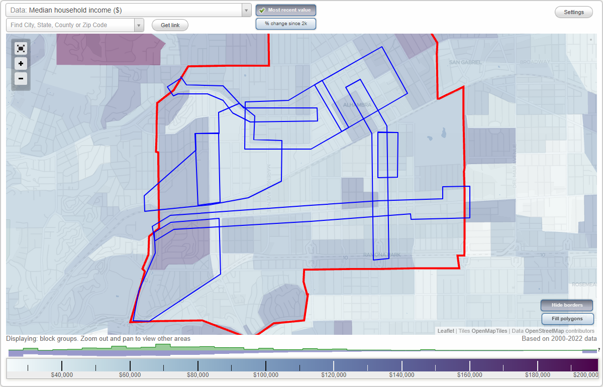
- City boundary
- Neighborhood boundaries
Business Search - 14 Million verified businesses
Neighborhoods:
Auto Row, Downtown Alhambra, Fremont Avenue, Garfield Avenue, Midwick Tract, Mission Palm, Stoneman, Valley Boulevard, West Main StreetAuto Row neighborhood in Alhambra statistics: (Find on map)
Area: 0.180 square miles
Population: 2,384
Population density:
Median household income in 2021:
Median rent in in 2021:
Male vs Females
Median age
Housing prices:
Average estimated value of detached houses in 2021 (22.7% of all units):
Average estimated value of townhouses or other attached units in 2021 (19.8% of all units):
Average estimated '21 value of housing units in 5-or-more-unit structures (4.6% of all units):
Most popular occupations of males: service occupations (16.1%); sales and office occupations (13.6%); management occupations (except farmers) (12.6%); production occupations (10.5%); transportation occupations (8.4%); business and financial operations occupations (8.1%); computer and mathematical occupations (6.4%)
Most popular occupations of females: sales and office occupations (25.1%); service occupations (24.4%); healthcare practitioners and technical occupations (12.6%); education, training, and library occupations (8.9%); management occupations (except farmers) (8.0%); business and financial operations occupations (6.1%); community and social services occupations (3.4%)
Roads and streets: W Main St; N Huntington Dr; Main St; N Primrose Ave; N Palm Ave; Palatine Dr; S Fremont Ave; S Meridian Ave; la Paloma St; N Atlantic Blvd; N Olive Ave; Cedar St; Hampden Ter; S Primrose Ave; Berkshire Ave.
Auto Row neighborhood detailed profile
Area: 0.180 square miles
Population: 2,384
Population density:
| Auto Row (Auto Row District): | 13,216 people per square mile |
| Alhambra: | 10,656 people per square mile |
Median household income in 2021:
| Auto Row (Auto Row District): | $73,002 |
| Alhambra: | $72,222 |
Median rent in in 2021:
| Auto Row (Auto Row District): | $1,541 |
| Alhambra: | $1,608 |
Male vs Females
| Males: | 1,064 |
| Females: | 1,319 |
Median age
| Males: | 40.8 years |
| Females: | 46.8 years |
Housing prices:
Average estimated value of detached houses in 2021 (22.7% of all units):
| Auto Row (Auto Row District): | $667,347 |
| California: | $881,672 |
Average estimated value of townhouses or other attached units in 2021 (19.8% of all units):
| This neighborhood: | $589,506 |
| California: | $745,373 |
Average estimated '21 value of housing units in 5-or-more-unit structures (4.6% of all units):
| Auto Row (Auto Row District): | $434,047 |
| California: | $701,962 |
Most popular occupations of males: service occupations (16.1%); sales and office occupations (13.6%); management occupations (except farmers) (12.6%); production occupations (10.5%); transportation occupations (8.4%); business and financial operations occupations (8.1%); computer and mathematical occupations (6.4%)
Most popular occupations of females: sales and office occupations (25.1%); service occupations (24.4%); healthcare practitioners and technical occupations (12.6%); education, training, and library occupations (8.9%); management occupations (except farmers) (8.0%); business and financial operations occupations (6.1%); community and social services occupations (3.4%)
Roads and streets: W Main St; N Huntington Dr; Main St; N Primrose Ave; N Palm Ave; Palatine Dr; S Fremont Ave; S Meridian Ave; la Paloma St; N Atlantic Blvd; N Olive Ave; Cedar St; Hampden Ter; S Primrose Ave; Berkshire Ave.
Auto Row neighborhood detailed profile
Downtown Alhambra neighborhood in Alhambra statistics: (Find on map)
Area: 0.393 square miles
Population: 4,477
Population density:
Median household income in 2021:
Median rent in in 2021:
Male vs Females
Median age
Housing prices:
Average estimated value of detached houses in 2021 (24.1% of all units):
Average estimated value of townhouses or other attached units in 2021 (10.9% of all units):
Average estimated value of housing units in 2-unit structures in 2021 (5.6% of all units):
Average estimated '21 value of housing units in 3-to-4-unit structures (10.5% of all units):
Average estimated '21 value of housing units in 5-or-more-unit structures (15.2% of all units):
Most popular occupations of males: service occupations (20.0%); management occupations (except farmers) (16.7%); sales and office occupations (14.5%); construction, extraction, and maintenance occupations (7.9%); transportation occupations (6.5%); business and financial operations occupations (6.4%); healthcare practitioners and technical occupations (4.6%)
Most popular occupations of females: sales and office occupations (32.5%); service occupations (18.0%); business and financial operations occupations (11.1%); healthcare practitioners and technical occupations (10.8%); management occupations (except farmers) (6.3%); arts, design, entertainment, sports, and media occupations (4.1%); education, training, and library occupations (3.9%)
Roads and streets: E Bay State St; E Main St; W Woodward Ave; W Main St; W Commonwealth Ave; S Chapel Ave; S Garfield Ave; S 2nd St; S 1st St; S 3rd St; S 4th St; E Commonwealth Ave; Elgin St; S Almansor St; E Woodward Ave; N Chapel Ave; N Stoneman Ave; N Almansor St; N Garfield Ave; N 1st St; N 2nd St; N 3rd St; N 4th St; S Monterey St; Chico St; W Bay State St; N Monterey St; Lindaraxa Park S; Lindaraxa Park.
Other features: San Pasqual Crk.
Other features: San Pascual Wash.
Downtown Alhambra neighborhood detailed profile
Area: 0.393 square miles
Population: 4,477
Population density:
| Downtown Alhambra (Main Street): | 11,404 people per square mile |
| Alhambra: | 10,656 people per square mile |
Median household income in 2021:
| Downtown Alhambra (Main Street): | $72,419 |
| Alhambra: | $72,222 |
Median rent in in 2021:
| Downtown Alhambra (Main Street): | $1,569 |
| Alhambra: | $1,608 |
Male vs Females
| Males: | 2,275 |
| Females: | 2,202 |
Median age
| Males: | 41.9 years |
| Females: | 46.2 years |
Housing prices:
Average estimated value of detached houses in 2021 (24.1% of all units):
| Downtown Alhambra (Main Street): | $990,740 |
| California: | $881,672 |
Average estimated value of townhouses or other attached units in 2021 (10.9% of all units):
| This neighborhood: | $506,216 |
| California: | $745,373 |
Average estimated value of housing units in 2-unit structures in 2021 (5.6% of all units):
| This neighborhood: | $604,732 |
| California: | $1,121,094 |
Average estimated '21 value of housing units in 3-to-4-unit structures (10.5% of all units):
| Downtown Alhambra (Main Street): | $436,852 |
| California: | $689,397 |
Average estimated '21 value of housing units in 5-or-more-unit structures (15.2% of all units):
| Downtown Alhambra (Main Street): | $304,064 |
| California: | $701,962 |
Most popular occupations of males: service occupations (20.0%); management occupations (except farmers) (16.7%); sales and office occupations (14.5%); construction, extraction, and maintenance occupations (7.9%); transportation occupations (6.5%); business and financial operations occupations (6.4%); healthcare practitioners and technical occupations (4.6%)
Most popular occupations of females: sales and office occupations (32.5%); service occupations (18.0%); business and financial operations occupations (11.1%); healthcare practitioners and technical occupations (10.8%); management occupations (except farmers) (6.3%); arts, design, entertainment, sports, and media occupations (4.1%); education, training, and library occupations (3.9%)
Roads and streets: E Bay State St; E Main St; W Woodward Ave; W Main St; W Commonwealth Ave; S Chapel Ave; S Garfield Ave; S 2nd St; S 1st St; S 3rd St; S 4th St; E Commonwealth Ave; Elgin St; S Almansor St; E Woodward Ave; N Chapel Ave; N Stoneman Ave; N Almansor St; N Garfield Ave; N 1st St; N 2nd St; N 3rd St; N 4th St; S Monterey St; Chico St; W Bay State St; N Monterey St; Lindaraxa Park S; Lindaraxa Park.
Other features: San Pasqual Crk.
Other features: San Pascual Wash.
Downtown Alhambra neighborhood detailed profile
Fremont Avenue neighborhood in Alhambra statistics: (Find on map)
Area: 0.154 square miles
Population: 815
Population density:
Median household income in 2021:
Median rent in in 2021:
Male vs Females
Median age
Average estimated value of detached houses in 2021 (88.1% of all units):
Most popular occupations of males: service occupations (22.4%); sales and office occupations (22.4%); management occupations (except farmers) (13.2%); education, training, and library occupations (8.2%); business and financial operations occupations (6.5%); material moving occupations (5.7%); production occupations (5.1%)
Most popular occupations of females: sales and office occupations (19.5%); service occupations (17.0%); education, training, and library occupations (15.2%); business and financial operations occupations (11.0%); computer and mathematical occupations (8.8%); management occupations (except farmers) (7.9%); production occupations (6.5%)
Roads and streets: S Fremont Ave; W Commonwealth Ave; Concord Ave; S Meridian Ave; la Paloma St.
Railroad features: Southern Pacific RR.
Fremont Avenue neighborhood detailed profile
Area: 0.154 square miles
Population: 815
Population density:
| Fremont Avenue (Fremont Ave): | 5,276 people per square mile |
| Alhambra: | 10,656 people per square mile |
Median household income in 2021:
| Fremont Avenue (Fremont Ave): | $87,555 |
| Alhambra: | $72,222 |
Median rent in in 2021:
| Fremont Avenue (Fremont Ave): | $1,507 |
| Alhambra: | $1,608 |
Male vs Females
| Males: | 408 |
| Females: | 406 |
Median age
| Males: | 44.8 years |
| Females: | 45.6 years |
Average estimated value of detached houses in 2021 (88.1% of all units):
| Fremont Avenue (Fremont Ave): | $645,824 |
| California: | $881,672 |
Most popular occupations of males: service occupations (22.4%); sales and office occupations (22.4%); management occupations (except farmers) (13.2%); education, training, and library occupations (8.2%); business and financial operations occupations (6.5%); material moving occupations (5.7%); production occupations (5.1%)
Most popular occupations of females: sales and office occupations (19.5%); service occupations (17.0%); education, training, and library occupations (15.2%); business and financial operations occupations (11.0%); computer and mathematical occupations (8.8%); management occupations (except farmers) (7.9%); production occupations (6.5%)
Roads and streets: S Fremont Ave; W Commonwealth Ave; Concord Ave; S Meridian Ave; la Paloma St.
Railroad features: Southern Pacific RR.
Fremont Avenue neighborhood detailed profile
Garfield Avenue neighborhood in Alhambra statistics: (Find on map)
Area: 0.275 square miles
Population: 3,677
Population density:
Median household income in 2021:
Median rent in in 2021:
Male vs Females
Median age
Housing prices:
Average estimated value of detached houses in 2021 (31.2% of all units):
Average estimated value of townhouses or other attached units in 2021 (15.9% of all units):
Average estimated value of housing units in 2-unit structures in 2021 (3.7% of all units):
Average estimated '21 value of housing units in 3-to-4-unit structures (13.3% of all units):
Average estimated '21 value of housing units in 5-or-more-unit structures (13.2% of all units):
Most popular occupations of males: service occupations (20.0%); sales and office occupations (18.0%); management occupations (except farmers) (9.0%); construction, extraction, and maintenance occupations (7.9%); architecture and engineering occupations (6.8%); business and financial operations occupations (6.2%); transportation occupations (5.7%)
Most popular occupations of females: sales and office occupations (33.4%); service occupations (17.3%); healthcare practitioners and technical occupations (9.3%); business and financial operations occupations (8.3%); management occupations (except farmers) (8.0%); community and social services occupations (4.9%); education, training, and library occupations (4.5%)
Limited-access highways (interstate or state) in this neighborhood: I- 10 (San Bernardino Fwy).
Roads and streets: S Garfield Ave; S Stoneman Ave; S 1st St; E Los Higos St; E Linda Vista Ave; E San Marino Ave; E Adams Ave; Chico St; E Main St; E Mission Rd; E Beacon St; W Bay State St; W Beacon St; W Commonwealth Ave; W Main St; E Bay State St; W Mission Rd; E Shorb St; E Valley Blvd; E Norwood Pl; E Glendon Way; N Garfield Ave; N Stoneman Ave; W San Marino Ave; W Shorb St; W Glendon Way; N 1st St.
Garfield Avenue neighborhood detailed profile
Area: 0.275 square miles
Population: 3,677
Population density:
| Garfield Avenue (Garfield Ave): | 13,362 people per square mile |
| Alhambra: | 10,656 people per square mile |
Median household income in 2021:
| Garfield Avenue (Garfield Ave): | $83,890 |
| Alhambra: | $72,222 |
Median rent in in 2021:
| Garfield Avenue (Garfield Ave): | $1,976 |
| Alhambra: | $1,608 |
Male vs Females
| Males: | 1,796 |
| Females: | 1,880 |
Median age
| Males: | 52.8 years |
| Females: | 52.2 years |
Housing prices:
Average estimated value of detached houses in 2021 (31.2% of all units):
| Garfield Avenue (Garfield Ave): | $884,884 |
| California: | $881,672 |
Average estimated value of townhouses or other attached units in 2021 (15.9% of all units):
| This neighborhood: | $161,888 |
| California: | $745,373 |
Average estimated value of housing units in 2-unit structures in 2021 (3.7% of all units):
| This neighborhood: | $604,732 |
| California: | $1,121,094 |
Average estimated '21 value of housing units in 3-to-4-unit structures (13.3% of all units):
| Garfield Avenue (Garfield Ave): | $838,009 |
| California: | $689,397 |
Average estimated '21 value of housing units in 5-or-more-unit structures (13.2% of all units):
| Garfield Avenue (Garfield Ave): | $407,139 |
| California: | $701,962 |
Most popular occupations of males: service occupations (20.0%); sales and office occupations (18.0%); management occupations (except farmers) (9.0%); construction, extraction, and maintenance occupations (7.9%); architecture and engineering occupations (6.8%); business and financial operations occupations (6.2%); transportation occupations (5.7%)
Most popular occupations of females: sales and office occupations (33.4%); service occupations (17.3%); healthcare practitioners and technical occupations (9.3%); business and financial operations occupations (8.3%); management occupations (except farmers) (8.0%); community and social services occupations (4.9%); education, training, and library occupations (4.5%)
Limited-access highways (interstate or state) in this neighborhood: I- 10 (San Bernardino Fwy).
Roads and streets: S Garfield Ave; S Stoneman Ave; S 1st St; E Los Higos St; E Linda Vista Ave; E San Marino Ave; E Adams Ave; Chico St; E Main St; E Mission Rd; E Beacon St; W Bay State St; W Beacon St; W Commonwealth Ave; W Main St; E Bay State St; W Mission Rd; E Shorb St; E Valley Blvd; E Norwood Pl; E Glendon Way; N Garfield Ave; N Stoneman Ave; W San Marino Ave; W Shorb St; W Glendon Way; N 1st St.
Garfield Avenue neighborhood detailed profile
Midwick Tract neighborhood in Alhambra statistics: (Find on map)
Area: 0.542 square miles
Population: 4,562
Population density:
Median household income in 2021:
Median rent in in 2021:
Male vs Females
Median age
Average estimated value of detached houses in 2021 (84.8% of all units):
Most popular occupations of males: sales and office occupations (19.2%); service occupations (18.8%); education, training, and library occupations (10.5%); management occupations (except farmers) (9.9%); computer and mathematical occupations (6.3%); business and financial operations occupations (4.6%); transportation occupations (4.1%)
Most popular occupations of females: education, training, and library occupations (23.1%); sales and office occupations (21.4%); management occupations (except farmers) (15.1%); business and financial operations occupations (9.5%); service occupations (8.2%); healthcare practitioners and technical occupations (8.0%); community and social services occupations (2.9%)
Limited-access highways (interstate or state) in this neighborhood: I- 10 (San Bernardino Fwy); Long Beach Fwy (I- 710).
Roads and streets: W Ramona Rd; W Hellman Ave; Westmont Dr; W Norwood Pl; W Ross Ave; Meridian Ave; Elm St; Orange Grove Ave; S Fremont Ave; Charnwood Ave; Parkview Dr; Grandview Dr; Midwick Dr; Westboro Ave; Winthrop Dr; Cabrillo Ave; la Paloma St; Pyrenees Dr; Warwick Rd; la Golondrina Ave; Westminster Ave; Balzac St; W Ramona Ter; Glenaven Ave; Alta Vista Dr; W Glendon Way; Avondale Dr; Glen View Dr; Terrace Ave; Viscount St; el Paseo St (el Paseo); Capetown Ave; W Valley Blvd; Jurich Pl; Danzig Pl; Julep Pl.
Other features: Luguna Chnnl.
Midwick Tract neighborhood detailed profile
Area: 0.542 square miles
Population: 4,562
Population density:
| Midwick Tract: | 8,415 people per square mile |
| Alhambra: | 10,656 people per square mile |
Median household income in 2021:
| Midwick Tract: | $80,181 |
| Alhambra: | $72,222 |
Median rent in in 2021:
| Midwick Tract: | $1,841 |
| Alhambra: | $1,608 |
Male vs Females
| Males: | 2,437 |
| Females: | 2,125 |
Median age
| Males: | 40.5 years |
| Females: | 41.2 years |
Average estimated value of detached houses in 2021 (84.8% of all units):
| Midwick Tract: | $717,438 |
| California: | $881,672 |
Most popular occupations of males: sales and office occupations (19.2%); service occupations (18.8%); education, training, and library occupations (10.5%); management occupations (except farmers) (9.9%); computer and mathematical occupations (6.3%); business and financial operations occupations (4.6%); transportation occupations (4.1%)
Most popular occupations of females: education, training, and library occupations (23.1%); sales and office occupations (21.4%); management occupations (except farmers) (15.1%); business and financial operations occupations (9.5%); service occupations (8.2%); healthcare practitioners and technical occupations (8.0%); community and social services occupations (2.9%)
Limited-access highways (interstate or state) in this neighborhood: I- 10 (San Bernardino Fwy); Long Beach Fwy (I- 710).
Roads and streets: W Ramona Rd; W Hellman Ave; Westmont Dr; W Norwood Pl; W Ross Ave; Meridian Ave; Elm St; Orange Grove Ave; S Fremont Ave; Charnwood Ave; Parkview Dr; Grandview Dr; Midwick Dr; Westboro Ave; Winthrop Dr; Cabrillo Ave; la Paloma St; Pyrenees Dr; Warwick Rd; la Golondrina Ave; Westminster Ave; Balzac St; W Ramona Ter; Glenaven Ave; Alta Vista Dr; W Glendon Way; Avondale Dr; Glen View Dr; Terrace Ave; Viscount St; el Paseo St (el Paseo); Capetown Ave; W Valley Blvd; Jurich Pl; Danzig Pl; Julep Pl.
Other features: Luguna Chnnl.
Midwick Tract neighborhood detailed profile
Mission Palm neighborhood in Alhambra statistics: (Find on map)
Area: 0.770 square miles
Population: 4,501
Population density:
Median household income in 2021:
Median rent in in 2021:
Male vs Females
Median age
Housing prices:
Average estimated value of detached houses in 2021 (68.1% of all units):
Average estimated value of townhouses or other attached units in 2021 (18.3% of all units):
Average estimated '21 value of housing units in 5-or-more-unit structures (9.6% of all units):
Most popular occupations of males: service occupations (18.1%); sales and office occupations (17.4%); management occupations (except farmers) (10.9%); material moving occupations (7.6%); production occupations (7.5%); education, training, and library occupations (7.0%); construction, extraction, and maintenance occupations (6.4%)
Most popular occupations of females: sales and office occupations (23.6%); service occupations (20.6%); education, training, and library occupations (11.8%); business and financial operations occupations (8.6%); healthcare practitioners and technical occupations (7.0%); management occupations (except farmers) (5.9%); computer and mathematical occupations (5.0%)
Roads and streets: W Mission Rd; W Commonwealth Ave; Concord Ave; S Palm Ave; S Raymond Ave; Orange St; S Fremont Ave; Date Ave; S Meridian Ave; S Marengo Ave; Lemon St; Westminster Ave; Chestnut St; Midvale Pl; Poplar Blvd; Front St; W Main St; Pepper St; Alhambra Ave; Maple Ct; Teagarden Ln; Lowell Ave; la Paloma St; Allan St; N Palm Ave; Winthrop Dr; Mimosa St; Norwich Ave.
Railroad features: Southern Pacific RR.
Mission Palm neighborhood detailed profile
Area: 0.770 square miles
Population: 4,501
Population density:
| Mission Palm (Mission Palm Industrial Corridor): | 5,847 people per square mile |
| Alhambra: | 10,656 people per square mile |
Median household income in 2021:
| Mission Palm (Mission Palm Industrial Corridor): | $74,692 |
| Alhambra: | $72,222 |
Median rent in in 2021:
| Mission Palm (Mission Palm Industrial Corridor): | $1,496 |
| Alhambra: | $1,608 |
Male vs Females
| Males: | 2,210 |
| Females: | 2,291 |
Median age
| Males: | 38.5 years |
| Females: | 42.2 years |
Housing prices:
Average estimated value of detached houses in 2021 (68.1% of all units):
| Mission Palm (Mission Palm Industrial Corridor): | $598,277 |
| California: | $881,672 |
Average estimated value of townhouses or other attached units in 2021 (18.3% of all units):
| This neighborhood: | $629,210 |
| California: | $745,373 |
Average estimated '21 value of housing units in 5-or-more-unit structures (9.6% of all units):
| Mission Palm (Mission Palm Industrial Corridor): | $398,261 |
| California: | $701,962 |
Most popular occupations of males: service occupations (18.1%); sales and office occupations (17.4%); management occupations (except farmers) (10.9%); material moving occupations (7.6%); production occupations (7.5%); education, training, and library occupations (7.0%); construction, extraction, and maintenance occupations (6.4%)
Most popular occupations of females: sales and office occupations (23.6%); service occupations (20.6%); education, training, and library occupations (11.8%); business and financial operations occupations (8.6%); healthcare practitioners and technical occupations (7.0%); management occupations (except farmers) (5.9%); computer and mathematical occupations (5.0%)
Roads and streets: W Mission Rd; W Commonwealth Ave; Concord Ave; S Palm Ave; S Raymond Ave; Orange St; S Fremont Ave; Date Ave; S Meridian Ave; S Marengo Ave; Lemon St; Westminster Ave; Chestnut St; Midvale Pl; Poplar Blvd; Front St; W Main St; Pepper St; Alhambra Ave; Maple Ct; Teagarden Ln; Lowell Ave; la Paloma St; Allan St; N Palm Ave; Winthrop Dr; Mimosa St; Norwich Ave.
Railroad features: Southern Pacific RR.
Mission Palm neighborhood detailed profile
Stoneman neighborhood in Alhambra statistics: (Find on map)
Area: 0.085 square miles
Population: 1,455
Population density:
Median household income in 2021:
Median rent in in 2021:
Male vs Females
Median age
Most popular occupations of males: sales and office occupations (21.2%); architecture and engineering occupations (13.8%); management occupations (except farmers) (8.2%); service occupations (8.1%); construction, extraction, and maintenance occupations (8.0%); material moving occupations (6.0%); life, physical, and social science occupations (5.5%)
Most popular occupations of females: sales and office occupations (20.3%); service occupations (18.0%); business and financial operations occupations (13.7%); management occupations (except farmers) (11.3%); education, training, and library occupations (9.3%); community and social services occupations (7.5%); material moving occupations (5.1%)
Roads and streets: S Stoneman Ave; S Chapel Ave; E San Marino Ave; E Los Higos St; E Linda Vista Ave; E Adams Ave.
Stoneman neighborhood detailed profile
Area: 0.085 square miles
Population: 1,455
Population density:
| Stoneman: | 17,029 people per square mile |
| Alhambra: | 10,656 people per square mile |
Median household income in 2021:
| Stoneman: | $59,913 |
| Alhambra: | $72,222 |
Median rent in in 2021:
| Stoneman: | $1,538 |
| Alhambra: | $1,608 |
Male vs Females
| Males: | 686 |
| Females: | 769 |
Median age
| Males: | 38.0 years |
| Females: | 35.3 years |
Most popular occupations of males: sales and office occupations (21.2%); architecture and engineering occupations (13.8%); management occupations (except farmers) (8.2%); service occupations (8.1%); construction, extraction, and maintenance occupations (8.0%); material moving occupations (6.0%); life, physical, and social science occupations (5.5%)
Most popular occupations of females: sales and office occupations (20.3%); service occupations (18.0%); business and financial operations occupations (13.7%); management occupations (except farmers) (11.3%); education, training, and library occupations (9.3%); community and social services occupations (7.5%); material moving occupations (5.1%)
Roads and streets: S Stoneman Ave; S Chapel Ave; E San Marino Ave; E Los Higos St; E Linda Vista Ave; E Adams Ave.
Stoneman neighborhood detailed profile
Valley Boulevard neighborhood in Alhambra statistics: (Find on map)
Area: 0.521 square miles
Population: 4,612
Population density:
Median household income in 2021:
Median rent in in 2021:
Male vs Females
Median age
Housing prices:
Average estimated value of detached houses in 2021 (52.9% of all units):
Average estimated value of townhouses or other attached units in 2021 (15.2% of all units):
Average estimated '21 value of housing units in 5-or-more-unit structures (18.1% of all units):
Most popular occupations of males: service occupations (24.8%); sales and office occupations (20.1%); management occupations (except farmers) (9.9%); construction, extraction, and maintenance occupations (5.8%); production occupations (5.8%); material moving occupations (5.3%); arts, design, entertainment, sports, and media occupations (3.9%)
Most popular occupations of females: service occupations (29.2%); sales and office occupations (25.5%); business and financial operations occupations (7.6%); management occupations (except farmers) (7.3%); healthcare practitioners and technical occupations (7.1%); education, training, and library occupations (5.8%); production occupations (4.1%)
Limited-access highways (interstate or state) in this neighborhood: .
Roads and streets: W Valley Blvd; E Valley Blvd; Camelia Dr; W Shorb St; W Norwood Pl; N New Ave (New Ave); S Vega St; E Shorb St; Violeta Dr; S Almansor St; Westmont Dr; Market Ln; S Atlantic Blvd; Westminster Ave; S Marguerita Ave; S Marengo Ave; S Ethel Ave; S Campbell Ave; S Stoneman Ave; S Sierra Vista Ave; S Chapel Ave; S Monterey St; S 7th St; S 9th St; S 8th St; Date Ave; S Raymond Ave; S Palm Ave; Cabrillo Ave; S 6th St; S Primrose Ave; Elm St; S 5th St; S Meridian Ave; S Fremont Ave; Edith Ave; Benito Ave; S Olive Ave; S Garfield Ave; S Curtis Ave; S 2nd St; S 4th St; S Electric Ave; S 3rd St; Grandview Dr; Edgewood Dr; S Granada Ave; W Ralph St.
Valley Boulevard neighborhood detailed profile
Area: 0.521 square miles
Population: 4,612
Population density:
| Valley Boulevard (Valley Blvd): | 8,846 people per square mile |
| Alhambra: | 10,656 people per square mile |
Median household income in 2021:
| Valley Boulevard (Valley Blvd): | $71,988 |
| Alhambra: | $72,222 |
Median rent in in 2021:
| Valley Boulevard (Valley Blvd): | $1,646 |
| Alhambra: | $1,608 |
Male vs Females
| Males: | 2,052 |
| Females: | 2,559 |
Median age
| Males: | 41.8 years |
| Females: | 47.4 years |
Housing prices:
Average estimated value of detached houses in 2021 (52.9% of all units):
| Valley Boulevard (Valley Blvd): | $709,997 |
| California: | $881,672 |
Average estimated value of townhouses or other attached units in 2021 (15.2% of all units):
| This neighborhood: | $733,750 |
| California: | $745,373 |
Average estimated '21 value of housing units in 5-or-more-unit structures (18.1% of all units):
| Valley Boulevard (Valley Blvd): | $487,966 |
| California: | $701,962 |
Most popular occupations of males: service occupations (24.8%); sales and office occupations (20.1%); management occupations (except farmers) (9.9%); construction, extraction, and maintenance occupations (5.8%); production occupations (5.8%); material moving occupations (5.3%); arts, design, entertainment, sports, and media occupations (3.9%)
Most popular occupations of females: service occupations (29.2%); sales and office occupations (25.5%); business and financial operations occupations (7.6%); management occupations (except farmers) (7.3%); healthcare practitioners and technical occupations (7.1%); education, training, and library occupations (5.8%); production occupations (4.1%)
Limited-access highways (interstate or state) in this neighborhood: .
Roads and streets: W Valley Blvd; E Valley Blvd; Camelia Dr; W Shorb St; W Norwood Pl; N New Ave (New Ave); S Vega St; E Shorb St; Violeta Dr; S Almansor St; Westmont Dr; Market Ln; S Atlantic Blvd; Westminster Ave; S Marguerita Ave; S Marengo Ave; S Ethel Ave; S Campbell Ave; S Stoneman Ave; S Sierra Vista Ave; S Chapel Ave; S Monterey St; S 7th St; S 9th St; S 8th St; Date Ave; S Raymond Ave; S Palm Ave; Cabrillo Ave; S 6th St; S Primrose Ave; Elm St; S 5th St; S Meridian Ave; S Fremont Ave; Edith Ave; Benito Ave; S Olive Ave; S Garfield Ave; S Curtis Ave; S 2nd St; S 4th St; S Electric Ave; S 3rd St; Grandview Dr; Edgewood Dr; S Granada Ave; W Ralph St.
Valley Boulevard neighborhood detailed profile
West Main Street neighborhood in Alhambra statistics: (Find on map)
Area: 0.464 square miles
Population: 5,311
Population density:
Median household income in 2021:
Median rent in in 2021:
Male vs Females
Median age
Housing prices:
Average estimated value of detached houses in 2021 (25.3% of all units):
Average estimated value of townhouses or other attached units in 2021 (20.0% of all units):
Average estimated '21 value of housing units in 5-or-more-unit structures (13.4% of all units):
Most popular occupations of males: service occupations (21.1%); sales and office occupations (17.4%); management occupations (except farmers) (10.7%); business and financial operations occupations (10.6%); transportation occupations (8.8%); production occupations (8.2%); construction, extraction, and maintenance occupations (4.3%)
Most popular occupations of females: service occupations (36.6%); sales and office occupations (22.9%); business and financial operations occupations (9.7%); healthcare practitioners and technical occupations (9.6%); education, training, and library occupations (6.6%); production occupations (4.1%); community and social services occupations (3.5%)
Roads and streets: W Commonwealth Ave; W Main St; W Woodward Ave; Vine St; S Marengo Ave; S Olive Ave; S Marguerita Ave; S Curtis Ave; S Electric Ave; S Atlantic Blvd; S Raymond Ave; Acacia St; S 4th St; S 5th St; S 6th St; N Atlantic Blvd; Pepper St; N 5th St; N 4th St; Irving St; N Olive Ave; Washington St; Howard St; N Curtis Ave; Maple Ct; S Bushnell Ave; N Electric Ave; N Marguerita Ave; N Raymond Ave; N Marengo Ave.
West Main Street neighborhood detailed profile
Area: 0.464 square miles
Population: 5,311
Population density:
| West Main Street (West Main Street Corridor): | 11,454 people per square mile |
| Alhambra: | 10,656 people per square mile |
Median household income in 2021:
| West Main Street (West Main Street Corridor): | $68,022 |
| Alhambra: | $72,222 |
Median rent in in 2021:
| West Main Street (West Main Street Corridor): | $1,573 |
| Alhambra: | $1,608 |
Male vs Females
| Males: | 2,465 |
| Females: | 2,845 |
Median age
| Males: | 40.2 years |
| Females: | 46.2 years |
Housing prices:
Average estimated value of detached houses in 2021 (25.3% of all units):
| West Main Street (West Main Street Corridor): | $644,192 |
| California: | $881,672 |
Average estimated value of townhouses or other attached units in 2021 (20.0% of all units):
| This neighborhood: | $631,454 |
| California: | $745,373 |
Average estimated '21 value of housing units in 5-or-more-unit structures (13.4% of all units):
| West Main Street (West Main Street Corridor): | $578,564 |
| California: | $701,962 |
Most popular occupations of males: service occupations (21.1%); sales and office occupations (17.4%); management occupations (except farmers) (10.7%); business and financial operations occupations (10.6%); transportation occupations (8.8%); production occupations (8.2%); construction, extraction, and maintenance occupations (4.3%)
Most popular occupations of females: service occupations (36.6%); sales and office occupations (22.9%); business and financial operations occupations (9.7%); healthcare practitioners and technical occupations (9.6%); education, training, and library occupations (6.6%); production occupations (4.1%); community and social services occupations (3.5%)
Roads and streets: W Commonwealth Ave; W Main St; W Woodward Ave; Vine St; S Marengo Ave; S Olive Ave; S Marguerita Ave; S Curtis Ave; S Electric Ave; S Atlantic Blvd; S Raymond Ave; Acacia St; S 4th St; S 5th St; S 6th St; N Atlantic Blvd; Pepper St; N 5th St; N 4th St; Irving St; N Olive Ave; Washington St; Howard St; N Curtis Ave; Maple Ct; S Bushnell Ave; N Electric Ave; N Marguerita Ave; N Raymond Ave; N Marengo Ave.
West Main Street neighborhood detailed profile