Members of the Washburn-Langford-Doane Expedition worked their way up a tall mountain peak during their explorations in 1870. This group of individuals eventually named this peak Mount Washburn after their leader Henry D. Washburn. This peak is found in Yellowstone National Park, Wyoming. It is also part of the Greater Yellowstone Range. Elevation for the mountain is 10,243 feet.
The best route to take to the top of the peak is, of course, to hike it. There is one trail that will take visitors up to the very summit of the peak and other trails that will lead around the Yellowstone range, including some aspects on Mount Washburn.
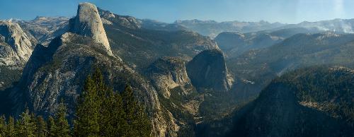
From the top of the peak it is possible to see the northern section of Yellowstone National Park and the Teton Range in the distance. During the summer this range can be very busy with summer tourists. Despite the ranges full elevation hikers will only climb 1,393 feet on the three mile hike from Dunraven Pass.
There is a second path visitors can travel from Chittenden parking area. This trail is a little shorter, but it offers a 1,491 feet elevation change. The hike is only 2.25 miles though. Along the way tourists are able to see one of the active fire lookout towers. Yellowstone has three towers that are active for fire fighters and park staff. Fire fighters will take shifts at the towers daily to look out for any fires started by arson, accidental issues, or natural causes. Yellowstone has been the victim of fires due to the massive amount of dry forest the park contains. A disastrous fire in the 80's caused many acres to burn.
Also along the path towards the summit is the small visitor center with restrooms. There is an observation deck on the second floor. The third floor of this structure has ranger quarters, so that they may remain in the park during the summer months. Before traveling to the park visitors can log on to Yellowstone National Parks webcam system to check out images from the fire tower of Mount Washburn.
Mount Washburn is part of the Canyon area trails. For visitors who begin at Chittenden or Dunraven Pass, the summit is very close and a trail will continue on towards Canyon Village. The trail breaks off towards Seven Mile Hole which also runs along Yellowstone River.
Visitors who do not go towards Seven Mile Hole can continue towards Canyon Village and work their way to Cascade Lake across the road. From Cascade Lake trails move to other Yellowstone lakes like Grebe and Wolf. There is not a loop trail for Mount Washburn.
The trail is a down and back or down and to another parking area like going from Dunraven Pass to Chittenden parking area. For tourists who drive their own car they will eventually have to return by bus or hiking to their vehicle. There are transportation systems within the park, but they are in every area, so it is best to check if Mount Washburn has a visitors' bus.
Review, comment, or add new information about this topic: