West Savannah neighborhood in Savannah, Georgia (GA), 31415 detailed profile
Settings
X


Business Search - 14 Million verified businesses
Area: 0.439 square miles
Population: 3,337
Population density:
| West Savannah: | 7,607 people per square mile |
| Savannah: | 1,980 people per square mile |

- 2,07547.3%Black
- 1,46433.3%White
- 3728.5%Hispanic or Latino
- 2686.1%Two or more races
- 2124.8%Asian

Distribution of median household income
![Distribution of median household income]()
- 225Less than $10,000
- 220$10,000 to $19,999
- 368$20,000 to $29,999
- 149$30,000 to $39,999
- 90$40,000 to $49,999
- 231$50,000 to $59,999
- 66$60,000 to $74,999
- 32$75,000 to $99,999
- 132$100,000 to $124,999
- 152$125,000 to $149,999
- 3$150,000 to $199,999

Distribution of owner-occupied house/condo value
![Distribution of owner-occupied house/condo value]()
- 301Less than $50,000
- 702$50,000 to $99,999
- 73$100,000 to $149,999
- 35$200,000 to $249,999
- 23$250,000 to $299,999
- 40$500,000 to $749,999

Distribution of rent paid by renters
![Distribution of rent paid by renters]()
- 69$100 to $199
- 11$200 to $299
- 14$300 to $399
- 295$500 to $599
- 257$600 to $699
- 115$700 to $799
- 50$800 to $899
- 139$900 to $999
- 195$1,000 to $1,249
- 23$1,250 to $1,499
- 7$1,500 to $1,999
- 172$2,000 or more

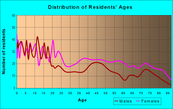
| Males: | 1,537 |
| Females: | 1,799 |
Males:
| This neighborhood: | 30.7 years |
| Whole city: | 33.3 years |
| This neighborhood: | 39.8 years |
| Whole city: | 35.7 years |
Average household size:
| West Savannah: | 2.7 people |
| Savannah: | 2.2 people |
Percentage of family households:
| West Savannah: | 27.3% |
| Savannah: | 34.5% |
| Here: | 12.9% |
| Savannah: | 27.9% |
Percentage of married-couple families with children (among all households):
| West Savannah: | 5.1% |
| Savannah: | 15.8% |
Percentage of single-mother households (among all households):
| West Savannah: | 32.8% |
| Savannah: | 24.1% |
Percentage of never married males 15 years old and over:
Percentage of never married females 15 years old and over:
| West Savannah: | 32.9% |
| Savannah: | 22.2% |
Percentage of never married females 15 years old and over:
| West Savannah: | 44.4% |
| city: | 26.6% |
Percentage of people that speak English not well or not at all:
| West Savannah: | 0.4% |
| Savannah: | 1.1% |
Percentage of people born in this state:
Percentage of people born in another U.S. state:
Percentage of native residents but born outside the U.S.:
Percentage of foreign born residents:
| Here: | 62.1% |
| Savannah: | 52.9% |
Percentage of people born in another U.S. state:
| West Savannah: | 32.9% |
| Savannah: | 39.2% |
Percentage of native residents but born outside the U.S.:
| Here: | 1.2% |
| city: | 2.0% |
Percentage of foreign born residents:
| Here: | 3.8% |
| Savannah: | 5.9% |

Owner-occupied
Renter-occupied


- Rooms in owner-occupied houses and condos in West Savannah
- 01 room
- 02 rooms
- 23 rooms
- 544 rooms
- 2015 rooms
- 1016 rooms
- 537 rooms
- 868 rooms
- 1149+ rooms

- Rooms in renter-occupied apartments in West Savannah
- 541 room
- 02 rooms
- 603 rooms
- 2964 rooms
- 1815 rooms
- 1176 rooms
- 1247 rooms
- 1388 rooms
- 179+ rooms
Owner-occupied
Renter-occupied

- Bedrooms in owner-occupied houses and condos in West Savannah
- 0no bedroom
- 01 bedroom
- 1342 bedrooms
- 1733 bedrooms
- 1144 bedrooms
- 05+ bedrooms

- Bedrooms in renter-occupied apartments in West Savannah
- 54no bedroom
- 961 bedroom
- 3072 bedrooms
- 2163 bedrooms
- 314 bedrooms
- 05+ bedrooms
Average number of cars or other vehicles available in houses/condos:
Average number of cars or other vehicles available in apartments:
| This neighborhood: | 1.3 |
| Savannah: | 1.9 |
Average number of cars or other vehicles available in apartments:
| Here: | 1.7 |
| city: | 1.4 |
Percentage of units with a mortgage:
| West Savannah: | 19.5% |
| Savannah: | 64.4% |
Average estimated value of detached houses in 2022 (74.2% of all units):
| West Savannah: | $108,812 |
| Savannah: | $283,633 |

- Year house built in West Savannah
- 02020 or later
- 2292010 to 2019
- 1232000 to 2009
- 1431990 to 1999
- 911980 to 1989
- 951970 to 1979
- 4241960 to 1969
- 1401950 to 1959
- 1411940 to 1949
- 2611939 or earlier

Travel time to work (commute)
![Travel time to work (commute)]()
- 51Less than 5 minutes
- 1635 to 9 minutes
- 27310 to 14 minutes
- 15215 to 19 minutes
- 34520 to 24 minutes
- 725 to 29 minutes
- 13530 to 34 minutes
- 2040 to 44 minutes
- 2245 to 59 minutes
- 8890 or more minutes

Means of transportation to work
![Means of transportation to work]()
- 67.5%741Drove a car alone
- 13.1%144Carpooled
- 11.2%123Bus
- 6.6%72Taxi
- 5.3%58Bicycle
- 9.4%103Walked
- 2.6%29Other means
- 15.0%165Worked at home

Time leaving home to go to work
![Time leaving home to go to work]()
- 12412:00 a.m. to 4:59 a.m.
- 535:00 a.m. to 5:29 a.m.
- 1475:30 a.m. to 5:59 a.m.
- 1216:00 a.m. to 6:29 a.m.
- 326:30 a.m. to 6:59 a.m.
- 947:00 a.m. to 7:29 a.m.
- 1407:30 a.m. to 7:59 a.m.
- 668:00 a.m. to 8:29 a.m.
- 718:30 a.m. to 8:59 a.m.
- 439:00 a.m. to 9:59 a.m.
- 510:00 a.m. to 10:59 a.m.
- 6411:00 a.m. to 11:59 a.m.
- 19212:00 p.m. to 3:59 p.m.
- 1364:00 p.m. to 11:59 p.m.

Occupations of males:
- Percentage of males in business and financial operations occupations:
Here: 1.6% city: 5.4%
- Percentage of males in architecture and engineering occupations:
Here: 5.7% city: 2.4%
- Percentage of males in education, training, and library occupations:
Here: 1.4% city: 3.3%
- Percentage of males in service occupations:
Here: 15.1% city: 22.7%
- Percentage of males in sales and office occupations:
Here: 8.4% city: 13.5%
- Percentage of males in construction, extraction, and maintenance occupations:
Here: 2.4% city: 6.4%
- Percentage of males in production occupations:
Here: 25.2% city: 6.0%
- Percentage of males in transportation occupations:
Here: 8.3% city: 8.8%
- Percentage of males in material moving occupations:
Here: 33.4% city: 8.2%
Occupations of females:
- Percentage of females in management occupations (except farmers):
Here: 6.0% city: 7.5%
- Percentage of females in architecture and engineering occupations:
Here: 1.4% city: 0.6%
- Percentage of females in education, training, and library occupations:
Here: 1.3% city: 8.5%
- Percentage of females in service occupations:
Here: 35.4% city: 24.1%
- Percentage of females in sales and office occupations:
Here: 38.8% city: 28.2%
- Percentage of females in production occupations:
Here: 6.9% city: 2.4%
- Percentage of females in transportation occupations:
Here: 10.6% city: 2.7%
Education in this neighborhood (subdivision or community):
- Percentage of people 3 years and older in K-12 schools:
West Savannah: 20.4% Savannah: 12.9%
- Percentage of people 3 years and older in undergraduate colleges:
West Savannah: 80.6% Savannah: 11.4%
- Percentage of people 3 years and older in grad. or professional schools:
West Savannah: 2.4% Savannah: 1.1%
- Percentage of students K-12 enrolled in private schools:
West Savannah: 0.0% Savannah: 14.5%
Percentage of population below poverty level:
| West Savannah: | 29.5% |
| Savannah: | 20.5% |
Median year owner moved in (as recorded in 2022):
Median year renter moved in (as recorded in 2022):
| West Savannah: | 1990 |
| Savannah: | 2012 |
Median year renter moved in (as recorded in 2022):
| West Savannah: | 2018 |
| Savannah: | 2020 |
Percentage of married-couple families with both working:
| West Savannah: | 100.0% |
| Savannah: | 79.0% |

- 66.0%Electricity
- 30.0%Utility gas
- 4.0%Bottled, tank, or LP gas
Limited-access highways (interstate or state) in this neighborhood:
I- 516 (State Rte 25, US Hwy 80, US Hwy 17, State Rte 21)
Length: 0.04 miles
Direction: N-S
Direction: N-S
Roads and streets:
Francis Bartow Pl (Augusta Ave)
Length: 1.23 miles
Directions: E-W, SE-NW
Address range: 1000 to 2399
Directions: E-W, SE-NW
Address range: 1000 to 2399
Richards St
Length: 0.78 miles
Directions: E-W, SE-NW
Address range: 1000 to 1999
Directions: E-W, SE-NW
Address range: 1000 to 1999
Comer St
Length: 0.67 miles
Directions: E-W, SE-NW
Address range: 1200 to 1699
Directions: E-W, SE-NW
Address range: 1200 to 1699
New Castle St
Length: 0.65 miles
Direction: E-W
Address range: 1200 to 1799
Direction: E-W
Address range: 1200 to 1799
Chester St
Length: 0.51 miles
Direction: E-W
Address range: 1300 to 1799
Direction: E-W
Address range: 1300 to 1799
Ferrill St
Length: 0.43 miles
Directions: N-S, SW-NE
Address range: 23 to 299
Directions: N-S, SW-NE
Address range: 23 to 299
McIntyre St
Length: 0.42 miles
Directions: N-S, SW-NE
Address range: 100 to 599
Directions: N-S, SW-NE
Address range: 100 to 599
Love St
Length: 0.38 miles
Directions: E-W, SE-NW
Address range: 1000 to 1399
Directions: E-W, SE-NW
Address range: 1000 to 1399
Stratford St
Length: 0.35 miles
Direction: E-W
Address range: 1500 to 1799
Direction: E-W
Address range: 1500 to 1799
Scarborough St
Length: 0.33 miles
Directions: N-S, SW-NE
Address range: 100 to 299
Directions: N-S, SW-NE
Address range: 100 to 299
Fell St
Length: 0.33 miles
Directions: N-S, SW-NE
Address range: 200 to 599
Directions: N-S, SW-NE
Address range: 200 to 599
Exley St
Length: 0.31 miles
Direction: E-W
Address range: 1 to 1499
Direction: E-W
Address range: 1 to 1499
Millen St
Length: 0.27 miles
Direction: SW-NE
Address range: 100 to 299
Direction: SW-NE
Address range: 100 to 299
Alexander St
Length: 0.27 miles
Directions: N-S, SE-NW
Address range: 300 to 358
Directions: N-S, SE-NW
Address range: 300 to 358
Margery St (Cullman St)
Length: 0.26 miles
Directions: E-W, SE-NW
Address range: 2000 to 2299
Directions: E-W, SE-NW
Address range: 2000 to 2299
Brittany St
Length: 0.24 miles
Directions: N-S, SW-NE
Address range: 120 to 449
Directions: N-S, SW-NE
Address range: 120 to 449
Golden St (Church St)
Length: 0.24 miles
Direction: SE-NW
Address range: 1300 to 1499
Direction: SE-NW
Address range: 1300 to 1499
Baker St
Length: 0.23 miles
Direction: SW-NE
Address range: 100 to 299
Direction: SW-NE
Address range: 100 to 299
Golden St (Way St)
Length: 0.22 miles
Directions: SE-NW, SW-NE
Address range: 1 to 1499
Directions: SE-NW, SW-NE
Address range: 1 to 1499
Tulip St
Length: 0.22 miles
Direction: SW-NE
Address range: 200 to 321
Direction: SW-NE
Address range: 200 to 321
Jenks St
Length: 0.22 miles
Direction: SW-NE
Address range: 1 to 299
Direction: SW-NE
Address range: 1 to 299
Coventry St
Length: 0.21 miles
Direction: E-W
Address range: 1600 to 1825
Direction: E-W
Address range: 1600 to 1825
Eagle St
Length: 0.19 miles
Directions: N-S, SW-NE
Address range: 1 to 281
Directions: N-S, SW-NE
Address range: 1 to 281
West St
Length: 0.19 miles
Direction: SW-NE
Address range: 200 to 299
Direction: SW-NE
Address range: 200 to 299
Newell St
Length: 0.18 miles
Direction: SW-NE
Address range: 1 to 99
Direction: SW-NE
Address range: 1 to 99
Millen Ln
Length: 0.17 miles
Direction: SW-NE
Address range: 101 to 298
Direction: SW-NE
Address range: 101 to 298
Cumming St
Length: 0.15 miles
Direction: N-S
Address range: 200 to 299
Direction: N-S
Address range: 200 to 299
Dexter St
Length: 0.15 miles
Direction: SE-NW
Address range: 1800 to 1899
Direction: SE-NW
Address range: 1800 to 1899
Graham Ave
Length: 0.14 miles
Directions: N-S, SW-NE
Address range: 1 to 12
Directions: N-S, SW-NE
Address range: 1 to 12
Patch St
Length: 0.14 miles
Direction: SE-NW
Address range: 2000 to 2299
Direction: SE-NW
Address range: 2000 to 2299
Kenilworth St
Length: 0.14 miles
Direction: SW-NE
Address range: 100 to 299
Direction: SW-NE
Address range: 100 to 299
Sugden St
Length: 0.13 miles
Direction: SW-NE
Address range: 100 to 299
Direction: SW-NE
Address range: 100 to 299
Demmond St
Length: 0.13 miles
Direction: E-W
Address range: 1000 to 1099
Direction: E-W
Address range: 1000 to 1099
Cope St
Length: 0.12 miles
Direction: E-W
Address range: 1000 to 1099
Direction: E-W
Address range: 1000 to 1099
Densler St
Length: 0.12 miles
Direction: N-S
Address range: 100 to 599
Direction: N-S
Address range: 100 to 599
Eppinger St
Length: 0.12 miles
Direction: SE-NW
Address range: 2000 to 2099
Direction: SE-NW
Address range: 2000 to 2099
Gugel St
Length: 0.11 miles
Direction: SE-NW
Address range: 2000 to 2099
Direction: SE-NW
Address range: 2000 to 2099
Lewden St
Length: 0.10 miles
Direction: SE-NW
Address range: 2000 to 2099
Direction: SE-NW
Address range: 2000 to 2099
Golden St
Length: 0.10 miles
Direction: SE-NW
Address range: 212 to 1399
Direction: SE-NW
Address range: 212 to 1399
E Lathrop Ave
Length: 0.10 miles
Direction: N-S
Address range: 251 to 299
Direction: N-S
Address range: 251 to 299
Lily St
Length: 0.09 miles
Directions: N-S, SW-NE
Address range: 300 to 314
Directions: N-S, SW-NE
Address range: 300 to 314
de Lyon St
Length: 0.09 miles
Direction: SW-NE
Address range: 200 to 299
Direction: SW-NE
Address range: 200 to 299
SE Lathrop Ave
Length: 0.08 miles
Direction: N-S
Address range: 82 to 227
Direction: N-S
Address range: 82 to 227
Glass St
Length: 0.08 miles
Direction: N-S
Address range: 200 to 299
Direction: N-S
Address range: 200 to 299
Portland St
Length: 0.08 miles
Direction: N-S
Address range: 300 to 399
Direction: N-S
Address range: 300 to 399
Norton St
Length: 0.07 miles
Directions: N-S, SW-NE
Address range: 100 to 199
Directions: N-S, SW-NE
Address range: 100 to 199
Dunn St
Length: 0.06 miles
Direction: E-W
Address range: 1700 to 1799
Direction: E-W
Address range: 1700 to 1799
Hudson St
Length: 0.05 miles
Direction: SE-NW
Direction: SE-NW
Railroad features:
Central of Georgia RR
Length: 1.75 miles
Direction: E-W
Direction: E-W