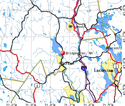
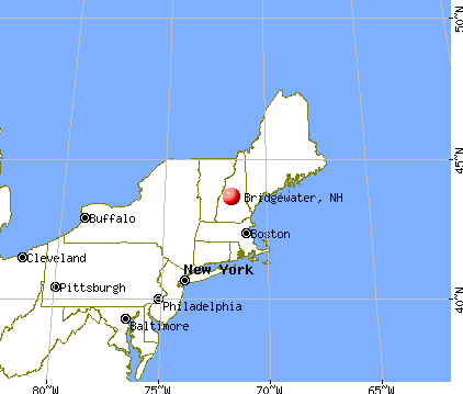
Bridgewater, New Hampshire
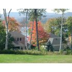
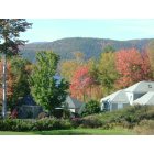
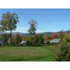
Submit your own pictures of this town and show them to the world
- OSM Map
- General Map
- Google Map
- MSN Map
Population change since 2000: +11.2%
 |
| Males: 516 | |
| Females: 567 |
| Median resident age: | 49.2 years |
| New Hampshire median age: | 43.9 years |
Zip codes: 03222.
| Bridgewater: | $99,055 |
| NH: | $89,992 |
Estimated per capita income in 2022: $65,036 (it was $28,600 in 2000)
Bridgewater town income, earnings, and wages data
Estimated median house or condo value in 2022: $418,386 (it was $130,900 in 2000)
| Bridgewater: | $418,386 |
| NH: | $384,700 |
Mean prices in 2022: all housing units: $486,096; detached houses: $533,852; townhouses or other attached units: $375,744; in 2-unit structures: $230,260; in 3-to-4-unit structures: $242,363; in 5-or-more-unit structures: $588,257; mobile homes: $127,035
Detailed information about poverty and poor residents in Bridgewater, NH


- 1,06698.4%White alone
- 40.4%Asian alone
- 30.3%Native Hawaiian and Other
Pacific Islander alone - 30.3%Two or more races
- 30.3%Hispanic
- 20.2%Black alone
- 10.09%American Indian alone
- 10.09%Other race alone

Races in Bridgewater detailed stats: ancestries, foreign born residents, place of birth
 Recent articles from our blog. Our writers, many of them Ph.D. graduates or candidates, create easy-to-read articles on a wide variety of topics.

 | What's it like to live in or near Plymouth? (6 replies) |
| What if NH Had a Flat Income Tax Like PA? (118 replies) |
| NH town suggestions? Retirement (14 replies) |
| What will be the biggest changes when moving to NH from MA? (44 replies) |
| Is it even legal to raise the taxes this much in one year? (72 replies) |
| Retiring Lakes District (17 replies) |
Latest news from Bridgewater, NH collected exclusively by city-data.com from local newspapers, TV, and radio stations
Ancestries: English (22.0%), Irish (17.1%), French (9.9%), German (9.0%), Italian (6.4%), Scottish (6.4%).
Current Local Time: EST time zone
Incorporated in 1788
Elevation: 638 feet
Land area: 21.3 square miles.
Population density: 51 people per square mile (very low).
15 residents are foreign born
| This town: | 1.5% |
| New Hampshire: | 4.4% |
| Bridgewater town: | 1.2% ($1,609) |
| New Hampshire: | 2.3% ($2,946) |
Nearest city with pop. 50,000+: Manchester, NH  (49.3 miles , pop. 107,006).
Nearest city with pop. 200,000+: Boston, MA (98.7 miles , pop. 589,141).
Nearest city with pop. 1,000,000+: Bronx, NY (224.3 miles , pop. 1,332,650).
Nearest cities:
Latitude: 43.67 N, Longitude: 71.72 W
Area code commonly used in this area: 603


Single-family new house construction building permits:
- 2022: 9 buildings, average cost: $321,200
- 2021: 13 buildings, average cost: $319,200
- 2020: 9 buildings, average cost: $306,900
- 2019: 8 buildings, average cost: $306,900
- 2018: 6 buildings, average cost: $270,000
- 2017: 5 buildings, average cost: $248,000
- 2016: 3 buildings, average cost: $193,300
- 2015: 3 buildings, average cost: $240,000
- 2014: 5 buildings, average cost: $247,000
- 2013: 3 buildings, average cost: $333,400
- 2012: 4 buildings, average cost: $197,500
- 2011: 4 buildings, average cost: $362,500
- 2010: 7 buildings, average cost: $343,700
- 2009: 2 buildings, average cost: $332,500
- 2008: 6 buildings, average cost: $185,800
- 2007: 8 buildings, average cost: $124,600
- 2006: 11 buildings, average cost: $124,600
- 2005: 13 buildings, average cost: $124,600
- 2004: 15 buildings, average cost: $124,600
- 2003: 14 buildings, average cost: $124,600
- 2002: 25 buildings, average cost: $91,700
- 2001: 23 buildings, average cost: $91,700
- 2000: 21 buildings, average cost: $91,700
- 1999: 20 buildings, average cost: $91,700
- 1998: 19 buildings, average cost: $91,700
- 1997: 16 buildings, average cost: $91,700


| Here: | 1.8% |
| New Hampshire: | 2.5% |


- Educational services (13.6%)
- Health care (9.8%)
- Construction (8.6%)
- Accommodation & food services (6.8%)
- Finance & insurance (6.4%)
- Machinery (3.6%)
- Repair & maintenance (3.6%)

- Construction (17.8%)
- Finance & insurance (8.7%)
- Educational services (7.0%)
- Accommodation & food services (7.0%)
- Repair & maintenance (4.5%)
- Machinery (4.1%)
- Broadcasting & telecommunications (3.7%)

- Educational services (19.7%)
- Health care (17.0%)
- Accommodation & food services (6.6%)
- Finance & insurance (4.2%)
- Miscellaneous manufacturing (3.9%)
- Public administration (3.5%)
- Used merchandise, gift, novelty, souvenir, other miscellaneous stores (3.1%)

- Other sales and related occupations, including supervisors (5.2%)
- Building and grounds cleaning and maintenance occupations (4.8%)
- Other management occupations, except farmers and farm managers (3.6%)
- Sales representatives, services, wholesale and manufacturing (3.6%)
- Other office and administrative support workers, including supervisors (3.4%)
- Metal workers and plastic workers (3.4%)
- Retail sales workers, except cashiers (3.2%)

- Other sales and related occupations, including supervisors (6.6%)
- Other management occupations, except farmers and farm managers (5.4%)
- Carpenters (5.0%)
- Building and grounds cleaning and maintenance occupations (5.0%)
- Sales representatives, services, wholesale and manufacturing (5.0%)
- Electrical equipment mechanics and other installation, maintenance, and repair workers, including supervisors (5.0%)
- Vehicle and mobile equipment mechanics, installers, and repairers (4.5%)

- Other office and administrative support workers, including supervisors (5.8%)
- Secretaries and administrative assistants (4.6%)
- Building and grounds cleaning and maintenance occupations (4.6%)
- Information and record clerks, except customer service representatives (4.2%)
- Registered nurses (4.2%)
- Waiters and waitresses (3.9%)
- Other sales and related occupations, including supervisors (3.9%)
Average climate in Bridgewater, New Hampshire
Based on data reported by over 4,000 weather stations


(lower is better)

Air Quality Index (AQI) level in 2022 was 46.9. This is significantly better than average.
| City: | 46.9 |
| U.S.: | 72.6 |

Ozone [ppb] level in 2022 was 29.9. This is about average. Closest monitor was 7.5 miles away from the city center.
| City: | 29.9 |
| U.S.: | 33.3 |

Particulate Matter (PM2.5) [µg/m3] level in 2022 was 4.52. This is significantly better than average. Closest monitor was 6.1 miles away from the city center.
| City: | 4.52 |
| U.S.: | 8.11 |
Tornado activity:
Bridgewater-area historical tornado activity is slightly below New Hampshire state average. It is 64% smaller than the overall U.S. average.
On 5/11/1973, a category F2 (max. wind speeds 113-157 mph) tornado 13.5 miles away from the Bridgewater town center .
On 7/3/1972, a category F2 tornado 22.7 miles away from the town center injured 7 people and caused between $5000 and $50,000 in damages.
Earthquake activity:
Bridgewater-area historical earthquake activity is significantly above New Hampshire state average. It is 71% smaller than the overall U.S. average.On 4/20/2002 at 10:50:47, a magnitude 5.3 (5.3 ML, Depth: 3.0 mi, Class: Moderate, Intensity: VI - VII) earthquake occurred 114.1 miles away from the city center
On 10/7/1983 at 10:18:46, a magnitude 5.3 (5.1 MB, 5.3 LG, 5.1 ML) earthquake occurred 132.3 miles away from Bridgewater center
On 4/20/2002 at 10:50:47, a magnitude 5.2 (5.2 MB, 4.2 MS, 5.2 MW, 5.0 MW) earthquake occurred 114.1 miles away from the city center
On 1/19/1982 at 00:14:42, a magnitude 4.7 (4.5 MB, 4.7 MD, 4.5 LG, Class: Light, Intensity: IV - V) earthquake occurred 13.4 miles away from the city center
On 10/16/2012 at 23:12:25, a magnitude 4.7 (4.7 ML, Depth: 10.0 mi) earthquake occurred 53.5 miles away from Bridgewater center
On 8/21/1996 at 07:54:14, a magnitude 3.8 (3.8 LG, 3.6 LG, Depth: 6.2 mi, Class: Light, Intensity: II - III) earthquake occurred 39.9 miles away from the city center
Magnitude types: regional Lg-wave magnitude (LG), body-wave magnitude (MB), duration magnitude (MD), local magnitude (ML), surface-wave magnitude (MS), moment magnitude (MW)
Natural disasters:
The number of natural disasters in Grafton County (32) is a lot greater than the US average (15).Major Disasters (Presidential) Declared: 20
Emergencies Declared: 9
Causes of natural disasters: Floods: 16, Storms: 16, Hurricanes: 3, Snows: 3, Winter Storms: 3, Tropical Storms: 2, Blizzard: 1, Heavy Rain: 1, Ice Storm: 1, Landslide: 1, Snowfall: 1, Snowstorm: 1, Wind: 1, Other: 1 (Note: some incidents may be assigned to more than one category).
Hospitals and medical centers near Bridgewater:
- NEWFOUND AREA NURSING ASSN (Home Health Center, about 6 miles away; BRISTOL, NH)
- SPEARE MEMORIAL HOSPITAL Critical Access Hospitals (about 6 miles away; PLYMOUTH, NH)
- BELKNAP COUNTY NURSING HOME (Nursing Home, about 15 miles away; LACONIA, NH)
- LACONIA CENTER, GENESIS HEALTHCARE (Nursing Home, about 15 miles away; LACONIA, NH)
- COMMUNITY HEALTH AND HOSPICE (Home Health Center, about 16 miles away; LACONIA, NH)
- MERRILL MANOR NURSING HOME (Nursing Home, about 16 miles away; FRANKLIN, NH)
- VNA OF FRANKLIN (Home Health Center, about 16 miles away; FRANKLIN, NH)
Colleges/universities with over 2000 students nearest to Bridgewater:
- Plymouth State University (about 7 miles; Plymouth, NH; Full-time enrollment: 4,838)
- Dartmouth College (about 29 miles; Hanover, NH; FT enrollment: 6,030)
- NHTI-Concord's Community College (about 33 miles; Concord, NH; FT enrollment: 2,865)
- Southern New Hampshire University (about 46 miles; Manchester, NH; FT enrollment: 16,552)
- Saint Anselm College (about 49 miles; Manchester, NH; FT enrollment: 2,059)
- Mount Washington College (about 51 miles; Manchester, NH; FT enrollment: 2,187)
- University of New Hampshire-Main Campus (about 55 miles; Durham, NH; FT enrollment: 15,243)
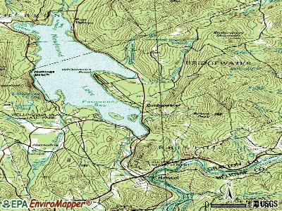
Points of interest:
Notable location: Department Of Public Safety Bridgewater Fire Department and Emergency Medical Services (A). Display/hide its location on the map
Cemeteries: Whittemores Cemetery (1), Webster Cemetery (2). Display/hide their locations on the map
Lakes and reservoirs: Webster Pond (A), Dick Brown Pond (B). Display/hide their locations on the map
Streams, rivers, and creeks: Reed Brook (A), Woodman Brook (B), Whittemore Brook (C), Great Brook (D), Fogg Brook (E), Clay Brook (F). Display/hide their locations on the map
Park in Bridgewater: Church Hill Wildlife Management Area (1). Display/hide its location on the map
Drinking water stations with addresses in Bridgewater and their reported violations in the past:
SANDY BEACH COTTAGES (Population served: 25, Groundwater):Past health violations:
- MCL, Monthly (TCR) - Between APR-2009 and JUN-2009, Contaminant: Coliform. Follow-up actions: St Violation/Reminder Notice (MAY-28-2009), St Public Notif requested (MAY-28-2009), St Public Notif received (JUN-22-2009), St Compliance achieved (FEB-16-2010)
- MCL, Monthly (TCR) - Between JUL-2006 and SEP-2006, Contaminant: Coliform. Follow-up actions: St Public Notif requested (AUG-09-2006), St Violation/Reminder Notice (AUG-09-2006), St Public Notif received (AUG-16-2006), St Compliance achieved (MAY-31-2007)
| This town: | 2.3 people |
| New Hampshire: | 2.5 people |
| This town: | 67.7% |
| Whole state: | 66.3% |
| This town: | 5.7% |
| Whole state: | 8.3% |
Likely homosexual households (counted as self-reported same-sex unmarried-partner households)
- Lesbian couples: 0.6% of all households
- Gay men: 0.2% of all households
| This town: | 6.9% |
| Whole state: | 6.5% |
| This town: | 2.6% |
| Whole state: | 2.8% |
For population 15 years and over in Bridgewater:

- Never married: 17.5%
- Now married: 66.0%
- Separated: 0.8%
- Widowed: 6.6%
- Divorced: 9.0%
For population 25 years and over in Bridgewater:
- High school or higher: 92.1%
- Bachelor's degree or higher: 31.8%
- Graduate or professional degree: 12.3%
- Unemployed: 4.4%
- Mean travel time to work (commute): 31.0 minutes


| Here: | 10.5 |
| New Hampshire average: | 10.9 |


Graphs represent county-level data. Detailed 2008 Election Results
Religion statistics for Bridgewater, NH (based on Grafton County data)


| Religion | Adherents | Congregations |
|---|---|---|
| Catholic | 9,503 | 12 |
| Mainline Protestant | 7,832 | 57 |
| Evangelical Protestant | 1,494 | 29 |
| Other | 1,320 | 11 |
| None | 68,969 | - |
Food Environment Statistics:
| Grafton County: | 3.87 / 10,000 pop. |
| New Hampshire: | 2.14 / 10,000 pop. |
| This county: | 0.23 / 10,000 pop. |
| State: | 0.15 / 10,000 pop. |
| Grafton County: | 1.29 / 10,000 pop. |
| New Hampshire: | 1.78 / 10,000 pop. |
| Grafton County: | 6.45 / 10,000 pop. |
| State: | 4.02 / 10,000 pop. |
| Here: | 14.41 / 10,000 pop. |
| State: | 9.70 / 10,000 pop. |
| This county: | 7.2% |
| New Hampshire: | 7.6% |
| Grafton County: | 22.9% |
| New Hampshire: | 24.4% |
| This county: | 15.9% |
| State: | 15.9% |
Strongest AM radio stations in Bridgewater:
- WPNH (1300 AM; 5 kW; PLYMOUTH, NH; Owner: NORTHEAST COMMUNICATIONS CORPORATION)
- WEZS (1350 AM; 5 kW; LACONIA, NH; Owner: GARY W. HAMMOND)
- WNTK (1020 AM; 10 kW; NEWPORT, NH; Owner: KOOR COMMUNICATIONS, INC.)
- WRKO (680 AM; 50 kW; BOSTON, MA; Owner: ENTERCOM BOSTON LICENSE, LLC)
- WCRN (830 AM; 50 kW; WORCESTER, MA; Owner: CARTER BROADCASTING CORPORATION)
- WEEI (850 AM; 50 kW; BOSTON, MA; Owner: ENTERCOM BOSTON LICENSE, LLC)
- WNNZ (640 AM; 50 kW; WESTFIELD, MA; Owner: CLEAR CHANNEL BROADCASTING LICENSES, INC.)
- WASR (1420 AM; 5 kW; WOLFEBORO, NH; Owner: RADIO WOLFEBORO, INC.)
- WGIN (930 AM; 10 kW; ROCHESTER, NH; Owner: CAPSTAR TX LIMITED PARTNERSHIP)
- WKOX (1200 AM; 50 kW; FRAMINGHAM, MA; Owner: CAPSTAR TX LIMITED PARTNERSHIP)
- WBZ (1030 AM; 50 kW; BOSTON, MA; Owner: INFINITY BROADCASTING OPERATIONS, INC.)
- WBIX (1060 AM; 40 kW; NATICK, MA; Owner: LANGER BROADCASTING CORPORATION)
- WWZN (1510 AM; 50 kW; BOSTON, MA; Owner: ROSE CITY RADIO CORPORATION)
Strongest FM radio stations in Bridgewater:
- WPNH-FM (100.1 FM; PLYMOUTH, NH; Owner: NORTHEAST COMMUNICATIONS CORPORATION)
- WSCY (106.9 FM; MOULTONBOROUGH, NH; Owner: NORTHEAST COMMUNICATIONS CORPORATION)
- WVFM (105.7 FM; CAMPTON, NH; Owner: DEVON BROADCASTING COMPANY, INC.)
- WPKQ (103.7 FM; NORTH CONWAY, NH; Owner: CITADEL BROADCASTING COMPANY)
- WHOM (94.9 FM; MT. WASHINGTON, NH; Owner: CITADEL BROADCASTING COMPANY)
- WLKZ (104.9 FM; WOLFEBORO, NH; Owner: TELE-MEDIA COMPANY OF NEW HAMPSHIRE, L.L.C.)
- WEVH (91.3 FM; HANOVER, NH; Owner: NEW HAMPSHIRE PUBLIC RADIO INC)
- WHDQ (106.1 FM; CLAREMONT, NH; Owner: GREAT NORTHERN RADIO, L.L.C.)
- WNHI (93.3 FM; BELMONT, NH; Owner: CONCORD BROADCASTING, L.L.C.)
- WVPR (89.5 FM; WINDSOR, VT; Owner: VERMONT PUBLIC RADIO)
- WLNH-FM (98.3 FM; LACONIA, NH; Owner: WLNH RADIO, INC)
- WFTN-FM (94.1 FM; FRANKLIN, NH; Owner: NORTHEAST COMMUNICATIONS CORPORATION)
- WJJR (98.1 FM; RUTLAND, VT; Owner: 6 JOHNSON ROAD LICENSES, INC.)
- WZRT (97.1 FM; RUTLAND, VT; Owner: CAPSTAR TX LIMITED PARTNERSHIP)
- WEBK (105.3 FM; KILLINGTON, VT; Owner: 6 JOHNSON ROAD LICENSES, INC.)
- WBHG (101.5 FM; MEREDITH, NH; Owner: WLNH RADIO, INC)
- WNTK-FM (99.7 FM; NEW LONDON, NH; Owner: SHEILA E. VINIKOOR)
- WGLV (91.7 FM; WOODSTOCK, VT; Owner: CHRISTIAN MINISTRIES INC)
- WHDQ-FM1 (106.1 FM; RUTLAND, VT; Owner: GREAT NORTHERN RADIO, L.L.C.)
- WVRR (101.7 FM; NEWPORT, NH; Owner: CAPSTAR TX LIMITED PARTNERSHIP)
TV broadcast stations around Bridgewater:
- WMTW-TV (Channel 8; POLAND SPRING, ME; Owner: WMTW BROADCAST GROUP, LLC)
- WMEA-TV (Channel 26; BIDDEFORD, ME; Owner: MAINE PUBLIC BROADCASTING CORP.)
- W15BK (Channel 15; HANOVER, NH; Owner: UNIVERSITY OF NEW HAMPSHIRE)
Bridgewater fatal accident list:
May 3, 2007 05:24 PM, Us-3a, Hunt Rd, Lat: 43.661978, Lon: -71.743394, Vehicles: 1, Persons: 2, Fatalities: 1
- National Bridge Inventory (NBI) Statistics
- 3Number of bridges
- 7ft / 2.1mTotal length
- $9,426,000Total costs
- 671Total average daily traffic
- 26Total average daily truck traffic
- 991Total future (year 2042) average daily traffic
FCC Registered Antenna Towers:
3- Michael J Umano, 831 Hemlock Brook Road (Lat: 43.642861 Lon: -71.700833), Type: 60.9, Structure height: 33009 m, Overall height: 54.8 m, Registrant: Industrial Tower And Wireless, LLC, Kevin.Delaney@induscom.Com, , Marsh-field, Phone: (781) 319-1011
- Michael J Umano, 831 Hemlock Brook Road (Lat: 43.642861 Lon: -71.700833), Type: 60.9, Structure height: 33009 m, Overall height: 54.8 m, Registrant: Industrial Tower And Wireless, LLC, Kevin.Delaney@induscom.Com, , Marsh-field, Phone: (781) 319-1011
- Michael J Umano, 831 Hemlock Brook Road (Lat: 43.642861 Lon: -71.700833), Type: 60.9, Structure height: 33009 m, Overall height: 54.8 m, Registrant: Industrial Tower And Wireless, LLC, Kevin.Delaney@induscom.Com, , Marsh-field, Phone: (781) 319-1011
FCC Registered Broadcast Land Mobile Towers:
1- 290 Duck Brown Pond Rd (Lat: 43.647278 Lon: -71.725611), Type: Building, Structure height: 12.1 m, Overall height: 15.2 m, Call Sign: KP7429,
Assigned Frequencies: 150.995 MHz, Grant Date: 04/15/1998, Expiration Date: 06/20/2003, Cancellation Date: 09/07/2003, Registrant: Skylines Unlimited Inc, 100 Stone Church Rd, Carlisle, PA 17013, Phone: (717) 218-5003, Fax: (717) 218-5005, Email:
FCC Registered Amateur Radio Licenses:
5- Call Sign: KE6SRR, Licensee ID: L01238664, Grant Date: 01/25/2007, Expiration Date: 04/06/2016, Cancellation Date: 04/07/2018, Certifier: Frank W Denson, Registrant: Frank W Denson, 94 Foxtail Lane, Bridgewater, NH 03222
- Call Sign: W1EQS, Licensee ID: L01430892, Grant Date: 06/20/2018, Expiration Date: 09/16/2028, Certifier: Paul T Hart, Registrant: Paul T Hart, 44 Mohawk Trail, Bridgewater, NH 03222
- Call Sign: WA1PBJ, Licensee ID: L00284535, Grant Date: 03/16/2018, Expiration Date: 05/01/2028, Certifier: John J Donovan Iii, Registrant: John J Donovan Iii, 2834 Dick Brown Road, Bridgewater, NH 03264
- Call Sign: KB1EMO, Licensee ID: L00164668, Grant Date: 10/19/1999, Expiration Date: 10/19/2009, Cancellation Date: 10/20/2011, Certifier: Stephen J Emanouil, Registrant: Stephen J Emanouil, 311 Whittemore Point Rd, Bridgewater, NH 03222
- Call Sign: KB1OYF, Licensee ID: L01277262, Grant Date: 04/27/2007, Expiration Date: 04/27/2017, Cancellation Date: 04/30/2019, Certifier: Kay T Denson, Registrant: Kay T Denson, 94 Foxtail Lane, Bridgewater, NH 03222
2002 - 2018 National Fire Incident Reporting System (NFIRS) incidents
- Fire incident types reported to NFIRS in Bridgewater, NH
- 8559.9%Structure Fires
- 3726.1%Outside Fires
- 149.9%Other
- 64.2%Mobile Property/Vehicle Fires
 Based on the data from the years 2002 - 2018 the average number of fires per year is 8. The highest number of reported fires - 29 took place in 2016, and the least - 0 in 2007. The data has a declining trend.
 When looking into fire subcategories, the most incidents belonged to: Structure Fires (59.9%), and Outside Fires (26.1%).
- 71.8%Fuel oil, kerosene, etc.
- 11.4%Wood
- 8.3%Bottled, tank, or LP gas
- 6.3%Electricity
- 2.3%Utility gas

- 72.1%Fuel oil, kerosene, etc.
- 13.1%Bottled, tank, or LP gas
- 11.5%Wood
- 3.3%Electricity
Bridgewater compared to New Hampshire state average:
- Unemployed percentage below state average.
- Black race population percentage significantly below state average.
- Hispanic race population percentage significantly below state average.
- Median age above state average.
- Foreign-born population percentage significantly below state average.
- Renting percentage below state average.
- Length of stay since moving in significantly above state average.
- Number of rooms per house significantly below state average.
- House age significantly below state average.

|
Total of 7 patent applications in 2008-2024.