South Bank neighborhood in Oxnard, California (CA), 93030 detailed profile
Settings
X


Business Search - 14 Million verified businesses
Area: 0.785 square miles
Population: 1,178
Population density:
| South Bank: | 1,500 people per square mile |
| Oxnard: | 7,918 people per square mile |

- 79367.2%Hispanic or Latino
- 21318.1%White
- 776.5%Two or more races
- 685.8%Asian
- 221.9%Black
- 40.3%Native Hawaiian and Other
Pacific Islander - 30.3%Some other race

Median household income in 2022:
| South Bank: | $86,333 |
| Oxnard: | $84,941 |
Distribution of median household income
![Distribution of median household income]()
- 19Less than $10,000
- 18$10,000 to $19,999
- 22$20,000 to $29,999
- 11$30,000 to $39,999
- 31$40,000 to $49,999
- 12$50,000 to $59,999
- 32$60,000 to $74,999
- 33$75,000 to $99,999
- 28$100,000 to $124,999
- 38$125,000 to $149,999
- 12$150,000 to $199,999
- 54$200,000 or more

Distribution of owner-occupied house/condo value
![Distribution of owner-occupied house/condo value]()
- 11Less than $50,000
- 18$50,000 to $99,999
- 17$400,000 to $499,999
- 86$500,000 to $749,999
- 58$750,000 to $999,999
- 21$1,000,000 or more

Distribution of rent paid by renters
![Distribution of rent paid by renters]()
- 12$300 to $399
- 11$1,000 to $1,249
- 51$1,250 to $1,499
- 11$1,500 to $1,999
- 55$2,000 or more

Median rent in 2022:
| South Bank: | $1,500 |
| Oxnard: | $1,876 |
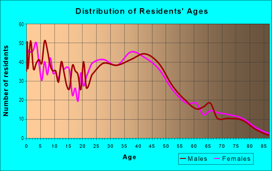
| Males: | 730 |
| Females: | 447 |
Males:
| This neighborhood: | 27.7 years |
| Whole city: | 35.1 years |
| This neighborhood: | 39.9 years |
| Whole city: | 34.3 years |
Average household size:
| South Bank: | 41.0 people |
| Oxnard: | 3.6 people |
Percentage of family households:
| South Bank: | 55.5% |
| Oxnard: | 51.5% |
| Here: | 45.0% |
| Oxnard: | 47.9% |
Percentage of married-couple families with children (among all households):
| South Bank: | 13.3% |
| Oxnard: | 16.4% |
Percentage of single-mother households (among all households):
| South Bank: | 8.8% |
| Oxnard: | 8.1% |
Percentage of never married males 15 years old and over:
Percentage of never married females 15 years old and over:
| South Bank: | 42.2% |
| Oxnard: | 22.9% |
Percentage of never married females 15 years old and over:
| South Bank: | 14.4% |
| city: | 20.1% |
Percentage of people that speak English not well or not at all:
| South Bank: | 0.0% |
| Oxnard: | 20.2% |
Percentage of people born in this state:
Percentage of people born in another U.S. state:
Percentage of native residents but born outside the U.S.:
Percentage of foreign born residents:
| Here: | 60.8% |
| Oxnard: | 58.8% |
Percentage of people born in another U.S. state:
| South Bank: | 12.6% |
| Oxnard: | 6.5% |
Percentage of native residents but born outside the U.S.:
| Here: | 1.2% |
| city: | 1.4% |
Percentage of foreign born residents:
| Here: | 25.4% |
| Oxnard: | 33.3% |

Owner-occupied
Renter-occupied


- Rooms in owner-occupied houses and condos in South Bank
- 01 room
- 02 rooms
- 53 rooms
- 14 rooms
- 155 rooms
- 486 rooms
- 377 rooms
- 298 rooms
- 309+ rooms

- Rooms in renter-occupied apartments in South Bank
- 01 room
- 152 rooms
- 173 rooms
- 344 rooms
- 195 rooms
- 96 rooms
- 37 rooms
- 08 rooms
- 249+ rooms
Owner-occupied
Renter-occupied

- Bedrooms in owner-occupied houses and condos in South Bank
- 0no bedroom
- 51 bedroom
- 192 bedrooms
- 693 bedrooms
- 854 bedrooms
- 75+ bedrooms

- Bedrooms in renter-occupied apartments in South Bank
- 0no bedroom
- 321 bedroom
- 392 bedrooms
- 183 bedrooms
- 134 bedrooms
- 205+ bedrooms
Average number of cars or other vehicles available in houses/condos:
Average number of cars or other vehicles available in apartments:
| This neighborhood: | 2.7 |
| Oxnard: | 2.5 |
Average number of cars or other vehicles available in apartments:
| Here: | 2.5 |
| city: | 1.9 |
Percentage of units with a mortgage:
| South Bank: | 72.2% |
| Oxnard: | 65.5% |

- Year house built in South Bank
- 02020 or later
- 232010 to 2019
- 1992000 to 2009
- 191990 to 1999
- 491980 to 1989
- 1091970 to 1979
- 921960 to 1969
- 221950 to 1959
- 01940 to 1949
- 51939 or earlier

City-data.com crime index for city in 2020 (higher means more crime):
| City: | 220.0 |
| U.S. average: | 219.5 |
Travel time to work (commute)
![Travel time to work (commute)]()
- 4Less than 5 minutes
- 485 to 9 minutes
- 24610 to 14 minutes
- 13515 to 19 minutes
- 9520 to 24 minutes
- 34625 to 29 minutes
- 4930 to 34 minutes
- 335 to 39 minutes
- 3540 to 44 minutes
- 845 to 59 minutes
- 3260 to 89 minutes
- 2590 or more minutes

Means of transportation to work
![Means of transportation to work]()
- 89.1%487Drove a car alone
- 2.2%12Carpooled
- 1.6%9Bus
- 2.7%15Long-distance train or commuter rail
- 0.7%4Motorcycle
- 0.9%5Other means
- 2.2%12Worked at home

Time leaving home to go to work
![Time leaving home to go to work]()
- 5712:00 a.m. to 4:59 a.m.
- 275:00 a.m. to 5:29 a.m.
- 2275:30 a.m. to 5:59 a.m.
- 626:00 a.m. to 6:29 a.m.
- 696:30 a.m. to 6:59 a.m.
- 707:00 a.m. to 7:29 a.m.
- 1377:30 a.m. to 7:59 a.m.
- 668:00 a.m. to 8:29 a.m.
- 718:30 a.m. to 8:59 a.m.
- 889:00 a.m. to 9:59 a.m.
- 2210:00 a.m. to 10:59 a.m.
- 3311:00 a.m. to 11:59 a.m.
- 4712:00 p.m. to 3:59 p.m.
- 564:00 p.m. to 11:59 p.m.

Occupations of males:
- Percentage of males in management occupations (except farmers):
Here: 6.5% city: 6.2%
- Percentage of males in business and financial operations occupations:
Here: 7.6% city: 2.6%
- Percentage of males in computer and mathematical occupations:
Here: 8.2% city: 2.4%
- Percentage of males in community and social services occupations:
Here: 1.0% city: 0.8%
- Percentage of males in legal occupations:
Here: 1.2% city: 0.3%
- Percentage of males in education, training, and library occupations:
Here: 1.5% city: 1.7%
- Percentage of males in arts, design, entertainment, sports, and media occupations:
Here: 1.7% city: 1.1%
- Percentage of males in service occupations:
Here: 12.0% city: 16.9%
- Percentage of males in sales and office occupations:
Here: 5.6% city: 11.7%
- Percentage of males in farming, fishing, and forestry occupations:
Here: 36.4% city: 14.1%
- Percentage of males in construction, extraction, and maintenance occupations:
Here: 1.1% city: 9.8%
- Percentage of males in production occupations:
Here: 7.7% city: 9.6%
- Percentage of males in transportation occupations:
Here: 1.2% city: 6.5%
- Percentage of males in material moving occupations:
Here: 10.5% city: 6.3%
Occupations of females:
- Percentage of females in management occupations (except farmers):
Here: 13.9% city: 6.3%
- Percentage of females in business and financial operations occupations:
Here: 7.4% city: 5.3%
- Percentage of females in computer and mathematical occupations:
Here: 5.6% city: 0.9%
- Percentage of females in architecture and engineering occupations:
Here: 3.9% city: 0.7%
- Percentage of females in life, physical, and social science occupations:
Here: 1.0% city: 0.7%
- Percentage of females in community and social services occupations:
Here: 18.3% city: 2.4%
- Percentage of females in legal occupations:
Here: 2.0% city: 0.5%
- Percentage of females in education, training, and library occupations:
Here: 1.8% city: 4.9%
- Percentage of females in healthcare practitioners and technical occupations:
Here: 15.5% city: 5.9%
- Percentage of females in service occupations:
Here: 31.7% city: 23.6%
- Percentage of females in sales and office occupations:
Here: 20.6% city: 27.3%
- Percentage of females in farming, fishing, and forestry occupations:
Here: 10.9% city: 8.0%
- Percentage of females in production occupations:
Here: 2.3% city: 6.8%
- Percentage of females in transportation occupations:
Here: 2.3% city: 0.9%
- Percentage of females in material moving occupations:
Here: 2.6% city: 3.7%
Education in this neighborhood (subdivision or community):
- Percentage of people 3 years and older in K-12 schools:
South Bank: 24.9% Oxnard: 21.0%
- Percentage of people 3 years and older in undergraduate colleges:
South Bank: 4.7% Oxnard: 5.2%
- Percentage of people 3 years and older in grad. or professional schools:
South Bank: 1.6% Oxnard: 0.8%
- Percentage of students K-12 enrolled in private schools:
South Bank: 6.6% Oxnard: 4.0%
Percentage of population below poverty level:
| South Bank: | 8.4% |
| Oxnard: | 12.8% |
Median year owner moved in (as recorded in 2022):
Median year renter moved in (as recorded in 2022):
| South Bank: | 2006 |
| Oxnard: | 2006 |
Median year renter moved in (as recorded in 2022):
| South Bank: | 2013 |
| Oxnard: | 2019 |
Percentage of married-couple families with both working:
| South Bank: | 77.3% |
| Oxnard: | 71.8% |

- 90.5%Utility gas
- 6.7%No fuel used
- 1.7%Electricity
- 1.1%Solar energy
Highways in this neighborhood:
State Rte 1 (Pacific Coast Hwy, N Oxnard Blvd)
Length: 1.49 miles
Directions: N-S, SE-NW
Address range: 2300 to 2599
Directions: N-S, SE-NW
Address range: 2300 to 2599
State Rte 232 (E Vineyard Ave)
Length: 0.17 miles
Direction: SW-NE
Address range: 2500 to 2579
Direction: SW-NE
Address range: 2500 to 2579
US Hwy 101 (Ventura Fwy, el Camino Real)
Length: 0.17 miles
Direction: E-W
Direction: E-W
State Rte 232 (N Vineyard Ave)
Length: 0.03 miles
Direction: SW-NE
Direction: SW-NE
Roads and streets:
Wagon Wheel Rd
Length: 1.01 miles
Directions: E-W, N-S, SE-NW
Address range: 800 to 2998
Directions: E-W, N-S, SE-NW
Address range: 800 to 2998
Kentia St
Length: 0.61 miles
Directions: E-W, N-S, SE-NW, SW-NE
Address range: 2400 to 2699
Directions: E-W, N-S, SE-NW, SW-NE
Address range: 2400 to 2699
N H St
Length: 0.55 miles
Directions: N-S, SW-NE
Address range: 2348 to 2680
Directions: N-S, SW-NE
Address range: 2348 to 2680
W Esplanade Dr
Length: 0.54 miles
Directions: E-W, N-S, SE-NW
Address range: 100 to 321
Directions: E-W, N-S, SE-NW
Address range: 100 to 321
W Vineyard Ave
Length: 0.50 miles
Direction: E-W
Address range: 100 to 1316
Direction: E-W
Address range: 100 to 1316
Apple Ln
Length: 0.47 miles
Directions: E-W, N-S, SE-NW
Address range: 2300 to 2599
Directions: E-W, N-S, SE-NW
Address range: 2300 to 2599
Lobelia Dr
Length: 0.43 miles
Directions: N-S, SE-NW, SW-NE
Address range: 2300 to 2599
Directions: N-S, SE-NW, SW-NE
Address range: 2300 to 2599
Nightingale Pl
Length: 0.34 miles
Directions: E-W, SW-NE
Address range: 900 to 1299
Directions: E-W, SW-NE
Address range: 900 to 1299
Northbrook Dr
Length: 0.34 miles
Directions: E-W, N-S, SE-NW, SW-NE
Address range: 2402 to 2699
Directions: E-W, N-S, SE-NW, SW-NE
Address range: 2402 to 2699
Surrey Cir
Length: 0.28 miles
Directions: E-W, N-S, SE-NW, SW-NE
Address range: 2 to 49
Directions: E-W, N-S, SE-NW, SW-NE
Address range: 2 to 49
Hillrose Pl
Length: 0.26 miles
Directions: N-S, SW-NE
Address range: 2400 to 2599
Directions: N-S, SW-NE
Address range: 2400 to 2599
Ostrich Hill Rd
Length: 0.25 miles
Directions: E-W, SW-NE
Address range: 1200 to 1399
Directions: E-W, SW-NE
Address range: 1200 to 1399
Raspberry Pl
Length: 0.25 miles
Directions: E-W, SE-NW, SW-NE
Address range: 400 to 599
Directions: E-W, SE-NW, SW-NE
Address range: 400 to 599
Honeysuckle Dr
Length: 0.25 miles
Directions: E-W, N-S, SE-NW
Address range: 2600 to 2699
Directions: E-W, N-S, SE-NW
Address range: 2600 to 2699
Redwing Ln
Length: 0.24 miles
Directions: E-W, N-S, SE-NW, SW-NE
Address range: 2300 to 2499
Directions: E-W, N-S, SE-NW, SW-NE
Address range: 2300 to 2499
Buckaroo Ave
Length: 0.24 miles
Directions: N-S, SE-NW
Address range: 2600 to 2799
Directions: N-S, SE-NW
Address range: 2600 to 2799
Nandina Pl
Length: 0.24 miles
Directions: E-W, SE-NW, SW-NE
Address range: 600 to 799
Directions: E-W, SE-NW, SW-NE
Address range: 600 to 799
Grapevine Dr
Length: 0.22 miles
Directions: N-S, SW-NE
Address range: 2 to 2511
Directions: N-S, SW-NE
Address range: 2 to 2511
Stone Creek Dr
Length: 0.21 miles
Directions: E-W, SW-NE
Directions: E-W, SW-NE
Saddle Ave
Length: 0.21 miles
Direction: N-S
Address range: 2600 to 2799
Direction: N-S
Address range: 2600 to 2799
Timber Creek Trl
Length: 0.21 miles
Directions: E-W, N-S, SE-NW, SW-NE
Address range: 2500 to 2599
Directions: E-W, N-S, SE-NW, SW-NE
Address range: 2500 to 2599
Upper Bay Dr
Length: 0.20 miles
Directions: E-W, SW-NE
Address range: 2500 to 2699
Directions: E-W, SW-NE
Address range: 2500 to 2699
Yearling Pl
Length: 0.20 miles
Directions: E-W, SW-NE
Address range: 2700 to 2799
Directions: E-W, SW-NE
Address range: 2700 to 2799
Rosebud Dr
Length: 0.19 miles
Directions: E-W, SW-NE
Address range: 800 to 898
Directions: E-W, SW-NE
Address range: 800 to 898
Orchard Pl
Length: 0.19 miles
Direction: E-W
Address range: 200 to 399
Direction: E-W
Address range: 200 to 399
Vista Loop
Length: 0.18 miles
Directions: N-S, SE-NW, SW-NE
Address range: 2600 to 2699
Directions: N-S, SE-NW, SW-NE
Address range: 2600 to 2699
Elderberry Dr
Length: 0.18 miles
Directions: N-S, SW-NE
Address range: 2400 to 2599
Directions: N-S, SW-NE
Address range: 2400 to 2599
Twin Oak Dr
Length: 0.18 miles
Directions: E-W, SW-NE
Address range: 2400 to 2599
Directions: E-W, SW-NE
Address range: 2400 to 2599
Underpass Rd
Length: 0.17 miles
Directions: E-W, N-S
Address range: 2500 to 2699
Directions: E-W, N-S
Address range: 2500 to 2699
Quail Run Way
Length: 0.17 miles
Direction: E-W
Address range: 1000 to 1141
Direction: E-W
Address range: 1000 to 1141
Dewberry Ln
Length: 0.16 miles
Directions: E-W, N-S, SE-NW, SW-NE
Address range: 401 to 2499
Directions: E-W, N-S, SE-NW, SW-NE
Address range: 401 to 2499
Otter Creek Ln
Length: 0.16 miles
Directions: N-S, SE-NW
Address range: 2300 to 2399
Directions: N-S, SE-NW
Address range: 2300 to 2399
Cactus Dr
Length: 0.16 miles
Direction: E-W
Address range: 300 to 399
Direction: E-W
Address range: 300 to 399
Winchester Dr
Length: 0.16 miles
Directions: E-W, SE-NW
Address range: 300 to 399
Directions: E-W, SE-NW
Address range: 300 to 399
Larkhaven Ln
Length: 0.15 miles
Direction: N-S
Address range: 2300 to 2499
Direction: N-S
Address range: 2300 to 2499
Ironstone St
Length: 0.15 miles
Directions: N-S, SE-NW
Address range: 2501 to 2599
Directions: N-S, SE-NW
Address range: 2501 to 2599
Lin Rd (Wagon Wheel Rd)
Length: 0.15 miles
Directions: N-S, SW-NE
Directions: N-S, SW-NE
Ivory Way
Length: 0.15 miles
Directions: N-S, SW-NE
Address range: 2400 to 2499
Directions: N-S, SW-NE
Address range: 2400 to 2499
Woodside Pl
Length: 0.14 miles
Directions: E-W, SW-NE
Address range: 2601 to 2699
Directions: E-W, SW-NE
Address range: 2601 to 2699
Jacaranda Dr
Length: 0.14 miles
Directions: N-S, SW-NE
Address range: 2400 to 2499
Directions: N-S, SW-NE
Address range: 2400 to 2499
Meadow Trl
Length: 0.14 miles
Directions: E-W, N-S, SE-NW, SW-NE
Address range: 2500 to 2599
Directions: E-W, N-S, SE-NW, SW-NE
Address range: 2500 to 2599
Blueberry Dr
Length: 0.14 miles
Direction: N-S
Address range: 2400 to 2499
Direction: N-S
Address range: 2400 to 2499
Cranberry Dr
Length: 0.13 miles
Directions: N-S, SE-NW
Address range: 2400 to 2499
Directions: N-S, SE-NW
Address range: 2400 to 2499
Joshua Ct
Length: 0.13 miles
Direction: SE-NW
Address range: 2500 to 2599
Direction: SE-NW
Address range: 2500 to 2599
Plum Pl
Length: 0.12 miles
Direction: E-W
Address range: 200 to 399
Direction: E-W
Address range: 200 to 399
Violet Way
Length: 0.12 miles
Directions: E-W, N-S, SE-NW
Directions: E-W, N-S, SE-NW
Orion Way
Length: 0.11 miles
Directions: E-W, SW-NE
Address range: 1000 to 1099
Directions: E-W, SW-NE
Address range: 1000 to 1099
Windcrest Pl
Length: 0.10 miles
Direction: SW-NE
Address range: 2700 to 2799
Direction: SW-NE
Address range: 2700 to 2799
Meadowlark Ln
Length: 0.10 miles
Directions: E-W, SE-NW, SW-NE
Address range: 1300 to 1399
Directions: E-W, SE-NW, SW-NE
Address range: 1300 to 1399
Tuxedo Row
Length: 0.10 miles
Direction: E-W
Address range: 2 to 99
Direction: E-W
Address range: 2 to 99
Lake Dr
Length: 0.10 miles
Direction: SE-NW
Address range: 2500 to 2599
Direction: SE-NW
Address range: 2500 to 2599
Cross Ave
Length: 0.10 miles
Direction: E-W
Address range: 200 to 299
Direction: E-W
Address range: 200 to 299
Nandina Cir
Length: 0.09 miles
Directions: E-W, N-S, SE-NW, SW-NE
Address range: 600 to 699
Directions: E-W, N-S, SE-NW, SW-NE
Address range: 600 to 699
Northstar Way
Length: 0.09 miles
Directions: E-W, N-S, SE-NW
Address range: 2300 to 2399
Directions: E-W, N-S, SE-NW
Address range: 2300 to 2399
Petticoat Ln
Length: 0.08 miles
Direction: E-W
Address range: 1 to 99
Direction: E-W
Address range: 1 to 99
Spur Dr
Length: 0.08 miles
Direction: E-W
Address range: 100 to 299
Direction: E-W
Address range: 100 to 299
Dogwood Dr
Length: 0.08 miles
Directions: N-S, SW-NE
Address range: 2500 to 2599
Directions: N-S, SW-NE
Address range: 2500 to 2599
Strawberry Pl
Length: 0.07 miles
Directions: E-W, SE-NW
Address range: 500 to 599
Directions: E-W, SE-NW
Address range: 500 to 599
Nandina Ct
Length: 0.06 miles
Directions: E-W, N-S
Address range: 700 to 799
Directions: E-W, N-S
Address range: 700 to 799
Surrey Creek
Length: 0.06 miles
Directions: E-W, N-S, SE-NW
Directions: E-W, N-S, SE-NW
Mint Way
Length: 0.05 miles
Directions: N-S, SW-NE
Address range: 2300 to 2399
Directions: N-S, SW-NE
Address range: 2300 to 2399
Partridge Dr
Length: 0.04 miles
Direction: E-W
Direction: E-W
N Ventura Rd
Length: 0.03 miles
Direction: SW-NE
Address range: 2668 to 2691
Direction: SW-NE
Address range: 2668 to 2691
Railroad features:
Union Pacific RR
Length: 0.57 miles
Direction: SE-NW
Direction: SE-NW