Nestor neighborhood in San Diego, California (CA), 92154 detailed profile
Settings
X


Business Search - 14 Million verified businesses
Area: 1.474 square miles
Population: 9,476
Population density:
| Nestor: | 6,430 people per square mile |
| San Diego: | 4,258 people per square mile |

- 7,22369.6%Hispanic or Latino
- 1,20311.6%White
- 8328.0%Native Hawaiian and Other
Pacific Islander - 6105.9%Asian
- 2712.6%Black
- 1471.4%Some other race
- 870.8%Two or more races

Distribution of median household income
![Distribution of median household income]()
- 334Less than $10,000
- 856$10,000 to $19,999
- 564$20,000 to $29,999
- 344$30,000 to $39,999
- 465$40,000 to $49,999
- 377$50,000 to $59,999
- 296$60,000 to $74,999
- 305$75,000 to $99,999
- 201$100,000 to $124,999
- 262$125,000 to $149,999
- 300$150,000 to $199,999
- 185$200,000 or more

Distribution of owner-occupied house/condo value
![Distribution of owner-occupied house/condo value]()
- 736Less than $50,000
- 405$50,000 to $99,999
- 82$100,000 to $149,999
- 208$150,000 to $199,999
- 15$200,000 to $249,999
- 430$250,000 to $299,999
- 142$300,000 to $399,999
- 279$400,000 to $499,999
- 729$500,000 to $749,999
- 240$750,000 to $999,999
- 54$1,000,000 or more

Distribution of rent paid by renters
![Distribution of rent paid by renters]()
- 509Less than $100
- 83$100 to $199
- 27$200 to $299
- 677$300 to $399
- 1,060$400 to $499
- 192$500 to $599
- 1,803$600 to $699
- 492$700 to $799
- 82$800 to $899
- 91$900 to $999
- 567$1,000 to $1,249
- 172$1,250 to $1,499
- 2,242$1,500 to $1,999
- 879$2,000 or more

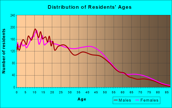
| Males: | 4,363 |
| Females: | 5,112 |
Males:
| This neighborhood: | 32.7 years |
| Whole city: | 35.4 years |
| This neighborhood: | 38.9 years |
| Whole city: | 37.2 years |
Average household size:
| Nestor: | 3.3 people |
| San Diego: | 2.5 people |
Percentage of family households:
| Nestor: | 56.0% |
| San Diego: | 41.7% |
| Here: | 49.9% |
| San Diego: | 43.2% |
Percentage of married-couple families with children (among all households):
| Nestor: | 13.3% |
| San Diego: | 27.8% |
Percentage of single-mother households (among all households):
| Nestor: | 17.0% |
| San Diego: | 7.9% |
Percentage of never married males 15 years old and over:
Percentage of never married females 15 years old and over:
| Nestor: | 16.8% |
| San Diego: | 23.4% |
Percentage of never married females 15 years old and over:
| Nestor: | 18.7% |
| city: | 18.8% |
Percentage of people that speak English not well or not at all:
| Nestor: | 11.7% |
| San Diego: | 5.9% |
Percentage of people born in this state:
Percentage of people born in another U.S. state:
Percentage of native residents but born outside the U.S.:
Percentage of foreign born residents:
| Here: | 55.3% |
| San Diego: | 48.1% |
Percentage of people born in another U.S. state:
| Nestor: | 10.7% |
| San Diego: | 24.9% |
Percentage of native residents but born outside the U.S.:
| Here: | 2.8% |
| city: | 2.4% |
Percentage of foreign born residents:
| Here: | 31.2% |
| San Diego: | 24.6% |

Owner-occupied
Renter-occupied


- Rooms in owner-occupied houses and condos in Nestor
- 3451 room
- 302 rooms
- 4153 rooms
- 3074 rooms
- 3015 rooms
- 2866 rooms
- 3337 rooms
- 2458 rooms
- 1499+ rooms

- Rooms in renter-occupied apartments in Nestor
- 851 room
- 1192 rooms
- 1,3303 rooms
- 1,0974 rooms
- 6425 rooms
- 866 rooms
- 837 rooms
- 3258 rooms
- 79+ rooms
Owner-occupied
Renter-occupied

- Bedrooms in owner-occupied houses and condos in Nestor
- 345no bedroom
- 921 bedroom
- 2262 bedrooms
- 5703 bedrooms
- 6564 bedrooms
- 825+ bedrooms

- Bedrooms in renter-occupied apartments in Nestor
- 85no bedroom
- 9701 bedroom
- 2,3212 bedrooms
- 2923 bedrooms
- 1894 bedrooms
- 475+ bedrooms
Average number of cars or other vehicles available in houses/condos:
Average number of cars or other vehicles available in apartments:
| This neighborhood: | |
| San Diego: |
Average number of cars or other vehicles available in apartments:
| Here: | |
| city: |
Percentage of units with a mortgage:
| Nestor: | 66.8% |
| San Diego: | 69.2% |

- Year house built in Nestor
- 172020 or later
- 1,0372010 to 2019
- 3882000 to 2009
- 2521990 to 1999
- 8351980 to 1989
- 9361970 to 1979
- 4791960 to 1969
- 3391950 to 1959
- 201940 to 1949
- 2641939 or earlier

City-data.com crime index for city in 2020 (higher means more crime):
| City: | 197.8 |
| U.S. average: | 219.5 |
Travel time to work (commute)
![Travel time to work (commute)]()
- 25Less than 5 minutes
- 1925 to 9 minutes
- 49510 to 14 minutes
- 64215 to 19 minutes
- 61220 to 24 minutes
- 29625 to 29 minutes
- 72030 to 34 minutes
- 22935 to 39 minutes
- 17940 to 44 minutes
- 35045 to 59 minutes
- 21760 to 89 minutes
- 13890 or more minutes

Means of transportation to work
![Means of transportation to work]()
- 70.5%2,707Drove a car alone
- 13.8%528Carpooled
- 11.3%435Bus
- 0.6%22Subway or elevated rail
- 2.4%92Long-distance train or commuter rail
- 4.7%182Light rail, streetcar or trolley
- 4.0%153Taxi
- 5.7%217Motorcycle
- 0.5%20Bicycle
- 2.7%105Walked
- 10.1%389Other means
- 9.2%354Worked at home

Time leaving home to go to work
![Time leaving home to go to work]()
- 38312:00 a.m. to 4:59 a.m.
- 2225:00 a.m. to 5:29 a.m.
- 3015:30 a.m. to 5:59 a.m.
- 3676:00 a.m. to 6:29 a.m.
- 2516:30 a.m. to 6:59 a.m.
- 2347:00 a.m. to 7:29 a.m.
- 2627:30 a.m. to 7:59 a.m.
- 6228:00 a.m. to 8:29 a.m.
- 1838:30 a.m. to 8:59 a.m.
- 3399:00 a.m. to 9:59 a.m.
- 6510:00 a.m. to 10:59 a.m.
- 311:00 a.m. to 11:59 a.m.
- 34012:00 p.m. to 3:59 p.m.
- 2994:00 p.m. to 11:59 p.m.

Occupations of males:
- Percentage of males in management occupations (except farmers):
Here: 6.6% city: 12.7%
- Percentage of males in business and financial operations occupations:
Here: 1.1% city: 6.6%
- Percentage of males in computer and mathematical occupations:
Here: 6.6% city: 8.8%
- Percentage of males in arts, design, entertainment, sports, and media occupations:
Here: 2.4% city: 2.9%
- Percentage of males in healthcare practitioners and technical occupations:
Here: 1.6% city: 3.8%
- Percentage of males in service occupations:
Here: 21.4% city: 14.6%
- Percentage of males in sales and office occupations:
Here: 12.3% city: 13.9%
- Percentage of males in farming, fishing, and forestry occupations:
Here: 3.8% city: 0.2%
- Percentage of males in construction, extraction, and maintenance occupations:
Here: 8.5% city: 5.9%
- Percentage of males in production occupations:
Here: 12.0% city: 4.6%
- Percentage of males in transportation occupations:
Here: 5.8% city: 3.9%
- Percentage of males in material moving occupations:
Here: 9.2% city: 3.3%
Occupations of females:
- Percentage of females in management occupations (except farmers):
Here: 8.5% city: 10.2%
- Percentage of females in business and financial operations occupations:
Here: 3.5% city: 9.0%
- Percentage of females in computer and mathematical occupations:
Here: 3.1% city: 3.3%
- Percentage of females in architecture and engineering occupations:
Here: 2.0% city: 1.7%
- Percentage of females in community and social services occupations:
Here: 1.3% city: 2.5%
- Percentage of females in legal occupations:
Here: 1.1% city: 1.8%
- Percentage of females in healthcare practitioners and technical occupations:
Here: 4.7% city: 9.7%
- Percentage of females in service occupations:
Here: 35.1% city: 19.9%
- Percentage of females in sales and office occupations:
Here: 22.4% city: 22.0%
- Percentage of females in production occupations:
Here: 5.1% city: 2.8%
- Percentage of females in transportation occupations:
Here: 3.2% city: 0.8%
- Percentage of females in material moving occupations:
Here: 6.3% city: 1.5%
Percentage of people 16-64 in Armed Forces:
| Nestor: | 3.8% |
| San Diego: | 4.0% |
Education in this neighborhood (subdivision or community):
- Percentage of people 3 years and older in K-12 schools:
Nestor: 36.0% San Diego: 13.8%
- Percentage of people 3 years and older in undergraduate colleges:
Nestor: 10.9% San Diego: 8.5%
- Percentage of people 3 years and older in grad. or professional schools:
Nestor: 2.1% San Diego: 2.3%
- Percentage of students K-12 enrolled in private schools:
Nestor: 29.8% San Diego: 13.6%
Percentage of population below poverty level:
| Nestor: | 20.3% |
| San Diego: | 11.3% |
Percentage of married-couple families with both working:
| Nestor: | 67.9% |
| San Diego: | 66.0% |

- 51.3%Utility gas
- 25.6%Electricity
- 12.0%Wood
- 5.4%No fuel used
- 2.8%Bottled, tank, or LP gas
- 1.4%Fuel oil, kerosene, etc.
- 1.4%Solar energy
Limited-access highways (interstate or state) in this neighborhood:
San Diego Fwy (I- 5)
Length: 2.34 miles
Direction: SE-NW
Direction: SE-NW
State Hwy 905
Length: 0.46 miles
Directions: E-W, SW-NE
Directions: E-W, SW-NE
Roads and streets:
Hollister St
Length: 1.26 miles
Direction: N-S
Address range: 1100 to 2099
Direction: N-S
Address range: 1100 to 2099
Oro Vista Rd
Length: 0.98 miles
Directions: E-W, N-S, SE-NW, SW-NE
Address range: 1300 to 1999
Directions: E-W, N-S, SE-NW, SW-NE
Address range: 1300 to 1999
Wardlow Ave
Length: 0.88 miles
Directions: E-W, SE-NW
Address range: 2600 to 3099
Directions: E-W, SE-NW
Address range: 2600 to 3099
Tocayo Ave
Length: 0.64 miles
Directions: E-W, SW-NE
Address range: 2100 to 2479
Directions: E-W, SW-NE
Address range: 2100 to 2479
Coronado Ave
Length: 0.59 miles
Direction: E-W
Address range: 1970 to 2359
Direction: E-W
Address range: 1970 to 2359
Green Bay St
Length: 0.57 miles
Directions: N-S, SW-NE
Address range: 1100 to 1559
Directions: N-S, SW-NE
Address range: 1100 to 1559
Biola Ave
Length: 0.53 miles
Directions: E-W, N-S, SE-NW, SW-NE
Address range: 2150 to 2699
Directions: E-W, N-S, SE-NW, SW-NE
Address range: 2150 to 2699
Ilex Ave
Length: 0.53 miles
Directions: E-W, SE-NW
Address range: 1954 to 2299
Directions: E-W, SE-NW
Address range: 1954 to 2299
Lieder Dr
Length: 0.50 miles
Direction: E-W
Address range: 1900 to 2299
Direction: E-W
Address range: 1900 to 2299
Grove Ave
Length: 0.49 miles
Directions: E-W, N-S, SW-NE
Address range: 1950 to 2499
Directions: E-W, N-S, SW-NE
Address range: 1950 to 2499
Sunset Ave
Length: 0.45 miles
Direction: E-W
Address range: 2002 to 2299
Direction: E-W
Address range: 2002 to 2299
Leon Ave
Length: 0.41 miles
Direction: E-W
Address range: 2037 to 2299
Direction: E-W
Address range: 2037 to 2299
Iris Ave
Length: 0.36 miles
Directions: E-W, SE-NW, SW-NE
Address range: 2100 to 2449
Directions: E-W, SE-NW, SW-NE
Address range: 2100 to 2449
Judith Ave
Length: 0.35 miles
Direction: E-W
Address range: 2090 to 2299
Direction: E-W
Address range: 2090 to 2299
Arbodar Rd
Length: 0.32 miles
Directions: E-W, SE-NW, SW-NE
Address range: 2800 to 3099
Directions: E-W, SE-NW, SW-NE
Address range: 2800 to 3099
Pikake St
Length: 0.32 miles
Directions: E-W, N-S, SE-NW, SW-NE
Address range: 2600 to 2799
Directions: E-W, N-S, SE-NW, SW-NE
Address range: 2600 to 2799
Green St
Length: 0.32 miles
Directions: E-W, N-S
Address range: 800 to 899
Directions: E-W, N-S
Address range: 800 to 899
Ingrid Ave
Length: 0.30 miles
Direction: E-W
Address range: 2100 to 2299
Direction: E-W
Address range: 2100 to 2299
Hemlock Ave
Length: 0.30 miles
Direction: E-W
Address range: 2100 to 2299
Direction: E-W
Address range: 2100 to 2299
Raedel Dr
Length: 0.29 miles
Directions: N-S, SW-NE
Address range: 900 to 1099
Directions: N-S, SW-NE
Address range: 900 to 1099
Imogene Ave
Length: 0.29 miles
Direction: E-W
Address range: 2100 to 2299
Direction: E-W
Address range: 2100 to 2299
Brando Dr
Length: 0.29 miles
Directions: E-W, N-S, SE-NW
Address range: 2900 to 3099
Directions: E-W, N-S, SE-NW
Address range: 2900 to 3099
Dalisay St
Length: 0.27 miles
Directions: E-W, N-S, SW-NE
Address range: 2600 to 2799
Directions: E-W, N-S, SW-NE
Address range: 2600 to 2799
Switzerland Dr
Length: 0.27 miles
Direction: N-S
Address range: 1200 to 1399
Direction: N-S
Address range: 1200 to 1399
Hofer Dr
Length: 0.26 miles
Directions: E-W, N-S, SE-NW, SW-NE
Address range: 2000 to 2199
Directions: E-W, N-S, SE-NW, SW-NE
Address range: 2000 to 2199
Tesoro Grove Way
Length: 0.26 miles
Directions: N-S, SE-NW, SW-NE
Directions: N-S, SE-NW, SW-NE
Valentino St
Length: 0.25 miles
Directions: N-S, SE-NW
Address range: 1900 to 2199
Directions: N-S, SE-NW
Address range: 1900 to 2199
Starburst Ln
Length: 0.24 miles
Direction: E-W
Address range: 2100 to 2299
Direction: E-W
Address range: 2100 to 2299
Madreselva Way
Length: 0.23 miles
Direction: E-W
Address range: 2100 to 2299
Direction: E-W
Address range: 2100 to 2299
Ave del Mexico
Length: 0.23 miles
Directions: E-W, N-S, SE-NW
Address range: 1910 to 3099
Directions: E-W, N-S, SE-NW
Address range: 1910 to 3099
Doran St
Length: 0.22 miles
Directions: E-W, N-S, SE-NW, SW-NE
Address range: 1800 to 1899
Directions: E-W, N-S, SE-NW, SW-NE
Address range: 1800 to 1899
Bluehaven Ct
Length: 0.20 miles
Directions: N-S, SE-NW, SW-NE
Address range: 1800 to 2199
Directions: N-S, SE-NW, SW-NE
Address range: 1800 to 2199
Servando Ave
Length: 0.19 miles
Direction: E-W
Address range: 2261 to 2449
Direction: E-W
Address range: 2261 to 2449
Quadra Ave
Length: 0.19 miles
Directions: E-W, N-S, SE-NW, SW-NE
Address range: 2800 to 2999
Directions: E-W, N-S, SE-NW, SW-NE
Address range: 2800 to 2999
Dunning Cir
Length: 0.19 miles
Directions: E-W, N-S, SE-NW, SW-NE
Address range: 1900 to 1999
Directions: E-W, N-S, SE-NW, SW-NE
Address range: 1900 to 1999
Alosta St
Length: 0.19 miles
Directions: E-W, N-S, SW-NE
Address range: 2481 to 2698
Directions: E-W, N-S, SW-NE
Address range: 2481 to 2698
Chavez Rd
Length: 0.19 miles
Directions: E-W, SE-NW
Address range: 2900 to 3099
Directions: E-W, SE-NW
Address range: 2900 to 3099
Leatherwood St
Length: 0.18 miles
Directions: N-S, SW-NE
Address range: 1900 to 1999
Directions: N-S, SW-NE
Address range: 1900 to 1999
Wintersweet St
Length: 0.18 miles
Directions: N-S, SW-NE
Address range: 1900 to 2099
Directions: N-S, SW-NE
Address range: 1900 to 2099
Rodear Rd
Length: 0.17 miles
Direction: N-S
Address range: 1650 to 1799
Direction: N-S
Address range: 1650 to 1799
International Rd
Length: 0.17 miles
Directions: E-W, N-S, SE-NW
Address range: 1800 to 1953
Directions: E-W, N-S, SE-NW
Address range: 1800 to 1953
Katella St
Length: 0.17 miles
Directions: E-W, N-S, SE-NW, SW-NE
Address range: 1800 to 1899
Directions: E-W, N-S, SE-NW, SW-NE
Address range: 1800 to 1899
Honestidad Rd
Length: 0.17 miles
Directions: E-W, N-S, SE-NW
Address range: 1700 to 1799
Directions: E-W, N-S, SE-NW
Address range: 1700 to 1799
Walpen Dr
Length: 0.17 miles
Direction: N-S
Address range: 1100 to 1299
Direction: N-S
Address range: 1100 to 1299
Revena St
Length: 0.17 miles
Directions: E-W, N-S, SW-NE
Address range: 1800 to 1899
Directions: E-W, N-S, SW-NE
Address range: 1800 to 1899
Corbin St
Length: 0.17 miles
Directions: E-W, N-S, SE-NW
Address range: 1800 to 1899
Directions: E-W, N-S, SE-NW
Address range: 1800 to 1899
Lawndale St
Length: 0.17 miles
Directions: N-S, SW-NE
Address range: 1900 to 1999
Directions: N-S, SW-NE
Address range: 1900 to 1999
Hansel Dr
Length: 0.16 miles
Direction: E-W
Address range: 1950 to 2099
Direction: E-W
Address range: 1950 to 2099
Planicie Way
Length: 0.16 miles
Directions: E-W, N-S, SE-NW
Address range: 1600 to 1699
Directions: E-W, N-S, SE-NW
Address range: 1600 to 1699
Toboggan Way
Length: 0.16 miles
Direction: E-W
Address range: 1948 to 2099
Direction: E-W
Address range: 1948 to 2099
Valance St
Length: 0.16 miles
Directions: N-S, SW-NE
Address range: 1900 to 1999
Directions: N-S, SW-NE
Address range: 1900 to 1999
Elm Ave
Length: 0.16 miles
Directions: E-W, N-S, SW-NE
Address range: 2000 to 2199
Directions: E-W, N-S, SW-NE
Address range: 2000 to 2199
Zurich Dr
Length: 0.15 miles
Directions: N-S, SW-NE
Address range: 1100 to 1299
Directions: N-S, SW-NE
Address range: 1100 to 1299
Cantamar Rd
Length: 0.15 miles
Directions: E-W, SW-NE
Address range: 1929 to 1999
Directions: E-W, SW-NE
Address range: 1929 to 1999
Flower Ave
Length: 0.14 miles
Direction: E-W
Address range: 2100 to 2299
Direction: E-W
Address range: 2100 to 2299
Cerrissa St
Length: 0.13 miles
Direction: SE-NW
Address range: 764 to 849
Direction: SE-NW
Address range: 764 to 849
Clairton Pl
Length: 0.13 miles
Direction: E-W
Address range: 2100 to 2199
Direction: E-W
Address range: 2100 to 2199
Cabrena St
Length: 0.12 miles
Direction: N-S
Address range: 1800 to 1899
Direction: N-S
Address range: 1800 to 1899
Rimbey Ave
Length: 0.10 miles
Direction: E-W
Address range: 2028 to 2099
Direction: E-W
Address range: 2028 to 2099
New Chatel Dr
Length: 0.10 miles
Directions: E-W, N-S, SE-NW, SW-NE
Address range: 1329 to 1439
Directions: E-W, N-S, SE-NW, SW-NE
Address range: 1329 to 1439
Atherton Ave
Length: 0.10 miles
Directions: E-W, N-S, SW-NE
Address range: 2170 to 2399
Directions: E-W, N-S, SW-NE
Address range: 2170 to 2399
Yodel Ln
Length: 0.10 miles
Directions: E-W, N-S
Address range: 1890 to 2029
Directions: E-W, N-S
Address range: 1890 to 2029
Bandolier Ln
Length: 0.10 miles
Directions: N-S, SW-NE
Address range: 1900 to 2099
Directions: N-S, SW-NE
Address range: 1900 to 2099
Reklow Dr
Length: 0.09 miles
Directions: N-S, SW-NE
Address range: 1500 to 1584
Directions: N-S, SW-NE
Address range: 1500 to 1584
Oakden Dr
Length: 0.09 miles
Direction: N-S
Address range: 1500 to 1582
Direction: N-S
Address range: 1500 to 1582
Frauline Dr
Length: 0.09 miles
Direction: N-S
Address range: 1330 to 1399
Direction: N-S
Address range: 1330 to 1399
Cantamar Pl
Length: 0.08 miles
Directions: E-W, N-S, SE-NW, SW-NE
Address range: 1900 to 1959
Directions: E-W, N-S, SE-NW, SW-NE
Address range: 1900 to 1959
Rhine St
Length: 0.08 miles
Directions: E-W, N-S, SE-NW
Address range: 1124 to 1199
Directions: E-W, N-S, SE-NW
Address range: 1124 to 1199
Deep Haven Ln
Length: 0.06 miles
Directions: E-W, N-S, SE-NW
Address range: 1800 to 1899
Directions: E-W, N-S, SE-NW
Address range: 1800 to 1899
Raedel Ct
Length: 0.06 miles
Direction: E-W
Address range: 1940 to 1999
Direction: E-W
Address range: 1940 to 1999
22nd St (Nestor Way)
Length: 0.06 miles
Direction: N-S
Address range: 1100 to 1199
Direction: N-S
Address range: 1100 to 1199
Rochdale Ln
Length: 0.05 miles
Direction: N-S
Address range: 1500 to 1549
Direction: N-S
Address range: 1500 to 1549
Barsanti Ct
Length: 0.05 miles
Direction: E-W
Address range: 1936 to 1999
Direction: E-W
Address range: 1936 to 1999
Simpatico Ct
Length: 0.05 miles
Direction: N-S
Address range: 1700 to 1799
Direction: N-S
Address range: 1700 to 1799
Stonewood Way
Length: 0.05 miles
Direction: N-S
Address range: 1200 to 2199
Direction: N-S
Address range: 1200 to 2199
Poesia Ct
Length: 0.05 miles
Direction: N-S
Address range: 1668 to 1699
Direction: N-S
Address range: 1668 to 1699
Cerrissa Ct
Length: 0.04 miles
Directions: N-S, SW-NE
Address range: 2000 to 2099
Directions: N-S, SW-NE
Address range: 2000 to 2099
Albata Ct
Length: 0.04 miles
Directions: N-S, SW-NE
Address range: 1500 to 1551
Directions: N-S, SW-NE
Address range: 1500 to 1551
Struedle Ct
Length: 0.04 miles
Direction: N-S
Address range: 1347 to 1399
Direction: N-S
Address range: 1347 to 1399
Galvez Ct
Length: 0.04 miles
Directions: N-S, SW-NE
Address range: 1900 to 1999
Directions: N-S, SW-NE
Address range: 1900 to 1999
Menendez Ct
Length: 0.04 miles
Directions: N-S, SW-NE
Address range: 1900 to 1999
Directions: N-S, SW-NE
Address range: 1900 to 1999
Predio Ct
Length: 0.04 miles
Directions: N-S, SW-NE
Address range: 1600 to 1699
Directions: N-S, SW-NE
Address range: 1600 to 1699
Risueno Ct
Length: 0.04 miles
Directions: N-S, SE-NW
Address range: 1700 to 1799
Directions: N-S, SE-NW
Address range: 1700 to 1799
Wardlow Ct
Length: 0.04 miles
Directions: N-S, SE-NW, SW-NE
Address range: 1900 to 1999
Directions: N-S, SE-NW, SW-NE
Address range: 1900 to 1999
Oreo Ln
Length: 0.03 miles
Direction: E-W
Address range: 1101 to 2129
Direction: E-W
Address range: 1101 to 2129
Glass Ct
Length: 0.03 miles
Direction: E-W
Address range: 1956 to 1999
Direction: E-W
Address range: 1956 to 1999
Gayo Ct
Length: 0.03 miles
Direction: N-S
Address range: 1670 to 1699
Direction: N-S
Address range: 1670 to 1699
Dairy Mart Rd
Length: 0.01 miles
Direction: N-S
Direction: N-S