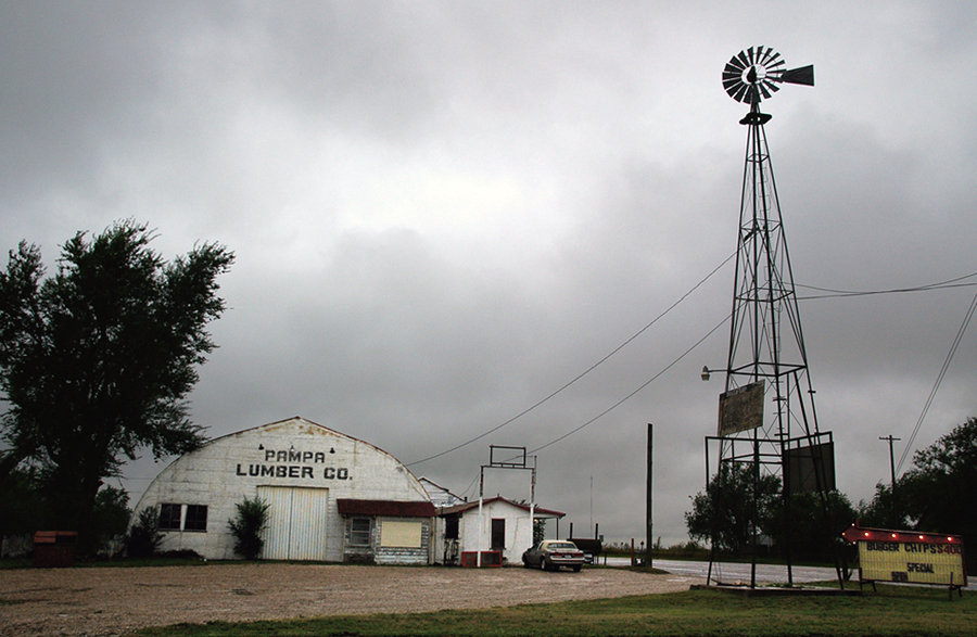
Pampa, TX: PAMPA LUMBER: this photo was conceived about 1962 by a 10-year-old, when it was still a lumber yard, and shot in 2007 after a 45-year absence. Apparently it's a diner now.
Rate this picture:
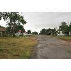
![Pampa: : NAIDA STREET, looking south, on the west side of town.]()
Pampa: NAIDA STREET, looking south, on the west side of town.
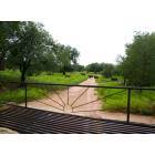
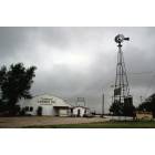
![Pampa: : BOWERS CITY PLANT of Phillips Petroleum occupied this site ten miles south of Pampa off FM Road 749 through the late 60s. The plant, scores of employee homes, an elementary school, a fire station, and a general store stood where only cows graze now.]()
Pampa: BOWERS CITY PLANT of Phillips Petroleum occupied this site ten miles south of Pampa off FM Road 749 through the late 60s. The plant, scores of employee homes, an elementary school, a fire station, and a general store stood where only cows graze now.
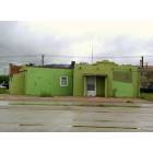
![Pampa: : CLOSED RESTAURANT on West Foster Avenue in the historic downtown area.]()
Pampa: CLOSED RESTAURANT on West Foster Avenue in the historic downtown area.
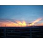
![Pampa: : Sunrise at the feedlot]()
Pampa: Sunrise at the feedlot
![Pampa: : PAMPA LUMBER: this photo was conceived about 1962 by a 10-year-old, when it was still a lumber yard, and shot in 2007 after a 45-year absence. Apparently it's a diner now.]()
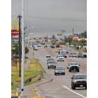
![Pampa: : THIS WAY TO WAL-MART: In 2007, most of Pampa's retail business is growing north along the Hobart Street/Highway 70 corridor.]()
Pampa: THIS WAY TO WAL-MART: In 2007, most of Pampa's retail business is growing north along the Hobart Street/Highway 70 corridor.
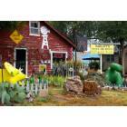
![Pampa: : RADCLIFF'S ROCK AND RELICS is a colorful presence on Hobart Street.]()
Pampa: RADCLIFF'S ROCK AND RELICS is a colorful presence on Hobart Street.
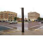
![Pampa: : PAMPA CITY HALL in the historic downtown area.]()
Pampa: PAMPA CITY HALL in the historic downtown area.
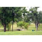
![Pampa: : CENTRAL PARK: Red Deer Creek, which begins as a shallow wash in west Pampa, flows through Central Park and eventually carves a deep, widening break in the escarpment of the Llano Estacado on its 35-mile journey northeast to the Canadian River.]()
Pampa: CENTRAL PARK: Red Deer Creek, which begins as a shallow wash in west Pampa, flows through Central Park and eventually carves a deep, widening break in the escarpment of the Llano Estacado on its 35-mile journey northeast to the Canadian River.
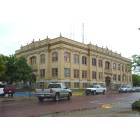
![Pampa: : GRAY COUNTY COURT HOUSE in the historic downtown area.]()
Pampa: GRAY COUNTY COURT HOUSE in the historic downtown area.
- see
43
more - add
your
Report an error or a problem with this picture
Upload your own Pampa, TX photo and show it to the world!- Viewed
- 7227 times
- Current avarege rating
- 6.5 (39 votes)
- Picture by
- TJ Pierce
- Submitted on
- 1/7/2008