Polytechnic Heights (Poly) neighborhood in Fort Worth, Texas (TX), 76103, 76104, 76105 detailed profile
Settings
X


Business Search - 14 Million verified businesses
Area: 3.409 square miles
Population: 23,741
Population density:
| Polytechnic Heights (Poly): | 6,964 people per square mile |
| Fort Worth: | 3,286 people per square mile |

- 14,81858.1%Hispanic or Latino
- 5,03619.8%Black
- 3,08012.1%White
- 9193.6%Asian
- 8993.5%Two or more races
- 4421.7%Some other race
- 2471.0%Native Hawaiian and Other
Pacific Islander - 560.2%American Indian

Median household income in 2022:
| Polytechnic Heights (Poly): | $41,821 |
| Fort Worth: | $71,527 |
Distribution of median household income
![Distribution of median household income]()
- 931Less than $10,000
- 1,191$10,000 to $19,999
- 1,253$20,000 to $29,999
- 1,101$30,000 to $39,999
- 1,182$40,000 to $49,999
- 821$50,000 to $59,999
- 1,055$60,000 to $74,999
- 599$75,000 to $99,999
- 730$100,000 to $124,999
- 468$125,000 to $149,999
- 553$150,000 to $199,999
- 171$200,000 or more

Distribution of owner-occupied house/condo value
![Distribution of owner-occupied house/condo value]()
- 2,061Less than $50,000
- 2,225$50,000 to $99,999
- 1,527$100,000 to $149,999
- 870$150,000 to $199,999
- 380$200,000 to $249,999
- 698$250,000 to $299,999
- 533$300,000 to $399,999
- 139$400,000 to $499,999
- 283$500,000 to $749,999
- 87$750,000 to $999,999
- 191$1,000,000 or more

Distribution of rent paid by renters
![Distribution of rent paid by renters]()
- 115Less than $100
- 541$100 to $199
- 633$200 to $299
- 786$300 to $399
- 392$400 to $499
- 567$500 to $599
- 891$600 to $699
- 1,788$700 to $799
- 847$800 to $899
- 589$900 to $999
- 790$1,000 to $1,249
- 361$1,250 to $1,499
- 131$1,500 to $1,999

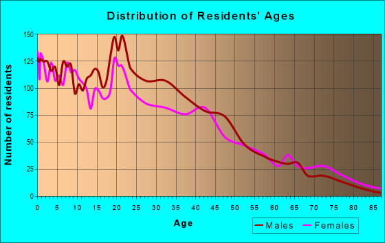
| Males: | 11,377 |
| Females: | 12,364 |
Males:
| This neighborhood: | 26.4 years |
| Whole city: | 33.6 years |
| This neighborhood: | 29.8 years |
| Whole city: | 34.8 years |
Average household size:
| Polytechnic Heights (Poly): | 15.0 people |
| Fort Worth: | 2.7 people |
Percentage of family households:
| Polytechnic Heights (Poly): | 48.7% |
| Fort Worth: | 52.4% |
| Here: | 33.3% |
| Fort Worth: | 48.2% |
Percentage of married-couple families with children (among all households):
| Polytechnic Heights (Poly): | 15.1% |
| Fort Worth: | 25.9% |
Percentage of single-mother households (among all households):
| Polytechnic Heights (Poly): | 15.7% |
| Fort Worth: | 7.4% |
Percentage of never married males 15 years old and over:
Percentage of never married females 15 years old and over:
| Polytechnic Heights (Poly): | 22.2% |
| Fort Worth: | 18.5% |
Percentage of never married females 15 years old and over:
| Polytechnic Heights (Poly): | 20.6% |
| city: | 17.3% |
Percentage of people that speak English not well or not at all:
| Polytechnic Heights (Poly): | 12.1% |
| Fort Worth: | 6.5% |
Percentage of people born in this state:
Percentage of people born in another U.S. state:
Percentage of native residents but born outside the U.S.:
Percentage of foreign born residents:
| Here: | 61.5% |
| Fort Worth: | 55.0% |
Percentage of people born in another U.S. state:
| Polytechnic Heights (Poly): | 10.6% |
| Fort Worth: | 26.2% |
Percentage of native residents but born outside the U.S.:
| Here: | 0.8% |
| city: | 2.1% |
Percentage of foreign born residents:
| Here: | 27.2% |
| Fort Worth: | 16.6% |

Owner-occupied
Renter-occupied


- Rooms in owner-occupied houses and condos in Polytechnic Heights <
> - 1891 room
- 292 rooms
- 4023 rooms
- 7494 rooms
- 9165 rooms
- 1,2316 rooms
- 8747 rooms
- 4158 rooms
- 1499+ rooms

- Rooms in renter-occupied apartments in Polytechnic Heights <
> - 7661 room
- 9572 rooms
- 8213 rooms
- 8874 rooms
- 8585 rooms
- 1,0546 rooms
- 3587 rooms
- 5688 rooms
- 549+ rooms
Owner-occupied
Renter-occupied

- Bedrooms in owner-occupied houses and condos in Polytechnic Heights <
> - 189no bedroom
- 3611 bedroom
- 1,3182 bedrooms
- 1,9553 bedrooms
- 6214 bedrooms
- 2635+ bedrooms

- Bedrooms in renter-occupied apartments in Polytechnic Heights <
> - 766no bedroom
- 9261 bedroom
- 1,6232 bedrooms
- 8683 bedrooms
- 4754 bedrooms
- 565+ bedrooms
Average number of cars or other vehicles available in houses/condos:
Average number of cars or other vehicles available in apartments:
| This neighborhood: | 2.1 |
| Fort Worth: | 2.1 |
Average number of cars or other vehicles available in apartments:
| Here: | 1.4 |
| city: | 1.5 |
Percentage of units with a mortgage:
| Polytechnic Heights (Poly): | 28.3% |
| Fort Worth: | 61.2% |
Average estimated value of detached houses in 2022 (76.3% of all units):
| Polytechnic Heights (Poly): | $125,884 |
| Fort Worth: | $264,175 |

- Year house built in Polytechnic Heights <
> - 1582020 or later
- 7332010 to 2019
- 6602000 to 2009
- 6031990 to 1999
- 7031980 to 1989
- 7871970 to 1979
- 9411960 to 1969
- 2,6601950 to 1959
- 1,0021940 to 1949
- 1,7711939 or earlier

City-data.com crime index for city in 2020 (higher means more crime):
| City: | 303.1 |
| U.S. average: | 219.5 |
Travel time to work (commute)
![Travel time to work (commute)]()
- 51Less than 5 minutes
- 5795 to 9 minutes
- 95310 to 14 minutes
- 1,40115 to 19 minutes
- 1,55020 to 24 minutes
- 48625 to 29 minutes
- 1,08930 to 34 minutes
- 10835 to 39 minutes
- 22440 to 44 minutes
- 54945 to 59 minutes
- 38360 to 89 minutes
- 20790 or more minutes

Means of transportation to work
![Means of transportation to work]()
- 72.1%6,922Drove a car alone
- 18.6%1,781Carpooled
- 2.8%268Bus
- 19.3%1,856Taxi
- 2.0%190Motorcycle
- 1.8%173Bicycle
- 14.2%1,362Walked
- 5.5%532Other means
- 7.7%741Worked at home

Time leaving home to go to work
![Time leaving home to go to work]()
- 56212:00 a.m. to 4:59 a.m.
- 3305:00 a.m. to 5:29 a.m.
- 7325:30 a.m. to 5:59 a.m.
- 9486:00 a.m. to 6:29 a.m.
- 8366:30 a.m. to 6:59 a.m.
- 9727:00 a.m. to 7:29 a.m.
- 5717:30 a.m. to 7:59 a.m.
- 4478:00 a.m. to 8:29 a.m.
- 2598:30 a.m. to 8:59 a.m.
- 3499:00 a.m. to 9:59 a.m.
- 23310:00 a.m. to 10:59 a.m.
- 6111:00 a.m. to 11:59 a.m.
- 56312:00 p.m. to 3:59 p.m.
- 4524:00 p.m. to 11:59 p.m.

Occupations of males:
- Percentage of males in management occupations (except farmers):
Here: 3.1% city: 11.7%
- Percentage of males in business and financial operations occupations:
Here: 1.4% city: 4.9%
- Percentage of males in architecture and engineering occupations:
Here: 1.5% city: 3.4%
- Percentage of males in education, training, and library occupations:
Here: 3.2% city: 2.9%
- Percentage of males in service occupations:
Here: 12.2% city: 12.0%
- Percentage of males in sales and office occupations:
Here: 7.8% city: 15.8%
- Percentage of males in construction, extraction, and maintenance occupations:
Here: 29.0% city: 11.7%
- Percentage of males in production occupations:
Here: 16.2% city: 7.8%
- Percentage of males in transportation occupations:
Here: 11.0% city: 7.1%
- Percentage of males in material moving occupations:
Here: 9.8% city: 7.1%
Occupations of females:
- Percentage of females in management occupations (except farmers):
Here: 4.7% city: 9.6%
- Percentage of females in education, training, and library occupations:
Here: 3.8% city: 9.5%
- Percentage of females in arts, design, entertainment, sports, and media occupations:
Here: 3.3% city: 1.8%
- Percentage of females in healthcare practitioners and technical occupations:
Here: 6.4% city: 7.9%
- Percentage of females in service occupations:
Here: 26.2% city: 20.2%
- Percentage of females in sales and office occupations:
Here: 26.9% city: 28.3%
- Percentage of females in production occupations:
Here: 11.9% city: 3.5%
- Percentage of females in transportation occupations:
Here: 3.1% city: 1.8%
- Percentage of females in material moving occupations:
Here: 10.1% city: 3.4%
Education in this neighborhood (subdivision or community):
- Percentage of people 3 years and older in K-12 schools:
Polytechnic Heights (Poly): 27.4% Fort Worth: 20.3%
- Percentage of people 3 years and older in undergraduate colleges:
Polytechnic Heights (Poly): 9.9% Fort Worth: 4.7%
- Percentage of people 3 years and older in grad. or professional schools:
Polytechnic Heights (Poly): 3.6% Fort Worth: 1.6%
- Percentage of students K-12 enrolled in private schools:
Polytechnic Heights (Poly): 64.7% Fort Worth: 7.2%
Percentage of population below poverty level:
| Polytechnic Heights (Poly): | 23.5% |
| Fort Worth: | 12.0% |
Median year owner moved in (as recorded in 2022):
Median year renter moved in (as recorded in 2022):
| Polytechnic Heights (Poly): | 2002 |
| Fort Worth: | 2013 |
Median year renter moved in (as recorded in 2022):
| Polytechnic Heights (Poly): | 2014 |
| Fort Worth: | 2020 |
Percentage of married-couple families with both working:
| Polytechnic Heights (Poly): | 56.0% |
| Fort Worth: | 71.2% |

- 58.7%Electricity
- 33.3%Utility gas
- 3.5%Bottled, tank, or LP gas
- 2.5%Solar energy
- 2.0%No fuel used
Highways in this neighborhood:
E Lancaster Ave (State Hwy 180)
Length: 4.18 miles
Directions: E-W, SE-NW
Address range: 1725 to 3199
Directions: E-W, SE-NW
Address range: 1725 to 3199
State Hwy 303 (E Rosedale St)
Length: 3.20 miles
Directions: E-W, SE-NW, SW-NE
Address range: 1700 to 4199
Directions: E-W, SE-NW, SW-NE
Address range: 1700 to 4199
US Hwy 287 (Poly North Fwy)
Length: 2.32 miles
Directions: N-S, SE-NW
Address range: 100 to 2499
Directions: N-S, SE-NW
Address range: 100 to 2499
US Hwy 287P Bus (S Riverside Dr)
Length: 1.93 miles
Direction: N-S
Address range: 100 to 1999
Direction: N-S
Address range: 100 to 1999
US Hwy 287
Length: 1.84 miles
Directions: N-S, SE-NW
Directions: N-S, SE-NW
Roads and streets:
Ave G
Length: 2.40 miles
Directions: E-W, SW-NE
Address range: 2200 to 4199
Directions: E-W, SW-NE
Address range: 2200 to 4199
S Beach St
Length: 2.38 miles
Directions: N-S, SW-NE
Address range: 100 to 1899
Directions: N-S, SW-NE
Address range: 100 to 1899
E Vickery Blvd
Length: 2.34 miles
Directions: E-W, SE-NW
Address range: 1720 to 3699
Directions: E-W, SE-NW
Address range: 1720 to 3699
Ave H
Length: 2.11 miles
Directions: E-W, SE-NW, SW-NE
Address range: 2300 to 4199
Directions: E-W, SE-NW, SW-NE
Address range: 2300 to 4199
Ave J
Length: 2.02 miles
Direction: E-W
Address range: 2500 to 4199
Direction: E-W
Address range: 2500 to 4199
Ave L
Length: 1.56 miles
Direction: E-W
Address range: 2600 to 4199
Direction: E-W
Address range: 2600 to 4199
Ave M
Length: 1.53 miles
Directions: E-W, SW-NE
Address range: 2900 to 4199
Directions: E-W, SW-NE
Address range: 2900 to 4199
Poly Frwy Svc Rd W
Length: 1.50 miles
Directions: N-S, SE-NW, SW-NE
Directions: N-S, SE-NW, SW-NE
Ave I
Length: 1.48 miles
Direction: E-W
Address range: 2600 to 3899
Direction: E-W
Address range: 2600 to 3899
Avenue N
Length: 1.39 miles
Directions: E-W, SE-NW
Address range: 3000 to 4199
Directions: E-W, SE-NW
Address range: 3000 to 4199
Ave K
Length: 1.26 miles
Direction: E-W
Address range: 2700 to 3799
Direction: E-W
Address range: 2700 to 3799
Ave C
Length: 1.25 miles
Directions: E-W, N-S, SE-NW
Address range: 1900 to 4099
Directions: E-W, N-S, SE-NW
Address range: 1900 to 4099
Avenue E
Length: 1.20 miles
Directions: E-W, SE-NW
Address range: 1700 to 3699
Directions: E-W, SE-NW
Address range: 1700 to 3699
Conner Ave
Length: 1.20 miles
Directions: N-S, SW-NE
Address range: 400 to 2199
Directions: N-S, SW-NE
Address range: 400 to 2199
Millet Ave
Length: 1.16 miles
Directions: E-W, SE-NW
Address range: 3100 to 4199
Directions: E-W, SE-NW
Address range: 3100 to 4199
Poly Frwy Svc Rd E
Length: 1.15 miles
Directions: N-S, SE-NW
Address range: 201 to 1999
Directions: N-S, SE-NW
Address range: 201 to 1999
Cobb Park Dr
Length: 1.10 miles
Directions: E-W, N-S, SE-NW, SW-NE
Address range: 1001 to 2511
Directions: E-W, N-S, SE-NW, SW-NE
Address range: 1001 to 2511
Ave B
Length: 1.09 miles
Directions: E-W, SW-NE
Address range: 1700 to 3399
Directions: E-W, SW-NE
Address range: 1700 to 3399
Binkley St
Length: 1.05 miles
Directions: N-S, SE-NW
Address range: 500 to 2199
Directions: N-S, SE-NW
Address range: 500 to 2199
Ash Crescent St
Length: 1.03 miles
Direction: N-S
Address range: 800 to 2199
Direction: N-S
Address range: 800 to 2199
Belzise Ter
Length: 1.01 miles
Direction: N-S
Address range: 800 to 2199
Direction: N-S
Address range: 800 to 2199
Ave D
Length: 0.98 miles
Directions: E-W, SW-NE
Address range: 1900 to 3599
Directions: E-W, SW-NE
Address range: 1900 to 3599
Collard St
Length: 0.94 miles
Directions: N-S, SE-NW, SW-NE
Address range: 615 to 2199
Directions: N-S, SE-NW, SW-NE
Address range: 615 to 2199
Ave A
Length: 0.88 miles
Directions: E-W, SW-NE
Address range: 2400 to 4099
Directions: E-W, SW-NE
Address range: 2400 to 4099
Bishop St
Length: 0.86 miles
Directions: N-S, SW-NE
Address range: 900 to 2299
Directions: N-S, SW-NE
Address range: 900 to 2299
Wesleyan St
Length: 0.85 miles
Direction: N-S
Address range: 800 to 2199
Direction: N-S
Address range: 800 to 2199
Mc Kenzie St
Length: 0.85 miles
Directions: N-S, SW-NE
Address range: 1000 to 2399
Directions: N-S, SW-NE
Address range: 1000 to 2399
Miller Ave
Length: 0.84 miles
Directions: N-S, SW-NE
Address range: 1000 to 2299
Directions: N-S, SW-NE
Address range: 1000 to 2299
E Maddox Ave
Length: 0.83 miles
Direction: E-W
Address range: 1700 to 2599
Direction: E-W
Address range: 1700 to 2599
S Ayers Ave
Length: 0.82 miles
Direction: N-S
Address range: 950 to 2299
Direction: N-S
Address range: 950 to 2299
Wallace St
Length: 0.79 miles
Directions: E-W, N-S, SW-NE
Address range: 1000 to 2299
Directions: E-W, N-S, SW-NE
Address range: 1000 to 2299
Thrall St
Length: 0.73 miles
Direction: N-S
Address range: 800 to 2099
Direction: N-S
Address range: 800 to 2099
Campbell St
Length: 0.73 miles
Direction: N-S
Address range: 1100 to 2299
Direction: N-S
Address range: 1100 to 2299
Mitchell Blvd
Length: 0.71 miles
Directions: N-S, SE-NW
Address range: 1400 to 2299
Directions: N-S, SE-NW
Address range: 1400 to 2299
Arch St
Length: 0.68 miles
Direction: N-S
Address range: 1000 to 2099
Direction: N-S
Address range: 1000 to 2099
Ludelle St
Length: 0.66 miles
Directions: E-W, SE-NW
Address range: 2300 to 2799
Directions: E-W, SE-NW
Address range: 2300 to 2799
Sycamore Park Dr
Length: 0.64 miles
Directions: E-W, N-S, SE-NW
Address range: 800 to 1399
Directions: E-W, N-S, SE-NW
Address range: 800 to 1399
E Arlington Ave
Length: 0.64 miles
Direction: E-W
Address range: 1613 to 1999
Direction: E-W
Address range: 1613 to 1999
E Richmond Ave
Length: 0.63 miles
Directions: E-W, SE-NW
Address range: 1602 to 2199
Directions: E-W, SE-NW
Address range: 1602 to 2199
Hawlet St
Length: 0.62 miles
Direction: E-W
Address range: 3700 to 4199
Direction: E-W
Address range: 3700 to 4199
Camilla St
Length: 0.62 miles
Direction: E-W
Address range: 2400 to 2799
Direction: E-W
Address range: 2400 to 2799
Little St
Length: 0.62 miles
Direction: N-S
Address range: 1300 to 2299
Direction: N-S
Address range: 1300 to 2299
Vaughn Blvd
Length: 0.62 miles
Direction: N-S
Address range: 900 to 2348
Direction: N-S
Address range: 900 to 2348
Burchill Rd
Length: 0.56 miles
Directions: E-W, N-S, SE-NW
Address range: 1800 to 2799
Directions: E-W, N-S, SE-NW
Address range: 1800 to 2799
Elmwood Ave
Length: 0.53 miles
Direction: E-W
Address range: 1700 to 2299
Direction: E-W
Address range: 1700 to 2299
Cromwell St
Length: 0.51 miles
Directions: N-S, SW-NE
Address range: 100 to 899
Directions: N-S, SW-NE
Address range: 100 to 899
Nashville Ave (Nashville St)
Length: 0.47 miles
Direction: SE-NW
Address range: 800 to 1399
Direction: SE-NW
Address range: 800 to 1399
Ernest St
Length: 0.43 miles
Direction: N-S
Address range: 500 to 999
Direction: N-S
Address range: 500 to 999
Parkdale St (Parkdale Ave)
Length: 0.40 miles
Direction: N-S
Address range: 400 to 1099
Direction: N-S
Address range: 400 to 1099
Bomar Ave
Length: 0.40 miles
Direction: E-W
Address range: 2200 to 2599
Direction: E-W
Address range: 2200 to 2599
Woodrow Ave
Length: 0.40 miles
Direction: N-S
Address range: 200 to 799
Direction: N-S
Address range: 200 to 799
Daniel St
Length: 0.37 miles
Direction: N-S
Address range: 1600 to 2199
Direction: N-S
Address range: 1600 to 2199
Christine Ct (Christine Ave)
Length: 0.34 miles
Directions: E-W, N-S, SE-NW
Address range: 2100 to 2799
Directions: E-W, N-S, SE-NW
Address range: 2100 to 2799
Essex St
Length: 0.31 miles
Direction: N-S
Address range: 300 to 799
Direction: N-S
Address range: 300 to 799
E Morphy St
Length: 0.30 miles
Direction: E-W
Address range: 1700 to 2099
Direction: E-W
Address range: 1700 to 2099
Blue Smoke Ct N
Length: 0.30 miles
Directions: E-W, SE-NW
Address range: 2300 to 2499
Directions: E-W, SE-NW
Address range: 2300 to 2499
Duval St
Length: 0.30 miles
Direction: N-S
Address range: 1600 to 2199
Direction: N-S
Address range: 1600 to 2199
Ravine Rd
Length: 0.29 miles
Directions: N-S, SE-NW
Address range: 500 to 799
Directions: N-S, SE-NW
Address range: 500 to 799
Vista St
Length: 0.29 miles
Direction: E-W
Address range: 2400 to 2699
Direction: E-W
Address range: 2400 to 2699
Midland St
Length: 0.29 miles
Direction: E-W
Address range: 2600 to 3099
Direction: E-W
Address range: 2600 to 3099
S Riverside Dr (Riverside Dr)
Length: 0.29 miles
Direction: N-S
Direction: N-S
McCurdy St
Length: 0.29 miles
Direction: N-S
Address range: 1700 to 1999
Direction: N-S
Address range: 1700 to 1999
Sycamore St
Length: 0.29 miles
Direction: N-S
Address range: 400 to 799
Direction: N-S
Address range: 400 to 799
Brooks St
Length: 0.28 miles
Direction: SE-NW
Address range: 2000 to 2399
Direction: SE-NW
Address range: 2000 to 2399
Sycamore Cir
Length: 0.28 miles
Directions: E-W, N-S, SE-NW, SW-NE
Address range: 2300 to 2499
Directions: E-W, N-S, SE-NW, SW-NE
Address range: 2300 to 2499
Renner Ave
Length: 0.25 miles
Direction: N-S
Address range: 1800 to 2199
Direction: N-S
Address range: 1800 to 2199
Sycamore Ter
Length: 0.23 miles
Direction: N-S
Address range: 800 to 1199
Direction: N-S
Address range: 800 to 1199
Irma St
Length: 0.23 miles
Direction: E-W
Address range: 1700 to 2099
Direction: E-W
Address range: 1700 to 2099
E Myrtle St
Length: 0.23 miles
Direction: E-W
Address range: 1900 to 2199
Direction: E-W
Address range: 1900 to 2199
Chicago Ave
Length: 0.23 miles
Direction: N-S
Address range: 923 to 1299
Direction: N-S
Address range: 923 to 1299
East Ave
Length: 0.23 miles
Directions: E-W, SW-NE
Address range: 1700 to 1999
Directions: E-W, SW-NE
Address range: 1700 to 1999
Ann St
Length: 0.22 miles
Direction: N-S
Address range: 800 to 1099
Direction: N-S
Address range: 800 to 1099
Hampshire Blvd
Length: 0.21 miles
Direction: E-W
Address range: 3300 to 3499
Direction: E-W
Address range: 3300 to 3499
Purington Ave
Length: 0.21 miles
Directions: E-W, SW-NE
Address range: 2700 to 2899
Directions: E-W, SW-NE
Address range: 2700 to 2899
Elsie St
Length: 0.21 miles
Direction: E-W
Address range: 2700 to 2897
Direction: E-W
Address range: 2700 to 2897
Ben Ave
Length: 0.20 miles
Directions: E-W, N-S, SE-NW
Address range: 400 to 2899
Directions: E-W, N-S, SE-NW
Address range: 400 to 2899
S Sargent Ave
Length: 0.20 miles
Directions: N-S, SW-NE
Address range: 1000 to 1299
Directions: N-S, SW-NE
Address range: 1000 to 1299
Mc Curdy St
Length: 0.20 miles
Direction: N-S
Address range: 500 to 799
Direction: N-S
Address range: 500 to 799
E Daggett Ave
Length: 0.19 miles
Directions: E-W, N-S, SE-NW
Address range: 1600 to 1899
Directions: E-W, N-S, SE-NW
Address range: 1600 to 1899
S Newark Ave
Length: 0.19 miles
Direction: N-S
Address range: 1000 to 1299
Direction: N-S
Address range: 1000 to 1299
S Poly Frwy Svc Rd W
Length: 0.18 miles
Direction: SE-NW
Direction: SE-NW
Koch St
Length: 0.18 miles
Direction: E-W
Address range: 2600 to 2699
Direction: E-W
Address range: 2600 to 2699
Quinn St
Length: 0.17 miles
Directions: E-W, SE-NW
Address range: 2600 to 2799
Directions: E-W, SE-NW
Address range: 2600 to 2799
Haynes Ave
Length: 0.17 miles
Direction: N-S
Address range: 1000 to 1299
Direction: N-S
Address range: 1000 to 1299
Court St
Length: 0.17 miles
Direction: N-S
Address range: 500 to 799
Direction: N-S
Address range: 500 to 799
Hattie St
Length: 0.17 miles
Directions: E-W, N-S, SE-NW
Address range: 2200 to 2399
Directions: E-W, N-S, SE-NW
Address range: 2200 to 2399
E Broadway Ave
Length: 0.17 miles
Direction: E-W
Address range: 1700 to 1899
Direction: E-W
Address range: 1700 to 1899
Hall St
Length: 0.16 miles
Directions: N-S, SE-NW
Address range: 1400 to 1599
Directions: N-S, SE-NW
Address range: 1400 to 1599
Lynnfield Dr (Lynnfield St)
Length: 0.15 miles
Direction: SE-NW
Address range: 3300 to 3499
Direction: SE-NW
Address range: 3300 to 3499
Withers St
Length: 0.15 miles
Direction: N-S
Address range: 1400 to 1599
Direction: N-S
Address range: 1400 to 1599
Uvalde St
Length: 0.15 miles
Direction: N-S
Address range: 1600 to 1999
Direction: N-S
Address range: 1600 to 1999
E Tucker St
Length: 0.14 miles
Direction: E-W
Address range: 1794 to 1903
Direction: E-W
Address range: 1794 to 1903
Beach St Svc Rd E
Length: 0.14 miles
Directions: N-S, SE-NW
Address range: 2301 to 2499
Directions: N-S, SE-NW
Address range: 2301 to 2499
Dillow St
Length: 0.13 miles
Direction: N-S
Address range: 2100 to 2349
Direction: N-S
Address range: 2100 to 2349
Hendricks St
Length: 0.13 miles
Directions: N-S, SE-NW
Address range: 1400 to 1599
Directions: N-S, SE-NW
Address range: 1400 to 1599
Beach St
Length: 0.12 miles
Direction: N-S
Address range: 2500 to 2699
Direction: N-S
Address range: 2500 to 2699
Blue Smoke Ct S
Length: 0.12 miles
Direction: E-W
Address range: 2400 to 2499
Direction: E-W
Address range: 2400 to 2499
Chester St
Length: 0.12 miles
Direction: N-S
Address range: 2300 to 2499
Direction: N-S
Address range: 2300 to 2499
Logan St
Length: 0.12 miles
Direction: N-S
Address range: 1600 to 1999
Direction: N-S
Address range: 1600 to 1999
Sanborn St
Length: 0.12 miles
Directions: N-S, SW-NE
Address range: 2600 to 2799
Directions: N-S, SW-NE
Address range: 2600 to 2799
Schmidt St
Length: 0.12 miles
Direction: N-S
Address range: 1900 to 2099
Direction: N-S
Address range: 1900 to 2099
Grafton St
Length: 0.11 miles
Directions: N-S, SW-NE
Address range: 2300 to 2399
Directions: N-S, SW-NE
Address range: 2300 to 2399
Harwood St
Length: 0.11 miles
Directions: N-S, SW-NE
Address range: 2600 to 2799
Directions: N-S, SW-NE
Address range: 2600 to 2799
Beach St Svc Rd W
Length: 0.11 miles
Direction: N-S
Direction: N-S
Bostick St
Length: 0.10 miles
Directions: N-S, SE-NW
Address range: 400 to 599
Directions: N-S, SE-NW
Address range: 400 to 599
Wilkinson Ave
Length: 0.10 miles
Direction: E-W
Address range: 2500 to 2599
Direction: E-W
Address range: 2500 to 2599
Meadowbrook Dr
Length: 0.10 miles
Direction: E-W
Address range: 2600 to 2699
Direction: E-W
Address range: 2600 to 2699
Kelly St
Length: 0.10 miles
Direction: E-W
Address range: 1900 to 1999
Direction: E-W
Address range: 1900 to 1999
Valkus St
Length: 0.09 miles
Directions: E-W, SE-NW
Address range: 2200 to 2399
Directions: E-W, SE-NW
Address range: 2200 to 2399
Anna St
Length: 0.09 miles
Direction: N-S
Address range: 2300 to 2399
Direction: N-S
Address range: 2300 to 2399
Maidstone St
Length: 0.09 miles
Direction: SW-NE
Address range: 600 to 699
Direction: SW-NE
Address range: 600 to 699
Blue Smoke Ct W
Length: 0.09 miles
Directions: N-S, SE-NW
Address range: 300 to 499
Directions: N-S, SE-NW
Address range: 300 to 499
Hudson St
Length: 0.09 miles
Direction: SW-NE
Address range: 2300 to 2399
Direction: SW-NE
Address range: 2300 to 2399
Panola Ave
Length: 0.09 miles
Directions: E-W, N-S, SE-NW
Address range: 3100 to 3299
Directions: E-W, N-S, SE-NW
Address range: 3100 to 3299
Windham St
Length: 0.08 miles
Direction: N-S
Address range: 1900 to 2399
Direction: N-S
Address range: 1900 to 2399
Stearns St
Length: 0.08 miles
Direction: N-S
Address range: 1400 to 1499
Direction: N-S
Address range: 1400 to 1499
Otto St
Length: 0.08 miles
Directions: N-S, SW-NE
Address range: 1900 to 2099
Directions: N-S, SW-NE
Address range: 1900 to 2099
Ave F
Length: 0.08 miles
Direction: E-W
Address range: 3600 to 3699
Direction: E-W
Address range: 3600 to 3699
Ward St
Length: 0.07 miles
Directions: N-S, SW-NE
Address range: 2500 to 2599
Directions: N-S, SW-NE
Address range: 2500 to 2599
Bessie St
Length: 0.07 miles
Directions: E-W, SW-NE
Address range: 1794 to 1899
Directions: E-W, SW-NE
Address range: 1794 to 1899
Mc Lean St
Length: 0.07 miles
Direction: E-W
Address range: 3000 to 3099
Direction: E-W
Address range: 3000 to 3099
Cobb St
Length: 0.06 miles
Directions: E-W, N-S, SE-NW
Address range: 2300 to 2399
Directions: E-W, N-S, SE-NW
Address range: 2300 to 2399
Whitson St
Length: 0.06 miles
Direction: N-S
Address range: 2200 to 2399
Direction: N-S
Address range: 2200 to 2399
Holmes St
Length: 0.06 miles
Direction: N-S
Address range: 1400 to 1499
Direction: N-S
Address range: 1400 to 1499
Jamaica Ln
Length: 0.06 miles
Direction: N-S
Address range: 800 to 899
Direction: N-S
Address range: 800 to 899
Rampart St
Length: 0.06 miles
Directions: E-W, SW-NE
Address range: 800 to 849
Directions: E-W, SW-NE
Address range: 800 to 849
Stella St
Length: 0.06 miles
Direction: E-W
Address range: 1794 to 1899
Direction: E-W
Address range: 1794 to 1899
Cobb Park Dr W
Length: 0.05 miles
Direction: SW-NE
Direction: SW-NE
Exeter St
Length: 0.05 miles
Direction: N-S
Address range: 100 to 199
Direction: N-S
Address range: 100 to 199
E Leuda St
Length: 0.05 miles
Direction: E-W
Address range: 1718 to 1899
Direction: E-W
Address range: 1718 to 1899
Ola St
Length: 0.05 miles
Directions: N-S, SE-NW
Address range: 500 to 599
Directions: N-S, SE-NW
Address range: 500 to 599
Oakland Blvd
Length: 0.04 miles
Direction: N-S
Address range: 950 to 999
Direction: N-S
Address range: 950 to 999
Hawkins St
Length: 0.04 miles
Direction: N-S
Address range: 300 to 499
Direction: N-S
Address range: 300 to 499
Ave H N
Length: 0.03 miles
Direction: E-W
Address range: 4133 to 4168
Direction: E-W
Address range: 4133 to 4168
S Collard St
Length: 0.03 miles
Directions: N-S, SW-NE
Address range: 600 to 799
Directions: N-S, SW-NE
Address range: 600 to 799
S Ben St
Length: 0.03 miles
Direction: SW-NE
Address range: 400 to 499
Direction: SW-NE
Address range: 400 to 499
Toronto Ave (Toronto St)
Length: 0.03 miles
Direction: N-S
Address range: 2718 to 2799
Direction: N-S
Address range: 2718 to 2799
E Hattie St
Length: 0.02 miles
Direction: E-W
Direction: E-W
Railroad features:
Texas and Pacific Rlwy
Length: 3.10 miles
Directions: E-W, SE-NW
Directions: E-W, SE-NW
Other features:
Sycamore Crk
Length: 2.19 miles
Directions: E-W, N-S, SE-NW, SW-NE
Directions: E-W, N-S, SE-NW, SW-NE