Northwest Massillon (North West Massillon) neighborhood in Massillon, Ohio (OH), 44647, 44666 detailed profile
Settings
X


Business Search - 14 Million verified businesses
Area: 12.519 square miles
Population: 7,294
Population density:
| Northwest Massillon (North West Massillon): | 583 people per square mile |
| Massillon: | 1,921 people per square mile |

- 6,85367.7%White
- 1,08110.7%Asian
- 1,02810.2%Black
- 6316.2%American Indian
- 2342.3%Hispanic or Latino
- 2012.0%Two or more races
- 1001.0%Some other race

Median household income in 2022:
| Northwest Massillon (North West Massillon): | $67,230 |
| Massillon: | $53,699 |
Distribution of median household income
![Distribution of median household income]()
- 66Less than $10,000
- 501$10,000 to $19,999
- 808$20,000 to $29,999
- 397$30,000 to $39,999
- 286$40,000 to $49,999
- 280$50,000 to $59,999
- 368$60,000 to $74,999
- 415$75,000 to $99,999
- 389$100,000 to $124,999
- 167$125,000 to $149,999
- 216$150,000 to $199,999
- 148$200,000 or more

Distribution of owner-occupied house/condo value
![Distribution of owner-occupied house/condo value]()
- 1,312Less than $50,000
- 1,458$50,000 to $99,999
- 794$100,000 to $149,999
- 385$150,000 to $199,999
- 189$200,000 to $249,999
- 159$250,000 to $299,999
- 101$300,000 to $399,999
- 155$400,000 to $499,999
- 27$500,000 to $749,999
- 26$750,000 to $999,999
- 417$1,000,000 or more

Distribution of rent paid by renters
![Distribution of rent paid by renters]()
- 271Less than $100
- 722$200 to $299
- 763$300 to $399
- 808$400 to $499
- 1,268$500 to $599
- 1,390$600 to $699
- 602$700 to $799
- 382$800 to $899
- 38$900 to $999
- 94$1,000 to $1,249
- 376$1,500 to $1,999

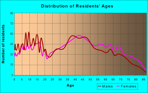
| Males: | 3,618 |
| Females: | 3,676 |
Males:
| This neighborhood: | 42.9 years |
| Whole city: | 39.7 years |
| This neighborhood: | 47.6 years |
| Whole city: | 41.9 years |
Average household size:
| Northwest Massillon (North West Massillon): | 3.9 people |
| Massillon: | 2.2 people |
Percentage of family households:
| Northwest Massillon (North West Massillon): | 45.8% |
| Massillon: | 43.2% |
| Here: | 51.8% |
| Massillon: | 39.0% |
Percentage of married-couple families with children (among all households):
| Northwest Massillon (North West Massillon): | 35.3% |
| Massillon: | 23.1% |
Percentage of single-mother households (among all households):
| Northwest Massillon (North West Massillon): | 32.9% |
| Massillon: | 14.2% |
Percentage of never married males 15 years old and over:
Percentage of never married females 15 years old and over:
| Northwest Massillon (North West Massillon): | 12.0% |
| Massillon: | 17.6% |
Percentage of never married females 15 years old and over:
| Northwest Massillon (North West Massillon): | 9.1% |
| city: | 14.6% |
Percentage of people that speak English not well or not at all:
| Northwest Massillon (North West Massillon): | 0.0% |
| Massillon: | 0.3% |
Percentage of people born in this state:
Percentage of people born in another U.S. state:
Percentage of native residents but born outside the U.S.:
Percentage of foreign born residents:
| Here: | 88.3% |
| Massillon: | 84.9% |
Percentage of people born in another U.S. state:
| Northwest Massillon (North West Massillon): | 10.5% |
| Massillon: | 13.4% |
Percentage of native residents but born outside the U.S.:
| Here: | 0.5% |
| city: | 0.3% |
Percentage of foreign born residents:
| Here: | 1.0% |
| Massillon: | 1.4% |

Owner-occupied
Renter-occupied


- Rooms in owner-occupied houses and condos in Northwest Massillon <
> - 2881 room
- 02 rooms
- 473 rooms
- 1924 rooms
- 6065 rooms
- 6386 rooms
- 4027 rooms
- 3728 rooms
- 2899+ rooms

- Rooms in renter-occupied apartments in Northwest Massillon <
> - 561 room
- 592 rooms
- 7323 rooms
- 3404 rooms
- 7375 rooms
- 3556 rooms
- 1477 rooms
- 5358 rooms
- 549+ rooms
Owner-occupied
Renter-occupied

- Bedrooms in owner-occupied houses and condos in Northwest Massillon <
> - 288no bedroom
- 2011 bedroom
- 8112 bedrooms
- 1,3023 bedrooms
- 3504 bedrooms
- 365+ bedrooms

- Bedrooms in renter-occupied apartments in Northwest Massillon <
> - 56no bedroom
- 1,2711 bedroom
- 3142 bedrooms
- 4353 bedrooms
- 3734 bedrooms
- 05+ bedrooms
Average number of cars or other vehicles available in houses/condos:
Average number of cars or other vehicles available in apartments:
| This neighborhood: | 2.6 |
| Massillon: | 2.0 |
Average number of cars or other vehicles available in apartments:
| Here: | |
| city: |
Percentage of units with a mortgage:
| Northwest Massillon (North West Massillon): | 56.8% |
| Massillon: | 63.6% |
Average estimated value of detached houses in 2022 (78.6% of all units):
| Northwest Massillon (North West Massillon): | $177,424 |
| Ohio: | $254,366 |

- Year house built in Northwest Massillon <
> - 882020 or later
- 1382010 to 2019
- 2652000 to 2009
- 4451990 to 1999
- 1721980 to 1989
- 2081970 to 1979
- 4521960 to 1969
- 3861950 to 1959
- 2901940 to 1949
- 1,1881939 or earlier

City-data.com crime index for city in 2020 (higher means more crime):
| City: | 180.9 |
| U.S. average: | 219.5 |
Travel time to work (commute)
![Travel time to work (commute)]()
- 114Less than 5 minutes
- 4465 to 9 minutes
- 51510 to 14 minutes
- 49015 to 19 minutes
- 58420 to 24 minutes
- 25125 to 29 minutes
- 56330 to 34 minutes
- 17035 to 39 minutes
- 8440 to 44 minutes
- 17445 to 59 minutes
- 12360 to 89 minutes
- 8790 or more minutes

Means of transportation to work
![Means of transportation to work]()
- 86.7%3,391Drove a car alone
- 3.5%137Carpooled
- 15.1%591Bus
- 2.1%83Bicycle
- 2.9%113Walked
- 9.5%371Other means
- 8.4%328Worked at home

Time leaving home to go to work
![Time leaving home to go to work]()
- 24212:00 a.m. to 4:59 a.m.
- 1435:00 a.m. to 5:29 a.m.
- 2785:30 a.m. to 5:59 a.m.
- 3556:00 a.m. to 6:29 a.m.
- 4606:30 a.m. to 6:59 a.m.
- 5147:00 a.m. to 7:29 a.m.
- 2937:30 a.m. to 7:59 a.m.
- 1918:00 a.m. to 8:29 a.m.
- 1518:30 a.m. to 8:59 a.m.
- 1379:00 a.m. to 9:59 a.m.
- 9510:00 a.m. to 10:59 a.m.
- 6611:00 a.m. to 11:59 a.m.
- 34212:00 p.m. to 3:59 p.m.
- 3014:00 p.m. to 11:59 p.m.

Occupations of males:
- Percentage of males in management occupations (except farmers):
Here: 6.8% city: 11.6%
- Percentage of males in business and financial operations occupations:
Here: 1.2% city: 2.6%
- Percentage of males in computer and mathematical occupations:
Here: 2.9% city: 2.0%
- Percentage of males in education, training, and library occupations:
Here: 2.1% city: 2.5%
- Percentage of males in arts, design, entertainment, sports, and media occupations:
Here: 4.3% city: 0.7%
- Percentage of males in healthcare practitioners and technical occupations:
Here: 1.6% city: 0.9%
- Percentage of males in service occupations:
Here: 8.7% city: 14.4%
- Percentage of males in sales and office occupations:
Here: 14.6% city: 14.1%
- Percentage of males in farming, fishing, and forestry occupations:
Here: 2.2% city: 0.4%
- Percentage of males in construction, extraction, and maintenance occupations:
Here: 5.1% city: 5.2%
- Percentage of males in production occupations:
Here: 17.0% city: 16.4%
- Percentage of males in transportation occupations:
Here: 10.4% city: 7.4%
- Percentage of males in material moving occupations:
Here: 11.7% city: 12.9%
Occupations of females:
- Percentage of females in management occupations (except farmers):
Here: 4.7% city: 6.4%
- Percentage of females in business and financial operations occupations:
Here: 2.0% city: 4.7%
- Percentage of females in computer and mathematical occupations:
Here: 2.4% city: 1.3%
- Percentage of females in education, training, and library occupations:
Here: 5.7% city: 8.1%
- Percentage of females in arts, design, entertainment, sports, and media occupations:
Here: 6.3% city: 1.3%
- Percentage of females in healthcare practitioners and technical occupations:
Here: 7.0% city: 6.6%
- Percentage of females in service occupations:
Here: 27.1% city: 28.1%
- Percentage of females in sales and office occupations:
Here: 23.6% city: 30.1%
- Percentage of females in production occupations:
Here: 6.3% city: 5.3%
- Percentage of females in transportation occupations:
Here: 2.2% city: 1.2%
- Percentage of females in material moving occupations:
Here: 4.7% city: 1.8%
Education in this neighborhood (subdivision or community):
- Percentage of people 3 years and older in K-12 schools:
Northwest Massillon (North West Massillon): 16.9% Massillon: 15.5%
- Percentage of people 3 years and older in undergraduate colleges:
Northwest Massillon (North West Massillon): 5.1% Massillon: 3.0%
- Percentage of people 3 years and older in grad. or professional schools:
Northwest Massillon (North West Massillon): 10.5% Massillon: 0.6%
- Percentage of students K-12 enrolled in private schools:
Northwest Massillon (North West Massillon): 116.8% Massillon: 10.0%
Percentage of population below poverty level:
| Northwest Massillon (North West Massillon): | 9.1% |
| Massillon: | 14.5% |
Median year owner moved in (as recorded in 2022):
| Northwest Massillon (North West Massillon): | 2006 |
| Massillon: | 2007 |
Percentage of married-couple families with both working:
| Northwest Massillon (North West Massillon): | 89.3% |
| Massillon: | 82.9% |

- 69.1%Utility gas
- 10.2%Electricity
- 9.9%Fuel oil, kerosene, etc.
- 4.8%Wood
- 4.4%Bottled, tank, or LP gas
- 1.7%Other fuel
Highways in this neighborhood:
State Hwy 21 (Great Lakes Blvd NW)
Length: 5.16 miles
Directions: N-S, SE-NW, SW-NE
Directions: N-S, SE-NW, SW-NE
Lincoln St W (State Hwy 172, Lincoln Way W)
Length: 4.82 miles
Direction: E-W
Address range: 716 to 12999
Direction: E-W
Address range: 716 to 12999
Manchester Ave NW (State Hwy 93)
Length: 0.83 miles
Direction: N-S
Address range: 898 to 3799
Direction: N-S
Address range: 898 to 3799
Lincoln Way W (State Hwy 172)
Length: 0.33 miles
Direction: E-W
Address range: 400 to 938
Direction: E-W
Address range: 400 to 938
Roads and streets:
353 (Earl Rd NW)
Length: 3.70 miles
Directions: E-W, N-S, SE-NW, SW-NE
Address range: 300 to 4399
Directions: E-W, N-S, SE-NW, SW-NE
Address range: 300 to 4399
348 (Orrville St NW)
Length: 2.84 miles
Directions: E-W, N-S, SE-NW
Address range: 501 to 12974
Directions: E-W, N-S, SE-NW
Address range: 501 to 12974
Corundite St NW (347)
Length: 2.72 miles
Directions: E-W, N-S, SE-NW
Address range: 1570 to 11699
Directions: E-W, N-S, SE-NW
Address range: 1570 to 11699
341 (Wooster St NW)
Length: 2.51 miles
Directions: E-W, SE-NW
Address range: 10654 to 12536
Directions: E-W, SE-NW
Address range: 10654 to 12536
340 (Kenyon Ave NW)
Length: 2.45 miles
Direction: N-S
Address range: 900 to 3399
Direction: N-S
Address range: 900 to 3399
Forty Corners Rd NW (514)
Length: 2.02 miles
Directions: E-W, SE-NW, SW-NE
Address range: 9190 to 10373
Directions: E-W, SE-NW, SW-NE
Address range: 9190 to 10373
338 (32nd St NW)
Length: 1.87 miles
Directions: E-W, N-S, SE-NW
Address range: 1100 to 2999
Directions: E-W, N-S, SE-NW
Address range: 1100 to 2999
Beaumont Ave NW (344)
Length: 1.24 miles
Directions: N-S, SE-NW, SW-NE
Address range: 1600 to 3084
Directions: N-S, SE-NW, SW-NE
Address range: 1600 to 3084
Cherry Rd NW (1179)
Length: 1.21 miles
Directions: E-W, SE-NW
Address range: 154 to 1599
Directions: E-W, SE-NW
Address range: 154 to 1599
Rolling Park Dr N
Length: 1.05 miles
Directions: E-W, N-S, SE-NW, SW-NE
Address range: 1 to 199
Directions: E-W, N-S, SE-NW, SW-NE
Address range: 1 to 199
3rd St NW (1438)
Length: 0.99 miles
Directions: E-W, N-S, SE-NW, SW-NE
Address range: 600 to 1399
Directions: E-W, N-S, SE-NW, SW-NE
Address range: 600 to 1399
17th St NW (1401)
Length: 0.83 miles
Direction: N-S
Address range: 400 to 885
Direction: N-S
Address range: 400 to 885
Parkbrook Ave NW
Length: 0.72 miles
Directions: N-S, SE-NW
Address range: 2201 to 2799
Directions: N-S, SE-NW
Address range: 2201 to 2799
Wooster St NW
Length: 0.68 miles
Direction: E-W
Address range: 10128 to 10653
Direction: E-W
Address range: 10128 to 10653
Thomas Blvd NW
Length: 0.66 miles
Directions: E-W, N-S, SE-NW, SW-NE
Address range: 2 to 147
Directions: E-W, N-S, SE-NW, SW-NE
Address range: 2 to 147
Standish St NW (1424)
Length: 0.53 miles
Directions: E-W, N-S, SE-NW, SW-NE
Address range: 400 to 822
Directions: E-W, N-S, SE-NW, SW-NE
Address range: 400 to 822
Lanedale St NW
Length: 0.49 miles
Direction: N-S
Address range: 900 to 1301
Direction: N-S
Address range: 900 to 1301
Woodstone Ave NW
Length: 0.48 miles
Direction: E-W
Direction: E-W
1465 (27th St NW)
Length: 0.47 miles
Direction: N-S
Address range: 500 to 1299
Direction: N-S
Address range: 500 to 1299
1469 (23rd St NW)
Length: 0.47 miles
Directions: N-S, SW-NE
Address range: 400 to 699
Directions: N-S, SW-NE
Address range: 400 to 699
Carver St NW (1172)
Length: 0.46 miles
Directions: E-W, N-S, SE-NW, SW-NE
Address range: 400 to 799
Directions: E-W, N-S, SE-NW, SW-NE
Address range: 400 to 799
Heck Blvd NW
Length: 0.42 miles
Directions: E-W, N-S, SW-NE
Directions: E-W, N-S, SW-NE
Abraham Ave NW
Length: 0.42 miles
Directions: E-W, N-S, SE-NW, SW-NE
Address range: 2700 to 2899
Directions: E-W, N-S, SE-NW, SW-NE
Address range: 2700 to 2899
Garnell St NW
Length: 0.40 miles
Directions: E-W, SE-NW
Address range: 12200 to 12481
Directions: E-W, SE-NW
Address range: 12200 to 12481
Skyland Ave NW
Length: 0.39 miles
Directions: E-W, N-S, SW-NE
Address range: 1800 to 2087
Directions: E-W, N-S, SW-NE
Address range: 1800 to 2087
24th St NW (1458)
Length: 0.38 miles
Directions: N-S, SW-NE
Address range: 222 to 703
Directions: N-S, SW-NE
Address range: 222 to 703
Lincoln Park Dr NW
Length: 0.38 miles
Directions: E-W, SE-NW, SW-NE
Directions: E-W, SE-NW, SW-NE
Bison Ave NW
Length: 0.38 miles
Direction: N-S
Address range: 1100 to 1615
Direction: N-S
Address range: 1100 to 1615
Shaeffer St NW
Length: 0.37 miles
Direction: E-W
Address range: 11200 to 11499
Direction: E-W
Address range: 11200 to 11499
Sippo Reserves Dr NW
Length: 0.36 miles
Direction: E-W
Direction: E-W
1454 (25th St NW)
Length: 0.36 miles
Direction: N-S
Address range: 400 to 699
Direction: N-S
Address range: 400 to 699
Idlefield Ave NW
Length: 0.34 miles
Direction: N-S
Address range: 1400 to 1799
Direction: N-S
Address range: 1400 to 1799
Rolling Acres Cir E
Length: 0.34 miles
Directions: E-W, N-S, SE-NW, SW-NE
Address range: 1 to 99
Directions: E-W, N-S, SE-NW, SW-NE
Address range: 1 to 99
28th St NW
Length: 0.34 miles
Directions: E-W, N-S, SW-NE
Address range: 600 to 799
Directions: E-W, N-S, SW-NE
Address range: 600 to 799
Lee Ave
Length: 0.32 miles
Directions: E-W, SW-NE
Address range: 2700 to 2899
Directions: E-W, SW-NE
Address range: 2700 to 2899
Poplar Ave NW (1377)
Length: 0.31 miles
Directions: E-W, N-S, SE-NW
Address range: 2800 to 2999
Directions: E-W, N-S, SE-NW
Address range: 2800 to 2999
Lyndale Ave NW
Length: 0.31 miles
Directions: N-S, SW-NE
Address range: 2400 to 2749
Directions: N-S, SW-NE
Address range: 2400 to 2749
1444 (32nd St NW)
Length: 0.30 miles
Direction: N-S
Address range: 850 to 1141
Direction: N-S
Address range: 850 to 1141
Kelford St NW
Length: 0.30 miles
Directions: E-W, SE-NW, SW-NE
Address range: 1100 to 1499
Directions: E-W, SE-NW, SW-NE
Address range: 1100 to 1499
Meadowside Rd NW
Length: 0.29 miles
Directions: N-S, SW-NE
Address range: 2300 to 2577
Directions: N-S, SW-NE
Address range: 2300 to 2577
Lawnwood St NW
Length: 0.28 miles
Directions: E-W, SW-NE
Address range: 12400 to 12699
Directions: E-W, SW-NE
Address range: 12400 to 12699
Woodforest St NW
Length: 0.28 miles
Direction: N-S
Direction: N-S
1269 (Grosvenor Dr NW)
Length: 0.28 miles
Directions: N-S, SW-NE
Address range: 400 to 599
Directions: N-S, SW-NE
Address range: 400 to 599
1342 (19th St NW)
Length: 0.28 miles
Direction: N-S
Address range: 350 to 599
Direction: N-S
Address range: 350 to 599
Rolling Acres Cir W
Length: 0.28 miles
Directions: E-W, N-S, SE-NW, SW-NE
Address range: 100 to 199
Directions: E-W, N-S, SE-NW, SW-NE
Address range: 100 to 199
Mayflower Ave NW (1331)
Length: 0.27 miles
Directions: E-W, SE-NW
Address range: 1900 to 2299
Directions: E-W, SE-NW
Address range: 1900 to 2299
Castle West Cir NW
Length: 0.27 miles
Direction: E-W
Address range: 3000 to 3199
Direction: E-W
Address range: 3000 to 3199
Hemlock St NW (1286)
Length: 0.27 miles
Direction: N-S
Address range: 700 to 949
Direction: N-S
Address range: 700 to 949
Highlander Ave NW
Length: 0.26 miles
Directions: N-S, SE-NW
Address range: 900 to 1199
Directions: N-S, SE-NW
Address range: 900 to 1199
Singer Dr NW
Length: 0.26 miles
Direction: E-W
Address range: 10700 to 10999
Direction: E-W
Address range: 10700 to 10999
1293 (Howard Ave NW)
Length: 0.26 miles
Direction: E-W
Address range: 1800 to 2499
Direction: E-W
Address range: 1800 to 2499
Meadows Ave NW (1333)
Length: 0.26 miles
Direction: E-W
Address range: 2400 to 2699
Direction: E-W
Address range: 2400 to 2699
Kenyon Creek Ave NW
Length: 0.26 miles
Direction: E-W
Direction: E-W
Kaywood St NW
Length: 0.25 miles
Directions: E-W, SE-NW
Address range: 12439 to 12629
Directions: E-W, SE-NW
Address range: 12439 to 12629
Sunshine Cir NW
Length: 0.25 miles
Directions: E-W, SE-NW
Address range: 11870 to 13051
Directions: E-W, SE-NW
Address range: 11870 to 13051
Evangel Ave NW
Length: 0.23 miles
Directions: E-W, SE-NW
Address range: 4400 to 4601
Directions: E-W, SE-NW
Address range: 4400 to 4601
Roseland Ave NW
Length: 0.23 miles
Direction: N-S
Address range: 900 to 1199
Direction: N-S
Address range: 900 to 1199
Young Ave NW
Length: 0.23 miles
Directions: N-S, SW-NE
Address range: 3200 to 3399
Directions: N-S, SW-NE
Address range: 3200 to 3399
Boyds Corner Rd NW
Length: 0.23 miles
Directions: E-W, N-S, SE-NW, SW-NE
Address range: 10100 to 10399
Directions: E-W, N-S, SE-NW, SW-NE
Address range: 10100 to 10399
1251 (4th St NW)
Length: 0.21 miles
Directions: N-S, SE-NW
Address range: 500 to 699
Directions: N-S, SE-NW
Address range: 500 to 699
Princehorn Cir NW (1379)
Length: 0.20 miles
Directions: N-S, SW-NE
Address range: 800 to 999
Directions: N-S, SW-NE
Address range: 800 to 999
Priscilla Ave NW (1379)
Length: 0.20 miles
Directions: E-W, SW-NE
Address range: 2100 to 2199
Directions: E-W, SW-NE
Address range: 2100 to 2199
Jormay Ave NW
Length: 0.20 miles
Directions: E-W, N-S, SW-NE
Directions: E-W, N-S, SW-NE
Northcrest St NW
Length: 0.20 miles
Directions: E-W, SE-NW
Address range: 11800 to 11999
Directions: E-W, SE-NW
Address range: 11800 to 11999
Ryder St NW
Length: 0.19 miles
Direction: E-W
Address range: 12000 to 12299
Direction: E-W
Address range: 12000 to 12299
State Ave NW (1427)
Length: 0.19 miles
Direction: E-W
Address range: 300 to 399
Direction: E-W
Address range: 300 to 399
Eldon Rd NW
Length: 0.18 miles
Directions: N-S, SW-NE
Address range: 700 to 999
Directions: N-S, SW-NE
Address range: 700 to 999
Cliff St NW (1184)
Length: 0.18 miles
Direction: SE-NW
Address range: 500 to 699
Direction: SE-NW
Address range: 500 to 699
1310 (Lake Ave NW)
Length: 0.18 miles
Direction: E-W
Address range: 49 to 399
Direction: E-W
Address range: 49 to 399
1449 (12th St NW)
Length: 0.17 miles
Directions: N-S, SW-NE
Address range: 300 to 499
Directions: N-S, SW-NE
Address range: 300 to 499
Winslow Ave NW (1500)
Length: 0.17 miles
Direction: E-W
Address range: 2100 to 2199
Direction: E-W
Address range: 2100 to 2199
Poplar Ave NW
Length: 0.17 miles
Direction: E-W
Address range: 2500 to 2673
Direction: E-W
Address range: 2500 to 2673
18th St NW (1210)
Length: 0.16 miles
Direction: N-S
Address range: 300 to 499
Direction: N-S
Address range: 300 to 499
1168 (Cable Ct NW)
Length: 0.16 miles
Direction: E-W
Address range: 500 to 899
Direction: E-W
Address range: 500 to 899
1486 (Water Ave NW)
Length: 0.16 miles
Direction: E-W
Address range: 400 to 470
Direction: E-W
Address range: 400 to 470
1145 (Alden Ave NW)
Length: 0.16 miles
Directions: E-W, SE-NW
Address range: 2100 to 2299
Directions: E-W, SE-NW
Address range: 2100 to 2299
Lynndell St NW
Length: 0.16 miles
Directions: E-W, SE-NW
Address range: 11500 to 11999
Directions: E-W, SE-NW
Address range: 11500 to 11999
1443 (30th St NW)
Length: 0.15 miles
Direction: N-S
Address range: 700 to 899
Direction: N-S
Address range: 700 to 899
Karen Ave NW
Length: 0.15 miles
Direction: N-S
Address range: 3400 to 3699
Direction: N-S
Address range: 3400 to 3699
Tudor St NW
Length: 0.15 miles
Direction: N-S
Direction: N-S
Guy St NW (1270)
Length: 0.15 miles
Direction: SE-NW
Address range: 500 to 699
Direction: SE-NW
Address range: 500 to 699
Delmont Ave NW
Length: 0.14 miles
Direction: N-S
Address range: 950 to 1099
Direction: N-S
Address range: 950 to 1099
Vindell Ave NW
Length: 0.14 miles
Direction: N-S
Address range: 800 to 1099
Direction: N-S
Address range: 800 to 1099
5th St NW
Length: 0.14 miles
Directions: N-S, SE-NW
Address range: 1 to 599
Directions: N-S, SE-NW
Address range: 1 to 599
Miami Ave NW
Length: 0.14 miles
Direction: N-S
Address range: 900 to 1099
Direction: N-S
Address range: 900 to 1099
1319 (Linden St NW)
Length: 0.14 miles
Directions: N-S, SW-NE
Address range: 300 to 898
Directions: N-S, SW-NE
Address range: 300 to 898
Silver Creek Cir NW
Length: 0.14 miles
Directions: E-W, N-S
Directions: E-W, N-S
Rolling Village Ln
Length: 0.14 miles
Directions: N-S, SW-NE
Address range: 1 to 99
Directions: N-S, SW-NE
Address range: 1 to 99
Carmela Cir NW
Length: 0.13 miles
Directions: N-S, SW-NE
Address range: 76 to 99
Directions: N-S, SW-NE
Address range: 76 to 99
Glen Ave NW
Length: 0.13 miles
Direction: N-S
Address range: 2200 to 2399
Direction: N-S
Address range: 2200 to 2399
1415 (6th St NW)
Length: 0.13 miles
Direction: SE-NW
Address range: 1 to 299
Direction: SE-NW
Address range: 1 to 299
1338 (Monroe St NW)
Length: 0.12 miles
Direction: N-S
Address range: 300 to 444
Direction: N-S
Address range: 300 to 444
1909 (Culverne Ave NW)
Length: 0.12 miles
Direction: N-S
Address range: 900 to 1099
Direction: N-S
Address range: 900 to 1099
Wagoner St NW
Length: 0.11 miles
Direction: N-S
Address range: 600 to 699
Direction: N-S
Address range: 600 to 699
Brightleaf Ave NW
Length: 0.11 miles
Direction: E-W
Direction: E-W
Nicholas Cir NW
Length: 0.11 miles
Directions: E-W, N-S, SE-NW, SW-NE
Address range: 27 to 41
Directions: E-W, N-S, SE-NW, SW-NE
Address range: 27 to 41
Brenner Ave NW
Length: 0.11 miles
Direction: N-S
Address range: 900 to 999
Direction: N-S
Address range: 900 to 999
1231 (15th St NW)
Length: 0.11 miles
Directions: N-S, SW-NE
Address range: 800 to 899
Directions: N-S, SW-NE
Address range: 800 to 899
Rolling Park Dr S
Length: 0.11 miles
Directions: E-W, SE-NW
Address range: 1 to 99
Directions: E-W, SE-NW
Address range: 1 to 99
Michael Cir NW
Length: 0.11 miles
Directions: E-W, N-S, SE-NW, SW-NE
Address range: 1 to 17
Directions: E-W, N-S, SE-NW, SW-NE
Address range: 1 to 17
Clyde Ave NW
Length: 0.11 miles
Direction: N-S
Address range: 1600 to 1699
Direction: N-S
Address range: 1600 to 1699
1363 (Orange St NW)
Length: 0.11 miles
Direction: N-S
Address range: 200 to 329
Direction: N-S
Address range: 200 to 329
Rolling Park Dr S NW
Length: 0.11 miles
Direction: E-W
Direction: E-W
Hess Ave NW
Length: 0.10 miles
Directions: E-W, N-S, SW-NE
Address range: 1501 to 1599
Directions: E-W, N-S, SW-NE
Address range: 1501 to 1599
Washington St NW
Length: 0.10 miles
Directions: N-S, SE-NW, SW-NE
Directions: N-S, SE-NW, SW-NE
Sweatleaf Cir NW
Length: 0.09 miles
Directions: N-S, SW-NE
Directions: N-S, SW-NE
Rolling Brook Dr
Length: 0.09 miles
Directions: N-S, SE-NW
Directions: N-S, SE-NW
Rolling View Cir
Length: 0.08 miles
Directions: N-S, SE-NW
Address range: 1 to 99
Directions: N-S, SE-NW
Address range: 1 to 99
Watts Ct
Length: 0.08 miles
Direction: E-W
Direction: E-W
Ordmont Ave NW
Length: 0.08 miles
Directions: N-S, SW-NE
Address range: 1400 to 1499
Directions: N-S, SW-NE
Address range: 1400 to 1499
Highbrook Ave NW
Length: 0.08 miles
Direction: SW-NE
Address range: 3300 to 3399
Direction: SW-NE
Address range: 3300 to 3399
High Mill Ave NW
Length: 0.08 miles
Directions: N-S, SW-NE
Directions: N-S, SW-NE
1245 (Floyd Ct NW)
Length: 0.08 miles
Directions: E-W, N-S, SE-NW
Address range: 645 to 2910
Directions: E-W, N-S, SE-NW
Address range: 645 to 2910
James Ave NW (1300)
Length: 0.08 miles
Direction: E-W
Address range: 1 to 199
Direction: E-W
Address range: 1 to 199
Main Ave W (1324)
Length: 0.07 miles
Direction: E-W
Address range: 700 to 830
Direction: E-W
Address range: 700 to 830
Gettysburg Cir NW
Length: 0.07 miles
Direction: E-W
Address range: 2800 to 2899
Direction: E-W
Address range: 2800 to 2899
Puritan Cir NW (1380)
Length: 0.07 miles
Direction: SE-NW
Address range: 2200 to 2238
Direction: SE-NW
Address range: 2200 to 2238
Standish St NW (1423)
Length: 0.07 miles
Directions: E-W, N-S, SE-NW, SW-NE
Address range: 821 to 899
Directions: E-W, N-S, SE-NW, SW-NE
Address range: 821 to 899
Alpha St NW
Length: 0.07 miles
Direction: SW-NE
Direction: SW-NE
Cloverleaf St NW
Length: 0.07 miles
Direction: E-W
Address range: 13000 to 13099
Direction: E-W
Address range: 13000 to 13099
Edgar Pl NW (1207)
Length: 0.07 miles
Direction: SE-NW
Address range: 100 to 209
Direction: SE-NW
Address range: 100 to 209
Cayuga St NW
Length: 0.07 miles
Direction: N-S
Address range: 600 to 2920
Direction: N-S
Address range: 600 to 2920
Lakeridge St NW
Length: 0.07 miles
Direction: E-W
Address range: 12624 to 12676
Direction: E-W
Address range: 12624 to 12676
Kiski Ave NW
Length: 0.06 miles
Direction: N-S
Address range: 900 to 1099
Direction: N-S
Address range: 900 to 1099
Lake Creek Cir
Length: 0.06 miles
Directions: N-S, SW-NE
Directions: N-S, SW-NE
Cable Ct NW
Length: 0.06 miles
Direction: E-W
Address range: 400 to 499
Direction: E-W
Address range: 400 to 499
Kayford Ave NW
Length: 0.05 miles
Direction: N-S
Address range: 1400 to 1499
Direction: N-S
Address range: 1400 to 1499
Raymond Cir NW
Length: 0.05 miles
Direction: SW-NE
Address range: 1 to 27
Direction: SW-NE
Address range: 1 to 27
Brotherly Ave NW
Length: 0.05 miles
Direction: E-W
Address range: 4400 to 4601
Direction: E-W
Address range: 4400 to 4601
Edgar Pl NW
Length: 0.05 miles
Direction: SE-NW
Address range: 1 to 99
Direction: SE-NW
Address range: 1 to 99
Utopia Cir NW
Length: 0.05 miles
Directions: N-S, SE-NW
Directions: N-S, SE-NW
Houston St NW
Length: 0.04 miles
Direction: SE-NW
Address range: 2 to 16
Direction: SE-NW
Address range: 2 to 16
Rolling Lea Cir
Length: 0.04 miles
Direction: SW-NE
Address range: 1 to 99
Direction: SW-NE
Address range: 1 to 99
Wood Creek Cir
Length: 0.03 miles
Directions: N-S, SE-NW
Directions: N-S, SE-NW
Country Club Cir NW
Length: 0.03 miles
Direction: SW-NE
Address range: 1 to 99
Direction: SW-NE
Address range: 1 to 99
Francis Pl NW
Length: 0.03 miles
Direction: SE-NW
Address range: 1 to 30
Direction: SE-NW
Address range: 1 to 30
1331 (Mayflower Cir NW)
Length: 0.03 miles
Direction: SW-NE
Address range: 800 to 899
Direction: SW-NE
Address range: 800 to 899
1214 (8th St SW)
Length: 0.03 miles
Direction: SE-NW
Direction: SE-NW
Railroad features:
Conrail RR
Length: 6.57 miles
Directions: E-W, N-S, SE-NW, SW-NE
Directions: E-W, N-S, SE-NW, SW-NE
Baltimore and Ohio RR
Length: 4.85 miles
Directions: E-W, N-S, SE-NW, SW-NE
Directions: E-W, N-S, SE-NW, SW-NE
Penn Central RR
Length: 2.10 miles
Directions: E-W, SE-NW
Directions: E-W, SE-NW
Norfolk and Western Rlwy
Length: 0.20 miles
Directions: E-W, SE-NW
Directions: E-W, SE-NW
Other features:
Newman Crk
Length: 5.59 miles
Directions: E-W, N-S, SE-NW, SW-NE
Directions: E-W, N-S, SE-NW, SW-NE
West Sippo Crk
Length: 5.31 miles
Directions: E-W, N-S, SE-NW, SW-NE
Directions: E-W, N-S, SE-NW, SW-NE