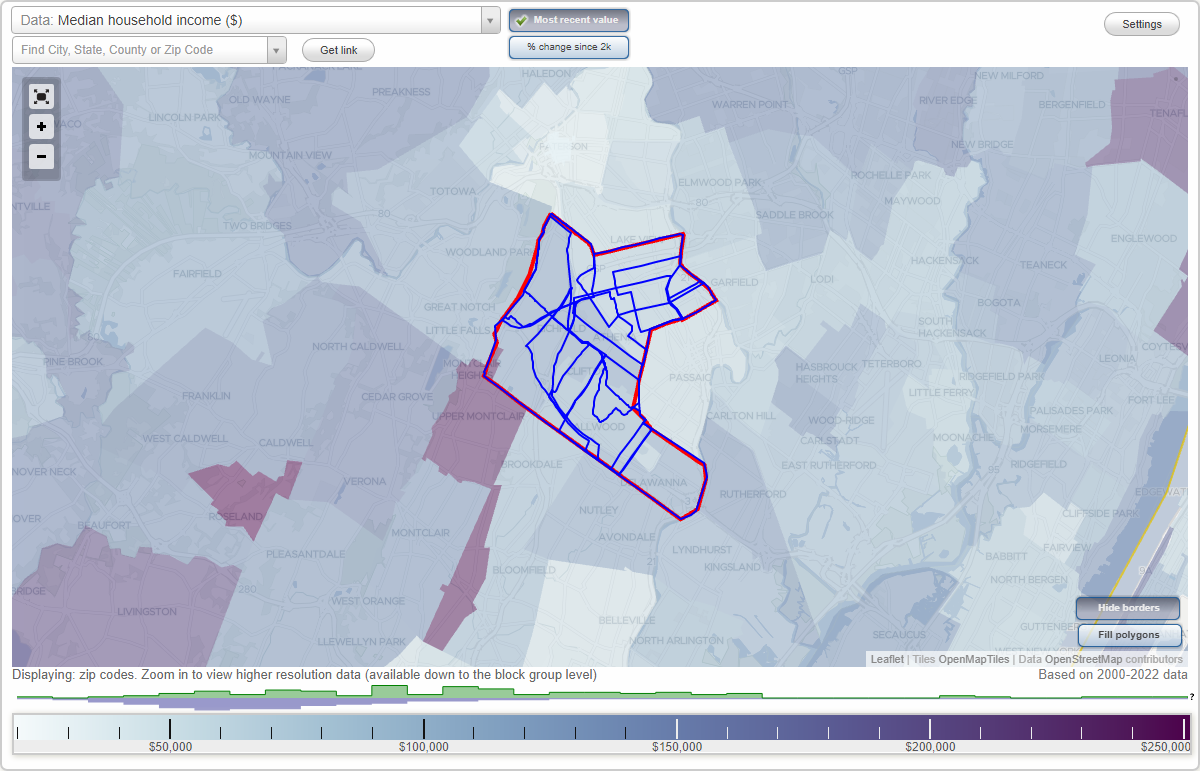
Clifton, New Jersey Neighborhood Map - Income, House Prices, Occupations, Boundaries
Settings
X

- City boundary
- Neighborhood boundaries
Business Search - 14 Million verified businesses
Neighborhoods:
Albion, Allwood, Athenia, Botany Village, Delawanna, Downtown, Dutch Hill, Lakeview, Maple Valley, Montclair Heights, Richfield, RosemawrAlbion neighborhood in Clifton statistics: (Find on map)
Area: 1.572 square miles
Population: 11,940
Population density:
Median household income in 2021:
Median rent in in 2021:
Male vs Females
Median age
Housing prices:
Average estimated value of detached houses in 2021 (51.7% of all units):
Average estimated value of housing units in 2-unit structures in 2021 (19.0% of all units):
Most popular occupations of males: management occupations (except farmers) (14.1%); sales and office occupations (11.0%); construction, extraction, and maintenance occupations (10.8%); production occupations (9.9%); transportation occupations (8.6%); arts, design, entertainment, sports, and media occupations (5.7%); business and financial operations occupations (5.4%)
Most popular occupations of females: sales and office occupations (38.6%); education, training, and library occupations (15.8%); service occupations (13.0%); healthcare practitioners and technical occupations (9.3%); material moving occupations (5.0%); computer and mathematical occupations (4.3%); management occupations (except farmers) (3.7%)
Highways in this neighborhood: Garden State Pkwy; State Rte 19; US Hwy 46; Broad St (State Rte 509).
Roads and streets: Hazel St (Passaic County 702); Valley Rd (Passaic County 621); Van Houten Ave (Passaic County 614); Kuller Rd; Maplewood Rd (Maplewood Ave); Edison St; Livingston St; Grove St; Elmwood Dr; Silleck St; Abbe Ln; Circle Ave; Mountainview Dr; Nelson St; Warren St; John St; Stanley St; Fenner Ave; Rutgers Pl; Bender Dr; Belgrade Ave; Ploch Rd; Dumont Ave; Lockwood Dr; Mount Washington Dr; Fordham Rd; Cathay Rd; Concord St; Tristan Rd; Claverack Rd; Gillies St; Emerson St; Sherwood St; Mountain Park Rd; Mountainside Ter; Stuyvesant Ct; Garrabrant Rd; E Emerson St; Graham Pl; Gould St; Karen Dr; Walman Ave; Thomas St; Gourley Ave; Henoch Ave; Tufts Rd; Lambert Ave; Martindale Rd; Edwards Ct; Trella Ter; Van Wagoner Ave; Taylor St; Dewey St (Dewey Ave); Serven Pl; Adams St; Prospect St; Frederick Ave; Norwood Ave (Norwood St); Wiedemann Ave; Montclair Ave; Homestead St; Inwood St; Degraw Ave; Mandeville Ave; Norman Ave; Florence Dr; Hazelview St (Hazelview Ave); Kashey St; Colfax Ave; View Pl; Mayfair Pl; Chestnut St; Bart Pl; Jerome Dr; Summit Ave; Passaic County 618; Harold Pl; Eldridge St; Butler St; Ferris Dr; Vale Ave; Louis Dr; Coppola Ct; Richmond St; Hamil Ct; Fitzgerald Ave; Chambers Ct; Brower Ave; Rodgers Pl; Paranya Ct; Ridge Ter; Ivy Ct; Seton Ln; Pond St; Sedeyen Ct; Everson Pl; Brannon Ct; Bobbink Ct; Skyview Ter; Garret Ct; Atkins Ct; Ravine Ct; Breen Ct; Tremont Pl; Passaic County 623; Rollins Ave; Layton Dr; 7th Ave.
Railroad features: Conrail RR.
Other features: Weasel Brk.
Albion neighborhood detailed profile
Area: 1.572 square miles
Population: 11,940
Population density:
| Albion (Albion Place): | 7,593 people per square mile |
| Clifton: | 7,913 people per square mile |
Median household income in 2021:
| Albion (Albion Place): | $97,423 |
| Clifton: | $81,857 |
Median rent in in 2021:
| Albion (Albion Place): | $1,565 |
| Clifton: | $1,479 |
Male vs Females
| Males: | 5,685 |
| Females: | 6,255 |
Median age
| Males: | 44.0 years |
| Females: | 47.2 years |
Housing prices:
Average estimated value of detached houses in 2021 (51.7% of all units):
| Albion (Albion Place): | $382,831 |
| New Jersey: | $482,322 |
Average estimated value of housing units in 2-unit structures in 2021 (19.0% of all units):
| This neighborhood: | $251,869 |
| New Jersey: | $412,131 |
Most popular occupations of males: management occupations (except farmers) (14.1%); sales and office occupations (11.0%); construction, extraction, and maintenance occupations (10.8%); production occupations (9.9%); transportation occupations (8.6%); arts, design, entertainment, sports, and media occupations (5.7%); business and financial operations occupations (5.4%)
Most popular occupations of females: sales and office occupations (38.6%); education, training, and library occupations (15.8%); service occupations (13.0%); healthcare practitioners and technical occupations (9.3%); material moving occupations (5.0%); computer and mathematical occupations (4.3%); management occupations (except farmers) (3.7%)
Highways in this neighborhood: Garden State Pkwy; State Rte 19; US Hwy 46; Broad St (State Rte 509).
Roads and streets: Hazel St (Passaic County 702); Valley Rd (Passaic County 621); Van Houten Ave (Passaic County 614); Kuller Rd; Maplewood Rd (Maplewood Ave); Edison St; Livingston St; Grove St; Elmwood Dr; Silleck St; Abbe Ln; Circle Ave; Mountainview Dr; Nelson St; Warren St; John St; Stanley St; Fenner Ave; Rutgers Pl; Bender Dr; Belgrade Ave; Ploch Rd; Dumont Ave; Lockwood Dr; Mount Washington Dr; Fordham Rd; Cathay Rd; Concord St; Tristan Rd; Claverack Rd; Gillies St; Emerson St; Sherwood St; Mountain Park Rd; Mountainside Ter; Stuyvesant Ct; Garrabrant Rd; E Emerson St; Graham Pl; Gould St; Karen Dr; Walman Ave; Thomas St; Gourley Ave; Henoch Ave; Tufts Rd; Lambert Ave; Martindale Rd; Edwards Ct; Trella Ter; Van Wagoner Ave; Taylor St; Dewey St (Dewey Ave); Serven Pl; Adams St; Prospect St; Frederick Ave; Norwood Ave (Norwood St); Wiedemann Ave; Montclair Ave; Homestead St; Inwood St; Degraw Ave; Mandeville Ave; Norman Ave; Florence Dr; Hazelview St (Hazelview Ave); Kashey St; Colfax Ave; View Pl; Mayfair Pl; Chestnut St; Bart Pl; Jerome Dr; Summit Ave; Passaic County 618; Harold Pl; Eldridge St; Butler St; Ferris Dr; Vale Ave; Louis Dr; Coppola Ct; Richmond St; Hamil Ct; Fitzgerald Ave; Chambers Ct; Brower Ave; Rodgers Pl; Paranya Ct; Ridge Ter; Ivy Ct; Seton Ln; Pond St; Sedeyen Ct; Everson Pl; Brannon Ct; Bobbink Ct; Skyview Ter; Garret Ct; Atkins Ct; Ravine Ct; Breen Ct; Tremont Pl; Passaic County 623; Rollins Ave; Layton Dr; 7th Ave.
Railroad features: Conrail RR.
Other features: Weasel Brk.
Albion neighborhood detailed profile
Allwood neighborhood in Clifton statistics: (Find on map)
Area: 2.030 square miles
Population: 14,160
Population density:
Median household income in 2021:
Median rent in in 2021:
Male vs Females
Median age
Housing prices:
Average estimated value of detached houses in 2021 (55.0% of all units):
Average estimated value of townhouses or other attached units in 2021 (4.0% of all units):
Average estimated value of housing units in 2-unit structures in 2021 (5.5% of all units):
Average estimated '21 value of housing units in 5-or-more-unit structures (18.1% of all units):
Most popular occupations of males: management occupations (except farmers) (13.9%); sales and office occupations (12.4%); service occupations (9.9%); construction, extraction, and maintenance occupations (9.2%); material moving occupations (8.0%); architecture and engineering occupations (7.4%); computer and mathematical occupations (6.1%)
Most popular occupations of females: sales and office occupations (27.8%); service occupations (15.2%); education, training, and library occupations (15.1%); management occupations (except farmers) (11.3%); healthcare practitioners and technical occupations (7.8%); business and financial operations occupations (7.4%); legal occupations (3.2%)
Railroad features: Erie-Lackawanna RR.
Highways in this neighborhood: State Rte 3; Clifton Ave (State Rte 161).
Roads and streets: Allwood Rd (Passaic County 602); Bloomfield Ave; Brighton Rd; Mount Prospect Ave; Passaic Ave; Dwasline Rd (Dwas Line Rd); Passaic County 602 N; Rowland Ave; Mayer Dr; Scoles Ave; Beverly Hill Rd; Edgewood Ave; Cresthill Ave; Saint Andrews Blvd; Oakridge Rd; Harrington Rd; Allwood Pl; Orchard Dr; Brookwood Rd; Chelsea Rd; Market St; Richfield Ter; Merrill Rd; Virginia Ave; Susan Ct; Ridgewood Rd; Parson Rd; Barnsdale Rd; Sycamore Rd; Hutton Rd; Donna Dr; Luisser St; Surrey Ln; Addison Pl; Hemlock St; Lyall Rd; Ardmore Ave; Nugent Dr; Hepburn Rd; Harvey Rd; Morris Rd; Hampton Rd; Heights Rd; Richfield Ct; Fenlon Blvd; Somerset Pl; Woodridge Rd; Braun Pl; Ravona St; Lehigh Ave; Belmont Ave; Lenox Ave; St James Pl; Burlington Rd; Shafto St; Englewood Rd; New Brier Ln; Windsor Rd; Sussex Rd; Summit Rd; Marlboro Rd; Bennington Ct; Laurel Ave; Cottage Ln; Olga B Ter; Lorraine Dr; Alvin Ct; Hackberry Pl; Lockwood Pl; Glen Oaks Ct; Collura Ln; Webro Rd; Meadow Ln; Industrial E; Industrial W; South Pkwy; Winding Way; Garfield Ave; Princeton Pl; Kowal St; Hooyman Dr; McClelland Way; Dianne Ct; Water St; Hamas St; Miller Plz; Hilltop Ct; Holly St; Peru Rd; Page Rd; Clairmont Rd; Samworth Rd; Knoll Pl (Knoll Rd); West Pkwy; Woodward Ave; Cathedral Ave; Gerald Ave; Ward Ave; Hugo St; Woods End Rd; Phyllis Pl; Jacklin Ct; Styertown Rd; Ellsworth St; Station St; Colin Ave; Kenter Rd (Kenter Pl); Thornton Pl; Chanda Ct; Combee Ln; Niader Ct; Book Ct; Mineral Spring Ave; Loumar Pl; Short Hill Rd; Allwood Access Rd; Greenbrier Ct; Pinebrae Ln; Rosemawr Pl; East Pkwy; Zeim Dr; Lydia Pl; Joyce Ln; Scharg Ct; Passaic County 602; Frost Ct; Garden Ct; Champlin Ct; W Pkwy; Lowry Ct; Cross St; Roy Ct; Passaic County 622; Oakwood Ct; Tyler Ct; Industrial S; Miller Ct; The Meadows; Gail Ct; Sunnycrest Ave.
Railroad features: Conrail RR.
Allwood neighborhood detailed profile
Area: 2.030 square miles
Population: 14,160
Population density:
| Allwood: | 6,976 people per square mile |
| Clifton: | 7,913 people per square mile |
Median household income in 2021:
| Allwood: | $118,237 |
| Clifton: | $81,857 |
Median rent in in 2021:
| Allwood: | $1,484 |
| Clifton: | $1,479 |
Male vs Females
| Males: | 6,935 |
| Females: | 7,224 |
Median age
| Males: | 43.1 years |
| Females: | 43.4 years |
Housing prices:
Average estimated value of detached houses in 2021 (55.0% of all units):
| Allwood: | $357,158 |
| New Jersey: | $482,322 |
Average estimated value of townhouses or other attached units in 2021 (4.0% of all units):
| This neighborhood: | $324,868 |
| New Jersey: | $337,140 |
Average estimated value of housing units in 2-unit structures in 2021 (5.5% of all units):
| This neighborhood: | $377,070 |
| New Jersey: | $412,131 |
Average estimated '21 value of housing units in 5-or-more-unit structures (18.1% of all units):
| Allwood: | $228,685 |
| New Jersey: | $343,430 |
Most popular occupations of males: management occupations (except farmers) (13.9%); sales and office occupations (12.4%); service occupations (9.9%); construction, extraction, and maintenance occupations (9.2%); material moving occupations (8.0%); architecture and engineering occupations (7.4%); computer and mathematical occupations (6.1%)
Most popular occupations of females: sales and office occupations (27.8%); service occupations (15.2%); education, training, and library occupations (15.1%); management occupations (except farmers) (11.3%); healthcare practitioners and technical occupations (7.8%); business and financial operations occupations (7.4%); legal occupations (3.2%)
Railroad features: Erie-Lackawanna RR.
Highways in this neighborhood: State Rte 3; Clifton Ave (State Rte 161).
Roads and streets: Allwood Rd (Passaic County 602); Bloomfield Ave; Brighton Rd; Mount Prospect Ave; Passaic Ave; Dwasline Rd (Dwas Line Rd); Passaic County 602 N; Rowland Ave; Mayer Dr; Scoles Ave; Beverly Hill Rd; Edgewood Ave; Cresthill Ave; Saint Andrews Blvd; Oakridge Rd; Harrington Rd; Allwood Pl; Orchard Dr; Brookwood Rd; Chelsea Rd; Market St; Richfield Ter; Merrill Rd; Virginia Ave; Susan Ct; Ridgewood Rd; Parson Rd; Barnsdale Rd; Sycamore Rd; Hutton Rd; Donna Dr; Luisser St; Surrey Ln; Addison Pl; Hemlock St; Lyall Rd; Ardmore Ave; Nugent Dr; Hepburn Rd; Harvey Rd; Morris Rd; Hampton Rd; Heights Rd; Richfield Ct; Fenlon Blvd; Somerset Pl; Woodridge Rd; Braun Pl; Ravona St; Lehigh Ave; Belmont Ave; Lenox Ave; St James Pl; Burlington Rd; Shafto St; Englewood Rd; New Brier Ln; Windsor Rd; Sussex Rd; Summit Rd; Marlboro Rd; Bennington Ct; Laurel Ave; Cottage Ln; Olga B Ter; Lorraine Dr; Alvin Ct; Hackberry Pl; Lockwood Pl; Glen Oaks Ct; Collura Ln; Webro Rd; Meadow Ln; Industrial E; Industrial W; South Pkwy; Winding Way; Garfield Ave; Princeton Pl; Kowal St; Hooyman Dr; McClelland Way; Dianne Ct; Water St; Hamas St; Miller Plz; Hilltop Ct; Holly St; Peru Rd; Page Rd; Clairmont Rd; Samworth Rd; Knoll Pl (Knoll Rd); West Pkwy; Woodward Ave; Cathedral Ave; Gerald Ave; Ward Ave; Hugo St; Woods End Rd; Phyllis Pl; Jacklin Ct; Styertown Rd; Ellsworth St; Station St; Colin Ave; Kenter Rd (Kenter Pl); Thornton Pl; Chanda Ct; Combee Ln; Niader Ct; Book Ct; Mineral Spring Ave; Loumar Pl; Short Hill Rd; Allwood Access Rd; Greenbrier Ct; Pinebrae Ln; Rosemawr Pl; East Pkwy; Zeim Dr; Lydia Pl; Joyce Ln; Scharg Ct; Passaic County 602; Frost Ct; Garden Ct; Champlin Ct; W Pkwy; Lowry Ct; Cross St; Roy Ct; Passaic County 622; Oakwood Ct; Tyler Ct; Industrial S; Miller Ct; The Meadows; Gail Ct; Sunnycrest Ave.
Railroad features: Conrail RR.
Allwood neighborhood detailed profile
Athenia neighborhood in Clifton statistics: (Find on map)
Area: 1.817 square miles
Population: 14,259
Population density:
Median household income in 2021:
Median rent in in 2021:
Male vs Females
Median age
Housing prices:
Average estimated value of detached houses in 2021 (36.9% of all units):
Average estimated value of housing units in 2-unit structures in 2021 (24.0% of all units):
Most popular occupations of males: sales and office occupations (21.3%); management occupations (except farmers) (15.4%); transportation occupations (11.3%); service occupations (9.4%); architecture and engineering occupations (7.7%); production occupations (6.9%); business and financial operations occupations (4.0%)
Most popular occupations of females: sales and office occupations (25.4%); business and financial operations occupations (16.1%); service occupations (14.1%); healthcare practitioners and technical occupations (9.5%); management occupations (except farmers) (9.1%); education, training, and library occupations (8.9%); computer and mathematical occupations (4.0%)
Highways in this neighborhood: US Hwy 46; Garden State Pkwy; Broad St (State Rte 509); Piaget Ave (US Hwy 46).
Roads and streets: Van Houten Ave (Passaic County 614); Paulison Ave; Colfax Ave; Clifton Blvd; Bloomfield Ave; Passaic County 611 (Clifton Ave); Speer Ave; Rowland Ave; Martin Ave; Scoles Ave; Mayer Dr; Sargeant Ave; Brighton Rd; Dawson Ave; Huron Ave; Wonham St; Fornelius Ave; Katherine Ave; Athenia Ave; Major St; Orono St; Luddington Ave; Mount Prospect Ave; Lizenbold Dr; 7th St; la Salle Ave (Lasalle Ave); Penobscot St; Campbell Ave; Hawthorne Ave; Washington Ave; Alfred St; Wesley St; Marconi St; Spencer Ave; Howard Ave; Union Ave; 6th St; Monhegan St; Cloverdale Rd; Lincoln Ave; Hobart Pl; Greentree Rd; Elm St; Liberty St; Harding Ave; Van Breeman Dr; Jewett Ave; Dick St; Shafto St; Althea St; Ellsworth St; Sipp Ave; Karen Dr; Somerset Pl; Renaissance Dr; Samuel Ave; Willett St; Martindale Rd; Strangeway Ter; Harcourt Rd; Hudson St; Viola Ave; Lorraine Dr; Madison Ave; Demott Ave; Clinton Ave; Passaic County 622 (Broadway); Emma Pl; Marrion St; George Russell Way; Webro Rd; Grunwald St; Sade St; Svea Ave; Whiteweld Ter; Orange Ave; Kennebec St; Collura Ln; McClelland Way; Highland Ave; Henry St; Machias St; Sanford St; Helen Pl; Comfort Pl; Lisbon St; Byron Pl; Spring St; Bowdoin St; Pleasant Ave; Macdonald St; Page Rd; Orchard St; Twain Pl; Milton Ave; Kenyon St; Brittany Ct; Sebago St; Sussex St; Delaware St; Parkway Ave; Scales Plz; Barkley Ave; Rose St; Belrose Ct; Waldo St; Gilbert Pl; Kruger Ct; Walnut St; Park Dr; Ladwik Ln; Josh Ct; Orth Ave; Clifton Ter; Irvington Pl; Hillcrest Ave; Kathryn St; Clair St; Chaytor St; Pershing Rd; Ball Ave; Ann St; Lewis Pl; Prospect Pl; Linden St; Saco St; Bird Ave; Century Pl; Jaskot Ln; Lydia Pl; Grandview Pl; Cambridge Blvd; Helen St; Underwood Pl; Seton Ln; Ravencroft Rd; Pond St; Green Meadow Ln; Sedeyen Ct; Wickham Ter; Dovenshire Dr; Carrington Pl; Kip St; Sago St; Tremont Pl; Winchester Ct; Burwood Rd; Dan St; Barrister Ct; Allwood Pl; Brighton Ave; Devonshire Dr.
Railroad features: Conrail RR.
Other features: Weasel Brk; Plog Brk.
Athenia neighborhood detailed profile
Area: 1.817 square miles
Population: 14,259
Population density:
| Athenia: | 7,849 people per square mile |
| Clifton: | 7,913 people per square mile |
Median household income in 2021:
| Athenia: | $89,343 |
| Clifton: | $81,857 |
Median rent in in 2021:
| Athenia: | $1,434 |
| Clifton: | $1,479 |
Male vs Females
| Males: | 6,419 |
| Females: | 7,840 |
Median age
| Males: | 43.6 years |
| Females: | 46.9 years |
Housing prices:
Average estimated value of detached houses in 2021 (36.9% of all units):
| Athenia: | $339,933 |
| New Jersey: | $482,322 |
Average estimated value of housing units in 2-unit structures in 2021 (24.0% of all units):
| This neighborhood: | $235,144 |
| New Jersey: | $412,131 |
Most popular occupations of males: sales and office occupations (21.3%); management occupations (except farmers) (15.4%); transportation occupations (11.3%); service occupations (9.4%); architecture and engineering occupations (7.7%); production occupations (6.9%); business and financial operations occupations (4.0%)
Most popular occupations of females: sales and office occupations (25.4%); business and financial operations occupations (16.1%); service occupations (14.1%); healthcare practitioners and technical occupations (9.5%); management occupations (except farmers) (9.1%); education, training, and library occupations (8.9%); computer and mathematical occupations (4.0%)
Highways in this neighborhood: US Hwy 46; Garden State Pkwy; Broad St (State Rte 509); Piaget Ave (US Hwy 46).
Roads and streets: Van Houten Ave (Passaic County 614); Paulison Ave; Colfax Ave; Clifton Blvd; Bloomfield Ave; Passaic County 611 (Clifton Ave); Speer Ave; Rowland Ave; Martin Ave; Scoles Ave; Mayer Dr; Sargeant Ave; Brighton Rd; Dawson Ave; Huron Ave; Wonham St; Fornelius Ave; Katherine Ave; Athenia Ave; Major St; Orono St; Luddington Ave; Mount Prospect Ave; Lizenbold Dr; 7th St; la Salle Ave (Lasalle Ave); Penobscot St; Campbell Ave; Hawthorne Ave; Washington Ave; Alfred St; Wesley St; Marconi St; Spencer Ave; Howard Ave; Union Ave; 6th St; Monhegan St; Cloverdale Rd; Lincoln Ave; Hobart Pl; Greentree Rd; Elm St; Liberty St; Harding Ave; Van Breeman Dr; Jewett Ave; Dick St; Shafto St; Althea St; Ellsworth St; Sipp Ave; Karen Dr; Somerset Pl; Renaissance Dr; Samuel Ave; Willett St; Martindale Rd; Strangeway Ter; Harcourt Rd; Hudson St; Viola Ave; Lorraine Dr; Madison Ave; Demott Ave; Clinton Ave; Passaic County 622 (Broadway); Emma Pl; Marrion St; George Russell Way; Webro Rd; Grunwald St; Sade St; Svea Ave; Whiteweld Ter; Orange Ave; Kennebec St; Collura Ln; McClelland Way; Highland Ave; Henry St; Machias St; Sanford St; Helen Pl; Comfort Pl; Lisbon St; Byron Pl; Spring St; Bowdoin St; Pleasant Ave; Macdonald St; Page Rd; Orchard St; Twain Pl; Milton Ave; Kenyon St; Brittany Ct; Sebago St; Sussex St; Delaware St; Parkway Ave; Scales Plz; Barkley Ave; Rose St; Belrose Ct; Waldo St; Gilbert Pl; Kruger Ct; Walnut St; Park Dr; Ladwik Ln; Josh Ct; Orth Ave; Clifton Ter; Irvington Pl; Hillcrest Ave; Kathryn St; Clair St; Chaytor St; Pershing Rd; Ball Ave; Ann St; Lewis Pl; Prospect Pl; Linden St; Saco St; Bird Ave; Century Pl; Jaskot Ln; Lydia Pl; Grandview Pl; Cambridge Blvd; Helen St; Underwood Pl; Seton Ln; Ravencroft Rd; Pond St; Green Meadow Ln; Sedeyen Ct; Wickham Ter; Dovenshire Dr; Carrington Pl; Kip St; Sago St; Tremont Pl; Winchester Ct; Burwood Rd; Dan St; Barrister Ct; Allwood Pl; Brighton Ave; Devonshire Dr.
Railroad features: Conrail RR.
Other features: Weasel Brk; Plog Brk.
Athenia neighborhood detailed profile
Botany Village neighborhood in Clifton statistics: (Find on map)
Area: 0.311 square miles
Population: 7,303
Population density:
Median household income in 2021:
Median rent in in 2021:
Male vs Females
Median age
Housing prices:
Average estimated value of detached houses in 2021 (14.8% of all units):
Average estimated value of housing units in 2-unit structures in 2021 (52.0% of all units):
Most popular occupations of males: service occupations (16.7%); production occupations (16.1%); material moving occupations (12.2%); sales and office occupations (10.6%); management occupations (except farmers) (9.7%); transportation occupations (7.0%); construction, extraction, and maintenance occupations (6.5%)
Most popular occupations of females: sales and office occupations (36.0%); service occupations (25.3%); production occupations (8.6%); material moving occupations (7.1%); arts, design, entertainment, sports, and media occupations (5.2%); business and financial operations occupations (4.9%); healthcare practitioners and technical occupations (4.5%)
Highways in this neighborhood: State Rte 21.
Roads and streets: Ackerman Ave; Highland Ave; Clifton Ave (Passaic County 611); Lake Ave (Village Sq E); Center St; Passaic County 625 (Lexington Ave); Randolph Ave; Parker Ave; Cutler St; Arthur St; Mahar Ave; Harrison Pl; Van Cleve Ave; Sherman Pl; Cheever Ave; Dayton Ave; Sears Pl; Holden St; Milosh St; Lincoln Pl; Russell St; Hope Ave; Whitmore Pl; Exchange Pl (Exchange Ave); Durant Ave; James St; Davidson Ave (Davidson St); Van Winkle Ave; Whitmore St; Loretta St (Loretta Pl); Unicorn Way; Wisnev St; Varettoni Pl (Botany Pl); Scribner Pl.
Other features: Weasel Brk.
Other features: Dundee Cnl.
Botany Village neighborhood detailed profile
Area: 0.311 square miles
Population: 7,303
Population density:
| Botany Village (Botany District): | 23,507 people per square mile |
| Clifton: | 7,913 people per square mile |
Median household income in 2021:
| Botany Village (Botany District): | $57,669 |
| Clifton: | $81,857 |
Median rent in in 2021:
| Botany Village (Botany District): | $1,205 |
| Clifton: | $1,479 |
Male vs Females
| Males: | 3,415 |
| Females: | 3,887 |
Median age
| Males: | 35.6 years |
| Females: | 36.9 years |
Housing prices:
Average estimated value of detached houses in 2021 (14.8% of all units):
| Botany Village (Botany District): | $419,286 |
| New Jersey: | $482,322 |
Average estimated value of housing units in 2-unit structures in 2021 (52.0% of all units):
| This neighborhood: | $346,761 |
| New Jersey: | $412,131 |
Most popular occupations of males: service occupations (16.7%); production occupations (16.1%); material moving occupations (12.2%); sales and office occupations (10.6%); management occupations (except farmers) (9.7%); transportation occupations (7.0%); construction, extraction, and maintenance occupations (6.5%)
Most popular occupations of females: sales and office occupations (36.0%); service occupations (25.3%); production occupations (8.6%); material moving occupations (7.1%); arts, design, entertainment, sports, and media occupations (5.2%); business and financial operations occupations (4.9%); healthcare practitioners and technical occupations (4.5%)
Highways in this neighborhood: State Rte 21.
Roads and streets: Ackerman Ave; Highland Ave; Clifton Ave (Passaic County 611); Lake Ave (Village Sq E); Center St; Passaic County 625 (Lexington Ave); Randolph Ave; Parker Ave; Cutler St; Arthur St; Mahar Ave; Harrison Pl; Van Cleve Ave; Sherman Pl; Cheever Ave; Dayton Ave; Sears Pl; Holden St; Milosh St; Lincoln Pl; Russell St; Hope Ave; Whitmore Pl; Exchange Pl (Exchange Ave); Durant Ave; James St; Davidson Ave (Davidson St); Van Winkle Ave; Whitmore St; Loretta St (Loretta Pl); Unicorn Way; Wisnev St; Varettoni Pl (Botany Pl); Scribner Pl.
Other features: Weasel Brk.
Other features: Dundee Cnl.
Botany Village neighborhood detailed profile
Delawanna neighborhood in Clifton statistics: (Find on map)
Area: 1.645 square miles
Population: 5,337
Population density:
Median household income in 2021:
Median rent in in 2021:
Male vs Females
Median age
Housing prices:
Average estimated value of detached houses in 2021 (42.7% of all units):
Average estimated value of townhouses or other attached units in 2021 (18.3% of all units):
Average estimated value of housing units in 2-unit structures in 2021 (24.5% of all units):
Average estimated '21 value of housing units in 5-or-more-unit structures (10.1% of all units):
Most popular occupations of males: sales and office occupations (16.8%); business and financial operations occupations (15.4%); education, training, and library occupations (10.2%); service occupations (10.2%); management occupations (except farmers) (8.4%); transportation occupations (6.3%); computer and mathematical occupations (5.8%)
Most popular occupations of females: sales and office occupations (23.7%); service occupations (17.3%); education, training, and library occupations (13.0%); business and financial operations occupations (12.3%); management occupations (except farmers) (9.8%); production occupations (7.0%); healthcare practitioners and technical occupations (6.7%)
Roads and streets: Robert St; River Rd.
Highways in this neighborhood: State Rte 3; State Rte 21.
Roads and streets: River Rd; South Pkwy; Main Ave (Passaic County 601); Delawanna Ave; Rutherford Blvd; Passaic Ave; Passaic County 602 (Allwood Rd); Fenlon Blvd; Entin Rd; Kingsland Rd; Patricia Pl; Myrtle Ave; William St; Princeton St; Dwasline Rd (Dwas Line Rd); Kingsland Ave; Water St; Ward Ave; Oak St; Linden Ave; Bridewell Pl; Cherry St; Ardmore Ave; Davan Rd; Lorrie Ln; Paterson Ave; Lehigh Ave; Belmont Ave; Lenox Ave; High St; Hollywood Ave; River Dr; Frances St; Myron St; Homer St; Dyer Ave; Annabelle Ave; Kensington Ave; Hall St; Ruth Ave; Lois Ave; Princeton Pl; Evergreen Dr; Autumn St; Robert St; Jefferson St; Carol St; Century Dr; Timber Dr; West Pkwy; Cathedral Ave; Peekay Dr; Pennington Ave; Johnson St; Park Ave; Hughes St; Essex St; Wicker St; Wheeler St; Spruce Ct; Swift Ct; Boll St; Colin Ave; Ringsland Ave; Colorado St; Conover Pl (Conover Ct); Filmore St; Toth Ct; Juniper Ct; Clay St; Nettie Pl; Evergreen Condos; East Pkwy; Balsam Ct; Cedar Pl; Beech St; Stanchak Ct; Wanda Ct; Pine St; Blanjen Ter; Austin Pl; Terrace Ave; Walnut St; Riverwalk Way (Pebble Brook Dr); Hillsdale Ave; Cambridge Ct; Anton St; Raymond Pl; Pavan Ave.
Railroad features: Conrail RR.
Other features: 3rd Riv; Yantacaw Riv.
Delawanna neighborhood detailed profile
Area: 1.645 square miles
Population: 5,337
Population density:
| Delawanna: | 3,244 people per square mile |
| Clifton: | 7,913 people per square mile |
Median household income in 2021:
| Delawanna: | $129,353 |
| Clifton: | $81,857 |
Median rent in in 2021:
| Delawanna: | $1,604 |
| Clifton: | $1,479 |
Male vs Females
| Males: | 2,861 |
| Females: | 2,476 |
Median age
| Males: | 42.6 years |
| Females: | 42.7 years |
Housing prices:
Average estimated value of detached houses in 2021 (42.7% of all units):
| Delawanna: | $389,596 |
| New Jersey: | $482,322 |
Average estimated value of townhouses or other attached units in 2021 (18.3% of all units):
| This neighborhood: | $324,868 |
| New Jersey: | $337,140 |
Average estimated value of housing units in 2-unit structures in 2021 (24.5% of all units):
| This neighborhood: | $377,070 |
| New Jersey: | $412,131 |
Average estimated '21 value of housing units in 5-or-more-unit structures (10.1% of all units):
| Delawanna: | $282,800 |
| New Jersey: | $343,430 |
Most popular occupations of males: sales and office occupations (16.8%); business and financial operations occupations (15.4%); education, training, and library occupations (10.2%); service occupations (10.2%); management occupations (except farmers) (8.4%); transportation occupations (6.3%); computer and mathematical occupations (5.8%)
Most popular occupations of females: sales and office occupations (23.7%); service occupations (17.3%); education, training, and library occupations (13.0%); business and financial operations occupations (12.3%); management occupations (except farmers) (9.8%); production occupations (7.0%); healthcare practitioners and technical occupations (6.7%)
Roads and streets: Robert St; River Rd.
Highways in this neighborhood: State Rte 3; State Rte 21.
Roads and streets: River Rd; South Pkwy; Main Ave (Passaic County 601); Delawanna Ave; Rutherford Blvd; Passaic Ave; Passaic County 602 (Allwood Rd); Fenlon Blvd; Entin Rd; Kingsland Rd; Patricia Pl; Myrtle Ave; William St; Princeton St; Dwasline Rd (Dwas Line Rd); Kingsland Ave; Water St; Ward Ave; Oak St; Linden Ave; Bridewell Pl; Cherry St; Ardmore Ave; Davan Rd; Lorrie Ln; Paterson Ave; Lehigh Ave; Belmont Ave; Lenox Ave; High St; Hollywood Ave; River Dr; Frances St; Myron St; Homer St; Dyer Ave; Annabelle Ave; Kensington Ave; Hall St; Ruth Ave; Lois Ave; Princeton Pl; Evergreen Dr; Autumn St; Robert St; Jefferson St; Carol St; Century Dr; Timber Dr; West Pkwy; Cathedral Ave; Peekay Dr; Pennington Ave; Johnson St; Park Ave; Hughes St; Essex St; Wicker St; Wheeler St; Spruce Ct; Swift Ct; Boll St; Colin Ave; Ringsland Ave; Colorado St; Conover Pl (Conover Ct); Filmore St; Toth Ct; Juniper Ct; Clay St; Nettie Pl; Evergreen Condos; East Pkwy; Balsam Ct; Cedar Pl; Beech St; Stanchak Ct; Wanda Ct; Pine St; Blanjen Ter; Austin Pl; Terrace Ave; Walnut St; Riverwalk Way (Pebble Brook Dr); Hillsdale Ave; Cambridge Ct; Anton St; Raymond Pl; Pavan Ave.
Railroad features: Conrail RR.
Other features: 3rd Riv; Yantacaw Riv.
Delawanna neighborhood detailed profile
Downtown neighborhood in Clifton statistics: (Find on map)
Area: 0.949 square miles
Population: 13,403
Population density:
Median household income in 2021:
Median rent in in 2021:
Male vs Females
Median age
Housing prices:
Average estimated value of detached houses in 2021 (30.0% of all units):
Average estimated value of townhouses or other attached units in 2021 (9.7% of all units):
Average estimated value of housing units in 2-unit structures in 2021 (45.4% of all units):
Most popular occupations of males: sales and office occupations (15.6%); production occupations (14.0%); service occupations (13.6%); transportation occupations (9.1%); construction, extraction, and maintenance occupations (7.7%); management occupations (except farmers) (6.7%); material moving occupations (5.6%)
Most popular occupations of females: sales and office occupations (31.5%); service occupations (24.7%); production occupations (12.1%); education, training, and library occupations (5.9%); management occupations (except farmers) (5.8%); business and financial operations occupations (5.6%); healthcare practitioners and technical occupations (4.3%)
Highways in this neighborhood: US Hwy 46; State Rte 21.
Roads and streets: Main Ave (Passaic County 601); Piaget Ave; Passaic County 625 (Lexington Ave); Getty Ave; E 9th St; Passaic County 611 (Clifton Ave); 3rd St; Merselis Ave; Passaic County 624 I (Lakeview Ave); Trimble Ave; Hadley Ave; Christie Ave; Madison Ave; 2nd St; Sheridan Ave; Bergen Ave; Sylvan Ave; E 11th St; Harding Ave; Union Ave; Clinton Ave; Barkley Ave; Hamilton Ave; Washington Ave; Demott Ave; Park Slope; Arlington Ave; Central Ave; 1st St; Howd Ave; Foster St; Vernon Ave; Maple Pl; Luddington Ave; Sewall Ave; Mina Ave; Rosalie Ave; Trenton Ave; Caroline Ave; Vreeland Ave; Wellington St; Russell St; Franklin Ave; Yereance Ave; Hillman St; Hilton St; Burgh Ave; Barrington Ave; McLean Blvd; Kulick St; E Madison Ave; Prescott Ave; Portland Ave; Garretsee Pl; Grace Ave; Alyea Ter; Troast Ct; Chester St; Wilson St; Putnam Pl; Brown Pl; Highpark Pl; Manila St; Elema Pl; 4th St; 5th St; Larson Ct; Fountain St; Haines Ave; Federal St; Louise St; E 8th St; Nash Ave; Ash St; Day St; Arlington Pl; Randall Ave.
Railroad features: Conrail RR.
Other features: Weasel Brk; Wabash Brk.
Downtown neighborhood detailed profile
Area: 0.949 square miles
Population: 13,403
Population density:
| Downtown (Clifton Downtown Business District): | 14,127 people per square mile |
| Clifton: | 7,913 people per square mile |
Median household income in 2021:
| Downtown (Clifton Downtown Business District): | $76,560 |
| Clifton: | $81,857 |
Median rent in in 2021:
| Downtown (Clifton Downtown Business District): | $1,366 |
| Clifton: | $1,479 |
Male vs Females
| Males: | 6,477 |
| Females: | 6,926 |
Median age
| Males: | 38.6 years |
| Females: | 37.3 years |
Housing prices:
Average estimated value of detached houses in 2021 (30.0% of all units):
| Downtown (Clifton Downtown Business District): | $385,361 |
| New Jersey: | $482,322 |
Average estimated value of townhouses or other attached units in 2021 (9.7% of all units):
| This neighborhood: | $333,582 |
| New Jersey: | $337,140 |
Average estimated value of housing units in 2-unit structures in 2021 (45.4% of all units):
| This neighborhood: | $336,314 |
| New Jersey: | $412,131 |
Most popular occupations of males: sales and office occupations (15.6%); production occupations (14.0%); service occupations (13.6%); transportation occupations (9.1%); construction, extraction, and maintenance occupations (7.7%); management occupations (except farmers) (6.7%); material moving occupations (5.6%)
Most popular occupations of females: sales and office occupations (31.5%); service occupations (24.7%); production occupations (12.1%); education, training, and library occupations (5.9%); management occupations (except farmers) (5.8%); business and financial operations occupations (5.6%); healthcare practitioners and technical occupations (4.3%)
Highways in this neighborhood: US Hwy 46; State Rte 21.
Roads and streets: Main Ave (Passaic County 601); Piaget Ave; Passaic County 625 (Lexington Ave); Getty Ave; E 9th St; Passaic County 611 (Clifton Ave); 3rd St; Merselis Ave; Passaic County 624 I (Lakeview Ave); Trimble Ave; Hadley Ave; Christie Ave; Madison Ave; 2nd St; Sheridan Ave; Bergen Ave; Sylvan Ave; E 11th St; Harding Ave; Union Ave; Clinton Ave; Barkley Ave; Hamilton Ave; Washington Ave; Demott Ave; Park Slope; Arlington Ave; Central Ave; 1st St; Howd Ave; Foster St; Vernon Ave; Maple Pl; Luddington Ave; Sewall Ave; Mina Ave; Rosalie Ave; Trenton Ave; Caroline Ave; Vreeland Ave; Wellington St; Russell St; Franklin Ave; Yereance Ave; Hillman St; Hilton St; Burgh Ave; Barrington Ave; McLean Blvd; Kulick St; E Madison Ave; Prescott Ave; Portland Ave; Garretsee Pl; Grace Ave; Alyea Ter; Troast Ct; Chester St; Wilson St; Putnam Pl; Brown Pl; Highpark Pl; Manila St; Elema Pl; 4th St; 5th St; Larson Ct; Fountain St; Haines Ave; Federal St; Louise St; E 8th St; Nash Ave; Ash St; Day St; Arlington Pl; Randall Ave.
Railroad features: Conrail RR.
Other features: Weasel Brk; Wabash Brk.
Downtown neighborhood detailed profile
Dutch Hill neighborhood in Clifton statistics: (Find on map)
Area: 1.603 square miles
Population: 18,780
Population density:
Median household income in 2021:
Median rent in in 2021:
Male vs Females
Median age
Housing prices:
Average estimated value of detached houses in 2021 (33.9% of all units):
Average estimated value of townhouses or other attached units in 2021 (12.6% of all units):
Average estimated value of housing units in 2-unit structures in 2021 (37.4% of all units):
Most popular occupations of males: sales and office occupations (17.7%); service occupations (13.9%); transportation occupations (11.0%); production occupations (10.9%); management occupations (except farmers) (8.6%); construction, extraction, and maintenance occupations (6.7%); architecture and engineering occupations (4.5%)
Most popular occupations of females: sales and office occupations (27.0%); service occupations (18.9%); business and financial operations occupations (9.9%); education, training, and library occupations (9.8%); production occupations (9.6%); management occupations (except farmers) (7.1%); healthcare practitioners and technical occupations (5.4%)
Highways in this neighborhood: Piaget Ave (US Hwy 46); US Hwy 46; Garden State Pkwy.
Roads and streets: Passaic County 611 (Clifton Ave); Paulison Ave; Clifton Blvd; Washington Ave; Union Ave; Colfax Ave; Harding Ave; Madison Ave; Luddington Ave; Demott Ave; Clinton Ave; Passaic County 625 (Lexington Ave); Passaic County 601 (Main Ave); 3rd St; Barkley Ave; Getty Ave; Lincoln Ave; 2nd St; Hadley Ave; 4th St; Sheridan Ave; Highland Ave; Sylvan Ave; Hamilton Ave; Passaic County 624 I (Lakeview Ave); Fornelius Ave; 7th St; Arlington Ave; 5th St; Gregory Ave; Hawthorne Ave; Central Ave; 1st St; Viola Ave; Rollins Ave; 6th St; Hobart Pl; Hudson St; Jewett Ave; Foster St; Bergen Ave; Maple Pl; Mina Ave; Rosalie Ave; Caroline Ave; Westervelt Pl; Strangeway Ter; Park Dr; Burgess Pl; Harcourt Rd; Russell St; Yereance Ave; Sisco Pl; Hillman St; Hammond Ave; Hilton St; Burgh Ave; George Russell Way; Barrington Ave; Svea Ave; Whiteweld Ter; Kulick St; E Madison Ave; Ward St; Prescott Ave; Sanford St; Helen Pl; Portland Ave; Comfort Pl; Byron Pl; Spring St; Garretsee Pl; Grace Ave; Alyea Ter; Elm St; Brittany Ct; Sussex St; Delaware St; Summer St; Montgomery St; Parkway Ave; Hazel St (Passaic County 702); Gilbert Pl; Wilson St; Putnam Pl; Federal St; Josh Ct; Clifton Ter; Parkview Ter; Chaytor St; Orchard St; Tromp St; Elema Pl; Lewis Pl; Prospect Pl; Linden St; Home Pl; Bird Ave; Grandview Pl; Larson Ct; Summit St; Cambridge Blvd; Passaic County 618; Fountain St; Short St; Martha Ave; Ravencroft Rd; Mount Prospect Ave; Penobscot St; Wickham Ter; Orono St; Dovenshire Dr; Carrington Pl; Ash St; Winchester Ct; Burwood Rd; Barrister Ct; Arlington Pl; Devonshire Dr.
Railroad features: Conrail RR.
Other features: Weasel Brk; Plog Brk.
Dutch Hill neighborhood detailed profile
Area: 1.603 square miles
Population: 18,780
Population density:
| Dutch Hill: | 11,717 people per square mile |
| Clifton: | 7,913 people per square mile |
Median household income in 2021:
| Dutch Hill: | $74,830 |
| Clifton: | $81,857 |
Median rent in in 2021:
| Dutch Hill: | $1,372 |
| Clifton: | $1,479 |
Male vs Females
| Males: | 8,973 |
| Females: | 9,806 |
Median age
| Males: | 40.0 years |
| Females: | 41.4 years |
Housing prices:
Average estimated value of detached houses in 2021 (33.9% of all units):
| Dutch Hill: | $373,365 |
| New Jersey: | $482,322 |
Average estimated value of townhouses or other attached units in 2021 (12.6% of all units):
| This neighborhood: | $333,582 |
| New Jersey: | $337,140 |
Average estimated value of housing units in 2-unit structures in 2021 (37.4% of all units):
| This neighborhood: | $306,758 |
| New Jersey: | $412,131 |
Most popular occupations of males: sales and office occupations (17.7%); service occupations (13.9%); transportation occupations (11.0%); production occupations (10.9%); management occupations (except farmers) (8.6%); construction, extraction, and maintenance occupations (6.7%); architecture and engineering occupations (4.5%)
Most popular occupations of females: sales and office occupations (27.0%); service occupations (18.9%); business and financial operations occupations (9.9%); education, training, and library occupations (9.8%); production occupations (9.6%); management occupations (except farmers) (7.1%); healthcare practitioners and technical occupations (5.4%)
Highways in this neighborhood: Piaget Ave (US Hwy 46); US Hwy 46; Garden State Pkwy.
Roads and streets: Passaic County 611 (Clifton Ave); Paulison Ave; Clifton Blvd; Washington Ave; Union Ave; Colfax Ave; Harding Ave; Madison Ave; Luddington Ave; Demott Ave; Clinton Ave; Passaic County 625 (Lexington Ave); Passaic County 601 (Main Ave); 3rd St; Barkley Ave; Getty Ave; Lincoln Ave; 2nd St; Hadley Ave; 4th St; Sheridan Ave; Highland Ave; Sylvan Ave; Hamilton Ave; Passaic County 624 I (Lakeview Ave); Fornelius Ave; 7th St; Arlington Ave; 5th St; Gregory Ave; Hawthorne Ave; Central Ave; 1st St; Viola Ave; Rollins Ave; 6th St; Hobart Pl; Hudson St; Jewett Ave; Foster St; Bergen Ave; Maple Pl; Mina Ave; Rosalie Ave; Caroline Ave; Westervelt Pl; Strangeway Ter; Park Dr; Burgess Pl; Harcourt Rd; Russell St; Yereance Ave; Sisco Pl; Hillman St; Hammond Ave; Hilton St; Burgh Ave; George Russell Way; Barrington Ave; Svea Ave; Whiteweld Ter; Kulick St; E Madison Ave; Ward St; Prescott Ave; Sanford St; Helen Pl; Portland Ave; Comfort Pl; Byron Pl; Spring St; Garretsee Pl; Grace Ave; Alyea Ter; Elm St; Brittany Ct; Sussex St; Delaware St; Summer St; Montgomery St; Parkway Ave; Hazel St (Passaic County 702); Gilbert Pl; Wilson St; Putnam Pl; Federal St; Josh Ct; Clifton Ter; Parkview Ter; Chaytor St; Orchard St; Tromp St; Elema Pl; Lewis Pl; Prospect Pl; Linden St; Home Pl; Bird Ave; Grandview Pl; Larson Ct; Summit St; Cambridge Blvd; Passaic County 618; Fountain St; Short St; Martha Ave; Ravencroft Rd; Mount Prospect Ave; Penobscot St; Wickham Ter; Orono St; Dovenshire Dr; Carrington Pl; Ash St; Winchester Ct; Burwood Rd; Barrister Ct; Arlington Pl; Devonshire Dr.
Railroad features: Conrail RR.
Other features: Weasel Brk; Plog Brk.
Dutch Hill neighborhood detailed profile
Lakeview neighborhood in Clifton statistics: (Find on map)
Area: 2.064 square miles
Population: 25,107
Population density:
Median household income in 2021:
Median rent in in 2021:
Male vs Females
Median age
Housing prices:
Average estimated value of detached houses in 2021 (38.4% of all units):
Average estimated value of townhouses or other attached units in 2021 (10.0% of all units):
Average estimated value of housing units in 2-unit structures in 2021 (36.8% of all units):
Average estimated '21 value of housing units in 3-to-4-unit structures (10.1% of all units):
Most popular occupations of males: service occupations (15.3%); sales and office occupations (14.9%); production occupations (12.9%); transportation occupations (12.0%); management occupations (except farmers) (8.5%); material moving occupations (5.3%); construction, extraction, and maintenance occupations (4.7%)
Most popular occupations of females: sales and office occupations (32.5%); service occupations (21.3%); education, training, and library occupations (9.2%); management occupations (except farmers) (7.5%); material moving occupations (6.9%); production occupations (5.5%); healthcare practitioners and technical occupations (5.2%)
Highways in this neighborhood: Garden State Pkwy; US Hwy 46; Piaget Ave (US Hwy 46); State Rte 21; State Rte 20.
Roads and streets: Clifton Ave (Passaic County 611); Crooks Ave (Passaic County 630); Passaic County 601 (Main Ave); Washington Ave; Union Ave; Harding Ave; Passaic County 624 I (Lakeview Ave); Getty Ave; E 1st St; E 4th St; Luddington Ave; E 6th St; Hazel St (Passaic County 702); Hamilton Ave; E 7th St; E 9th St; Barkley Ave; E 8th St; Lexington Ave (Passaic County 625); Lincoln Ave; Merselis Ave; Trimble Ave; Arlington Ave; Paulison Ave; Vernon Ave; 7th St; Christie Ave; Madeline Ave; Mahar Ave; Trenton Ave; W 2nd St; Park Slope; Knapp Ave; Randolph Ave; Bergen Ave; W 1st St; Van Riper Ave; E 2th St; E 3rd St; E 11th St; Roosevelt Ave; E Clifton Ave; Vreeland Ave; W 3rd St; Louise St; W 4th St; E 5th St; Day St; Fairmount Ave; Seger Ave; Kuller Rd; 5th St; 4th St; 3rd St; 6th Ave; Gordon St; Curie Ave; Howd Ave; Rollins Ave; 6th St; Fernwood Ct; Wabash Ave; Hobart Pl; Grant Ave; Marilyn Pl; Walman Ave; Maple Pl; McLean Blvd; Scribner Pl; Fleischer Pl; Rooney St; Van Orden Pl; 2nd St; Sewall Ave; Mina Ave; Rosalie Ave; Caroline Ave; Haines Ave; W 7th St; 7th Ave; 5th Ave; Wellington St; Martha Ave; Franklin Ave; Hillman St; Hilton St; Burgh Ave; Thompson St; Barrington Ave; Wiedemann Ave; Schoonmaker Pl; Oregon St; Kehoe St; Donald St; Olympia St; Spring St; Colonial Ct; Garretsee Pl; Hazelview St (Hazelview Ave); W 5th St; Alyea Ter; Manila St; Highpark Pl; Sussex St; Delaware St; Montgomery St; Parkway Ave; Passaic County 618; Troast Ct; Columbia St; Chester St; Putnam Pl; Brown Pl; Hawthorne Ave; Josh Ct; May St; Fitzgerald Ave; George St; Arlington Pl; Costello Pl; Homcy Pl; Elema Pl; Bakers Ct; Grandview Pl; Larson Ct; 1st St; Leopold Ter; Lee Pl; Whitmore Pl; Nash Ave; Fernwood Ln; Randall Ave.
Railroad features: Conrail RR.
Other features: Wabash Brk.
Lakeview neighborhood detailed profile
Area: 2.064 square miles
Population: 25,107
Population density:
| Lakeview: | 12,163 people per square mile |
| Clifton: | 7,913 people per square mile |
Median household income in 2021:
| Lakeview: | $76,982 |
| Clifton: | $81,857 |
Median rent in in 2021:
| Lakeview: | $1,414 |
| Clifton: | $1,479 |
Male vs Females
| Males: | 12,078 |
| Females: | 13,028 |
Median age
| Males: | 41.2 years |
| Females: | 40.4 years |
Housing prices:
Average estimated value of detached houses in 2021 (38.4% of all units):
| Lakeview: | $360,659 |
| New Jersey: | $482,322 |
Average estimated value of townhouses or other attached units in 2021 (10.0% of all units):
| This neighborhood: | $334,782 |
| New Jersey: | $337,140 |
Average estimated value of housing units in 2-unit structures in 2021 (36.8% of all units):
| This neighborhood: | $339,469 |
| New Jersey: | $412,131 |
Average estimated '21 value of housing units in 3-to-4-unit structures (10.1% of all units):
| Lakeview: | $304,813 |
| New Jersey: | $377,679 |
Most popular occupations of males: service occupations (15.3%); sales and office occupations (14.9%); production occupations (12.9%); transportation occupations (12.0%); management occupations (except farmers) (8.5%); material moving occupations (5.3%); construction, extraction, and maintenance occupations (4.7%)
Most popular occupations of females: sales and office occupations (32.5%); service occupations (21.3%); education, training, and library occupations (9.2%); management occupations (except farmers) (7.5%); material moving occupations (6.9%); production occupations (5.5%); healthcare practitioners and technical occupations (5.2%)
Highways in this neighborhood: Garden State Pkwy; US Hwy 46; Piaget Ave (US Hwy 46); State Rte 21; State Rte 20.
Roads and streets: Clifton Ave (Passaic County 611); Crooks Ave (Passaic County 630); Passaic County 601 (Main Ave); Washington Ave; Union Ave; Harding Ave; Passaic County 624 I (Lakeview Ave); Getty Ave; E 1st St; E 4th St; Luddington Ave; E 6th St; Hazel St (Passaic County 702); Hamilton Ave; E 7th St; E 9th St; Barkley Ave; E 8th St; Lexington Ave (Passaic County 625); Lincoln Ave; Merselis Ave; Trimble Ave; Arlington Ave; Paulison Ave; Vernon Ave; 7th St; Christie Ave; Madeline Ave; Mahar Ave; Trenton Ave; W 2nd St; Park Slope; Knapp Ave; Randolph Ave; Bergen Ave; W 1st St; Van Riper Ave; E 2th St; E 3rd St; E 11th St; Roosevelt Ave; E Clifton Ave; Vreeland Ave; W 3rd St; Louise St; W 4th St; E 5th St; Day St; Fairmount Ave; Seger Ave; Kuller Rd; 5th St; 4th St; 3rd St; 6th Ave; Gordon St; Curie Ave; Howd Ave; Rollins Ave; 6th St; Fernwood Ct; Wabash Ave; Hobart Pl; Grant Ave; Marilyn Pl; Walman Ave; Maple Pl; McLean Blvd; Scribner Pl; Fleischer Pl; Rooney St; Van Orden Pl; 2nd St; Sewall Ave; Mina Ave; Rosalie Ave; Caroline Ave; Haines Ave; W 7th St; 7th Ave; 5th Ave; Wellington St; Martha Ave; Franklin Ave; Hillman St; Hilton St; Burgh Ave; Thompson St; Barrington Ave; Wiedemann Ave; Schoonmaker Pl; Oregon St; Kehoe St; Donald St; Olympia St; Spring St; Colonial Ct; Garretsee Pl; Hazelview St (Hazelview Ave); W 5th St; Alyea Ter; Manila St; Highpark Pl; Sussex St; Delaware St; Montgomery St; Parkway Ave; Passaic County 618; Troast Ct; Columbia St; Chester St; Putnam Pl; Brown Pl; Hawthorne Ave; Josh Ct; May St; Fitzgerald Ave; George St; Arlington Pl; Costello Pl; Homcy Pl; Elema Pl; Bakers Ct; Grandview Pl; Larson Ct; 1st St; Leopold Ter; Lee Pl; Whitmore Pl; Nash Ave; Fernwood Ln; Randall Ave.
Railroad features: Conrail RR.
Other features: Wabash Brk.
Lakeview neighborhood detailed profile
Maple Valley neighborhood in Clifton statistics: (Find on map)
Area: 1.187 square miles
Population: 10,587
Population density:
Median household income in 2021:
Median rent in in 2021:
Male vs Females
Median age
Average estimated value of detached houses in 2021 (75.5% of all units):
Most popular occupations of males: sales and office occupations (26.6%); management occupations (except farmers) (19.7%); education, training, and library occupations (11.2%); construction, extraction, and maintenance occupations (10.5%); arts, design, entertainment, sports, and media occupations (9.6%); material moving occupations (5.1%); service occupations (2.9%)
Most popular occupations of females: healthcare practitioners and technical occupations (30.3%); sales and office occupations (24.4%); service occupations (23.6%); management occupations (except farmers) (10.9%); education, training, and library occupations (10.1%)
Highways in this neighborhood: US Hwy 46; State Rte 509 (Broad St); State Rte 3.
Roads and streets: Valley Rd (Passaic County 621); Maplewood Rd (Maplewood Ave); Edison St; Livingston St; Van Houten Ave (Passaic County 614); Elmwood Dr; Silleck St; Abbe Ln; Mountainview Dr; Nelson St; Warren St; John St; Stanley St; Rutgers Pl; Fenner Ave; Bender Dr; Grove St; Ploch Rd; Dumont Ave; Lockwood Dr; Rock Hill Rd; Mount Washington Dr; Fordham Rd; Belgrade Ave; Long Hill Dr; Cathay Rd; Concord St; Tristan Rd; Claverack Rd; Gillies St; Emerson St; Sherwood St; Mountain Park Rd; Mountainside Ter; Saint Philips Dr; Maple Hill Rd; Stuyvesant Ct; Garrabrant Rd; E Emerson St; Graham Pl; Gould St; Cliff Hill Rd; Lotz Hill Rd; Sperling Rd; Brook Hill Ter; Gourley Ave; Henoch Ave; Tufts Rd; Lambert Ave; Elm Hill Rd; Melody Hill Rd; Fair Hill Rd; Trella Ter; Van Wagoner Ave; Stony Hill Rd; Taylor St; Stevens Rd; Dewey St (Dewey Ave); Homestead St; Brownstone Rd; Degraw Ave; Mandeville Ave; Norman Ave; Spring Hill Rd; Blue Hill Rd; Kashey St; View Pl; Park Hill Ter; Mayfair Pl; Bart Pl; Summit Ave; Harold Pl; Ferris Dr; Vale Ave; Coppola Ct; Van Ness Ct; Hamil Ct; Rock Hill Blvd; Chambers Ct; Jennifer Ct; Brower Ave; Goss Pl; Kozy Ln; Rodgers Pl; Paranya Ct; Pine Hill Dr (Pine Hill Rd); Ridge Ter; Marble Ct; Eldridge St; Ivy Ct; Everson Pl; Brannon Ct; Bobbink Ct; Skyview Ter; Garret Ct; Atkins Ct; Ravine Ct; Passaic County 709; Breen Ct; Passaic County 623; Fern Hill Rd; Topaz Ln; Layton Dr.
Other features: Weasel Brk; 3rd Riv.
Maple Valley neighborhood detailed profile
Area: 1.187 square miles
Population: 10,587
Population density:
| Maple Valley: | 8,918 people per square mile |
| Clifton: | 7,913 people per square mile |
Median household income in 2021:
| Maple Valley: | $118,417 |
| Clifton: | $81,857 |
Median rent in in 2021:
| Maple Valley: | $1,747 |
| Clifton: | $1,479 |
Male vs Females
| Males: | 6,112 |
| Females: | 4,474 |
Median age
| Males: | 37.8 years |
| Females: | 41.8 years |
Average estimated value of detached houses in 2021 (75.5% of all units):
| Maple Valley: | $448,842 |
| New Jersey: | $482,322 |
Most popular occupations of males: sales and office occupations (26.6%); management occupations (except farmers) (19.7%); education, training, and library occupations (11.2%); construction, extraction, and maintenance occupations (10.5%); arts, design, entertainment, sports, and media occupations (9.6%); material moving occupations (5.1%); service occupations (2.9%)
Most popular occupations of females: healthcare practitioners and technical occupations (30.3%); sales and office occupations (24.4%); service occupations (23.6%); management occupations (except farmers) (10.9%); education, training, and library occupations (10.1%)
Highways in this neighborhood: US Hwy 46; State Rte 509 (Broad St); State Rte 3.
Roads and streets: Valley Rd (Passaic County 621); Maplewood Rd (Maplewood Ave); Edison St; Livingston St; Van Houten Ave (Passaic County 614); Elmwood Dr; Silleck St; Abbe Ln; Mountainview Dr; Nelson St; Warren St; John St; Stanley St; Rutgers Pl; Fenner Ave; Bender Dr; Grove St; Ploch Rd; Dumont Ave; Lockwood Dr; Rock Hill Rd; Mount Washington Dr; Fordham Rd; Belgrade Ave; Long Hill Dr; Cathay Rd; Concord St; Tristan Rd; Claverack Rd; Gillies St; Emerson St; Sherwood St; Mountain Park Rd; Mountainside Ter; Saint Philips Dr; Maple Hill Rd; Stuyvesant Ct; Garrabrant Rd; E Emerson St; Graham Pl; Gould St; Cliff Hill Rd; Lotz Hill Rd; Sperling Rd; Brook Hill Ter; Gourley Ave; Henoch Ave; Tufts Rd; Lambert Ave; Elm Hill Rd; Melody Hill Rd; Fair Hill Rd; Trella Ter; Van Wagoner Ave; Stony Hill Rd; Taylor St; Stevens Rd; Dewey St (Dewey Ave); Homestead St; Brownstone Rd; Degraw Ave; Mandeville Ave; Norman Ave; Spring Hill Rd; Blue Hill Rd; Kashey St; View Pl; Park Hill Ter; Mayfair Pl; Bart Pl; Summit Ave; Harold Pl; Ferris Dr; Vale Ave; Coppola Ct; Van Ness Ct; Hamil Ct; Rock Hill Blvd; Chambers Ct; Jennifer Ct; Brower Ave; Goss Pl; Kozy Ln; Rodgers Pl; Paranya Ct; Pine Hill Dr (Pine Hill Rd); Ridge Ter; Marble Ct; Eldridge St; Ivy Ct; Everson Pl; Brannon Ct; Bobbink Ct; Skyview Ter; Garret Ct; Atkins Ct; Ravine Ct; Passaic County 709; Breen Ct; Passaic County 623; Fern Hill Rd; Topaz Ln; Layton Dr.
Other features: Weasel Brk; 3rd Riv.
Maple Valley neighborhood detailed profile
Montclair Heights neighborhood in Clifton statistics: (Find on map)
Area: 2.204 square miles
Population: 12,081
Population density:
Median household income in 2021:
Median rent in in 2021:
Male vs Females
Median age
Housing prices:
Average estimated value of detached houses in 2021 (77.2% of all units):
Average estimated '21 value of housing units in 5-or-more-unit structures (36.4% of all units):
Most popular occupations of males: sales and office occupations (16.3%); management occupations (except farmers) (10.4%); transportation occupations (9.5%); business and financial operations occupations (8.7%); service occupations (7.8%); computer and mathematical occupations (7.5%); architecture and engineering occupations (6.3%)
Most popular occupations of females: sales and office occupations (30.3%); healthcare practitioners and technical occupations (14.8%); service occupations (13.2%); education, training, and library occupations (10.3%); management occupations (except farmers) (9.3%); business and financial operations occupations (6.0%); legal occupations (3.5%)
Roads and streets: Sylvan Rd.
Railroad features: Erie-Lackawanna RR.
Highways in this neighborhood: State Rte 3; Garden State Pkwy; US Hwy 46; State Rte 509 (Broad St); Clifton Ave (State Rte 161).
Roads and streets: Grove St; Valley Rd (Passaic County 621); Notch Rd; Chittenden Rd; Haddenfield Rd; Charles St; McCosh Rd; Robin Hood Rd; Highview Dr; Knollwood Ter; Van Houten Ave (Passaic County 614); Rolling Hills Rd; Friar Ln; Doherty Dr; Normandy Rd; Woodlawn Ave; Hepburn Rd; Huemmer Ter; Staudtmauer Dr; Broadale Rd (Broadale Ave); Avondale Ave; Edwards Rd; Linwood Ter; Greenlawn Ave; Pearl Brook Dr; Greg Lawn Dr; Anderson Dr; Haussler Ter; Thanksgiving Ln; Birchwood Ter; Field Rd; Churchill Dr; Holster Rd; Macarthur Dr; Vincent Dr; Pilgrim Dr; Passaic County 602 (Allwood Rd); Chatham Ter; Donnalin Pl; Karen Dr; Standish Dr; Chrisibar Dr; Ivanhoe Ln; Priscilla St; Brantwood Pl; Witherspoon Rd; Fairfield Rd; Bloomfield Ave; Manor Dr; Martindale Rd; Northfield Ter; Conklin Dr; Independence Ct; Jones Ct; Craig Pl; Daniels Dr; Lennon Pl; John Alden St; Rabkin Dr; Scott Ter; Bogert Pl; Lester Pl; Mayflower St; Earnshaw Pl; Gould Ter; Tamboer Ave; Carline Dr; Graydon Ter; Doherty Dr E; Robinson Ter (Robinson Pl); Noll Ter; Charles Ct; Ronald Dr; Isabella St; Tancin Ln; Barberry Ln; Adams Ter; Buttel Dr; Colfax Ave; Potter Rd; Pino Ct; Plymouth Rd; Nottingham Ter; Jani Ct; Country Ln; Ehrle Pl; Wester Pl; Knox Pl; Hickory St; Carol Ln; Hibben Pl; Calstan Pl; Yorkshire Rd; Maclean Rd; Normal Ave (E Normal Ave); Malcolm Ct; Janice Ter; Charlene Dr; Weeks Ct; Canterbury Ct; Wayne Pl; Oak Hill Rd; Buttel Ter; Albury Rd; Barbara Dr; E Gate St; Tulip Ct; Breezy Hill Ct; S Field Ter; Walsh Ct; Gleeson Dr; Kennedy Ct; Seton Ln; Pond St; Arcadia Ln; Sedeyen Ct; Peterson Ct; Dando Ct; Saint Philips Dr; Wells Ct; Passaic County 709; Tremont Pl; Coyle Ct; North Ct; South Ct; Lio Dr; Hegman Pl; Woodside Ct.
Railroad features: Conrail RR.
Other features: 3rd Riv.
Montclair Heights neighborhood detailed profile
Area: 2.204 square miles
Population: 12,081
Population density:
| Montclair Heights (Upper Montclair): | 5,482 people per square mile |
| Clifton: | 7,913 people per square mile |
Median household income in 2021:
| Montclair Heights (Upper Montclair): | $136,309 |
| Clifton: | $81,857 |
Median rent in in 2021:
| Montclair Heights (Upper Montclair): | $1,705 |
| Clifton: | $1,479 |
Male vs Females
| Males: | 5,738 |
| Females: | 6,343 |
Median age
| Males: | 43.0 years |
| Females: | 46.3 years |
Housing prices:
Average estimated value of detached houses in 2021 (77.2% of all units):
| Montclair Heights (Upper Montclair): | $452,731 |
| New Jersey: | $482,322 |
Average estimated '21 value of housing units in 5-or-more-unit structures (36.4% of all units):
| Montclair Heights (Upper Montclair): | $285,897 |
| New Jersey: | $343,430 |
Most popular occupations of males: sales and office occupations (16.3%); management occupations (except farmers) (10.4%); transportation occupations (9.5%); business and financial operations occupations (8.7%); service occupations (7.8%); computer and mathematical occupations (7.5%); architecture and engineering occupations (6.3%)
Most popular occupations of females: sales and office occupations (30.3%); healthcare practitioners and technical occupations (14.8%); service occupations (13.2%); education, training, and library occupations (10.3%); management occupations (except farmers) (9.3%); business and financial operations occupations (6.0%); legal occupations (3.5%)
Roads and streets: Sylvan Rd.
Railroad features: Erie-Lackawanna RR.
Highways in this neighborhood: State Rte 3; Garden State Pkwy; US Hwy 46; State Rte 509 (Broad St); Clifton Ave (State Rte 161).
Roads and streets: Grove St; Valley Rd (Passaic County 621); Notch Rd; Chittenden Rd; Haddenfield Rd; Charles St; McCosh Rd; Robin Hood Rd; Highview Dr; Knollwood Ter; Van Houten Ave (Passaic County 614); Rolling Hills Rd; Friar Ln; Doherty Dr; Normandy Rd; Woodlawn Ave; Hepburn Rd; Huemmer Ter; Staudtmauer Dr; Broadale Rd (Broadale Ave); Avondale Ave; Edwards Rd; Linwood Ter; Greenlawn Ave; Pearl Brook Dr; Greg Lawn Dr; Anderson Dr; Haussler Ter; Thanksgiving Ln; Birchwood Ter; Field Rd; Churchill Dr; Holster Rd; Macarthur Dr; Vincent Dr; Pilgrim Dr; Passaic County 602 (Allwood Rd); Chatham Ter; Donnalin Pl; Karen Dr; Standish Dr; Chrisibar Dr; Ivanhoe Ln; Priscilla St; Brantwood Pl; Witherspoon Rd; Fairfield Rd; Bloomfield Ave; Manor Dr; Martindale Rd; Northfield Ter; Conklin Dr; Independence Ct; Jones Ct; Craig Pl; Daniels Dr; Lennon Pl; John Alden St; Rabkin Dr; Scott Ter; Bogert Pl; Lester Pl; Mayflower St; Earnshaw Pl; Gould Ter; Tamboer Ave; Carline Dr; Graydon Ter; Doherty Dr E; Robinson Ter (Robinson Pl); Noll Ter; Charles Ct; Ronald Dr; Isabella St; Tancin Ln; Barberry Ln; Adams Ter; Buttel Dr; Colfax Ave; Potter Rd; Pino Ct; Plymouth Rd; Nottingham Ter; Jani Ct; Country Ln; Ehrle Pl; Wester Pl; Knox Pl; Hickory St; Carol Ln; Hibben Pl; Calstan Pl; Yorkshire Rd; Maclean Rd; Normal Ave (E Normal Ave); Malcolm Ct; Janice Ter; Charlene Dr; Weeks Ct; Canterbury Ct; Wayne Pl; Oak Hill Rd; Buttel Ter; Albury Rd; Barbara Dr; E Gate St; Tulip Ct; Breezy Hill Ct; S Field Ter; Walsh Ct; Gleeson Dr; Kennedy Ct; Seton Ln; Pond St; Arcadia Ln; Sedeyen Ct; Peterson Ct; Dando Ct; Saint Philips Dr; Wells Ct; Passaic County 709; Tremont Pl; Coyle Ct; North Ct; South Ct; Lio Dr; Hegman Pl; Woodside Ct.
Railroad features: Conrail RR.
Other features: 3rd Riv.
Montclair Heights neighborhood detailed profile
Richfield neighborhood in Clifton statistics: (Find on map)
Area: 1.446 square miles
Population: 10,545
Population density:
Median household income in 2021:
Median rent in in 2021:
Male vs Females
Median age
Housing prices:
Average estimated value of detached houses in 2021 (54.3% of all units):
Average estimated '21 value of housing units in 5-or-more-unit structures (15.9% of all units):
Most popular occupations of males: sales and office occupations (14.4%); management occupations (except farmers) (13.5%); computer and mathematical occupations (11.0%); service occupations (9.2%); business and financial operations occupations (7.3%); architecture and engineering occupations (7.2%); material moving occupations (6.8%)
Most popular occupations of females: sales and office occupations (29.0%); healthcare practitioners and technical occupations (16.1%); management occupations (except farmers) (12.4%); service occupations (11.3%); education, training, and library occupations (10.3%); business and financial operations occupations (7.9%); arts, design, entertainment, sports, and media occupations (3.1%)
Highways in this neighborhood: State Rte 3; Garden State Pkwy; Broad St (State Rte 509); Clifton Ave (State Rte 161); US Hwy 46.
Roads and streets: Van Houten Ave (Passaic County 614); Mount Prospect Ave; Grove St; Pershing Rd; Passaic County 602 (Allwood Rd); Urma Ave; Starmond Ave; Highview Dr; Notch Rd; Saint Andrews Blvd; Oakridge Rd; Friar Ln; Doherty Dr; Huemmer Ter; Staudtmauer Dr; Broadale Rd (Broadale Ave); Avondale Ave; Brookwood Rd; Greenlawn Ave; Richfield Ter; Barnsdale Rd; Greg Lawn Dr; Thanksgiving Ln; St James Pl; Field Rd; Sycamore Rd; Larkspur Ln; Hutton Rd; Pilgrim Dr; Donna Dr; Luisser St; Village Rd; Karen Dr; Addison Pl; Hemlock St; Standish Dr; Dalewood Rd; Hepburn Rd; Greendale Rd; Richfield Ct; Priscilla St; Runyon Rd; Braun Pl; Brookside Dr; Forest Way; Doremus Pl; Bennington Ct; Martindale Rd; Olga B Ter; Hackberry Pl; Rosedale Ave; Sunnycrest Ave; Lockwood Pl; Lennon Pl; John Alden St; Springdale Ct; Springdale Ave; Mayflower St; Kowal St; Graydon Ter; Hooyman Dr; Doherty Dr E; Dianne Ct; Hamas St; Holly St; Barberry Ln; Joan Pl; Lawrence Ct; Godwin Pl; Plymouth Rd; Van Vliet Ct; Landis Pl; Jani Ct; Richland Ct; Duane Rd; Knox Pl; Hickory St; Passaic County 602 N; Saint Michaels Pl; Lynn Dr; Lindale Ct; Thornton Pl; Chanda Ct; Weeks Ct; Dwight Ter; Albury Rd; Barbara Dr; Tulip Ct; Zeim Dr; Hadrys Ct; Breezy Hill Ct; Margery Ct; Joyce Ln; Scharg Ct; Ferncliff Ave (Ferncliff St); Frost Ct; Champlin Ct; Glenwood St; Lowry Ct; Cross St; Pond St; Marie Pl; Arcadia Ln; Sedeyen Ct; Roy Ct; Oakwood Ct; Gail Ct; Coyle Ct; North Ct; South Ct; Sundown Ln.
Railroad features: Conrail RR.
Other features: Weasel Brk.
Richfield neighborhood detailed profile
Area: 1.446 square miles
Population: 10,545
Population density:
| Richfield: | 7,292 people per square mile |
| Clifton: | 7,913 people per square mile |
Median household income in 2021:
| Richfield: | $114,440 |
| Clifton: | $81,857 |
Median rent in in 2021:
| Richfield: | $1,426 |
| Clifton: | $1,479 |
Male vs Females
| Males: | 5,157 |
| Females: | 5,387 |
Median age
| Males: | 42.8 years |
| Females: | 45.3 years |
Housing prices:
Average estimated value of detached houses in 2021 (54.3% of all units):
| Richfield: | $390,196 |
| New Jersey: | $482,322 |
Average estimated '21 value of housing units in 5-or-more-unit structures (15.9% of all units):
| Richfield: | $285,897 |
| New Jersey: | $343,430 |
Most popular occupations of males: sales and office occupations (14.4%); management occupations (except farmers) (13.5%); computer and mathematical occupations (11.0%); service occupations (9.2%); business and financial operations occupations (7.3%); architecture and engineering occupations (7.2%); material moving occupations (6.8%)
Most popular occupations of females: sales and office occupations (29.0%); healthcare practitioners and technical occupations (16.1%); management occupations (except farmers) (12.4%); service occupations (11.3%); education, training, and library occupations (10.3%); business and financial operations occupations (7.9%); arts, design, entertainment, sports, and media occupations (3.1%)
Highways in this neighborhood: State Rte 3; Garden State Pkwy; Broad St (State Rte 509); Clifton Ave (State Rte 161); US Hwy 46.
Roads and streets: Van Houten Ave (Passaic County 614); Mount Prospect Ave; Grove St; Pershing Rd; Passaic County 602 (Allwood Rd); Urma Ave; Starmond Ave; Highview Dr; Notch Rd; Saint Andrews Blvd; Oakridge Rd; Friar Ln; Doherty Dr; Huemmer Ter; Staudtmauer Dr; Broadale Rd (Broadale Ave); Avondale Ave; Brookwood Rd; Greenlawn Ave; Richfield Ter; Barnsdale Rd; Greg Lawn Dr; Thanksgiving Ln; St James Pl; Field Rd; Sycamore Rd; Larkspur Ln; Hutton Rd; Pilgrim Dr; Donna Dr; Luisser St; Village Rd; Karen Dr; Addison Pl; Hemlock St; Standish Dr; Dalewood Rd; Hepburn Rd; Greendale Rd; Richfield Ct; Priscilla St; Runyon Rd; Braun Pl; Brookside Dr; Forest Way; Doremus Pl; Bennington Ct; Martindale Rd; Olga B Ter; Hackberry Pl; Rosedale Ave; Sunnycrest Ave; Lockwood Pl; Lennon Pl; John Alden St; Springdale Ct; Springdale Ave; Mayflower St; Kowal St; Graydon Ter; Hooyman Dr; Doherty Dr E; Dianne Ct; Hamas St; Holly St; Barberry Ln; Joan Pl; Lawrence Ct; Godwin Pl; Plymouth Rd; Van Vliet Ct; Landis Pl; Jani Ct; Richland Ct; Duane Rd; Knox Pl; Hickory St; Passaic County 602 N; Saint Michaels Pl; Lynn Dr; Lindale Ct; Thornton Pl; Chanda Ct; Weeks Ct; Dwight Ter; Albury Rd; Barbara Dr; Tulip Ct; Zeim Dr; Hadrys Ct; Breezy Hill Ct; Margery Ct; Joyce Ln; Scharg Ct; Ferncliff Ave (Ferncliff St); Frost Ct; Champlin Ct; Glenwood St; Lowry Ct; Cross St; Pond St; Marie Pl; Arcadia Ln; Sedeyen Ct; Roy Ct; Oakwood Ct; Gail Ct; Coyle Ct; North Ct; South Ct; Sundown Ln.
Railroad features: Conrail RR.
Other features: Weasel Brk.
Richfield neighborhood detailed profile
Rosemawr neighborhood in Clifton statistics: (Find on map)
Area: 1.965 square miles
Population: 11,853
Population density:
Median household income in 2021:
Median rent in in 2021:
Male vs Females
Median age
Housing prices:
Average estimated value of detached houses in 2021 (76.8% of all units):
Average estimated value of townhouses or other attached units in 2021 (5.5% of all units):
Average estimated value of housing units in 2-unit structures in 2021 (3.1% of all units):
Average estimated '21 value of housing units in 5-or-more-unit structures (3.7% of all units):
Most popular occupations of males: management occupations (except farmers) (15.6%); sales and office occupations (14.7%); construction, extraction, and maintenance occupations (8.7%); production occupations (8.7%); service occupations (8.4%); architecture and engineering occupations (5.9%); material moving occupations (5.4%)
Most popular occupations of females: sales and office occupations (28.0%); education, training, and library occupations (20.2%); service occupations (17.5%); healthcare practitioners and technical occupations (7.9%); business and financial operations occupations (7.1%); management occupations (except farmers) (5.7%); legal occupations (3.1%)
Roads and streets: Sylvan Rd.
Railroad features: Erie-Lackawanna RR.
Highways in this neighborhood: State Rte 3.
Roads and streets: Passaic County 602 (Allwood Rd); Bloomfield Ave; Brighton Rd; Passaic Ave; Passaic County 614 (Van Houten Ave); Dwasline Rd (Dwas Line Rd); Speer Ave; Rowland Ave; Martin Ave; Mayer Dr; Scoles Ave; Beverly Hill Rd; Edgewood Ave; Cresthill Ave; Mount Prospect Ave; Knollwood Ter; Passaic County 602 N; Dawson Ave; Huron Ave; Harrington Rd; Wonham St; Allwood Pl; Katherine Ave; Major St; Orchard Dr; Linwood Ter; Chelsea Rd; Market St; la Salle Ave (Lasalle Ave); Campbell Ave; Merrill Rd; Alfred St; Wesley St; Virginia Ave; Susan Ct; Marconi St; Spencer Ave; Howard Ave; Birchwood Ter; Ridgewood Rd; Parson Rd; Liberty St; Dick St; Shafto St; Althea St; Ellsworth St; Sipp Ave; Surrey Ln; Lyall Rd; Ardmore Ave; Nugent Dr; Harvey Rd; Morris Rd; Hampton Rd; Heights Rd; Fenlon Blvd; Somerset Pl; Woodridge Rd; Ravona St; Lehigh Ave; Belmont Ave; Lenox Ave; Burlington Rd; Samuel Ave; Willett St; Englewood Rd; New Brier Ln; Windsor Rd; Sussex Rd; Summit Rd; Marlboro Rd; Laurel Ave; Cottage Ln; Lorraine Dr; Alvin Ct; Passaic County 622 (Broadway); Glen Oaks Ct; Emma Pl; Marrion St; Collura Ln; Webro Rd; Meadow Ln; Industrial E; Industrial W; South Pkwy; Winding Way; Orange Ave; Garfield Ave; Princeton Pl; McClelland Way; Brook Ave; Water St; Isabella St; Miller Plz; Hilltop Ct; Macdonald St; Peru Rd; Page Rd; Clairmont Rd; Samworth Rd; Knoll Pl (Knoll Rd); West Pkwy; Woodward Ave; Cathedral Ave; Gerald Ave; Ward Ave; Hugo St; Woods End Rd; Rose St; Belrose Ct; Phyllis Pl; Carol Ln; Jacklin Ct; Styertown Rd; Station St; Orono St; Colin Ave; Kenter Rd (Kenter Pl); Orth Ave; Combee Ln; Niader Ct; Book Ct; Mineral Spring Ave; Loumar Pl; Ball Ave; Short Hill Rd; Allwood Access Rd; Greenbrier Ct; Pinebrae Ln; Rosemawr Pl; East Pkwy; Century Pl; Jaskot Ln; Lydia Pl; Passaic County 602; Garden Ct; W Pkwy; Penobscot St; Passaic County 622; Industrial S; Miller Ct; The Meadows; Woodside Ct.
Railroad features: Conrail RR.
Rosemawr neighborhood detailed profile
Area: 1.965 square miles
Population: 11,853
Population density:
| Rosemawr: | 6,032 people per square mile |
| Clifton: | 7,913 people per square mile |
Median household income in 2021:
| Rosemawr: | $109,446 |
| Clifton: | $81,857 |
Median rent in in 2021:
| Rosemawr: | $1,650 |
| Clifton: | $1,479 |
Male vs Females
| Males: | 5,978 |
| Females: | 5,874 |
Median age
| Males: | 43.1 years |
| Females: | 45.7 years |
Housing prices:
Average estimated value of detached houses in 2021 (76.8% of all units):
| Rosemawr: | $352,876 |
| New Jersey: | $482,322 |
Average estimated value of townhouses or other attached units in 2021 (5.5% of all units):
| This neighborhood: | $324,868 |
| New Jersey: | $337,140 |
Average estimated value of housing units in 2-unit structures in 2021 (3.1% of all units):
| This neighborhood: | $377,070 |
| New Jersey: | $412,131 |
Average estimated '21 value of housing units in 5-or-more-unit structures (3.7% of all units):
| Rosemawr: | $222,870 |
| New Jersey: | $343,430 |
Most popular occupations of males: management occupations (except farmers) (15.6%); sales and office occupations (14.7%); construction, extraction, and maintenance occupations (8.7%); production occupations (8.7%); service occupations (8.4%); architecture and engineering occupations (5.9%); material moving occupations (5.4%)
Most popular occupations of females: sales and office occupations (28.0%); education, training, and library occupations (20.2%); service occupations (17.5%); healthcare practitioners and technical occupations (7.9%); business and financial operations occupations (7.1%); management occupations (except farmers) (5.7%); legal occupations (3.1%)
Roads and streets: Sylvan Rd.
Railroad features: Erie-Lackawanna RR.
Highways in this neighborhood: State Rte 3.
Roads and streets: Passaic County 602 (Allwood Rd); Bloomfield Ave; Brighton Rd; Passaic Ave; Passaic County 614 (Van Houten Ave); Dwasline Rd (Dwas Line Rd); Speer Ave; Rowland Ave; Martin Ave; Mayer Dr; Scoles Ave; Beverly Hill Rd; Edgewood Ave; Cresthill Ave; Mount Prospect Ave; Knollwood Ter; Passaic County 602 N; Dawson Ave; Huron Ave; Harrington Rd; Wonham St; Allwood Pl; Katherine Ave; Major St; Orchard Dr; Linwood Ter; Chelsea Rd; Market St; la Salle Ave (Lasalle Ave); Campbell Ave; Merrill Rd; Alfred St; Wesley St; Virginia Ave; Susan Ct; Marconi St; Spencer Ave; Howard Ave; Birchwood Ter; Ridgewood Rd; Parson Rd; Liberty St; Dick St; Shafto St; Althea St; Ellsworth St; Sipp Ave; Surrey Ln; Lyall Rd; Ardmore Ave; Nugent Dr; Harvey Rd; Morris Rd; Hampton Rd; Heights Rd; Fenlon Blvd; Somerset Pl; Woodridge Rd; Ravona St; Lehigh Ave; Belmont Ave; Lenox Ave; Burlington Rd; Samuel Ave; Willett St; Englewood Rd; New Brier Ln; Windsor Rd; Sussex Rd; Summit Rd; Marlboro Rd; Laurel Ave; Cottage Ln; Lorraine Dr; Alvin Ct; Passaic County 622 (Broadway); Glen Oaks Ct; Emma Pl; Marrion St; Collura Ln; Webro Rd; Meadow Ln; Industrial E; Industrial W; South Pkwy; Winding Way; Orange Ave; Garfield Ave; Princeton Pl; McClelland Way; Brook Ave; Water St; Isabella St; Miller Plz; Hilltop Ct; Macdonald St; Peru Rd; Page Rd; Clairmont Rd; Samworth Rd; Knoll Pl (Knoll Rd); West Pkwy; Woodward Ave; Cathedral Ave; Gerald Ave; Ward Ave; Hugo St; Woods End Rd; Rose St; Belrose Ct; Phyllis Pl; Carol Ln; Jacklin Ct; Styertown Rd; Station St; Orono St; Colin Ave; Kenter Rd (Kenter Pl); Orth Ave; Combee Ln; Niader Ct; Book Ct; Mineral Spring Ave; Loumar Pl; Ball Ave; Short Hill Rd; Allwood Access Rd; Greenbrier Ct; Pinebrae Ln; Rosemawr Pl; East Pkwy; Century Pl; Jaskot Ln; Lydia Pl; Passaic County 602; Garden Ct; W Pkwy; Penobscot St; Passaic County 622; Industrial S; Miller Ct; The Meadows; Woodside Ct.
Railroad features: Conrail RR.
Rosemawr neighborhood detailed profile