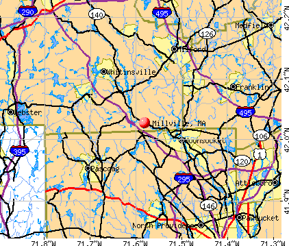
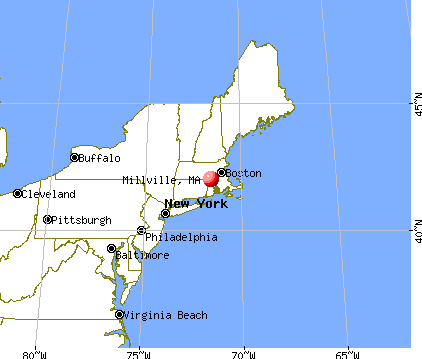
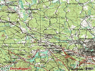
Millville, Massachusetts
Submit your own pictures of this town and show them to the world
- OSM Map
- General Map
- Google Map
- MSN Map
Population change since 2000: +17.1%
 |
| Males: 1,585 | |
| Females: 1,605 |
| Median resident age: | 37.8 years |
| Massachusetts median age: | 39.2 years |
Zip codes: 01529.
| Millville: | $102,701 |
| MA: | $94,488 |
Estimated per capita income in 2022: $39,965 (it was $20,497 in 2000)
Millville town income, earnings, and wages data
Estimated median house or condo value in 2022: $363,423 (it was $131,600 in 2000)
| Millville: | $363,423 |
| MA: | $534,700 |
Mean prices in 2022: all housing units: $419,164; detached houses: $447,621; townhouses or other attached units: $343,592; in 2-unit structures: $323,295; in 3-to-4-unit structures: $332,295; in 5-or-more-unit structures: $232,758; mobile homes: $113,885
Detailed information about poverty and poor residents in Millville, MA


- 3,07396.3%White alone
- 411.3%Hispanic
- 290.9%Asian alone
- 270.8%Two or more races
- 130.4%Black alone
- 70.2%American Indian alone

Races in Millville detailed stats: ancestries, foreign born residents, place of birth
Type |
2009 |
2010 |
2011 |
2012 |
2013 |
2014 |
2015 |
2016 |
2017 |
2018 |
2019 |
2020 |
2021 |
2022 |
|---|---|---|---|---|---|---|---|---|---|---|---|---|---|---|
| Murders (per 100,000) | 0 (0.0) | 0 (0.0) | 0 (0.0) | 0 (0.0) | 0 (0.0) | 0 (0.0) | 0 (0.0) | 0 (0.0) | 0 (0.0) | 0 (0.0) | 0 (0.0) | 0 (0.0) | 0 (0.0) | 0 (0.0) |
| Rapes (per 100,000) | 1 (34.7) | 1 (31.3) | 0 (0.0) | 0 (0.0) | 1 (31.2) | 0 (0.0) | 1 (30.9) | 0 (0.0) | 1 (30.7) | 0 (0.0) | 3 (92.3) | 0 (0.0) | 0 (0.0) | 0 (0.0) |
| Robberies (per 100,000) | 0 (0.0) | 0 (0.0) | 0 (0.0) | 0 (0.0) | 1 (31.2) | 0 (0.0) | 0 (0.0) | 2 (62.0) | 0 (0.0) | 0 (0.0) | 0 (0.0) | 0 (0.0) | 0 (0.0) | 0 (0.0) |
| Assaults (per 100,000) | 4 (139.0) | 7 (219.4) | 3 (93.5) | 1 (31.0) | 0 (0.0) | 5 (155.1) | 2 (61.9) | 1 (31.0) | 0 (0.0) | 0 (0.0) | 2 (61.6) | 1 (30.8) | 0 (0.0) | 2 (63.5) |
| Burglaries (per 100,000) | 11 (382.2) | 7 (219.4) | 6 (187.0) | 15 (464.7) | 5 (155.8) | 12 (372.2) | 5 (154.7) | 5 (154.9) | 2 (61.5) | 3 (92.0) | 1 (30.8) | 3 (92.4) | 3 (91.8) | 0 (0.0) |
| Thefts (per 100,000) | 39 (1,355) | 14 (438.9) | 13 (405.1) | 26 (805.5) | 27 (841.4) | 4 (124.1) | 15 (464.1) | 7 (216.9) | 11 (338.0) | 15 (460.1) | 13 (400.1) | 8 (246.4) | 12 (367.3) | 5 (158.6) |
| Auto thefts (per 100,000) | 6 (208.5) | 4 (125.4) | 2 (62.3) | 1 (31.0) | 0 (0.0) | 0 (0.0) | 1 (30.9) | 2 (62.0) | 1 (30.7) | 1 (30.7) | 0 (0.0) | 1 (30.8) | 0 (0.0) | 0 (0.0) |
| Arson (per 100,000) | 2 (69.5) | 0 (0.0) | 0 (0.0) | 0 (0.0) | 0 (0.0) | 0 (0.0) | 1 (30.9) | 0 (0.0) | 0 (0.0) | 1 (30.7) | 0 (0.0) | 0 (0.0) | 0 (0.0) | 0 (0.0) |
| City-Data.com crime index | 153.2 | 111.9 | 53.0 | 73.4 | 78.8 | 62.0 | 69.0 | 49.3 | 44.9 | 27.3 | 104.3 | 24.9 | 21.1 | 19.0 |
The City-Data.com crime index weighs serious crimes and violent crimes more heavily. Higher means more crime, U.S. average is 246.1. It adjusts for the number of visitors and daily workers commuting into cities.

Crime rate in Millville detailed stats: murders, rapes, robberies, assaults, burglaries, thefts, arson
Full-time law enforcement employees in 2020, including police officers: 6 (5 officers - 5 male; 0 female).
| Officers per 1,000 residents here: | 1.54 |
| Massachusetts average: | 2.59 |
 Recent articles from our blog. Our writers, many of them Ph.D. graduates or candidates, create easy-to-read articles on a wide variety of topics.

 | Big MA Ancestry Data Thread by Town (31 replies) |
| Most similar and dissimilar adjacent towns and cities in MA? (34 replies) |
| Millville (1 reply) |
| How Much Massachusetts Households Make Per Year: Census Data (37 replies) |
| Wondering about Millville MA (3 replies) |
| Boundaries of MA's regions (63 replies) |
Latest news from Millville, MA collected exclusively by city-data.com from local newspapers, TV, and radio stations
Ancestries: French (23.1%), Irish (19.8%), Italian (15.9%), French Canadian (13.5%), English (11.2%), German (7.1%).
Current Local Time: EST time zone
Incorporated in 1916
Elevation: 230 feet
Land area: 4.93 square miles.
Population density: 647 people per square mile (low).
64 residents are foreign born (1.2% Europe, 0.6% Asia, 0.3% Latin America).
| This town: | 2.3% |
| Massachusetts: | 12.2% |
| Millville town: | 1.4% ($1,904) |
| Massachusetts: | 1.3% ($2,336) |
Nearest city with pop. 50,000+: Pawtucket, RI  (15.2 miles , pop. 72,958).
Nearest city with pop. 200,000+: Boston, MA (31.9 miles , pop. 589,141).
Nearest city with pop. 1,000,000+: Bronx, NY (144.7 miles , pop. 1,332,650).
Nearest cities:
), ), Latitude: 42.04 N, Longitude: 71.58 W

Single-family new house construction building permits:
- 2022: 1 building, cost: $400,000
- 2021: 1 building, cost: $400,000
- 2020: 2 buildings, average cost: $425,000
- 2019: 1 building, cost: $200,000
- 2018: 4 buildings, average cost: $162,400
- 2017: 4 buildings, average cost: $162,400
- 2015: 7 buildings, average cost: $214,800
- 2014: 5 buildings, average cost: $200,000
- 2013: 3 buildings, average cost: $200,000
- 2012: 3 buildings, average cost: $200,000
- 2011: 2 buildings, average cost: $200,000
- 2009: 2 buildings, average cost: $250,000
- 2007: 4 buildings, average cost: $225,000
- 2005: 13 buildings, average cost: $200,000
- 2004: 10 buildings, average cost: $185,000
- 2003: 13 buildings, average cost: $153,100
- 2002: 24 buildings, average cost: $129,800
- 2001: 25 buildings, average cost: $132,800
- 2000: 14 buildings, average cost: $108,600
- 1999: 10 buildings, average cost: $88,200
- 1998: 9 buildings, average cost: $95,000
- 1997: 22 buildings, average cost: $83,800


| Here: | 3.9% |
| Massachusetts: | 3.5% |


- Health care (10.6%)
- Construction (8.3%)
- Educational services (7.1%)
- Professional, scientific, technical services (6.4%)
- Accommodation & food services (6.2%)
- Finance & insurance (6.2%)
- Computer & electronic products (6.2%)

- Construction (15.7%)
- Computer & electronic products (7.0%)
- Professional, scientific, technical services (6.2%)
- Health care (6.1%)
- Accommodation & food services (4.0%)
- Motor vehicle & parts dealers (3.5%)
- Educational services (3.4%)

- Health care (15.7%)
- Educational services (11.2%)
- Finance & insurance (10.6%)
- Accommodation & food services (8.7%)
- Professional, scientific, technical services (6.7%)
- Miscellaneous manufacturing (5.4%)
- Computer & electronic products (5.2%)

- Other sales and related occupations, including supervisors (5.9%)
- Computer specialists (3.8%)
- Other management occupations, except farmers and farm managers (3.7%)
- Secretaries and administrative assistants (3.5%)
- Driver/sales workers and truck drivers (3.5%)
- Metal workers and plastic workers (3.3%)
- Vehicle and mobile equipment mechanics, installers, and repairers (3.3%)

- Other sales and related occupations, including supervisors (7.0%)
- Vehicle and mobile equipment mechanics, installers, and repairers (6.2%)
- Driver/sales workers and truck drivers (6.1%)
- Metal workers and plastic workers (5.9%)
- Other management occupations, except farmers and farm managers (5.7%)
- Building and grounds cleaning and maintenance occupations (5.4%)
- Computer specialists (5.0%)

- Secretaries and administrative assistants (6.7%)
- Preschool, kindergarten, elementary, and middle school teachers (5.1%)
- Registered nurses (4.9%)
- Other sales and related occupations, including supervisors (4.6%)
- Bookkeeping, accounting, and auditing clerks (4.3%)
- Customer service representatives (4.2%)
- Waiters and waitresses (4.0%)
Average climate in Millville, Massachusetts
Based on data reported by over 4,000 weather stations


(lower is better)

Air Quality Index (AQI) level in 2022 was 65.3. This is about average.
| City: | 65.3 |
| U.S.: | 72.6 |

Carbon Monoxide (CO) [ppm] level in 2022 was 0.225. This is about average. Closest monitor was 14.8 miles away from the city center.
| City: | 0.225 |
| U.S.: | 0.251 |

Nitrogen Dioxide (NO2) [ppb] level in 2022 was 10.1. This is significantly worse than average. Closest monitor was 4.5 miles away from the city center.
| City: | 10.1 |
| U.S.: | 5.1 |

Sulfur Dioxide (SO2) [ppb] level in 2022 was 0.266. This is significantly better than average. Closest monitor was 4.5 miles away from the city center.
| City: | 0.266 |
| U.S.: | 1.515 |

Ozone [ppb] level in 2022 was 27.0. This is better than average. Closest monitor was 4.9 miles away from the city center.
| City: | 27.0 |
| U.S.: | 33.3 |


Particulate Matter (PM2.5) [µg/m3] level in 2022 was 6.68. This is better than average. Closest monitor was 9.8 miles away from the city center.
| City: | 6.68 |
| U.S.: | 8.11 |

Lead (Pb) [µg/m3] level in 2001 was 0.0157. This is significantly worse than average. Closest monitor was 15.1 miles away from the city center.
| City: | 0.0157 |
| U.S.: | 0.0093 |
Tornado activity:
Millville-area historical tornado activity is near Massachusetts state average. It is 34% smaller than the overall U.S. average.
On 6/9/1953, a category F4 (max. wind speeds 207-260 mph) tornado 18.5 miles away from the Millville town center killed 90 people and injured 1228 people and caused between $50,000,000 and $500,000,000 in damages.
On 6/9/1953, a category F3 (max. wind speeds 158-206 mph) tornado 13.5 miles away from the town center injured 17 people and caused between $500,000 and $5,000,000 in damages.
Earthquake activity:
Millville-area historical earthquake activity is significantly above Massachusetts state average. It is 73% smaller than the overall U.S. average.On 10/7/1983 at 10:18:46, a magnitude 5.3 (5.1 MB, 5.3 LG, 5.1 ML, Class: Moderate, Intensity: VI - VII) earthquake occurred 192.7 miles away from the city center
On 4/20/2002 at 10:50:47, a magnitude 5.3 (5.3 ML, Depth: 3.0 mi) earthquake occurred 201.8 miles away from the city center
On 4/20/2002 at 10:50:47, a magnitude 5.2 (5.2 MB, 4.2 MS, 5.2 MW, 5.0 MW) earthquake occurred 200.9 miles away from the city center
On 1/19/1982 at 00:14:42, a magnitude 4.7 (4.5 MB, 4.7 MD, 4.5 LG, Class: Light, Intensity: IV - V) earthquake occurred 101.2 miles away from the city center
On 10/16/2012 at 23:12:25, a magnitude 4.7 (4.7 ML, Depth: 10.0 mi) earthquake occurred 117.7 miles away from the city center
On 8/22/1992 at 12:20:32, a magnitude 4.8 (4.8 MB, 3.8 MS, 4.7 LG, Depth: 6.2 mi) earthquake occurred 213.2 miles away from the city center
Magnitude types: regional Lg-wave magnitude (LG), body-wave magnitude (MB), duration magnitude (MD), local magnitude (ML), surface-wave magnitude (MS), moment magnitude (MW)
Natural disasters:
The number of natural disasters in Worcester County (27) is a lot greater than the US average (15).Major Disasters (Presidential) Declared: 15
Emergencies Declared: 12
Causes of natural disasters: Floods: 9, Storms: 8, Hurricanes: 6, Snowstorms: 5, Winter Storms: 4, Blizzards: 2, Snows: 2, Fire: 1, Heavy Rain: 1, Snowfall: 1, Tornado: 1, Wind: 1 (Note: some incidents may be assigned to more than one category).
Hospitals and medical centers near Millville:
- BLACKSTONE NURSING HOME (Nursing Home, about 3 miles away; BLACKSTONE, MA)
- LYDIA TAFT HOUSE (Nursing Home, about 3 miles away; UXBRIDGE, MA)
- FRIENDLY HOME INC, THE (Nursing Home, about 4 miles away; WOONSOCKET, RI)
- ST ANTOINE RESIDENCE (Nursing Home, about 4 miles away; NORTH SMITHFIELD, RI)
- MOWRY AVENUE GROUP HOME (Hospital, about 5 miles away; NORTH SMITHFIELD, RI)
- EVERGREENS NURSING HOME (Nursing Home, about 5 miles away; WOONSOCKET, RI)
- TRINITY HEALTH AND REHABILITATION CENTER (Nursing Home, about 5 miles away; WOONSOCKET, RI)
Amtrak stations near Millville:
- 17 miles: PROVIDENCE (100 GASPEE ST.) . Services: ticket office, fully wheelchair accessible, enclosed waiting area, public restrooms, public payphones, snack bar, ATM, paid short-term parking, paid long-term parking, call for car rental service, taxi stand, public transit connection.
- 19 miles: FRAMINGHAM (443 WAVERLY ST.) . Services: public payphones, snack bar, paid short-term parking, taxi stand, public transit connection.
- 20 miles: WORCESTER (WORCHESTER, 45 SHREWSBURY ST.) . Services: ticket office, fully wheelchair accessible, enclosed waiting area, public restrooms, public payphones, vending machines, free short-term parking, free long-term parking, call for taxi service, public transit connection.
Colleges/universities with over 2000 students nearest to Millville:
- Bryant University (about 9 miles; Smithfield, RI; Full-time enrollment: 3,440)
- Rhode Island College (about 15 miles; Providence, RI; FT enrollment: 7,189)
- Providence College (about 16 miles; Providence, RI; FT enrollment: 4,312)
- Brown University (about 17 miles; Providence, RI; FT enrollment: 8,458)
- Rhode Island School of Design (about 17 miles; Providence, RI; FT enrollment: 2,714)
- Johnson & Wales University-Providence (about 18 miles; Providence, RI; FT enrollment: 10,898)
- College of the Holy Cross (about 19 miles; Worcester, MA; FT enrollment: 3,125)
Public elementary/middle school in Millville:
- MILLVILLE ELEMENTARY (Students: 352, Location: 122 BERTHELETTE WAY, Grades: PK-5)
Points of interest:
Notable locations in Millville: Millville Fire Department Station 1 Headquarters (A), Millville Fire Department Station 2 (B), Chestnut Hill Meeting House (C), Millville Free Public Library (D), Chestnut Hill Community Center (E). Display/hide their locations on the map
Cemetery: Chestnut Hill Meeting House Cemetery (1). Display/hide its location on the map
Lake: Mansfield Pond (A). Display/hide its location on the map
| This town: | 2.9 people |
| Massachusetts: | 2.5 people |
| This town: | 78.2% |
| Whole state: | 63.0% |
| This town: | 9.1% |
| Whole state: | 7.0% |
Likely homosexual households (counted as self-reported same-sex unmarried-partner households)
- Lesbian couples: 0.5% of all households
- Gay men: 0.3% of all households
| This town: | 5.8% |
| Whole state: | 9.3% |
| This town: | 3.5% |
| Whole state: | 4.4% |
For population 15 years and over in Millville:

- Never married: 26.8%
- Now married: 61.3%
- Separated: 1.0%
- Widowed: 4.5%
- Divorced: 6.3%
For population 25 years and over in Millville:
- High school or higher: 85.6%
- Bachelor's degree or higher: 20.4%
- Graduate or professional degree: 5.0%
- Unemployed: 2.3%
- Mean travel time to work (commute): 31.3 minutes


| Here: | 10.0 |
| Massachusetts average: | 13.1 |


Graphs represent county-level data. Detailed 2008 Election Results
Religion statistics for Millville, MA (based on Worcester County data)


| Religion | Adherents | Congregations |
|---|---|---|
| Catholic | 306,925 | 118 |
| Mainline Protestant | 43,326 | 171 |
| Evangelical Protestant | 37,511 | 203 |
| Other | 18,931 | 69 |
| Orthodox | 7,935 | 15 |
| Black Protestant | 497 | 6 |
| None | 383,427 | - |
Food Environment Statistics:
| This county: | 1.73 / 10,000 pop. |
| State: | 1.98 / 10,000 pop. |
| Worcester County: | 0.05 / 10,000 pop. |
| Massachusetts: | 0.05 / 10,000 pop. |
| This county: | 1.79 / 10,000 pop. |
| State: | 2.22 / 10,000 pop. |
| This county: | 2.22 / 10,000 pop. |
| Massachusetts: | 1.77 / 10,000 pop. |
| Here: | 7.27 / 10,000 pop. |
| Massachusetts: | 8.76 / 10,000 pop. |
| This county: | 8.0% |
| State: | 8.1% |
| Here: | 24.0% |
| Massachusetts: | 22.5% |
| Worcester County: | 16.6% |
| Massachusetts: | 16.5% |
4.71% of this county's 2021 resident taxpayers lived in other counties in 2020 ($76,229 average adjusted gross income)
| Here: | 4.71% |
| Massachusetts average: | 6.35% |
0.02% of residents moved from foreign countries ($100 average AGI)
Worcester County: 0.02% Massachusetts average: 0.01%
Top counties from which taxpayers relocated into this county between 2020 and 2021:
| from Middlesex County, MA | |
| from Norfolk County, MA | |
| from Suffolk County, MA |
4.84% of this county's 2020 resident taxpayers moved to other counties in 2021 ($87,252 average adjusted gross income)
| Here: | 4.84% |
| Massachusetts average: | 7.18% |
0.03% of residents moved to foreign countries ($199 average AGI)
Worcester County: 0.03% Massachusetts average: 0.02%
Top counties to which taxpayers relocated from this county between 2020 and 2021:
| to Middlesex County, MA | |
| to Norfolk County, MA | |
| to Suffolk County, MA |
Businesses in Millville, MA
- New Balance: 1
Strongest AM radio stations in Millville:
- WALE (990 AM; 50 kW; GREENVILLE, RI; Owner: NORTH AMERICAN BROADCASTING CO., INC.)
- WKOX (1200 AM; 50 kW; FRAMINGHAM, MA; Owner: CAPSTAR TX LIMITED PARTNERSHIP)
- WCRN (830 AM; 50 kW; WORCESTER, MA; Owner: CARTER BROADCASTING CORPORATION)
- WEEI (850 AM; 50 kW; BOSTON, MA; Owner: ENTERCOM BOSTON LICENSE, LLC)
- WBIX (1060 AM; 40 kW; NATICK, MA; Owner: LANGER BROADCASTING CORPORATION)
- WAMG (890 AM; 25 kW; DEDHAM, MA; Owner: MEGA COMMUNICATIONS OF DEDHAM LICENSEE, LLC)
- WNRI (1380 AM; 2 kW; WOONSOCKET, RI; Owner: ANASTOS MEDIA GROUP, INC.)
- WRKO (680 AM; 50 kW; BOSTON, MA; Owner: ENTERCOM BOSTON LICENSE, LLC)
- WDDZ (550 AM; 5 kW; PAWTUCKET, RI; Owner: ABC, INC.)
- WRNI (1290 AM; 10 kW; PROVIDENCE, RI; Owner: WRNI FOUNDATION)
- WOON (1240 AM; 1 kW; WOONSOCKET, RI; Owner: O-N RADIO, INC.)
- WVNE (760 AM; daytime; 25 kW; LEICESTER, MA; Owner: BLOUNT MASSCOM, INC.)
- WWZN (1510 AM; 50 kW; BOSTON, MA; Owner: ROSE CITY RADIO CORPORATION)
Strongest FM radio stations in Millville:
- WWKX (106.3 FM; WOONSOCKET, RI; Owner: AAA ENTERTAINMENT LICENSING LLC)
- WWBB (101.5 FM; PROVIDENCE, RI; Owner: CLEAR CHANNEL BROADCASTING LICENSES, INC.)
- WBMX (98.5 FM; BOSTON, MA; Owner: INFINITY RADIO OPERATIONS INC.)
- WAAF (107.3 FM; WORCESTER, MA; Owner: ENTERCOM BOSTON LICENSE, LLC)
- WJMN (94.5 FM; BOSTON, MA; Owner: AMFM RADIO LICENSES, L.L.C.)
- WBOS (92.9 FM; BROOKLINE, MA; Owner: GREATER BOSTON RADIO, INC.)
- WCRB (102.5 FM; WALTHAM, MA; Owner: CHARLES RIVER BROADCASTING WCRB LICE)
- WTKK (96.9 FM; BOSTON, MA; Owner: GREATER BOSTON RADIO, INC.)
- WROR-FM (105.7 FM; FRAMINGHAM, MA; Owner: GREATER BOSTON RADIO, INC.)
- WGBH (89.7 FM; BOSTON, MA; Owner: WGBH EDUCATIONAL FOUNDATION)
- WBUR-FM (90.9 FM; BOSTON, MA; Owner: TRUSTEES OF BOSTON UNIVERSITY)
- WPRO-FM (92.3 FM; PROVIDENCE, RI; Owner: CITADEL BROADCASTING COMPANY)
- WSNE-FM (93.3 FM; TAUNTON, MA; Owner: CAPSTAR TX LIMITED PARTNERSHIP)
- WSRS (96.1 FM; WORCESTER, MA; Owner: CAPSTAR TX LIMITED PARTNERSHIP)
- WWLI (105.1 FM; PROVIDENCE, RI; Owner: CITADEL BROADCASTING COMPANY)
- WODS (103.3 FM; BOSTON, MA; Owner: INFINITY BROADCASTING OPERATIONS, INC.)
- WXKS-FM (107.9 FM; MEDFORD, MA; Owner: AMFM RADIO LICENSES, L.L.C.)
- WMJX (106.7 FM; BOSTON, MA; Owner: GREATER BOSTON RADIO, INC.)
- WBRU (95.5 FM; PROVIDENCE, RI; Owner: BROWN BROADCASTING SERVICE, INC.)
- WHJY (94.1 FM; PROVIDENCE, RI; Owner: CAPSTAR TX LIMITED PARTNERSHIP)
TV broadcast stations around Millville:
- WCVB-TV (Channel 5; BOSTON, MA; Owner: WCVB HEARST-ARGYLE TV, INC.)
- WUNI (Channel 27; WORCESTER, MA; Owner: ENTRAVISION HOLDINGS, LLC)
- WGBH-TV (Channel 2; BOSTON, MA; Owner: WGBH EDUCATIONAL FOUNDATION)
- WNAC-TV (Channel 64; PROVIDENCE, RI; Owner: WNAC, LLC)
- WPRI-TV (Channel 12; PROVIDENCE, RI; Owner: TVL BROADCASTING OF RHODE ISLAND, LLC)
- WUTF (Channel 66; MARLBOROUGH, MA; Owner: TELEFUTURA BOSTON LLC)
- WMFP (Channel 62; LAWRENCE, MA; Owner: WSAH LICENSE, INC.)
- WHDH-TV (Channel 7; BOSTON, MA; Owner: WHDH-TV)
- WJAR (Channel 10; PROVIDENCE, RI; Owner: OUTLET BROADCASTING, INC.)
- WBZ-TV (Channel 4; BOSTON, MA; Owner: VIACOM INC.)
- WGBX-TV (Channel 44; BOSTON, MA; Owner: WGBH EDUCATIONAL FOUNDATION)
- WSBK-TV (Channel 38; BOSTON, MA; Owner: VIACOM INC.)
- WLVI-TV (Channel 56; CAMBRIDGE, MA; Owner: WLVI, INC.)
- WLNE-TV (Channel 6; NEW BEDFORD, MA; Owner: FREEDOM BROADCASTING OF SOUTHERN NEW ENGLAND, INC.)
- WPXQ (Channel 69; BLOCK ISLAND, RI; Owner: OCEAN STATE TELEVISION, L.L.C.)
- WFXT (Channel 25; BOSTON, MA; Owner: FOX TELEVISION STATIONS INC.)
- WSBE-TV (Channel 36; PROVIDENCE, RI; Owner: RHODE ISLAND PUBLIC TELECOM. AUTHORITY)
- WWDP (Channel 46; NORWELL, MA; Owner: NORWELL TELEVISION, LLC)
- W40BO (Channel 40; BOSTON, MA; Owner: PAXSON COMMUNICATIONS LPTV, INC.)
- WRIW-LP (Channel 50; PROVIDENCE, RI; Owner: ZGS PROVIDENCE, INC.)
- WYDN (Channel 48; WORCESTER, MA; Owner: EDUCATIONAL PUBLIC TV CORPORATION)
- WBPX (Channel 68; BOSTON, MA; Owner: PAXSON BOSTON-68 LICENSE, INC.)
- WTMU-LP (Channel 32; BOSTON, MA; Owner: ZGS BOSTON, INC.)
- WCEA-LP (Channel 58; BOSTON, MA; Owner: CHANNEL 19 TV CORPORATION)
- WLWC (Channel 28; NEW BEDFORD, MA; Owner: C-28 FCC LICENSEE SUBSIDIARY, LLC)

- National Bridge Inventory (NBI) Statistics
- 5Number of bridges
- 30ft / 8.9mTotal length
- $3,902,000Total costs
- 31,978Total average daily traffic
- 2,237Total average daily truck traffic
- 28,743Total future (year 2031) average daily traffic
FCC Registered Antenna Towers:
9 (See the full list of FCC Registered Antenna Towers in Millville)FCC Registered Broadcast Land Mobile Towers:
3- Central Street (Lat: 42.027111 Lon: -71.581750), Type: Pole, Structure height: 8 m, Overall height: 11 m, Call Sign: KGR326,
Assigned Frequencies: 159.367 MHz, 159.367 MHz, Grant Date: 02/25/2022, Expiration Date: 04/22/2032, Registrant: Modular Communications LLC, 932 Fitchburg Road, Greenville, NH 03048-3340, Phone: (603) 217-2346, Fax: (508) 883-9655, Email:
- Fire Hq Main St (Lat: 42.026778 Lon: -71.576444), Call Sign: WNCD528,
Assigned Frequencies: 155.745 MHz, Grant Date: 12/09/2004, Expiration Date: 03/05/2015, Cancellation Date: 05/09/2015, Registrant: Commonwealth Of Massachusetts Emergency Management Agency, 400 Worcester Rd, Framingham, MA 01702, Phone: (508) 820-2023, Fax: (508) 875-2517, Email:
- Lat: 42.029278 Lon: -71.574500, Call Sign: WQDI483, Licensee ID: L00311521,
Assigned Frequencies: 153.950 MHz, 153.950 MHz, 153.770 MHz, 153.770 MHz, Grant Date: 09/06/2005, Expiration Date: 10/17/2005, Cancellation Date: 01/07/2006, Certifier: John J Mullaly, Registrant: Millville Town Of, 196 Main Street, Millville, MA 01529, Phone: (508) 883-4740, Fax: (508) 883-9655, Email:
FCC Registered Microwave Towers:
1- Millville MA 2, 70 Quaker Street (Lat: 42.022000 Lon: -71.592806), Type: Tower, Structure height: 48.8 m, Overall height: 51.8 m, Call Sign: WQIL270,
Assigned Frequencies: 10795.0 MHz, Grant Date: 03/07/2008, Expiration Date: 03/07/2018, Cancellation Date: 09/07/2009, Certifier: William Chastain, Registrant: Radio Dynamics Corporation, 774 Mays Blvd., #10-465, Silver Spring, MD 20914, Phone: (301) 493-5171, Fax: (301) 576-4553, Email:
FCC Registered Amateur Radio Licenses:
12 (See the full list of FCC Registered Amateur Radio Licenses in Millville)2002 - 2018 National Fire Incident Reporting System (NFIRS) incidents
- Fire incident types reported to NFIRS in Millville, MA
- 10448.4%Structure Fires
- 9142.3%Outside Fires
- 125.6%Mobile Property/Vehicle Fires
- 83.7%Other
 Based on the data from the years 2002 - 2018 the average number of fires per year is 13. The highest number of fire incidents - 29 took place in 2002, and the least - 2 in 2014. The data has a declining trend.
 When looking into fire subcategories, the most reports belonged to: Structure Fires (48.4%), and Outside Fires (42.3%).
- 84.9%Fuel oil, kerosene, etc.
- 5.5%Bottled, tank, or LP gas
- 4.2%Electricity
- 3.0%Utility gas
- 1.9%Wood
- 0.5%Coal or coke

- 79.1%Fuel oil, kerosene, etc.
- 15.4%Electricity
- 5.5%Bottled, tank, or LP gas
Millville compared to Massachusetts state average:
- Unemployed percentage significantly below state average.
- Black race population percentage significantly below state average.
- Hispanic race population percentage significantly below state average.
- Foreign-born population percentage significantly below state average.
- Renting percentage below state average.
- Length of stay since moving in significantly above state average.
- Number of rooms per house significantly below state average.
- House age significantly below state average.
- Number of college students below state average.
- Percentage of population with a bachelor's degree or higher below state average.

|
|
Total of 60 patent applications in 2008-2024.